Scan the QR code and open PeakVisor on your phone
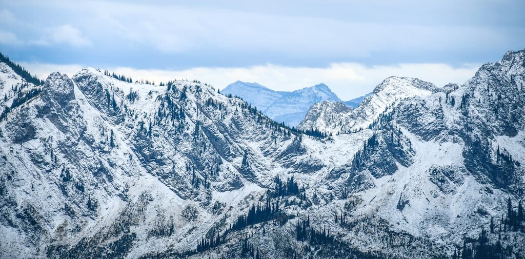
The Lizard Range is a sub-range of the Crowsnest Range that is located in southeast British Columbia to the northwest of the city of Fernie. There are 14 named peaks in the Lizard Range, the tallest of which is Lizard Peak with 2,372 m (7,783 ft) of elevation.
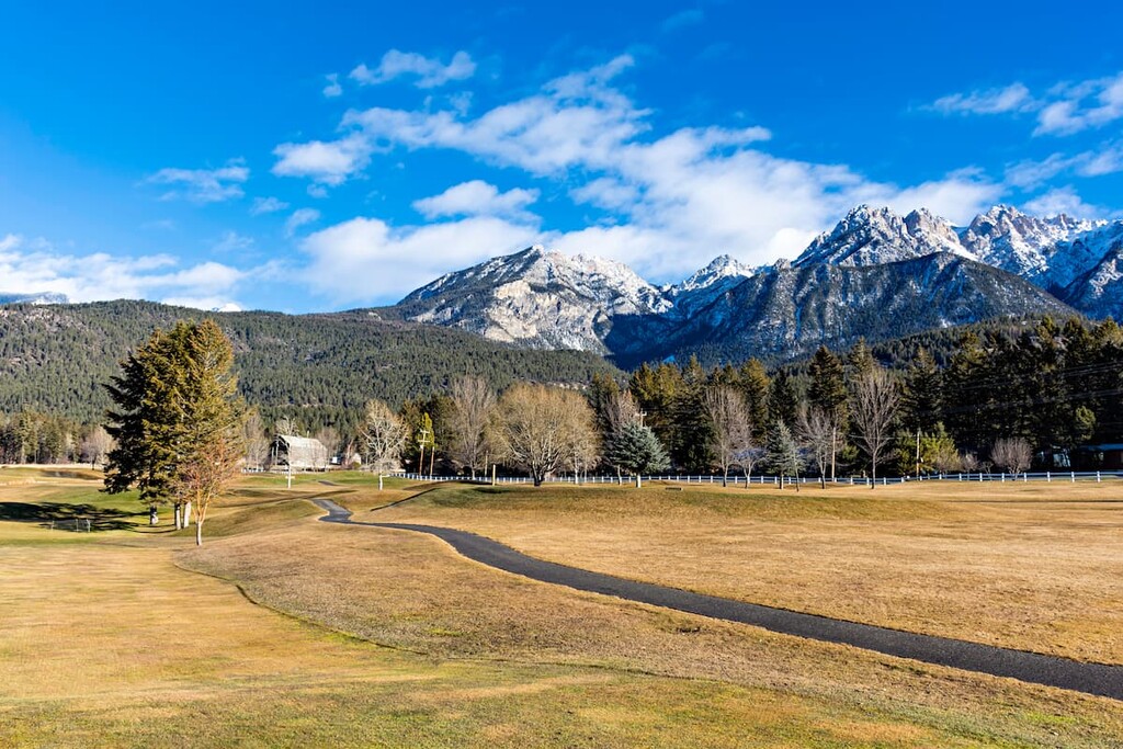
Located to the southeast of Fernie, in the Canadian province of British Columbia, the Lizard Range is a collection of peaks that forms a subrange of the Crowsnest Range. The Lizard Range’s southern terminus is bordered by Highway (Crowsnest Pass Highway). It is about 31 km (19 mi) wide and 44 km (27 mi) long.
The range is located to the east of the Kootenay River and the Rocky Mountain Trench. It is also situated to the south of Lizard Creek, to the west of the Elk River, and to the east of the Bull River.
As a part of the larger Crowsnest Range, the Lizard Range is surrounded by other named subranges. This includes some other ranges within the Crowsnest Range such as the Taylor Range, Flathead Range, and the Blairmore Range. The Kootenay and Harrison Ranges are also located to the north, while the Whitefish-MacDonald Range is situated to the south and crosses into the United States.
The Lizard Range is located in a rather remote part of British Columbia and it doesn’t have any particularly notable peaks that have official geographic names. However, the local hiking and climbing community are actively encouraging summit hikes in the range and, as such, they have given names to at least thirteen of the peaks.
One of the peaks likely refers to the snow accumulation, such as Big White, which is the peak above Fernie Alpine Resort. Peaks in the north of the range include Lizard Peak and Wolverine Peak. There are a series of peaks close together called Papa Bear, Baby Bear, and Mama Bear, which are popular for hiking.
The southern part of the range contains Planetary Peak and Tunnel Creek Hut Ridge, which references the Tunnel Creek Hut which was constructed by the Fernie Trails and Ski Touring Club in 2011.
Starting about 1.5 billion years ago, various sediments started accumulating in the coastal seas near what is now the Lizard Range. As a result, various undersea became home to concentrated locations of ore that helped spur the modern day mining industry.
As life began to form and inhabit these seas, organic material eventually accumulated on the seafloor. This organic material eventually transformed into the limestone and dolostones that we see in the region today.
About 170 million years ago, the North American continent began its collision course with the tectonic plates under the Pacific Ocean. The North American continent continued advancing forward and, as the ocean plates subducted below the continental plate, the west coast of British Columbia acquired land mass.
Most of the landmass west of East Kootenay was acquired from the Pacific plate. About 75 million years ago, the former continental margin seafloor, which is west of the Kootenays, was squeezed and stacked into a thick series of faulted layers. Lasting about 40 million years, this squeezing and uplifting of the continental margin is called the Laramide orogeny, the mountain building event that formed the Rocky Mountains.
The mountain belt of the Rocky Mountains is an estimated 200 km (120 mi) narrower than the continental margin from which the mountains were formed. As the seafloor was lifted, massive amounts of water were displaced causing immense erosion of the newly forming mountains deepening valleys.
Towards the end of the mountain formation, around 10 million years ago, the land pulled apart along the major north trending faults creating long trough like valleys. The largest was the great valley of the Rocky Mountain Trench, which stretches from Montana to Alaska, west of the Canadian Rockies.
The Lizard Range and Rocky Mountains are typically made of limestone and dolostone, which are hard marine sediment rocks that resist erosion. The younger Cretaceous rocks that are found in the Rocky Mountain Trench, west of the Lizard Range are softer sandstones and mudstones. So, as the Rocky Mountains were lifting, the rivers began flowing down the trench, rapidly eroding the softer rocks, increasing the relief between the valley and the mountains.
The faults continued to shift, lowering the Rocky Mountain Trench even further while lifting the Rocky Mountains. These faults may also be related to the formation of the many hot springs in the region, such as the Fairmont Hot Springs and the Radium Hot Springs north of the Lizard Range.
There are three ecological regions represented in the Lizard Range of British Columbia, including the Interior Cedar-Hemlock Zone, the Montane Spruce Zone, and the Engelmann Spruce-Subalpine Fir Zone.
The Interior Cedar-Hemlock Zone consists of the lower and middle elevations in the interior belt of the region. Winters are cool and wet while the summers are dry and warm; however, in the wetter parts of the zone, sufficient precipitation minimizes the impact of forest fires. This has allowed old growth forests to thrive in the region, rivaling those found along the coast of British Columbia.
This zone has productive coniferous forests and the greatest variety of tree species out of all the ecological zones in the province. Western red cedar, western hemlock characterizes the forest; however, ponderosa pine, Douglas fir, western larch, lodgepole pine, western yew, and western white pine are also common. Additionally, trembling aspen and paper birch thrive in drier parts of the zone, while subalpine fir and spruce grow in the wetter areas.
The wildlife that thrive in this region have adapted to living in the deep snows that come each winter or are willing to relocate to warmer climates while the snow is deep. White-tail and mule deer, and Rocky Mountain elk spend summers in the valleys of the Lizard Range, however, they leave during the winter.
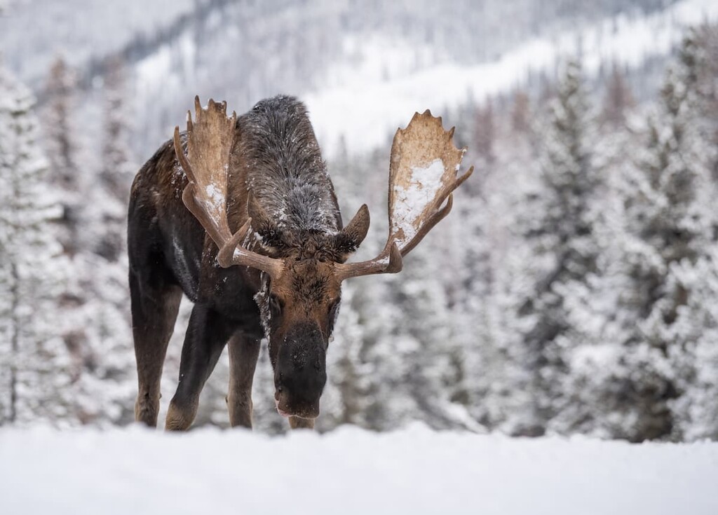
Moose, with their long legs, are very capable of wading through the deep snow, while the resident bears hibernate to bypass winter altogether. The range is an important link in the range of grizzly habitat in North America.
The Montane Spruce Zone of the Lizard Range is relegated to the lower slopes around the perimeter of the range. It is cooler than the cedar-hemlock forests and receives more snow. This zone is the transition area between the lower elevation cedar-hemlock forest and the Engelmann spruce-subalpine fir forest that’s found at higher elevations.
As a transition area, the montane forests contain species from the neighboring ecologies such as the subalpine fir and understory of grouseberry and black huckleberry typical of higher elevations. As well as Douglas-fir and pinegrass typical of lower elevations. Additionally, lodgepole pine, white spruce, western larch, western red cedar, trembling aspen, and black cottonwood grow within this zone.
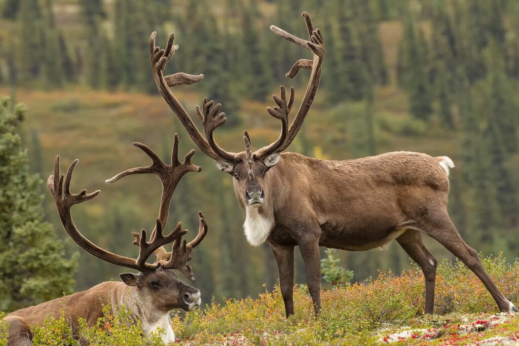
Caribou and moose inhabit this zone year-round, while deer tend to migrate to lower elevations. The old growth forest in this zone also provides a preferred habitat for many animals including the fisher, marten, red crossbill, southern red-backed vole, porcupine, and the great grey owl.
Bighorn sheep, mountain goats, golden eagles, mule deer, and the golden mantled ground squirrel prefer dry grassland areas. Such areas are usually steep and south-facing. They also provide superb foraging opportunities and shallower winter snow packs, which make them popular among wildlife..
The highest elevations of the Lizard Range are the barren rocks of the alpine and a forest/meadow matrix. Dense forests of Engelmann spruce and subalpine fir dominate the upper elevations of the Lizard Range. Whitebark pine, limber pine, and alpine larch are also found in this zone.
White-flowered rhododendron is a characteristic shrub throughout the zone, sometimes forming thick tangles that are difficult to walk through. Other shrubs include black huckleberry, grouseberry, and false azalea. Where the forest breaks, subalpine meadows are filled with a variety of flowering herbs, including Indian hellebore, paintbrush, foam flower, and Sitka valerian.
The animals common to the lower altitudes all spend part of their time in the subalpine zone. Mountain goats and caribou will typically remain in the region over winter, the caribou relying on tree lichen to feed on over winter.
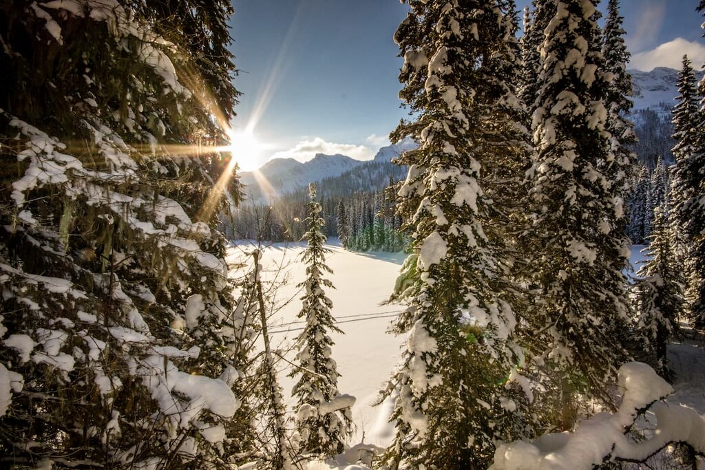
Nevertheless, the high snowfall in the Lizard Range tends to deter most animals from inhabiting the subalpine zone year-round. However, when combined with the open slopes and subalpine meadows, this high snowfall has helped the range become a popular place for backcountry ski touring.
During the Pleistocene, beginning about 2.58 million years ago, British Columbia and the northern half of North America were covered with a series of ice sheets. Starting about two million years ago a corridor between the cordilleran (mountain) ice sheet and the Laurentide ice sheet (this ice sheet covered Canada east of the Rocky Mountains) would open and subsequently close on several occasions.
It is believed that, possibly starting as early as 70,000 years ago, human populations began to migrate from Asia, through Beringia, to Alaska and Yukon. As the corridor would intermittently open, groups of animals and people would migrate south, such that when the ice sheets melted for the final time about 14,000 years ago, there were possibly already humans present in the southern half of North America.
As the ice sheets melted and the corridor opened connecting Asia to southern North America, geological records show that the ice in the East Kootenay District melted fairly early. Therefore, it’s unclear whether the first inhabitants of the region migrated south from Yukon, or if they came north from the populations that were already located to the south of the ice sheet.
The Lizard Range and the surrounding region of East Kootenay are the traditional territory of the Ktunaxa Nation. One interesting theory suggests that the Ktunaxa are the descendants of the inhabitants that lived in the region 11,500 years ago, who came from the south after the ice had melted.
It is possible that, during the interglacial periods of the Pleistocene, other groups of people inhabited the region; however, the subsequent glaciers would have likely destroyed any archaeological evidence of this habitation.
The first recorded European contact with the Ktunaxa occurred when David Thompson received a group of Ktunaxa people who were searching for him in his home at the Rocky Mountain House in 1800. In 1807, Thompson finally crossed the Rockies and entered into the Columbia Valley, the home of the Ktunaxa.
Nearly a century after a European entered the Kootenay region, settlers, prospectors, surveyors, miners, and loggers started to make a home there. Encouraged by the discovery of ore, coal, gypsum, and lumber, the Canadian Pacific Railway made its way through the passes and valleys on its way to the Pacific Ocean.
The city of Fernie is on the edge of the Lizard Range, and Cranbrook is to the west. These and the other towns of the valley were all founded around the turn of the twentieth century to support the mines, logging, and agriculture of the region.
Ski touring has been popular in the region since the early twentieth century. It’s said that the best powder in the region is found at Fernie. The Fernie Alpine Resort opened in 1962, offering lift-assisted skiing. These days, backcountry ski touring and cat skiing are also very popular activities.
The Lizard Range is a small, out-of-the-way range in southeast British Columbia; however, since a number of towns were established in the region, the soft powder, and deep snowy slopes of the range have been popular with skiers. The following is a list of the major attractions in the area.
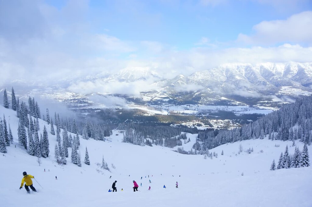
Having officially opened on January 10, 1962, the resort that is now known as Fernie Alpine Resort embodies the generations of ski culture in the region. The resort has 1,000 hectares (2,500 acres) of skiable terrain, 10 lifts, and ski runs as long as 5 km (3.1 mi) long.
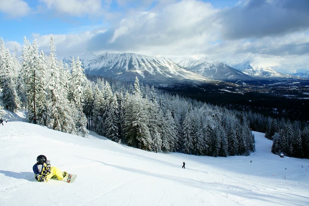
Fernie Alpine Resort is located to the south of the city of Fernie and the resort is situated on the east side of the Lizard Range. There are on-hill accommodations and amenities at the resort, too. Additionally, the resort isn’t just open for skiing as it also offers lift assisted mountain biking throughout the summer months.
Ski touring in the Lizard Range dates back at least 100 years, as it was once a necessary form of transportation, as well as a way to recreate during the winter. The Fernie Trails and Ski Touring Club is a local organization that helps build trails and promotes the trails of the region. In 2011, the club constructed Tunnel Creek Hut on one of the southern ridges of the range.
As was previously mentioned, the locals certainly believe that they have the best snow in the region and skiing is a big part of the local culture. They thank The Griz for their fantastic snow conditions, which is a legend you can ask the locals about when you visit.
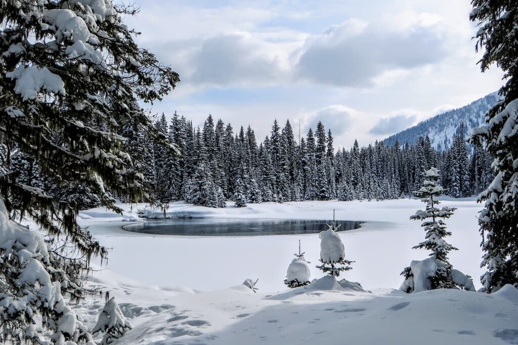
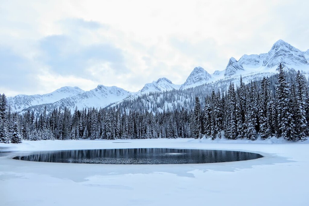
The Lizard Lake Trail is 3.4 km (2 mi) long with 529 m (1,735 ft) of elevation gain. The trail leads up through dense cedar forest to arrive at a small mountain tarn. This trail is short and steep and, while it is difficult, the tarn and subalpine meadow are a beautiful destination to strive for.
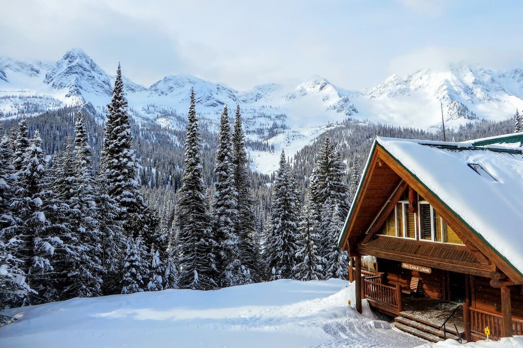
Summer or winter, the Island Lake Lodge is a lovely destination in the Lizard Range. The beautiful lodge is constructed from 800-year-old cedar, spruce, and Douglas fir, which only magnifies the beauty of the surrounding scenery.
There is fine dining, a spa, hiking trails for the summer, and cat skiing during the winter at the lodge. The lodge is also a wonderful place from which to launch a day trip into the range. Alternatively, it’s a great place to simply relax in an elegant outdoor setting.
The Lizard Range has some of the best powder for skiing in the Canadian Rockies, along with some incredible hikes. The following are a couple places to rest your head and relax while visiting the area.
The city of Fernie is the only city class Canadian municipality to be completely surrounded by mountains. Located within an ancient glacial valley in the District of East Kootenay in British Columbia, Fernie is best known for the incredible skiing in the nearby mountains.
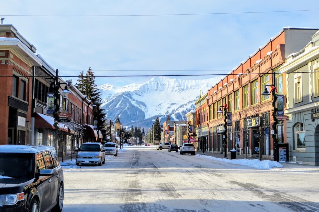
With the nearby Fernie Alpine Resort, cat skiing from the Island Lake Lodge, incredible backcountry tours, and some of the best powder in the world, Fernie is a skier’s paradise. If you visit during the summer, the same amazing scenery and trails are available, the ride down just isn’t as fun as it is in the snow.
Founded at the beginning of the twentieth century, sly political maneuvering made Cranbrook the commercial hub of the Kootenay Valley instead of nearby Fort Steele. Located west of the Lizard Range and within the Rocky Mountain Trench, Cranbrook is a working town that helps the mining and logging industries in the region thrive.
While there are certainly recreation opportunities from the edges of Cranbrook, one of the major attractions of the city is the museum. The Cranbrook History Centre features displays of passenger railway cars from the turn of the century as well as over 30,000 artifacts of the former inhabitants of the region.