
Scan the QR code and open PeakVisor on your phone
The Harrison Group is a small collection of peaks located in the Harrison Range within the southeastern part of the Canadian province of British Columbia. The group contains 4 named mountains, the tallest of which is Mount Harrison (3,360 m/ 11,024 ft). Mount Harrison is also an ultra-prominent peak that has 1,779 m (5,837 ft) of prominence.

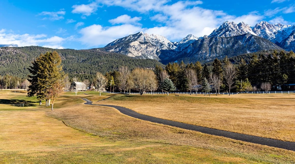
The Harrison Group is a subsection of the Harrison Ranges, which are one of the southern ranges of the Canadian Rockies. These peaks are all located in southeast British Columbia near the province’s borders with Alberta and the United States.
As it is located in a heavily mountainous part of British Columbia, the Harrison Group is surrounded by other mountain ranges. In particular, the Harrison Group is adjacent to the Quinn Range, which is also part of the Harrison Range. The High Rock Range is also situated to the east of the Harrison Group and the Hughes Range is located to the west.
Mount Harrison is the southernmost of the Canadian 11,000ers, which are a collection of the 54 tallest peaks in the Canadian Rockies, all of which are taller than 11,000 feet. While there are no parks or protected areas in the Harrison Group, some of the region’s most incredible parks are located nearby, including:
The Rocky Mountains started forming about 75 million years ago when oceanic tectonic plates subducted beneath North America. This subduction was not a peaceful event, as the Earth’s crust slowly pushed together, creating volcanoes along the continental margin. At the same time, tectonic uplifting further inland from the continental margin helped to create the peaks that we see in the region to this day.
During this time, older Paleozoic layers of limestone and dolomite slid over the younger Cretaceous shales and sandstones. These layers of limestone and sandstone were stacked during the tectonic collision to form the basis of the Rocky Mountains. Most of the peaks in the Rocky Mountains, including those of the Harrison Group, are jagged and precipitous limestone formations.
While wind and water have been eroding away the region’s mountains for millions of years, the Pleistocene glaciers created most of the topography that we see in the region’s high elevation mountain ranges, such as the Harrison Group. In particular, the northern aspects of Mount Harrison and Mount Folk display evidence of intense cirque glaciation.
Throughout this period, the Cordilleran ice sheet, which was over 1 kilometer (0.6 mi) thick in places over the Rocky Mountains, ground away at the softer Cretaceous rocks, leaving behind durable limestone and dolomite peaks. However, some of the taller peaks were not covered by the ice sheet during this time and were considered to be nunataks. These nunataks were often the epicenter for local glaciers, which wore down even the most durable of limestones.
The most recent glacial cycle of the Pleistocene epoch may have ended only about 12,000 years ago, but it was responsible for creating the current topography of the Rocky Mountains and the Harrison Group.
As mentioned, the glaciers carved out mountain sides creating cirques, and moving enormous amounts of stone debris in the process. Most of this debris was deposited as moraines and sinuous eskers when the glacier melted and many of these post-glacial features can be seen in the region to this day.
While the Harrison Group only contains four named mountains, the group is home to many different ecosystems and habitats. The range has barren and ice-covered peaks that transition to dense forests of spruce, fir, and pine as you make your way to the bottom of the region’s valleys.
The alpine and subalpine zones occur at the highest elevations of the group where the climate features cool summers and long, cold winters. The tops of the mountains are dominated by rocks with limited growth of sedges and lichens. Ice and snow are typically present in the group well into late summer, especially on Mount Harrison. As a result, most of the Harrison Group is representative of the alpine ecosystem and habitats.
The tree line that divides the alpine from the subalpine in the Harrison Group is open parkland. It features trees that are clumped together and interspersed with meadow, heath, and grassland. Engelmann spruce, subalpine fir, and lodgepole pine are the dominant tree species in the group’s subalpine zone.
The lower slopes and valleys of the Harrison Group are representative of a montane ecosystem. Here, the winters are still cold; however, the growing season is significantly longer than in the subalpine, which allows for a greater variety of flora and fauna to thrive.
Engelmann, hybrid Engelmann-white spruce, and subalpine fir are the common tree species in the valleys of the Harrison Group. Forests of lodgepole pine, Douglas-fir, and trembling aspen are also found in this part of the range and are often the primary pioneer species after wildfires.
Grizzly and black bears both inhabit the mountains and valleys of the Harrison Group, as do numerous small mammals. Pikas, marmots, ground squirrels, and voles all have their place in the biosphere. Many bird species, such as Forster’s terns, ospreys, western grebes, and long-billed curlews can be seen throughout the range.
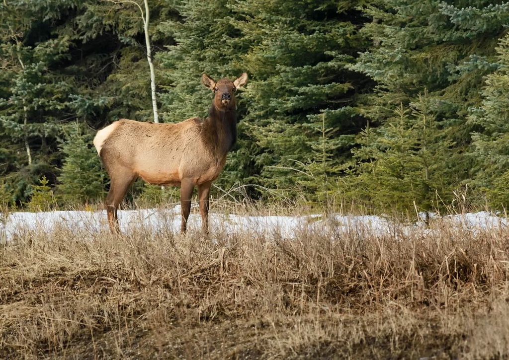
White-tailed and mule deer, bighorn sheep, and elk are common to the Harrison Group; however, mountain goats are by far the most common ungulate within the range. Small populations of caribou have managed to survive in the region and generally live in old-growth spruce forests.
Around 14,000 years ago, the ice sheet that had gripped North America for thousands of years began to permanently melt in the Kootenay Region. Evidence of the early human settlement from around this time can be found throughout the East Kootenay region (which includes the Harrison Group) in the form of ancient quarries, workshops, and campsites.
For countless generations, many Indigenous communities in the region would quarry and work chert to make tools. Chert is an opaque gray sedimentary stone that, when fractured, can produce a very sharp edge. It was particularly valuable to many Indigenous communities at the time as it could be used to create tools that need to be both durable and sharp.
The Harrison Group is part of the traditional lands of the Ktunaxa Nation. The word ‘Kootenay,’ which is used for the names of the region’s river, valley, and adjacent mountain range, is the anglicized pronunciation of the name ‘Ktunaxa.’
Historically, the Ktunaxa regularly traveled from their homes in the region’s valleys for both trading and hunting purposes. They often moved eastward along the Kootenay and Columbia Rivers to the Rocky Mountains. It is known that the Ktunaxa were among the many First Nations who traditionally hunted bison along the eastern slopes of the Rocky Mountains.
European travelers arrived in the region during the early nineteenth century. They first made contact with the First Nations in the region around this time. Adventurers and surveyors, such as Thompson, Simpson, and Palliser, created some of the first formal maps of the region.
In the 1930s, after Mount Andromeda in the Columbia Icefield region saw its first ascent, it was believed that all the peaks above 11,000 feet (3,353 m) in the Canadian Rockies had been surveyed and climbed. However, in the early 1960s, a tall peak in a remote valley to the east of Canal Flats was noticed by the British Columbia mapping branch.
After the cartographers completed their surveys, they concluded that the peak in question was over 11,000 feet (3,353 m) in elevation. In the Canadian Rockies, peaks over 11,000 feet are a big deal. While the Rocky Mountains in the United States boast many mountains over 14,000 ft (4,267 m) in elevation, the Canadian Rockies only have 54 peaks that reach above 11,000 ft (3,353 m).
The tallest peaks in the Canadian Rockies are referred to as the 11,000ers, and Mount Harrison is number 53 on that list as it is 3,360 m (11,024 ft) tall. With a new 11,000er on record, a group from Vancouver climbed the peak for the first time on August 11, 1964. Within a couple of months of the climb, the mountain was officially named Mount Harrison.
Mount Harrison is the tallest mountain of the Harrison Group and the greater Harrison Range. The namesake of the mountain and range is Francis Arthur Harrison, a WWII soldier and recipient of the Distinguished Flying Cross. Harrison was killed in action when his bomber crashed in Germany.
As an 11,000er as well as the tallest mountain in both the Harrison Group and the whole Harrison Range, Mount Harrison is the main climbing attraction in the region.
Ever since it was first summited in 1964, several mountaineering routes have been established for climbers looking to reach the top of the mountain. There is also a route up the peak that would be considered a scramble rather than a technical climb.
In addition to Mount Harrison, there are scrambling routes to the summits of Mount Folk and Smith Peak. The routes to the summits in the range do not have signage; however, some of them have cairns that mark paths across the region’s expansive scree slopes.
It is wise to remember that there is a difference between hiking and scrambling in that scrambling should be considered low-level mountaineering and not just an extreme hike. There is far more risk to scrambling than hiking. Adventurers should ensure they are adequately prepared for the rigors and dangers of any trek in the Harrison Group.
The following are some of the closest cities and towns to the Harrison Group. They all serve as great starting points for adventures in the region.
The city of Cranbrook lies in the Kootenay River Valley in the Canadian Rockies Trench of eastern British Columbia. Cranbrook is the largest city in the region and it is located about 120 km (72 mi) to the west of the Harrison Group.
Cranbrook got its start thanks to the shrewd business dealings of one Colonel Baker during the height of railroad expansion in the region at the end of the nineteenth century. These dealings convinced the Canadian Pacific Railway to run their Crowsnest Pass line through Cranbrook. It was the railway that cemented the town's importance, and it’s what allowed Cranbrook to gain more commercial power over nearby communities, such as Fort Smith.
If you’re headed to Cranbrook, be sure to check out the Cranbrook History Center. The History Center is considered to have both national and international importance thanks to its extensive collection of cultural items. At the museum, there are displays and exhibits of passenger rail cars from the early 1900s, natural history specimens, and artifacts from early human communities in the region.
Located along Highway 3 in British Columbia at the south end of the Harrison Range, the town of Fernie was founded in 1898 by William Fernie after he started mining nearby coal reserves. By 1904, Fernie was incorporated as a city, and, to this day, it remains the only city-class municipality to be completely surrounded by the Rocky Mountains.
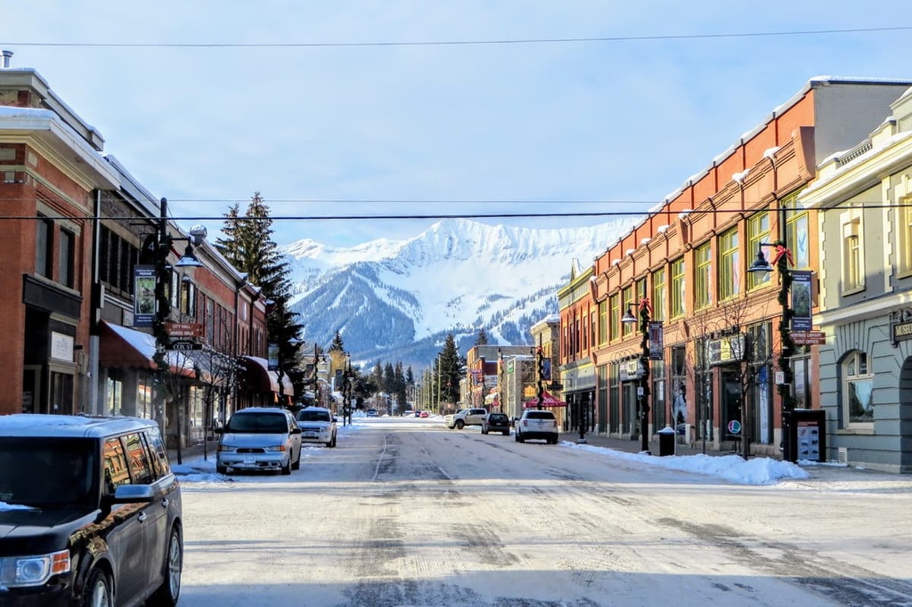
While Fernie started as a coal mining town, it has embraced the mountain culture that’s also found in the towns of Banff and Canmore in Alberta. This has allowed it to become a tourist hotspot, especially during the winter months. Skiing is especially popular near Fernie, thanks to the Fernie Alpine Resort, which was originally created in the 1960s and has since grown to be the modern ski resort that we all know and love.
In addition to excellent skiing, Fernie is home to an assortment of incredible outdoor activities, amazing scenery and wildlife, and an adorable downtown that’s filled with charming stone buildings.
Sparwood is a small town located in southeastern British Columbia that’s home to people who love their wilderness areas and outdoor adventures. In Sparwood, you’ll find everything you need for an adventure into the mountains.
Located along the side of the highway at the edge of Sparwood sits a monstrous green dump truck called the Terex Titan. During its heyday of working in the coal mines between 1978 and 1991, the Titan was the largest functional truck in the world. The truck is now an iconic landmark and tourist stop in the town of Sparwood.
The town’s visitor center is located right next to the Titan and it’s a great place to get expert advice on local activities. Here, you can also pick up a local trails map that highlights all of the paths that have been created and maintained by the Sparwood Trails Association for hiking, cycling, fat biking, cross-country skiing, and snowshoeing.


