
Scan the QR code and open PeakVisor on your phone
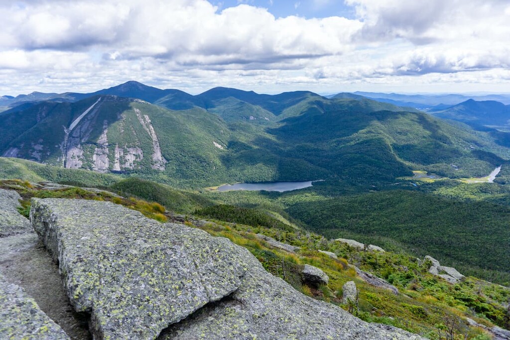
The MacIntyre Mountains are some of the tallest peaks in all of the northeastern US, featuring towering alpine summits and some of the hardest day hikes in the Adirondack Park. There are 10 named peaks in the range, the highest and most prominent of which is Algonquin Peak, the second highest peak in New York state after Mount Marcy and one of the only two mountains in the state above 5,000 ft (1,524 m).
The MacIntyre Mountains are located in the north-central area of the upstate region of the US state of New York. They are situated in the heart of the High Peaks Wilderness in the Adirondack Park.
The range lies to the northwest of Mount Marcy, to the west of Lake Colden, and it runs about 8 miles (13 km) in a northeast–southwest direction. The MacIntyres are bordered on the southwest side by Indian Pass.
The highest peak in the range is Algonquin Peak, followed by Iroquois Peak, Wright Peak, and Mount Marshall. These four mountains are all recognized as official Adirondack High Peaks. There are two other named high points in the range, Boundary Peak and Shepherd’s Tooth, but don’t have enough prominence to be considered separate peaks from an Adirondack 46er perspective.
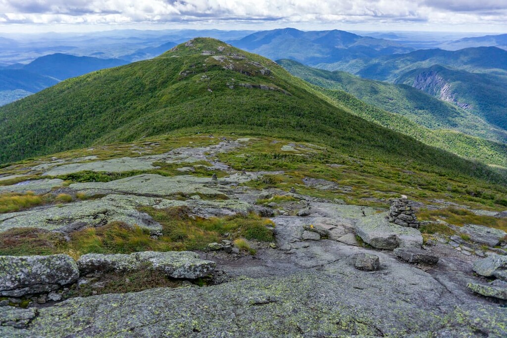
Algonquin, Iroquois, and Wright peaks are all located in a tight ridgeline and they’re frequently hiked as a trio. Mount Marshall lies just to the south of the other three peaks, from which it is separated by Cold Brook Pass. Because it has minimal summit views and no official trail, Mount Marshall is hiked mostly by aspiring Adirondack 46ers.
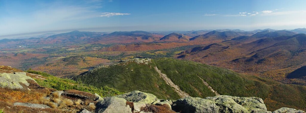
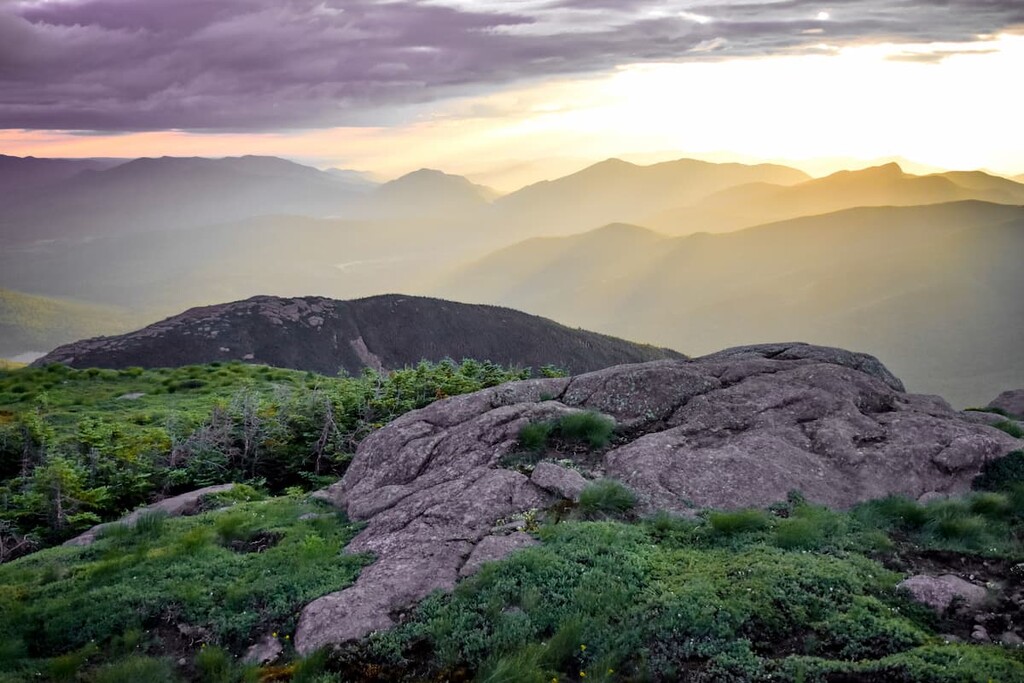
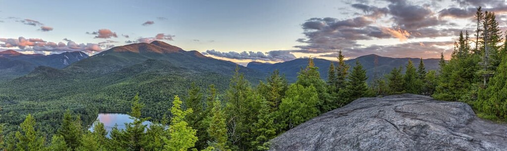
The three highest MacIntyre Mountains feature wide open, above-treeline summits with sweeping views and some of the largest areas of alpine vegetation in New York. On a clear day, you can see all the way to the Green Mountains in Vermont from the summits of the MacIntyres.
The MacIntyre Mountains are surrounded by fantastic hiking opportunities in every direction. The Sentinel Range Wilderness, the McKenzie Mountain Wilderness, the Dix Range, and the rest of the High Peaks Wilderness are all located nearby.
The MacIntyre Mountains are part of the High Peaks region, the zone of the tallest mountains at the heart of the Adirondack range. The Adirondacks are unique in the northeast because they form a circular, dome-shaped grouping of mountains as opposed to a chain, like the Appalachians or the Rockies.
In fact, the Adirondacks are the only mountains in the northeastern US that aren’t directly related to the Appalachians. They formed separately during the earlier Grenville Orogenic Cycle, and some of the exposed bedrock in these mountains is over a billion years old. Furthermore, the Adirondacks are still being lifted by geological forces to this day.
The rock that forms the MacIntyre Mountains and the rest of the Marcy Massif is largely anorthosite, an intrusive igneous rock with a high concentration of plagioclase feldspar. Anorthosite is relatively rare on earth and can only form under extremely high pressures deep within the Earth’s crust. While it’s rare on Earth, anorthosite is fairly common on the surface of the moon.
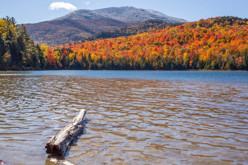
Many of the features we see today in the MacIntyre Mountains, including the nearby scenic Heart Lake and Avalanche Lake, and the large boulders (called erratics) on the mountain summits, were left by glaciers. These glaciers covered the area in ice that was approximately 1 kilometer (0.6 miles) thick during the last glacial maximum.
Another remnant of New York’s glacial history are the large swaths of high alpine vegetation on Algonquin, Wright, and Iroquois peaks. Indeed, the state was largely covered in alpine tundra after the glaciers receded about 12,000 years ago.
As the climate warmed, these unique plants migrated to higher elevations, where they were adapted to the harsh winds and 10 months of frequent frost. Today, these alpine tundra zones are some of the rarest ecosystems in the northeast, with only a few other examples found on the tallest mountains in Vermont, New Hampshire and Maine.
On the summits of Algonquin, Wright, and Iroquois peaks, you can view plants normally only found thousands of miles north, like white diapensia, pink Lapland rosebay (alpine rhododendron), or mountain sandwort.
These alpine zones are incredibly delicate and many places have been badly trampled by hikers over the years. When you’re on the summits of the MacIntyre Mountains, avoid the areas that have been sectioned off for regeneration and walk only on the rocks.
Below the high alpine zones, the MacIntyre Mountains are covered in dense forests, including areas of coniferous boreal forest and lower elevation zones featuring mixed northern hardwood forest. Beech, maple, pine, spruce and larches are all common.
In terms of wildlife, the eastern High Peaks Wilderness is home to a significant bear population. Campers must store food bear canisters, which can be rented for $5 per night (as of 2021) at the High Peaks Information Center at Heart Lake.
The MacIntyre Mountains are also home to other mammals, including deer, coyotes, beavers and racoons. Notable birds in the area include bald eagles, peregrine falcons, great horned owls, and wild turkeys.
There have been people living in the area of the Adirondacks for over 11,000 years. The most active tribal nation in this area prior to European contact was the Mohawk (Kanienʼkehá꞉ka), the easternmost members of the Iroquois (Haudenosaunee) Confederacy.
The Mohawk originally lived around what’s now the Mohawk Valley south of the Adirondacks, but they were pushed north after the arrival of European-descended colonists. During and after the Revolutionary War, the new US government made aggressive moves to strip the Mohawk of their lands, eventually pushing many toward the border with Canada.
Today, there are about 30,000 Mohawk living in the US and Canada, with some represented by the Saint Regis Mohawk Tribe, which is based on the Akwesasne/Saint Regis Mohawk Reservation just north of the Adirondacks.
Algonquin, Iroquios, and Boundary peaks are supposedly named for these Tribes’ territories and the border between them, but there were never actually any Algonquin people active in the High Peaks. (There were some Algonquian-speaking Abenaki and Mohican people in New York state, but not in this area.)
Another thing to note is that the MacIntyre Range’s highest peak is spelled “Algonquin,” which is the spelling correctly used to refer to a specific tribe of Algonquian-speaking people in what is now Canada. The spelling “Algonquian” refers to the Algonquian languages spoken by various tribes across North America.
The Abenaki and Mohican people of New York state were Algonquian-speaking, but have no direct relation to the Algonquin people of Canada. So, spelling this peak as “Algonquian” might be preferable, but the “Algonquin” spelling persists.
Similarly, the MacIntyre range is named for Archibald McIntyre, despite the difference in spelling. McIntyre was involved in the discovery of iron deposits in the area and the founding of the Tahawus mine, which was built during the early nineteenth century just south of the range in the town of Newcomb. The mining operation is closed today, but some of the abandoned buildings are still accessible to intrepid hikers.
Wright Peak, like many of the other High Peaks, was named for a New York Governor, in this case Silas Wright. Mount Marshall was originally named for New York governor DeWitt Clinton, then renamed for original Adirondack 46er Herbert Clark, and finally renamed for Robert Marshall, another one of the original three 46ers and a prominent wilderness activist of Bob Marshall Wilderness fame.
Along with the Great Range, the MacIntyre Mountains are one of the most visited destinations in the Adirondack Park. They can be crowded on weekends and holidays, especially during fall foliage season.
Plan for crowds and arrive early to the trailhead if you want to be sure you’ll find parking. Parking at the Adirondack Loj, where many of these hikes start, is $9 per day for nonmembers and $3 for members as of 2021.
The shortest route to the top of Algonquin Peak is only 4.3 miles (6.9 km) one-way, but it’s steep and nearly technical in places. The trail starts at Adirondack Loj and climbs a total of 2,936 ft (895 m) to the summit of Algonquin Peak. Wright Peak is also accessed via a 0.5 mile (0.8 km) spur off to the right, about 40 minutes before reaching the summit of Algonquin Peak.
At the summit, enjoy the 360-degree views of the surrounding High Peaks. From here, you can continue on to Iroquois Peak 1 mile (1.6 km) away, then retrace your steps down to Adriondack Loj. Be aware that portions of the ridgeline between Algonquin and Iroquois require some scrambling.
Round trip to the summit of Algonquin Peak is 8.6 miles (13.8 km). If you add in Iroquois Peak, it’s an 11 mile (17.7 km) roundtrip.
A great option if you’re looking to extend your hike is to add Avalanche Lake and Lake Colden for a loop. This hike takes you through some of the most beautiful scenery in the Adirondacks, including open peaks and high alpine lakes.
Start from the trailhead at Adirondack Loj and follow the Van Hoevenberg Trail to the Marcy Dam, where there are numerous camping options. From here, the trail continues past Avalanche Lake, which sits below high cliffs in a narrow valley between Avalanche Mountain and Mount Colden. There are ladders and bridges in this area to get hikers over the rock slides.
From here, the trail heads to Lake Colden, where it comes to a junction with the Algonquin Trail to the right. Brace yourself for one of the steepest climbs in the region. The trail is only a little over 1 mile (1.6 km), but it’s so steep that it’s recommended to climb rather than descend it.
The trail gains the ridgeline in the saddle between Boundary and Algonquin peaks. From here, you can turn left to summit Iroquois first, or head straight for Algonquin. The loop continues down the Algonquin Trail to Adirondack Loj, with an optional side trip to Wright Peak.
This loop covers 11.4 miles (18.3 km) and 3,854 ft (1,174 m) of elevation gain, not counting a side trip to Iroquois Peak. While many people do it as a day hike, it can easily be broken up by an overnight stay at the Marcy Dam or Lake Colden.
If you’re looking to summit all 46 Adirondack High Peaks, you’ll need to hike Mount Marshall. While it lacks the 360-degree panoramas of its neighbors, there are still a few good views and the hike is much less popular than others nearby. Be aware this is a herd path and not an official trail, so expect some rough terrain underfoot.
There are two main approaches to Mount Marshall. The first starts from the Adirondack Loj and follows the Avalanche Pass Trail to Lake Colden. From there, take the Cold Brook Pass Trail off to the right. As you climb the pass, you’ll see a herd path leading off to the left which climbs to the Mount Marshall summit. The trail is 14 miles (22.5 km) round trip with 2,595 ft (791 m) of climbing.
You can also approach Lake Colden from the south on the Calamity Brook Trail (parking at Upper Works trailhead) and reach Mount Marshall from there.

If you’re looking for a good base for hiking the MacIntyre Mountains, there are several lovely small towns nearby. Here are some of the best towns to check out in the region:
Keene includes the tiny mountain towns of Keene, Keene Valley and St. Huberts, with a total population of just over 1,000 residents.
While they might not be the largest towns in the Adirondacks, the Keene Valley area is a prime outdoors destination, with high mountain lakes, rock climbing, and trailheads leading off into the High Peaks right from town.
The towns of Keene and Keene Valley are popular access points for the Great Range, but they’re close and convenient for hiking in the MacIntyre Mountains, too. Some of the best rock climbing in the area can be found on the Beer Walls on Route 73, and there are several waterfalls that make for great day hikes.
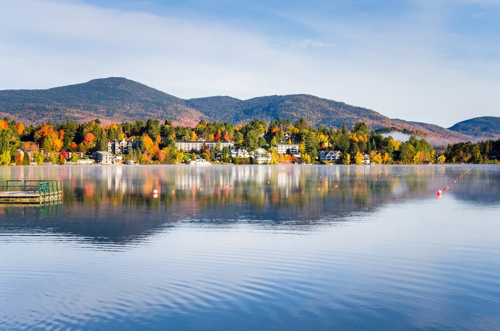
The town of Lake Placid is a beautiful hamlet of 2,300 people on the shores of scenic Mirror Lake, located (confusingly) just south of its namesake lake. The town is a quick 15 minute drive from Adirondack Loj, the main jumping-off point for hikes in the MacIntyre mountains.
Lake Placid punches above its weight with sports and cultural amenities, having hosted the Winter Olympics in 1932 and 1980. The ski jumps, speed skating rink and bobsled run built for the games are still in use in town.
Lake Placid is centrally located, so it makes a good base for exploring other hiking areas in the region, like the Great Range and the McKenzie Mountain Wilderness.


ahp46
northeast-115-4000ers
adirondack-top-100
adirondack-29ers-challenge
ahp46
northeast-115-4000ers
adirondack-top-100
adirondack-29ers-challenge


