
Scan the QR code and open PeakVisor on your phone
The Dix Range include 24 named peaks. The highest is Dix Mountain at 1,478 m. Other notable peaks include Beck-horn, Hough Peak and Macomb Mountain.
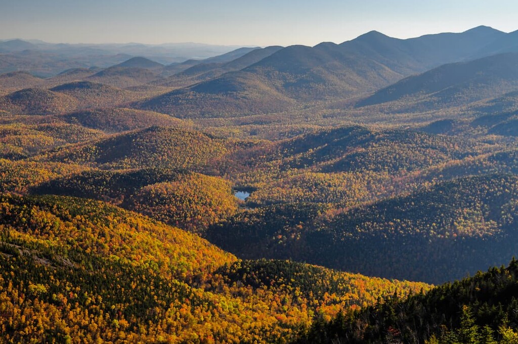
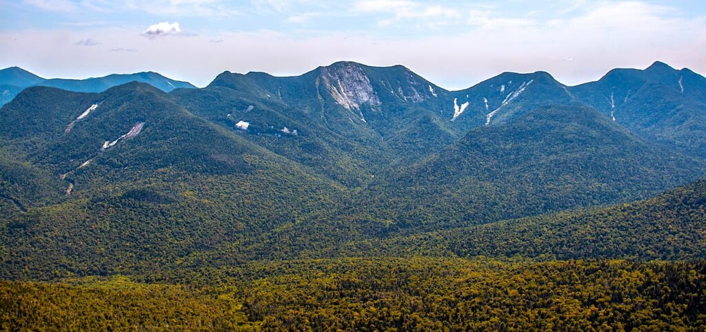
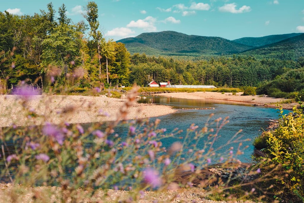
Less visited than the nearby Great Range, but offering equally challenging hikes and beautiful views, the Dix Range is home to some of the tallest mountains in the Adirondack Park. There are 24 named mountains in the Dix Range, including 5 of the official 46 Adirondack High Peaks. The highest and the most prominent peak is Dix Mountain at 4,898 ft (1,493 m).
The Dix Range lies within the High Peaks Wilderness in the north-central area of the Adirondack Park in upstate New York. The range is just southeast of Mount Marcy and the other peaks of the Great Range. Dix Mountain, the highest point in the range, is the sixth-tallest peak in New York.
The Dix Range is about 12 miles (19 km) long and 9 miles (14 km) wide. It’s bordered roughly by I-87 to the east, Route 73 to the north, and the Ausable Valley to the west. The five High Peaks of the range are Dix Mountain, Hough Peak, South Dix (Carson Mountain), Grace Peak (formerly East Dix) and Macomb Mountain.
The Dix Range is part of the former Dix Mountain Area, an independent, 45,000 acre (18,211 ha) tract of Forest Preserve land that was incorporated into the High Peaks Wilderness in 2018. The Dix Range is now considered to be part of the Outer Zone of the High Peaks Wilderness.
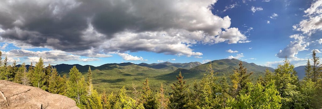
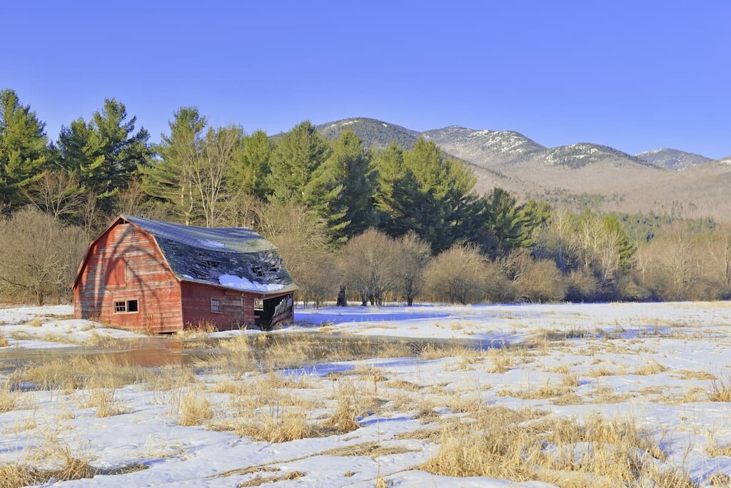
The range is popular for hiking, hunting and trapping, fishing, and rock climbing. Cross-country skiing, ice climbing and snowshoeing are popular in the winter.
Due to its location in the heart of the Adirondack Park, the Dix Range is close to lots of other hiking areas. The rest of the High Peaks Wilderness lies just beyond the Ausable Valley to the northwest of the range. Meanwhile, the Giant Mountain Wilderness, Hoffman Notch Wilderness, and the Hammond Pond Wild Forest are all a short drive (or hike) from the range.
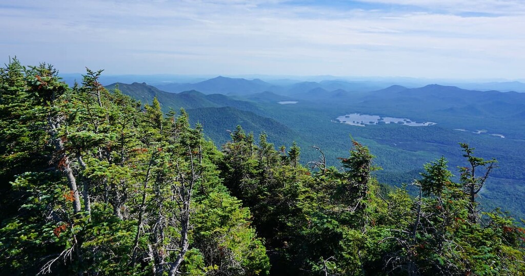
From the open summits of the Dix Range, hikers can even see all the way to the Green Mountains in neighboring Vermont.
The Dix Range is part of the Adirondacks, a unique mountain range that forms a 160 mile (257 km) wide dome reaching over a mile (1.6 km) high.
The Adirondacks formed separately from the nearby Appalachians during the Grenville Orogenic cycle, and they’re still rising about 2 millimeters per year, faster than they’re being eroded away.
The Dix Range is part of the Marcy Massif, which makes up the concentrated zone of the tallest High Peaks. Most of the rock in this area is anorthosite, an intrusive igneous rock with a high concentration of plagioclase feldspar. Anorthosite is only formed under intense pressures that occur deep within Earth’s crust. While it’s relatively rare on Earth, it’s fairly common on the surface of the moon.
The landforms we see today in the Dix Range formed mostly as a result of extensive glaciation when the Laurentide Ice Sheet covered the area during the last glacial maximum. Hikers can still see the amphitheater-shaped cirques and large boulders, called erratics, left behind by the glacier.
The Dix Range is popular for its rock slides, steep mountain areas where thin soil has washed away exposing the rock underneath. Some slides are used as “herd paths,” or informal trails, to trailless summits, while others are climbed just for the challenge.
The Finger Slides, located in a cirque on the northern slope of Dix Mountain, are some of the most popular slides—long exposed areas of bedrock going down a slope—in the region.
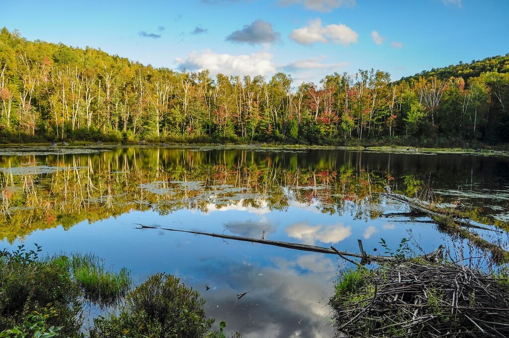
The Dix Range is home to boreal and northern hardwood forests. Pine, spruce, larches, beech and maple trees are common in the range.
Dix Mountain has a unique area of high alpine tundra, which features hardy plants that are more commonly found thousands of miles closer to the Arctic. These alpine tundra zones are rare and extremely delicate, so be sure to stay on the rocks when climbing these peaks, especially in areas with no designated trail.
The Dix Range is remote and, as such, it is a good habitat for large mammals like moose, deer and bears. Moose are protected in the Adirondacks, but both deer and bears are hunted in the fall.
There’s enough bear activity in the area that hikers are required to store food in canisters outside of winter months. Bear hangs are no longer permitted in the Dix Range as Adirondack bears are too familiar with them.
There are also a number of birds in the area, including wild turkeys, blue birds, and great blue herons. Hikers have also spotted bald eagles, ospreys, and great horned owls in the range.
The earliest human settlement in the Adirondacks dates back over 11,000 years. The mountainous terrain of the High Peaks was used for hunting, fishing and transit by the Indigenous groups in the area, but less often for permanent settlement.
The most active tribe in the High Peaks region prior to European contact was the Mohawk (Kanienʼkehá꞉ka), the easternmost member of the Iroquois (Haudenosaunee) Confederacy, also called the Six Nations. After the arrival of European settlers, the Mohawk developed a reputation as fierce defenders of their territory and culture.
They allied with the British during the Revolutionary War and frequently defeated American soldiers, but most (including those that allied with the colonists) were forced to leave their homes after the war. Sullivan’s Expedition, a series of American raids that destroyed 40 Mohawk and other Iroquois villages in the area, was particularly devastating.
The Mohawk were forced northward toward the Canadian border, with some settling in the area that became the Six Nations of the Grand River in Ontario and others on the Akwesasne/Saint Regis Mohawk Reservation. These days, more than 100,000 members of the Six Nations live both in the US and Canada, and there are approximately 30,000 people of the Mohawk Nation living in both countries.
The Dix Range is named for John Dix, a Union general during the Civil War and governor of New York. The other peaks in the range are also named for prominent Americans. Macomb Mountain is named for general Alexander Macomb, who won a historic victory at the Battle of Plattsburg during the War of 1812.
Hough Peak (pronounced “Huff”) is named after Franklin B. Hough, the first chief of the United States Division of Forestry who considered a foundational figure in American environmental conservation. East Dix was recently renamed Grace Peak in honor of Grace Hudowalski, the first woman to summit all of the High Peaks and a pioneer of the ADK46ers.
South Dix is currently in the process of being renamed Carson Peak after Russell M.L. Carson, whose 1927 book "Peaks and People of the Adirondacks" is credited with increasing interest in the Adirondack region.
Hiking in the Dix Range can be challenging. Only Dix Mountain has an official trail to the summit. The other four High Peaks are accessed by slide climbing or herd paths, unmaintained trails that have developed over the years. These climbs are steep, remote, and require some navigation skills.
Hikers should be aware that while the Dix Range isn’t as popular as neighboring Mount Marcy, it can still get crowded.
The Elk Lake trailhead lot is small and it fills up early. Do keep in mind that cars parked on the road are towed quickly as the road and trailhead are technically private property, but there is an easement to allow access to the Dix Range. To avoid any issues with parking, please note that there’s an overflow parking lot two miles down the road.
The Elk Lake trailhead is also closed to hikers during big game hunting season in late fall, and hikers should be aware that the whole Dix Range area is popular with hunters and trappers throughout the year. Check if there’s a hunting season running before you head out on the trail and make sure you (and your dog) are wearing bright colors during hunting season.
The most popular starting point for hiking in the Dix Range is the Elk Lake trailhead, which leads up to the summit of Dix Mountain in 6 miles (9.7 km) one-way with a minimum of 2,600 ft (792 m) of elevation gain. There are two routes to the summit, one over Beckhorn rock and the other through Hunter’s Pass. They can be joined to make a 14.1 mile (22.7 km) partial loop over Dix Mountain.
While all the High Peaks of the Dix Range can be day hiked, they’re so remote and difficult to access that it’s common to hike all five as one 15.3 mile (24.2 km) loop. After Dix Mountain, you’ll have to follow herd paths to reach the rest of the peaks. (Grace Peak is a 2.2 mile (3.5 km) round trip detour from the main loop.)
Some hikers will attempt the whole loop in a day, but it makes a great overnight or weekend trip. There are two campsites on the Dix Trail that make a great base for peak bagging, one at Slide Brook and the other at Lillian Brook. Both have lean-tos, but they often fill up at peak times so be prepared to tent camp.
There are herd paths leading to the peaks from each campsite. The Slide Brook herd path is popular because it leads up to Macomb Mountain and sets hikers up for a counterclockwise loop that finishes on Dix Mountain, the highest peak.
When hiked as a loop in this direction, the Dix Range is a grueling 15.3 mile (24.2 km) trek with 5,183 ft (1,580 m) of climbing.
While the herd paths in the range are fairly well defined, this hike is very strenuous and not recommended for children or beginner hikers. Anyone attempting the loop should carry a map and compass and keep track of their location.
Adventurous hikers seek out Adirondack slides for the added challenge of scrambling over steep rock faces called slides. Some of the herd paths in this area follow slides, others require bushwacking too and from the slide.
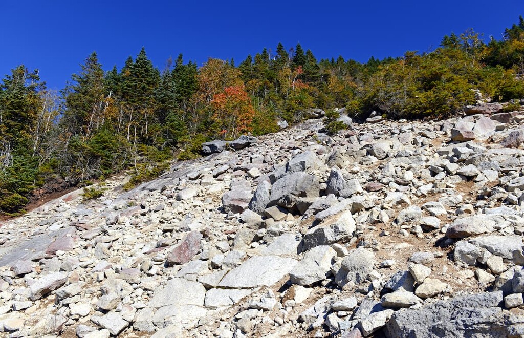
In the Dix Range, there are numerous slides that can be climbed. Some of the most popular are on Dix Mountain, including the Hunter’s Pass Slide, which extends 900 vertical feet (274 m) on the western side of the mountain. Grace Peak also features a long rock section called the Great Slide.
Novices should be aware that slide climbing can be much more dangerous than trail hiking. Some slides are steeply pitched, while others will have loose rock and some might even require a rope and harness to climb safely. A long fall in the Adirondack wilderness could mean hours without help. Plan accordingly and go with experienced slide climbers or guides.
Looking for a place to stay during your trip to the Dix Range? Here are some of the best nearby towns to check out:
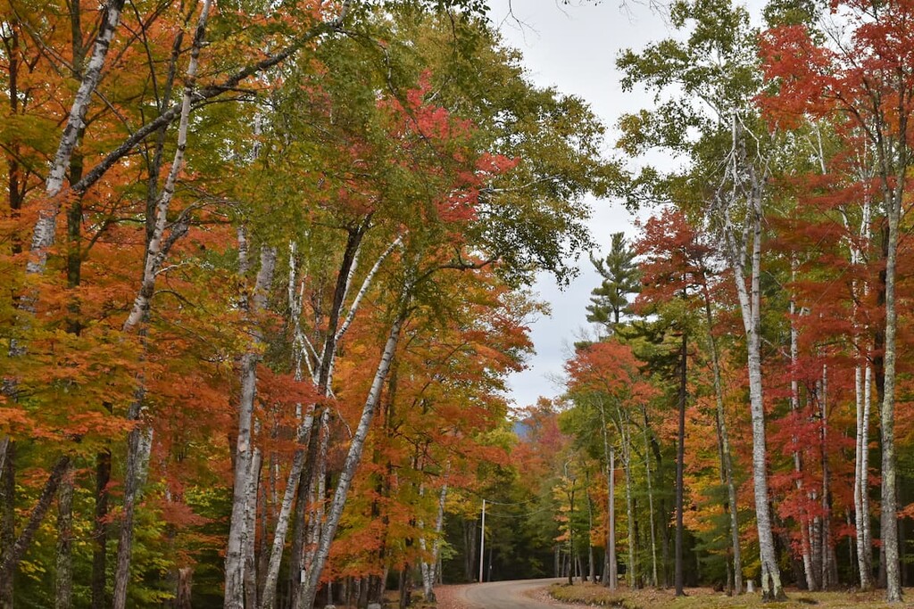
The towns of Keene and Keene Valley, located due north of the Dix Range on scenic Route 73, are one of the most popular bases for hikers heading into the High Peaks. These are small towns of just over 1,000 people, but they offer visitors access to the best of the region, including rock climbing, waterfall hikes and scenic lakes.
The Beer Walls and the Chapel Pond Slabs are home to some of the best-known rock climbing areas in the High Peaks region. There are also great day hikes to waterfalls in the area, including 100-foot (30 m) Roaring Brook Falls and 20-foot (6 m) Bushnell Falls.
Elizabethtown, another small town located northeast of the Dix Range, bills itself as the “Eastern Gateway to the Adirondack High Peaks.” It’s located on Route 9 just outside Giant Mountain Wilderness.
For a small mountain village, Elizabethtown has a number of attractions for tourists, including a museum, antique stores, restaurants and a golf course.
North Hudon is a tiny town of 240 people on Blue Ridge Road/County Route 84. It’s the closest settlement to the main Elk Ridge Trailhead for the Dix Range. There are a couple of lodging options in town, including a large campground with areas for equestrian camping and day use.
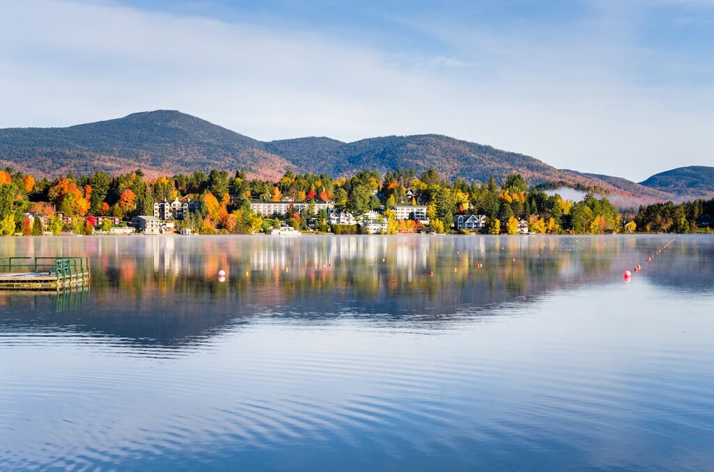
Lake Placid is a town of 2,300 residents located to the northwest of the Dix Range on Route 73. It’s one of the major tourist destinations in the Adirondacks, thanks in part to the fact that it hosted the Winter Olympics in 1932 and 1980. The winter sports infrastructure from those events, including the ski jumps, speed skating rink, and bobsled run, are all still in use to this day.
Lake Placid is about an hour from the Elk Ridge trailhead, but if you’re looking to stay somewhere with the most infrastructure and tourist amenities, Lake Placid is the best choice.


The highest peak in the Dix Range is Dix Mountain, at 1,478 m.
The Dix Range have 24 named peaks.


