
Scan the QR code and open PeakVisor on your phone
The Yellow Mountain State Natural Area is a State Natural Area that protects critical scientific, aesthetic, and ecological resources in the Roan Highlands area of the US state of North Carolina. There are 11 named mountains in Yellow Mountain State Natural Area. Big Roan Ridge (6,132 ft/1,869 m) is the highest point and the most prominent is Little Yellow Mountain (5,492 ft/1,674 m).
The Yellow Mountain State Natural Area is managed by Grandfather Mountain State Park. In addition to protecting about 2,456 acres (994 ha) of wilderness in Caldwell County and Watauga County, Grandfather Mountain State Parkalso preserves about 4,563 acres (1,847 ha) of non-contiguous Appalachian Mountain bogs and fens in the Yellow Mountain State Natural Area, Bear Paw State Natural Area, Beech Creek Bog, Sugar Mountain Bog, and Pineola Bog.
The Yellow Mountain State Natural Area lies in portions of Mitchell County and Avery County, near the Tennessee-North Carolina border. It encompasses portions of the Unaka Range, a subrange of the Appalachian Mountains that stretches from the Nolichucky River to the south, to the Watauga River to the north.
The Unakas are surrounded by many other subranges of the Appalachian Mountains, including the Iron Mountains to the north and Bald Mountains to the south. Directly adjacent to the Yellow Mountain State Natural Area, Roan Mountain encompasses five distinct summits.
The first set of summits, Roan High Bluff and Roan High Knob, lie west of Carvers Gap. The second set of summits, collectively known as Grassy Ridge, are situated east of Carvers Gap. The three peaks atop Grassy Ridge are Round Bald, Jane Bald, and Grassy Ridge Bald.
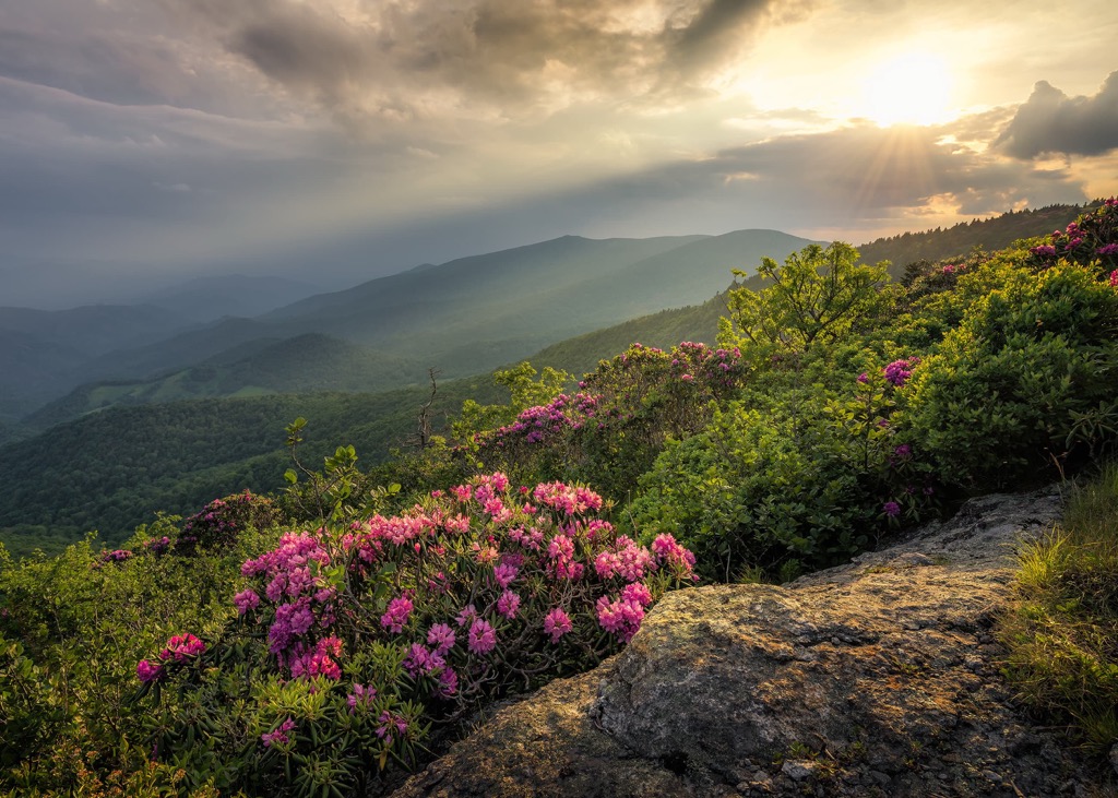
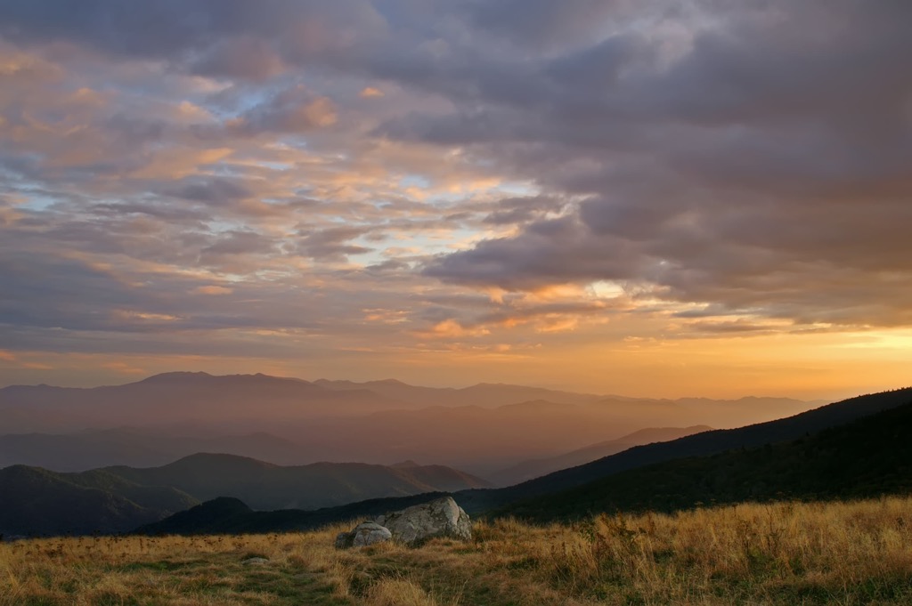
The Yellow Mountain State Natural Area protects the high mountain heath bald and grasses of the Roan Highlands in the Unakas, where several summits rise above 5,000 feet (1,524 m). Prominent peaks in the area include Little Yellow Mountain, Big Roan Ridge, and Hawk Mountain.
The Yellow Mountain State Natural Area is encircled by the Pisgah National Forest, which is bordered by the Cherokee National Forest to the north and Great Smoky Mountains National Park to the west.
There are many protected parks and wilderness areas near the Yellow Mountain State Natural Area, including the Unaka Mountain Wilderness, Sampson Mountain Wilderness, Linville Gorge Wilderness, Pond Mountain Wilderness, and Mount Mitchell State Park.
The Yellow Mountain State Natural Area lies in the Appalachian Mountains, which stretch from the state of Alabama to the south all the way to the province of Newfoundland and Labrador in Canada to the north.
More specifically, the park protects the high mountain heath bald and grasses of the Roan Highlands. The rocks that make up Roan Mountain, adjacent to the Yellow Mountain State Natural Area, are a type of metamorphic rock known as Cranberry gneiss.
The mountains in this region formed about 1.1 billion to 250 million years ago, during the Grenville orogeny and subsequent Alleghanian orogeny. Another form of metamorphic rock found in the area, Roan gneiss, was formed roughly 800 million years ago. Beech granite, a 700-million-year-old igneous rock, is also prevalent in the area.
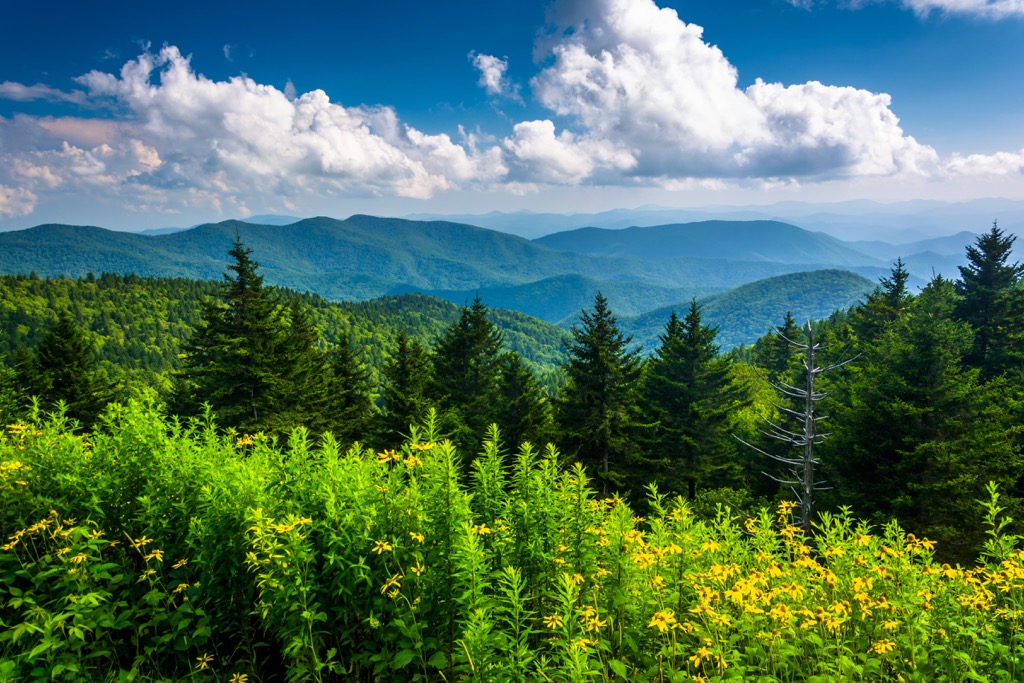
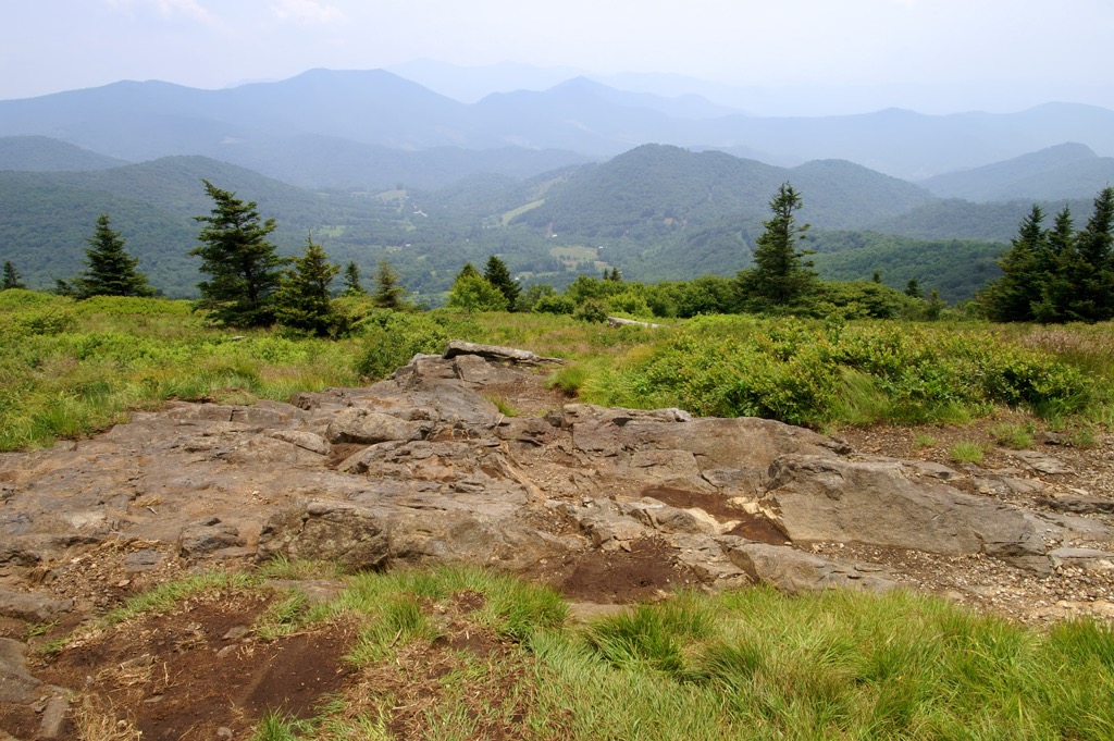
The Yellow Mountain State Natural Area is one of the most biologically diverse areas in the southern Appalachian Mountains. The area sustains an incredible mix of habitat, including spruce-fir forest, grassy balds, high elevation summits, and rich coves.
Nearly 220 acres (89 ha) of the Yellow Mountain State Natural Area lies on Little Hawk Mountain, which adjoins Little Yellow Mountain and the Hawk Mountain Natural Area. The Audubon Society’s Roan Mountain Important Bird Area covers much of this acreage.
More than 1,000 acres (405 ha) of Little Yellow Mountain are also protected by the Yellow Mountain State Natural Area. Little Yellow Mountain contains 76 rare species of plants and animals. The mountain also generates feeder streams for the North Toe River, which acts as a critical habitat for aquatic species, including smallmouth bass, green sunfish, redbreast sunfish, and rock bass.
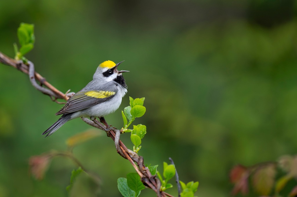
Rare plants and animals found in the Yellow Mountain State Natural Area include the northern flying squirrel, the spruce-fir moss spider, Gray’s lily, Roan Mountain bluet, and rock gnome lichen. Elevated ridgelines in the area also provide passage for neotropical birds during migration, including Common Raven, Golden-winged Warbler, and Northern Saw-whet Owl.
Present-day Mitchell County and Avery County, where the Yellow Mountain State Natural Area is located, have been home to humans for thousands of years.
Before contact with Europeans, the Catawba people inhabited much of the area east of the Blue Ridge Mountains and the Cherokee lived west, among the foothills of the Unaka Mountains.
Though neither tribe lived in the present-day Yellow Mountain State Natural Area permanently, they regularly used the Toe River Valley and surrounding mountains as a hunting ground.
Spanish conquistadors led by Hernando de Soto reached what is now Avery County as early as 1540. In search of gold, De Soto and his men followed an ancient path first used Native Americans to traverse from the rolling piedmont across the high mountains. Sadly, his men also introduced smallpox and other deadly European diseases to indigenous populations.
Not long after, in 1566, Spanish explorer Juan Pardo began a similar expedition through western North Carolina. Pardo sought to subdue Native inhabitants and find a route to the Spanish settlement in Zacatecas, Mexico, where they had silver mines. Along his journey, Pardo made contact with the Catawba, Wateree, and Sazapahaw people, among others.
Pardo established several forts and claimed sovereignty over many Native settlements in the area. One example, Fort San Juan, occupied Joara, a large Native American settlement near present-day Morganton, North Carolina. After many years of violent conflict between Spanish colonizers and Natives, the Spanish ended their colonization efforts in the interior of the southeast.
Westward expansion and colonization in the southern Appalachians didn’t end with the Spanish. For the next several decades, European settlers of English, Scotch-Irish, and German descent traversed through and settled in northwest North Carolina.
The Yellow Mountain State Natural Area lies in Mitchell County, created in 1861, and Avery County, created in 1911. Since 2008, the Southern Appalachian Highlands Conservancy (SAHC) has been actively acquiring land in both counties to protect critical habitats in and around the Yellow Mountain State Natural Area.
As recent as 2019, the SAHC purchased 456 acres (185 ha) in the Cane Creek Mountains to preserve an important ridgeline corridor that adjoins Cane Creek Mountain Preserve and Little Hawk Mountain Preserve, joining sections of the Yellow Mountain State Natural Area.
There are no designated trails that begin in the Yellow Mountain State Natural Area. However, many miles of the Appalachian Trail traverse through the area. These are some of the best trails in the area:
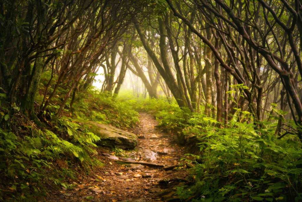
The ascent to Roan High Knob begins from the Roan Mountain trailhead at Carvers Gap. It follows the Appalachian Trail west from Carvers Gap, traversing through a lush forest filled with balsam fir trees, fern, and moss. The trail reaches the highest elevation shelter on the Appalachian Trail, Roan High Knob shelter, before traversing to an overlook with exceptional views of the surrounding wilderness.
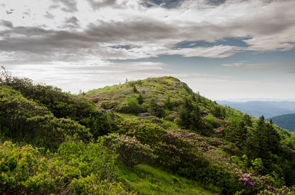
Located on the eastern flank of Roan Mountain, Grassy Ridge is the longest stretch of grassy bald in the Appalachian Mountains. The trail begins with a quick climb from Carvers Gap to the summit of Round Bald. From there, hikers continue along the Appalachian Trail to the summit of Jane Bald before making a final ascent to Grassy Ridge Bald. From Grassy Ridge Bald, hikers are rewarded with panoramic views of surrounding summits, including Grandfather Mountain, Beech Mountain, Sugar Mountain, Mount Mitchell, and the Black Mountains.
Looking for a place to stay near the Yellow Mountain State Natural Area? These are some of the best nearby towns:
Spruce Pine is a small mountain town with deep roots in arts, culture, and community. Its annual festivals and events celebrate the region’s local culture and heritage. Surrounded by national forest and the scenic Blue Ridge Parkway, Spruce Pine is known as a gateway to the southern Appalachians. Nearby hikes and natural attractions include Grassy Creek Falls, Gem Mountain, Linville Falls, Mount Mitchell State Park, and Roan Mountain.
Like Spruce Pine, Bakersville is a charming mountain town with a thriving arts community and ample access to outdoor recreation. The town sits in a valley at about 2,460 feet (750 m) near the Toe River, South Toe River, and Cane Creek.
Though less than 500 people reside in Bakersville, the town hosts a variety of unique shops, restaurants, and accommodations. Visitors to Bakersville can easily access hiking trails on Roan Mountain, drive the Blue Ridge Parkway, or explore dozens of nearby waterfalls.


