Scan the QR code and open PeakVisor on your phone
The Shenandoah Wildlife Management Area (WMA) is an outdoor recreation destination located within the US state of West Virginia. The WMA lies within the George Washington National Forest along the state’s border with Virginia. The tallest and most prominent peak is Reddish Knob at 4,393 feet (1,339 m) tall with 1,998 feet (609 m) of prominence.
The Shenandoah WMA lies in eastern West Virginia, along the state’s border with Virginia. The WMA spans 50,738 acres (20,533 ha) and is surrounded by a portion of the George Washington National Forest.
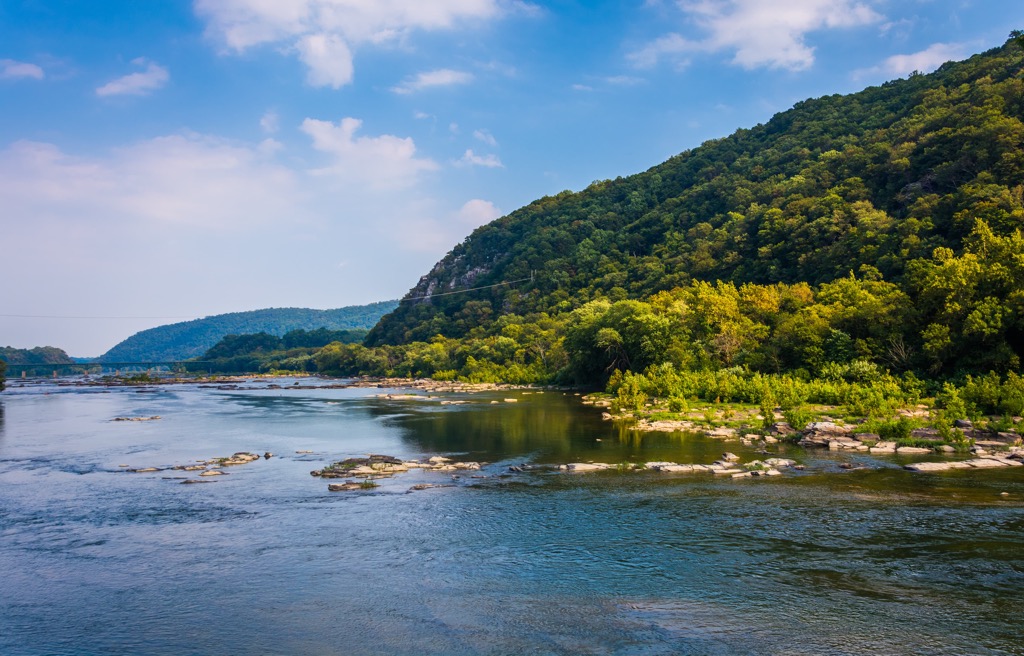
The entire WMA lies within Pendleton County with elevations ranging from around 1,250 feet (381 m) up to the summit of Reddish Knob. The state’s border marks the eastern boundary while the South Branch Potomac River defines the western border.
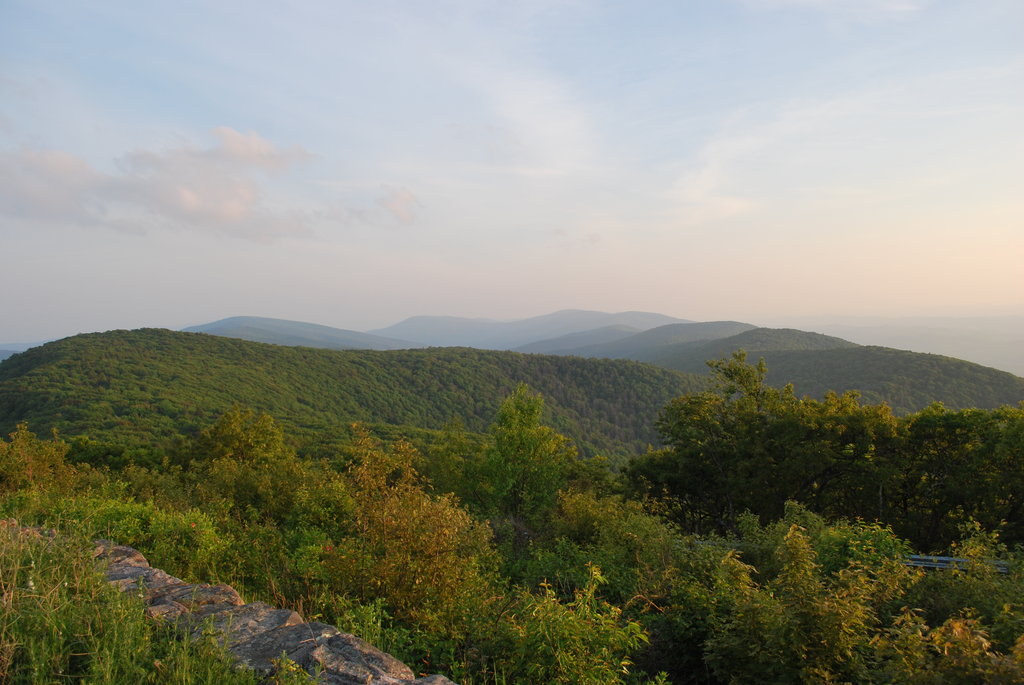
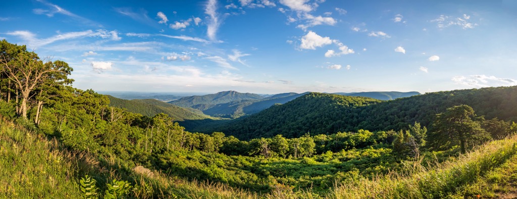
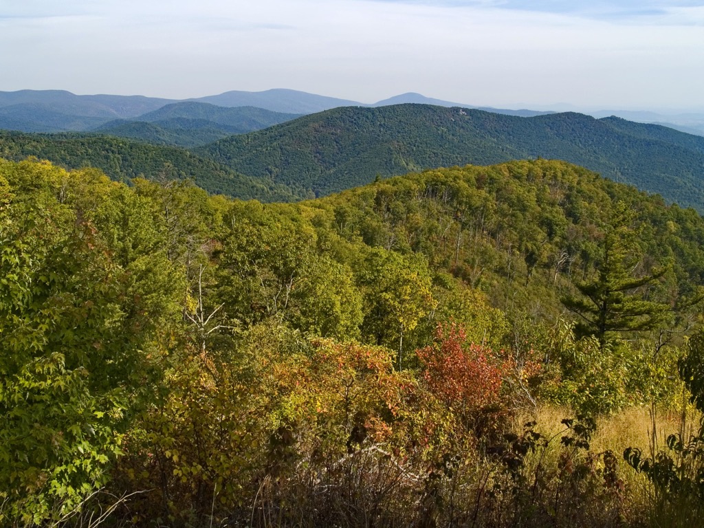
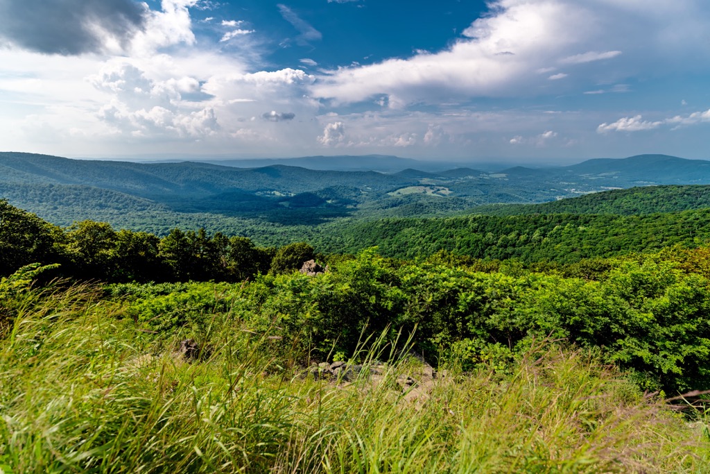
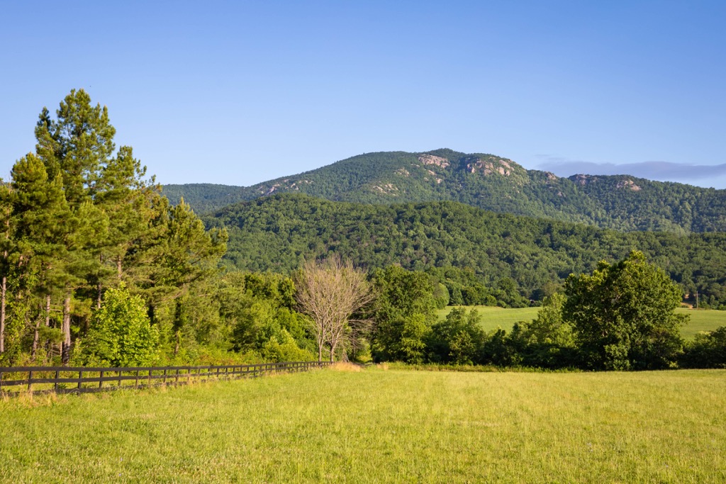
A majority of the landscape is defined by rugged and steep forested hills. A main ridgeline runs down the center of the WMA in a north to south fashion, encompassing the major peaks in the region.
The landscape consists primarily of oak-hickory forests with some of the taller peaks providing views of the region. Various seasonal creeks and streams run throughout during the wetter months of the year.
The Shenandoah WMA lies within the North River District of the George Washington National Forest. Other nearby protected areas include Wardensville WMA to the northeast and Potomac WMA to the northwest. The Warm Springs District of the George Washington National Forest lies to the south along with the Rich Hole Wilderness.
The main ridgeline in the WMA is part of the Appalachian Mountains, a range that spans across the eastern US from the state of Alabama northward to the Canadian province of Newfoundland and Labrador.
These peaks are also part of the Appalachian Ridges, a subrange of the Appalachian Mountains that are often referred to as the Ridge-and-Valley Appalachians. This subrange extends throughout the North River District of the forest.
These peaks are geologically separate from the nearby Blue Ridge Mountains, which are located in the southern portion of West Virginia. The peaks found in the nearby Shenandoah National Park and part of the Blue Ridge Mountains.
The Appalachian Ridges were formed by a fold and thrust belt that was uplifted during the Alleghenian orogeny. This major mountain building event helped lay the foundation for the Appalachian Mountains.
As the land was thrust further upwards, various rivers and streams carved out the landscape, deepening the valleys found in the region. The rounded peaks found in both West Virginia and Virginia help showcase the geological history of the area.
Major peaks found within the Shenandoah WMA include Reddish Knob, High Knob, Cow Knob, Fisher Knob, and Bother Knob.
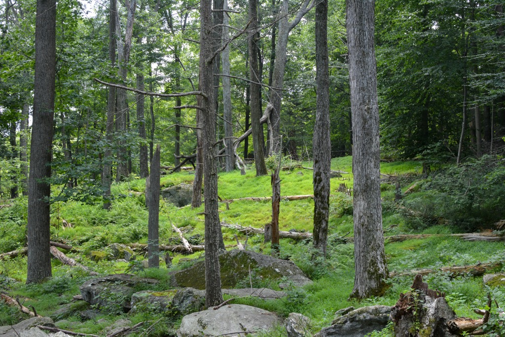
Despite the relatively small size of the WMA, a variety of flora and fauna are able to thrive due to the network of surrounding national forest lands. The WMA is part of the larger Appalachian-Blue Ridge forests ecoregion.
Home to more than 50 tree species and over 2,000 species of flowering plants, this ecoregion is one of the most biodiverse places in the entire eastern US.
A majority of the region is forested, consisting primarily of mixed pine hardwood. Hikers are likely to also spot deciduous trees such as beech, yellow birch, mountain maple, and sugar maple.
The WMA is also used for hunting, trapping, and fishing. Larger animals found in the area include black bear, white-tailed deer, bobcat, coyote, and red fox. Other common animals include squirrels, grouse, mink, muskrat, and opossum. The various creeks and rivers are home to largemouth bass, channel catfish, and trout.
The land within and surrounding the Shenandoah WMA has been inhabited by humans for thousands of years. Though territorial boundaries are often difficult to discern, the surrounding region marks part of the ancestral homelands of the Sapony, Cherokee, Monacan, Tutelo, and Mannahoac tribes.
During the eighteenth century, the first people of European descent arrived in the region. Over the following decades, the nearby settlements began to steadily grow, often forcing the Indigenous peoples from their homelands.
One of the most prominent settlements was Staunton which quickly became an important trading post. Staunton continued to act as an important post during the Civil War as it was a vital location for the Confederacy.
European diseases, such as measles and smallpox, drastically affected the Indigenous groups as they had no natural immunity to the illnesses. Following the Indian Removal Act, the US government forcibly removed the tribes and relocated them to reservations.
In what would later be known as the Trail of Tears, the Indigneous peoples were forced to travel by foot to present-day Oklahoma. As much as a quarter of all those who began the journey would die along the route.
The Shenandoah National Forest was established in 1918 and would later be renamed the George Washington National Forest in 1932. The forest was administratively combined with Jefferson National Forest in 1995.
The Shenandoah WMA is home to numerous hiking trails. Here are a few of the popular routes within this region:
Located along the eastern edge of the WMA lies the High Knob Tower Trail. The out and back trail climbs steadily throughout along the forested hillsides. Once at the summit, hikers are greeted with a fire lookout tower that offers panoramic views of the alternating valleys and ridgelines. This entire trail is 2.7 miles (4.3 km) roundtrip with 682 feet (208 m) of total elevation gain.
This trail follows along one of the main ridgelines on the eastern side of the WMA, along the border between Virginia and West Virginia. The route is used by hikers and those with off roading vehicles. The best views along the route are at the summit of Shenandoah Mountain. This out and back hike is 8 miles (13 km) long and features 941 feet (287 m) of elevation gain.
The Sawmill Loop Trail lies in the center of the WMA. The route begins at the Brandywine campground and gently winds through the forest. Hikers can extend the route by summitting nearby High Knob and Cowger Mountain. This loop trail is 4.8 miles (7.7 km) round trip and features 695 feet (212 m) of elevation gain.
Looking for a place to stay near the Shenandoah Wildlife Management Area? Here are some of the best cities and villages to check out in the region:
The city of Winchester lies northeast of the WMA. Situated in northern Virginia, within the Shenandoah Valley, the city is home to a multitude of historical sites. Major sites include the Museum of the Shenandoah Valley, Handley Library, and the Glen Burnie House.
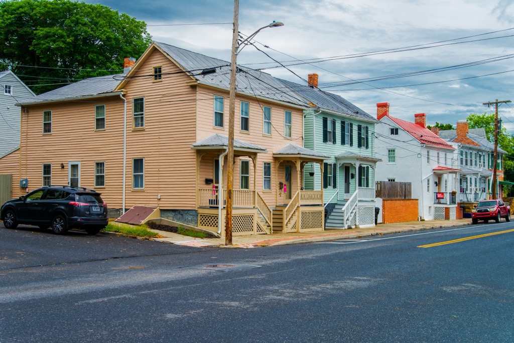
Home to around 28,000 residents, Winchester provides a quaint city scene, compared to nearby Washington D.C. Every year Winchester hosts the Shenandoah Apple Blossom Festival which has been running annually since 1924. With close proximity to both Washington and Jefferson National Forests, Winchester is an ideal location for year round outdoor recreation.
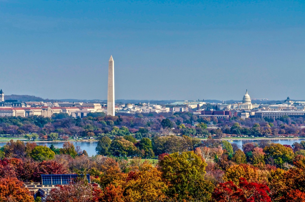
Washington, D.C is the closest major city to the WMA and the capital of the US. Known for its museums, historical sites, and performing arts, the city is also home to the major branches of government.
With a population around 700,000 residents, the district lies along the Potomac River and is bordered by the states of Virginia and Maryland. Major historical landmarks include the United States Capitol, Library of Congress, Smithsonian, Lincoln Memorial, National Gallery of Art, and the Washington Monument.
A majority of the major sites in the region also offer tours in order to learn more about the history of the country. In recent decades, Washington D.C. has also become known for its thriving food scene.