Scan the QR code and open PeakVisor on your phone
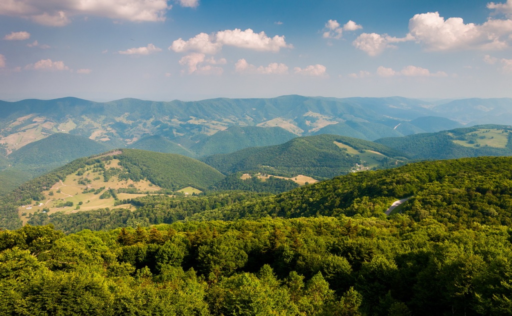
The Potomac Wildlife Management Area is one of ten wildlife management areas (WMAs) within Monongahela National Forest in the US state of West Virginia. The Potomac WMA contains 44 named mountains. Spruce Knob is both the highest and most prominent mountain in the Potomac WMA at 4,862 ft (1,482 m) in elevation and with 2,805 ft (855 m) prominence. It is also the tallest peak in West Virginia.
Encompassing parts of Randolph, Pendleton, Grant, and Tucker counties in West Virginia, the Potomac Wildlife Management Area covers 139,786 acres (56,569 ha) of land within Monongahela National Forest. It is jointly managed by the US Forest Service and the West Virginia Division of Natural Resources.
Mountains in the Potomac WMA range in elevation from lows of around 900 ft (274 m) to a high of 4,862 ft (1,482 m) at Spruce Knob. The mountains in the WMA are part of the Allegheny Mountains, which are a subrange of the Appalachians.
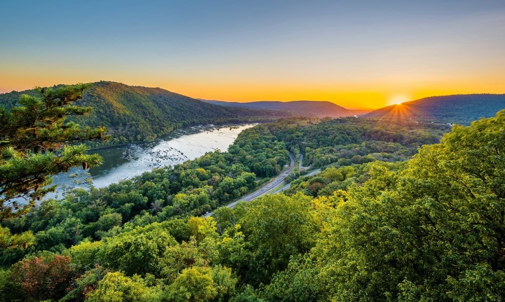
The WMA encompasses the South Branch of the Potomac River, the North Fork of the South Branch River, Red Creek, Gandy Creek, and Spruce Knob Lake. It also overlaps with a number of other areas of public land such as the Dolly Sods Wilderness, the Roaring Plains West Wilderness Area, and the Spruce Knob–Seneca Rocks National Recreation Area.
The mountains in the Potomac WMA were created as part of the Alleghenian orogeny. The Alleghenian orogeny was a mountain-building event that occurred when the tectonic plates underlying Africa and North America collided between 325 million and 260 million years ago during the formation of the supercontinent Pangaea.
Exposed columns of rock in the WMA reveal sandstones, limestones, and shales dating from the Silurian period (443.8 million to 419.2 million years ago) to the Devonian period (419.2 million to 358.9 million years ago). Although glaciers were not present in the region during the Pleistocene, rock patterns indicate that the area experienced alternating periods of freezing and thawing from fluctuations in the local climate.
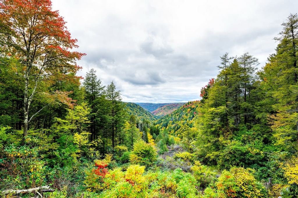
Around 185 million years ago, the sedimentary rock in the region began to fold over itself, and water flowing through the valley began to course through the troughs, carving out deep gorges. One of the most impressive of these troughs is Smoke Hole Canyon, a canyon that’s nearly 0.5 mi (0.8 km) deep and 20 mi (32 km) long.

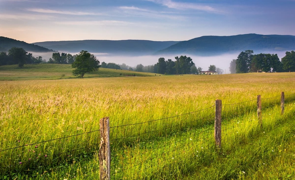
Oak-hickory and northern hardwoods such as maple, beech, cherry, and birch dominate the forest in the region.
Historically, red spruce covered many mountainsides in the WMA, growing in thick, nutrient-dense humus. However, early European settlers to the region logged and burned the old-growth forest to clear space for pastureland. Regular logging and fires subsequently stripped the soil of many of its nutrients.
The US Forest Service took over Monongahela National Forest in 1921. Subsequent efforts to restore red spruce forests in the region have been slow but ultimately successful.
On Spruce Knob, red spruce still grows, but these trees are often bare on one side where strong winds from the west prevent branches from growing. Blueberry, huckleberry, and azaleas all grow in the understory of these forests.
One of the largest intact red spruce-northern hardwood forests of the Central Appalachian Forest region exists on Mount Porte Crayon and is managed by The Nature Conservancy. Here, highbush cranberry dominates the forest understory.
Hunting is permitted within the Potomac WMA for turkey, deer, bear, squirrel, grouse, and rabbit. There are excellent opportunities for trout fishing in the North Fork and the main South Branch of the Potomac Rivers as well as in Gandy Creek, Red Creek, and Spruce Knob Lake.
Archaeologists have found artifacts that indicate the presence of humans hunting wooly mammoths in the region as far back as 14,000 years ago. Further archeological studies have found human-made mounds in the area that date back about 2,500 years.
Several Indigenous Tribes have called the land home since at least the 1600s. However, many of these Tribes were forcibly relocated by settlers of European descent and the US Government by the mid-1800s. Some of the main Tribes that have ancestral homelands in the region include the Saponi and Delaware as well as the Shawnee, who traditionally lived to the northwest.
Early European settlers cleared much of the old-growth forest in the region for pastureland and logging. Today, the area is used for hiking, hunting, and other outdoor recreation. Throughout the region, the extraction of coal, natural gas, and petroleum is an important aspect of the local economy.
With nearly 60 miles (97 km) of trails surrounding Spruce Knob and Seneca Rocks, hikers and backpackers in the Potomac Wildlife Management Area have their pick of both out-and-back and loop trails to choose from in the region.
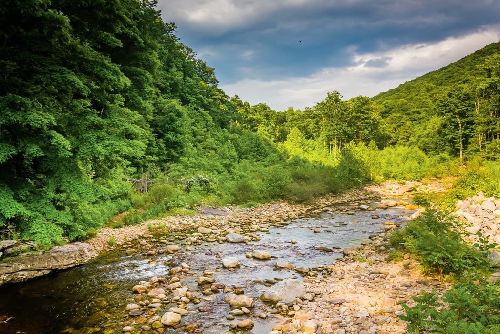
Another enticing spot for visitors in the WMA is Smoke Hole Canyon. The North Fork Mountain Trail runs along the western ridge of the canyon for 24 mi (39 km). Within the canyon, kayaking, canoeing, fishing, and wildlife viewing are all popular activities.
With that in mind, here are some of the best hikes in the Potomac Wildlife Management Area to check out during your next trip to the region.
The hike to the ridgeline and summit of Spruce Knob begins along Seneca Creek on the Huckleberry Trail. This trail is 4.6 mi (7.4 km) long and it gains 1000 ft (305 m) in elevation as it climbs through hardwood forest. When the trail hits the ridge, it continues on for 3 mi (4.8 km) to reach the Spruce Knob Tower at the summit.
You can get to the trailhead for this hike via Seneca Rocks. Take WV-28S/WV-55W for 10 mi (16 km) before turning right on Briery Gap Run Road. Then drive for 2.4 mi (3.9 km) to reach FR 112, which you’ll continue on for 7.4 mi (11.9 km). Finally, turn right onto FR 104. The trailhead is located 1.6 mi (2.6 km) down FR 104.
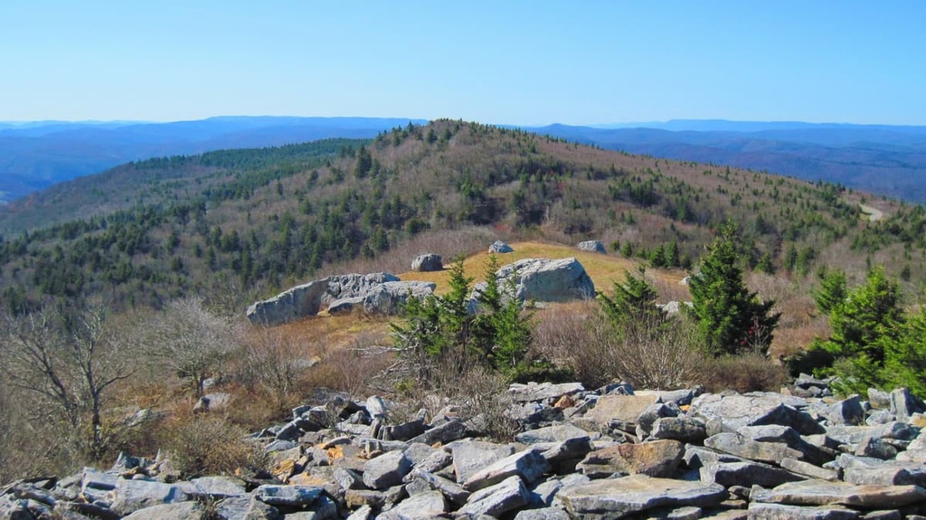
The Whispering Spruce Trail is a scenic 0.5 mi (0.8 km) walk around the Spruce Knob Tower. It’s a short and relatively flat hike that’s perfect for families and small children.
Additionally, the Whispering Spruce Trail offers exceptional views of the surrounding region due to its lofty elevation. To access this trail, drive to the parking lot at the summit of Spruce Knob Mountain and then follow the signs to find the hiking path
The trek up Mount Porte Crayon via the Flatrock Run Trail is a challenging hike of more than 5 mi (8 km) one-way with 2,500 ft (762 m) elevation gain. This hike brings you to the summit of Mount Porte Crayon and is best suited for experienced hikers who are ready for some bushwhacking.
Thanks to its remoteness and ruggedness, hikers on this route will be able to appreciate one of the largest red spruce-northern hardwood forests in the region. This forest is also home to the federally endangered Cheat Mountain salamander and the West Virginia northern flying squirrel.
You can reach the Flatrock Run Trailhead from both Petersburg and Canaan Valley. The trailhead and parking area are located on Bonner Mountain Road near the bridge that takes you over Red Creek.
The Potomac Wildlife Management Area is situated in a relatively remote part of West Virginia, but there are plenty of nearby cities and towns to check out in the surrounding area.
There are also many public camping areas that lie within and surrounding the Potomac WMA that are maintained by the US Forest Service. In particular, boating and fishing draw many visitors to Spruce Knob Lake Campground. The nearby Gatewood Campground also offers group camping sites for larger parties.
Here are some of the best cities and towns to check out during your next trip to the Potomac Wildlife Management Area.
Home to a population of just over 7,000 people, Elkins has something for both outdoor adventurers and history buffs to enjoy.
Hiking, biking, camping, fishing, canoeing, and kayaking can be found a stone’s throw away from town. During the winter, trails around Elkin are used for cross-country skiing and snowshoeing while nearby ski resorts offer some of the best skiing for the mid-Atlantic region.

Both in Elkins and elsewhere in Randolph County, there are a handful of small museums and other sites that showcase the history of the area. Many of these museums and historic sites are dedicated to the Civil War, as a number of important skirmishes were fought in the region.
As far as accommodation goes, everything from camping, B&Bs, hotels, motels, lodges, inns, and vacation rentals are available for visitors in Elkin. Downtown Elkins has a modest range of dining options, too. Most of these restaurants are heavy on American classics such as burgers and steaks, but there are a few different cuisines thrown in the mix, too.
With a population of just over 600 residents, the community of Franklin gives visitors a taste of an authentic West Virginia town. The small downtown area in Franklin is charming as it is filled with local shops and a few restaurants. A number of older houses, such as the Preston Boggs House, have been maintained in their Victorian splendor and give the town a timeless quality.
Located near Franklin is the Fisher Mountain Golf Club and Resort, which is a nice option for those looking to stay somewhere a bit fancier. There are a couple of motels in Franklin, too. Those willing to go beyond town can find a number of nearby RV campsites and vacation rentals. There are also good camping options near Seneca Rocks and Brandywine Lake.
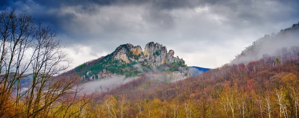
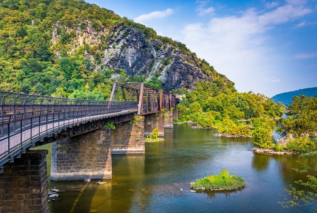
From Franklin, it is only a 30-minute drive to Seneca Rocks, one of West Virginia’s most famous landmarks. Towering almost 900 ft (274 m) above the North Fork River, this rock formation is a big draw for rock climbers. Those interested in learning more about Indigenous history in the area can visit the Seneca Rocks Discovery Center.
Another popular attraction found only 40 minutes away from Franklin is Smoke Hole Canyon. In addition to being a great spot for hiking, fishing, and rock climbing, Smoke Hole Canyon is also home to a number of rare and ecologically important habitats. As a result, The Nature Conservancy has worked to protect more than 8,000 acres (3,238 ha) of land in the canyon.
Located just under two hours away from the Potomac WMA and across the state border in Virginia, Harrisonburg is a medium-sized city with around 55,000 inhabitants. Since it is situated in the stunning Shenandoah Valley, the city offers amazing views of Shenandoah National Park and the Blue Ridge Mountains.

Harrisonburg is home to two universities, and it holds the distinction of having the first Arts and Cultural and Culinary Districts in Virginia. Visitors to the region will find an abundance of restaurants, shops, and cultural centers throughout the extensive historic downtown area of Harrisonburg. Live music, history tours, hiking, biking, and fishing are just a few of the many activities that can be enjoyed in or around Harrisonburg.
With respect to accommodation, you can find everything from B&Bs, motels, hotels, and guest houses in Harrisonburg. The city is considered to be “pet friendly,” too, so those traveling with furry friends will find plenty of options for accommodation with their pets.