
Scan the QR code and open PeakVisor on your phone
Dolly Sods Wilderness has 5 named peaks. The highest is Harman Knob at 1,273 m. Other notable peaks include Rocky Knob, Blackbird Knob and Breathed Mountain.
Dolly Sods is a 17,371 acre US Wilderness Area located in the Monongahela National Forest, which encompasses, in part, the Allegheny Plateau, the Cumberland Mountains, and the Cumberland Plateau (which encompasses Dolly Sods specifically) of the central Appalachian Mountain Range. Dolly Sods is part of the Potomac Highlands region of Eastern West Virginia, bordering Virginia and Maryland.
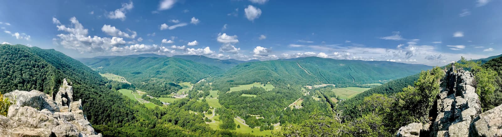
Dolly Sods is the highest plateau east of the Mississippi River and ecompasses most of the North Fork of the Red Creek Drainage. Altitudes in Dolly Sods range from 2,644 ft. (806 m), at the outlet of Red Creek, to 4,123 ft. (1,257 m) at the top of the eastern edge mountain ridge on the Allegheny Front. As a result of being located on a rocky, high altitude plateau with a pronounced drainage system, Dolly Sods is more rugged and about 10 degrees cooler and considerably more humid than the surrounding region and its landscape is more reminiscent of New England or Canada than the Central Appalachians, making it a particularly popular hiking spot in the region for its novelty.
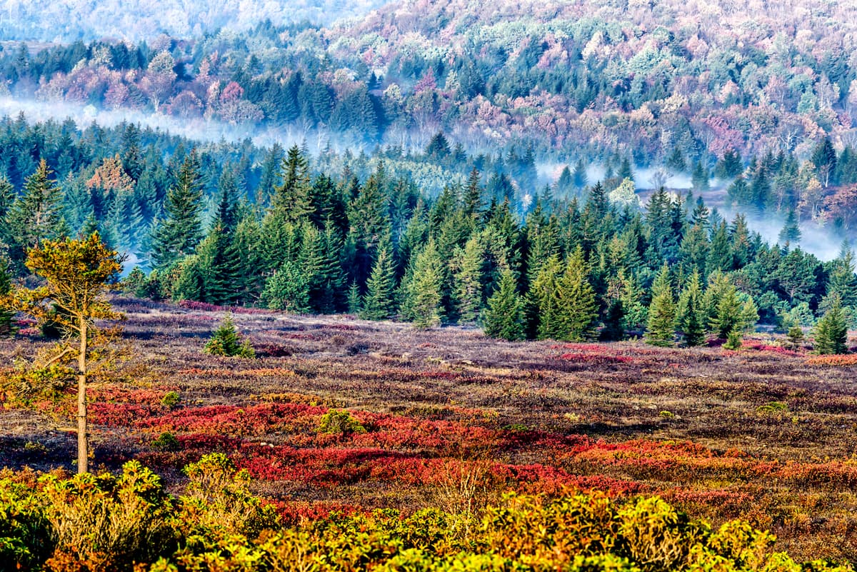
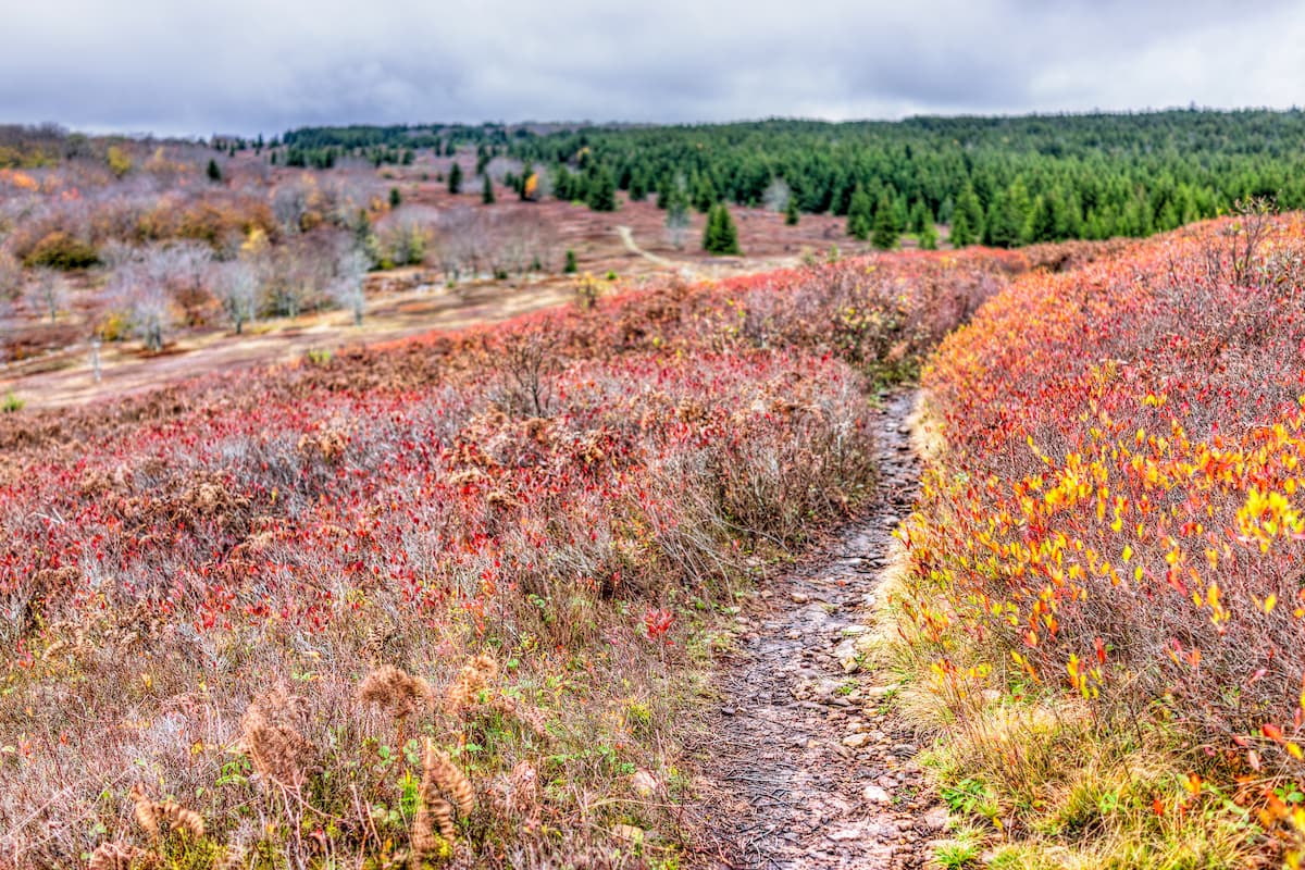
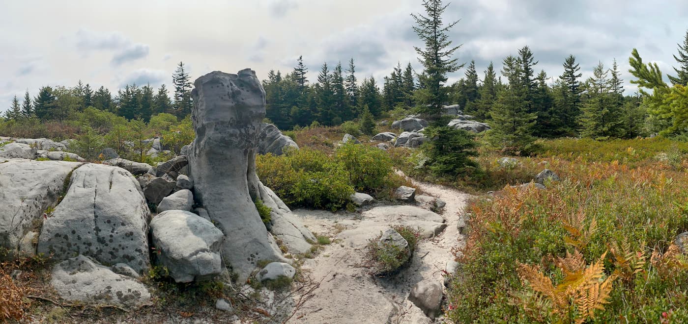
The landscape of Dolly Sods is spectacular and unique for the region and its characteristic landscape is broken into two distinct regions, North and South. Northern Dolly Sods is characterized by a more exposed landscape made up of stunted ("flagged") trees, gnarly wind-carved boulders, heath barrens, and grassy meadows that were created in the last century by logging and fires, as well as considerably older sphagnum bogs. Southern Dolly Sods is covered in a dense cove forest within the branched canyon that was excavated by the North Fork of Red Creek and is considerably more humid and muddy.
Hikers should be prepared to hike colder and wetter than they might in the surrounding areas, as well as more technically as Dolly Sods trails tend to vary between rocky, rooty, muddy, and boggy technical terrain. This often slows down even seasoned hikers. The weather up in Dolly Sods can also be a bit more extreme in the more exposed camping sites with higher wind speeds and rain that will require a well staked, waterproof tent.
Dolly Sods is also part of the over 6000 mile, hiking, biking, and trail riding coast to coast American Discovery Trail.
The “Dolly” of Dolly Sods derived its name from an 18th-century German homesteading family, the Dahles (which developed into ‘Dolly’). Johann Dahle (1749–1847) was a German immigrant who settled nearby. “Sods” is a term used in the Allegheny Mountain Range of eastern West Virginia in particular to indicate a mountain top meadow or bog, in an area that is otherwise generally forested. The term is similar to that of a "grass bald", which is a more widespread designation applied throughout the central and southern Appalachian region. The history of Dolly Sods can be divided into four distinct periods; pre-logging, logging, military use, and preservation.
Dolly Sods was first discovered by Europeans in 1746 when Peter Jefferson, Thomas Lewis and others surveyed the region for the British Crown. For years, the northern margin of the Wilderness near Bear Rocks created the Fairfax Line, which dictated the border of colonial Virginia. For around a century, the Dolly Sods region was considered too wild to penetrate. Dolly Sods and the Flatrock-Roaring Plains region were originally mostly covered by dense, ancient red spruce and eastern hemlock forests, with trees that often measured 60 to 90 ft (18 to 27 m) tall and 12 ft (3.7 m) in diameter. At one time, the greatest stand of red spruce in the world was found along the upper Red Creek before logging moved into the region. The largest recorded tree ever cut in West Virginia was a white oak, harvested in this region, which measured nearly as large as a Giant Sequoia and was likely over 1,000 years old. Centuries of accumulated needles from these trees created a blanket of humus (soil) seven to nine feet deep.
Logging and grazing of Dolly Sods came about at around the same time. As logging companies cleared out the ancient growth forest and burning kept the land clear, for a short time, it was ideal for animal grazing. However, repeated wildfires and overgrazing of the land eventually left mostly bracken fern, which is useless as fodder and grazing eventually moved out of the region as both the land became unconducive to the practice and animal herding fell off as an economic option in the region with the rise of logging and coal mining.

Logging records for the region are largely non-existent so the extent to which the ancient growth forest had grown and was leveled will never really be known. Suffice it to say that Dolly Sods used to be home to what was formerly described as the best spruce-hemlock-black cherry forest in the world, with some enormous trees up to 12 feet in diameter. Logging in the area hit a fever pitch in the late 1800s, early 1900s, when railroad companies moved in and the lumber boom town of Laneville soon sprang up in the region with a population that peaked at over 300 people.
The ancient, virgin forest was quickly cleared away and the normally humid humus laid down by centuries of old growth dried up and, along with the extensive slash left behind by loggers, acted as fast kindling under that sparks of locomotives, saw mills and log camp fires. A number of wildfires ravaged the region until the 1910’s and burned everything down to the bed rock. Local wildlife, large and small, was whipped out for a time and the area became a desert and the Laneville mill closed shortly after in 1920 after almost all the timber had been cut and the local population dwindled.
The Monongahela National Forest was created in 1915, with the hopes of mitigating the sort of wholesale destruction that had swept over the Sods. In 1916 most of Dolly Sods was purchased by the federal government, while mineral rights remained in private ownership. In the 1930s, the Civilian Conservation Corps made some modest attempts to remediate the damage to Dolly Sods by re-planting stands of red spruce there.
In 1943 and 1944, the U.S. Army used the area as a practice artillery and mortar range and maneuver area before troops were sent to Europe to fight in World War II. As a result, there is still the risk of finding live bombs from the former WWII training. An extensive survey was conducted in 1997 to try and excavate as many of the remaining shells as possible. There were 32,594 excavations made along the trails and 14 live mortar shells were discovered and detonated on site, most along the Fisher Spring Run Trail. Two inert shells were found. Numerous railroad spikes, iron tools and horseshoes left over from logging days were also discovered. However, off-trail searches proved to be impossible and as a result some of the artillery and mortar shells (60 mm and 81 mm rounds) shot into the area likely still remain there.
Dolly Sods became a popular recreation spot in the mid-1960s among recreationalists and conservationists. Around that time local farmers also ceased letting their livestock graze in the area. While the political will to set aside the land as a federal wilderness was present, there were still a number of threats to Dolly Sods’ development including; the proposed development of a subdivision, the proposed development of a highway, coal mining in the region, and the proposal of creating a reservoir by damming the surrounding area. In October 1970, the Forest superintendent announced the creation of a 10,200-acre "Dolly Sods Scenic Area". In 1972, the Nature Conservancy purchased the coal rights under the future federal wilderness 15,558 acres of the Sods and Roaring Plains for $15 million and Dolly Sods finally became a federally designated wilderness area in 1975 which resulted in greatly increased numbers of visitors.

The area had only an estimated 500 visitors in 1965, but by 1997 there were 7,499 registered (and many more unregistered) users annually. Today, Dolly Sods is considered among the best hiking in West Virginia and is visited by thousands of people annually.
There are three notable peaks in the Dolly Sods Wilderness, none of which have trails cut to their summit. The three major peaks include;
Blackbird Knob - 3950 ft, 131 ft Prominence
Breathed Mountain - 3,848 ft
Coal Knob - 3770 ft, 49 ft Prominence
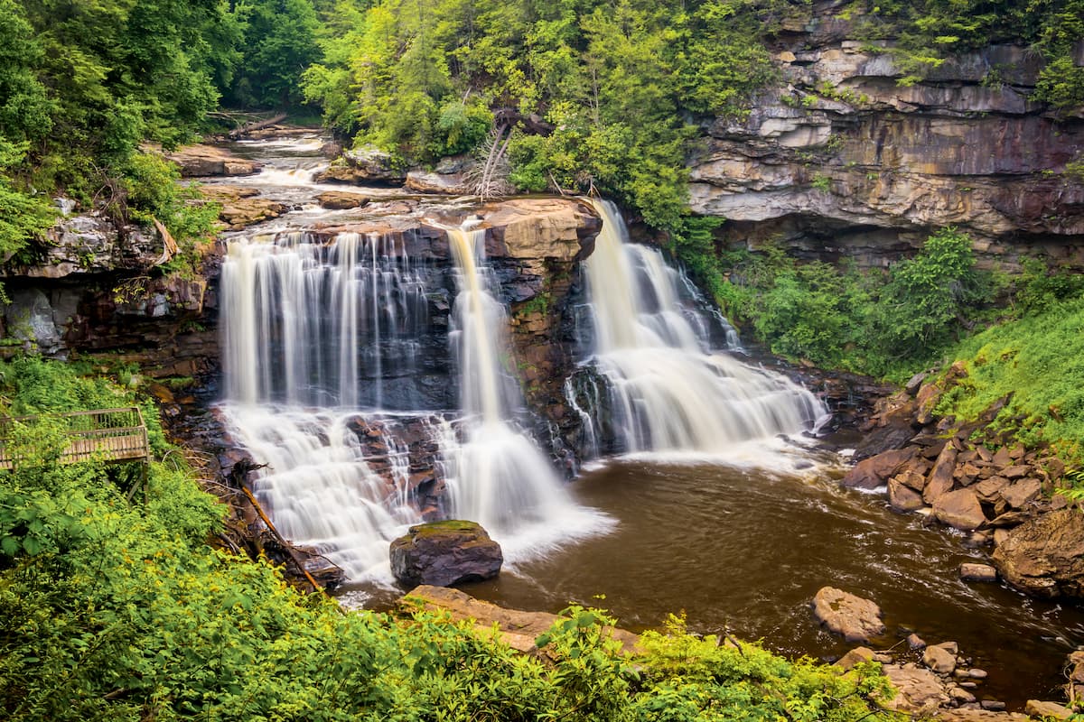
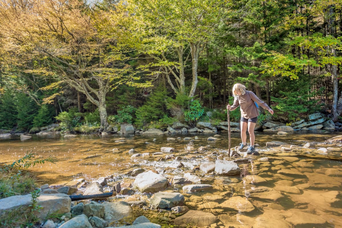
Red Creek is one of the defining features of Dolly Sods. True to its name, the creek is a deep red color, having been tannin stained at its head and all along its tributaries by the northern spruce-edged sphagnum glades that are home to thickets of red spruce, speckled alder, sphagnum moss, polytrichum moss hummocks, cotton grass, round leaf sundew and lichen known as reindeer moss. As red creek moves south through Dolly Sods it is overcome by maturing spruce copses, rhododendron thickets, northern hardwoods on the ridges, and cove hardwoods. Red Creek eventually comes to a confluence with Fisher Spring Run.
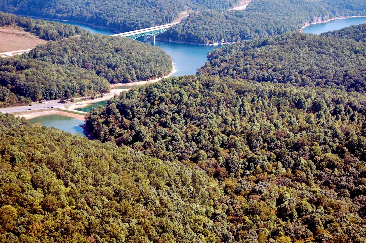
Dolly Sods is located on a ridge crest that forms part of the Eastern Continental Divide, so the Red Creek headwaters system is incredibly important to the surrounding watersheds. Most of Dolly Sods’ area is drained by the North Fork of Red Creek, which is a tributary of the Dry Fork River. Via the Dry Fork, Black Fork, Cheat, Monongahela and Ohio Rivers, the Red Creek is part of the Mississippi River watershed. Drainage on the east side of the ridge crest flows into the headwaters of the South Branch of the Potomac River, which is part of the Chesapeake Bay watershed.

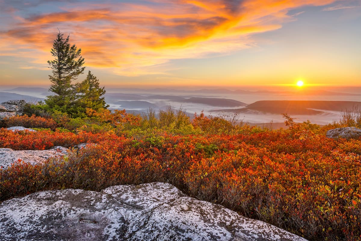
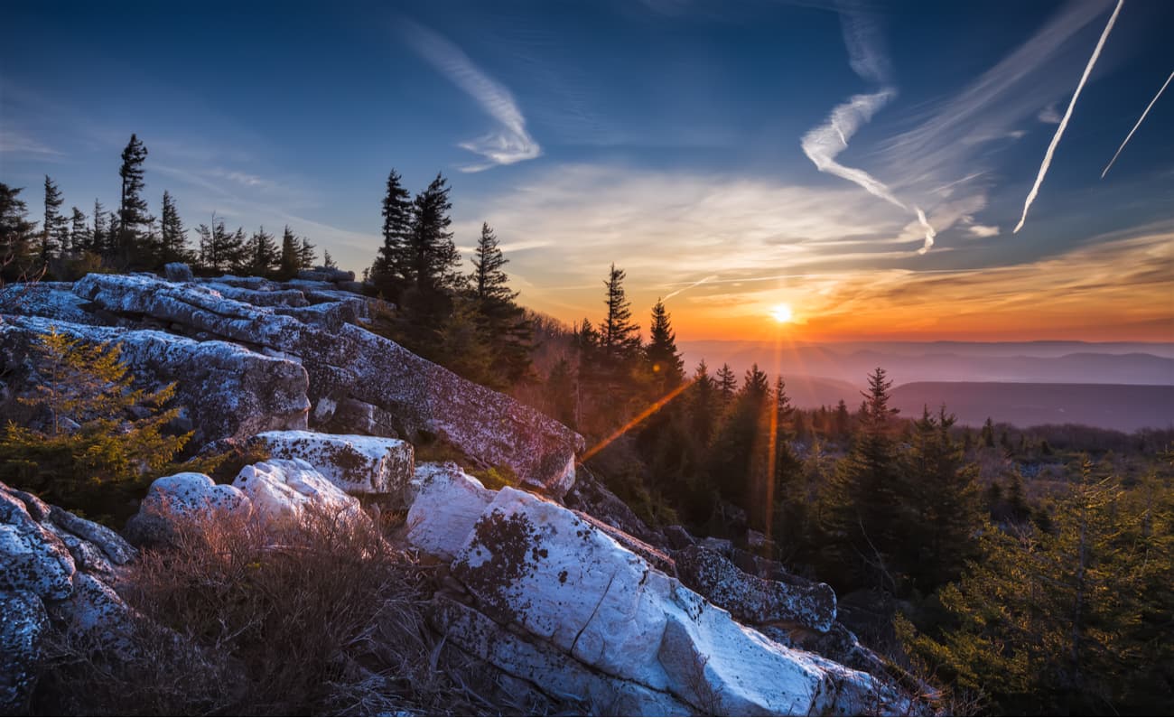
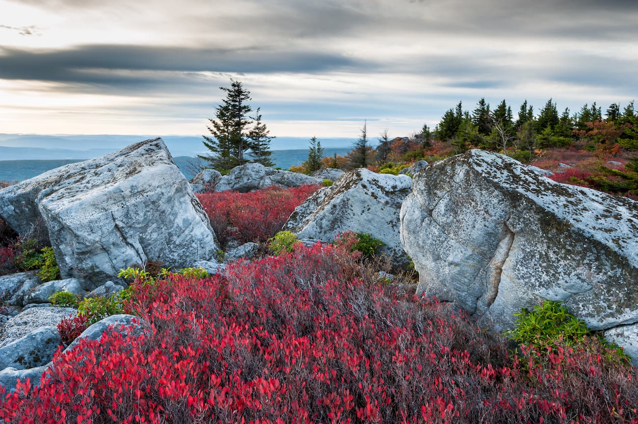
Bear Rocks is the most popular destination for many day trippers to Dolly Sods. Bear Rocks is an easy 2 minute hike to the overlook coupled with a relatively easy drive up highway 75 to the parking lot that both leads to Bear Rocks overlook to the north, as well as the Bear Rock, Beaver Dam, Blackbird Knob, Northland Loop, Fisher Spring Run, Wildlife, and Rohrbaugh Trailheads respectively heading south. In addition, the Red Creek Campground is just a few miles south of the Bear Rocks Preserve so visitors can stay in the wilderness without necessarily ruffing it in the backcountry.
Looking out over Bear Rocks you can see east onto the Allegheny Mountain Range and Potomac Highlands. Some of the immediate mountains you can spot are; Stony Man (4003 ft), Hawksbill (4042 ft), Fork Mountain (3845 ft), West Mountain (2703 ft), Foremost Mountain (2976 ft), Hightop (3586 ft), Lairds Knob (3281 ft), New Creek Mountain (3107 ft), Bulls Head (2756 ft), and Spring Mountain (3120 ft), among others.

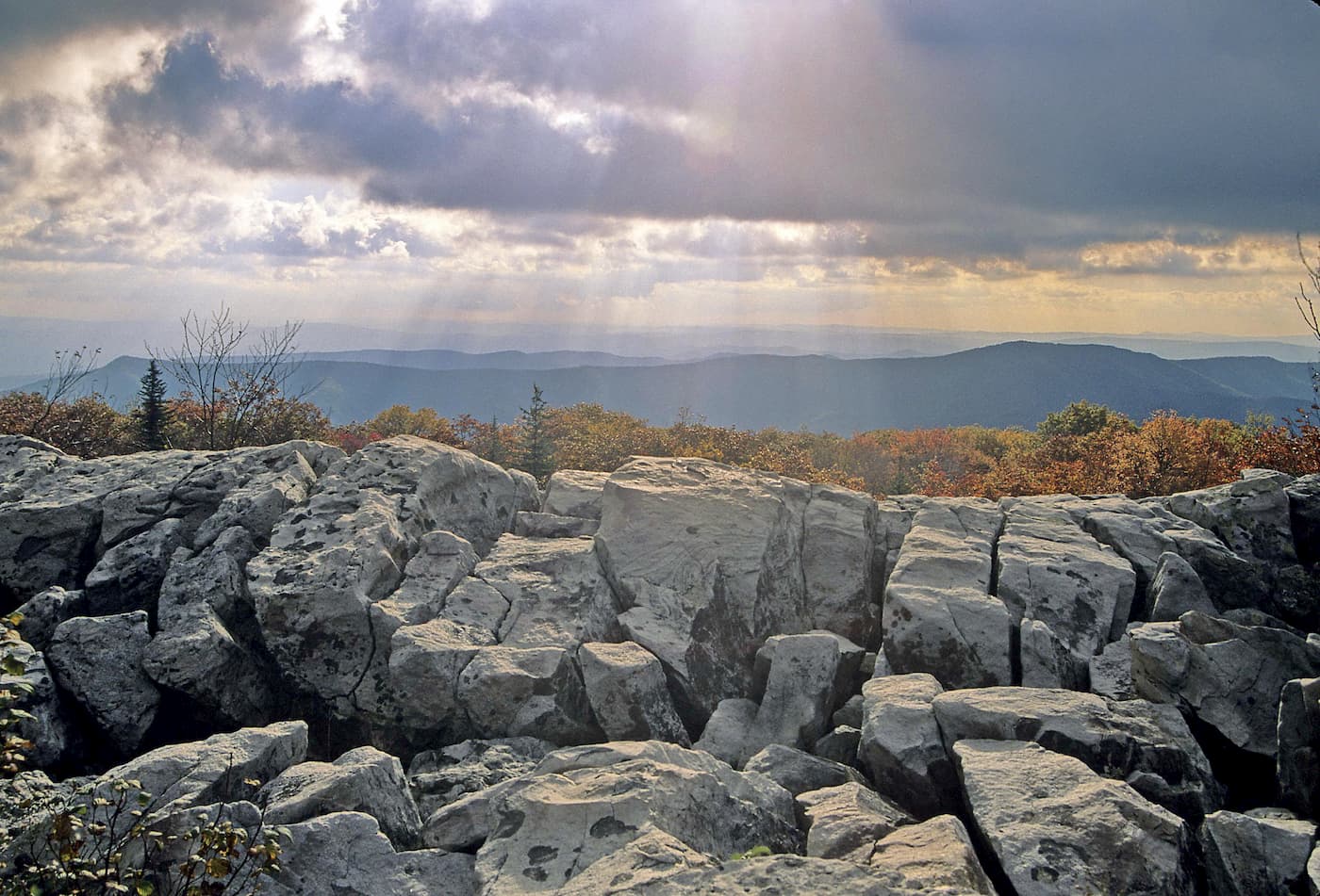
Lion’s Head Rock looks south below the Breathed Mountain Summit and is a favorite hiking location for the South section of Dolly Sods. Lion’s Head rock consists of a mixture of sandstone and conglomerate. While Bear’s Rock is more popular for low key visitors who are not too interested in hiking, Lion’s Head provides a lovely in and out destination for day hikers and multi-day backpackers alike.
Dolly Sods has grown from its original 650 acre mountain top meadow starting at the southern end of Rohrbaugh Plains, near the present Dolly Sods Picnic Area to the 17,371 acres of U.S. Forest Service land that it is today. This is in addition to the larger 32,000-acre area now known as "Dolly Sods". The Dolly Sods Wilderness is bordered by Forest Service Routes 75 and 19 on the east and south sides, respectively. The area encompassed by highways 75 and 19 were locally known as Huckleberry Plain.
To the northeast, the Dolly Sods Wilderness is bordered by the Bear Rocks Nature Preserve, which is owned by The Nature Conservancy. The surrounding area was recently added to the Wilderness and is known as Dolly Sods North (the High Sods). North of Dolly Sods North is an area known as Dobbins Slashings, which is a sub-arctic bog forming the headwaters of Red Creek on Cabin Mountain. To the southwest, the Wilderness is adjoined by the 16,000-acre Canaan Valley National Wildlife Refuge. Almost all of the Dolly Sods Wilderness is in the southeast corner of Tucker County with only very small sections extending into Randolph and Grant Counties.
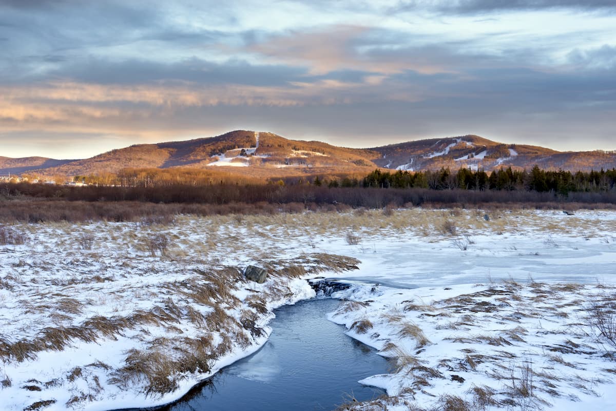
Dolly Sods’ climate is classified as humid continental, similar to portions of Canada, meaning that it is typified by four distinct seasons and large seasonal temperature differences, with warm to hot (often humid) summers and bitterly cold winters. Precipitation is usually evenly distributed throughout the year.
The definition of this climate regarding temperature includes a mean temperature of the coldest month must be below −3 °C (26.6 °F) and there must be at least four months whose mean temperatures are at or above 10 °C (50 °F). Additionally, humid continental climates such as Dolly Sods are not arid and often very damp year round.
Daily weather in Dolly Sods can vary greatly with large extremes in temperature occurring dangerously fast. Fog can form and roll in extremely quickly, dropping visibility to dangerous, disorienting near-zero conditions. Access roads can quickly become blocked by dense fog, downed trees from high wind, and snow/snow drifts.
Summers are cool and wet. At 4,000 feet (1,220 m), the average afternoon maximum is around a pleasant 70 °F (21 °C) and the average morning minimum is in the 50s (10-15 °C), getting as low as the 40s as early in the year as August. Thunderstorms are frequent during the warmer months. Frosts and freezes can occur any month of the year. Winters are typically cold, windy, and snowy. Minimum temperatures can drop to -30 °F (-34 °C). The average seasonal snowfall is estimated to be around 150 inches (381 cm). In exceptionally snowy winters, large drifts of up to 20 ft (7 m) can form, lasting in sheltered locations into May. Due to high elevation, frequently located at cloud level, spectacular rime ice is frequently seen totally coating the forest in pure white. Despite the overall vigorous winter, the relative southern location (39th North parallel) allows for occasional intrusions of warmer, well above freezing air from the Gulf of Mexico. Thus, rain can occur during even the coldest winter months.
Dolly Sods has some of the most varied and beautiful landscapes you can imagine, which speaks to the voracity of this landscape amid even the most acute human intrusion. Ranging from windblown, rocky highlands, to highland and lowland bogs, to hardwood coniferous and deciduous forests, Dolly Sods has a beautiful landscape to fit nearly any hiker’s preference. This is doubly so for the Dolly Sods Wilderness’ flora and fauna.
If you were to appear in the middle of the Dolly Sods Wilderness suddenly, it would be understandable if you mistook it for Canada or somewhere in Northern New England. Dolly Sods’ well known open expanses of sphagnum bog, heath shrubs and scattered and stunted red spruce are all reminiscent of areas much farther north and many plant communities are indeed similar to those of sea-level eastern Canada. But the ecosystems within Dolly Sods are remarkably varied. In recent decades, the many stages of ecological succession throughout Dolly Sods have made the wilderness one of the most interesting areas ecologically in the entire Central Appalachian region. In general, you can break Dolly Sods into four distinct ecological groups; the Sods (grass blades), Heath Barrens (Huckleberry Plains), Sphagnum Glades (Cranberry Bogs), and hardwood forests.
In general, you can split these four groups into two larger ecological groups that are encompassed in the highlands and lowlands of Dolly Sods. The Highlands section of Dolly Sods is located in the Allegheny Front, which is one of the windiest spots east of the Mississippi. The effect of these winds in Dolly Sods can be seen in the flag-form red spruce trees; their branches grow mostly on one side (east), away from the prevailing west winds. Because of the drying influence of the winds, stunted branches are produced on the west side of the tree above the protective shrub layer. Stunted branches on the east side give the trees a twisted appearance. Where spruce are protected by a shrub layer, luxuriant webs of branches extend for a radius of a dozen feet, giving a mat-like look to vegetation. These winds and the subsequent spruce growth give the highlands of Dolly Sods a downright Tim Burton-esque appearance.
The “Sods” of Dolly Sods refer to several high-elevation meadows in the High Alleghenies. The term “sod” is a regional term meaning "grass bald," which they are more often referred to as in the southern Appalachians. These grassy areas have been common in the Appalachian mountain range for milenia, but the origin of these grassy tracts has been the subject of wide-ranging speculation. One theory is that the Appalachian mountains have a variety of "bald-susceptible zone" present at mountain summits where various causes such as extreme weather or wildfires have culminated to wipe out trees and were followed by a succession of grasses that were so competitive with the new tree seedlings that the cleared areas persist for a much longer period than at lower elevations.
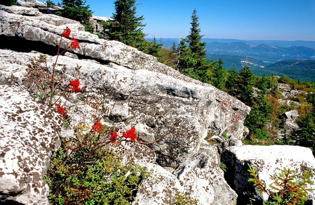
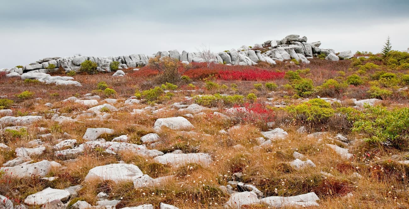
Heath Barrens, largely seen in places like Alaska, speckle Dolly Sods. The traditional local name for these unusual expanses of heath barrens are "huckleberry plains". These upper reaches have been extensively colonized by various Ericaceae (heaths), including; blueberry and cranberry (Vaccinium), huckleberry (Gaylussacia), rose azalea (Rhododendron prinophyllum) and rosebay rhododendron (Rhododendron maximum), mountain laurel (Kalmia latifolia), teaberry (or wintergreen, Gaultheria), and Allegheny menziesia (Menziesia pilosa). Members of Rosaceae (the rose family) also abound, including; chokeberry, mountain ash, serviceberry, and pin cherry (Prunus pensylvanica). Boulder fields left by the denuding topsoil fires of 80 years ago are extensive here.
In the upper sections of the Red Creek tributary as the elevations begin to lower hikers can find Sphagnum glades, also known as “Cranberry bogs” and they are often associated with thickets of speckled alder. There are similar Sphagnum glade areas throughout the High Alleghenies, most famously the Cranberry Glades of the Cranberry Wilderness south of Dolly Sods in West Virginia. The largest Sphagnum glade at Dolly Sods is about a mile long and half a mile wide. The thick carpet of sphagnum moss and the polytrichum moss hummocks also sustain cotton grass (which abounds in the Dolly Sods Wilderness), round leaf sundew and the lichen known as reindeer moss. In addition to the spruce, the bog margins are frequented by ferns, sedges and the occasional balsam fir. The three-toothed cinquefoil (Sibbaldiopsis tridentata) is often abundant and orchids, such as pink lady's slippers, are sometimes seen.
Lastly, there are a variety of hardwood forests in the mid and lower reaches of the wilderness, specifically more concentrated in the southerly section of the Dolly Sods Wilderness. These hardwood forests are extremely varied and include maturing spruce copses, rhododendron thickets, northern hardwoods on the ridges and cove hardwoods in the deep tributaries of Red Creek. All of the original old-growth forest was removed a century ago during the logging boom, followed by fires that burned, then smoldered, for months. Much of the deep topsoil was lost forever. Today, there are patches of recovering native red spruce forest plus twisted yellow birch, sugar and red maple, eastern hemlock, and black cherry. American beech, pine and hickory can also be found. The wild onion known as the ramp (Allium tricoccum) is also present in the deeper forests.
The larger megafauna that once inhabited the High Alleghenies, such as elk, bison, and mountain lion, were all exterminated during the 19th century. However, because of the high altitude and the rugged remoteness of the Dolly Sods Wilderness, these megafauna were able to survive longer in this area than in many other parts of the eastern United States. Dolly Sods’ cool climate also made it a good home to many animals more typically found about 1,600 miles (2,600 km) farther north in Canada. Many species found here are near their southernmost range. For example, the snowshoe hare found in Dolly Sods is usually found in Canada and Alaska and is adapted to snow conditions, with its large, hairy feet which allow it to run on the snow surface. Beaver, which were restored to West Virginia after a period of being driven out, continually create and refurbish their beaver ponds in the high elevation watersheds of Dolly Sods.
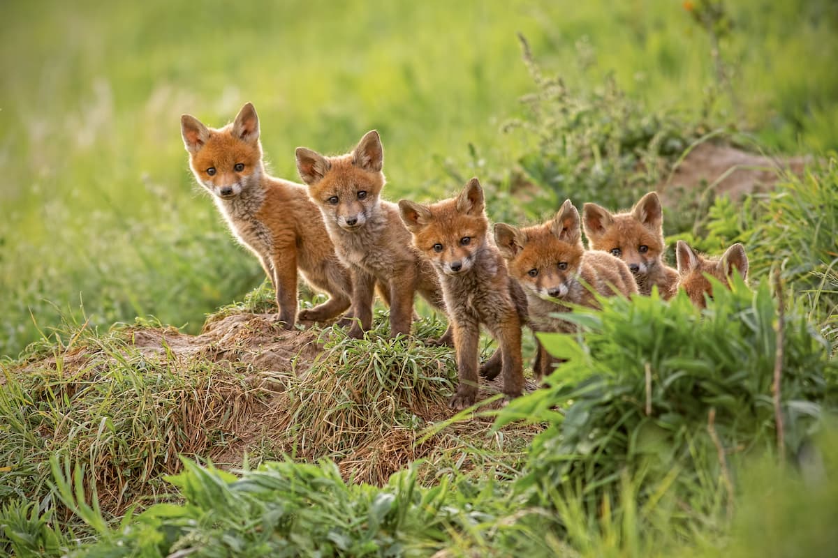
Other animals that may be encountered include; red and gray foxes, bobcats, black bears, groundhog, timber rattlers, wild turkey, and grouse. White-tailed deer, also once eliminated from the region, were reintroduced in the 1930s and are now abundant. It is very common to come across a white-tailed deer in the Dolly Sods Wilderness and they are protected from hunting in the area. Currently, the West Virginia Department of Natural Resources is considering an elk restoration program in Dolly Sods and other areas. The Cheat Mountain salamander, listed since 1989 by the U.S. Fish and Wildlife Service as threatened, is also present in Dolly Sods.
Dolly Sods, like much of the Appalachian region, is home to a wide variety of fungi and lichen. Some of these species include edible mushrooms like king boletes, Oyster mushrooms, and black trumpet mushrooms, as well as a number of other interesting mushrooms, like hoof fungus, Bear’s head Tooth fungus, common Earthballs, blushers, red stinkhorns, and many, many more. Mycoheterotrophic plants such as ghost pipes are found in this region as well, in addition to a variety of lichen such as pink earth lichen, red-fruited pixie cup lichen, and grey reindeer lichen, among others.
Even though the high traffic of recreationalists to Dolly Sods keep the bear population relatively scarce, precautions need to be taken to avoid interactions with bears while hiking and camping. In the United States there are estimated to be over 300,000 black bears and approximately 8,000 individual bears in West Virginia. While black bears are typically pretty shy when it comes to humans, an increase in bear sightings at Dolly Sods have been reported, some of which have been ‘tense’. When hiking, take the normal precautions, including; wearing bear bells, hanging a bear bag from a tree at least 50 feet from your tent, and clearing away all camping refuse.
Live WWII shells are still expected to exist in the Dolly Sods wilderness from its use as a West Virginia Maneuver Area in 1943 and 1944. While shells have been removed from trails the rest of the wilderness was deemed too difficult to find remaining shells. As such, recreationalists should not go off trail at any time. If hikers do find remaining shells they are directed to report them immediately by calling 1-888-283-0303.
Since Dolly Sods is not a National or State Park, but rather a protected wilderness, as such, the standards for trail maintenance and identification are less rigorous and there are rumors that focused maintenance will be further deprioritized in the coming years. There is no blazing of the trails on Dolly Sods and maintenance of the trails is largely insured by the sheer number of visitors that come to the wilderness every year and continually pack down the trails from month to month. Luckily, Dolly Sods is incredibly popular as a hiking spot and many hikers help insure trail maintenance as they hike. The only signage you will see in the wilderness are trailhead names at intersections, as well as the mileage to further trailhead intersections. While most of the wilderness is well marked with signs at these intersections, there are a few intersections in the wilderness that are missing markers intermittently, including the area around the Beaver Dam and Dobbin Strait Trail. Sometimes trail intersection markers fall over as well and are not quickly re-buried. GPS in these sections can also be spotty so even if you bring a cell phone based GPS map system, it is advisable to also bring a map and compass for good measure.
Dolly Sods is also famous for its swift moving, near-zero visibility fog, which can roll in quickly and disorient hikers, especially in the more exposed rocky areas where trail markings are hard to follow in even the best of conditions. Check the weather before coming to Dolly Sods and move slowly (or pause your hike all together) if visibility is reduced. Additionally, There are fords on some of the trails that may be a problem to cross during high water events. While there are not a large number of ford-level water crossings, hiking in the lower southern Dolly Sods region is best done during the dryer summer months. This will both prevent high water fords incidents, the increased risk of hypothermia (temperature late in the season gets down to 40 and 30 degrees fahrenheit in the mornings, evenings, and at night).
Dolly Sods can be reached via highway 75 or 19 or via Highway 37, which turns into forest road (really more of a walking trail since commercial vehicles are not permitted) 80 to the west heading towards the White Grass cross country skiing recreational land. Coming from the north the easiest entrance into Dolly Sods is to turn onto highway 75 heading up to the Bear Rocks Preserve. Highway 74 connects with highway 28/7 which goes both north towards Cumberland, Maryland, and south towards Seneca Rocks, West Virginia. As you drive up the mountain the road eventually turns into a forest service gravel road and will stay gravel surrounding the entirety of Dolly Sods. If you come more from the south and want to explore the southern half do Dolly Sods you can take highway 19, which connects with highway 75 as it goes north. Highway 19 also connects in with highway 28/7 a few miles south of the intersection with highway 17.
Another option for reaching Dolly Sods is to go through the White Grass recreational cross country ski area. This is a nice option because you can drive less on gravel roads heading up the mountain since you are already starting high on the Canaan Valley. If you follow highway 37 it will eventually turn into a forest service gravel road as it heads up the mountain for a short time before terminating just outside of Dolly Sods the trail you take in is technically 80 on Google Maps. Follow the trails into the hiking area at the top of the road and you will eventually come to a major junction in the Dolly Sods Trail system where the Blackbird Knob, Big Stonecoal, and Breathed Mountain Trailheads meet.
It is important to note that Forest Road 19 and 75 are gated closed to vehicle access from January to April. Effectively the open season for Dolly Sods is from May to December, however, many cross country skiers frequent the wilderness during the off season.
If you want to stay close to Dolly Sods, but are not interested in camping in the wilderness, and don’t mind spending the extra money then the Canaan Valley Ski and Golf Resort may be a good fit for you. The Canaan Valley has itself become a popular ski destination with many seasonal homes having been built in the area for that purpose abutting the Dolly Sods Wilderness. The Canaan Valley Resort has primitive and RV camping, cabins, and an available lodge for visitors. Campground amenities include; paved sites with access to Hiking Trails, 30/50 AMP electric, water & sewer (water & Sewer is disconnected October-April), comfort station w/laundry & shower facilities year round, discharge station for self-contained units, complimentary WiFi fire ring & picnic table at each site, a camp store located at the check-in station, playground & recreational activities in the resort, and leashed pets are permitted. Rates for the campsites, lodge, and cabins vary per season.
Yokum’s Vacationland at Seneca Rocks is a great option for affordable camping, cabin rentals or hotel stays if you do not want to rough it in the Dolly Sods Wilderness and it is located about 30-40 minutes away from the Wilderness. Seneca Rocks itself is a great place to stop either before or after your visit to Dolly Sods and there is an approximately 3 mile hiking trail in and out up to the Rocks with great views of the surrounding Potomac Highlands.
Both primitive and RV campsites are available. Tent camping costs $10 per person and you have access to a firepit, water and bathrooms. RV sites are available for $28 per 1-2 people and an additional $10 per extra person over the age of 6. Bunkhouses are available for $50 per 1-2 people and an additional $10 per extra person over 6. Teepees are available for $25 per 1-2 people with an additional $10 per extra person over 6. There are also cabins and a motel with a cafe and shop that are available year round for varying rates depending on the season. Next to Yokum’s is also a small gas station (which can be hard to find in the area), outfitters and rock climbing school.
Blackwater Falls State Resort Park is located near Dolly Sods and has additional hiking and recreational activities for visitors. The state park also has camping, a lodge, and cabins available for rent. The campground is open late April through October 31, weather permitting. Beginning each November 1, the non-electric loop (sites 31-65) and shower houses close for the winter; sites 1-30 are open for primitive camping. Campsites can be reserved online at any time, by phone or at the campground office Reservations may be made for no less than two consecutive nights on weekends (Fri., Sat.) or one night during the week (Sun.-Thurs.) Visitors may book a maximum of 14 consecutive nights. The campground is home to 65 total tent and trailer sites 30 of the sites include an electric hookup The park features a centrally-located bathhouse with hot showers, a laundromat and a dumping station. The lodge and cabins are available for varying prices depending on the season.
The Red Creek Campground is the only developed campground in the wilderness and has about ten available spots that are reserved on a first come, first serve basis. There is water and bathrooms in the campground, but no electric hook up. Each campsite has a raised flat for tents, a picnic table, and a fire pit. As is the rule for the entirety of the wilderness, no groups larger than ten are allowed. Each campsite costs $11 per night to reserve with additional fees for extra cars.
The forest service requests all visitors to Dolly Sods to practice Leave No Trace outdoor ethics. This includes not building a camp within 200 feet of roads, streams and trails. Additionally, the forest service asks that backcountry campers not ‘improve’ campsites by moving around rocks to create chairs or rock walls. You will see that this request is often ignored by some hikers in the area. However, it does have the added benefit of making various backcountry campsites easier to find.
There are a number of places that hikers can backcountry camp, including the popular campsite in the center of the Dolly Sods Wilderness on Red Creek, located off of the Red Creek Trail, just north of the intersection of the Breathed Mountain Trail, where there a couple handfuls of available campsites. There are a number of backcountry campsites in North Dolly Sods that are very exposed, so while the views of the Canaan Valley and the surrounding wilderness are phenomenal, hikers will have to plan for high winds and potential torrential rains. South Dolly Sods encompasses more of the Red Creek lower drainage so while it is more protected in forested portions of the park, the conditions are considerably muckier, humid and overall wet. Both options have their upsides and downsides and hikers should plan ahead of time what conditions they would prefer to contend with. There is no fee for backcountry camping in the wilderness.
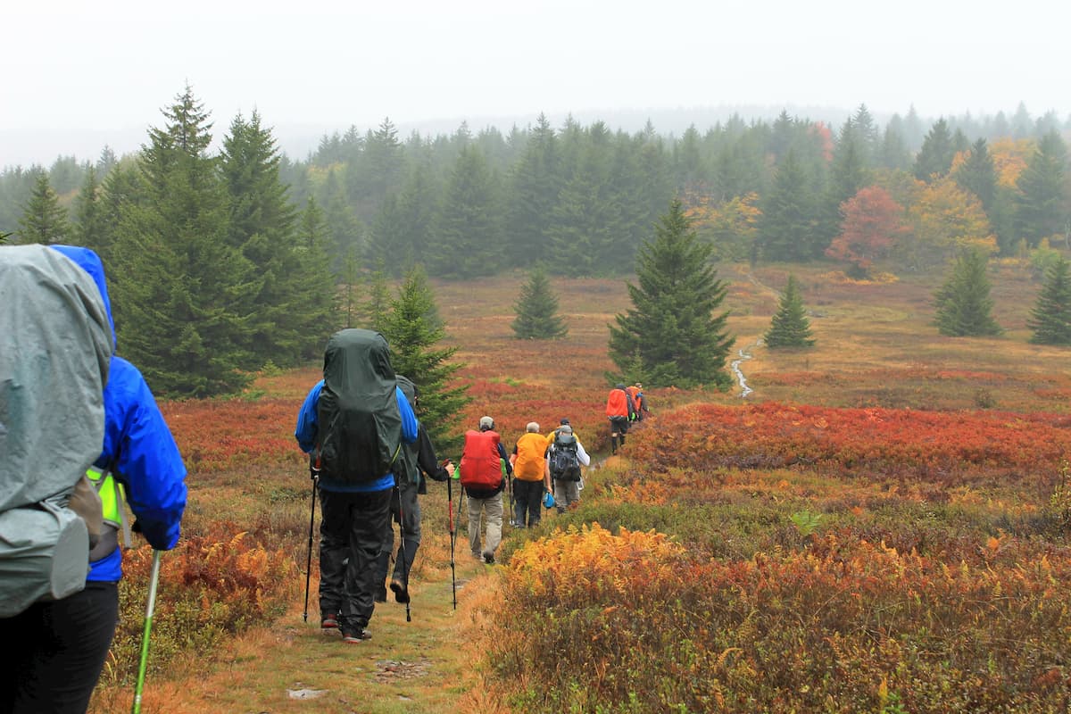
Dolly Sods is a veritable choose your own adventure for hiking. With around 47 miles of trails and 19 distinct trails to choose from you can criss cross the entire wilderness to see every inch of what Dolly Sods has to offer, from the highland sods to the low forests of the Red Creek Basin. While many trails are situated along the courses of abandoned railroad grades and old logging roads, do not let that lull you into a false sense of security. These trails have been made rugged by Dolly Sods’ intense weather and you will often have to navigate rocky, muddy and rooty terrain. Additionally, hikers will have to keep their wits about them as none of the trails are blazed and the only indicator of which trail is which are the signs are trail intersections, as well as signs at the perimeter of the wilderness that indicate its boundary and the beginning of private property. Distinct trails include;
While Flatrock-Roaring Plains are not technically part of the Dolly Sods Wilderness, their proximity to the wilderness makes them a popular side trip for those visiting Dolly Sods. Flatrock-Roaring Plains is home to Mount Porte Crayon, the sixth highest point in the state. Also known as "Roaring Plains West" to the advocates of a much larger area (15,138 acres) of proposed wilderness preservation, the Roaring Plains West consists of 6,820 acres (27.6 km2) set aside by the Wild Monongahela Act, which was made law on 30 March 2009. There are also areas known as "Roaring Plains North" and "Roaring Plains East" not included in the Wild Monongahela Act. Along with neighboring Flatrock Plains, these areas comprise the highest plateau in the eastern United States.
Just south of Dolly Sods, Flatrock-Roaring Plains has four major hiking trails including; South Prong Trail, Boars Nest Trail, Roaring Plains Trail, and Flatrock Run Trail.
If you are traveling with kids, the Northland Loop Trail is an easy, short option. The Northland Loop Trail is a 0.3 mile interpretive trail just south of Red Creek Campground on highway 75 which accesses Alder Run Bog a northern bog or southern muskeg.
The Raven Ridge Trail is located in Dolly Sods North and connects to the Dobbin Grade Trail at its southernmost terminus near one of the confluences of the northern Red Creek Drainage, as well as Bear Rocks Trail around its midpoint in the highlands of North Dolly Sods, and eventually connecting to the Rocky Ridge Trail at the Northwesternmost corner of the wilderness. The Ravens Ridge Trail traverses the higher reaches of Dolly Sods giving spectacular views of the highland bogs and hardwood forests. While on the trail you can catch glimpses of Marsh Hill (3110 ft), Roman Nose Hill (3002 ft), Snowy Point (4072 ft), Big Savage Mountain (2995 ft), Sampson Rock (2936 ft), Dans Mountain (2897 ft), and Martin Hill (2661 ft), among others, as well as Dans Storm Lake and connecting features of Dolly Sods on the Rocky Ridge Trail. Ravens Ridge traces the very periphery of the park for a short time with Tucker County were there are marsh tributaries to Red Creek that are not accessible to hikers. Numerous Private Property signs indicate where the park ends.
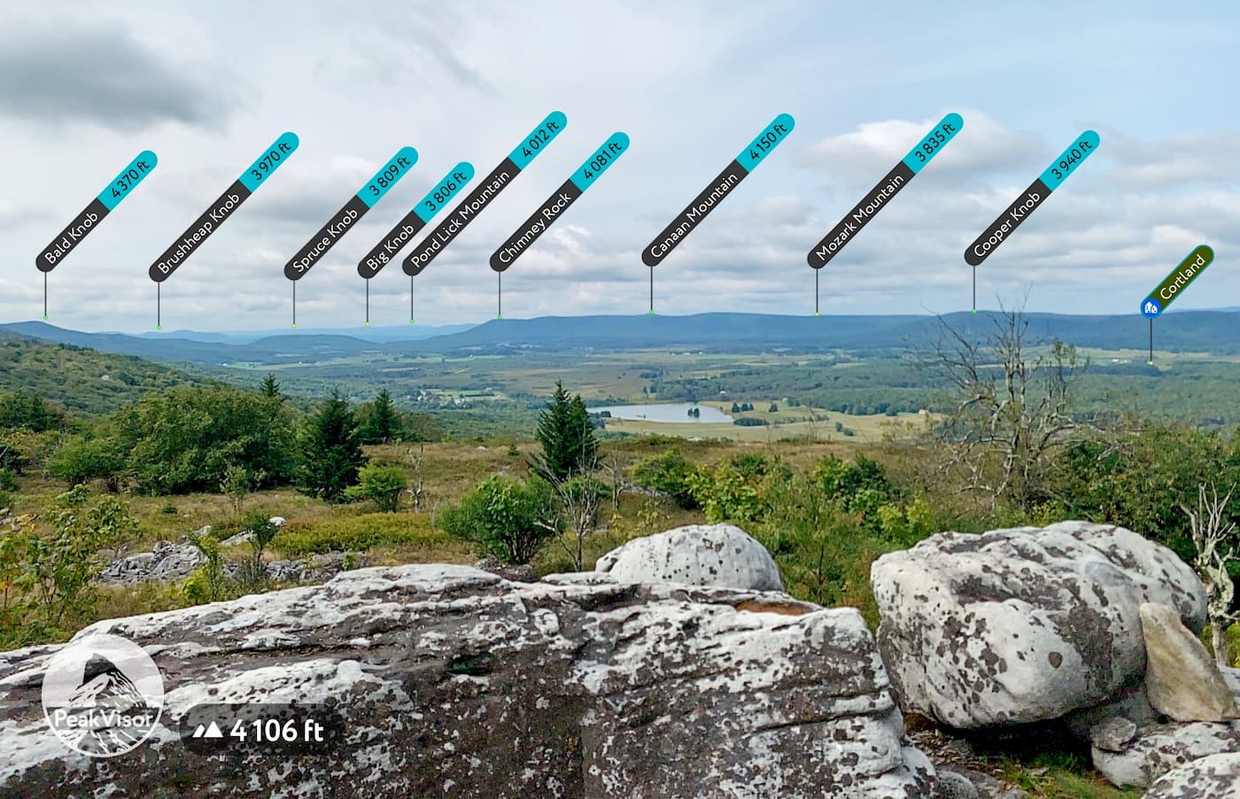
The Rocky Ridge Trail is one of the most fun and beautiful trails in the park and traces the northwesternmost edge of the wilderness overlooking the Canaan Valley. This trail not only has some of the best views of the region (if not the best), it also traverses some of the most intricate and interesting rock formations in the park. It should be noted that hikers need to take care regarding navigation. Some of the rocky hiking trails are hard to follow and when visibility is low the risk of unintentionally going off trail is very high. Rocky Ridge connects with the Raves Ridge Trail at its northwesternmost terminus, as well as the Dobbin Grade and Harman Trails before meeting the Blackbird Knob Trail at its southwesternmost terminus. From the Rock Ridge Trail you will see Bald Knob (4370 ft), Brushheap Knob (3970 ft), Spruce Knob (3809 ft), Big Knob (3806 ft), Pond Lick Mountain (4012 ft), Chimney Rock (4081 ft), Canaan Mountain (4150 ft), Mozark Mountain (3835 ft), and Cooper Knob (3940 ft), among others, as well as Cortland, West Virginia.
Bear Rocks TrailBear Rocks Trail is a popular trail to enter the park on and will be obvious when you see how worn the first half mile of the trail is up to its meeting point with the Dobbin Grade Trail. Traversing the highland bogs of the park starting from the Bear Rocks Trailhead on highway 75, you will get a great view of the headwaters regions of Red Creek and provides access to many of the park’s other popular trails. Beginning on the northeasternmost corner of the park Bear Rocks Trail heads west with two small creek crossings. The Dobbin Grade Trail intersects with the Bear Rocks Trail at its midpoint before the Bear Rocks Trail eventually connects with the Ravens Ridge Trail at its Northwesternmost terminus.
Blackbird Knob Trail is one of the most beautiful trails in the wilderness and highlights the wilderness’ hardwood forests, highlands, and Red Creek in a way that no other trail in the park can. It is also one of the easiest trails to find in the park, having an entry on both highway 75 just above the Red Creek Campground on its easternmost terminus, and via the White Grass entry point to the park where the Blackbird Knob Trail meets with the Big Stonecoal and Breathed Mountain Trailheads at its westernmost terminus. Starting from the west, the Blackbird Knob Trail connects with the Ravens Ridge, Harman, Red Creek, and Upper Red Creek Trails, making it the best access trail to both the northern and southern sections of the park.
The Red Creek Trail, true to its name, follows the Red Creek Tributary. This means that it goes through some of the most beautiful hardwood forests in the wilderness. Yet, it is important to know that since it follows Red Creek this trail will be much muckier and wet than higher altitude trails and is best traversed during the drier summer months. The Red Creek Trail also leads to the Red Creek Backcountry Campground on Red Creek, which is very well developed for a backcountry campsite and has great shallow pools in Red Creek to swim. The Red Creek trail is also the long unique trail in the park and starts at the midpoint of the Blackbird Knob Trail heading into Dolly Sods South. The Red Creek Trail also intersects with the Breathed Mountain, rocky Point, Fisher Spring Run, Big Stonecoal, and Little Stonecoal Trails before terminating at its southwesternmost point at the Red Creek Trailhead at the intersections of highway 19 and 45/4 heading toward Laneville, West Virginia. If you are interested in seeing Lion’s Head Rock you will first have to take the Red Creek Trail to Rocky Point.
The great thing about Dolly Sods is that it is a beautiful wilderness with tons to see in a relatively small space, so hikers can make decisions on the fly based on weather and skill. Longer hikes can be easily shortened and shorter hikes have the option of extensions based on what aspects of the park you are excited to see. That being said, there are a few must see areas of the park for any first time visitor.
This loop gives hikers access to both Dolly Sods North and South, while also providing a variety of backcountry camping spots for either a 2 or 3 days trip. Starting at the Bear Rocks Trailhead on highway 75 you will head west for 2.4 miles until you reach the Ravens Ridge Trail. You will then turn right on the Ravens Ridge Trail a little under a mile and a half until you come to its terminus with the Rocky Ridge Trail where you will continue left along the northwesternmost ridge of the park. Follow the Rocky Ridge Trail for 3 miles until you come to its intersection with the Blackbird Knob, big Stonecoal, and Breathed Mountain trails. The Rocky Ridge trail, true to its name can be a little technical, so if you prefer to hike a shorter day there are a number of beautiful campsites overlooking the Canaan Valley.
When you get to Rocky Ridges trail intersection take the Breathed Mountain Trail. If you want to extend your trip you can also take the Big Stonecoal Trail and connect with the Rocky Point Trail to see Lion’s Head Rock. This will add about 3 miles overall to your trip, but will be going through some of the wetter regions of the wilderness and may not be the best option during the wetter spring and fall sessions. If you take the Breathed Mountain Trail you will continue on until you meet the Red Creek Trail 2.5 miles later. Turn left on the trail for a short jaunt and you will come to the Red Creek backcountry campsite, which is a great place to stop for the day.
On your last day you will continue north on the Red Creek Trail for about a mile until you meet the Blackbird Knob Trail where you will turn right. You can either take the Blackbird Knob Trail all the way to the forest service road and walk back to your car along that route or you can take a left turn at the Upper Red Creek Trail less than half a mile up and explore a bit more of the Sods region of Dolly Sods. The trail markings here get very spotty so you should take good care to navigate carefully, that being said, if you stay on the trail you will eventually either end up north or east, both directions which will get you back to the Bear Rocks Parking lot eventually. Take the Upper Red Creek Trail for 1.3 miles until you reach the Dobbin Grade Trail, which you can take to the Bear Rocks Trail. If you want to add a bit of mileage you can turn left on the Ravens Ridge trail rather than follow Dobbins Grade all the way to Bear Rocks. Both Routes will intersect with the Bear Rocks Trail in about a mile and a half, but the Ravens Ridge Trail will intersect with the Bear Rocks trail at its westernmost terminus while the Dobbin Grade Trail will meet the Bear Rocks Trail at its midpoint.
The premier viewpoint within the Wilderness, affording a vista of the entire Red Creek drainage, is at a set of rocky crags known as Lion's Head Rock. the Lion’s Head Rock Loop is great for a longer day hike or an easy overnighter depending on your preference. It is reached by an almost three-mile climb from the nearest road. The last quarter mile is an eight-foot-wide bench (an old railroad grade) on the side of an otherwise steep slope. Like the cliffs constituting the eastern edge of the Sods at Rohrbaugh Plains, Lion's Head Rock consists of a mixture of sandstone and conglomerate rock.
Starting from the Red Creek Trailhead you will head north until you reach the intersection with the Rocky Point Trail on your left after about 3 miles. Turn Left and hike for about a mile where you should start seeing signs for Lion’s Head Rock. There is a loop section on Rocky Point that heads to Lion’s Head Rock that you will need to keep an eye out for. After viewing the Rock you will continue on your west heading route along Rocky Point for another mile until you hit the Big Stonecoal Trail. Turn left and head south on the trail for about a mile until you meet the Red Creek Trail again, turn right and continue south for a couple miles until you end up back at the Red Creek Campground Trailhead.


The highest peak in Dolly Sods Wilderness is Harman Knob, at 1,273 m.
Notable peaks in Dolly Sods Wilderness include Harman Knob, Rocky Knob, Blackbird Knob, Breathed Mountain and Coal Knob.


