
Scan the QR code and open PeakVisor on your phone
The Wardensville Wildlife Management Area (WMA) is an outdoor recreation destination located within the US state of West Virginia. The WMA lies within the George Washington National Forest. The tallest and most prominent peak is Mill Mountain at 3,301 ft (1,006 m) tall with 1,542 ft (470 m) or prominence.
The Wardensville WMA lies in eastern West Virginia, along the state’s border with Virginia. Surrounded by a portion of the George Washington National Forest, the WMA spans 55,031 acres (22,270 ha).
The WMA spans across Hardy and Hampshire counties while running along the border of the two states. The Lost River and Cacapon River run along the western edge of the protected region, creating a natural boundary while the state border marks the eastern boundary.
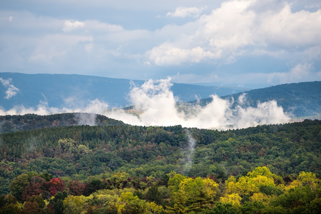
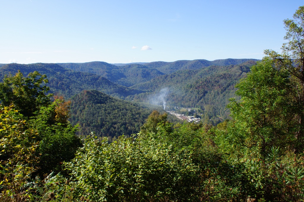
Elevations range from around 1,000 feet (305 m) up to the summit of Mill Mountain. The landscape in the region is marked by steep forested hillsides and rugged ridgelines. Though there aren’t massive changes in elevation, the series of steep valleys and ridges add to the ruggedness of the terrain.
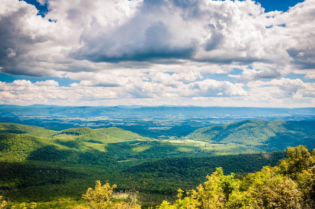
A majority of the mountainous landscape is covered in oak-hickory forests, with other small low growing shrubs and plants. While the hillsides are densely forested, many of the peaks are free of tree coverage, allowing panoramic views for hikers.
The Wardensville WMA lies within the Lee District of the George Washington National Forest. Other nearby protected areas include Warden Lake, Short Mountain, and Nathaniel Mountain Wildlife Management Areas to the north. The North River district of George Washington National Forest lies to the south while Seven Bends State Park and Cedar Creek & Belle Grove National Historical Park is to the east.
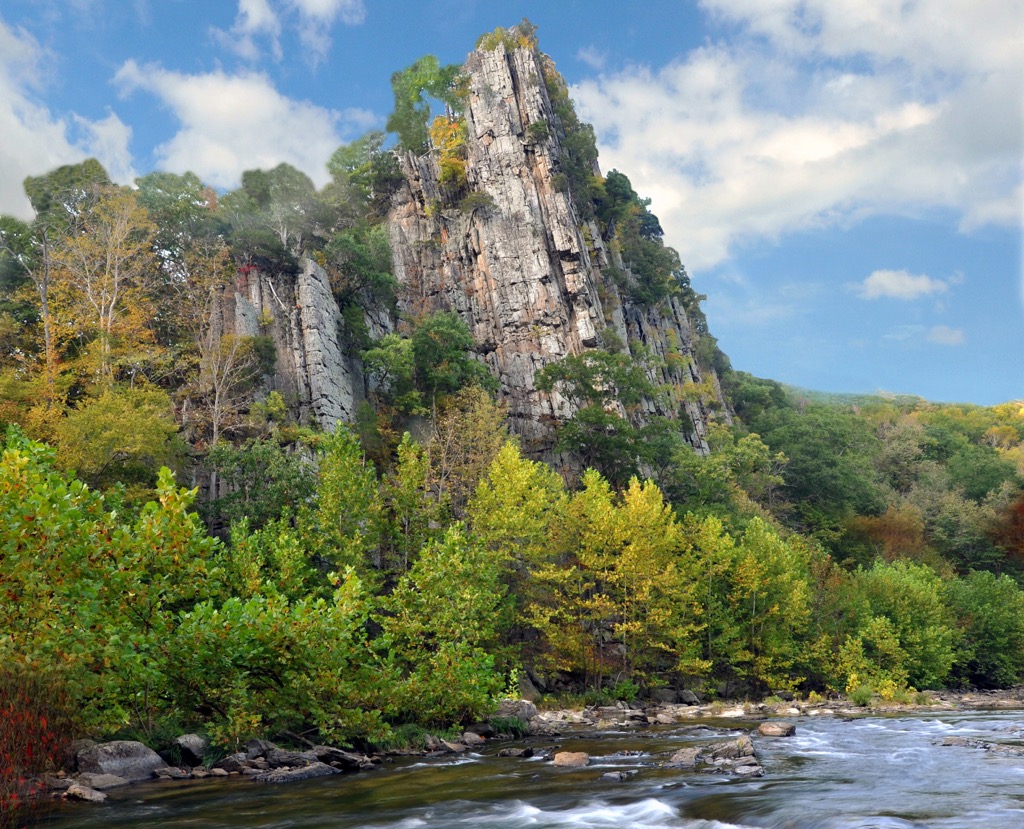
The mountains found throughout the WMA are part of the Appalachian Mountains, a range that spans from US state of Alabama northward to the Canadian province of Newfoundland and Labrador.
Furthermore, the peaks found in this WMA are part of the Appalachian Ridges, which are also commonly referred to as the Ridge-and-Valley Appalachians. This subrange extends southward into the North River District of the George Washington National Forest.
The Appalachian Ridges are separate from the Blue Ridge Mountains, another subrange of the Appalachians, which are located in the southern portion of West Virginia. A majority of the Blue Ridge Mountains lie in Shenandoah National Park.
Peaks found within the Wardensville WMA are the result of fold and thrust belts that began taking shape during the Alleghenian orogeny. This major mountain building period helped form the entire Appalachian Range.
Over the last few hundred million years, the peaks of the range have been heavily eroded. Today this erosion can be seen by the rounded peaks that define much of the mountainous regions of West Virginia and Virginia.
Major peaks found within the Wardensville WMA include Mill Mountain, Devils Benchmark, Cove Mountain, Snyder Knob, and Tibbet Knob.
The flora and fauna found within the WMA is similar to that found throughout the surrounding George Washington National Forest. The land is part of the larger Appalachian-Blue Ridge forests ecoregion.
This ecoregion marks one of the most biodiverse sections in the eastern US. The entire ecoregion is home to more than 50 tree species and over 2,000 species of flowering plants.
A majority of the hillsides are covered in mixed pine hardwood forests. Common deciduous trees include sugar maple, yellow birch, beech, and mountain maple. Lower elevations feature tulip, sweet birch, red oak, and black cherry.
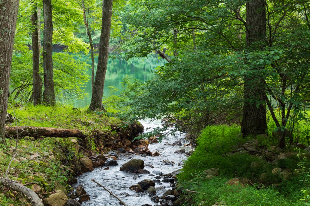
A variety of animals live throughout the WMA and the region is used for hunting, trapping, and fishing. Common animals include deer, black bear, squirrel, wild turkey, and grouse. Visitors may also spot bobcat, coyote, muskrat, bevar, mink and red fox. The various creeks, streams, and lakes are full of trout, smallmouth bass, rock bass, and redbreast sunfish.
The land in and surrounding the Wardensville WMA has been inhabited by humans for thousands of years. Determining precise territorial boundaries is often difficult to discern but the surrounding region marks part of the ancestral homelands of the Sapony, Cherokee, Monacan, Tutelo, and Mannahoac tribes.
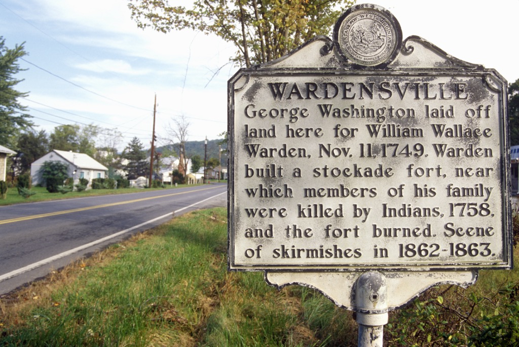
The first people of European descent to explore the region arrived during the eighteenth century. Over the following decades more groups of Europeans began settling throughout the region, forcing the Indigenous people from their land. Many of these early settlers owned slaves and arrived in the region because the British Crown claimed they owned the land.
As more people began arriving, the settlement of Staunton quickly became an important trading post. During the American Civil War the city continued to act as a vital location for both supply and communication for the Confederacy.
The arrival of European diseases, such as smallpox and measles, decimated the Indigneous people as they had no natural immunity to these illnesses. In what would later be known as the Trail of Tears, the US Government forcibly removed the Indigneous tribes from their homelands and onto reservations throughout present-day Oklahoma.
The surrounding George Washington National Forest was established in 1918 but was originally called the Shenandoah National Forest. The forest boundaries were later expanded and it was renamed to George Washington National Forest in 1932. In 1995 the forest was administratively combined with the neighboring Jefferson National Forest.
The Wardensville WMA is home to numerous hiking trails. Here are a few of the popular routes within this portion of the national forest:
Out of all of the trails in the WMA, the Eagle Rock trail is the most popular in the region. The out and back trail climbs steadily through the forested hillside along a rocky route.
Near the summit of Eagle Rock the trees begin to thin, opening up to sweeping views of the surrounding WMA and national forest land. The entire route is 2.5 miles (4 km) long with 492 feet (150 m) of elevation gain.
This trail is a rugged route that offers some of the best views in the entire region. The first mile of the trail climbs steadily before reaching a series of switchbacks that lead to the summit.
Similar to other trails in the region, a majority of the route is densely forested before reaching the rocky summit. Hikers have sweeping views of the surrounding Appalachian Ridges. This out and back hike is 6.8 miles (11 miles) long with 1,696 feet (517 m) of elevation gain.
The North Mountain Trail is a less traveled route within the WMA. The single track trail follows along a ridgeline with multiple small climbs and descents. Clearings throughout the route allow for views of the nearby peaks and valleys. This out and back trail is 4.3 miles (6.9 km) long with 456 feet (139 m) of elevation gain.
Looking for a place to stay near the Wardensville Wildlife Management Area? Here are some of the best cities and villages to check out in the region:
Winchester lies northeast of the WMA in the northern stretches of Virginia. Situated in the stunning Shenandoah Valley, the city is home to around 28,000 residents. Each year the city hosts the Shenandoah Apple Blossom Festival which has been running annually since 1924.

The small city is also home to numerous historical sites including the Museum of the Shenandoah Valley, Handley Library, and the Glen Burnie House. Just outside of the city is the Jim Barnett Park which also features a lake and arboretum.
Washington, DC is the capital of the US and the closest major city to the WMA. Home to around 700,000 residents the city is known for its historical sites, museums, and performing arts.
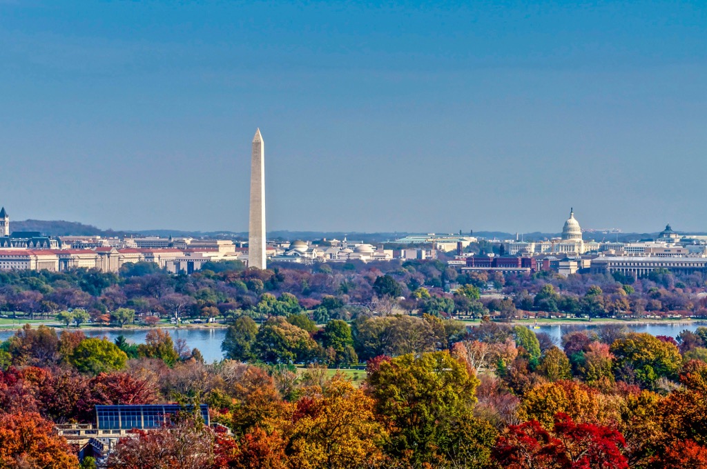
Some of the top sites include the United States Capitol, Library of Congress, Smithsonian, Lincoln Memorial, National Gallery of Art, and the Washington Monument. Many of the major sites also have tours available to learn more about the history of the country and the capital city.
Washington, DC lies along the Potomac River and is bordered by both Maryland and Virginia. Besides the governmental and historical importance of the city, Washington, DC is also known for its thriving food scene.


