
Scan the QR code and open PeakVisor on your phone
Porcupine Meadows Provincial Park is an outdoor recreation area located near the southern end of the Bonaparte Plateau section of the Thompson Plateau in British Columbia, Canada. The park boasts a number of features, including extensive Engelmann spruce and subalpine fir forests, wetlands, and Porcupine Ridge. The park’s tallest peak is Silwhoiakun Mountain (1,870 m/6,135 ft).
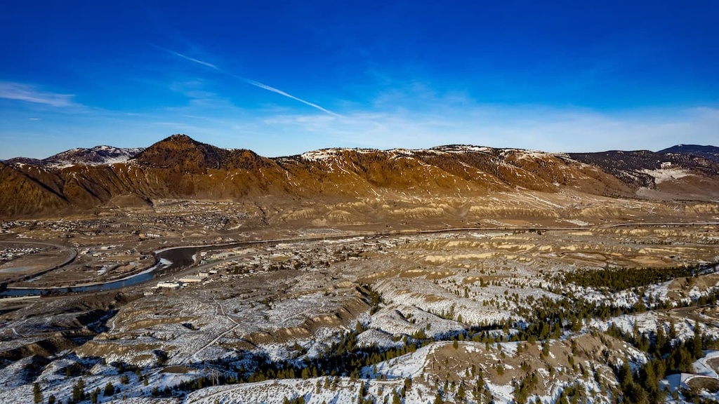
Situated in the interior of British Columbia, Canada, Porcupine Meadows Provincial Park is a protected area that covers 2,704 ha (6,681 acres) of terrain to the north of the city of Kamloops. The park is located on the Thompson Plateau near its border with the Fraser Plateau.
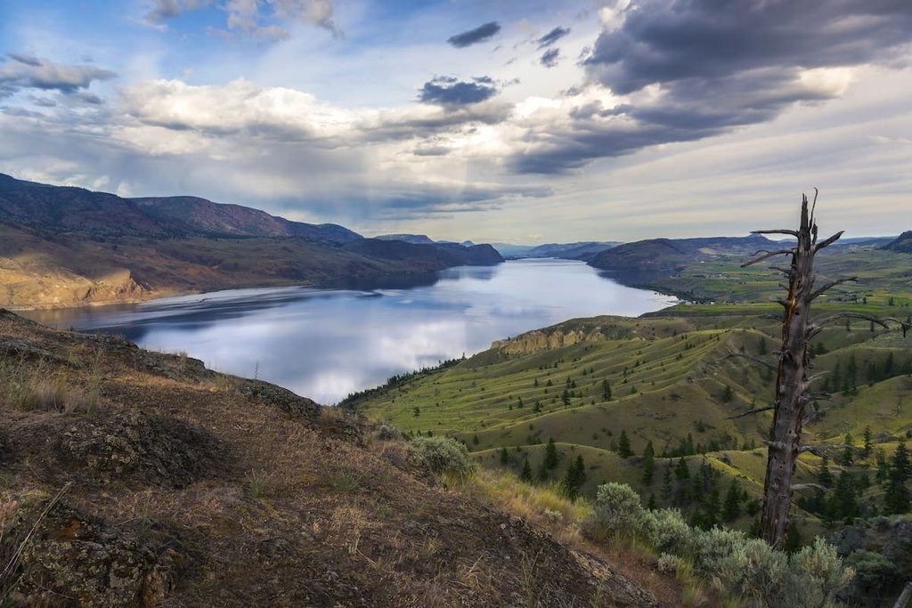
Porcupine Meadows Provincial Park is also located upon the Silwhoiakun Plateau, which itself is situated at the southern end of the Bonaparte Plateau. Within the park, you can find wetlands, old-growth forests, and two lakes— Alexander Lake and Carlo Lake.
Silwhoiakun Mountain 1,870 m/6135 ft) is the tallest peak in the park. It is located in the northwest corner of the park while Porcupine Ridge overlooks the southern end of the park.
The park was originally created to conserve the region’s wetland ecosystems and old-growth forests. It plays a vital role in protecting the region's ecology alongside a number of other nearby parks, including Tsintsunko Provincial Park, Bonaparte Provincial Park, High Lakes Basin Provincial Park, Emar Lakes Provincial Park, and Taweel Provincial Park.
Other parks that are located near Porcupine Meadows Provincial Park and are worth checking out if you’re in the area include:
The geology of Porcupine Meadows Provincial Park is characteristic of the regional geology of the Thompson Plateau. The mountains and plateaus of interior British Columbia were created during several different events that started over 500 million years ago. During this time, sediment began accumulating on the seafloor off the western coast of North America.
As the tectonic plates under the Pacific Ocean subducted beneath North America around 180 million years ago, the mountains of western Canada started to form. The Columbia Mountains were the first mountains to form in western Canada, followed by the Interior Mountains, the Coast Mountains, the Insular Mountains, and, finally, the Rocky Mountains.
When these tectonic plates subducted beneath the continent, magma often flowed through the weakened layers of the crust. This flowing magma either erupted above the surface as volcanoes or collected under the surface where it created batholiths.
Much of western Canada was also formed as a result of the accretion of terranes, or crustal fragments. One such terrane, the Wrangellia terrane, originated as an island arc off the coast of the continent but was eventually accreted (attached) to the continent through tectonic collision. The accretion of these terranes and the subsequent tectonic collision helped to form many of the mountains in the northern part of what we now call the western cordillera.
Following the formation of the western cordillera, lava erupted over the interior of British Columbia, creating the vast plateaus that are present today. For example, to the northwest of Porcupine Meadows Provincial Park is the Fraser Plateau, which boasts some of the youngest rocks in the region. In fact, about 5 million years ago, volcanic eruptions covered the plateau in a thick layer of basalt.
The volcanic rocks of Porcupine Meadows Provincial Park and the Thompson Plateau are at least 60 million years old. The layers of underlying Paleozoic sedimentary rocks on the plateau may be hundreds of millions of years old; however, the basaltic lava and granitic intrusions in the region are much younger.
About 60 million years ago, crustal thinning that occurred in the region’s tectonic subduction zones led to major eruptions across the interior of British Columbia. These lava flows filled in the ancient topography of the region to create the Thompson Plateau.
As the region contains a substantial amount of schist, the highland areas of what is now Interior British Columbia were easily eroded during the Pleistocene to create the province’s current topography. In fact, the mountains that we now see on the plateaus are primarily made of erosion-resistant rocks, such as granite, which were able to withstand the erosive power of the Pleistocene ice sheet.
Porcupine Meadows Provincial Park and the rest of the Thompson Plateau are generally considered to be in the rain shadow of the Pacific Ranges. As such, the plateaus usually experience lower-than-average rainfall for the region.
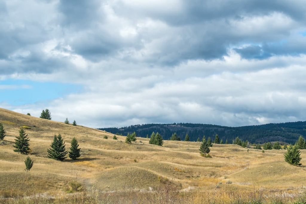
An area with lower-than-average rainfall might not seem like a good place to find wetlands and bogs. However, Porcupine Meadows Provincial Park is home to these sorts of ecosystems because it boasts a persistent snowpack that tends to stick around until mid-summer.
During the winter, snowmobilers will frequent the wide-open spaces of Porcupine Meadows; however, once the snow melts it’s nearly impossible to navigate the meadow and keep your feet dry.
There are many ponds, scrubby copses, meadows, and knolls across the plateau that are home to a wide variety of plants and animals. Above these meadows, particularly on the slopes of Silwhoiakun Mountain and Porcupine Ridge, you’ll find an extensive area of Engelmann spruce and subalpine fir old-growth forest.
Moose, elk, coyotes, grizzly bears, and black bears all make their homes among the forests and wetlands of the provincial park. Additionally, the park’s wetlands are a unique ecosystem in the region, so they are popular nesting and feeding sites for both local and migratory birds.
As it is part of the traditional territory of the Secwepemc (Shuswap) First Nation, the land and resources of Porcupine Meadows Provincial Park have been used by First Nations for countless generations. It is likely that the area around the park has been inhabited by humans for at least the past 10,000 years.
There is mixed opinion among archeologists on who the first inhabitants of the region were; however, it is known that the ancestors of the Secwepemc likely arrived in the region about 4,000 years ago. The Secwepemc are a people of the Interior Salish culture that migrated to the area from the coast and supplanted the previous inhabitants of the Thompson Plateau.
It is speculated that the Salish’s fishing skills are what historically helped them thrive in the region. The Interior Salish traditionally migrated to camping sites in the summer to gather resources before returning to live in a community of pit houses for the winter.
Fur traders of European descent likely first reached the Thompson Plateau in 1811. By 1862, smallpox had reached the interior of British Columbia. Recorded accounts from this era state that disease likely killed at least two-thirds of the Indigenous people in the region. In some cases, entire villages died as a result of introduced diseases.
After the smallpox epidemic, settlers of European descent began to arrive in the region in full force. Many of these settlers claimed the land for industry and agriculture. Ranching and forestry became major industries in the region; however, part of what makes Porcupine Meadows special is that cattle grazing never occurred in the current park area.
Porcupine Meadows Provincial Park was established in 1996 as a result of the land management guidance suggested by the Kamloops Land and Resource Management Plan.
Porcupine Meadows is especially popular among snowmobile enthusiasts because of the great snow conditions and the fun terrain that you can find within the park. During the winter, the Kamloops Snowmobile Association maintains trails to the park and to the old fire lookout on Porcupine Ridge, which doubles as an emergency shelter.
After the snow has melted, the only way to access Porcupine Meadows Provincial Park is by hiking. There are no maintained hiking trails in the region, and you’ll likely end up with wet feet while crossing the park’s meadows. While there are no maintained trails in the meadows, there are a couple of historic paths that you may be able to follow if you have the right navigation skills and experience.
For example, if you depart from Pass Lake, which is located to the south of the park, there is a historic packhorse trail that leads to Porcupine Ridge. This trail was created by the early surveyors in the region and still exists in places, but it can be difficult to follow. There is another trail in the park around Carlo Lake that was created by the Fruitland Irrigation District.
The Thompson and Fraser Plateaus surrounding Porcupine Meadows Provincial Park are home to rugged wilderness areas. The following are some of the major cities and towns that you can stay in while exploring Porcupine Meadows and the region’s other cultural sites, stunning rivers, beautiful landscapes, and rugged mountain peaks.
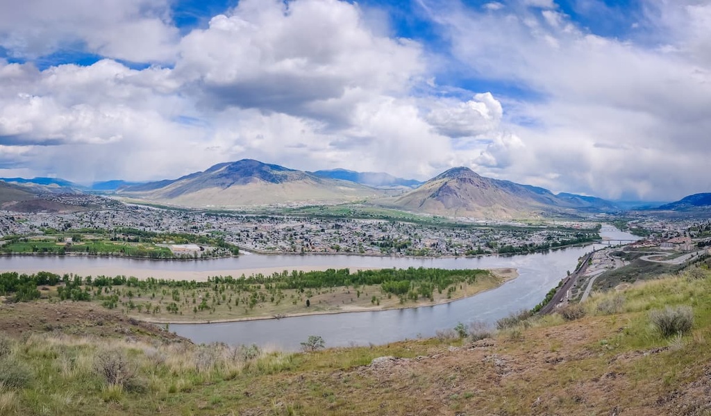
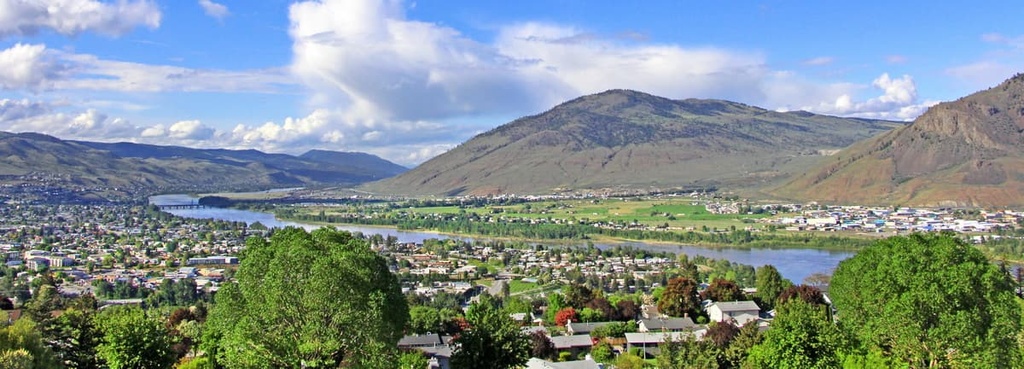
Located along the Thompson River about 40 km (24 mi) to the south of Porcupine Meadows Provincial Park is the city of Kamloops. Kamloops is known as the Tournament Capital of Canada because the city hosts over 100 sports tournaments each year.
Whether you’re visiting Kamloops for a tournament or just passing through, you may find yourself taking part in one of the many other annual events that are hosted in the city each year. Some major events that take place in Kamloops are film and wine festivals, mountain bike festivals, car shows, art shows, and comedy festivals.
With so much happening in the city, you may find that you’d like to get away from the crowds of Kamloops and enjoy some wilderness time, too. Some of the best hiking areas that are located near Kamloops include the Kenna Cartwright Nature Park, Lac du Bois Grasslands Protected Area, Greenstone Mountain Provincial Park, and Mount Savona Provincial Park.
Merritt is a town that’s situated at the confluence of the Nicola and Clearwater Rivers. It has served as a meeting place for settlers and First Nations for hundreds of years. The town is located about 90 km (54 mi) to the south of Porcupine Meadows, so it is a perfect place to base yourself for any trip to the region.
There are also many opportunities for hiking while in Merritt, including on the Coldwater River Trail, Iron Mountain Loop, Tom Lacey Trail, Godey Creek Trail, and Lone Pine Loop. The city is also located near Monck Provincial Park, Coquihalla Summit Recreation Area, Tunkwa Provincial Park, and the tourist-friendly Okanagan Lake.


