Rarely can you meet a person of such astounding faith, resilience and visionary mindset as Nicholas Roerich (the full name is Nikolay Konstantinovich Roerich). You’ve surely seen his Banner of Peace - the symbol of protection of Culture. You know about the Hague Convention for the Protection of Cultural Property in the Event of Armed Conflict but have you known it was Roerich who laid its foundations with his Roerich Pact? The influence this man has exuded on the world culture is immeasurable.
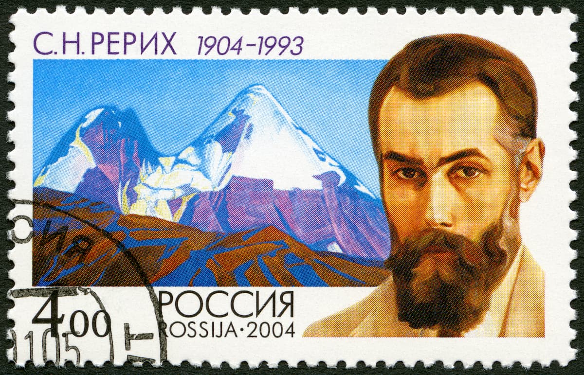
Apart from creating a new ideological movement (some call it religion), Nicholas Roerich is famous for his over 7,000 paintings, approximately two thirds of which feature mountains. The temptation to see the summits and compare them to the true ones proved irresistible. Let’s have a look at his marvelous 5-year travel in Central Asia and admire those beauties.
Roerich’s Central Asian Expedition
Roerich travelled in the Himalayas, Tibet, and the Altai from 1923 to 1928. WW1 and the October Revolution of 1917 in Russia took its toll on him. Coming to Finland in 1916 for medical treatment, he happened to be locked out of his motherland in 1917 when Finland closed borders with Russia. He and his wife Elena had to travel to London and later to the US where Nicholas Roerich had a 3-year tour with his paintings around the US and made a deal with Lous L. Horch to set up two corporations - Belukha and Ur - to sponsor the Indian-Pakistani-Chinese-Mongolian-Russian trip that was meant to explore the artistic, ethnographic and spiritual treasures of the region little known to the Westerners as well as to analyze their business potential.
During the expedition, Roerich found rare manuscripts, collected linguistic materials, folklore artifacts, made descriptions of local customs, wrote two books The Heart of Asia and The Altai - the Himalayas. He created about 500 paintings depicting the picturesque panoramas of the route, began a series of paintings called The Himalayas, created a series of Maitreya, Sikkim Way, His country, Teachers of the East. His special interest lay in the Altai. Apart from scientific exploration and ethnographic research, Roerich was studying opportunities for proposed concessions and exploring the possibility of organizing a cultural and industrial centre in the Belukha Mountain area.
Without further ado, let’s dive into Nicholas Roerich’s long adventures unravelling the secrets of sacred places.
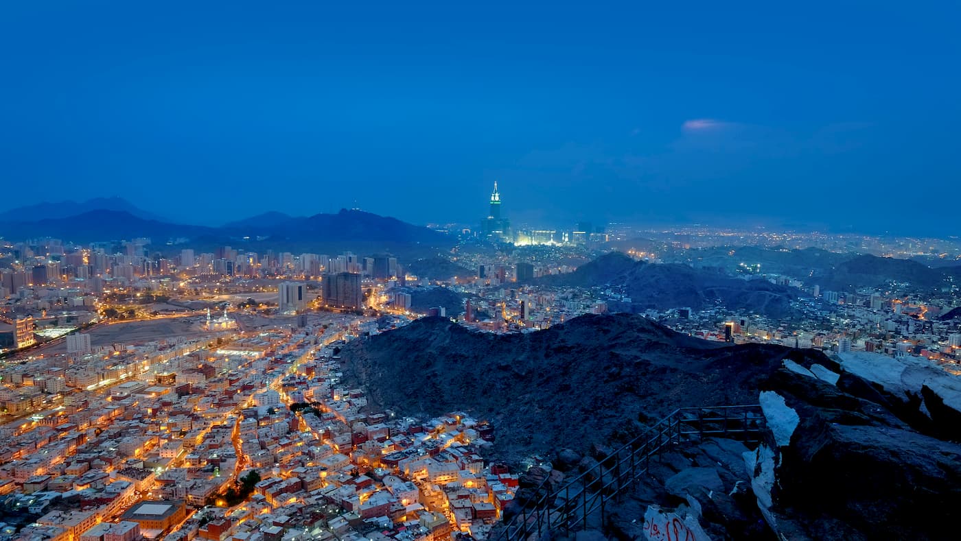
Mount Hira, which is not a Mount per se
Sometimes the names of the pictures can be pretty deceptive but not because the artist had some ill intention of fooling the righteous public. It might happen just because of the lack of information. If Roerich had PeakVisor app back in 1925, he would probably have renamed his much-famed picture The Prophet Muhammad on Mount Hira into Prophet Muhammad at Cave Hira on Jabal an-Nour Mountain. Anyway, the picture is well-worth seeing and the mountain is well-worth visiting even though you are not a Muslim.

The Hira Cave, featuring on this painting that belongs to the cycle called The Banners of the East, is located on Jabal al-Nur (or Nour) mountain aka Jabal al-Hira or the Mountain of Light, which is 2 km from Kaaba - a Muslim shrine in the form of a cubic structure in the courtyard of the Masjid al-Haram Mosque (Protected Mosque) in Mecca. The Cave is modest in size, about 3.5 meters long and 2 meters wide, and it faces the Kaaba. Never mind the size though. What is significant about the Cave is that the Prophet Muhammad loved its solitude for reflection. According to the scriptures, it is here that angel Jabrail (the name can also go as Jibreel, Jibra'il or even Gabriel) gave the Prophet Muhammad the first divine revelation, the first five ayats of Surah Al-Alaq. The first of which was reading! And the Prophet was illiterate before. The famous dialogue went as “The angel said to him, “Recite!”. “I cannot read”, the Prophet replied (which repeated 3 times). The angel took hold of him a second time and pressed him until he could not endure it any longer... The angel released him and said: “Read in the name of your Lord, the Creator. He Who created man from a clot. Read! And your Lord is the Most Bounteous. Who taught by the Pen, taught man what he knew not.” [96:1-5]. This was the first day of his Prophethood and these were the first verses of the Quran revealed to him.”
Although the cave is located near the road to Mina Valley, its visit has nothing to do with the Hajj rite or any other kind of worship.
How to get there
Jabal Al-Nur is a short drive northwest of the Old City of Mecca. As the sun and heat are intense during the day, most travellers and pilgrims attempt the summit at dawn, dusk or in the evening. Depending on your physical abilities, the climb takes anywhere from 45 minutes to 3 hours. Be sure to bring plenty of water and, if climbing when it’s dark, a flashlight.
After ascending about 1,200 steps, you will reach the summit and the Hira cave, marked by a sign painted on stone. Don't be put off by the height of the mountain, there are many more steps and stairs now than before. Still, it is not recommended for older people and people having knee problems. You can also go after Asr but Fajr probably better and try to return before Zahur. Climb slowly, take breaks, wear good comfortable sports shoes and carry plenty of water with you. Thankfully, the descent is not nearly as difficult.
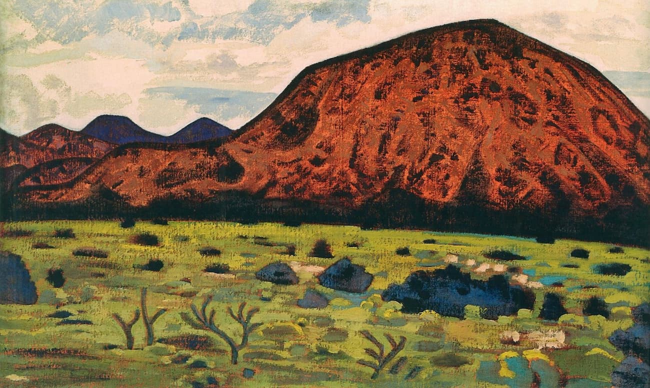
Red Rocks of New Mexico
Speaking of resilience necessary for traversing the mountainous terrain, let’s remember Roerich’s early diaries when he travelled in the US in 1920-22. When we saw the Santa Fe Mountains, those eerie outworldly vastness of New Mexico hostile landscapes, he wrote:
“In the areas adjacent to the Grand Canyon, the enchanted mesas keep their desolate charm. The heat in there is great. There often come storms and hurricanes that make the sands rise. The drought is great. But adaptability is a great quality in all life. Everything that wants to live has invincible adaptability. Whoever wants to live survives. (N.K. Roerich. "Good.")”
His further trips remind of Russian roulette game with Death, but his perseverance kept him safe.
Back in the early 1920s Santa Fe might have been a tough place with landscapes featuring bizarre red rocks and deep canyons that could not fail to impress a traveller. Nowadays, it is an eclectic yet sumptuous city with countless experiences to encounter. In 1912, the city planners designed and enacted a sophisticated city plan that incorporated elements of the contemporary City Beautiful movement, city planning, and historic preservation. The plan anticipated limited future growth, considered the scarcity of water, and recognized the future prospects of suburban development on the outskirts. The planners foresaw that its development must be in harmony with the city's character.
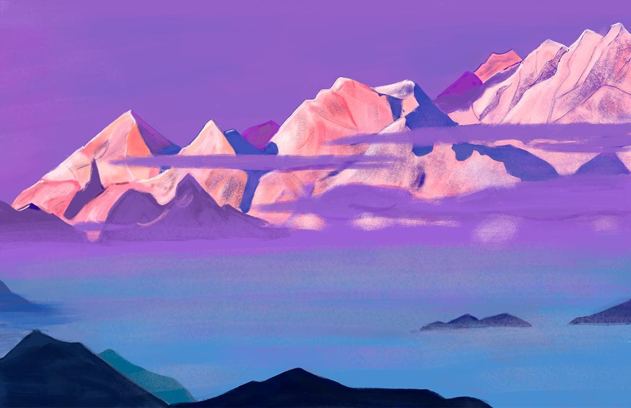
The Himalayas
When N. Roerich was travelling the Himalayas, he wrote in his diary:
"The Himalayas! How many aspirations they embolden! How wide and beautiful this vast mountainous country is, the true Roof of the World. From the Pamir through all of Tibet - from Kuen-Lun to the Indian plains - the beauty is immeasurable. When we were passing via the Tang-La, countless snowy tops rose steeply around us. Every day you see something new and wonderful, and terrible, and beautiful."
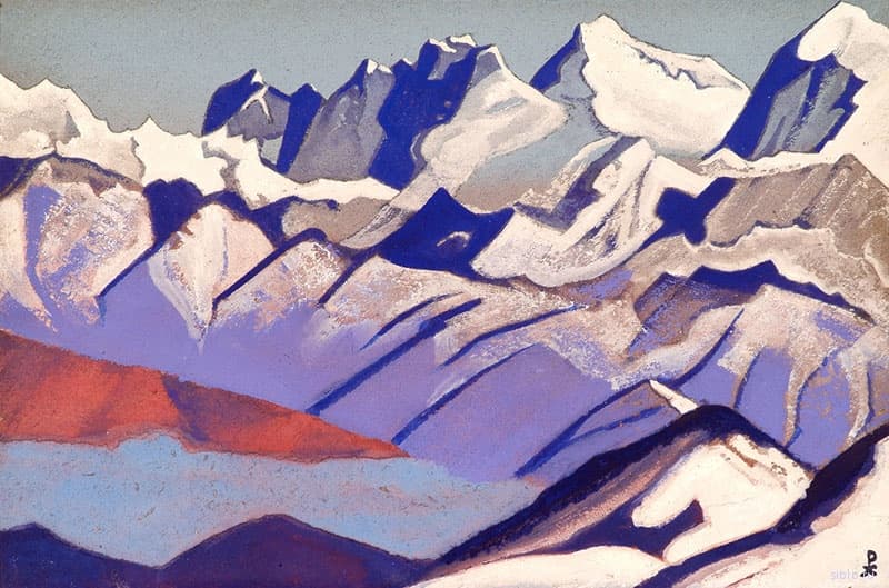
His portrayals of the Himalayas are numerous. Sadly, but most pictures have just numbers, e.g. Himalayas #79. It would be a good quest to pin all those images to real names of the peaks. Here we’ll have a look at three biggest beauties, but there are many more that he put on canvas.
Roerich brings into the system of traditional artistic coordinates the idea of feeling, the idea of spirit, not just the truth or falsehood of the depicted object.
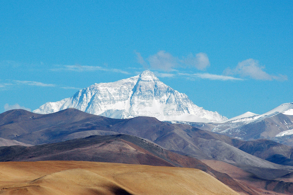
Mount Everest: The Ultimate Temptation
Being known by at least three names, Mount Everest, the mother of all mountains, was discovered by a Bengali surveyor in 1852 who estimated it to be the highest mountain in the world with an astonishing height of 8,848 meters (29,029 feet). It was known as Peak XV at the time, but later, during British rule, renamed Mount Everest. (After a British Surveyor General of India, Sir George Everest.)
Now it is also known by two other names: the Tibetian name Chomolungma - “Goddess Mother of Mountains” and the Nepalese name Sagarmatha - “Forehead of the Sea or Sky,” or “Mother of the Universe”.
The secrets held within the treasure chests of Mount Everest are legendary. It has attracted aplenty of starry-eyed climbers and adventurers who were doing their best at unravelling them, attempting to unfold the secrets, mysteries and legends she holds. And yet, for centuries she kept them at bay, expanding her flanks yearly at a rate of 5mm, burying her secrets even deeper and deeper into the depths of her snowy womb. She buried not only secrets but the too eager explorers as well. The loss of lives is legendary. The tales of bodies disappearing under the snow, forever lost, are not dampening the spirit of those flocking to Mount Everest yearly.
Every climber, experienced or not, has dreamt of conquering her deep-set valleys and towering peaks. The ultimate goal to finally stand atop the highest mountain on earth, gazing down at the rest of the world.
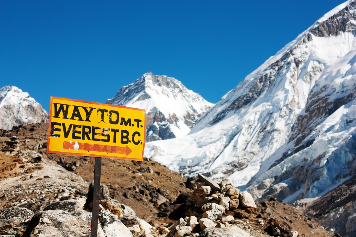
How to climb Everest
The mountain has two approaches, one from the southeast side in Nepal, the other from its northern side in Tibet. The best time to visit is from April to May. Much of your experience will depend on the weather since it is crucial to your success on Everest. You will find yourself frustrated by its power, it will either make you or break you. When you are ready, the wind might be howling above you, when you decide to wait - the sun might shine from a clear blue sky.
We cannot really consider the journey to Everest summit as a ‘hike’ by any stretch of the imagination. It is a climb, and the mother of all climbs at that. Adverse weather, lack of oxygen, treacherous terrain and extreme cold beyond imagination, all gang up against climbers attempting to climb Mount Everest.
To exacerbate your climb a bit more, every foreign traveller needs to apply for at least three permits to visit the Mount Everest base camp because the international border between China and Nepal runs across the precise summit point of Mount Everest. You need the permit from the Tibet Tourism Bureau, it is better to apply 6 months prior to the expedition, enclose a passport copy, passport pictures and a Letter of Recommendation from your local Alpine Association/Climbing club.
Quite nasty situation with permit obtaining happened to Roerich and his family as well. According to official evidence found in the Indian archives, N. Roerich and his caravan spent almost 7 months (from October 6, 1927 to March 06, 1928) locked on the Changthang Plateau, 4,000-4,500 m. a.s.l. It is located in western and northern Tibet extending into southeastern Ladakh, with vast highlands and giant lakes. From eastern Ladakh, the Changtang stretches approximately 1600 km east into Tibet, as far as the province of Qinghai. By the order of a British colonel F. Bailey, the Chinese authorities stopped Roerich’s expedition on the way to Nagcha, the passports were taken away, the expedition members were forbidden to speak to the bypassing caravans and buy food for people and animals from the locals. The expedition was doomed, 5 people and 92 out of 102 animals died, not being able to survive the cold and hunger. Yet, despite harsh winter conditions and dire threat of death, the Roerichs managed to save most of the paintings, diaries and ethnographic collections.
Refuges or Mountain Huts Nearby on Mount Everest
Due to the extreme climatic conditions there are no transit huts or refuges along the route to the summit. However, there are transit camps and particular places where climbers can take rest during ascent or descent.
There are two routes to climb Mount Everest, the South Col Route and the North Col Route. The south route is the simplest and most popular. Here are the main stop-over points along the way:
- Base Camp (17,600ft) is the first point from where climbers make their preparations for the journey ahead. It is accessed by flying into Kathmandu, and from there, traveling to Lukla. From Lukla, the camp is reached by road.
- Camp I (19,900 ft) is accessed by passing through the Khumbu Icefall and can only be reached with the help of ropes and ladders. The approach is dangerous; extreme caution needs to be taken. As acclimatization is of prime importance from this time onwards, climbers traverse the Khumbu Icefall several times to get their bodies adjusted to the extreme conditions before proceeding further.
- Camp II (21,300 ft) is accessed by passing through a glacial valley called The Western Cwm. The word, “Cwm,” is Welsh for, “bowl-shaped valley.” This valley is surprisingly hot due to receiving extreme sunlight with barely any wind. This poses a great difficulty for climbers, as they are exposed to intense heat at such a high altitude.
- Camp III (24,500ft) appears once you clear Lhotse Face, whe sheer wall of ice that needs to be climbed with ropes. By now, the lack of oxygen saps out almost all energy within the body, with severe discomfort due to extreme cold conditions. Camp III is situated on a slope of more than 45°, where even walking can be risky!
- Camp IV (26,000 ft) aka South Col is located in what is known as Death Zone. Once you cover The Geneva Spur, Camp IV is the last resting point on the journey to the summit of Mount Everest. From this point onwards, sheer climbing skills and grit is what makes a climber succeed or fail in the trek to the summit.
The North Col Route is less-popular, although favored by some who feel that it is less crowded, and in some ways easier than the South Col route.
Roerich was robbed twice on his Indian trip, don’t think much has changed over 100 years. You must be quite sagacious when planning the Everest trip. Analyse the tour operators meticulously as some of them are faces. Rip offs are common – beware. Climbing Mount Everest is not a cheap affair. Making use of a tour operator may involve a quote ranging from $30,000 to $85,000. The final amount largely depends on the number and quality of facilities on offer. Other than the expense involved in traveling to Katmandu, expect numerous miscellaneous expenses to pop up. Keep a buffer amount available for such expenses.
Nanda Devi, the Quiet Mountain
The Garhwal Himalayas are rarely visited by tourists since these are sacred lands of strictly protected reserves that are difficult and sometimes even impossible to reach. The first successful attempt to climb the highest peak of the Garhwal Himalayas, the notorious , a Bliss-giving Goddess as it is known locally, was in 1936 by a British-American expedition. Before that, Hugh Ruttledge attempted to reach the peak three times in the 1930s and failed each time. In a letter to The Times he wrote that 'Nanda Devi imposes on her votaries an admission test as yet beyond their skill and endurance', adding that gaining entry to the Nanda Devi Sanctuary alone was more difficult than reaching the North Pole.
Nanda Devi is a two-peaked massif, forming a 2-kilometre-long (1.2 mi) high ridge almost entirely at a height of over 7000 m, oriented east-west. The western summit is higher, and the eastern summit, called Nanda Devi East, locally known as Sunanda Devi is the lower one (7,434 m). For the Hindi people, Nanda Devi is a blessed mountain, the name of which can be translated as follows: Nanda is one of the nicknames of the Goddess of Death, the wife of Shiva, while Devi means ‘Goddess’. Well, death is a bliss sometimes. The Rishi Ganga River originates here and then flows down from Nanda Devi to create a deep valley.
Currently, the area is closed for visitors with a few exceptions, such as army or IMF sponsored expeditions. Nobody is allowed to climb or explore Nanda Devi, purportedly for environmental reasons.
However, what you can do here is apply for the visit and be among those 500 per season lucky trekkers who are now allowed to enter the core zone till Dharansi between the months of May to October. The trek to Nanda Devi National Park starts from the village of Lata, located 25 kilometers upstream from the town of Joshimath on Niti-Malari highway.
The Sanctuary has a "rim" of mountains around it and is known as the Sanctuary Wall. Inside this Sanctuary Wall is the Inner Sanctuary Ridge. The North Sanctuary Wall includes the peaks Latu Dhura (6,392m), Rishi Pahar (6,992m), Deo Damla (6,620m), and Mangroan (21,500ft). On the west flank of the Sanctuary wall, you will find Kalanka (6,931m), Changabang (6,864m), and Dunagiri (7,066m).
On the south side of the Sanctuary Wall rises Bethartoli Himal and South (6,352m and 6,318m), Trisul (7,120m). On the eastern edge of the Sanctuary stands the impressive Mrigthuni (6,855m), Devtoli (6,788m) and Maiktoli (6,803m). Many of these peaks on the outer rim of the Sanctuary are still open to climbing.
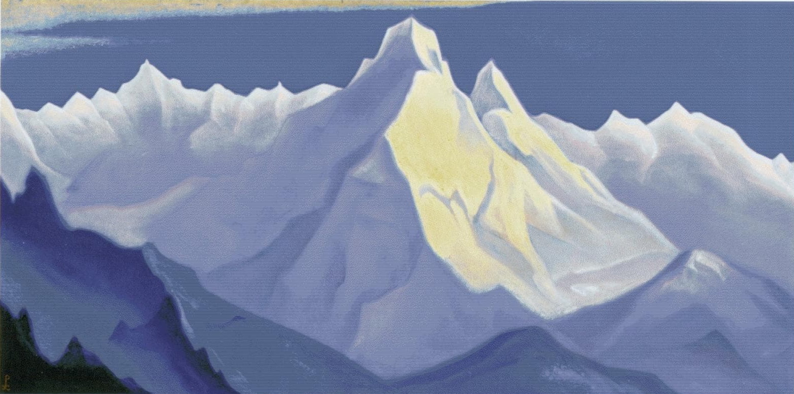
Kangchenjunga, The Place Where Shiva Drank the Poison
Roerich kept extensive diaries, here is what he wrote about Kanchenjunga:
“Kanchenjunga is the sacred peak of the Himalayas. Inspiring myths about Shiva have been generated here. He drank the poison of the world to save humanity. Here rises the shining Lakshmi for the happiness of the world. On the peaks of Sikkim in the Himalayan spurs shrouded in the scents of balu and rhododendrons, Lama pointed to the five peaks of Kanchenjunga and said: "There is the entrance to the sacred land of Shambhala. By underground caves through amazing ice caves the few chosen have reached the sacred place. All wisdom, all glory, all shine are gathered there... Kan-chanzond-nga, the five treasures of the Great Snows. What kind of treasure is that? Gold, diamonds, rubies? No, the Old East values quite different treasures.
Let's go to the mountains of India! The war has bled the world. Droughts and rains have broken eternal order. Hunger has shown its face. And again from the highest mountain, the mountain of the "five treasures", in the wind and thunder, in the glow of lightning we hear the forgotten: "Away from many worries let's go to India." (N.K.Roerich. Altai-Himalayas, Heart of Asia)
Nowhere else can you find such glow, such spiritual richness as among these precious snows … All the stages of conscious tension are here...
At 11,000 feet of altitude, the Thin Body gains a special quality. The higher you go, the less food and sleep your body needs. Mountains is the beginning that brings one out of the lower earth state, out of the usual Earth needs. For earthly bodies, every thousand meters elevates one into a special state. You can't artificially reduce mountain states to earthly habits." (The Living Ethics)
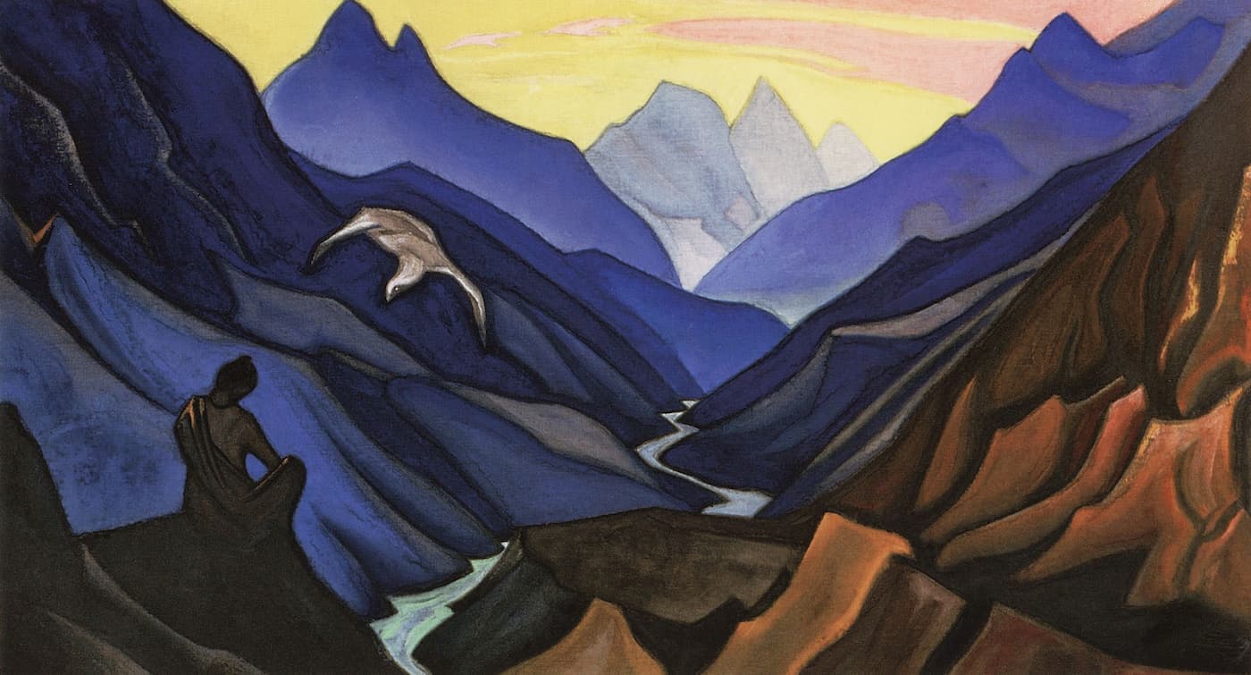
![N.K. Roerich, Himalayas #93 [Kangchenjunga]. 1936](/img/news/Nicholas-Roerich-Himalayas-93.jpg)
Kangchenjunga, also spelt Kanchenjunga (8,586 m) was first climbed in 1955 by Joe Brown and George Band who stopped short of the summit in accordance with the promise given to the Chogyal that the top of the mountain would remain intact. Every climber or climbing group that has reached the summit has followed this tradition.
The myths and legends are innumerable here. The area around Kanchenjunga is said to be home to a mountain deity, called Dzö-ngaor "Kangchenjunga Demon", a type of yeti or rakshasa. For generations, there have been legends recounted by the inhabitants of the areas surrounding Mount Kanchenjunga, both in Sikkim and in Nepal, that there is a valley of immortality hidden on its slopes.
Basically, Kanchenjunga is not one peak, but a massif of 16 peaks with five highest summits being Kangchenjunga Main (8,586m), Kangchenjunga West aka Yalung Kang (8,505m), Kangchenjunga Central (8,482m), Kangchenjunga South (8,494m), and Kangbachen (7,903). That might be the reason for Roerich to refer to it as a place of five hidden treasures. The Kangchenjunga transboundary landscape is shared by Bhutan, China, India, and Nepal, and comprises 14 protected areas with a total of 6,032sq.km. Here is the list of the areas with their official websites where you can find the timings for visits, info on the permits and entrance requirements and much more:
- Nepal: Kanchenjunga Conservation Area
- Sikkim, India: Khangchendzonga National Park, Barsey Rhododendron Sanctuary, Fambong Lho Wildlife Sanctuary, Kyongnosla Alpine Sanctuary, Maenam Wildlife Sanctuary, Shingba Rhododendron Sanctuary, Pangolakha Wildlife Sanctuary
- Darjeeling, India: Jore Pokhri Wildlife Sanctuary, Singalila National Park, Senchal Wildlife Sanctuary, Mahananda Wildlife Sanctuary, Neora Valley National Park
- Bhutan: Jigme (formerly Torsa) Strict Nature Reserve
There are four climbing routes to reach the summit of Kangchenjunga, three of which are in Nepal from the southwest, northwest, and northeast, and one from northeastern Sikkim in India. To date, the northeastern route from Sikkim has been successfully used only three times. The Indian government has banned expeditions to Kanchenjunga; therefore, this route has been closed since 2000. Despite improved climbing gear the fatality rate of climbers attempting to summit Kanchenjunga is high. Since the 1990s, more than 20% of people have died while climbing Kanchenjunga's main peak.
Because of its remote location in Nepal and the difficulty involved in accessing it from India, the Kangchenjunga region is not much explored by trekkers. It has, therefore, retained much of its pristine beauty. In Sikkim too, trekking into the Kangchenjunga region has just recently been permitted. The Goecha La trek is gaining popularity amongst tourists. It goes to the Goecha La Pass, located right in front of the huge southeast face of Kangchenjunga. Another trek to Green Lake Basin has recently been opened for trekking. This trek goes to the Northeast side of Kanchenjunga along the famous Zemu Glacier.
The Tibet
The journey was getting on, so were the ultimate survival tests for Roerich’s expedition. Apart from the ‘Great Tibetian Halt’ close to Khotan on the Changthang Plateau that we’ve mentioned before, the expedition got under a landslide, was twice attacked by bandits, traversed large mountain ridges of Marco Polo, Kukushili, Dungbure and Tangla. They also crossed two deserts. One was the Tsaidam Salt Desert, one of the most deserted places in Central Asia. Due to lack of water, it took 36 hours of continuous movement to cross the desert. The other was the Taklamakan.
The Karakoram ended the Himalayas. There began a huge ancient plain, scorched and dried up along the edges by the great deserts of Asia. In twelve days, the expedition went through five passes. Our companions were icy steep rocks and blizzards, altitude sickness and severe frost at which hands were shaking and it was impossible to draw or write. The trails were dotted with bones of the lost caravans. Snowfalls and piercing winds caused heart failures and made horses fall off in ice crevices. Once we passed the mountains, the great Taklamakan desert appeared in the pink mist. At the Chinese border checkpoint, the passports were checked and a sand-covered road led us to Khotan. The expeditionary caravan followed the Great Silk Road. The desert was breathing heat.
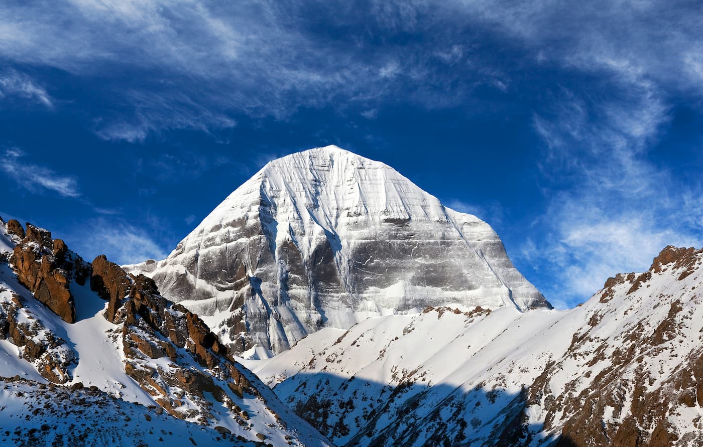
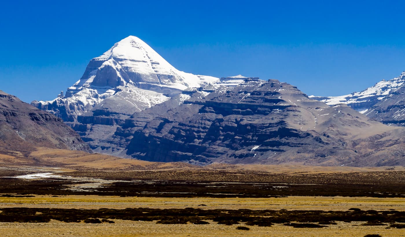
Mount Kailash: The Sacred Pyramid Amassing Good Karma
![N.K. Roerich, Sacred Mountains #29 [Way to Kailash]. 1933](/img/news/Nicholas-Roerich-Sacred-Mountains-29.jpg)
Mount Kailash: The Sacred Pyramid Amassing Good Karma
Mount Kailash (6,638m) aka Kailasa is a crown of the Kailash Range (aka Gangdisê Mountains) in the Transhimalaya in the Ngari Prefecture, Tibet Autonomous Region, China. The legends, esoteric philosophies and numerological conspiracies surrounding it are numerous and sometimes totally incredible but the main fact is Mount Kailash is much revered and considered sacred in four Asian religions (Hinduism, Buddhism, Jainism and Bön) that climbing it is off limits. Mount Kailash is believed to be the Axis Mundi aka the cosmic axis, world axis, world pillar, centre of the world, the world tree. It is the point where heaven meets earth. Kailash is the centre of the universe, the seat of all spiritual power, the summer residence of Shiva and home to the Buddha of supreme bliss. It’s not something to conquer. It’s a symbol of transcendence. To climb it would be to profane what is sacred to millions. That is the religious reasoning not to climb it.
However, there is a massive pilgrimage to Kailash each year to complete a “kora” - a 52-km long walk around its base. If you are a truly staunch believer, you will do it on your belly. The route starts in Darchen, so people adhering to Hinduism and Buddhism must do a kora to the west (in a clockwise direction), whereas Bon and Jainism adepts must do it to the east (in a counter-clockwise direction). Altitude ranges from 4,675m at Darchen, the starting point to 5,630m at Drolma-la, the highest point of the kora. Each kora amasses good karma and blessings and ensures better reincarnation in the next life.
Mount Kailash, aka the Stairway to Heaven, is minor compared to the giants of the Himalaya and technically less challenging than its notorious neighbours. Located in a remote area of west Tibet, near the border of Nepal and India, Kailash is about 1200 km from Lhasa, the administrative capital of Tibet. It’s about 800 km from the border to Nepal. It takes between two to five days to drive there.
Two beautiful lakes, Mansarovar and Rakshas Tal, are located at the base of Mount Kailash. Of the two, Mansarovar, which lies at an altitude of 4,590m, is considered the highest freshwater body in the world.
How to get there and Paperwork
Even though Tibet is considered sacred, it hasn’t remained intact to politics. If you are a foreigner, you will need to obtain
If you travel from Tibet:
- Tibet Travel Permit (TTP), which is required for entering the area of Lhasa Prefecture-level City and travelling in Tibet.
- Alien's Travel Permit for travel in the opened areas of Tibet outside Lhasa
- The Frontier Pass, which is required for all tourists, domestic and international, when traveling in the areas of Tibet that border with Bhutan, Nepal, and India.
- plus the Military Permit and Foreign Affairs Permit. This is applied for through Tibet Tourism Bureau (TTB) in Lhasa, it takes around 20 days to process.
If you opt for a tour via Kathmandu, plus to the above, you will also need a China Group Visa. This is not the regular Chinese Entry Visa, but a special visa issued by the Chinese Embassy in Kathmandu, known as a Group Tourist Visa, which can only be applied for on your behalf by the tour operator.
Visitors traveling to Tibet, can either fly from Tribhuvan International Airport in Kathmandu to Lhasa Gonggar International Airport in Tibet, and then follow the overland route from Lhasa to Kailash. Or they can take the Tibet train that departs daily from Guangzhou, Shanghai, and Beijing, and every other day from Chengdu, Chongqing, Lanzhou, and Xining. Trains take from 22 to 55 hours to get to Lhasa, and the trip is one of the most spectacular in the world, traveling up over some of China’s highest mountain ranges to get onto the Tibetan plateau.
The best time to visit the region is from April to the first half of October. During these periods, the temperature at the area hovers around 8 to 9 degrees Celsius on average. Monsoon season begins in July up to August. Hence, you should double check the weather for these months before embarking for Mount Kailash. You should expect snowfall when you reach Dolma-la Pass. So, bring some cold-weather clothes. You can schedule your visit to Kailash during the Saga Dawa Festival that usually falls on June 15th.
The Altai
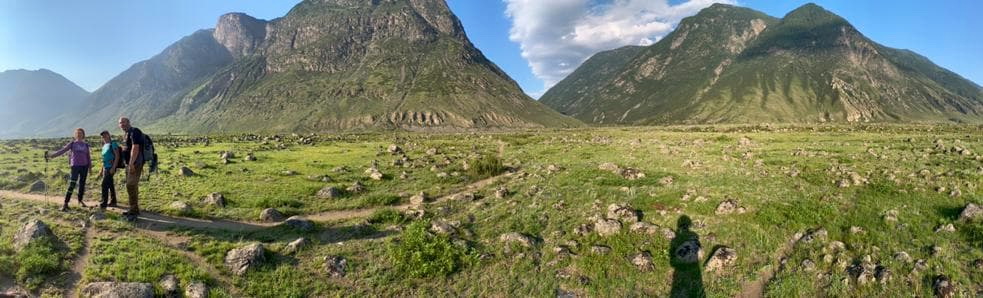
The Roerichs’ expedition entered the Altai mountains from the south, they went along the Katun Ridge, the highest part of the Altai. But mountains are not the only high thing there. You can easily get lost in the tall grass, even now.
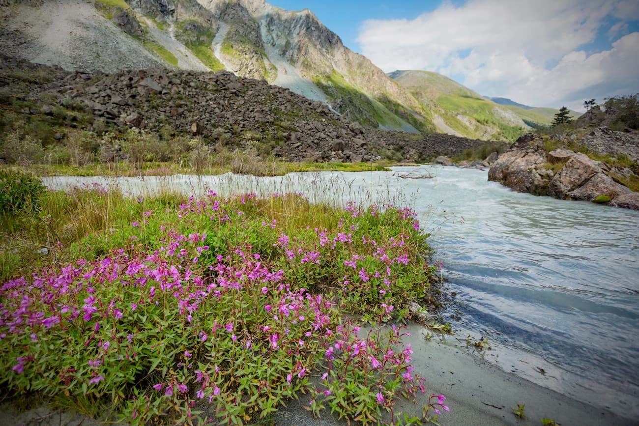
Once we waded the Edigol River, the Altai opened up its vastness. It blossomed with all the greens and blues, and the whites of the distant snows. The grass and flowers are higher than the horsemen. You can lose a horse in this grass. Never before have we seen such lush greenery. The Katun is welcoming, the blue mountains are singing, Belukha is white, the flowers are bright. Who says Altai is cruel and impregnable? Whose heart has taken fright of this empowering might and beauty?
According to the diaries, Roerich was interested in finding Belovodie (White Water Country), a legendary land of freedom in the Russian folklore. It is associated with ancient Slavic Heaven, the Milky River and with an overall blessed prosperous country. Another reason to seek the mystery land was Roerich’s interest in old Orthodox Christian religion and the refugees that fled to the Altai after the church reform in the 16-17th centuries.
There is actually the river, confirming the old legends - the White Berel River water is really milky white. It's caused by the kaolin clay deposits at the source of the river, the clay is washed away by water thus giving it the milky whiteness. Moreover, there is fireweed, aka blooming sally growing along the banks. Its bright pink to fuchsia colour creates a fairy-tale image much spoken of in many Russian folklore tales.
Upper Uymon Village became the headquarters of the expedition, a starting point for radial horse routes. Roerich visited the Katun Ridge, the Terektinsky Ridge, the Katun River, Katanda and Tyungur, the Kucherla River Valley, the mouth of the Ak-Kem River and finally the Belukha Mountain. He also visited the famous Black Anui cave on the Black Anui river, which probably served a prototype for his painting called Chud (Miracle) that is a safe haven for any refugee.
The Katun Ridge
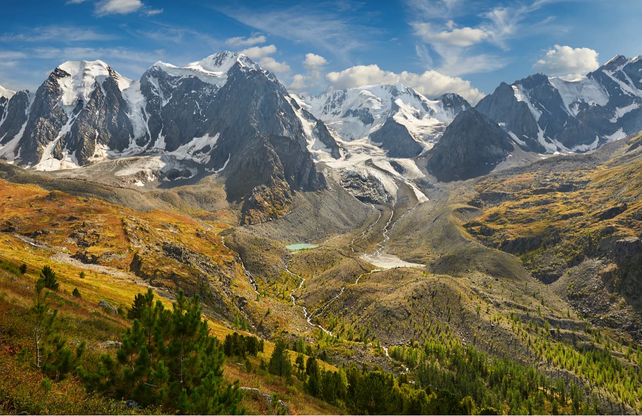
The Katun Ridge is one of the highest ranges of the Altai Mountains. There is no forest above 2000-2200 meters, only rocks that are covered with eternal snows and alpine meadows. On the slopes of the Katun Range, there are more than 386 glaciers, their total area exceeds 150 sq.km. Here starts the river Katun, it originates in the Gebler glacier. Just north of the Katun Range is the famous Uymon Steppe – an intermountain ravine at an altitude of about 900 meters above sea level.
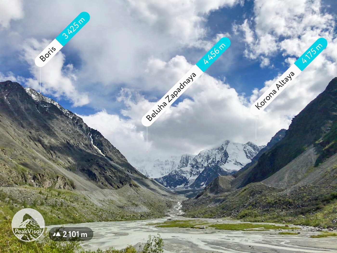
The most outstanding snowy peaks are Belukha (4,506m), Crown of Altai (4,178 m, the old name was 20 years of October), Urusvati (3,556 m), and Roerich (3,494 m).
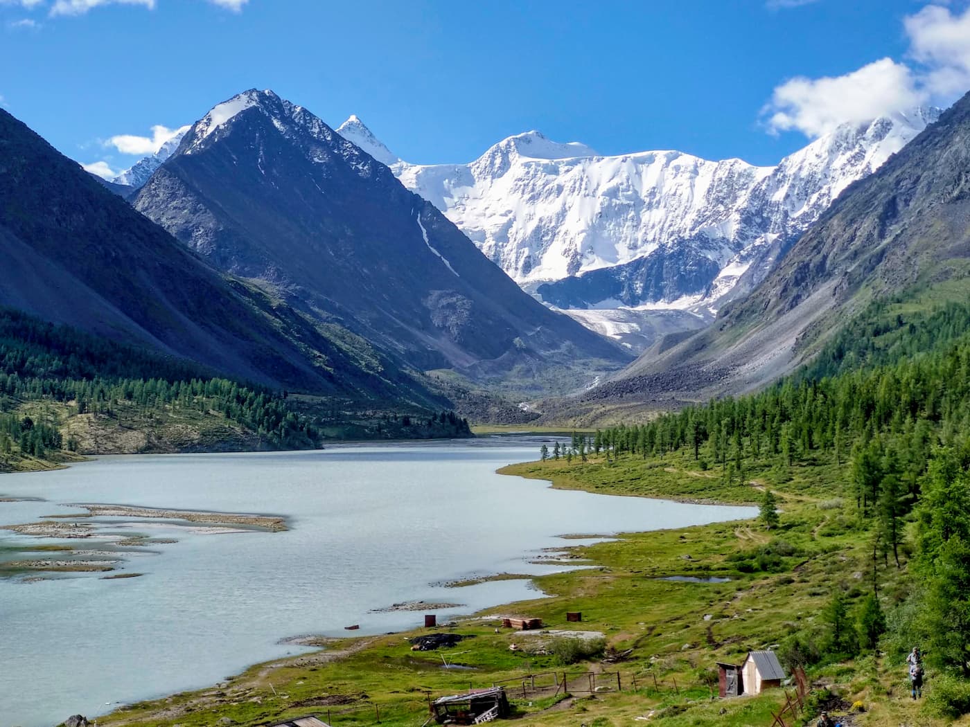
Belukha Mountain
Belukha (4,506m) is the highest peak of the Altai Mountains and the highest peak of Siberia. Geographically, this mountain is about the same distance from the Arctic, Pacific and Indian oceans. The top of Mount Belukha is always covered with snow and ice, thus the name – white mountain.
It has two summits, the Eastern and the Western, the former being a bit higher than the latter. In 2002, two paragliders started synchronously from the Eastern summit (4,509m). Probably the best two places to observe Belukha in full grandeur is Lake Ravnovesie (Equilibrium) and Lake Yazovoye.
Lake Ravnovesie seems hanging in limbo in the intermountain hollow above the White Berel River Valley, right in front of Belukha. This is the spot where Belukha opens her face to everyone, whereas usually it is shrouded in clouds and mists.
Lake Yazovoye is on the path to Belukha that runs from the southern Kazakhstan side. It is from here that you can see two of its peaks looming in the distance for the first time.
Whether Nicholas Roerich really saw Belukha used to be a controversial issue for the Soviet scientists until in the 1970s an IT guy called P.Kulichenko analyzed the paintings and calculated the points from which Roerich was painting. The results were astounding: the easel must have been at 400 m above sea level and a long way from Upper Uymon, a two-day journey at least. It would take at least four days to get there and back. Roerich had no such time, nor did the old-timers mention such a long journey. Kulichenko supposes that from this point Roerich could not see Belukha physically and that he saw it with his spiritual vision. The same applies to some of his visions of the Himalaya mountains. In the painting Burning the Darkness experienced mountaineers recognize the exact image of the glacier near Everest and do not understand how this characteristic view, seen only by them, came to the picture of the artist who has not been there himself.
Currently, you can climb Belukha, yet the level of difficulty is even greater than that for notoriously bad-tempered Elbrus. The starting point is the village of Ust-Koksa.
The Belukha Nature Park
The Belukha Nature Park is named thus due to Belukha Mountain. The territory of the park begins from the foot of Belukha and extends to the north and north-west up to the Katun River, covering the basins of its right tributaries – the Kucherla and Akkema rivers.
The main sights are the Tekelu waterfall (falling from a 60-meter height), Lake Akkemsk, Lake Kucherlinskoye. The park is also known for its petroglyphs – the stone drawings of the early Bronze Age. The Kuylu Petroglyph has over 100 drawings made in a niche of a small rocky grotto, about a dozen more drawings are applied on separate stones within 1 km from the grotto. The main characters depicted are deer, goats, horses and humans. In general, the petroglyphs date from the Eneolithic Age to the Middle Ages. Petroglyphs of the Black River are silhouette drawings on rocks made by fine dot-cutting. There are about 30 images in total.
The Altai Nature Reserve
The Altai Nature Reserve is definitely the star of the show with its majestic 22 lakes and numerous rivers, it is heaven for fishermen and just those who enjoy relaxing by the water. It is home to the snow leopard – a gracious, yet deadly, highest mountain cat. The maximum height at which it was found reaches 6000 meters, but they usually live at an altitude of 1500-4000 meters above sea level.
Take into account that visiting the territory of the Altai natural reserve (located on the territories of Ulazhan and Turachak districts) requires a special pass. One must get it a month before the expected date, it is necessary to contact the central office of the reserve or fill out a special request on the site. This rule also applies to other reserves. You can get to the Altai reserve by bus from Gorno-Altaisk, next to Artybash settlement (the mouth of the Teletskoe lake), you can get there by boat. The lake connection is feasible only for summer.
Roerich Museum in Altai
Roerich Museum is located in the buffer zone of the Reserve on the Upper Uymon River (the Republic of Altai, Ust-Koksinsky district, Upper Uymon village, Naberezhnaya, 20a). The museum is in a beautiful two-storey wooden house. Here in August 1926 Nikolay Konstantinovich Roerich stayed for 13 days during his Central Asian expedition. The museum keeps the interior of living rooms, utensils, personal belongings, books, maps, travel records, portraits, photographs and, most importantly, paintings of the great Russian artist. Roerich is famous not only for his bright and vibrant landscapes of the Altai mountains, he was a researcher as well. He led an expedition into the Central Asia regions and wrote a book on the ethics of Old Believers who lived in the area. The name of the book is Community.
How to get there
To get to the Altai reserves, you need to fly by plane to Barnaul (airport Mikhailovka) or Gorno-Altaisk (airport Maima) or Novosibirsk (airport Tolmachevo) or take a train to Barnaul or Biysk. Then by bus go to the village of Ust-Koksa. There is a daily bus service from Barnaul (one bus per day) and scheduled shuttle bus service from Gorno-Altaisk to Ust-Koksa. You can also book a ride from Barnaul or Biysk by minibus or bus. Almost every trail starts from Usk-Koksa.
The distance to Gorno-Altaisk is 320 km, to Biysk is 420 km, to Barnaul is almost 600 km, to Novosibirsk is 850 km. There is no railway in Gorno-Altaisk, so you can travel by train only to Biysk, which is 100 km away.
The Altai was the last mountain range on Roerich’s Central Asian expedition. He has covered over 10 000 km (6K mi) over roughly 5 years, mostly on foot and horseback. He was a wander and introduced into his paintings wanderers seeking holy lands of peace and bliss.
The Master’s Last Work
According to Oriental beliefs, our thought is energy, real power, a good thought can help another person, regardless of his physical presence, as long as the thought is directed with heart fire and love.
In The Order, the Teacher at the top of the mountain is giving his instruction to the disciple who is in the form of a flying white bird. "Bring, the bird, the Teachings and fly lower to the hearth where they live so shall they get the foreknowledge". ("Agni-Yoga" 669). This barely finished work remained standing on the easel when the Master passed away.
Nicholas Roerich’s body was burnt in the sacred fire in India. In the Kullu valley, on the site of a funeral pyre, there is a large rectangular stone with the inscription: “The body of Maharishi Nicholas Roerich, a great friend of India, was committed to the flames on this site 30 Maghar 2004 Vikram Era (December 15, 1947). OM RAM (Peace be upon us).”
The Outcomes of Roerich’s Travels and the New Religion
Nicholas Roerich was a man assiduously studying world religions. Being born and baptized an Orthodox Christian, he studied all the main religions of the world (Christian, Islam, Buddism, Cоnfucianism, Zoroastrism) and managed to build up his own religion called the Living Ethics (Agni-Yoga).

The term Agni Yoga means "Mergence with Divine Fire" or "Path to Mergence with Divine Fire". It is the yoga of fiery energy, of consciousness, of responsible, directed thought. It teaches that the evolution of planetary consciousness is a pressing necessity and that, through individual striving, it is an attainable aspiration for mankind. According to Helena Roerich, Agni Yoga is the synthesis of all yogas because Agni–Fire, which to a varying degree is at the heart of all yogas, will eventually saturate the atmosphere of our planet, and all the branches of yoga will be merged into a fiery synthesis. Agni Yoga is a fire baptism. The most significant features of Agni Yoga are cosmism and universalism. They are expressed in the interpretation of any phenomena of human existence from the point of view of their cosmic significance and interrelation with the being of the universe.
Agni Yoga played a significant role in bringing knowledge of Asian religions to the Western world. Living Ethics has an international following and has thousands of adherents. The ideas of the Teaching of Life have exerted an influence on other esoteric movements and philosophies, among them New Age and transhumanism.
It is a most heinous treason to know the Teaching and not apply it.
— Agni Yoga, § 98.
Let’s share the things we know. Tell us (peakvisor@routes.tips) about your long journeys around the world, we deeply appreciate the feedback you are sharing.
