
Scan the QR code and open PeakVisor on your phone
The Earle Range include 4 named peaks. The highest is Earle Range at 1,938 m. Other notable peaks include Mount Drew, Mount Louie and Mount Sumner.
The Earle Range is located along the rugged Sunshine Coast of British Columbia, Canada. The range has 4 named peaks, the highest of which is Yuon Peak at 2,003 m (6,572 ft) above sea level.
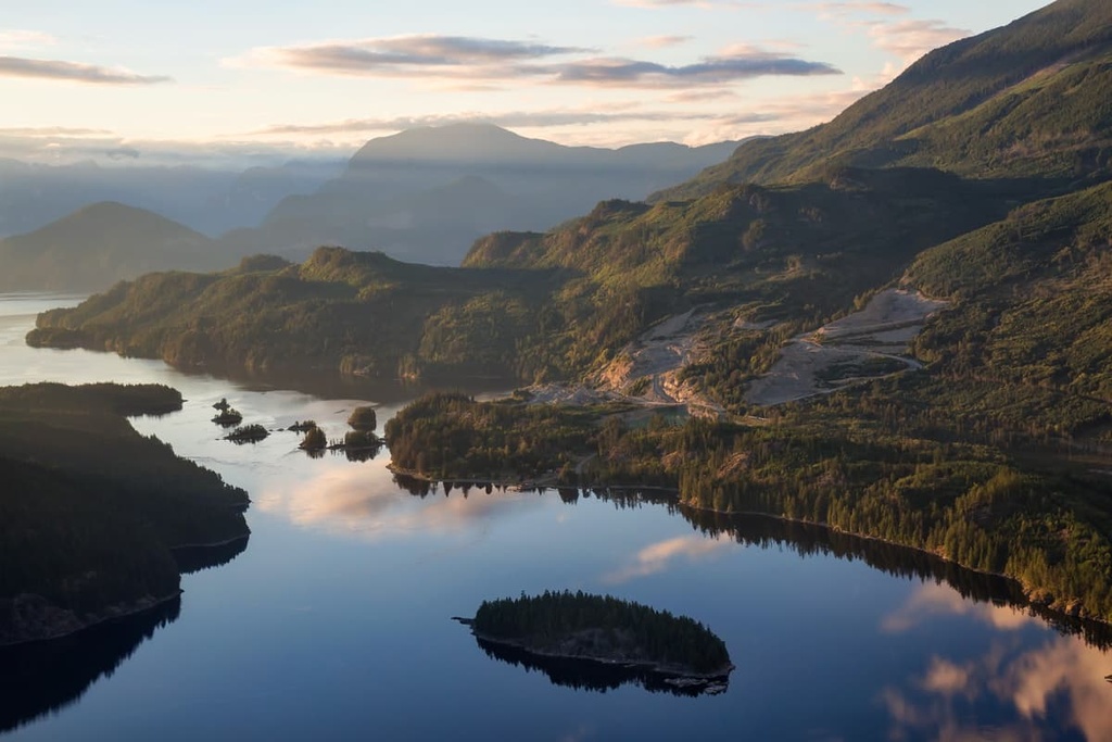
The Pacific Coast of Canada contains numerous rugged and remote mountain ranges that are all part of the Canadian Coast Mountains. The Earle Range is a subrange of the Pacific Ranges within the Coast Mountains that covers the central and southern coast of the province of British Columbia.
The Earle Range extends between the Vancouver River in the east to the Salish Sea and the Pacific Ocean in the west. The range also reaches from the Jervis Inlet in the north to the Sechelt Inlet and Tzoonie River in the south.
Additionally, the range has seven named peaks, the tallest of which is Yuon Mountain at 2,003 m (6,572 ft) in elevation. The other peaks in the range are Chickwat Peak, Earle Peak, Mount Sumner, Mount Louie, Mount Drew, and Falk Peak.
While there are no protected areas within the Earle Range, the Sunshine Coast Regional District and other neighboring districts are home to many protected areas. Some of the parks located near the Earle Range include:
The Earle Range is a subrange of the Pacific Ranges of the Canadian Coast Mountains. Nearby and surrounding ranges include the Caren Range, Smith Range, Tantalus Range, and the Park Range.
The events that formed the Coast Mountains started about 130 million years ago when the Insular tectonic plate began to subduct beneath North America. During this period of subduction, a chain of volcanic islands collided with and stuck to the western edge of North America, as lava erupted along the continental margin, welding the exotic terrane to the continent in the process.
The collision caused the old continental margin to compress, which resulted in fractured layers of rocks that were folded and heaved. Furthermore, the subduction of tectonic plates beneath North America caused volcanic events that created volcanoes and massive granitic intrusions into the continent.
As such, the Coast Mountains and the Earle Range are composed of igneous and metamorphosed Paleozoic and Mesozoic layers of rocks. The mountains are created from several different terranes that formed at different times and at diverse locations around the world.
The formation of the Earle Range lasted around 70 million years as exotic terranes collided with the west coast to further uplift the Coast Mountains. Starting about 2.5 million years ago the Earth began to cool and the world entered the Pleistocene, at which time glaciers began to cover the continents.
During the Pleistocene, glaciers coalesced in the Coast Mountains to form an ice sheet that was several kilometers thick. The weight of the ice sheet ground away at the mountains, removing any of the softer layers of rock and exposing the granitic core of the Coast Mountains.
Throughout the Pleistocene the glaciers also flowed from the peaks and carved U-shaped valleys as they made their way toward the ocean. Additionally, alpine glaciers carved out the region’s mountain tops to create cirques and horned peaks. As the glaciers receded around 15,000 years ago, they left behind glacial till in various formations.
The retreat of glaciers created moraines and kames, while the path of glacial rivers is documented by the many sinuous piles of debris, called eskers, that we see in the region to this day. Furthermore, as the glaciers melted, the sea level began to rise and fill the steep-sided glacial valleys, creating the rugged fjords that border the Earle Range and that cover the coast of British Columbia.
The Earle Range is part of the “wet belt” that’s located along the west coast of Canada. As a result, it is covered by the temperate rainforest that is commonly found across much of western British Columbia. The range experiences heavy rainfall from the tops of its peaks to the valley bottoms.
The highest elevations in the Earle Range are part of the Coastal Mountain-heather Alpine zone, which is located along the coast and typically consists of communities of heather on otherwise barren peaks. The subalpine is a narrow band below the alpine and is typically a mosaic of meadows and scattered stands of trees that gradually become a dense forest at lower elevations.
The subalpine forests of the Earle Ranges are filled with mountain hemlock, yellow cedar, and amabilis fir. At lower elevations the forests contain amabilis fir, western hemlock, and western redcedar.
Douglas fir can also be found throughout the valleys of the range, and they grow to massive sizes. Additionally, Sitka spruce is especially prevalent along the coast of the range because it has adapted to thrive amidst the salty air and sea spray.
The Earle Range is home to many of Canada’s iconic animals, such as grizzly and black bears, elk, moose, cougars, deer, wolves, coyotes, and foxes, among others. There are also many species of woodpeckers, owls, eagles, hawks, and other birds that inhabit the range.
The Earle Range is the traditional territory of the shíshálh First Nation. The shíshálh are a people who traditionally speak the Coast Salish language and who have lived along what is now referred to as Canada’s western coast for thousands of years.
The many First Nations that traditionally live in the region moved, hunted, and gathered resources based on what was historically available during the different seasons. The women of the shíshálh First Nation are traditionally known for their intricate cedar woven baskets, which were historically made from cedar tree roots, cannery grass, and birch bark.
As European settlers and traders arrived in the region, the shíshálh were hit hard by introduced diseases like smallpox, which killed many First Nations citizens. While there are no publicly documented archeological sites in the Earle Range, the location and climate of the range suggest that the area was likely used for hunting, fishing, and the gathering of other resources since time immemorial.
Access to the Earle Range is generally limited to boats and long stretches of logging roads. For those willing to make the journey to the Earle Range, there are many unique experiences to have and locations to check out.
Some of the major attractions and trails of the Earle Range include:
While there are many potential hikes and destinations in the Earle Range, the remote wilderness is relatively untouched by visitors.
However, some people enjoy traveling to the unnamed lake in the southwest corner of the Earle Range. Logging roads lead from Jake’s Landing to within 1 km (0.6 mi) of the lake, where minor route-finding is required to make it the rest of the way. The lake is a peaceful spot for camping or a picnic.
The west coast of Canada is typically very rugged and difficult to access. Indeed, even though the Coast Mountains had been viewed for centuries from the sea, many of the mountains were ascended for the first time in the 1940s. The following are some of the closest cities and towns to the remote Earle Range that are worth checking out during your adventures.
Sechelt is the largest community in the Sunshine Coast. It is located halfway up the southern Sunshine Coast and is situated about 60 km (36 mi) to the south of the Earle Range. Sechelt is nestled along the shores of the Sechelt Inlet, and it is a fantastic home base for exploring the region.
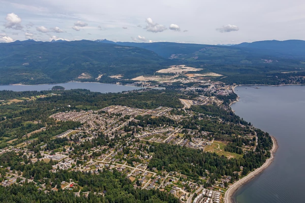
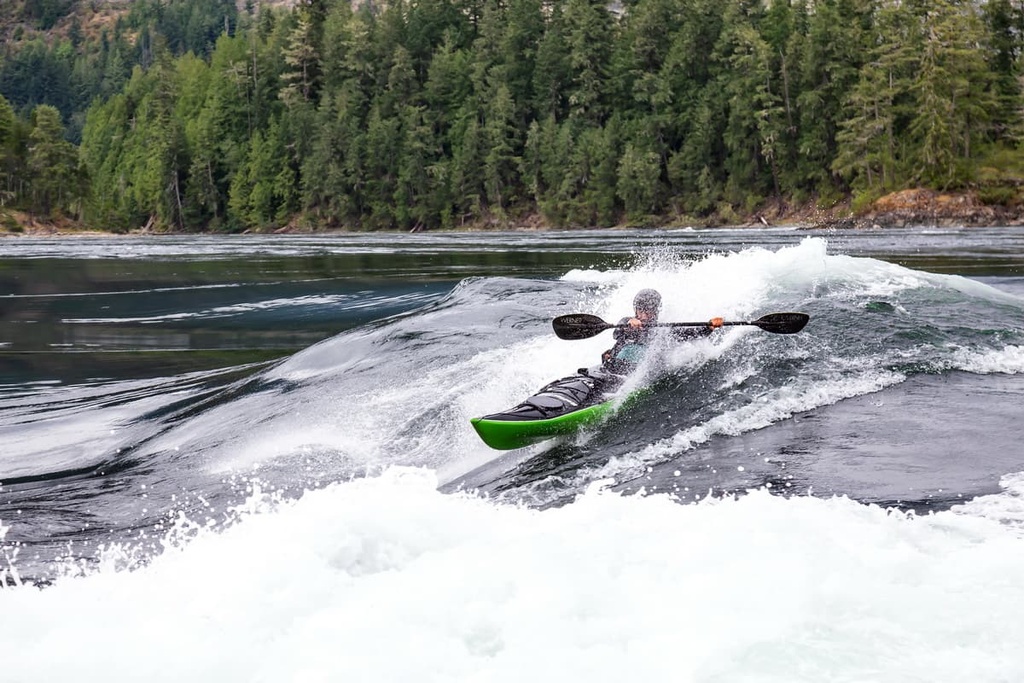
The adjacent inlet offers sheltered waters for fishing, kayaking, boating, and free marine-access-only campsites. Trail Bay, Davis Bay, and Porpoise Bay Provincial Park are popular places to swim in the area, as are the many lakes in the region. The ocean waters also offer world class scuba diving, in addition to land-based mountain biking, hiking, and golfing.
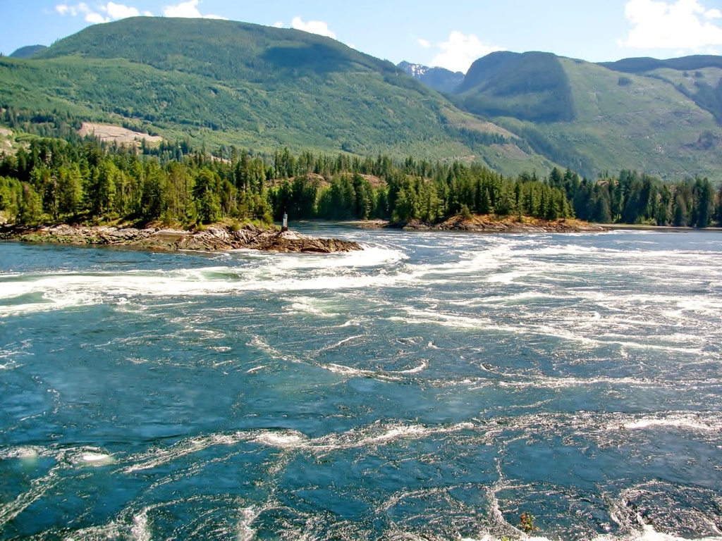
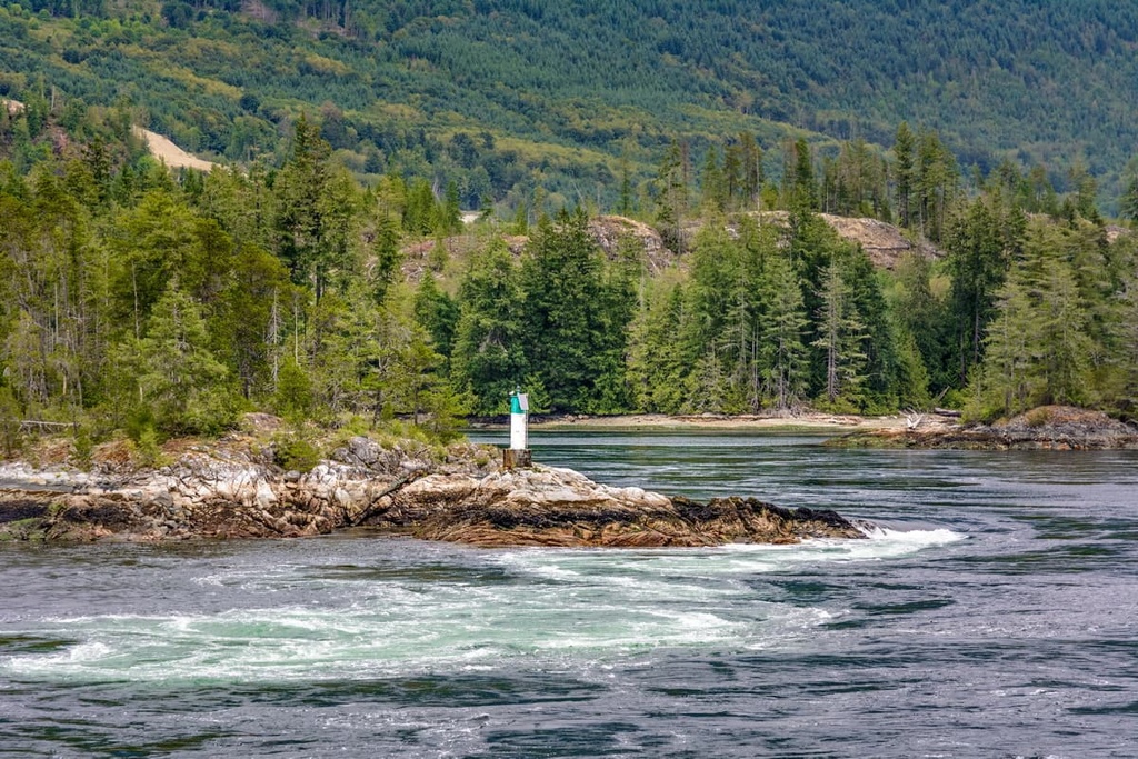
Some of the popular wilderness hiking areas and attractions that are located near Sechelt include Spipiyus Provincial Park, Skookumchuck Narrows Provincial Park, Mount Richardson Provincial Park, and Tetrahedron Provincial Park.
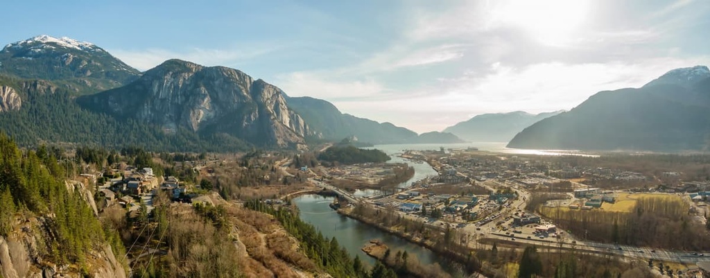
Located at the north end of Howe Sound on the Sea to Sky Highway in British Columbia, the town of Squamish is situated about 40 km (24 mi) from the Earle Range; however, overland travel to the range is possible only if you drive over rough logging roads.
The community of Squamish is a popular destination for tourists in search of outdoor adventure and recreation. Indeed, climbing and bouldering are extremely popular activities around Squamish.
Climbing attractions in the town include the granite massif called the Stawamus Chief, which features over 300 climbing routes, as well as Shannon Falls, Murrin Park, The Malamute, and the Smoke Bluffs, all of which contain an additional 1,500 routes. Additionally, the area is home to over 2,500 bouldering problems that are published in local guidebooks.
Squamish is also popular for windsurfing and kiteboarding, ultra trail running, visiting Shannon Falls, river-rafting on the Squamish and Elaho Rivers, snowmobiling, hiking, mountaineering, and backcountry skiing.
Some of the many popular hiking areas around Squamish include Tantalus Provincial Park, Garibaldi Provincial Park, and the area around the Whistler-Blackcomb ski resort, which includes the Fitzsimmons and the Spearhead Range.
The city of Vancouver is located at the south end of the Pacific Ranges, about 125 km (75 mi) from the Earle Range. Originally founded in 1862, Vancouver is one of British Columbia’s youngest cities; however, it is now the largest city in British Columbia.
Vancouver has a vibrant nightlife and concert scene as many young bands get their big break on Vancouver stages. Cultural attractions to check out in the city include libraries, museums, performing arts, and art galleries.
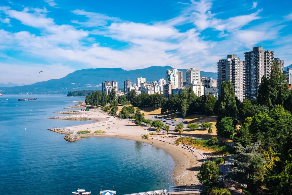
In Vancouver, you can check out Stanley Park, which is one of North America’s largest urban parks. Some of the popular hikes around Vancouver include the trails to St. Marks Summit, Norvan Falls, Quarry Rock, the Grouse Grind as well as the trails in Pacific Spirit Regional Park and Burnaby Lake Park.
Vancouver also offers great access to many incredible wilderness provincial parks, such as Mount Seymour Provincial Park, Garibaldi Provincial Park, Golden Ears Provincial Parks, and Pinecone Burke Provincial Park. All of these parks feature trails for day hikes, weekend camping, and longer backcountry expeditions.


The highest peak in the Earle Range is Earle Range, at 1,938 m.
The Earle Range have 4 named peaks.


