
Scan the QR code and open PeakVisor on your phone
Tetrahedron Provincial Park has 3 named peaks. The highest is Tetrahedron Peak at 1,739 m. Other notable peaks include Panther Peak and Mount Steele.
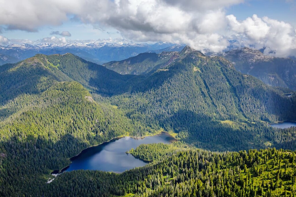
Established in 1995, Tetrahedron Provincial Park protects 14,826-acres of incredible mountain peaks, semi-open meadows, lakes, streams, and wetlands. The park also serves another important function: To protect the headwaters of Chapman and Gray Creeks, the principal water source for over 21,000 Sunshine Coast residents.
Because the role of the park is to maintain and protect the region’s water quality and community watershed, Tetrahedron is not actively promoted as an outdoor recreation destination. Instead, the park is managed to provide limited backcountry wilderness recreation activities, including hiking and backcountry skiing. Hunting, open fires, domestic animals, swimming, and mechanized travel is prohibited, and overnight visitors are only permitted to camp in the park’s four rustic cabins.
Tetrahedron lies within the traditional territories of the Sechelt Indian Band and Squamish First Nation. Little is known about the area’s significance to both First Nations people and early European settlers. However, records indicate that historical aboriginal use was limited due to the area’s altitude and relative inaccessibility. The Sechelt Indian Band still actively uses the area to exercise cultural and spiritual activities and visitors are asked not to disturb them.
Situated within the Southern Pacific Ranges ecosection, Tetrahedron represents the Coastal Western Hemlock and Mountain Hemlock biogeoclimatic zones. Lower elevations of the park contain western hemlock and western red cedar, while higher elevation forests support mountain hemlock, yellow cedar, and Pacific silver fir. The park contains many acres of undisturbed ancient forest, including one of the oldest stands of undisturbed ancient forest in Canada.
Elevations in Tetrahedron range from 2,950 feet to over 5,900 feet. The park is nestled between the Sechelt and Salmon Inlets, the Tantalus Range of the Coast Mountains, Howe Sound and Georgia Strait and its three distinctive peaks, Tetrahedron Peak, Panther Peak, and Mount Steele are clearly visible across Howe Sound from Vancouver.
A variety of wildlife can be found in the Tetrahedron area, including black-tailed deer, mountain goat, black bear, cougar, and coyote. The park's many streams, creeks, and lakes also contain populations of cutthroat trout, rainbow trout, and modest populations of Dolly Varden char.
Tetrahedron contains roughly 21 miles of established trails that are used primarily for winter ski touring and summer hiking. The most popular trails in the park lead to four rustic cabins: The Bachelor Lake, Edwards Lake, Mount Steele, and McNair cabins.
A popular loop route runs from the park parking lot to Edwards Lake and then returns via the cabin at Bachelor Lake. Visitors looking for a longer adventure can also trek from Edwards Lake to the cabin on Mt. Steel and/or McNair Lake.
These cabins were constructed in 1987 by the Tetrahedron Ski Club and are currently maintained by the Tetrahedron Outdoor Club. The cabins are available for overnight use on a first-come, first-served basis.
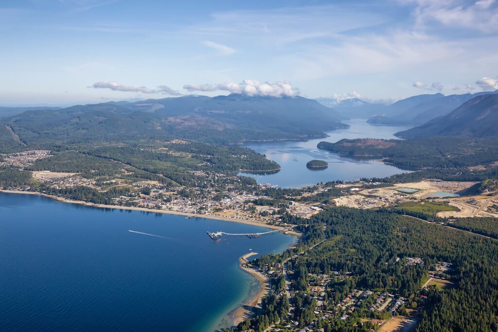
Just a 40-minute ferry ride from West Vancouver, Sechelt is a laid-back, scenic community surrounded by lofty summits and stunning seaside vistas. Named after the original First Nations people of the region, the shíshálh, Sechelt lies on the narrow Sechelt isthmus along the Sunshine Coast. Though small, this charming seaside town is the perfect hub for exploring the Sechelt Inlet, Davis Bay, Porpoise Bay Provincial Park, and Tetrahedron Provincial Park.
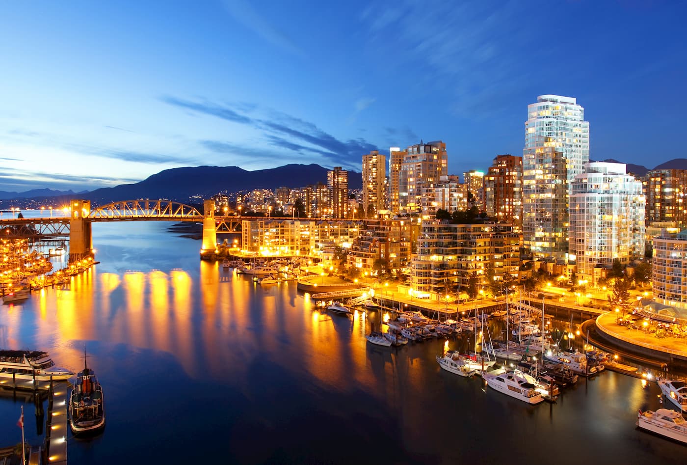
In terms of major cities, Vancouver is the closest metropolis to Tetrahedron Provincial Park. Vancouver is the perfect basecamp for any adventure in British Columbia. The city itself is surrounded by mountains and is known for its thriving art, theater, and music scenes. It is also considered to be one of the most ethnically and linguistically diverse cities in Canada. Vancouver is walkable and is home to a number of footpaths to scenic vistas and beautiful parks, as well as plenty of accommodations and eateries.


The highest peak in Tetrahedron Provincial Park is Tetrahedron Peak, at 1,739 m.
Notable peaks in Tetrahedron Provincial Park include Tetrahedron Peak, Panther Peak and Mount Steele.


