Scan the QR code and open PeakVisor on your phone
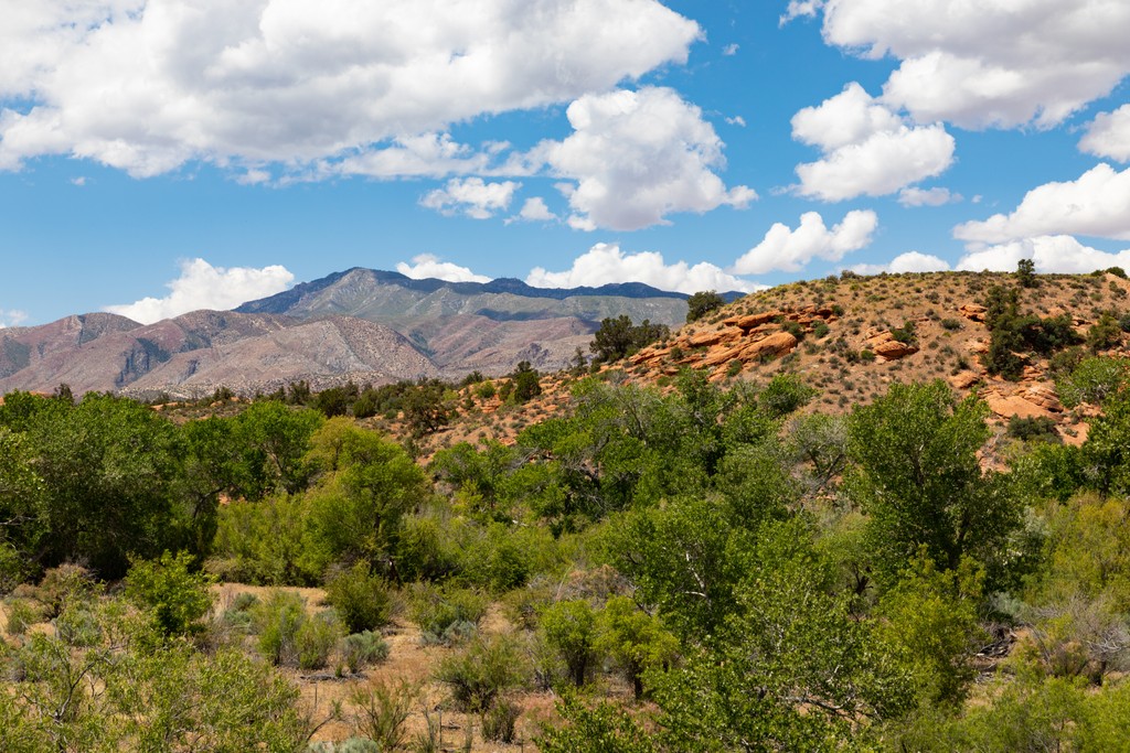
The Bull Valley Mountains are a relatively small mountain range situated in the southwestern corner of the US state of Utah. The range lies within Dixie National Forest and contains 31 named mountains. The tallest and most prominent peak in the range is Lost Peak at 7,503 feet (2,287 m) tall with 1,506 feet (459 m) of prominence.
The Bull Valley Mountains span for roughly 30 miles (48 km) across southwestern Utah, near the state’s border with Nevada. The Great Basin Divide runs along the main ridgeline in the range.
Terrain found in the range is similar to that of the surrounding Dixie National Forest and nearby ranges such as the Pine Valley Mountains and the Clover Mountains. These peaks mark some of the most eastern stretches of the Great Basin Ranges.
The entire range lies within Washington County in Utah. Geographically the Bull Valley Mountains straddle the Great Basin watershed with the Escalante Valley to the north and the watershed of Colorado River to the south.
In the northern stretches of the range lies the Lower Enterprise Reservoir along Little Pine Creek. The Santa Clara River marks the southeastern boundary of the range, separating these peaks from the nearby Pine Valley Mountains.
A majority of the region is marked by forested hillsides though some sections of the range feature white hoodoos and rock outcroppings. Many of the peaks and ridgelines are forested.
The Bull Valley Mountains lie within Dixie National Forest and are surrounded by various other areas for outdoor recreation. Directly east lies the Pine Valley Mountain Wilderness while Snow Canyon State Park and the Red Cliffs National Conservation Area are situated to the southeast. West of the range lies the Cougar Canyon Wilderness, Beaver Dam State Park and Tunnel Spring Wilderness. Further west of the range lies Zion National Park.
The peaks within the Bull Valley Mountains are part of the larger Great Basin Ranges, which extend throughout much of Utah, Nevada, Idaho, Oregon, and California.
This range marks some of the most eastern stretches of the topography that defines the Great Basin Ranges. The series of rotating ranges and basins in the region is what has given Great Basin Ranges their name. The Rocky Mountains, which are found in eastern Utah, feature wider mountain ranges and less valleys.
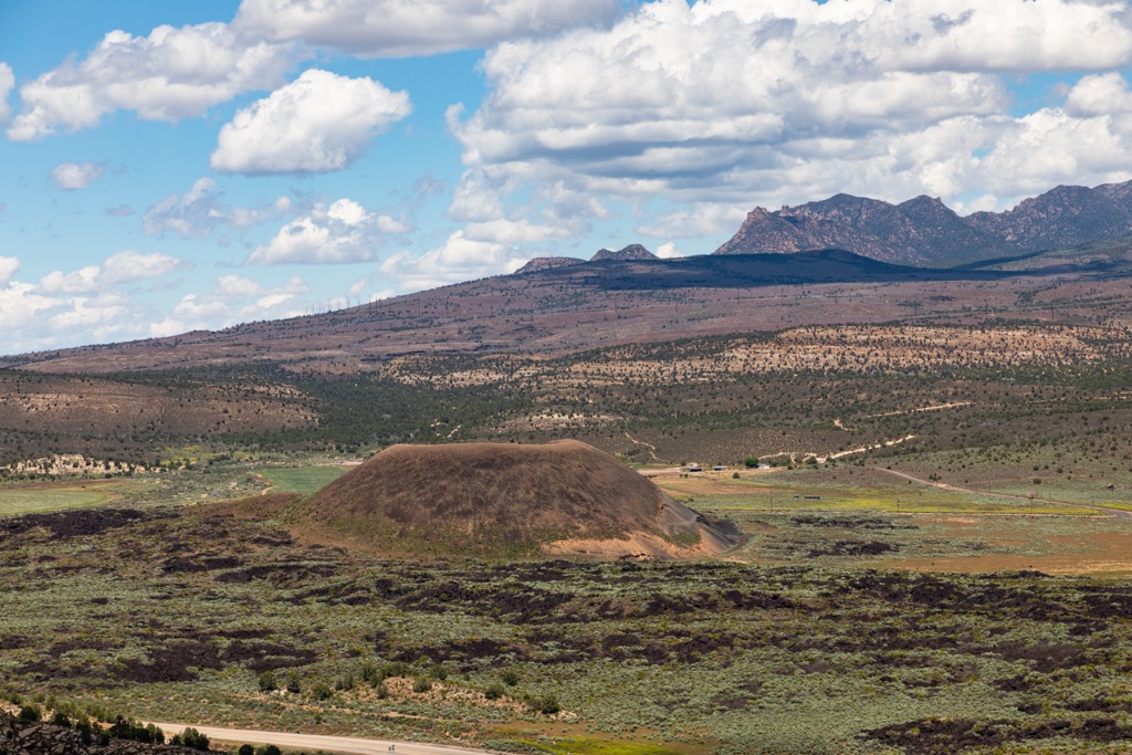
The Bull Valley Mountains share a close geological history to the nearby Pine Valley Mountains. These ranges consist primarily of rock from the Pine Valley Laccolith. Over the course of 20 million years, widespread volcanic activity dominated the landscape.
During this time thousands of feet of volcanic magma was deposited on the Claron Formation. This magma sealed off other volcanic activity, forcing the magma to be pushed along a seam of the Claron Formation. This process formed the laccolith that makes up the base of the mountains.
Over the course of millions of years, the laccolith was exposed due to erosion; a process that may have occurred as recent as one million years ago. Volcanic cinder cones in the region date back around 20,000 years.
Lava flows in the region dammed the nearby Santa Clara River causing a lake to form. Mineral deposits from this body of water can be found throughout the surrounding ranges.
Major peaks within the Bull Valley Mountains include Lost Peak, Square Top Mountain, Cove Mountain, and Bull Mountain.
The ecology of the Pine Valley Mountains is similar to that found throughout southwestern Utah. Here the forested hillsides are interspersed with meadows while a desert landscape marks the lower elevations.
The forested sections of the range are populated by Engelmann spruce and fir trees. Conifer species dominate the landscape of the range along with vast sections of Dixie National Forest.
Some sections of old-growth Engelmann spruce lie within the range while the largest section in the region can be found in the Pine Valley Mountain Wilderness to the east. Common tree species include limber pine, Douglas fir, aspen, and subalpine fir.
The expansive network of surrounding national forests and wilderness areas helps support a wide range of animal species. Some of the most common animals include Uinta chipmunk, red squirrel, dusky grouse, deer, and the yellow-bellied marmot.
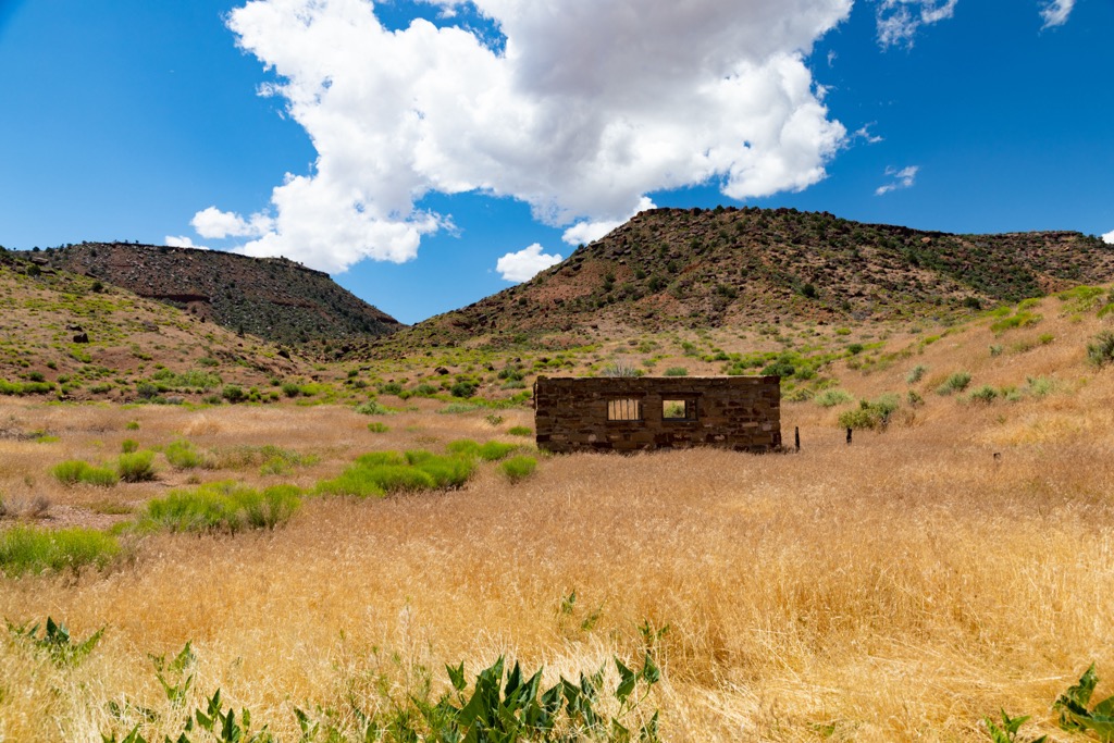
Human history in the surrounding region dates back as early as 10,00 years ago. Prior to the arrival of Europeans, this land was primarily inhabited by the Ute people.
Over the years, the Great Basin region has been inhabited by numerous Indigenous groups and tribes. This land marks part of the traditional territory of many Tribal Nations, including the Ute Indian Tribe, Eastern Shoshone Tribe, Confederated Goshute Tribes of the Goshute Reservation, Skull Valley Band of Goshute, and Shoshone-Bannock Tribes.
Land throughout present-day Colorado and Utah marks part of the ancestral lands of the Ute Indian Tribe.
Contact between the Ute people and Spanish explorers dates back as early as 1590. However, settlers of European descent did not begin settling in the region until the early 1800s. Many of these early settlers were fur trappers who would hunt and trap in the surrounding mountain ranges.
During the 1820s, Brigham Young sent a group of Mormon missionaries to settle in what is now called Utah. This group arrived in the region by claiming what they believe to be their promised land. As the number of settlers continued to grow, the Mormons began traveling south of the Salt Lake Region into southern Utah.
These groups began to establish small communities throughout the region, though most stayed in the greater Salt Lake City region. Conflict arose between the two groups as the Mormons, settlers, and US Army fought to displace the Indigneous Tribes from their native homelands.
Despite their continual efforts, the Indigneous peoples of the region were continually harassed, attacked, killed, and eventually displaced onto reservations by the US government. Shortly after the Dixie National Forest was established in 1905.
Though southern Utah is still far less populated than northern Utah, the population of the nearby cities of St. George and Cedar City have continued to grow.
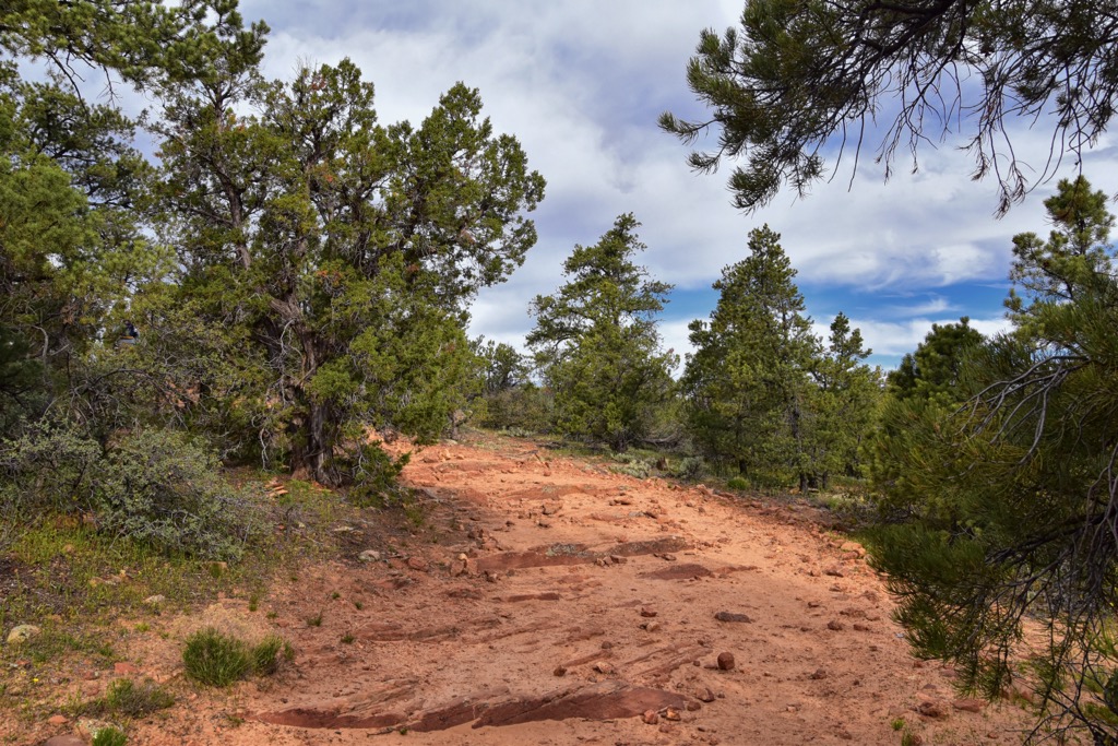
The Bull Valley Mountains are home to minimal hiking trails, especially when compared to the nearby Pine Valley Mountains. Here are some of the most popular hiking trails in the range:
This hiking route begins just outside the community of Veyo, along the edge of the range and Dixie National Forest. The point to point trail roughly follows an ATV route while passing through the Bull Valley Mountains and along the eastern edge of the Cougar Canyon Wilderness.
The trial features numerous climbs and descents throughout before finishing along Pine Park Road. The point to point trail is 23.4 miles (37.6 km) in length and boasts 5,816 feet (1,773 m) of total elevation gain.
True to its name, this route follows along the southern edge of the Upper Enterprise Reservoir. Situated in the northern stretches of the range, the trail features stunning white hoodoos along with forested hillsides and views of the water.
Hikers should note that there is minimal shade throughout and should bring plenty of water during the warmer months of the year. Round trip this trail is 6.6 miles (10.6 km) in length and features 419 feet (128 m) of elevation gain.
Beginning just south of the Upper Enterprise Reservoir lies the Pilot Peak Trail. The route climbs steadily throughout, along the forested hillsides and rock formations before passing along the edge of Flat Top Mountain. The route then descends in order to reach the summit of Pilot Peak. Round trip the trail is 8.3 miles (13.3 km) in length and features 1,505 feet (458 m) of total elevation gain.
Looking for a place to stay near the Bull Valley Mountains? Here are some of the best cities and villages to check out in the region:
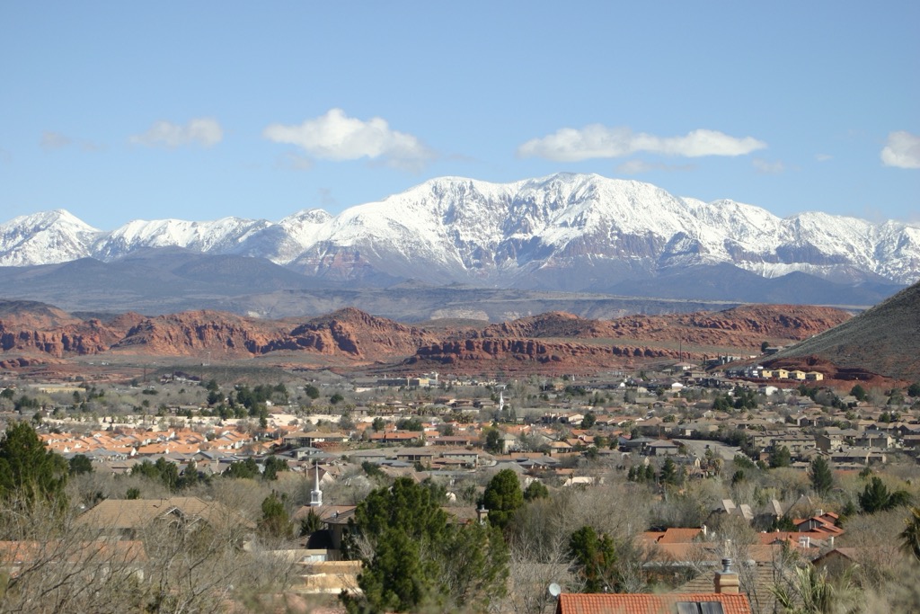
St. George lies just southeast of Bull Valley Mountain, along the southern edge of Dixie National Forest. Home to around 70,000 residents and Dixie State University, St. George is situated along the Virgin River.
Just outside the city limits lie a plethora of unique landscapes, ideal for outdoor recreation. Besides its proximity to Dixie National Forest, the city is also near Snow Canyon State Park and Zion National Park.
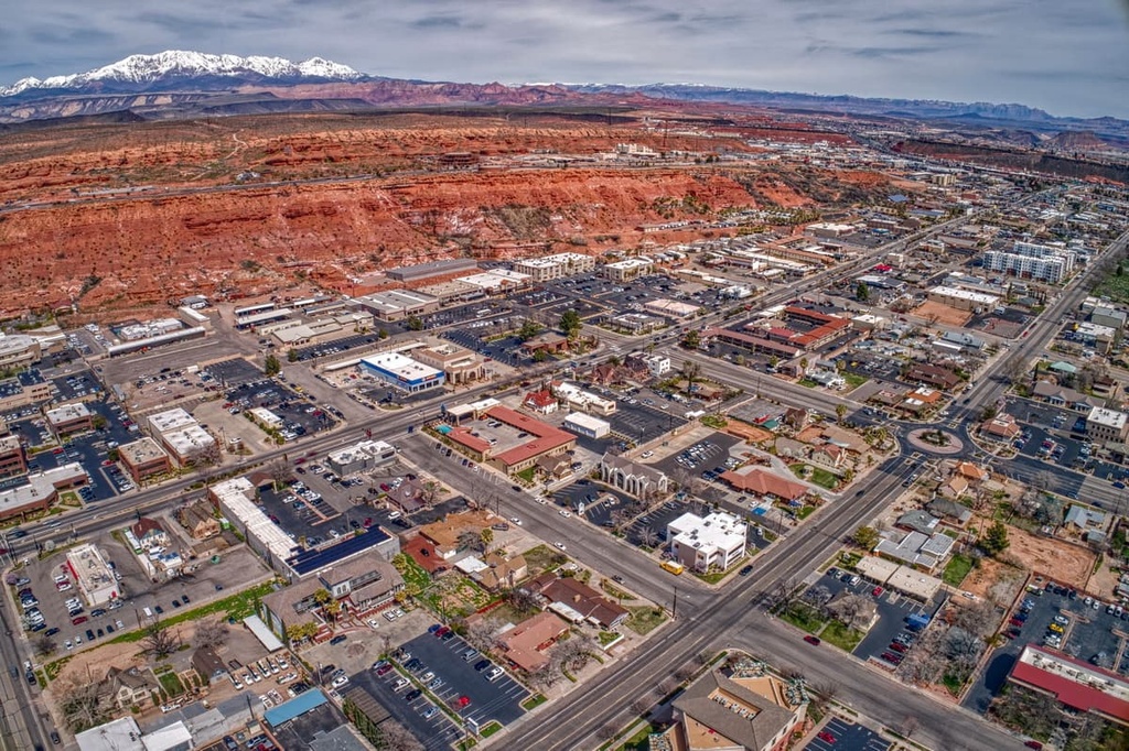
Trails surround the city, providing easy access for hiking, mountain biking, trail running, canyoneering, and skiing during the winter months. The downtown streets are full of local shops and restaurants along with the Tuacahn Amphitheater and Southwest Symphony Orchestra.
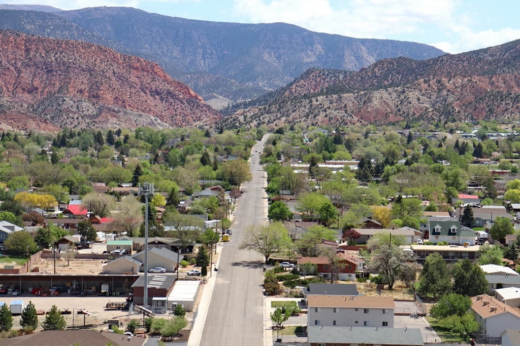
Cedar City lies just northeast of the Bull Valley Mountains. Home to around 35,000 residents and Southern Utah University, Cedar City lies directly next to Dixie National Forest. Zion National Park lies a short drive south of the city.
Those visiting the region can also take advantage of the city’s close proximity to Brian Head Ski Resort, Cedar Breaks National Monument, and the Pine Valley Mountains Wilderness Area. Every year the small city hosts the Utah Summer Games and Utah Shakespeare Festival along with other local events.
The city of Las Vegas, Nevada lies just a two hours drive southwest of the range. With a metro population of 2.2 million people, Las Vegas marks the most populous city in Nevada. Home to massive casinos, resorts, and the famous Las Vegas Strip, the city has garnered the reputation of the “Entertainment Capital of the World”.
Along with its plethora of luxury hotels, shows, and thriving nightlife, Las Vegas is also surrounded by national forests and wilderness areas. Just outside the city limits lie trails for hiking, running, and mountain biking. Just a short drive outside the city lies Red Rock Canyon National Conservation Area, a popular spot for rock climbing.