
Scan the QR code and open PeakVisor on your phone
Simson Provincial Park has 2 named peaks. The highest is Spyglass Hill at 156 m. Other notable peaks include Mount Seafield.
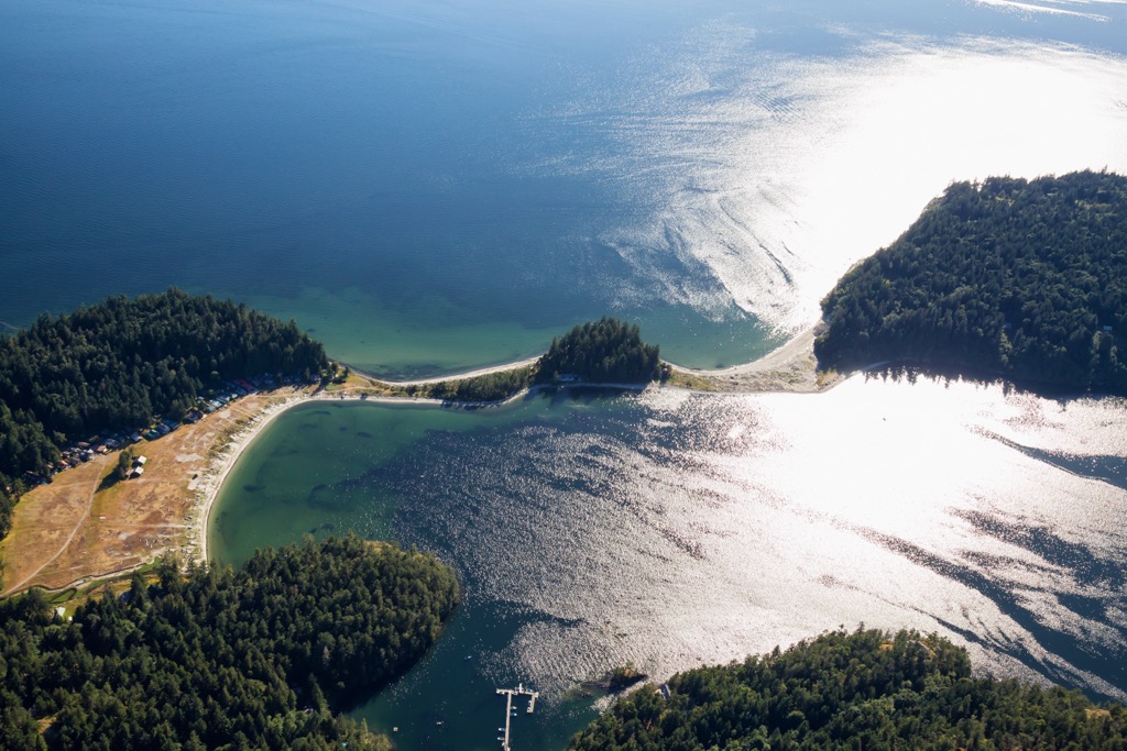
Located off the Sunshine Coast of British Columbia, Canada, Simson Provincial Park occupies the southern extent of South Thormanby Island in the Georgia Strait. The boat-accessible park showcases beautiful beaches, ancient and second-growth forests, and the remains of ancient habitation. The island's best view is from Spyglass Hill (156 m / 512 ft), the tallest of the park’s two peaks.
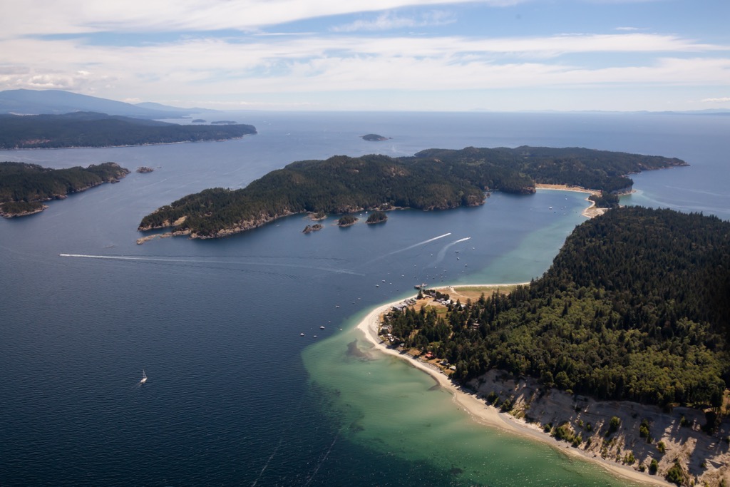
Simson Provincial Park is on South Thormanby Island in the Georgia Strait, off the coast of British Columbia, Canada. The park encompasses 461 hectares (1,027 acres) of the east and south portions of the island. The islands and park are part of the Sunshine Coast Regional District of British Columbia.
North and South Thormanby Island are named for a horse that ran in the 1860 Epsom Derby. Captain George Richards of the ship ‘H.M.S. Plumper’ had bet on the winning horse and subsequently named the islands. Other nearby landmarks that hearken back to the famous race are Epsom Point, Derby Point, and the Tattenham Ledge.
While private ownership prevents exploration across the whole island, there are many places to explore in Simson Provincial Park. Old skid roads cross the park and access different areas, including Spyglass Hill (156 m/512 ft) and Mount Seafield (120 m/394 ft), the most prominent points on the island.
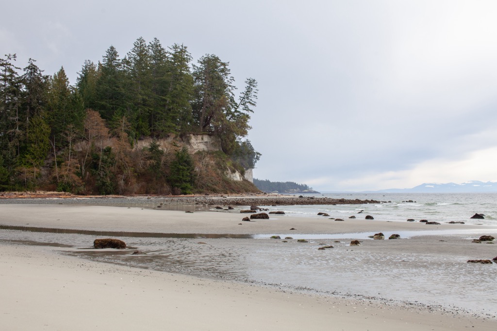
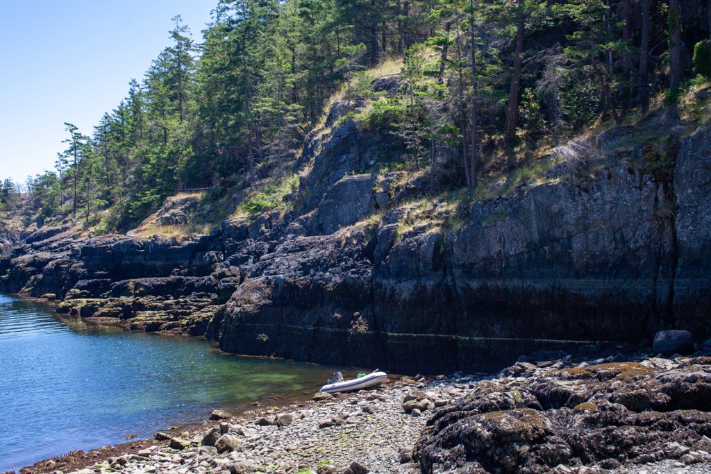
Private boats and water taxis are the only way to visit the park. It is possible to kayak to the park from the mainland and enjoy exploring the empty beaches and inlets while circumnavigating the island. The government permits wilderness camping within the park; however, no facilities exist.
Nearby Simson Provincial Park is Buccaneer Bay Provincial Park, centered upon the spit of land between North and South Thormanby islands. Buccaneer Bay Provincial Park has several backcountry, marine-accessible visitor campsites based on first-come-first-served registration. The following are other parks and wilderness areas near Simson Provincial Park:
Simson Provincial Park encompasses part of South Thormanby Island, which lies in the Georgia Strait off the coast of British Columbia. The Georgia Strait occupies a geological area, the Georgia Depression, between the Canadian Coast Mountains and the Insular Mountains.
The Coast Mountains dominate the mainland coast of western Canada. The Insular Mountains, though mainly underwater, include the Vancouver Island Ranges, the Queen Charlotte Mountains, and many of the northwest coast islands.
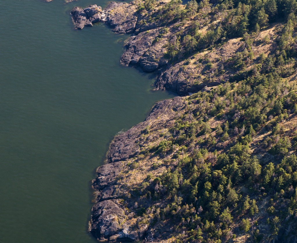
Some islands within the Georgia Strait, such as North and South Thormanby Island, straddle the major geological boundary between the Coast and Insular Mountains. While other nearby islands consist of uplifted structural bedrock, the Thormanby Islands are little more than unstable sediments and unconsolidated glacial deposits upon bedrock.
The Thormanby Islands formed during the Pleistocene from the intense glaciation within the Georgia Depression. During the Pleistocene, ice poured east from the Vancouver Island Ranges and west from the Coast Mountains to coalesce in the Georgia Depression.
The coalesced glacier flowed south and escaped to the sea through the Juan de Fuca Strait. While the Georgia Depression was a natural feature before the Pleistocene, the glaciers eroded the depression to make it deeper.
The glaciers stripped low-lying rock surfaces and shaped the terrain. Some islands in the Strait of Georgia, such as Texada Island, stood as a monadnock above the glacial onslaught. Elsewhere, glacial materials were deposited as ground moraines and outwash plains to form Hernando, Savary, and Harwood Islands, geologically similar to the Thormanby Islands.
The park's temperate climate features warm and dry summers and mild and wet winters. The park is part of the coastal western hemlock biogeoclimatic zone, characterized as a coniferous temperate rainforest.
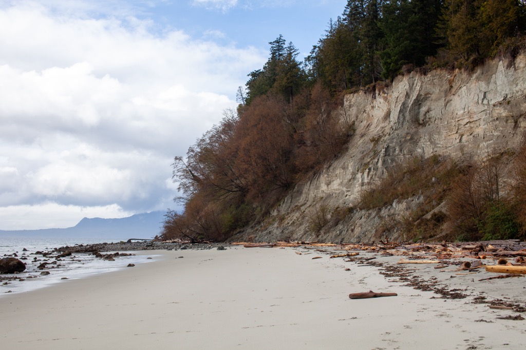
Forests of massive Douglas fir, western red cedars, Sitka spruce, big leaf maple, and arbutus trees once populated the park. Logging at the beginning of the turn of the century saw most of the island’s giant old-growth trees cut down, especially the Douglas fir.
Some ancient stands were deemed unfit for commercial use and left intact, while significant second-growth forest covers the rest of the island; today's forests are mainly second-growth Douglas fir and western red cedar. Western hemlock, alder, arbutus, lodgepole pine, and broadleaf maple are also common tree species within the park’s forests.
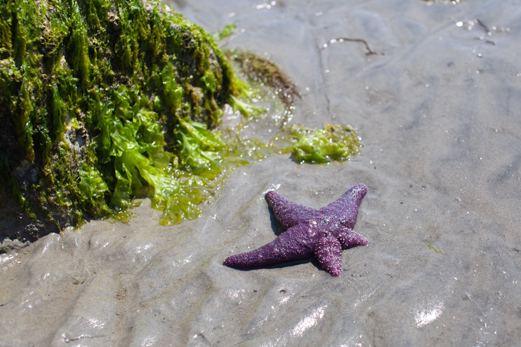
The park has many edible berries, such as salal, salmonberries, thimbleberries, huckleberries, and blackberries. Some semi-wild apple and cherry trees are remnants of an orchard near the south side of South Thormanby Island.
Bears and cougars can theoretically swim across Welcome Passage, between the islands and the mainland; however, no known cougar and bear residents exist. The park’s largest animal is the coast blacktail deer which resides on the island and has a population of several hundred.
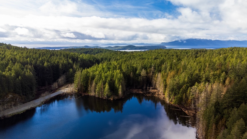
Other small animals keen on stealing your food are minks, raccoons, squirrels, chipmunks, and many birds. Beavers are a more recent addition to the island's ecology; however, they have made their mark by damming the creeks and streams to flood parts of the old orchard, creating the Walter Mather Memorial Lake.
The Thormanby Islands are in the traditional Shíshálh territory, also known as the Sechelt. The Sechelt are indigenous people of the Pacific Northwest who are part of the Coast Salish culture, language, and traditions.
The Sechelt were an industrious people who lived along the Sunshine Coast of British Columbia from Jervis Inlet to the Sechelt Inlet. During the winter, thousands would inhabit their four principal villages, constructing longhouses made of cedar and adorned with traditional carvings.
During the summer, the people would spread out from their villages to hunt, fish, and gather resources. The Sechelt would travel to different summer camps where they knew resources were plentiful. Families likely traveled to camp in the same location generation after generation.
Upon South Thormanby Island, five known shell middens indicate regular use by indigenous groups. Since there are no noticeable remains of villages, it’s speculated that the island was used for hunting, gathering, and fishing during the summer and was not permanently inhabited.
Traditionally the men would hunt and fish while the women would care for children and create practical necessities, such as baskets. Sechelt women were known for their beautiful and intricate baskets woven from birch bark, cedar tree roots, and cannery grass.
The first recorded European to visit the islands was Jose Maria Narváez, who anchored on July 12, 1791. At the time, the island was then named Isla de San Ignacio. It wasn’t until 1860 when Captain George Richards surveyed the area in his ship, the HMS Plumper, and called the islands North and South Thormanby after the horse who had won the Epsom Derby that same year.
The Thormanby Islands remained unsettled until the early twentieth century when John William Vaughan built the first cabin and wharf on North Thormanby Island. Most of South Thormanby Island was bequeathed to Calvert Simson as a crown grant in 1892; however, it wasn’t until 1912 that Simson cleared a swamp on the island's south end to establish a farm and orchard.
During the 1920s and 1930s, the islands became a popular destination for tourists visiting Vaughan’s recreational resort on North Thormanby Island and recreational properties around Buccaneer Bay. Over the following decades, Westerners explored the island, named the bays, and created trails. Slowly, the island was divided into recreational properties for summer homes and getaways.
By 1948, the Simson farm was abandoned. On South Thormanby Island, timber companies selectively logged the island’s remaining pockets of old-growth forest from the 1950s until the 1980s. Three-quarters of the haul was Douglas fir; the remainder was red cedar and balsam poplar.
In 1984 and 1985, beavers were introduced to the island, and they went to work creating their homes and damming up creeks and streams. One of their primary projects was to build a dam that flooded parts of the old farm and orchard. Indeed, Walter Mathers Memorial Lake is where the farm once sat.
In 1986, the government established Simson Provincial Park on the land donated by the family of the original owner, Calvert Simson. The park contains the remains of old farm buildings and the orchard. Semi-wild apple and cherry trees still grow as a tasty reminder of the area’s homesteading history.
The northern part of South Thormanby Island is all privately owned, while the only way to access Simson Provincial Park is by boat or water taxi. The park encompasses the island's southern half and is an incredible wilderness area to visit and explore.
Due to the lack of facilities, most people enjoy a day on the island; however, there is enough to do and see to keep visitors busy for many days. The following are the major activities and attractions in Simson Provincial Park:
Once at the island, there are miles and miles of shoreline to explore and countless coves and inlets where paddlers can rest for the night. Paddling is the most intimate way to experience Simson Provincial Park.
The Marine Forest Trail starts from the north end of the island and loops around the old farm and orchard as you circle Walter Mathers Memorial Lake. One of the routes to Spyglass Hill starts along the island's east coast and is a 2.6 km (1.5 mi) loop that will bring you back to your boat or campsite.
Furthermore, visitors can take in the beavers’ handiwork that flooded the farm fields. The fields were a swamp until the Simson family cleared them in 1912. They’ve since returned to their natural state with the help of these feisty beavers.
Simson Provincial Park is a beautiful island wilderness sanctuary. Visitors can only arrive by boat; paddling along the shore and hiking are the best ways to explore the park. The park’s remote location along the Sunshine Coast means few communities are nearby. The following are the major communities and other accommodations near Simson Provincial Park.
Powell River is the closest mainland city to Simson Provincial Park, located about 55 km (35 mi) northwest of the park. Powell River is the regional capital; however, even though it’s on the mainland, visitors must take a plane or ferry to reach the community.
The Sunshine Coast is rugged, and wide and deep fjords make travel along the coast difficult. However, there are many beautiful places to visit and explore near the community and along the Sunshine Coast.
One of the most popular wilderness activities in the region is hiking the 180 km (108 mi) Sunshine Coast Trail. You can hike there and back (360 km), point-to-point, or just do a portion of the trail and dip out when needed. Between watching Orcas breaching in the surrounding coves, camping in wild manzanita forests, and meeting fellow travelers, this trail is a fantastic way to experience the beautiful, rugged west coast wilderness.

Inland Lake Provincial Park, Tetrahedron Provincial Park, Mount Richardson Provincial Park, and Spipiyus Provincial Park are some other parks to check out while visiting this spectacular corner of the world.
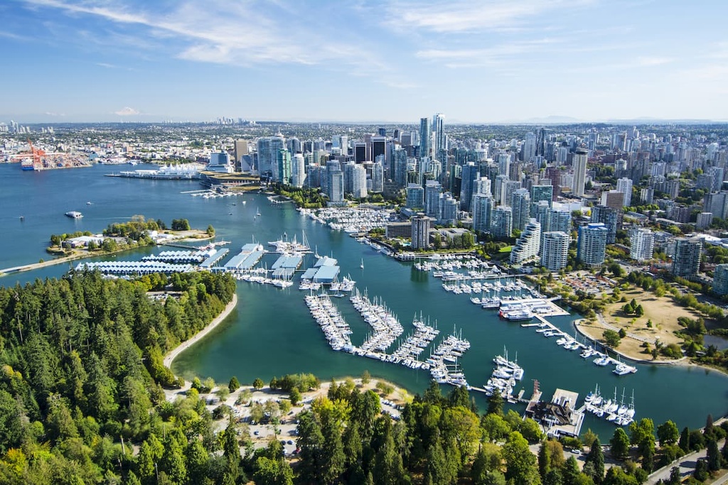
Vancouver is the namesake city for the Metropolitan Area that dominates the Lower Mainland of BC. Vancouver is about 70 km (48 mi) southeast of Simson Provincial Park.
Even though Vancouver is one of British Columbia’s youngest cities, founded in 1862, it is also the largest metropolitan area in the province. The city is often mistaken for the capital city of BC; however, the capital is Victoria, on Vancouver Island. Vancouver is a beautiful city with a diverse populace and an incredible culinary scene, particularly for seafood and Asiatic cuisine (think sushi). There is a sizable Asian expatriate community (Japanese, Chinese, Filipino, and more) that adds dimension to this global city.
If you’re looking to go on some hikes but stay in or near the city, there are many great places to visit. Stanley Park, one of North America’s largest urban parks, is an excellent place for a stroll or a bike ride; nearby hiking trails include St. Marks Summit, Quarry Rock, and the Grouse Grind. Other nearby places to hike are Pacific Spirit Regional Park, Burnaby Lake Park, and Norvan Falls.
Metro Vancouver stretches from the sea to the mountains, and the locals are known for their dedication to preserving the environment. Mount Seymour Provincial Park, Garibaldi Provincial Park, Golden Ears Provincial Parks, and Pinecone Burke Provincial Park are adjacent to the city and have opportunities for day hikes, weekend camping trips, and trails for more extended backcountry expeditions.


The highest peak in Simson Provincial Park is Spyglass Hill, at 156 m.
Notable peaks in Simson Provincial Park include Spyglass Hill and Mount Seafield.


