
Scan the QR code and open PeakVisor on your phone
South Texada Island Provincial Park has 2 named peaks. The highest is Mount Shepherd at 881 m. Other notable peaks include Mount Dick.
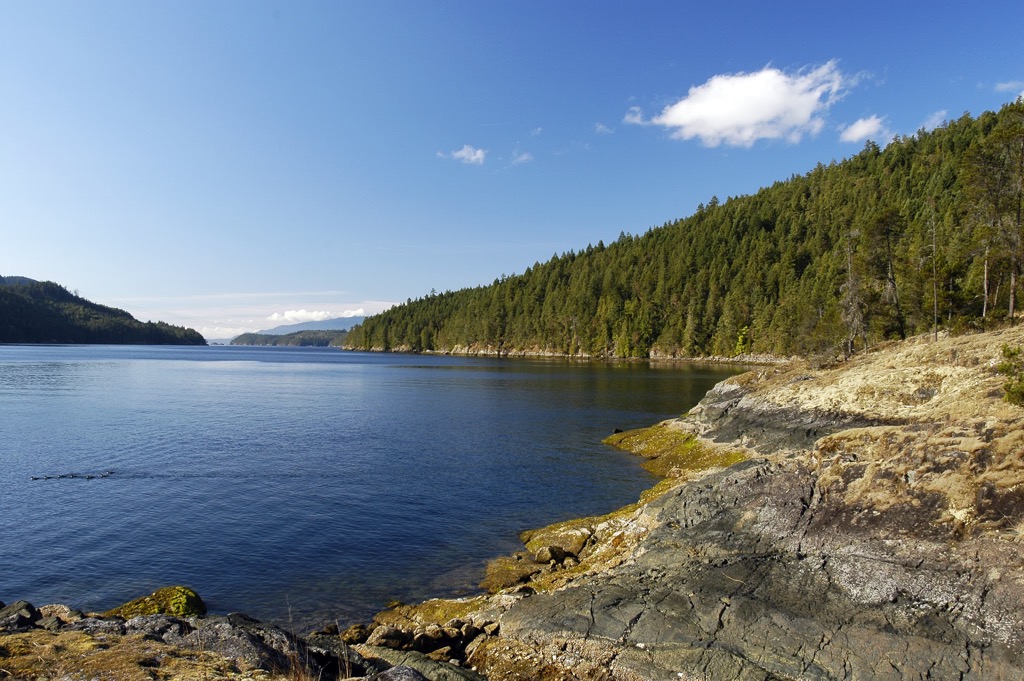
South Texada Island Provincial Park is on the south end of Texada Island, which is situated in the Georgia Strait, between Vancouver Island and the British Columbia mainland. The island park has two summits that are worth mentioning, which are Mount Shepherd ( 881 m/2,890 ft) and Mount Dick (350 m /1,148 ft)
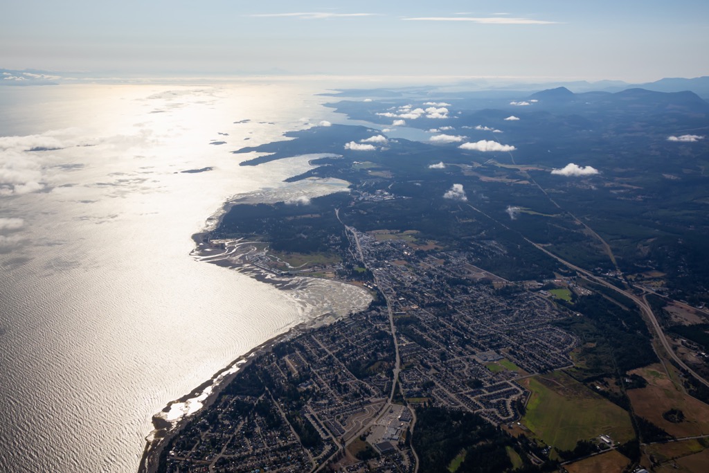
The qathet Regional District encompasses a portion of the central coast of British Columbia, Canada, as well as Texada and Lasqueti Islands, upon which South Texada Provincial Park is found. The islands are in the Georgia Strait between mainland British Columbia and the east coast of Vancouver Island.
The Regional District of Nanaimo and the Comox Valley Regional District are located west of Texada Island, on Vancouver Island. The Sunshine Coast Regional District is southeast of Texada Island and encompasses the neighboring mainland and seaways of the Georgia Strait.
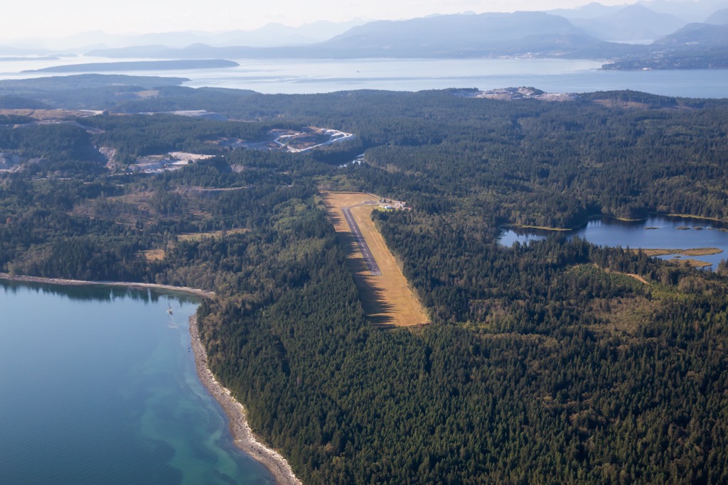
Of the many Gulf Islands, Texada Island is the largest and it has regular ferry service from Powell River’s Westview Ferry Terminal. Other ways to get to the island include private boat and plane. Flying to the island and staying overnight is especially popular during the Texada Annual Fly-In event.

Texada Islands is unique among the Sunshine Coast Islands, in that it is one of the few where you can bring your vehicle with you. Most of the island’s roads are gravel; however, having our own vehicle will give you the freedom to explore the many unique destinations and attractions at your own pace.
However, even though you may have a vehicle with you on the island, getting to the park still requires a boat or a grueling trek through the forest. If reaching South Texada Island Provincial Park is too difficult for you, the following are some other nearby parks and wilderness reserves that are worth checking out:
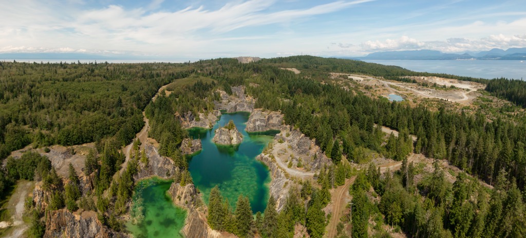
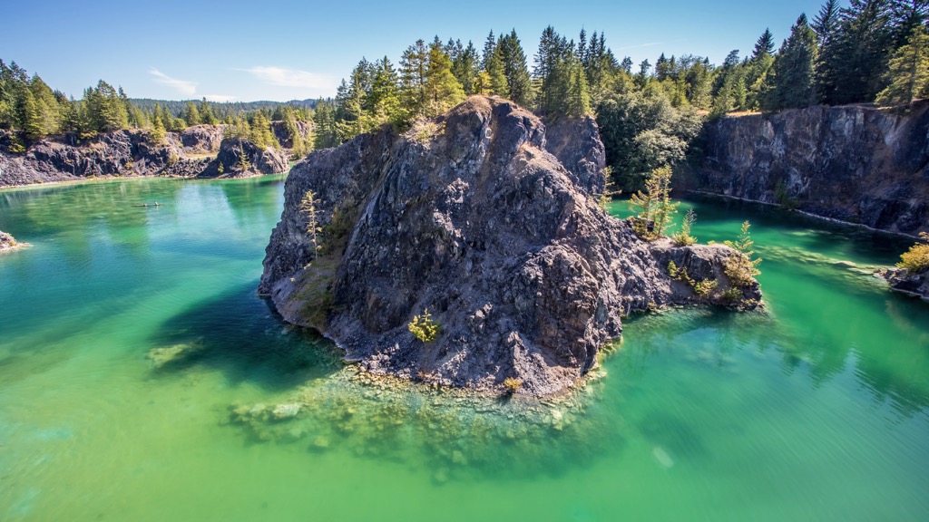
Since South Texada Island Provincial Park is only 90 square kilometers (34 square miles) the geologic discussion of the park will include information pertaining to the entirety of Texada Island. Since gold was found on the island in the early 1800s, the geology of the island is rather well studied.
Two Jurassic aged formations underlie Texada Island. The limestone Marble Bay Formation and the volcanic Texada Formation underlie the islands are equivalent to the Quatsino and Karmutsen Formation on Vancouver Island. The Karmutsen Formation is prevalently displayed in the Karmutzen Range of northern Vancouver Island.
Further analysis of the rocks of Texada Island show that volcanic activity during the Jurassic created a suite of intrusive rocks, when magma intruded between older layers to create batholiths and other granitoid formations.
As mentioned, the discovery of gold near Surprise Mountain in the 1800s created a bit of a stir in the island and companies came to mine what they could. In the process of searching for gold, other valuable things were found such as copper and iron. Furthermore, limestone became a major export from the island, with quarries exporting over 3 million tons annually.
The ecology of South Texada Island Provincial Park is divided into the lowlands and the highlands. The lowlands are representative of the Coastal Douglas-fir ecology while the highlands are filled with the forests of the Coastal Western Hemlock ecology.
The western coastline of the park falls within the rain shadow of the Vancouver Islands Ranges, creating a rather dry, Mediterranean-like climate. Typically the coastal forests of British Columbia contain the massive Douglas fir and red cedars that stand hundreds of feet tall and dozens of feet around the base; however, the forests of Texada Island contain a large amount of the inland lodgepole pine.
The forests of the park are thick, consisting of Douglas fir, red alder, red cedar, white pine Sitka spruce, hemlock, bigleaf maple, and arbutus. The underbrush is dominated by sword fern and deer fern.

Columbian black-tailed deer are the most common animal to see and they have a very dense population due to a lack of predators on the island. In addition to the deer, bald eagles, turkey vultures, ravens, and hawks reside on the island.
The intertidal zone offer most of the opportunities for viewing wildlife, and sighting of sea lions, sea otters, Pacific white-sided dolphins, orcas , humpback whales, and Pacific gray whales are possible
Until about 14,000 years ago glaciers covered Vancouver Island and the Georgia Strait. At the end of the Pleistocene, as the ice sheet was beginning to melt and areas of habitable land emerged, the sea level was significantly lower than it is now. Indeed, it is thought that the Georgia Strait may have been used somewhat as a thoroughfare for the migration of ancient people.
As the glaciers continued to melt and the land began to rebound from the weight of the ice, the Georgia Strait filled with water once again, likely covering important archaeological sites. The earliest evidence that has been found on land regarding the habitation of the first people comes from about 5,000 years ago.
The traditional lifestyle of hunting, gathering, and fishing was dominant in the region for thousands of years. The region and Texada Island had a mild climate and plentiful resources which encouraged settlement. Texada Island is the traditional territory of the Tla’amin, shishalh, K’ómoks, and the Wei Wai Kum Nations.
North of South Texada Island Provincial Park, Shelter Point Regional Park is believed to have been inhabited for over 3,000 years before the colonization of the region. The island was named in 1791 by a Spanish explorer for Felix de Tejada, a Spanish rear-admiral.
Before the end of the nineteenth century, whaling and mining had become major industries on the island. Farms, mills, and towns were constructed to serve the mining boom of copper and gold. However, the longest lasting industry on Texada Island appears to be the limestone quarries which were opened near the beginning of the twentieth century and supplied limestone to the Pacific Northwest for over a century.
With the mines closing by the 1950s, Texada Island’s population has dwindled and the island is now an off-the-beaten-track tourist destination known for fishing, hunting, birdwatching, hiking, camping, and kayaking.
South Texada Island Provincial Park is a remote park with no road access, on a remote island in the middle of the Georgia Strait, between Vancouver Island and the British Columbia mainland. The shoreline of the park is rugged, and the terrain is rough.
Despite how difficult it is to arrive at the park, visitors will be welcomed with immense beauty, fantastic views, and incredible solitude. Aside from boat access along the rugged shore, the Mount Shepherd Trail is the main trail into the park.
Starting from a trailhead off the Texada Island Forest Service Road, the 6 km (3.6 mi) trek leads to the summit of Mount Shepherd, at the north end of the park. The trail passes Cathedral Lake, which can be used as an overnight stop or a basecamp for further exploration of the south end of Texada Island.
There are several communities on Texada Island, and many campgrounds to choose from on the out of the way destination. The following are some of the places to stay and shop while exploring British Columbia's Gulf Islands.
Upon the island there are several communities, such as Blubber Bay, Van Anda, and Gillies Bay. There are several campgrounds to stay at as well as a hotel. There are minimal services, such as stores, restaurants, and a gas station. If you happen to make it to the island, it is highly recommended that you take several days to explore.
Some of the places to explore on the island are Shelter Point Regional Park and Anderson Bay Provincial Park. The waters around the island are typically warm and the coastline is incredibly scenic if you wish to view it from a kayak.
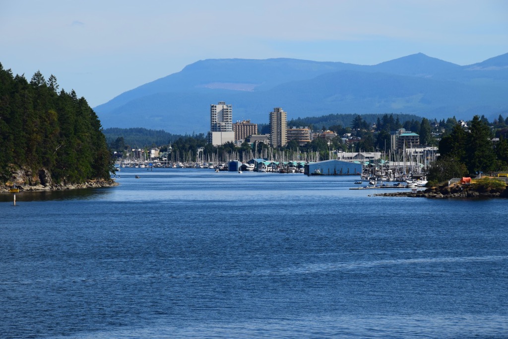
Powell River is the regional capital of the qathet Regional District and is the only city that offers regular ferry Service to Texada Island. Located along the shores of the Malaspina Strait it’s about a 40-minute ferry ride to Texada Island and you can ride as a pedestrian or with your bike or car.
The city and area are only accessible by ferry or plane, as deep fjords prevent a road from being constructed to the community. Once you make it to Powell River, there are many beautiful wilderness parks and hiking trails to check out.
Inland Lake Provincial Park is a beautiful destination while visiting qathet Regional District; however, the gem of the wilderness in the area is arguably the Sunshine Coast Trail. The Sunshine Coast Trail is a 180 km (108 mi) backcountry trail that traverses the coast of qathet Regional District. It is free to access, and it winds through old growth forests, along lake shores, and along beaches for all to enjoy.
Nanaimo was established as a coal mining town in the middle of the nineteenth century and is the closest city on Vancouver Island to Texada Island. Nanaimo hosts one of the major ports for Vancouver Island, with ferries shuttling thousands of passengers daily to and from mainland British Columbia. Nanaimo also has a regional airport with flights to and from major destinations, such as Vancouver, Calgary, and Victoria.
While in the city, there are many houses still standing that were built during the town's boom time in the early twentieth century. Many historic houses and buildings feature Victorian, Edwardian, and Craftsman architecture.
Some of the nearby places to visit and hike are Mount Benson, Westwood Lake Park, and the Morrell Nature Sanctuary. Newcastle Island Marine Provincial Park is an island that is several hundred meters from the Nanaimo coast and offers camping, hiking, picnicking, and many other activities.
Located 40 km (24 mi) north of the city of Nanaimo and about 20 km (12 mi) from the south end of Texada Island, Parksville is a coastal community that is popular for the beautiful beaches that grace its shores. While you can see Texada Island from the Parksville shores, without a private plane or boat the trip to the island is circuitous.
Adventure seekers and backcountry enthusiasts wishing to reach Texada Island from Vancouver Island need to charter a plane or boat, or take a couple public ferries. Visitors can leave from Comox to Powell River, where they can board another ferry that will dock at Blubber Bay on Texada Island.
However, if you’re on Vancouver Island, Parksville is a great place to be. Nearby Rathtrevor Beach Provincial Park is a beautiful park with many campsites, a BMX pump track, stunning rocky beaches, peaceful woodlands, and long tidal sand flats to play on and beachcomb.
The community of Parksville has stores and services for all your needs as well as plenty of restaurants serving fresh seafood and other fare for those days you don’t want to cook for yourself. Parksville is also close to the community of Coombs, which has the popular Goats on the Roof store, as well as trailheads to many beautiful riverside and forest hiking trails.


The highest peak in South Texada Island Provincial Park is Mount Shepherd, at 881 m.
Notable peaks in South Texada Island Provincial Park include Mount Shepherd and Mount Dick.


