Scan the QR code and open PeakVisor on your phone
Qilai and Taroko Mountains Ecological Reserve (奇萊、太魯閣山群生態保護區) is situated in the southern zone of Taroko National Park (太魯閣國家公園) in eastern Taiwan. The highest and most prominent peak of the 36 named mountains in the reserve is Qilaishan North Peak (奇萊北峰), with an elevation of 3,607 metres (11,834 ft).
Located between the Xiulin Township (秀林鄉) of Hualien County (花蓮縣) and Ren’ai Township (仁愛鄉) of Nantou County (南投縣) lies one of Taiwan’s top natural tourist attractions: the sublime limestone cliffs and jagged peaks of Qilai and Taroko Mountains Ecological Reserve.
The reserve is part of the vast Taroko National Park, which contains an enormous 92,000 ha (227,337 ac) of land. As such, it is subsequently divided into different reserves. Qilai and Taroko Mountains Ecological Reserve lies in the south of Taroko National Park, while Nanhu Ecological Reserve (南湖中央尖山群生態保護區) forms the western zone of the park.
The area contains seven of Taiwan’s top 100 peaks, which are also known as Baiyue. The Baiyue of Qilai and Taroko Mountains Ecological Reserve include:
Another Baiyue in the reserve, Hehuanshan (合歡山), is a hugely popular peak to climb. It lies 1 km (0.6 mi) north of Hehuanshan East Peak.
Also within the reserve is the aquamarine spectacle of the Liwu River (立霧溪), which snakes its path along the dramatically sheer marble cliffs of the northern boundary of the reserve. The river originates between Hehaunshan and QIlaishan at an elevation of 3,000 metres (9,842 ft). It then flows east towards the Truku village of Tianxiang before reaching the Pacific Ocean.
Rainfall is abundant on the east coast of Taiwan. The average yearly rainfall here is around 2,000 mm (79 in). The winter months herald in the northeast monsoons while the summer months bring an onslaught of turbulent typhoons.
As nothing shields the mountains from these furious typhoons, damage to the hills is common each year. This damage usually takes the form of landslides, rockfalls, and fallen trees.
In terms of weather conditions in the reserve, the conditions vary dramatically according to elevation.
On peaks over 3,000 metres (9,842 ft), the average temperature is a crisp 46°F (7.7°C). At 2,000 metres (6,562 ft), the average temperature jumps to 54.5°F (12.5°C), rising even further to 63.5°F (17.5°C) at 1,000 metres (3,281 ft) above sea level. In the winter months, the Baiyue of Qilai and Taroko Mountains Ecological Reserve are typically snow-covered.
To the north of Qilai and Taroko Mountains Ecological Reserve is Taipingshan National Forest Recreation Area (太平山國家森林遊樂區). Meanwhile, to the south lies the Danda Major Wildlife Reserve (丹大野生動物重要棲息環境). To the east is the Pacific Ocean, while to the west lies Huisan Forest Area (惠蓀林場).
The lofty high peaks of Qilai and Taroko Mountains Ecological Reserve are part of the Central Mountain Range (中央山脈).
Known as the backbone of Taiwan, the Central Mountain Range extends up the country from the southern region of Pingtung County (屏東縣) to the north shore of New Taipei City (新北市). The peaks of Qilai are primarily composed of metamorphic rock strata of the Tertiary era.
Qilai and Taroko Mountain Ecological Reserve’s cliffs have endured millennia of erosion and mountain building to create the peaks that exist today. Millions of years ago, the island of Taiwan did not exist and was entirely submerged by ocean water. During this time, calcareous deposits drifted in the ocean, which accumulated over time to produce limestone via lithification.
The accumulation process continued as bits of other ocean materials covered the limestone. Over a gradual process of metamorphism driven by heat and pressure, the limestone transformed into marble.
Due to tectonic shifting, the peaks of the Central Mountain Range were uplifted to their current shapes. The marble cliffs of Qilai and Taroko Mountains Ecological Reserve soon followed suit and uplifted from the seabed, resulting in dramatic sheer cliffs. As time has passed, the cliffs have undergone erosion from flowing rivers and rainwater.

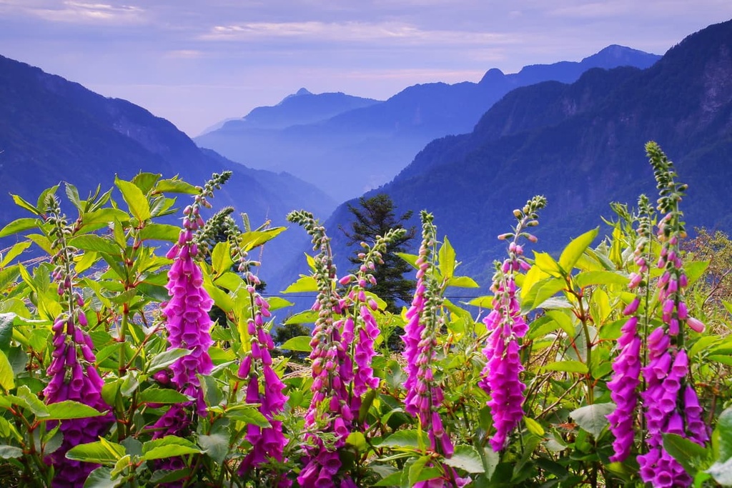
The plant life of Qilai and Taroko Mountains Ecological Reserve represents the forest, river, and grasslands ecosystems of Taiwan throughout both its high and low elevations.
A broad-leaved evergreen forest of Jiuxiong tree (Lagerstroemia subcostata) and Taiwan jade (Bambusa dolichomerithalla) dominates the plant life in low elevations in the reserve. In addition, hardy silvergass (Miscanthus sinensis) is found in the reserve’s grasslands.
The reserve’s ecology transforms into a mix of coniferous trees interspersed with a broad-leaved evergreen forest as the elevation rises. Taiwan spruce, Taiwan hemlock, Taiwan cypress, and Taiwan cedar are the main plant species in the region.
Yushan juniper and Taiwan fir populate the cold-temperate forest zones of the reserve, where the temperature has dropped dramatically, and misty mountain fog frequently swarms the trails.
As the elevation increases ever further, plant life becomes limited as the chilly climate and draughts of billowing winds hinder plant growth. However, Pseudosasa japonica, known as arrow bamboo, is a hardy plant that can withstand the turbulent conditions of the high mountains.
The reserve contains a variety of landforms, such as mountains, valleys, cliffs, forests, and plains; thus, a great selection of wildlife roams the land. Mammals that inhabit the reserve include the Formosan black bear, Taiwan rock macaque, Taiwan serow, and Formosan wild boar.
A staggering 152 species of birds have been recorded in the area. The Formosan blue magpie, Formosan laughing thrush, and the spotted nutcracker are some birds that frequent the reserve.
The Xueshan grass lizard and Taiwan pit viper are some of the 35 species of reptiles found in the region. In the reserve’s refreshing streams, 21 freshwater fish species thrive, such as the Taiwan freshwater trout.
The presence of butterflies is abundant in the reserve, too. Graphium Sarpendon, Papilio Thaiwonus, and Hebomoia Glaucippe Formosana are a few of the most common butterflies in the area.
Qilai and Taroko Mountains Ecological Reserve is part of the ancestral homelands of the Truku tribe. The Truku are related to the Atayal, whose traditional territory encompasses much of west-central Taiwan.
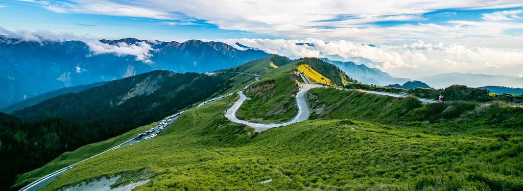
During the Japanese Occupation Era, the Japanese waged war against the Truku people at the Sakuma Pass, which is now home to Wuling (武嶺). Wuling is the highest road in Taiwan at 3,275 metres (10,745 ft) and the highest alpine road in East Asia.
A staggering 20,000 troops were called to the area, marching from the eastern city of Hualien and the the south-west village Wushe (霧社), joining forces at Wuling. Although they only had an army of 2,000 fighters, the Truku bravely fought against the Japanese for 60 days; however, they eventually surrendered after being greatly outnumbered.
Relics of the war still stand in the region today. These relics include a cylindrical military bunker that’s situated on the side of Route 14. There’s also the old Army Cold Training Centre, which was used under the command of the Japanese general Sakuma Zuomatai.
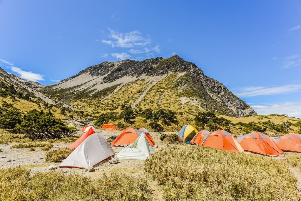
Qilai and Taroko Mountains Ecological Reserve features a variety of outdoor activities for visitors. This includes hikes in the mountains and to spectacular waterfalls.
Many Taiwanese hiking enthusiasts rank climbing Qilaishan as highly as the hikes to the summits of Yushan (玉山) and Xueshan (雪山).
However, the infamous Qiliashan is often referred to as ‘Black Qilai’ as a number mountaineering accidents and mishaps occurred on this peak in the 1970s. Nowadays, the trail is much less dangerous to traverse, and its path is one of the most beautiful and scenic in Taiwan.
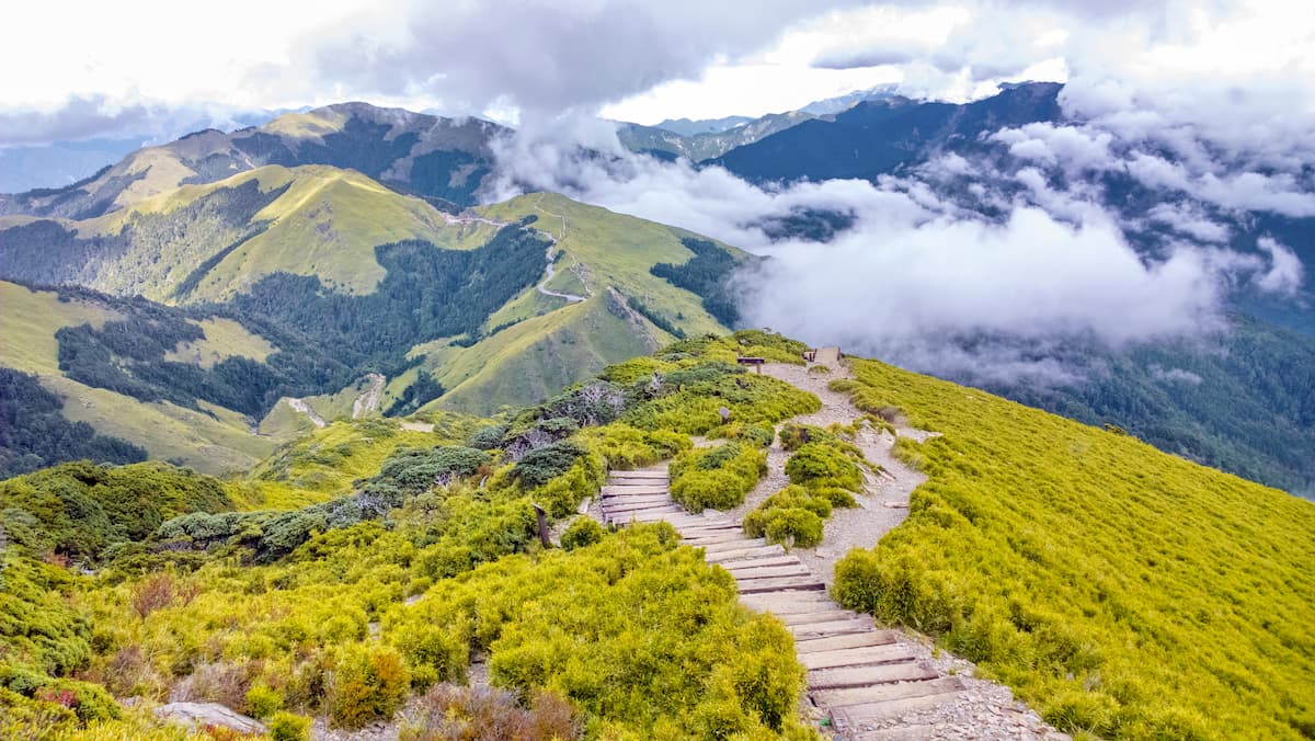
Hikers will begin the first day of the trek at the Song Xue Lou Lodge. They will commence their ascent immediately, trekking through tall sheets of silvergrass (Miscanthus sinensis) set against a steep gradient. Here, the wispy mountain fields of silvergrass transform into dense woods of arrow bamboo, which signals that the summit of Qilaishan North Peak is nearby.
Predictable afternoon mountain fog and cloud cover descend on the hill each day; thus, hikers can watch the gliding movement of willowy clouds engulf the land below. But, if the weather cooperates, hikers can enjoy wide open views of the surrounding landscape.
From here, Qilaishan can be seen in the south and Qilaishan South Peak can be spotted further in the distance. Meanwhile, the peaks of Hehuanshan are easy to see in the east, while Zhongyang Jianshan (中央尖山) and Nanhu Dashan (南湖大山) are relatively easy to see to the north.
After a long day of hiking, hikers then descend the summit towards Qilai Mountain House, which serves as an overnight rest stop.
The following morning, hikers set off from camp towards Qilaishan. To ensure that hikers reach Qilaishan before sunrise, they should wake up early in the morning on this day of the trek.
Qilaishan is a 3.8 km (2.3 mi) journey uphill, and it normally takes hikers two hours to reach the summit as the path becomes increasingly steep. At one stage, hikers make use of rope assists to pull themselves up the mountain.
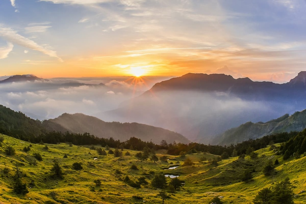
If you wake up early, you can reach the summit of Qilaishan just in time to witness the sun’s warm watercolours paint the sky. Here, a picture of vast wilderness and undulating mountains unfurls before one’s eyes.
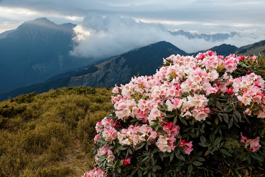
At the summit, Qiliashan North Peak and Qilaishan South Peak are noted to the immediate north and south. Yushan azaleas and Yushan juniper flowers also decorate the summit with pretty pastel blooms.
Hikers then proceed toward the infamous Karoluo Cliff, which is composed of incredibly thin ridgelines with loose soil and rock so fragile that it feels unstable. This scary cliff stretches for 3 km (1.8 mi), dropping dramatically in some parts; thus, hikers should hike along this cliff with extreme caution and the utmost care. The intense winds brushing off the eastern Pacific Ocean add to the severity of trekking this frightening mountain terrain.
Once hikers see the end of Karolou Cliff, they will set up camp at Nanfeng Crossroads Camps on the ridge between Qilaishan and Qiliashan South Peak. The slopes of Qilaishan South Peak are kinder to hikers as its gradient is less steep than that of the previous two peaks.
Hikers should leave camp early to witness daybreak on the hill that morning. Alpine flowers, such as Yushan carnations, Alishan gentian, and Yushan angelica, elegantly adorn the mountain path in shades of deep red, periwinkle blue, and cloudy white.
The views from Qilaishan South Peak are impressive as one can see the Central Mountain Range as it descends towards central Taiwan. This section of the range includes peaks such as Nenggao Shan (能高山) and Nenggao Shan Nanfeng (能高山南峰).
Hikers then continue towards Nanhua Shan (南華山), where they descend the trail toward the splendidly tranquil lake of Tianchi. From here, the path will take them to the end of the trail at Tunyuan Mountaineering Pass.

Known as the most accessible Baiyue in Taiwan, the trailhead for the trail to Hehuanshan is conveniently situated on Route 14. The climb to Hehuanshan is only 1.8 km (1.1 mi) long; thus, it’s a popular choice among hikers that eagerly want to summit a Baiyue.
This trail is both pristine and pretty. During the summer months, Yushan rose, Yushan rhododendron and Yushan juniper erupt in bloom, adding splashes of colour to the scenery around the trail. In late summer, Alishan gentian and Taiwan lady bells elegantly display their purple shades against the lush emerald foliage.
The Taiwan laughing thrush and Eurasian wren are alpine birds that visit the mountain forests near the peak in the warm months of June and July. Meanwhile, autumn is a period of transformation in the region as the forests turn shades of warm honey gold, deep reds, and burnt orange. Finally, heavy snow descends on the mountain in winter, turning the mountain into a winter wonderland.
As hikers reach the summit of Hehuanshan, they’re treated to a sweeping panorama of the significant Baiyue of the region, including Nenggao Shan, Nanhu Dashan, Zhongyang Jianshan, and even Yushan. Additionally, Hehuanshan is a great place to see the sun rise from the mouth of the Liwu River.
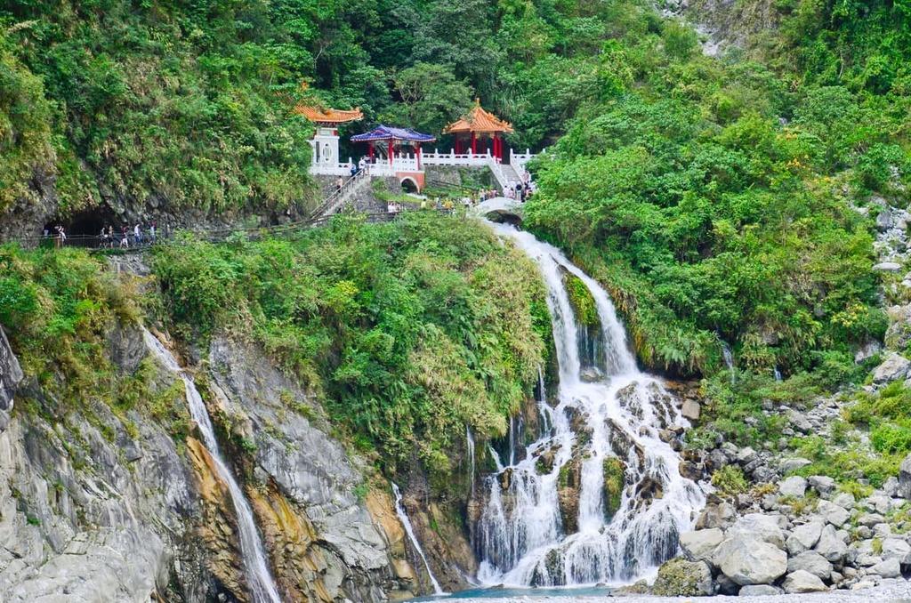
One of the most iconic images of Taroko National Park and Qilai and Taroko Mountains Ecological Reserve is the grand Changchun Shrine. Also known as the Eternal Spring Shrine, this landmark sits above the meandering path of the Liwu River.
This much-loved trail is a local favourite as the hike is short and relatively flat. The highlights of this route are the pristine natural attractions of dramatic cliffs, verdant forests, and sapphire blue waters. There are also many majestic temples built in the ornate style of traditional Chinese architecture.
Hikers begin the trail near the Changchun Shrine bus stop on Old Changchun Bridge. From here, hikers trek for 300 metres (984 ft) until the magnificent sight of the Changchun Shrine surrounded by lush foliage unfolds before them.
The Changchun Shrine pays homage to the 226 fallen military workers who helped build the Central Cross-Island Highway that connects the east coast of Hualien to the west coast of Taichung City (臺中市).
Hikers then ascend a stairway that leads them sharply up the mountain. For supreme views of the iconic Taroko Gorge (太魯閣峽谷), hikers continue uphill for 2.2 km (1.3 mi) to the Taroko Tower and Bell Tower. Legend dictates that by ringing the bell three times, your wish will come true. From here, hikers can also see the entrance gate to Taroko National Park. The route from Changchun Shrine to Bell Tower might be closed due to safety reasons. Please check the official website before setting off.
Hikers will then descend the trail, which leads through a shaded forest of evergreen broad-leaved plants and crosses a suspension bridge that leads to Changuang Temple. The trail ends on the Central Cross-Island Highway by the Changuang Temple Gate.
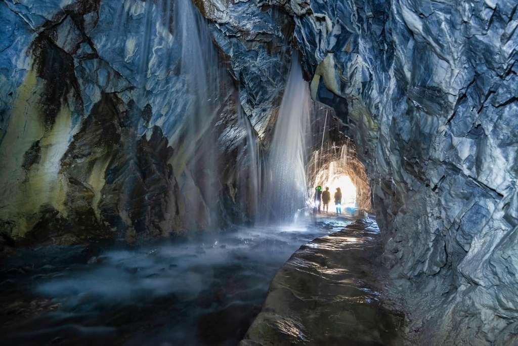
With a distance of only 1.9 km (1.1 mi), the Tunnel of Nine Turns is one of the shortest trails in the Qilai and Taroko Mountains Ecological Reserve. This path is hugely popular with visitors as the route leads through tunnels that have been created by cutting into large cliffs.
These sheer cliffs stand high above the strikingly blue Liwu River. Here, intricate swirling patterns feature on the hardy marbleised cave walls. Visitors can appreciate the incredibly steep Taroko Gorge below by walking on the highest cliff in Qilai and Taroko Mountains Ecological Reserve.
Do note that this trail has been closed a number of times due to rockfall; however, the path has been maintained and assessed for safety. Always heed any warning signs and respect trail closures if and when they happen.
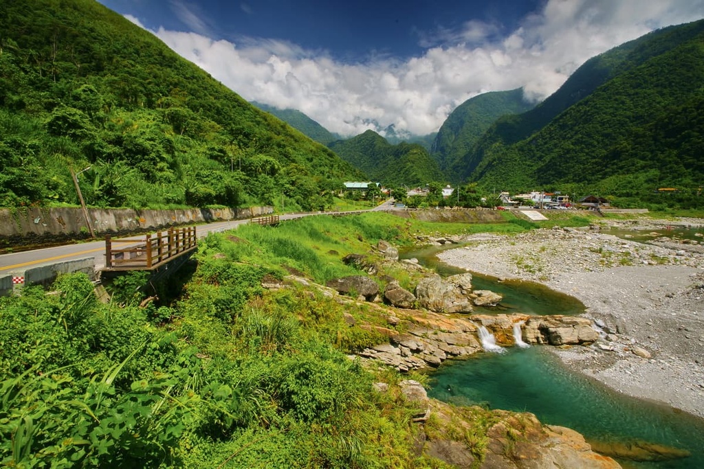
Located to the south of the entrance of Taroko National Park is the Truku village of Sanzhan, where the sea-green waters of the Sanzhan River (三棧溪) flow. Here, boulders sideline the river path with the tufted coastal mountains overlooking the valley. Swimming and rock jumping are the top activities for visitors to enjoy in the lush river valley.
However, the main draw to Sanzhan River Valley is the Golden Canyon (黃金峽谷). At sunset, the gushing waterfall reflects the golden hues of the sun.
Canyoning tours are offered here, too. During these tours, visitors voyage through the canyons, following the course of the river and observing the marine life, plant ecosystems, and the geological composition of the caves throughout their expedition.
Along the Baiyang Waterfall Trail, a series of darkened tunnels leads the path to the Baiyang Waterfall (白楊步); however, as of the time of writing, the trail is partially closed.
While visitors may not reach the majestic beauty of the waterfall, they will pass a water curtain pouring a sheet of crystal-clear water over the cliff.
From here, visitors can watch breathlessly from the cliff opening as water gushes ahead of them. Visitors can almost touch the water as it passes overhead, all while feeling the fine spritz of its water vapour.
Hualien City (花蓮市) is the closest hub in eastern Taiwan to Qilai and Taroko Mountains Ecological Reserve. For more of a small town vibe, the Truku village of Tianxiang (天祥) near the reserve’s boundaries is a great choice.
Taiwan's east coast isn’t as well-connected to the rest of the island as the west coast; thus, fewer visitors transit through this secluded part of the island.
Although Taroko National Park and the region of Qilai and Taroko Mountains Ecological Reserve is a hugely popular attraction, the city remains less heavily visited by tourists than the major cities of Taipei (臺北市), Kaohsiung (高雄市), and Taichung.
One of the main attractions in the city is Qixingtan Beach (七星潭海灘), a well-known pebble beach of different sizes and colours. Locals love strolling across the stony beach, watching the waves crash against the shore. While swimming is prohibited due to the strong currents, the beach's stunning beauty of endless coastline is what attracts visitors to the region.

Meanwhile, Pine Garden is a Hualien staple that’s cemented in history. This stately structure was once a Japanese Navy Administration Office. Pine Garden is listed as one of Taiwan's top 100 historical buildings. Facing towards the ocean, Pine Garden was the perfect place to spot approaching ships. Visitors can enjoy picnicking on the lawn while appreciating the view of the endless Pacific Ocean.
Additionally, near the city, the marble coastal Qingshui Cliffs (清水斷崖) rise sharply from the Pacific Ocean to heights of 58 metres (190 ft). Waves lap and crash against the cliffs, which are covered in dense shrubbery. These marble cliffs extend for 21 km (13 mi) against the east coast.
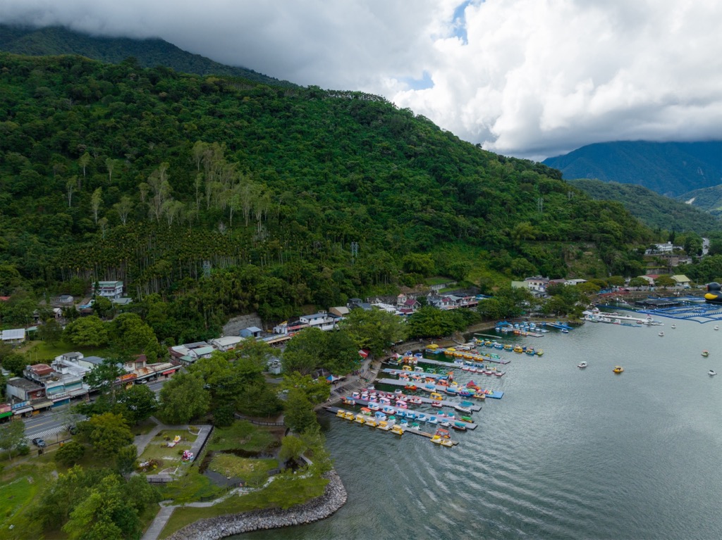
Liyu Lake (鲤鱼潭), Hualien's answer to Sun Moon Lake (日月潭), is the second largest natural lake in Taiwan with an area of 104 ha (257 ac). Here, visitors can enjoy water sports, such as canoeing and stand up paddleboarding. A 5 km (3 mi) wooden boardwalk circles the still lake, too. In March and May, fireflies illuminate the evening skies. Additionally, hiking trails journey through the verdant hills of Liyushan (鯉魚山).
Ruishui Hot Springs near the city was first developed as a resort by the Japanese in 1919. The average temperature of the springs is 118°F (48°C). The thermal waters are rich in iron and low-alkaline chloride-carbonate, which alleviates skin rashes and rheumatism. According to local legend, if a pregnant woman bathes in the waters, there is a strong possibility of bearing a male child.
The small Truku village of Tianxiang makes for a scenic base for visitors wishing to explore the numerous trails of the Qilai and Taroko Mountains Ecological Reserve. Many Truku families offer homestays for visitors who seek to experience a more intimate way of learning the culture and customs of the Truku people.
Rich in ecology, Tianxiang is a nature wonderland. Set in a verdant valley where the Liwu River and Dasha Creek merge, clusters of plum trees populate the region around Tianxiang. The surrounding mountains add depth and drama to the quiet village.
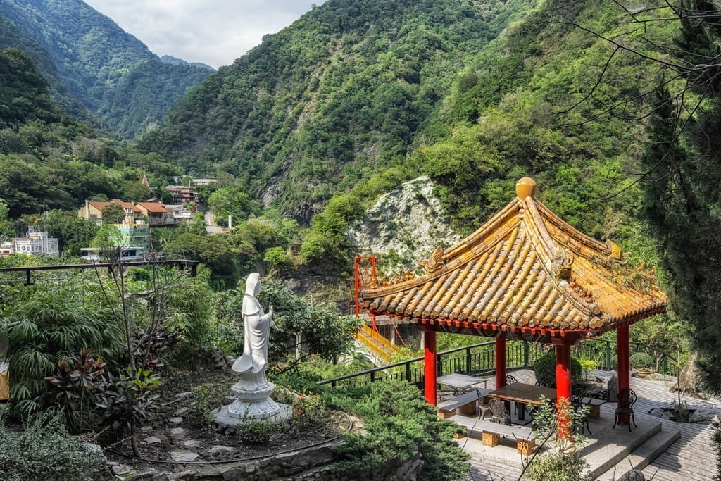
Xiangde Temple is the local temple that houses resident monks. The temple is known for its striking beauty and gorgeous views of the emerald valley of Tianxiang. Another nearby structure that offers sweeping vistas is the seven-layered Tianfeng Pagoda.
One reason visitors love this location is its proximity to nearby trails and attractions. The trailheads for the Baiyang Waterfall Trail, Bilu Sacred Tree Trail, and Lotus Pond Trail are just short distances from the village.
From the cities of Kaohsiung, Tainan, Chaiyi, Taichung, Hsinchu, and Taoyuan, take the Taiwan High-Speed Rail (HSR) or the local express train (TRA) to Taipei. From Taipei Main Station, board the local express train to Hualien or Xincheng Train Station.
Visitors then board the Taiwan Trip Bus - Taroko Route 310 from either Hualien or Xincheng train stations. This alights at Tianxiang in the Qilai and Taroko Mountains Ecological Reserve.
Alternatively, visitors can rent a car or scooter from Hualien or Xincheng. It is a 41.8 km (26 mi) journey from Hualien and a 36 km (22 mi) drive from Xincheng to reach Qilai and Taroko Mountains Ecological Reserve.