Scan the QR code and open PeakVisor on your phone
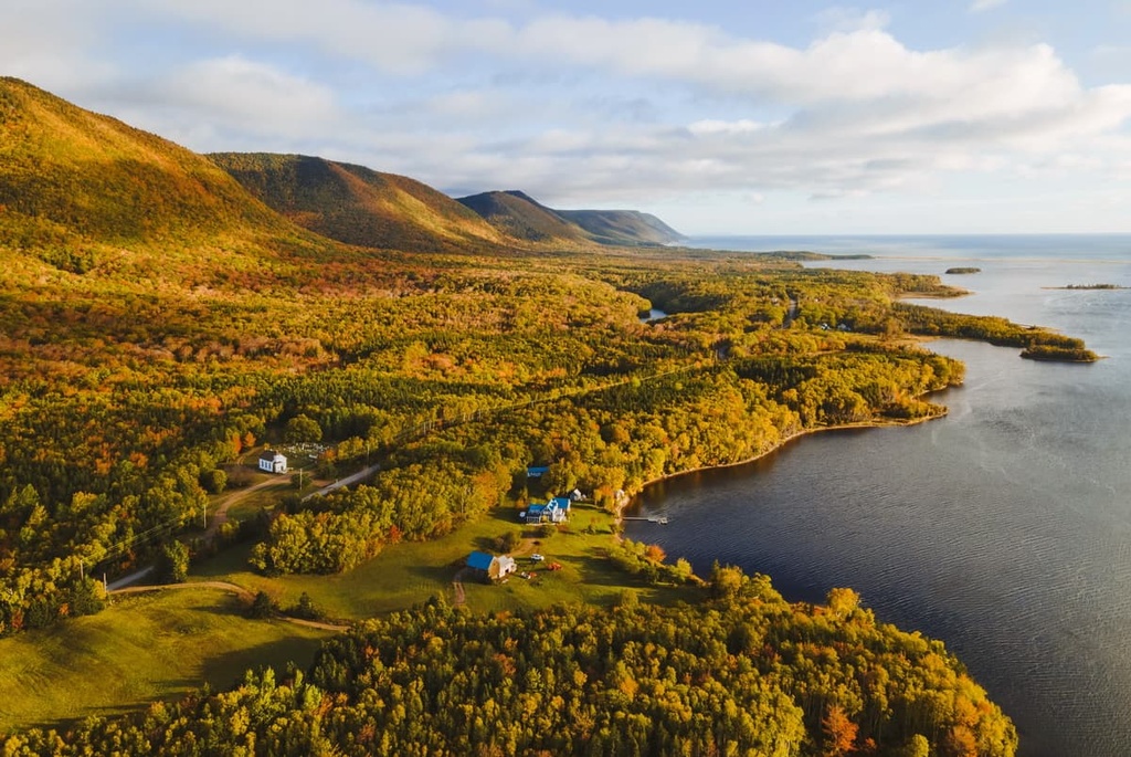
Situated on the northernmost tip of the island of Cape Breton in the Canadian province of Nova Scotia, Pollett's Cove–Aspy Fault Wilderness Area is a rugged and remote region that features a spectacular blend of highlands, canyons, beaches, and coves. The wilderness area is home to 12 named mountains, the highest of which is Grey Hill (459 m/1,506 ft) and the most prominent of which is Bear Hill (238 m/781 ft).
Pollett's Cove–Aspy Fault Wilderness Area is a rugged protected area located in the northern part of the Canadian province of Nova Scotia. It covers 27,230 ha (67,287 acres) of land in the northernmost reaches of Cape Breton Island in Victoria and Inverness counties, making it the largest wilderness area on the island.
As its name suggests, Pollett's Cove–Aspy Fault Wilderness Area is centered around two major topographical features: Pollett’s Cove and Aspy Fault.
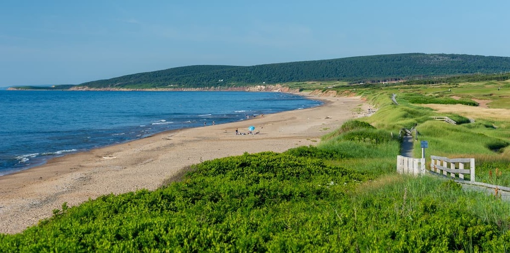
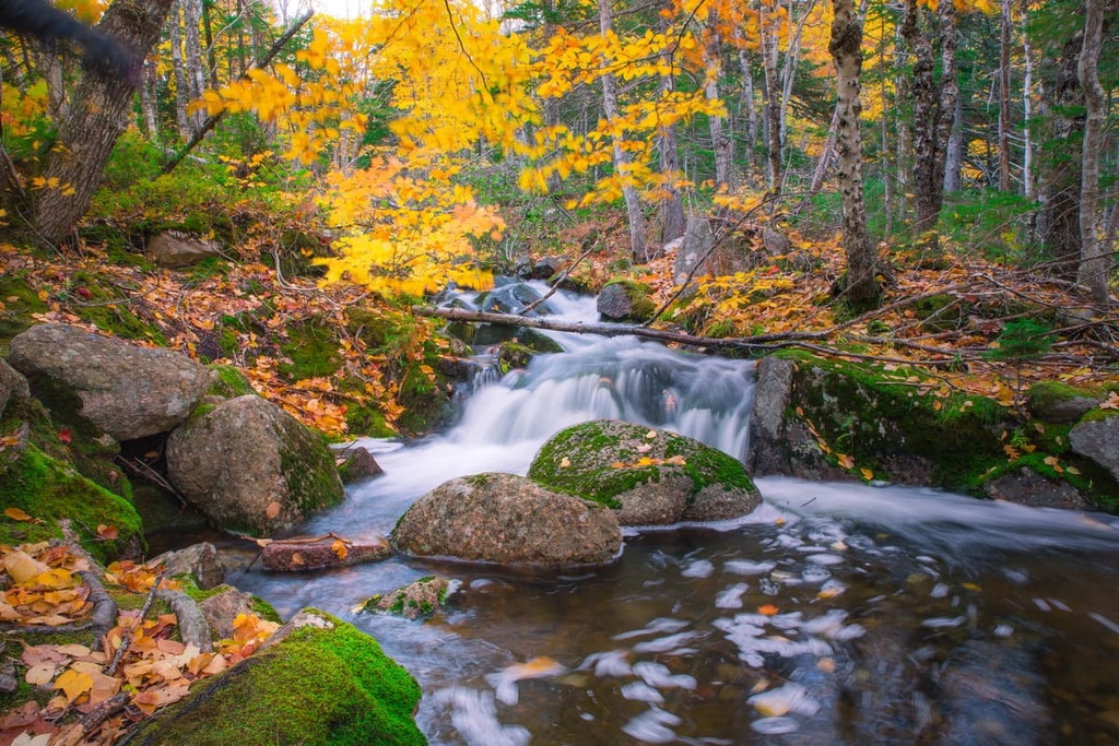
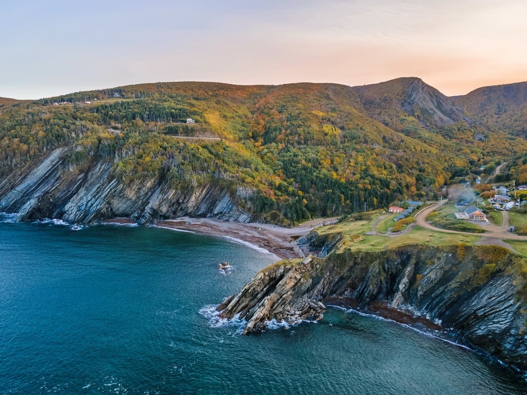
Pollett's Cove is a magnificent inlet situated along the northwest coast of Cape Breton Island to the north of the community of Pleasant Bay. The cove is known for its long sandy beach, which runs along the coast of the Gulf of the Saint Lawrence, and for its views of the Cape Breton Highlands, which tower overhead.
Although it’s now a protected area, Pollett's Cove has long been home to humans. It is part of the traditional territory of the Mi'kmaq and there had long been a Mi'kmaq village at the cove before European colonization.
Interestingly, the cove itself is still privately owned though the surrounding land is part of either the wilderness area or the nearby Cape Breton Highlands National Park. It was purchased in 2017 by a Pleasant Bay resident named Mathew Moore who bought the cove using money that he won in a 2006 lottery jackpot. The area has remained open to the public in the years since.
Aspy Fault, on the other hand, is a massive strike-split fault line that traverses Cape Breton island. It runs for about 40 km (25 mi) from Margaree Valley northward to Cape North. The area around the fault in the wilderness area is particularly rugged. The aptly named Aspy River also runs through the fault and it empties out into Aspy Bay in the northeastern part of the park.
Pollett's Cove–Aspy Fault Wilderness Area is surrounded by other important protected areas and outdoor recreation destinations. In particular, its land borders are adjacent to Cape Breton Highlands National Park on nearly all sides. It is also located within driving distance of a number of other wilderness areas that are situated to the south, including:
Like the rest of Cape Breton Island, the Pollett's Cove–Aspy Fault Wilderness Area has a unique and varied geological history.
Cape Breton Island itself is actually a collection of three terranes: Blair River Inlier, Bras d’Or, and Avalon. These terrains were effectively mushed together as a result of tectonic activity. They consist of a blend of volcanic and sedimentary rocks and the wilderness area actually includes some of the oldest known rock outcroppings in the Maritimes.
The geological history of Cape Breton Island and the wilderness area as we know them today begins about 1.5 billion to 750 million years ago when the island was located in the middle of the massive supercontinent of Rodinia. At the time, they were situated at the core of the North American continent.
Eventually, around 750 to 450 million years ago, Rodinia started to break up into a series of smaller continents called Laurentia, Baltica, Protogondwana, and Amazonia. As these continents started to drift apart, oceans began to open between them. Around this time, the Iapetus Ocean began to open up between Amazonia and Laurentia.
These tectonic movements happened alongside the creation of volcanic island arcs off the coast of Protogondwana. This volcanic activity eventually created the igneous rocks of the Avalon terrane while sedimentary rocks that were deposited in the ocean created the rocks in the Bras d’Or terrane.
Starting around 580 to 450 million years ago, the Avalon and Bras d’Or terranes were mashed together with the closing of the Brazilide Ocean, which helped to form Gondwana.
Not long afterward, the continent of Baltica collided with Laurentia and formed another new continent called Eurameria. As a result, the Avalon and Bras d’Or terranes became part of Euramerica where they joined up with the Blair River inlier to create the core of what is now Cape Breton Island.
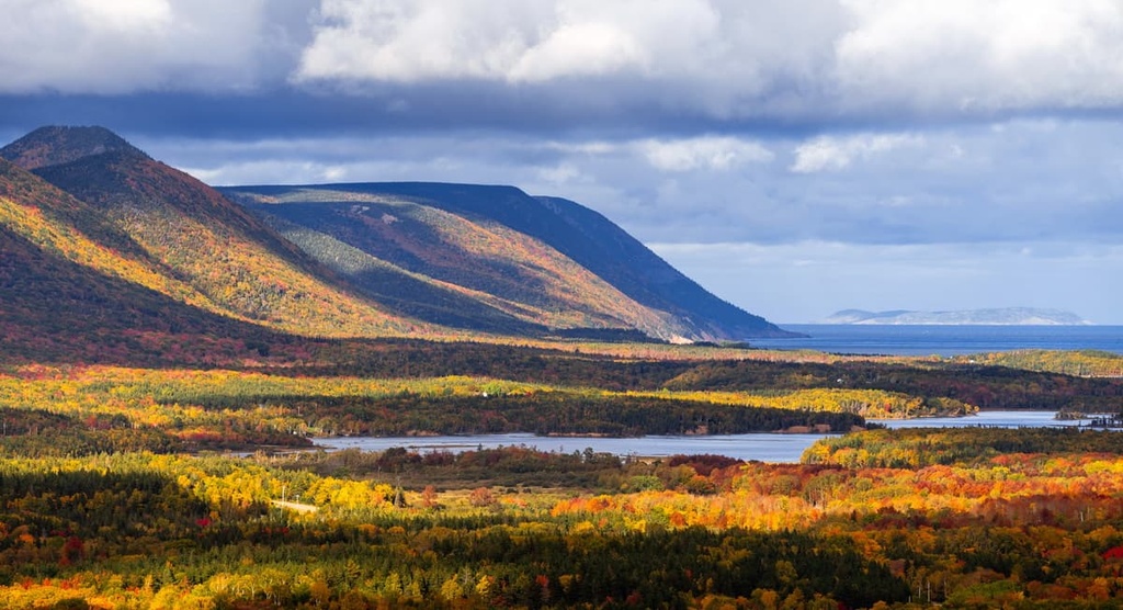
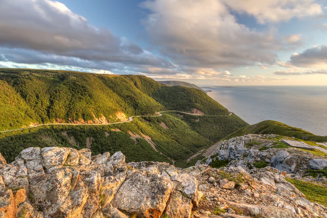
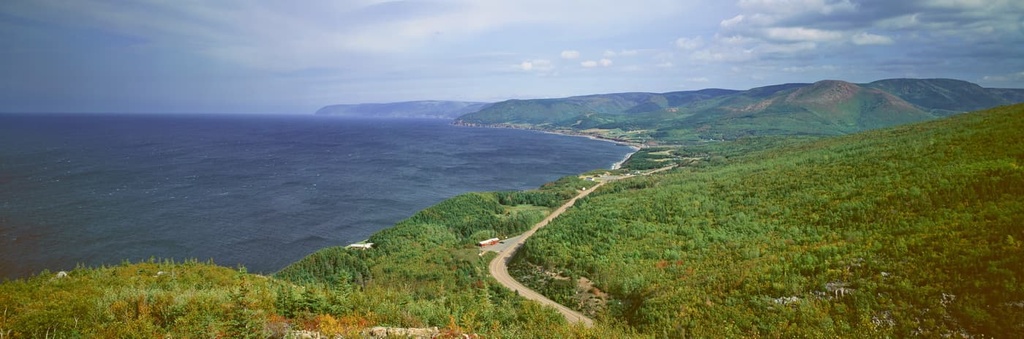
The mountains on Cape Breton Island and in the Pollett's Cove–Aspy Fault Wilderness Area are technically part of the Canadian Appalachians, which are a subrange of the Appalachian Mountains. However, these mountains have been well eroded over the past few millions of years, which is why they are not as lofty as their neighbors to the south.
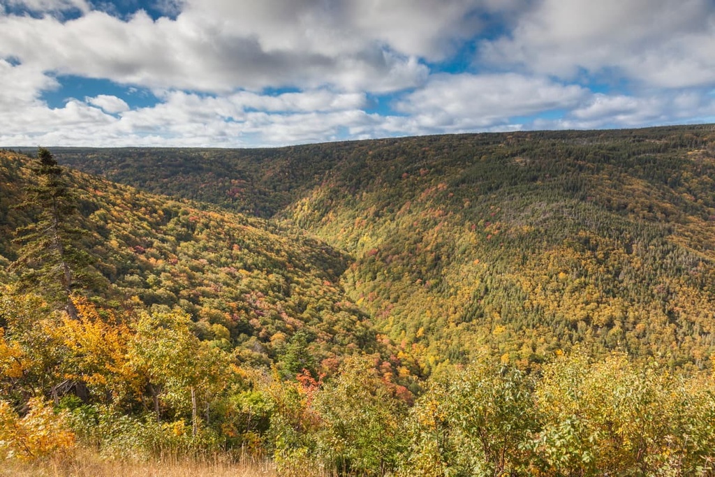
That said, the main geologic feature of the wilderness area is not its mountains, but the Aspy Fault. Often called the most spectacular fault on the island, the Aspy Fault runs for about 40 km (25 mi) through northwestern Cape Breton.
Geologists believe that the Aspy Fault was previously linked to a number of other faults in Europe before the opening of the Atlantic Ocean. In particular, it’s believed that the Great Glen Fault in the Scottish Highlands was once linked to the Aspy Fault.
Due to the diversity of different landscapes found in northern Cape Breton Island, the Pollett's Cove–Aspy Fault Wilderness Area is home to a large number of different ecosystems.
In the wilderness area, you’ll find everything from forests to highlands and alpine zones. The forests in the wilderness are mostly hardwoods that feature yellow birch, beech, and maple.
Meanwhile, the highlands in the wilderness area feature a variety of unique and rare flora, such as diapensia, pink crowberry, alpine bilberry, northern blueberry, and blue mountain heather. In the wilderness area, you’ll also find large areas of heath as well as bogs.
The islands in the wilderness area feature barrier beach complexes, salt marshes, and brackish lagoons. The wilderness is even home to a rare species of aquatic lichen called eastern waterfan.
As far as wildlife goes, the wilderness area is home to everything from white-tailed deer, Canada lynx, bobcats, and snowshoe hares to rock voles and martens. In particular, the wilderness is also home to one of the biggest populations of moose in the province.

Pollett's Cove–Aspy Fault is particularly well known for its bird species. It is home to the endangered Bicknell’s thrush, which tends to hang out in higher elevation areas. You can also find piping plovers on the barrier beaches of the wilderness’ islands.
The region that is now Pollett's Cove–Aspy Fault Wilderness Area has a long history of human habitation.
Traditionally, the land in and around the wilderness area has been and continues to be the territory of the Mi'kmaq, which is referred to as Miꞌkmaꞌki. The Mi'kmaq have long lived throughout what are now the Maritime provinces of Canada (Nova Scotia, Prince Edward Island, and New Brunswick), as well as in what is now the US states of Maine and Massachusetts.
In particular, the land that is now called Cape Breton Island is known as Unama'ki by the Mi'kmaq. The Mi'kmaq traditionally lived in many villages throughout the island, including at what’s now known as Pollett's Cove. Nowadays, the Union of Nova Scotia Mi'kmaq has its headquarters at Membertou on Cape Breton Island.
It’s unclear when people of European descent first arrived at Cape Breton Island. There isn’t much evidence to suggest that the Norse made their way to the region, though they did have a settlement much further to the north at L’Anse aux Meadows in Newfoundland.
Although there’s some dispute over the accuracy of the records, some historians believe John Cabot of Italy visited what’s now Cape Breton in 1497 while sailing for the English crown. If he did make it to Cape Breton, it’s believed that Cabot landed around Aspy Bay. But it’s possible that Cabot actually visited Newfoundland instead.
What we do know is that the Mi'kmaq began sailing with fishermen from Europe (likely from the Basque Country and the surrounding area) around the 1520s. Fishermen from Portugal established a fishing colony on Cape Breton around the time though it was abandoned sometime before 1570.
During the Anglo-French War in the early 1600s, the English established a colony at Baleine on the eastern part of Cape Breton, which was the start of a long history of English colonization of the region. The region then became a source of conflict between the French, English, and Scottish crowns until the 1707 Acts of Union combined the English and Scottish crowns and the end of the Seven Years’ War all but drove the French out of the region.
Ultimately, Cape Breton and the area around what’s now the Pollett's Cove–Aspy Fault Wilderness Area became a popular destination for Loyalists escaping the US after the American Revolutionary War. It also became a common place to settle among Gaelic-speaking Scottish Highlanders who were evicted from their homes in Scotland during the Highland Clearances.
A number of Scottish immigrants ended up settling in Pollett’s Cove. The area was granted by the Crown to the MacLean family in 1861 and it was given to the MacGregor Family in 1873. The MacGregors held onto the land until it was sold in 2017 to Matthew Moore of Pleasant Bay.
In the years since, the northwestern part of Cape Breton, including the current wilderness area, has remained relatively sparsely populated. There are quite a few smaller communities in the area, but the largest cities are all located to the south.
The northern part of Cape Breton Island is home to a large quantity of public land. Cape Breton Highlands National Park, which is located near the wilderness area, was established in 1936, making it the first national park in Atlantic Canada. The Pollett's Cove–Aspy Fault Wilderness Area was established in 1999 and it was expanded to include more islands in Aspy Bay in 2015.
The Pollett's Cove–Aspy Fault Wilderness Area is a fairly remote place and there aren’t many maintained trails in the wilderness area. If you want a great network of marked trails to hike on, consider a trip to the nearby Cape Breton Highlands National Park instead.
However, if you’re ready for an adventure, here are two of the best hikes in the Pollett's Cove–Aspy Fault Wilderness Area to check out on your next trip to the region.
Arguably the most popular hike in the wilderness area is the trail to Pollett’s Cove. The trail leads to Pollett’s Cove from near the community of Pleasant Bay and it is the only way to reach this isolated cove by land.
To start this hike, you’ll need to drive to Pleasant Bay and then turn onto Red River Road, which leads out of town. Eventually, the road will pass by Gampo Abbey, which is a Buddhist monastery that was founded in 1983. The road will come to an end and that’s where you’ll start walking.
Once you get on the trail, you’ll follow the well-worn path for over 8 km (5 mi) one-way to get to the cove. Many people hike this trail as an overnight backpacking trip, but it can be done as a day trip, too.
The Theodore Fricker Mountain Trail takes you to the summit of Tenerife Mountain, which is also known as Theodore Fricker Mountain. It is located in the eastern part of the wilderness area between Cape North and Dingwall.
The trail itself is just 2.3 mi (3.7 km) long, but it gets fairly steep toward the top of the mountain. Once you get to the summit, you can enjoy panoramic views of the surrounding landscape. If you want to extend your hike, you can also follow the informal path that runs along the ridgeline.
Looking for a place to stay near the Pollett's Cove–Aspy Fault Wilderness Area? Here are some of the best cities and towns to check out in the region.
The community of Pleasant Bay is located just to the south of Pollett's Cove on the northwestern coast of Cape Breton Island. Its main economic activities revolve around fishing, and most of the fishing boats in the region haul in lobster during the spring and snow crab in the summer months.
Although the community of Pleasant Bay is quite small, it’s home to a number of hotels and B&Bs. The town also has a great museum called the Whale Interpretive Center that helps to promote awareness of these amazing marine mammals.
Despite its remoteness, Pleasant Bay is fairly easy to get to as it’s located along the Cabot Trail (Trunk 30). You can take the Cabot Trail and the Trans-Canada Highway to make the 3-hour journey between Pleasant Bay and Sydney by car.
Aspy Bay is one of the best places to stay if you’re looking to venture into the eastern part of the Pollett's Cove–Aspy Fault Wilderness Area or into Cape Breton Highlands National Park. However, it is not one town, but rather a collection of communities that includes:
South Harbour and Dingwall are among the largest communities that are located around the bay. Most of the communities in the area are fishing towns, though tourism also brings quite a few people to the region. There are plenty of small hotels and B&Bs that cater to visitors at Aspy Bay, too.
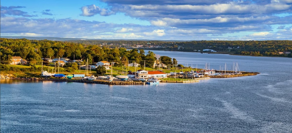
Sydney is a community of around 30,000 people that’s located in the northeastern part of Cape Breton Island. It is the largest community in the most populous part of the island, so it is both the commercial and cultural center of Cape Breton.
In recent decades, Cape Breton Island has become an increasingly popular tourist destination, which has helped Sydney develop a substantial tourism industry. It has a lively arts scene as well as a great selection of museums for visitors to enjoy. You can get to Sydney by air, road, and sea, so it’s a great place to start your trip to Cape Breton Island.
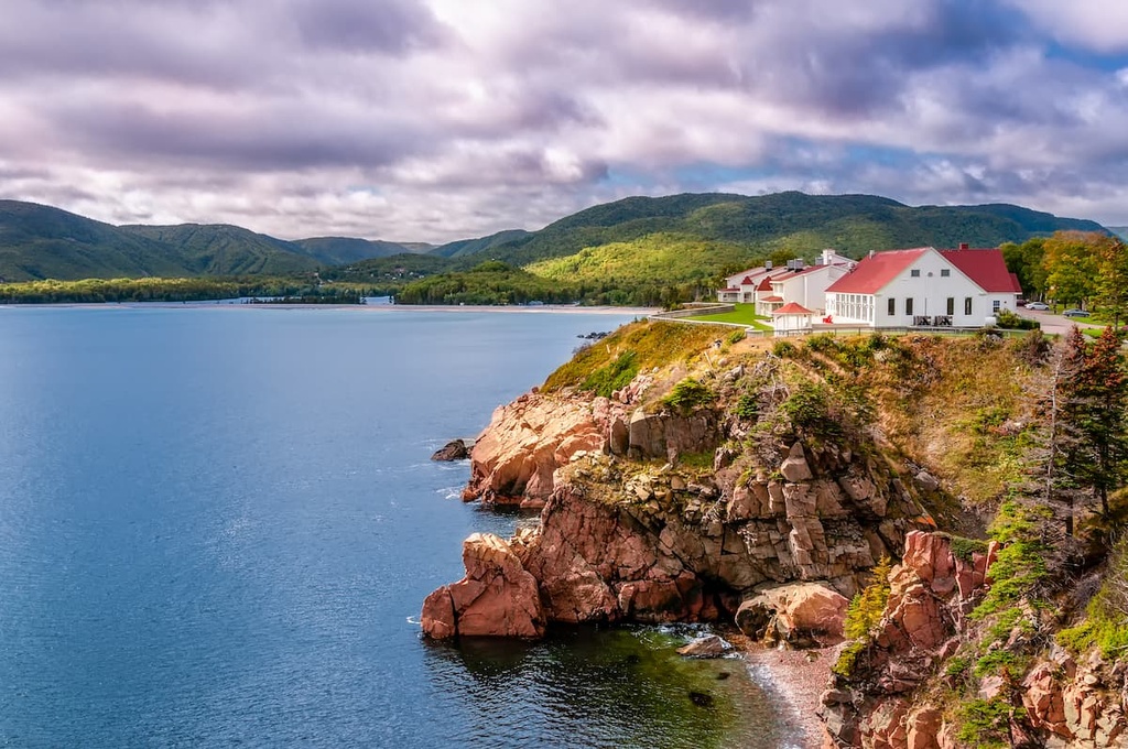
One of the most popular tourist destinations in the northern part of Cape Breton Island, Ingonish is situated just to the southeast of Pollett's Cove–Aspy on the shores of North Bay. It is also located just a short distance away from the communities of Ingonish Beach and Ingonish Ferry near Cape Smokey Provincial Park.
Ingonish is a very popular destination for people visiting Cape Breton Highlands National Park. Near the village, you can also find the famous Keltic Lodge and a large public golf course called the Highlands Links.
Not to be confused with Inverness in Scotland, the community of Inverness is located along the western coast of Cape Breton Island. It is situated just about an hour’s drive to the north of the Canso Causeway, which is the main road and rail link that connects Cape Breton Island to the Nova Scotia peninsula.
While Inverness has a population of only around 1,500 people, it’s rapidly growing in size. This increase in population is due to both the expansion of tourism in the region and the creation of two popular golf courses: Cabot Cliffs and Cabot Links.
There are plenty of hotels in and around Inverness for visitors to choose from. Additionally, if you’re staying in Inverness, you can head to the Glenora Inn & Distillery, which is the oldest single malt whisky distillery in North America, for a tour of the distillery and a tasting of their fine whiskies.