
Scan the QR code and open PeakVisor on your phone
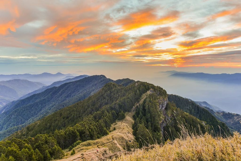
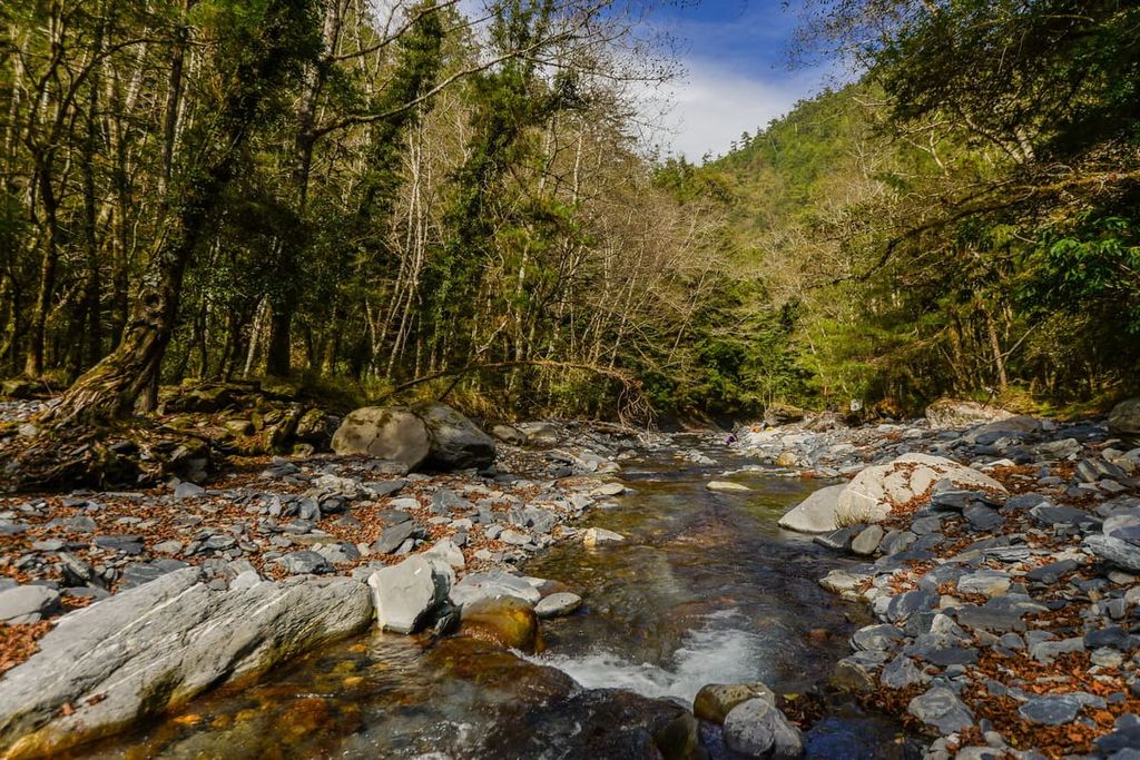
Located in the northwest region of Taroko National Park (太魯閣國家公園) in northern Taiwan is Nanhu Ecological Reserve (南湖中央尖山群生態保護區). The reserve is renowned for its mammoth mountain peaks and stunning alpine landscapes. There are 54 named mountains in the reserve; the highest and most prominent mountain is Nanhu Dashan (南湖大山) at 3,742 metres (12,277 ft) in elevation.
Nanhu Ecological Reserve is located three counties: Heping District (和平區) of Taichung County (台中县) in the west, Xuilin Township (秀林鄉) of Hualien County (花莲县), and Ren’ai Township (仁愛鄉) of Nantou County (南投县) in the south.
The Nanhu Dashan massif, which dominates much of the reserve, consists of many peaks, including the main peak of Nanhu Dashan (南湖大山主峰), Nanhu Dashan East Peak (南湖大山東峰), Nanhu Dashan South Peak (南湖大山南峰), and Nanhu Dashan North Peak (南湖大山北峰).
In addition to these peaks, Nanhu Dashan encompasses Nanhu Dashan Central East Peak (南湖大山中南峰), Nanhu Dashan Northeast Peak (南湖大山東北峰), Nanhu Dashan Southeast Peak (南湖大山東南峰), and Nanhu Beishan (南湖北山).
The incredibly hilly Nanhu Ecological Reserve comprises 14 of Taiwan’s top 100 peaks, which are also known as Baiyue. Nanhu Dashan is one of the top 5 Baiyue, while Zhongyang Jianshan (中央尖山) and Wuming Shan (無明山) is in the top 20.
The other remaining Baiyue in the reserve are:
As the region is wet and rainy throughout the year, Nanhu Ecological Reserve receives a large amount of precipitation—an average of 2,000 mm (79 in) per year. Spring brings seasonal rains from March to May, followed by the turbulent typhoon season from June to November.
Furthermore, winter announces the arrival of frosty northeast monsoons. In addition to this, severe snowfall descends on the peaks of the reserve that are over 3,000 metres (9,842 ft) in elevation, increasing the difficulty of the already challenging summits.
Although the eastern region of Taroko National Park is home to low-lying hills, the western part of Nanhu Dashan is much more rugged and it is not shielded from fierce storms. During typhoon season, the high mountains of Nanhu Ecological Reserve are pelted with severe wind and rain, causing damage by rockfalls and landslides to the mountain terrain.
The range in elevation is most significant in Nanhu Ecological Reserve. The lowest elevation point in the reserve is a meager 60 metres (197 ft) in elevation while the highest point is at approximately 3,742 metres (12,277 ft). Due to the vast disparities in elevation in the reserve, the region is home to a number of different ecozones.
The average temperature in the reserve is about 74°F (23.7°C), which decreases as elevations increase. Along the Central Cross-Island Highway at the 1,000 metres (3,281 ft) point, the average temperature drops to 63°F (17°C). At 2,000 metres (6,562 ft), the temperature decreases to 54°F (12°C), and the average temperature is just 45°F (7°C) at 3,000 metres (9,842 ft).
Areas of importance surrounding Nanhu Ecological Reserve include Shei-Pa National Park (雪霸國家公園), where Taiwan’s second-highest mountain, Xueshan (雪山) is located, to the east, and the forested woodlands of Taipingshan National Forest Recreation Area (太平山國家森林遊樂區) to the north. Furthermore, the sprawling cliffs of Qingshui Shan (清水山) in Taroko National Park are situated to the east and Taroko National Park’s Baiyue of Qilai Shan (奇萊山) is located to the south.
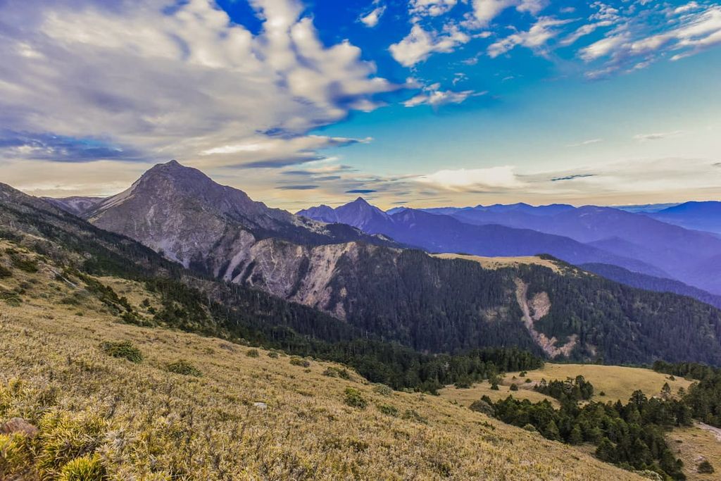
The pointy peaks of Nanhu Ecological Reserve belong to Taiwan's primary mountain range, the Central Mountain Range (中央山脈). Known as the spine of Taiwan, the Central Mountain Range stretches from the northern area of New Taipei City (新北市) to the southern point of Taiwan on the Hengchun Peninsula. In fact, Nanhu Dashan is the third tallest peak of the Central Mountain Range.

The peaks of Nanhu Dashan consist mostly of metamorphosed sandstones that date to the Eocene through Oligocene. The mountains in the southern half of Nanhu Ecological Reserve primarily consist of phyllite, shale, and slate from the Miocene.
Surrounding the main ridge and east ridge of Nanhu Dashan are two broad valleys, which geologists believe are glacial cirques. These cirques likely formed as a result of glacial activity and heavy snowfall during the last glacial maximum.
While Nanhu Dashan lies just north of the Tropic of Cancer, most of the area sits at an average of 2,000 metres (6,562 ft) in elevation; thus, the climatic zones range between cold temperate and subalpine frigid within the reserve.
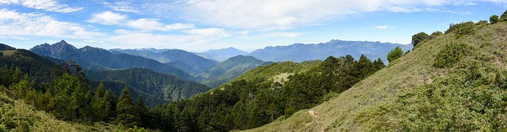
Pastures of dwarf bamboo and fields of Yushan cane flourish in the lower regions of Nanhu Ecological Reserve. At the same time, mixed coniferous and broadleaf forests of high mountain Taiwan fir, Chinese spruce, Taiwan hemlock, Taiwan white pine, Taroko oak, clusters of alpine Yushan juniper, and Chinese photinia shrubbery are the primary vegetation existing in Nanhu Ecological Reserve.
Changes in vegetation are most evident driving along Central Cross-Island Highway. Here, visitors can witness plains of grasslands in the lower elevations break into verdant woodlands as the elevation increases.
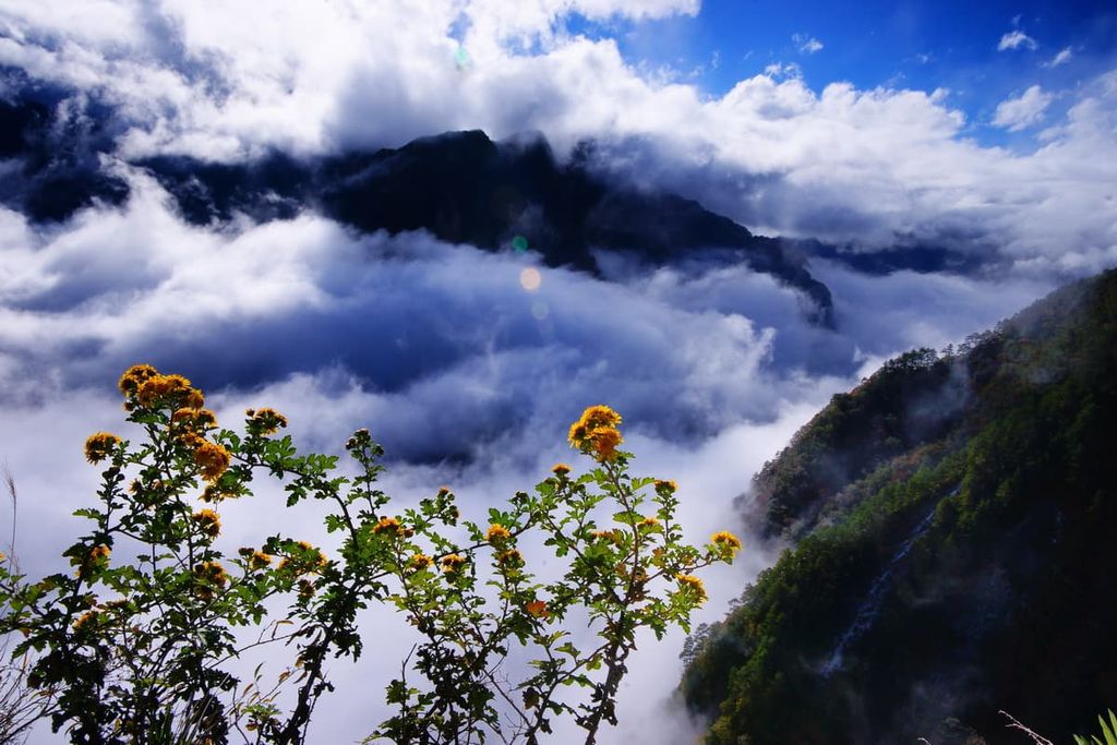
Additionally, high mountain blossoms flourish in the alpine zone over 3,000 metres (9,842 ft). These include varieties and species such as rhododendron, Nanhu Dashan willow leaf (Epilobium nankotaizanense), Yushan azaleas, and Taiwan edelweiss.

The area of Nanhu Ecological Reserve is home to more than 2,093 native vascular plants, of which 132 are considered rare or endangered, such as the endemic Nanhu Dashan willow leaf.
The wildlife in Nanhu Ecological Reserve consists of 46 species of large mammals. This includes the Formosan black bear, Formosan macaque, Formosan serow, and Formosan sambar deer.
In addition to this, a staggering 152 bird species roam the skies, such as Swinhoe’s pheasant, Formosan blue magpie, and the fire-breasted flowerpecker. Moreover, 15 types of amphibians and 35 kinds of reptiles feature in medium elevations, while 302 species of butterflies skim the mountain paths of Nanhu Ecological Reserve.
The mountainous region of Nanhu Ecological Reserve is part of the traditional territory of the Truku tribe, who lived primarily in the mountains to the east of what is now the reserve. The Truku people are descendants of the Atayal tribe, who ventured east from the Xueshan Range (雪山山脈) in what is now Miaoli (苗栗縣), Hsinchu (新竹縣), and Taichung (台中縣) counties.
The Truku people traditionally practice farming, hunting, and fishing for subsistence, and their weaving skills are considered one of the finest in Taiwan. The Truku community prides itself on their interweaving tapestries of colourful shades and bold designs.
During the Japanese Occupation Era, the Japanese undertook a project of constructing a cross-island highway, during which time they forced the Truku people into labour. The Japanese were known to have used inhumane and hazardous methods of making this area accessible for construction.

Many in the Truku community lost their lives during the Japanese Occupation Era. In the eastern region of Taroko National Park, the Eternal Spring Shrine was established to respect the fallen labourers who tragically passed away while attempting to build what is now a major highway.
The main hiking trail of Nanhu Ecological Reserve centres around the mammoth peaks of Nanhu Dashan, which are notoriously challenging to ascend in any season or weather. As Nanhu Ecological Reserve accommodates many Baiyue, hikers have several options to scale towering mountain peaks of differing difficulties.
The prime attractions of this lengthy 22.9 km (14 mi) trek are the presence of unique plants and the striking variety of flora, such as Nanhu Dashan willow leaf. Other attractions include two U-shaped valleys believed to be glacial cirques, and the chance to summit the four Baiyue of Shenmazhen Shan, Nanhu Beishan, Nanhu Dashan, and Nanhu Dashan East Peak.
In addition to Nanhu willow leaf, other plant life features on the trail are Nanhu Rhododendron, catclaw buttercup, and Nanhu mountain orchid.

The entire trek takes three to four days to complete from Shenmazhen Shan to Nanhu Dashan East Peak; however, if hikers want to loop back to the start of the trail, it takes an additional two days. The trek to Nanhu Dashan stretches longer than the expedition to either Yushan or Xueshan, Taiwan’s number 1 and 2 tallest peaks, respectively.
Hikers begin the journey in the north, where they access the trailhead to Nanhu Peaks on Siyuan Pass. The first four hours leads hikers through a coniferous forest from which they summit the mountain of Duojiatun Shan (多加屯山), from where they proceed towards Yunlin Cottage for an overnight rest.
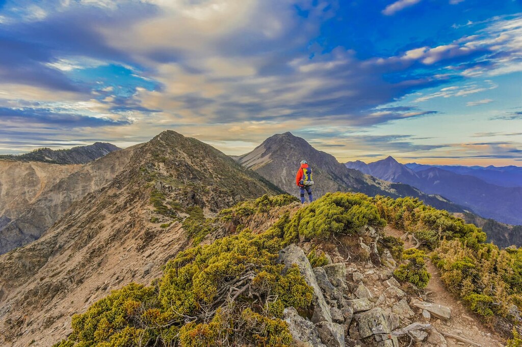
A gruelling 9-hour trek awaits hikers the following morning as they pursue the mountain path to Shenmazhen Shan and Nanhu Beishan. The open grassland summit of Shenmazhen Shan, the first Baiyue, is a constant four-hour uphill journey, albeit not incredibly taxing. Nanhu Dashan can be viewed to the east, and the pointy peak of Zhongyang Jianshan is situated in the south.
An additional four-hour uphill journey leads hikers through grassy meadows and dense woodlands to the taller Baiyue of Nanhu Beishan, the northernmost Baiyue of the Central Mountain Range. The gentle gradient compares to Shenmazhen Shan, as the climb is not too physically exerting. From the summit, hikers can appreciate a different angle of Nanhu Dashan, while noting the Holy Ridge which connects Xueshan and Dabajianshan (大霸尖山) in Shei-Pa National Park.
Hikers then proceed downhill to Nanhu Cottage, where they shall arise early in the morning to embark on a 1.5-hour sunrise hike to the solid and sturdy mountain of Nanhu Dashan. As the mountain shape is substantial and broad, Nanhu Dashan is referred to as the ‘Mountain of Kings’ to denote its majestic presence. The journey to Nanhu Dashan is renowned for its scenic beauty as Nanhu rhododendron and Nanhu mountain orchid add a gentle presence to the dramatic mountain landscape.

From the summit of Nanhu Dashan, hikers witness the warm glow of the morning sky as the soft sunlight rays gently illuminate the surrounding views of the surrounding Nanhu peaks.
From Nanhu Dashan, hikers journey for an additional 2 hours to the more steeply inclined slopes of Nanhu Dashan East Peak. On their way to Nanhu Dashan East Peak, hikers pass the hollowed valleys believed to have been carved from glacial activity.
From here, hikers can either descend Nanhu Dashan East Peak or venture back to the starting point on Siyuan Pass. Additionally, keen hikers can create longer hiking itineraries along this route by venturing to the summits of Nanhu Dashan South Peak and Baba Shan.
If you choose to extend the Nanhu Peaks Trail as described above, you will then travel south from Nanhu Cottage to the Baiyue of Nanhu Dashan South Peak and Baba Shan. As this is a linear trail, hikers will finish further south in the valley between Baba Shan and Zhongyang Jianshan.
Nanhu Dashan South Peak has a different topography to the main peak as an incredibly rocky terrain of rugged and haphazard boulders of various shapes and sizes litter the path. While the gradient is not too steep, the boulders are awkward to scale as they slow down the pace of the hikers.
Hikers are soon rewarded for their efforts with an entire panoramic outlook from Nanhu Dashan South Peak, where Baba Shan, Nanhu Dashan, Nanhu Beishan, and Zhongyang Jianshan are clearly visible.
While Baba Shan lies a mere 700 metres (2,297 ft) away, making these two mountains the two closest Baiyue, the journey is nearly 4 km (2.5 mi) long due to constant dips and rises along the trail. Hikers descend for 1 km (0.6 mi) to the Central Jianxi Wooden House, the stop for the night.
The southern slope of Nanhu Dashan South Peak mimics the jagged mountain path of the northern slope. However, the southern slope consists of exposed metamorphic sandstone.
The following morning, hikers commence the journey to Baba Shan, ascending a gentle grassy slope to the summit. From Baba Shan, hikers can gawk at the extraordinarily precipitous cliffs of Nanhu Dashan South Peak some 700 metres (2,297 ft) away. Hikers then descend the mountain, encountering more chaotic rocky cliffs, after which a pine forest leads the path to the Jianxi River.

For excellent views and the challenge of trekking along the tricky terrain of 'death ridge', the North Section 2 Hiking Trail is a great choice.
From the ridge connecting the four Baiyue of Ganshu Feng, Wuming Shan, Lingming Shan, and Shuan Shan, magnificently vast views of the Holy Ridge, Zhijiayang Shan (志佳陽山), Dajian Shan (大劍山) of Shei-Pa National Park and Hehuan Shan (合歡山), Nanhu Dashan, and even Qingshui Shan in the east are impeccably presented.
This trail is divided into two parts. The first part of North Section 2 proceeds from Zhongyang Jianshan to Ganshu Feng, connecting to the second part of the trail leading to Shuan Shan.
Hikers usually opt to take the second part of the trail, too. This part of the trail forms a circular route from Shuan Shan, starting from 730 Forest Road to Ganshu Feng and looping back to Shuan Shan via the mountain path. The total journey is a five-day trek covering 51 km (32 mi).
The entire North Section 2 Hiking Trail connects with the extension of North Section 1, where hikers descend Baba Shan. Instead of descending to Jianxi Creek, they continue the mountain road to Central Jianxi Mountain House to spend the night. The entire journey of North Section 2 spans 54.6 km (34 mi).
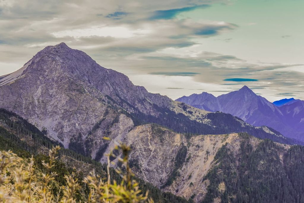
Hikers follow the mountain path from Baba Shan to Zhongyang Jianshan, clambering up sharp mountain walls to summit the pointed peak of Zhongyang Jianshan. Here, hikers can witness Taiwan's second tallest mountain, Xueshan, in the west, the majestic Nanhu Dashan in the north, and Qilai North Peak in the south.
Immediately after hikers begin to descend the mountain, they encounter the ominous 'death ridge' connecting Zhongyang Jianshan and Ganshu Feng. The rocky cliff has been severely weathered due to the battering of extreme conditions; thus the terrain is uneven and tricky to traverse.
After successfully navigating the ridge, hikers head into a sea of dense Pseudosasa japonica bamboo as they ascend the slope of Ganshu Feng, where on the saddle, hikers will pitch their tents and camp overnight.
In the morning, hikers proceed to Ganshu Feng where they can revel in the generous prospects of blue skies, feathery cotton mountain clouds, and partially obscured views of Zhongyang Jianshan. Hikers should then cautiously descend the gravel slope to the overgrown summit of Ganshu South Peak before setting up a tent on Ganshu Nanfeng Campsite.
To reach the second Baiyue, Wuming Shan, of this part of the trail, hikers first climb Guimenguan Feng (鬼門關峰). The menacing Guimenguan Cliff is so high and steep, it hurts one's neck to absorb the full view of the cliff. The wrinkled surface and weathered rock create a daunting sight and terrifying climb. While the journey up is tough, there is beauty along the route after the cliff. Yushan juniper forms a striking appearance with its distorted branches that generate a haunting presence.
From the summit of Guimenguan Feng, hikers take a breather from the nerve-racking journey while they locate the nearby Wuming Shan. Hikers then head off to the grassy slopes of Wuming Shan. While the gradient is not flat, the climb is still smoother than scaling the Guimenguan cliffs. Wuming Shan offers hikers a generous 360 degree view of Ganshu Feng, Zhongyang Jianshan, Yangtou Shan, and Lingming Shan.
As hikers descend, they must make their way down steep cliffs of loose rock. The taxing journey continues through a dense forest dotted with fallen trees that adds to the physical exertion. The notorious “Ignorance Cliff” soon follows, a sheer collapse of mountainous rock that is terrifying in both sight and practise. The trail's difficulty greatly intensifies with hikers clambering down the soft gravel slope of the gigantic ridge.
A 3-metre (10 ft) vertical cliff awaits hikers after the mountain saddle, after which hikers are further challenged as they make their way through a dense arrow bamboo forest. This then leads to the timbered peak of Wuming West Peak (無明山西峰). After such an arduous journey, hikers then head onwards to Lingming Dongan Camp for a well-deserved rest.
The following morning is the last day of the trek, in which hikers will summit the two remaining Baiyue of Lingming Shan and Shuan Shan. A Pseudosasa japonica bamboo forest once again challenges hikers as it obscures the path. The route becomes gentler until the trail's end as the grassy mountain slopes make it easier to climb.
As Lingming Shan is located to the southeast of Wuming Shan, the views from the peak are slightly different. From here, hikers can see the southern mountains of Bilu Shan, Hehuan Shan, and Qilai Shan. Wuming Shan in the northwest and the snow-capped mountain of Xueshan in the northeast.
To reach the final Baiyue, hikers descend Lingming Shan to the 730 Forest Road, which links up with the Shuan Shan Mountain Trail. Like the uphill climb to Lingming Shan, the mountain path is far more manageable than the trail on Ganshu Feng and Wuming Shan. From the summit of Shuan Shan, hikers can appreciate the mountain views of Xueshan, Dajian Shan, Zhijiayang Shan, Nanhu Dashan, and Lingming Shan.
Hikers proceed to the mountain trail path leading to 730 Forest Road, where the trail finally ends.
This two-day hiking trail features steep ascents and descents along the ridgeline connecting Bilu Shan and Yangtou Shan. While the climb is challenging, the views are astounding as Baiyues surround this 19.4 km (12 mi) long trail.
Starting from 820 Forest Crossing Road, hikers ascend the trail that features a tall vertical cliff that hikers climb with the help of rope assists. The summit of Bilu Shan features stunning views. Hikers can see Hehuan Shan in the south, Wuming Shan in the northeast, Yangtou Shan in the east, and Xueshan in the northwest. The mountain ridge of Bilu Shan is where hikers camp for the night, from where they will witness incredible sunrise and a sea of clouds the following morning.
The next day, hikers can head to Ju Shan (鋸山), also known as Sawtooth Mountain, as the mountain ridge forms a sawtooth shape. The most challenging aspect of the hike is scaling the tall cliffs, the sheer gradient of the mountain slope, overgrown patches of Pseudosasa japonica bamboo and an obstacle course of fallen trees and knotty roots.
The presence of layered mountain rock and Taiwan hemlock add a touch of beauty to the tiring trek. The path descends steeply as hikers tread towards Yangtou Shan, which rises sharply from the saddle.
Even though the incline is steep, the path is still manageable as it is devoid of Ju Shan's challenging terrain. From the summit of Yangtou Shan, you can get great views of Nanhu Dashan, Zhongyang Jianshan, the mountains of North Section 2, Pingfeng Shan (屏風山), Qilai Shan, and Hehuan Shan.
To reach the end of the trail, hikers descend Yangtou Shan to Ci'en Mountain Pass.
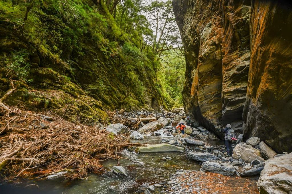
The Baiyang Trail features a series of tunnels that lead to the elegant water curtain of Baiyang Waterfall. The entire trip is 4.2 km (2.6 mi) long.
While some tunnels on the trail are short, straight, and simple, other tunnels are long and winding, leaving hikers in darkness. Hikers should bring a torch to find one's way in the dark, especially in the 380 meter (1,247 ft) long entrance tunnel.
The grand outlook of the waterfall forming a veil of water from the eroded mountain rock is best witnessed from the viewing deck, which is situated past the bridge. While the waterfall is the trail's highlight, the views of the precipitous cliffs from the tunnels are simply captivating, as the darkness of the tunnel frames the magical sight of marbleised ridges that dip sharply to the sparkling turquoise waters of the Liwu River.
The Bilu Giant Tree is a Taiwan fir that’s some 50 meters (164 ft) in height and 3.5 metres (11 ft) in diameter. It is the largest and potentially the oldest tree on the Central Cross-Island Highway at an estimated 3,200 years old.
Taiwan fir is known to exceed 70 metres (230 ft) in height, making it one of Taiwan’s tallest native trees. The Bilu Giant Tree is situated at 2,150 metres (7,054 ft) in elevation in a forest of various tree species, such as Taiwan hemlock, Chinese spruce, and other Taiwan fir. Below the woodlands, at lower elevations, is an evergreen mixed broadleaf forest of deciduous trees of Taroko oak and Taiwan trident maple.
A scenic spot off Zhongheng Highway, visitors can witness the sea of clouds resting above the mountains of Yangtou Shan, Ju Shan, Jiabeili Shan (加卑里山), Heiyan Shan (黑岩山), and Bilu Shan from Yugong Cliff.
The presence of Yugong Cliff cannot be mentioned without also telling the story of construction workers, mostly the Truku people, who were hoisted from the high cliff to drop explosives on the land below to create a road through the mountains.
Where there is now a highway was once rugged terrain. Many risked their lives to construct the highway through the mountainous era. In addition to being a scenic attraction, standing at Yugong Cliffs evokes somber thoughts thinking of the lives lost during the highway construction process.
Many visitors opt to stay in Hualien when exploring Taroko National Park; however, Nanhu Dashan is situated in the northwest region of this expansive park. The closest and most convenient city to reach Nanhu Dashan is Yilan (宜蘭市).
Yilan is synonymous with peaceful, calm, slow-living, a welcome respite from the nearby hustle and bustle from the capital, Taipei. Visitors who frequent Yilan find tranquillity and mindfulness from the abundant scenic beauty within and around this naturally picturesque city.
A popular place in the city for nature lovers is Fushan Botanical Garden, which is home to over 700 species of vascular plants. Visitors can embark on the generous 20 km (12.4 mi) path that explores the 410 ha (1,013 ac) of this living tree museum of Taiwan phoebe, Taroko oak, and the wheel tree (Trochendendron aralioides).
Just a short drive from Yilan lies Taipingshan National Forest Recreation Area, a luscious woodland sporting many trails that wind their way up the verdant mountains while passing derelict railways of a once-thriving logging industry. Visitors can hop on the Bong Bong Train to glimpse even more into the logging past as the train passes old wooden bridges, abandoned cabins and railway tracks.

Another favourite spot for nature lovers is Wufengqui Scenic Area, which houses the magnificent 100-metre three-tiered Wufengqi Waterfall. To observe the full view of the waterfall, visitors embark on a 1.8 km (1.1 mi) long hike, where the waterfall unveils itself layer by layer until the final showing of its majestic presence.
Qilan Wildlife Reserve is home to the Divine Tree Garden, a forest of 400 to 1,000-year-old Taiwan cypress and Taiwan red cypress. At least 51 of these trees possess divine status, which means they are over 1,000 years old. The age of the trees is reflected in their height. Thus, the 51 divine trees are known for their colossal presence.
In addition to admiring the Divine Tree Garden, visitors can also experience a forest bathing adventure along the Xiaotaishan Forest Bathing Trail, known for its production of fendoxin and anions, which aid in restoring one’s natural energy.
Apart from the glorious abundance of nature, no visit to a Taiwanese city is complete without venturing to a night market. Dongmen Night Market, situated on Gongyuan Road in Yilan, is filled with energy thanks to its illuminated strip of neon signboards and the merry repertoire of friendly vendors that line the streets. Visitors can tantalise their taste buds by trying the local Yilan specialities of Sanxing spring onion buns, pork and garlic soup, red yeast cuttlefish, and peanut roll with ice cream.
The gateway to Taroko National Park, Hualien, lies on the east coast of Taiwan, and its remoteness adds to the rustic charm of a sleepy seaside town. Fishing boats dot the shoreline while welcoming locals inviting you to explore the beautiful surroundings of this scenic city.
For many tourists who frequent Hualien City, the main reason is to visit the marble cliffs and meandering rivers of Taroko National Park. The easily accessible paths of the Shakadang Trail, Swallow’s Grotto Trail, and Changchun Shrine Trail are firm favourites with visitors. These trails venture along the aquamarine waters of the Liwu River, allowing tourists to marvel at the rock folds on the marble canyons and the ample variety of plant life in Taroko National Park.

The bold and grand traditional architectural style of Martyr’s Shrine pays respect to the fallen Kuomintang soldiers who fought in mainland China. While the building is stately and impressive, the outlooks from the grounds are equally impressive, as the majestic mountains of Taroko National Park loom in the distance.
Hualien Railway Culture Park is set in a 1932 wooden structure, showcasing well-preserved Japanese style buildings and old models of railway liners. Hualien Railway Culture Park is known for its quiet ambience as train-lovers enjoy observing historical train artefacts in the quaint quarters of the ancient railway setting.
Qixingtan Beach spans a long crescent-shaped stretch of black pebbles. While this beach is not ideal for swimming, the views are sublime, especially those overlooking the scenic Qingshui Cliffs, which sharply drop into the Pacific Ocean. In addition, Qixingthan Beach is the start and endpoint for the circular Coastal Bike Trail that leads cyclists inland through the highlands before returning to the seashore.
Liyu Lake is the largest inland lake in Hualien at 104 ha (257 acres). A 4 km (2.5 mi) circular path traces the outskirts of the lake so that visitors can admire the picturesque setting of the nearby mountain range while reflecting in the still and clear waters. The tranquil atmosphere is disrupted during Dragon Boat Festival, where dragon boat races are held annually, bestowing an exciting and celebratory atmosphere on an ancient tradition.
In terms of public transport, Hualien City offers the most convenient way to access Nanhu Ecological Reserve as far as Baiyang Trail and Bilu Giant Tree, as visitors can board one of the many buses that circle around the popular trails in Taroko National Park.
However, if visitors are wishing to make their own way there, then Yilan City is the closest drive to Nanhu Ecological Reserve at just 77 km (48 mi) away.
Visitors will generally start their journey in Taipei City. To get to Yilan or Hualien, visitors should board the TRA express train at Taipei Main Station heading to either of these cities.
If visitors are heading to Hualien, the Hualien Bus Company runs the 1133A, 1126 and 1141 buses, while the Taroko Bus Company runs the 302 bus. These hourly buses stop at the Baiyang Trail and Bilu Giant Tree.
To get to the other areas of Nanhu Ecological Reserve, visitors can rent a scooter or car to venture to the more remote and less accessible areas.


