
Scan the QR code and open PeakVisor on your phone
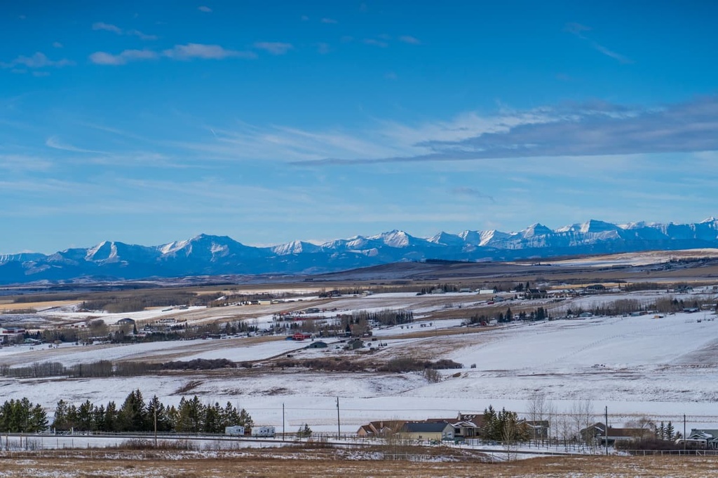
The Municipal District of Foothills (MD of Foothills) is an administrative region located in the southern part of the Canadian province Alberta to the south of the city of Calgary. The district is located in the foothills of the Canadian Rockies and has 9 significant summits, of which Okotoks Mountain is the tallest and most prominent with 1,762 m (5,781 ft) of elevation and 308 m (1,010 ft) of prominence.
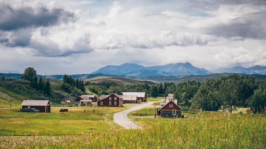
The MD of Foothills is situated in southern Alberta, Canada, in the foothills of the Rocky Mountains. The municipal district is located to the south of the city of Calgary and is home to the major cities and towns of Okotoks, High River, Turner Valley, and Black Diamond.
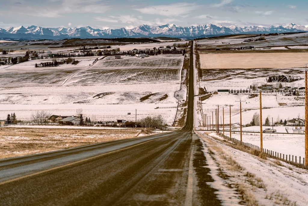
Highway 2 runs north to south through the eastern side of the district while Highway 22 (The Cowboy Trail), runs along the west side of the district. The Cowboy Trail traverses the foothills of the Rocky Mountains and is a spectacularly scenic drive.
The MD of Ranchland and Willow Creek are located to the south of the MD of Foothills while Wheatland County is located to the east. Rockyview County is situated to the north of the MD of Foothills, as is the city of Calgary. The Kananaskis Improvement District (Kananaskis Country) is also located to the west of the MD of Foothills.
As the MD of Foothills is located in the foothills of the Rocky Mountains, most of the land in the district is rolling rangeland that transitions into the flat prairies of Canada. However, there are still nine peaks that stand out among the foothills, of which Okotoks Mountain is the tallest and the most prominent with 1,762 m (5,781 ft) of elevation and 308 m (1,010 ft) of prominence.
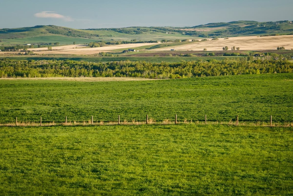
Most of the land in the MD of Foothills is productive land for grazing cattle and for growing crops, with little in the way of significant areas to be preserved.
Brown-Lowery Provincial Park and the Ann and Sandy Cross Conservation Area are the two main protected areas within the municipal district. However, the following are some of the many protected areas near the MD of Foothills:
The Laramide orogeny, which is the mountain formation event responsible for the formation of the Rocky Mountains, was also responsible for the formation of Alberta's foothills, for which the MD of Foothills was named. The Laramide orogeny lasted from about 75 million years ago and ended about 40 million years ago.
The collision of tectonic plates against the west coast of Canada caused the compression of the ancient coastal margin and the subsequent uplift of the Canadian Rockies. The initial force of the collision was strong enough to break the region’s Paleozoic marine sediment layers and thrust them over the younger Cretaceous layers to form the predominantly limestone Rockies that exist today.
However, as the force of the collision reached the eastern slopes, it had dissipated substantially, such that only the younger Cretaceous layers were thrust upward. The foothills in the region are mainly composed of uplifted Cretaceous sandstones and shales that were thrust upon the ground to the east.
When looking over the foothills from one of the many peaks in the Rockies, you can see the foothills running parallel to the eastern slopes and see how they were formed. The steep eastern slope is evidence that the layer of rock in the region was thrust eastward over the adjacent terrain.
The foothills, like the Rockies, were formed through a process called thrust faulting. The thrust faulting of the foothills makes them look like rows of roofing shingles extending from the mountains.
The MD of Foothills is located where two significant ice sheets of the Pleistocene once ebbed and flowed. The Cordilleran ice sheet, which covered the mountains at its greatest extent, flowed down the eastern slopes of what is now the municipal district and over the foothills.
Meanwhile, the Laurentide ice sheet, which once covered the eastern portion of Canada, occasionally reached nearly to the eastern slopes of the Rocky Mountains.
Formations of glacial till and the composition of the till helps scientists determine how far each ice sheet moved. Additionally these glacial till formations also give researchers an estimate of the approximate time periods where the ice sheets merged and when there was a corridor between the ice.
The two main ecologies in the MD of Foothills are the Foothills Parkland subregions of the Parkland Natural Region and the Foothills Fescue Subregion of the Grassland Natural Region.
Highway 2 is the divide between the two different ecologies. In particular, the Foothills Parkland zone’s primary use is for cattle grazing and hay production while the eastern Foothills Fescue zone is used to farm crops.
The Foothills Parkland zone is a transitional area between the Rocky Mountains and the prairies. It is characterized by rolling and hilly terrain, punctuated with the occasional significant rise. Aspen woodlands dot the terrain, and the natural grass in the region is predominantly fescue-oatgrass.
Toward the eastern part of the municipal district, the topography levels out and the prairies begin. The trees are sparser in the Foothills Fescue Zone and are mainly found along river and creek banks.
There are two reasons why the western side of the MD of Foothills has a greater variety of wildlife than the eastern side. The first reason is that the foothills are a transitional area and contain the wildlife native to the mountains and the prairies.
Some of these animals include mule and white-tail deer, bobcats, moose, elk, wolves, coyotes, fox, and many more small mammals. Bears will sometimes find their way out of the mountains and into the foothills; however, their eastward migration is not common.
The second reason that the east side of the MD of Foothills has less diversity in its wildlife is that the foothills are the most densely populated area in Alberta. As such, intensive settlement and agriculture have occurred since the early 1800s. This intensive settlement and farming has cut off and replaced many of the natural habitats with crops that do not support a diversity of wildlife.
The MD of Foothills and the eastern slopes in general, are part of the area that is called the ice-free corridor.
The ice-free corridor once connected Alaska and Yukon to the southern half of North America via a stretch of ice-free land between the Pleistocene ice sheets. There were several periods where the route between the north and the south was free of ice during the past 100,000 years.
The ice-free corridor is one of the speculated migration routes that enabled the human inhabitation of North America. While it is possible that the route through Alberta was the migration route of the first humans to the southern half of North America, the initial migration likely would have occurred before the final opening of the corridor.
Archaeological evidence suggests that at the end of the Pleistocene, by over 13,000 years ago, people were already established in North America. Archaeological findings also suggest that habitation of what is now Canada began in the south, and as the ice melted and the lands became more hospitable, people migrated north, following the migration of large mammals.
The MD of Foothills contains archaeological evidence of past cultures as well as records of the flora and fauna that covered and inhabited the foothills. In particular, the river banks contain countless archaeological sites, such as hunting camps, bison kill sites, and other evidence of continuous occupation of the region for thousands of years.
The Blackfoot Confederacy, the Tsuu T’ina, Stoney, and the Ktunaxa First Nations have traditionally inhabited and used the foothills territory to the south of what is now Calgary.
Since the 1800s, when European settlement of the west began, the foothills and their Chinook winds have been a popular place for settlers. In addition to the relatively nice climate, the region is close to good agricultural land, forestry resources, as well as potential mine sites in the Rockies. As such, the district is home to some of the largest and oldest ranches in Alberta.
While there are not many protected areas and unique landscapes in the MD of Foothills, there are still plenty of worthwhile hikes and local attractions. The following are some of the places to look for while travelling in southern Alberta.
Located about 7 km (4 mi) west of the city of Okotoks, Alberta, the Okotoks Erratic, also known as ‘Big Rock’ is the world’s largest known erratic. This light grey, pink, and purplish quartzite rock is about 9-meters tall (30 ft), 41-meters long (134 ft), and 18-meters wide (59 ft) and weighs 16,500 tonnes.
The rock is part of the Gog Formation, which consists of layers of sediment that were deposited between 600 and 520 million years ago in a shallow sea. The layer was covered by upwards of 4 km (2.4 mi) of additional sediments. Eventually, the heat and pressure caused by the weight of the overlying sediments compacted the sand into the incredibly hard and durable quartzite that exists today.
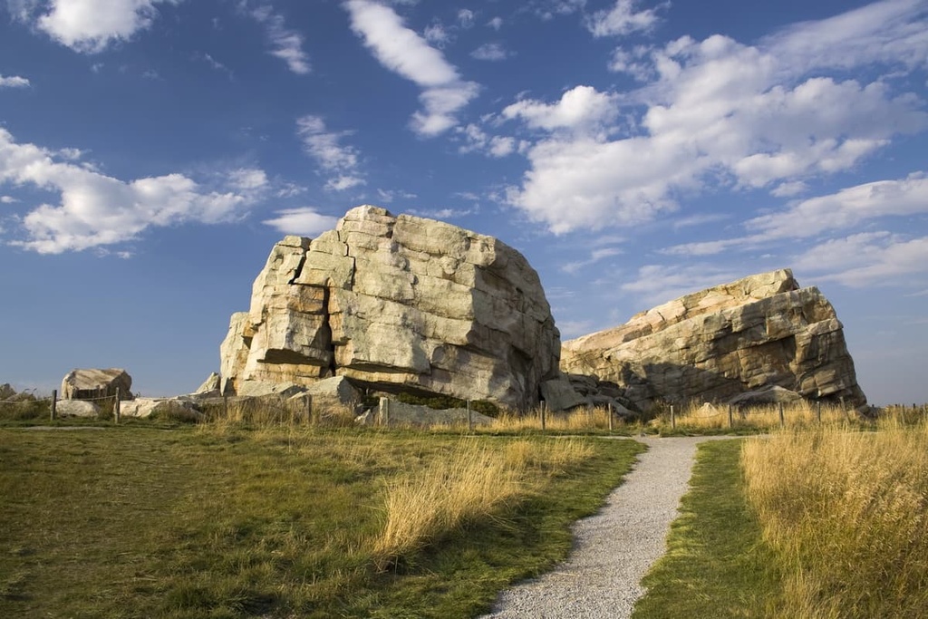
During the Laramide orogeny, the layer of rock from which the Okotoks Erratic originated was pushed up and formed part of a mountain in Jasper National Park, 500 km (300 mi) to the northwest. During the Pleistocene, about 30,000 years ago, a rockslide crashed debris onto a glacier that filled the Athabasca Valley.
The glacier grew out of the mountains and was then pushed south, possibly as it connected with the Athabascan ice sheet, taking its cargo of massive stones for a ride to southern Alberta. As the ice melted, glacial debris that included the Okotoks Erratic was left behind as testament of the reach and power of glacial ice.
Located along the Cowboy Trail (Highway 22) near Longview, Alberta, the Bar U Ranch was one of the leading ranching operations in Canada for 70 years after its founding in 1881. At its peak, the ranch encompassed 65,000 ha (160,000 acres). It was also home to 30,000 head of cattle and 1,000 Percheron horses.
While most of the land was eventually sold, the core of the ranch was kept and maintained until, in 1991, Parks Canada purchased the ranch to create a National Historic Site. The ranch contains a remnant of the rich ranching history in southern Alberta.
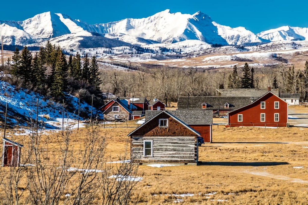
Founded by Fred Stimson and owned by the likes of George Lane and Patrick Burns, the ranch also has connections to Harry Longabaugh who broke horses at the ranch before becoming “the Sundance Kid.”
The MD of Foothills is in southern Alberta, Canada and is primarily composed of ranch and farm land. The municipal district borders the beautiful wilderness of Kananaskis Country, and contains some exciting remnants of historical events such as the Okotoks Erratic and the historic Bar U Ranch.
Here are some of the major communities located in and around the MD of Foothills:
Located in the foothills of the Rocky Mountains, Calgary is the largest city in Alberta. It is often seen as a gateway to the Rocky Mountains, and it is located just to the north of the MD of Foothills. Many tourists come through Calgary on their way to Canmore, Banff, and the parks of southern Alberta.
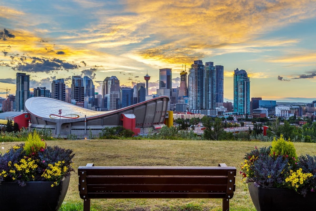
During the summer, there are many outdoor events in Calgary ranging from street festivals to The Nationals at Spruce Meadows, and the Calgary Stampede. Year-round productions are hosted by Calgary Philharmonic Orchestra, Calgary Opera, and the many theater companies.
Some of the popular hiking areas near Calgary are Kananaskis Country and Banff National Park. Kananaskis Country envelopes many provincial parks such as the Peter Lougheed, Bow Valley, Spray Valley Provincial Parks.
The name Okotoks is derived from ohkotok, which is the Blackfoot (Siksiká / ᓱᖽᐧᖿ) word for “rock.” This possibly refers to the Big Rock, or the Okotoks Erratic, which is the largest known glacial erratic in the world. The rock played an important role as a navigational tool for many First Nations that lived and hunted on the prairies and in the foothills.
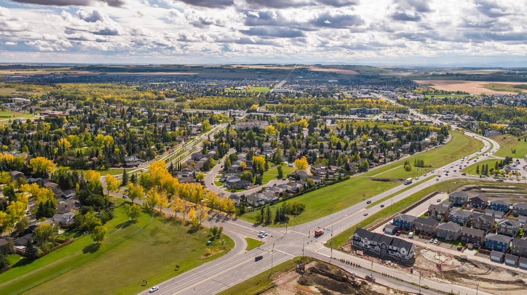
Initially, the town grew around a sawmill that was established in 1891. It would later grow in size to become one of the largest towns in Alberta. While Okotoks has its own thriving economy, the town is considered to be a bedroom community for Calgary, the same as Airdrie to the north and Cochrane to the west.
The Sheep River runs through the middle of the town and there are also many parks and green spaces. Walking trails connect the different communities and typically lead towards the river.
Okotoks is also situated near Kananaskis Country, which is home to many provincial parks that offer stunning scenery and beautiful hiking experiences.
Some of the parks to the west of Okotoks include Bluerock Wildland Provincial Park, Peter Lougheed Provincial Park, the Plateau Mountain Ecological Reserve, and the Elbow-Sheep Wildland Provincial Park.


