Scan the QR code and open PeakVisor on your phone
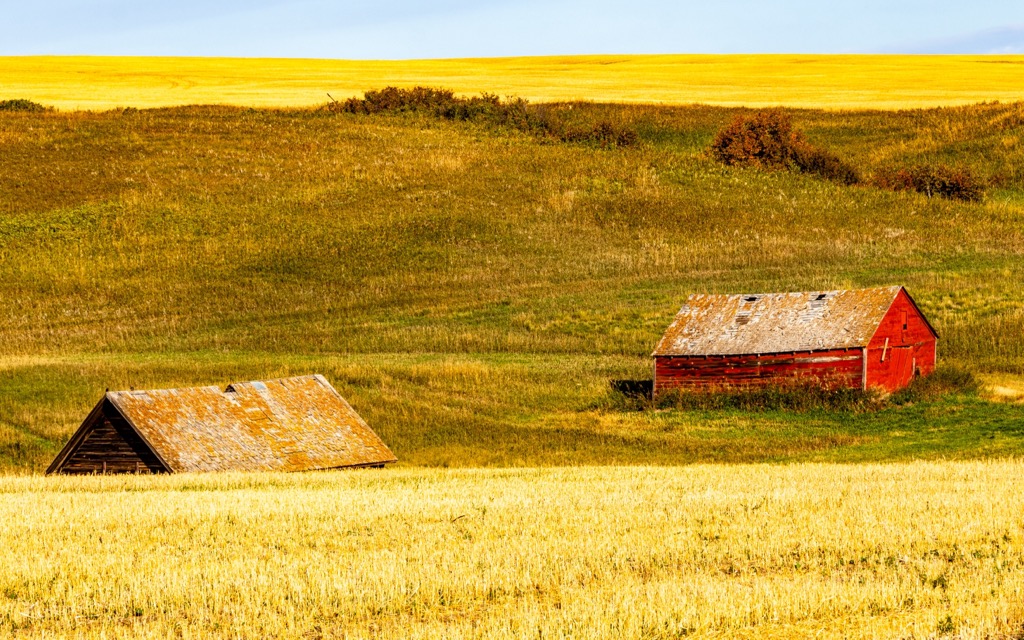
Wheatland County is a municipal district in south-central Alberta, Canada. The county is east of Calgary and the Trans-Canada Highway is the major route through the county. The county encompasses 4,505 square kilometers (1,739 square miles) or rangeland, prairie farmland, and the north side includes part of the Badlands.
Located in south-central Alberta, Canada, Wheatland County is just east of the city of Calgary, along the Trans-Canada Highway. The county offices are located east of the county’s largest community, Strathmore.
The county encompasses 4,505 square kilometers (1,739 square miles) of mainly farmland and ranchland. The north side of the county is part of the Alberta Badlands, where the unique geology has led to the discovery of many fossils.
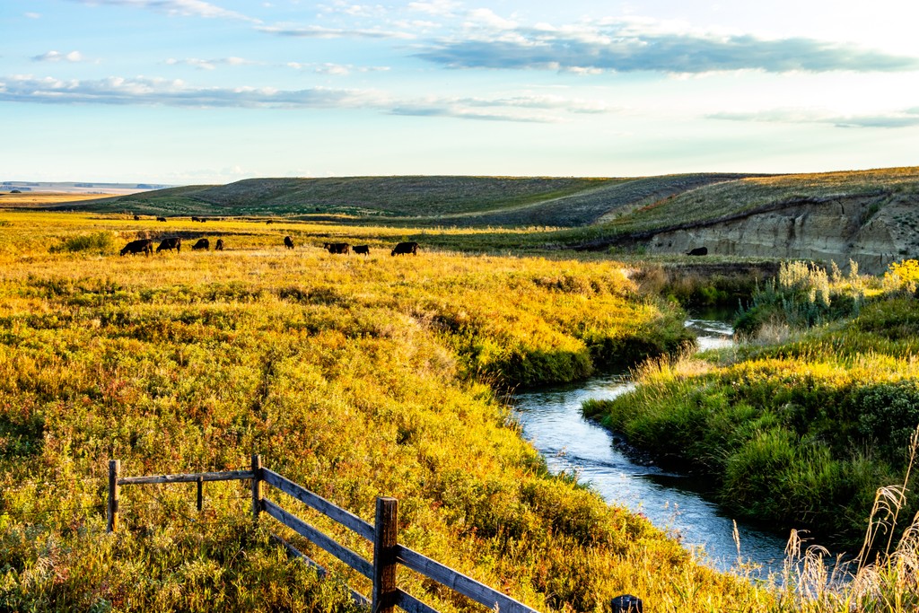
There are 6 named hills in the county, the tallest of which is the Wintering Hills which are in the northeast corner of the county, adjacent to the Badlands. The Bow River is the county’s southern border, the Red Deer River forms the northeastern boundary, and the Rosebud River and Serviceberry Creek are the major waterways in the county.
The county is almost completely divided into agricultural parcels and there are no formal wilderness areas, parks, or recreational areas in the county; However, some of Alberta’s incredible non-mountain parks are adjacent to the county. The following are the parks and recreation areas near Wheatland County:
At the end of the Jurassic, about 140 million years ago, the North American continental margin was essentially western Alberta. At this time, oceanic tectonic plates were beginning to press against the west side of North America, adding new terranes to the continent and starting the formation of the Canadian Cordillera.
While the tectonic collision compressed the crust and began to form the Columbia and BC’s Interior Mountains, Alberta’s crust atop the North American tectonic plate was depressed, causing flooding in what became the Alberta Basin. Sediments from the west poured into the basin, covering the ancient swamps.
The sediment accumulated and formed thick layers of rock which continued to depress the basin. However, during the Cretaceous, about 72 to 65 million years ago, the tectonic collisions along the west coast had lifted the west side of the continent so much that the sea water retreated from the basin and Alberta dried out for the final time.
The bedrock formations of Wheatland County are generally Tertiary aged erosion surfaces or deposits of Cretaceous aged sandstone, siltstone, shale, mudstone, and coal. The coal was formed from the ancient peat bogs that once covered parts of Alberta, where bacteria was able to transform dead plants into the valuable resource.
Furthermore, the coastal and swampy ancient history of Alberta and the subsequent drying up make it a hotbed for paleontological discoveries. There are some areas of paleontological importance in the southern end of the county near the community of Cluny; however, the richest areas of fossil discovery are in the northeast corner of the county, near Rosebud, Dallum, and the Badlands canyons along the Red Deer River.
While the ecology of Wheatland County is defined as part of the Foothills Fescue subregion of Alberta’s Grassland Natural Region, about 80% of the county is cultivated for agriculture. Crops are abundant across the county and the areas that are less than ideal for crops are typically used for grazing cattle.
The Grassland Natural Region is characterized by a level to rolling landscape and is often referred to as prairie. However, while a significant portion of the prairies is used for agriculture, there are still some distinct habitats in the county.
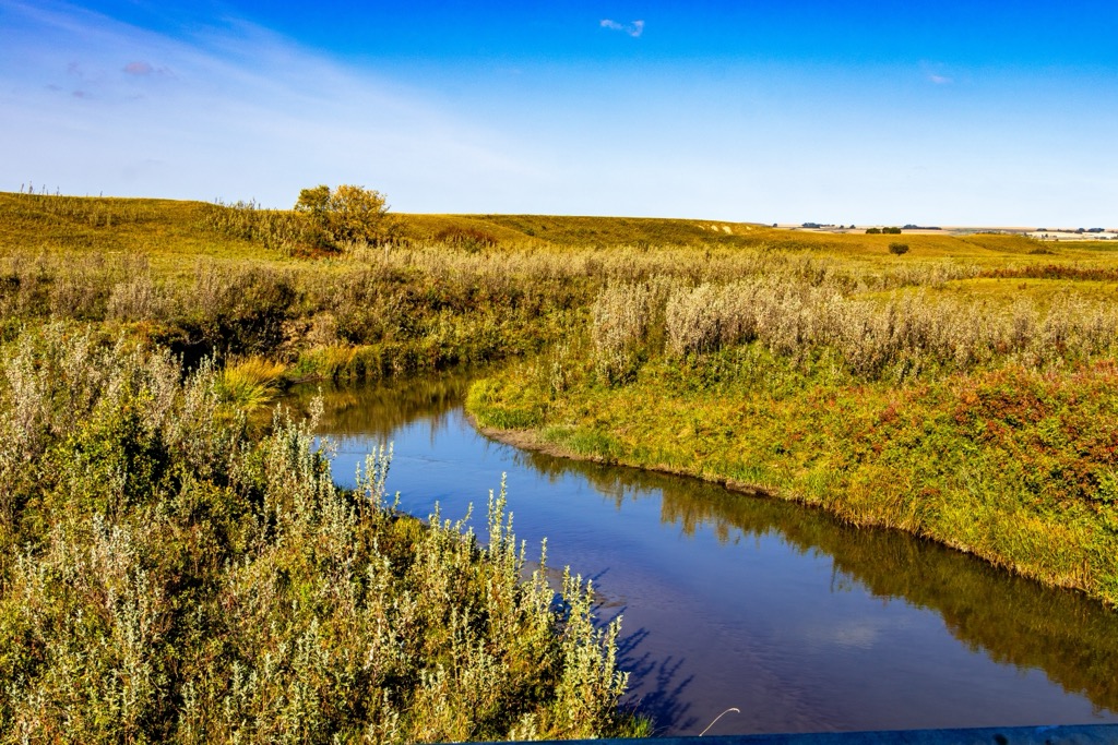
Some of the natural grasslands remain and woodlands grow in narrow strips along the rivers. The wetlands tend to be shallow and saline, and the rocky outcrops of the badlands are home to many birds and animals.
Some of the animals that are found throughout the county are the swift fox, greater sage-grouse, mountain plover, painted turtle, short-horned lizard, and the western rattlesnake. Richardson’s ground squirrels are an important food source for predators such as the ferruginous hawk, American badger, and coyote. Furthermore, white-tailed and mule deer roam the prairies, as do some moose.
People began to inhabit the grasslands, and the foothills east of the Rockies about 12,000 years ago. The warming effects of the Chinook winds made the region a popular area for winter camps for thousands of years and countless generations.
Wheatland County is part of the ancient ice-free corridor that once stretched from Yukon and Alaska, through Alberta, connecting the north to the southern half of North America. At the end of the Pleistocene, the strip of land along the eastern slopes of the Rockies was the first area to become ice free.
Starting in the south, the ice melted along the slopes, where the Laurentide and Cordilleran ice sheets coalesced. The ice sheet continued to melt and during the earliest part of this ice-free period, the region was filled with giant bison, mastodons, camels, and many more prehistoric megafauna.
More recently, the valleys of the eastern slopes and foothills were prime winter grazing for herds of bison. The county is part of the traditional territory of the Blackfoot Confederacy, who are a collective of linguistically related groups which included the Siksika, Kainai, Peigan nations as well as the allied Tsuu T’ina and A’aninin.
The Blackfoot Confederacy lived in bands that consisted of 80 to over 200 people that fished for trout and hunted bison on the prairies. The confederacy had adopted the use of the horse which allowed them their extended range and mobility, and within short order of arriving on the western prairies, they soon dominated the region. The Blackfoot have a reserve on the south side of the county.
Wheatland County has many archaeological sites that consist of teepee rings, medicine wheels, fire pits, and the effigy of a man that may represent the Blackfoot trickster deity, Napi. It is likely that many archaeological sites were destroyed as settlers arrived in the late nineteenth century as they planted crops and moved the stones that were meticulously laid by prehistoric people.
The vast prairie views are beautiful in Wheatland County throughout the year and there are different activities and amenities to visit. Each season offers a different perspective on the landscapes and the cultural destinations within the county. The following are some of the major attractions in Wheatland County.
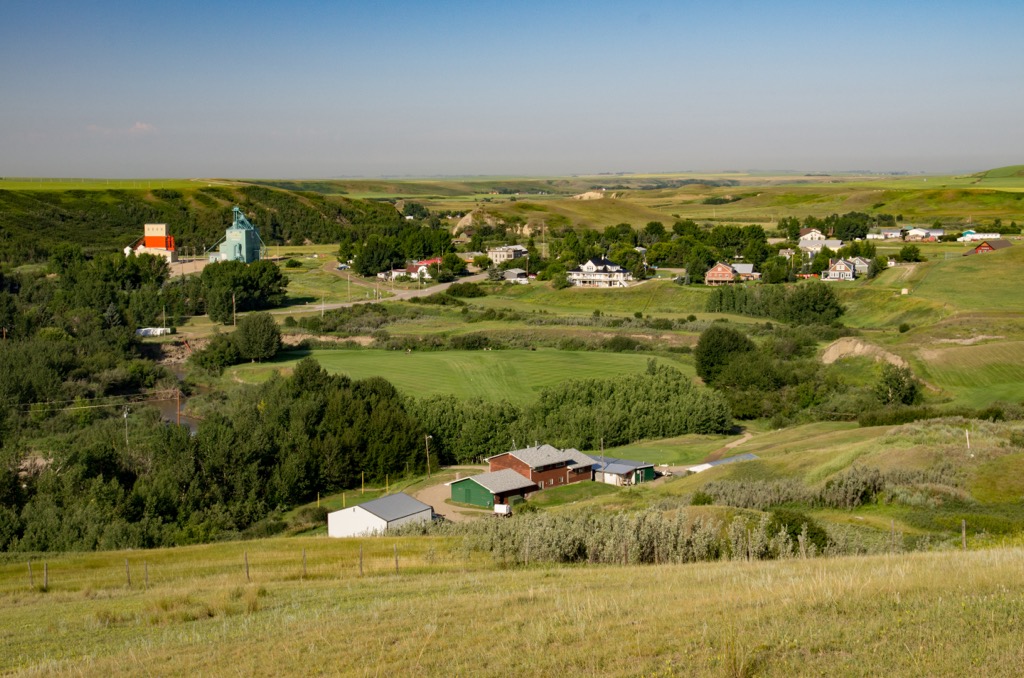
The small communities of Wheatland County are home to several historic sites and buildings that were constructed at the turn of the twentieth century. Visitors can take a day or, better yet, a weekend, and explore the historical sites of the county.
Some of the historic sites pertaining to the settlement of the county are St. Andrew’s Anglican Church, the Beach/Rennie House, and the Gleichen water tower, all of which are in Gleichen. The Rosebud Hotel has historical significance and the Scheer/Sproule farm site near Strathmore which is one of the original farms in the county.
Alberta has thousands of archaeologically significant sites pertaining to prehistory and the first inhabitants of the prairies. There are many sites in Wheatland County with the remains of teepee rings, cairns, and other remnants of the habitation of the prairies.
To learn more about the culture of some of Alberta’s indigenous, people are encouraged to visit Blackfoot Crossing, which is a museum located on the Siksika Reserve. The museum is an immersive experience that helps visitors understand the culture of the Blackfoot. You are introduced to their culture and people, as well as shown the hardships that were endured by the First Nations.
Other places to visit are the archaeological sites that are around the county. Most of the sites are concentrated along the south side, in the Siksika Reserve and along the Red Deer River, in the Badlands. Many sites are on public record and their locations can be found with some investigation. One of the major ancient sites to visit is the location of the Ward Effigy.
The ward effigy is one of fourteen known or probable male boulder outline figures on the prairies, of which eight are in Alberta. Collectively known as Napi figures, they are related to Napi, a Blackfoot creation figure who traveled the region and is said to have placed these figures to outline where he rested on his journey. The site is located immediately north of the Siksika Nation, about 100 km (60 mi) from Calgary.
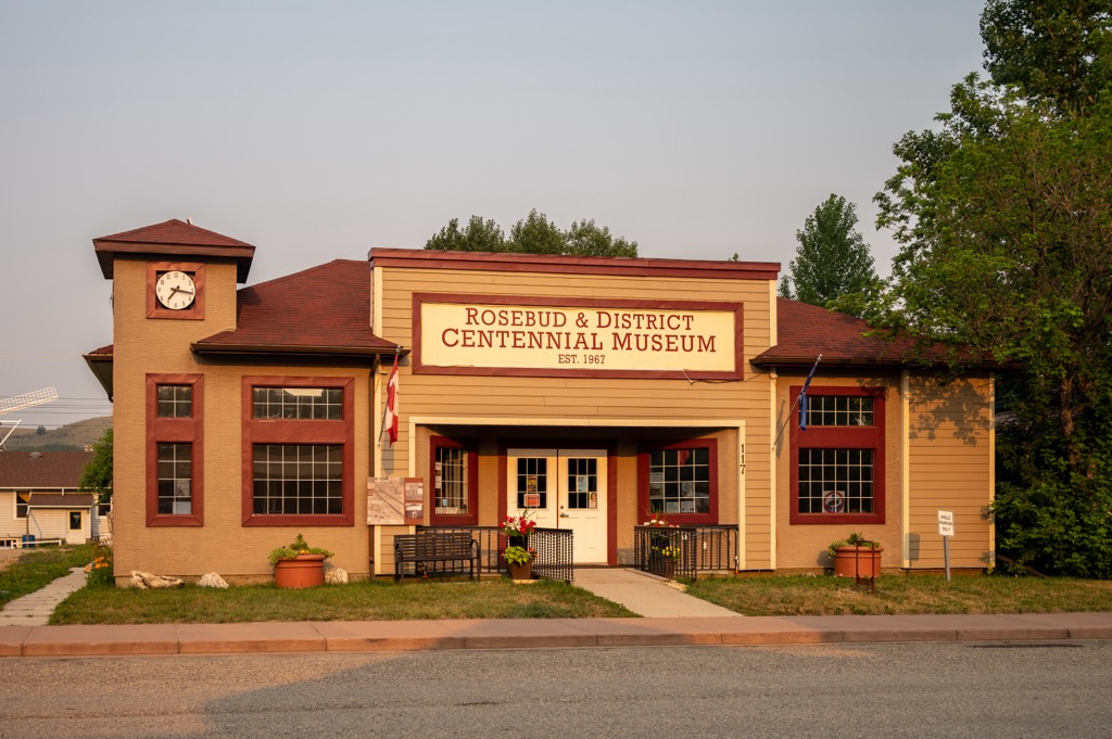
In the community of Rosebud, which is along the edge of the Canadian Badlands, the Rosebud Theatre is a surprisingly popular regional attraction. Presented in the community opera house, there are live theater events year-round. Many visitors will go for dinner and a show, or they may spend the weekend in the charming community.
The following are the major and popular communities in and around Wheatland County.
Calgary is located less than 50 km (30 mi) west of Wheatland County. The city has a population of around 1.4 million people, with many outdoor enthusiasts that regularly head west into the mountains.
While Calgary is often used as just the airport that tourists fly into so they can make their way to the majestic Rockies; however, Calgary is a destination in its own right. There are many cultural and natural attractions to keep visitors busy and entertained.
Locals and visitors can make their way across the city via the paths that connect all the major parks and greenspaces from Fish Creek Provincial Park in the south of Calgary, to Nose Hill Park in the north, and the Glenmore Reservoir in between.

Furthermore, local and Canadian history are highlighted alongside international exhibits at the Glenbow Museum. The Calgary Tower gives you a bird’s eye view of the city that has sprawled out from the river over the past 100 years, and the Calgary Zoo is a fantastic example of animal husbandry and wildlife conservation efforts, some of which include studying whooping cranes to aid in their recovery as a species.
Finally, the annual Calgary Stampede runs for 10 days in July and with its midway, concerts, rodeo, chuckwagon races, grandstand show, and daily fireworks it is the self-proclaimed “Greatest Outdoor Show on Earth.”
Located just north of Wheatland County, Drumheller is situated in the stunning topography of the Canadian Badlands. The topography appears otherworldly, though fossils are the major attraction to the area.
There are many hikes and viewpoints within the park and region that pass by and overlook archaeological sites where fossils, ranging from microscopic fern spores to giant carnivores such as Albertosaurus, are routinely excavated.
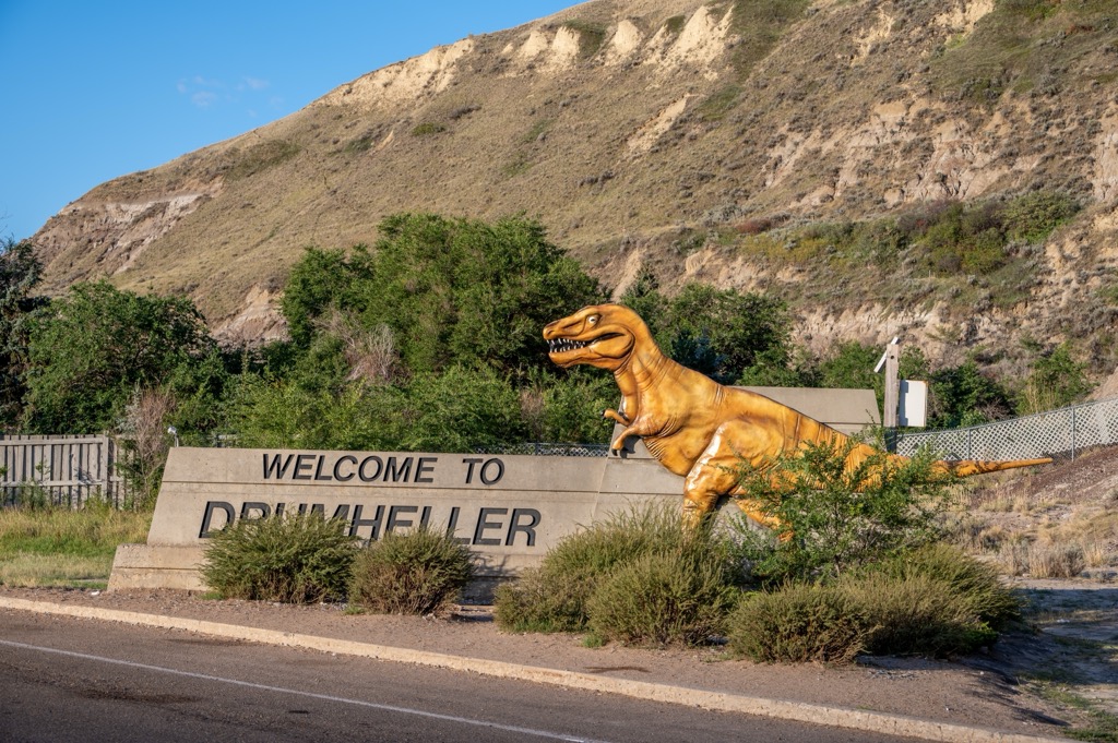
The nearby Dinosaur Provincial Park is a UNESCO World Heritage Site as it is one of the richest dinosaur fossil locations in the world. The Royal Tyrrell Museum is generally responsible for archeological studies in the area and fossils from 58 dinosaur species have been found, with over 500 specimens removed for display around the world.
Situated in a beautiful valley along the edge of the Canadian Badlands, Rosebud has a reputation as “the” place for charming live entertainment. The community theater presents shows year-round at the community opera house and their popularity rises with each performance.
Visitors can come for the day to enjoy dinner and a show, or there are packages that allow you to stay in one of the charming accommodations around town for the weekend of your preferred show. Furthermore, there are many lovely places around Rosebud to walk or hike and explore the incredible Canadian Badlands.