
Scan the QR code and open PeakVisor on your phone
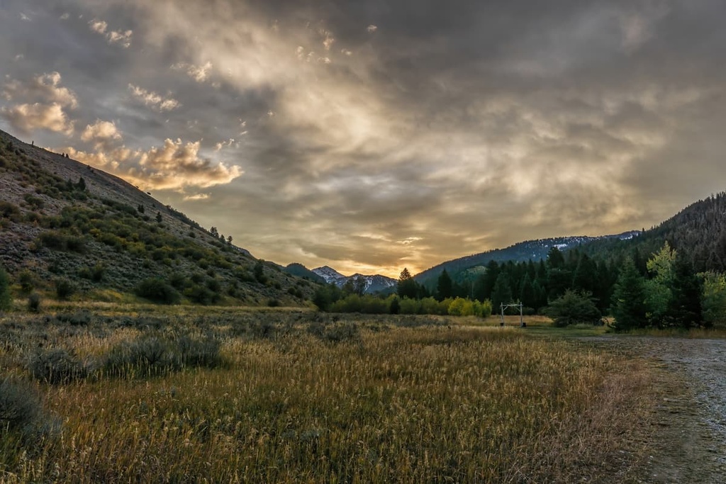
The Big Hole Mountains are located in the eastern part of the US state of Idaho. The range is home to rugged ridgelines, streams, and meadows. The tallest and most prominent peak in the Big Hole Mountains is Garns Mountain with 9,016 ft (2,748 m) of elevation and with 2,247 ft (685 m) of prominence.
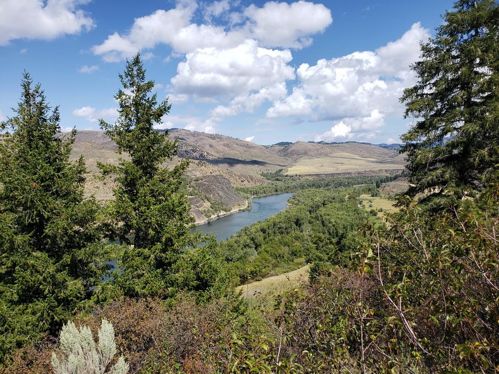
The Big Hole Mountains are situated in eastern Idaho, near the state’s border with Wyoming. The Snake River lies to the south, forming the southwestern border of the range. Meanwhile, the Teton River roughly marks the range’s northeastern boundary.
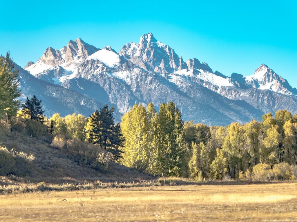
These mountains are part of the larger Snake River Range. Additionally, the Tetons extend out from the northeastern part of the Big Hole Mountains and continue to the north. As the rugged peaks in the range are situated to the west of the Teton Basin, the Big Hole Mountains tower above the flat lands of southern Idaho.
The Snake River Plain marks the western boundary of the range. As such, the Big Hole Mountains are particularly prominent above the surrounding landscape. To the southeast lies the Palisades Reservoir, while smaller lakes and streams are scattered throughout the range.
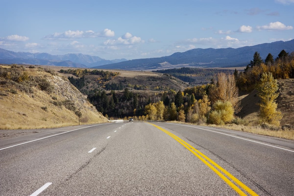
The range lies within Caribou-Targhee National Forest alongside the Snake River Range. Route 26 also follows along the Snake River, providing access to hiking throughout the Big Hole Mountains.
Though the Big Hole Mountains and Snake River Range share different names, the two ranges are physically and geographically the same. Pine Creek Pass Road, also known as Highway 31, cuts across the landscape, forming the artificial line that distinguishes the two ranges.
The Big Hole Mountains are surrounded by a number of parks and national forests. To the east lies Bridger-Teton National Forest, Grand Teton National Park, and the Gros Ventre Wilderness Area, while Yellowstone National Park lies to the northeast.
The Big Hole Mountains are a subrange of the larger Greater Yellowstone Rockies. As a whole, the Rockies span from British Columbia, Canada to New Mexico in the southwestern US. The peaks in the Big Hole Mountains mark some of the westernmost peaks in the Greater Yellowstone Rockies.
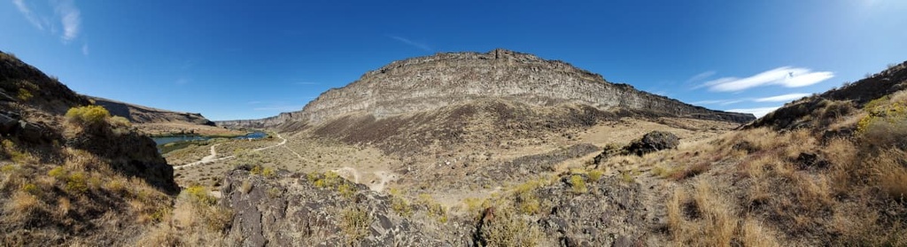
The peaks within the Big Hole Mountains are part of the Overthrust Belt within the Rockies. This belt formed during the Sevier orogeny, which took place during the Cretaceous.
During this time, continual thrust faulting and folding deformed the thick layer of sedimentary rock that dominates the region. This continual folding created a region that’s particularly geologically complex.
This layer of sedimentary rock is believed to have originated on the west coast of the US. Over the course of millions of years, the rock moved eastward until it collided with another rock. The layer of sedimentary rock was lifted on top of the other rock, forming the rugged peaks that we see today.
Glacial lakes and cirques can be seen throughout the landscape, showcasing the glacial history of the range. Rock slides are also common in both the Big Hole Mountains and the Snake River Range due to the abundance of talus fields in the region.
Major peaks within the Big Hole Mountains include Garns Mountain, Stouts Mountain, Piney Peak, Ryan Peak, and Henderson Peak.
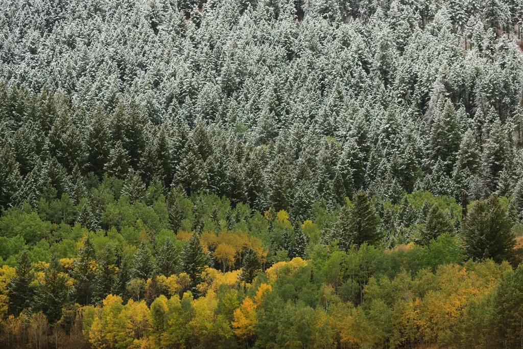
The landscape varies dramatically throughout the Big Hole Mountains, allowing a variety of flora and fauna to thrive. Dense sections of forest cover much of the landscape, though rocky summits and alpine pastures are also common in the range.
Forested sections in the Big Hole Mountains are populated by Douglas fir, Engelmann spruce, and subalpine fir trees. Lower elevations also provide the ideal habitat for aspen and bigtooth maple.
At higher elevations in the range, flora consists of various wildflowers. Common species include coneflower, lupine, and monkshood, which often bloom during the summer months amidst the alpine meadows.
Relatively few roads run through the range, allowing for a variety of animals to thrive in the mountainous environment. Populations of elk, mule deer, coyotes, black bears, and bighorn sheep all inhabit the region. The Snake River is also home to some of the best trout fishing in the entire region.
Humans have inhabited the land surrounding the Big Hole Mountains for over 10,000 years, long before Europeans arrived in the region.
The region is part of the traditional territory of the Shoshone, Gros Ventre, Nez Perce, Bannock, Blackfoot, and Crow. Traditionally, the mountains provided fantastic hunting grounds during the warmer months of the year, while the lower elevations along the Snake River provided the ideal respite from the mountains during the winter months.
Peoples of European descent began arriving and settling in the region sometime around the early nineteenth century. Their arrival was not always welcome as, in many cases, it resulted in the forced removal of Indigenous peoples in the region from their ancestral homelands.
In response, many local tribal nations, including members of the Shoshone and Bannock tribes, began fighting back against the settlers. For example, the Shoshone joined forces with the Bannock tribe in an effort to take back their ancestral land in what was known as the Snake War. However, at the end of the nineteenth century the Shoshone people were forced to move to reservations in Idaho and Wyoming.
Settler communities continued to grow in the coming decades after the war, particularly during the construction of the Palisades Dam during the 1950s. This dam led to the formation of the Palisades Reservoir, which is located to the southeast of the Big Hole Mountains.
Today, much of the range lies within the Caribou-Targhee National Forest. The mountains are used primarily for hiking and backpacking, with trails that span from the summits of some of the highest peaks down to the valley of the Snake River.
The Big Hole Mountains are home to numerous hiking trails. Here are some of the most popular hiking areas in the range:
Kelly Canyon Trail is one of the most popular hiking routes within the range. The loop trail is 3.7 miles (5.9 km) long with 613 ft (187 m) of elevation gain.
Located on the southwestern edge of the range, this route offers stunning views of both the mountains and the flatlands to the west. After a short climb through the forest, the trail opens up on the hillsides, with shrubs and wildflowers dominating the surrounding landscape.
The Websters Dam trail is a 2.7 mile (4.3 km) out and back route with 587 ft (179 m) of elevation gain. The trail is relatively flat and can be reached by a 4x4 vehicle. The trail winds its way through the forest before reaching a small bridge that crosses over a stream.
From there, hikers have views of the short, yet powerful Manmade Falls. The surrounding forest and unique rock formations make this an enjoyable hike with minimal elevation gain.
Situated on the northern edge of the Big Hole Mountains lies Packsaddle Lake. Roundtrip, the trail is 5.2 miles (8.3 km) long with 1,072 feet (327 m) of elevation gain. However, the trail can be shortened to 2 miles (3.2 km) with a 4 wheel drive vehicle.
After walking along the service road, the trail narrows for the final mile before dipping down to the lake. Dense forested sections surround the blue green waters of the lake, however, there’s also a beach that’s perfect for enjoying a mid-hike snack.
Looking for a place to stay near the Big Hole Mountains? Here are some of the best cities and villages to check out in the region:
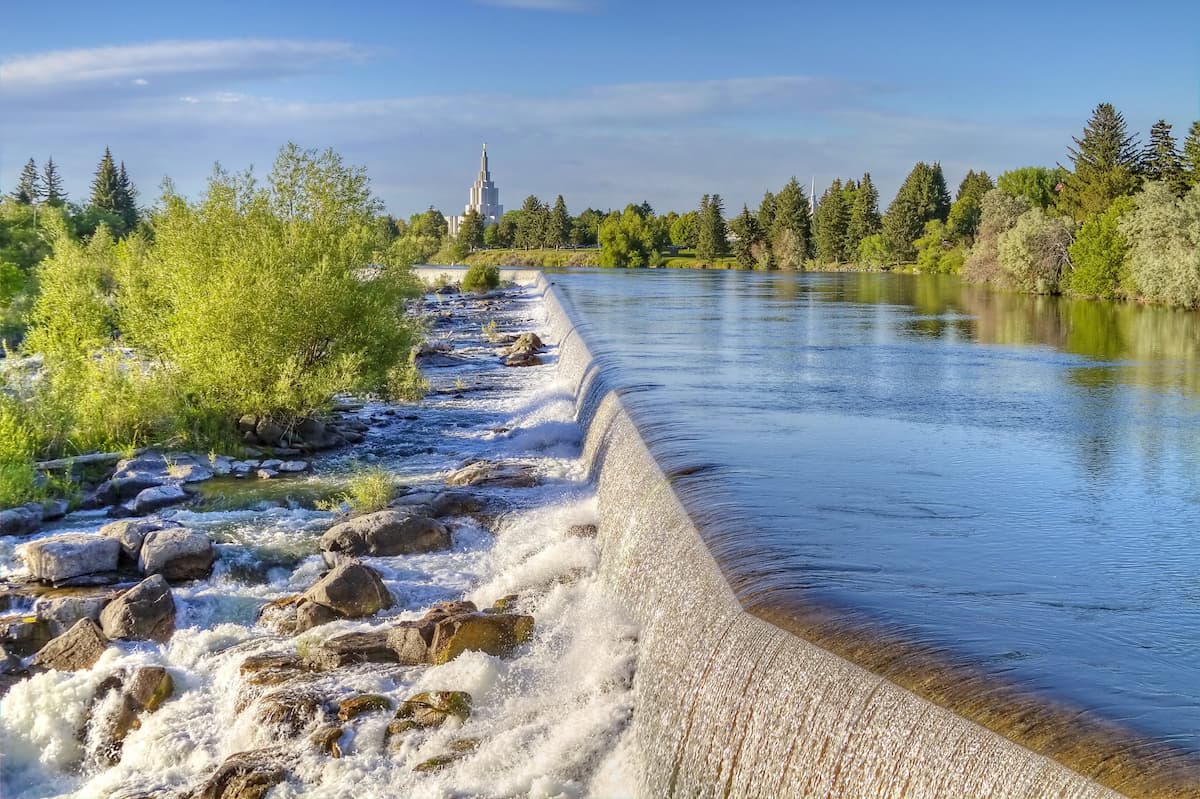
West of the Big Hole Mountains lies the city of Idaho Falls. With a population of around 65,000 people, the city is the most populous in the state outside of the Boise metropolitan area. Idaho Falls is a cultural hub for much of eastern Idaho and western Wyoming.
The Snake River runs through the city and there are nice walking paths along its banks. Both the Art Museum of Eastern Idaho and the Museum of Idaho are located within the city, too, showcasing the history and arts of the region. The city is located in close proximity to the Caribou-Targhee National Forest, which offers trails for hiking and mountain biking.
Jackson, Wyoming is a small mountain town located within the Jackson Hole Valley in Teton County. The city has a population of around 10,000 people and is a popular tourist destination. Surrounded by the Jackson Hole Mountain Resort, Grand Teton National Park, Yellowstone National Park, and Snow King Mountain, the city is busy throughout the year.
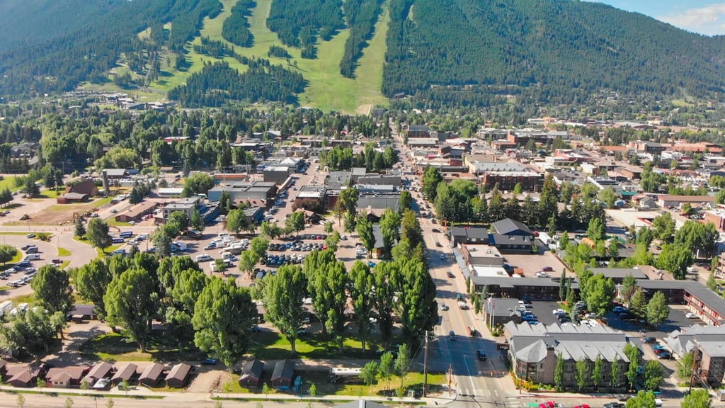
Hiking, mountain biking, and skiing are some of the most popular activities in the surrounding region. Besides outdoor activities, Jackson is home to numerous local restaurants, art galleries, and boutiques.


