
Scan the QR code and open PeakVisor on your phone
The Tarvantovaara Wilderness Area is one of the 12 wilderness areas in Finland. It is located in the country’s Lapland region, and its main feature is that it contains a point of the Struve Geodetic Arc in Finland, which is a UNESCO World Heritage Site that helped to provide the earliest accurate measurements of the shape and size of the Earth. There are 11 named mountains in the wilderness, the highest and most prominent of which is Urtivaara (661 m / 2,169 ft).
The Tarvantovaara Wilderness Area (Tarvantovaaran erämaa-alue) gets its name from Tarvantovaara (593 m / 1,945 ft), a mountain that is located to the northwest of the wilderness’ geographical center. In turn, the word Tarvantovaara comes from the language of the Sámi, the Indigenous Finno-Ugric-speaking people of Lapland.
Naming wilderness areas after peaks is a common occurrence in the northern region of Finland. The names of these wilderness areas may have different endings, such as vaara, tunturi, or oaivi, but these are all different words for mountains in the various Sámi languages.
The Tarvantovaara Wilderness Area is located in Finland’s Lapland. It is situated at the base of the northwestern arm of Lapland near the country’s border with Norway. This area is the northwesternmost part of Finland and its peaks belong to the Scandinavian Mountains.
In total, the Tarvantovaara Wilderness Area encompasses 670 sq. km (258 sq. mi) of terrain. It is also administratively part of the municipality of Enontekiö, which is the largest municipality in the Lapland region.
Additionally, Tarvantovaara is located in close proximity to a number of other protected areas including Käsivarsi Wilderness Area (Käsivarren erämaa-alue) to the west and Pöyrisjärvi Wilderness Area (Pöyrisjärven erämaa-alue) to the east. To the southeast of Tarvantovaara is Pallas-Yllästunturi National Park (Pallas-Yllästunturin kansallispuisto), Finland's most popular national park in terms of its total number of visitors (over 500,000 annually).
To the north, the wilderness area extends to the boundary between Finland and Norway. Meanwhile, to the south, the wilderness almost reaches the international border between Finland and Sweden.
The easiest and fastest way to get to the Tarvantovaara Wilderness Area is from the capital of Lapland, Rovaniemi.
From Rovaniemi, you can get to one of a number of towns that are located near the wilderness. For example, you can travel from the city to Kuttanen in the south (toward Kaaresuvanto), where you can then pick up a dirt road that leads to Kultima on the southernmost border of the wilderness area. Or you can travel to Leppäjärvi and Palojärvi, which are located on the eastern borders of the wilderness.
You can make the journey from Rovaniemi by car or bus. In turn, you can get to Rovaniemi by plane, train, and bus from Helsinki.
When traveling in Finland by bus, however, it’s important that you learn at least a little bit of Finnish. Not all of the drivers outside of the major cities will speak English, so, at a minimum, write down and learn to pronounce clearly the name of your route and the stop where you want to get off. Otherwise, if you miss a stop, you can easily find yourself 100 or even 200 km (62–124 mi) away from your destination.
You can buy your bus tickets in advance online at Matkahuolto.fi.
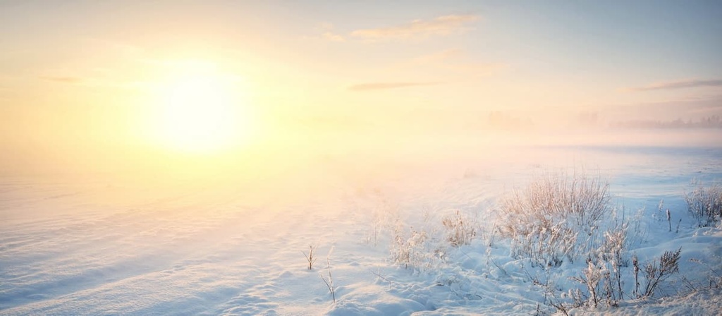
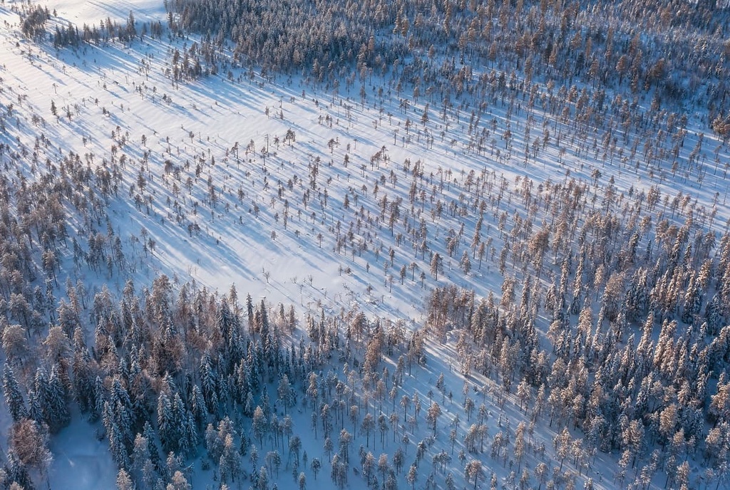
To the south of the Tarvantovaara Wilderness Area is the northern limit of pine growth in Lapland. That said, even in these southerly regions of the wilderness area, you will only find small trees that are no more than 10 m (33 ft) in height. Further to the north, only pines and fell birch forests grow on vast mires and uplands of fell tundra.
The landscape in the wilderness is primarily home to low-lying shrubs and other similar plants. Here, you can find lichens and dwarf shrubs such as Scapania uliginosa, marsh saxifrage, and Trisetum subalpestre.
With respect to fauna, the area is known for its large bird population. This includes species such as golden eagles, gyrfalcons, and broad-billed sandpipers, among others.
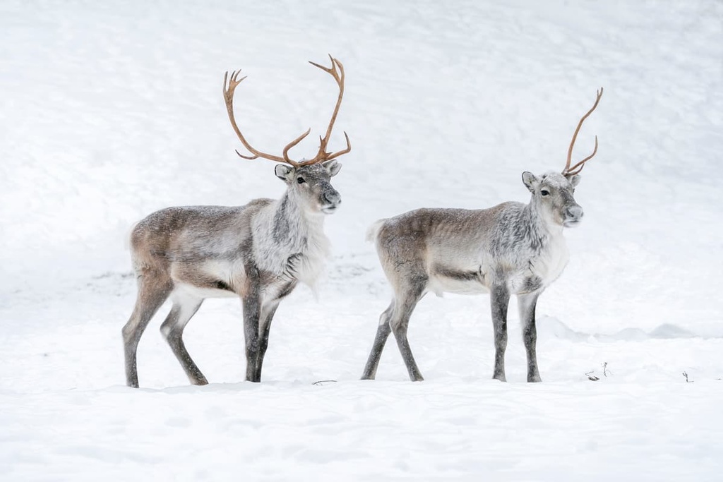
Among mammals, you can find many kinds of large predators in the wilderness, including bears, lynxes, wolverines, Arctic foxes, and others. Wolves are sometimes found here, but, like everywhere else in Lapland, they have become a very rare phenomenon.
All of the named mountains in the Tarvantovaara Wilderness Area belong to the Karelides. This is a range of low-lying hills or fells that reach elevations of up to 1,000 m (3,280 ft).
In particular, the highest mountain in the area, Urtivaara, reaches an elevation of only 661 m (2,169 ft). These mountains used to be as high as 5,000 m (16,404 ft) in elevation, like the Alps, but they have since been eroded away by geological forces over the course of millennia.
However, neither Urtivaara nor Tavantovaara is the most famous peak in the wilderness area as this title is held by Stuorrahanoaivi (543 m / 1,781 ft). Stuorrahanoaivi is located in the northern part of the wilderness close to Finland’s border with Norway.
The Tarvantova Wilderness Area has two marked hiking trails as well as one unmarked trail that follows an old road. Here’s what you need to know about hiking in the wilderness area before your next trip to the region.
The Kultima—Leppäjärvi Trail is the most popular trail in the south of the wilderness area. It travels between the villages of Kultima and Leppäjärvi.
This trail is 25 km (15.5 mi) long one way, which is suitable for either a day hike or a one-night overnight trip. An overnight trip is arguably the better option as it gives you time to enjoy the wild Finnish nature. In my experience, 10 km (6.2 mi) of walking with stops is enough for one day on this trail.
The Kultima—Leppäjärvi Trail leads through a lichen-filled dry forest. But there are some wet sections of this trail that do not have duckboards over them, so bring some waterproof boots to keep your feet dry as you hike.
The Kaaresuvanto—Syväjärvi Trail is another great hiking trail in the wilderness area. It winds its way from the village of Kaaresuvanto on the southwestern borders of the wilderness area and heads northward to the lake named Syväjärvi.
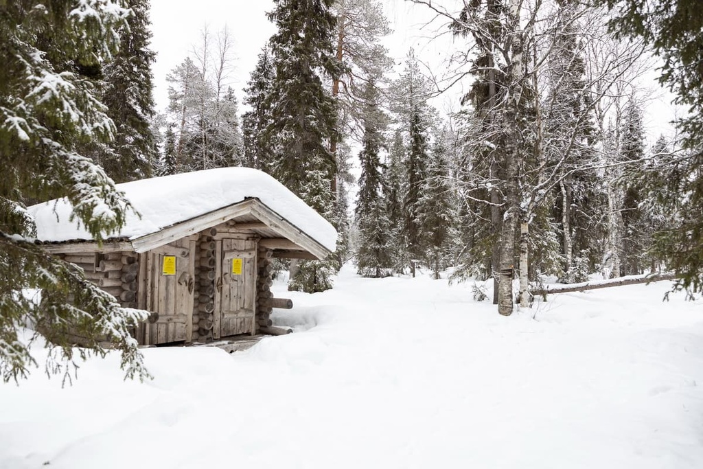
At the lake, you’ll find an open wilderness hut near Lavivaara (552 m / 1,811 ft) where you can spend the night. This trail is approximately 20 km (12.4 mi) long, so it’s ideal for a day trip or a quick overnight adventure.
If you’re looking for yet another hiking trip in the wilderness, you can walk on an old road in the very north of the region. This road travels between the village of Palojärvi and the reindeer herders’ summer cabins at the lake named Salvasjärvi, which is located near Finland’s border with Norway.
This trail is also about 20 km (12.4 mi) long. Salvasjärvi is also the name of the open wilderness hut that’s located along this trail. Alternatively, near the beginning of the hike, you can also stay at the Puussasvaara hut.
Stuorrahanoaivi (543 m / 1,781 ft) is the most important peak in the wilderness area, and for good reason: It is home to one of Finland’s six triangulation station points, which are part of the Struve Geodetic Arc.
You can get to the station point (this one is called Stuor-Oivi/Stuorrahanoaivi) by heading off of the Palojärvi-Salvasjärvi Trail in the direction of the lake named Ravaltojärvi. The summit with the station point is located to the east of the lake.
The other five points of the Struve Geodetic Arc in Finland from north to south are:
All these objects look slightly different. In some places these station points are towers, but in others, they are crosses carved in stone or even important buildings like the Alatornio Church. Stuor-Oivi is a small wooden structure made of several logs that are connected in the shape of a triangle.
The Struve Geodetic Arc in Finland was put into place between 1850 and 1852. It provided the most accurate measurements of the shape and size of the Earth at the time. The arc is a chain of 265 triangulation points that stretch across almost 3,000 km (1,864 mi) of Norway, Sweden, Finland, Russia, Estonia, Latvia, Lithuania, Belarus, Moldova, and Ukraine.
The arc is named after the German-born Russian geographer and scientist Friedrich Georg Wilhelm von Struve, who initiated the measurements. Struve’s main achievement is that his measurements allowed him to confirm that the Earth is an ellipsoid rather than a perfect sphere.
Further satellite measurements confirmed Struve’s measurements with a discrepancy of no more than 2 meters (6.6 feet), which means that they were impressively accurate.
Since 2005, the Struve Geodetic Arc in Finland has also been designated as one of seven UNESCO World Heritage Sites in Finland. The other UNESCO sites in the country are:
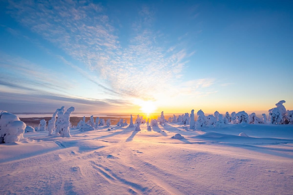
There are no maintained skiing trails in the Tarvantovaara Wilderness Area, but you can ski along any of the wilderness area’s snowmobile tracks.
There are two such snowmobile tracks in the wilderness that follow the same path as two of the region’s hiking trails. One of these snowmobile tracks goes from Palojärvi to Salvasjärvi and another goes from Kaaresuvanto to Syväjärvi. The Kultima-Leppäjärvi Trail can also be used for winter wilderness treks.
You can learn about the closest major ski resorts to the wilderness area on the Finland page of the World Mountains Lifts section on PeakVisor’s website.
The closest visitor's center to the Tarvantovaara Wilderness Area is located in the southeastern part of the region in the village of Hetta, which is the capital of the municipality of Enontekiö. This info point is also the main visitor center for the entire Lapland region, so be sure to visit it during your trip to the area.
Fell Lapland Visitor Center
Peuratie, 15, 99400, Enontekiö, Lapland, Finland
Open all year round with varying hours
+358206397950
In addition to the three aforementioned open wilderness huts in the Tarvantovaara Wilderness Area (Syväjärvi, Salvasjärvi, and Puussasvaara/Palojärvi), you can pitch a tent and make a fire anywhere you want in the region.
Finland’s Everyman’s Right law gives you permission to camp and make fires nearly anywhere in the country except in certain highly protected areas. That said, it’s best to camp on already impacted sites to minimize your impact on the environment.
You can also find plenty of lodging in the area surrounding the wilderness. Many of the villages in the region offer cottages, campgrounds, hotels, and caravan parking areas for visitors to enjoy. You can find accommodation options in the villages of Kaaresuvanto, Kuttanen, Leppäjärvi, Palojärvi, and Hetta.
Enontekiö is the largest settlement in the region around the Tarvantovaara Wilderness Area. It is a great place to start your travels in the area, least of all because it is home to the region’s main tourist office.
The second most important settlement in the region is likely Karesuvanto, which is located on the southern borders of Tarvantovaara. It is a small village with just over 140 inhabitants. It is located on the locally important Muonio River, which forms part of Finland's western border with Sweden. It is also located on the European route E8, which travels from Tromsø, Norway, to Turku, Finland.
The most interesting fact about Karesuvanto is that another village with a similar name, Karesuando is located on the Swedish side of the river. The two villages are parts of the same locality, which has a total population of about 470 people. However, an international border separates the two villages. Interestingly, the villages have only been linked by a road bridge since 1980.
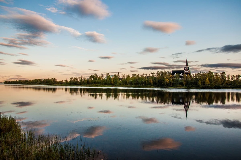
The main architectural landmark of the Finnish Karesuvanto village is a small church called Karesuvannon kappeli, which has an interesting design and is painted in a beautiful blue color. In the village, there is also a large cottage complex called the Davvi Arctic Lodge, as well as several bars, including Rajabaari and Palaveri Blue Star.
For more information, check out the official tourist site of Enontekiö: EnontekioLapland.com.


