
Scan the QR code and open PeakVisor on your phone
Southern Nantahala Wilderness has 44 named peaks. The highest is Standing Indian at 1,677 m. Other notable peaks include Lower Trail Ridge, Upper Trail Ridge and Big Scaly.
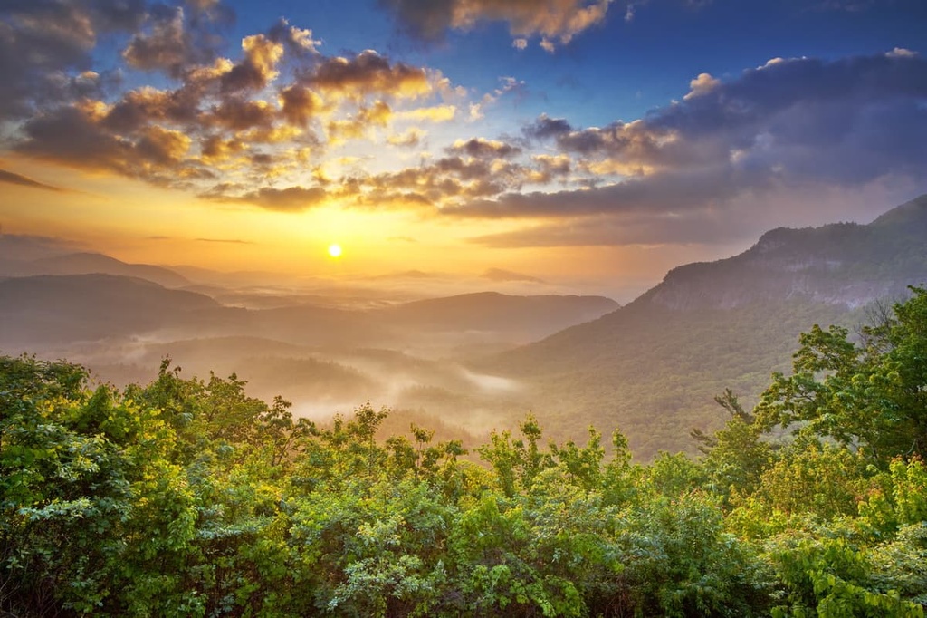
The Southern Nantahala Wilderness is a federally protected area located in southern North Carolina and northern Georgia in the eastern US. It is part of the Nantahala National Forest in North Carolina and the Chattahoochee-Oconee National Forest in Georgia. There are 44 named mountains in the wilderness area. The highest and most prominent of these peaks is Standing Indian (5,502 ft/1,677 m).
Designated as a wilderness area in 1984, the 23,365 acres (9,455 ha) of the Southern Nantahala Wilderness are divided between the US states of Georgia and North Carolina.
Approximately 11,732 acres (4,748 ha) of the wilderness area lie within Nantahala National Forest in North Carolina. The other 11,633 acres (4,798 ha) of the wilderness are part of the Chattahoochee-Oconee National Forest in Georgia.
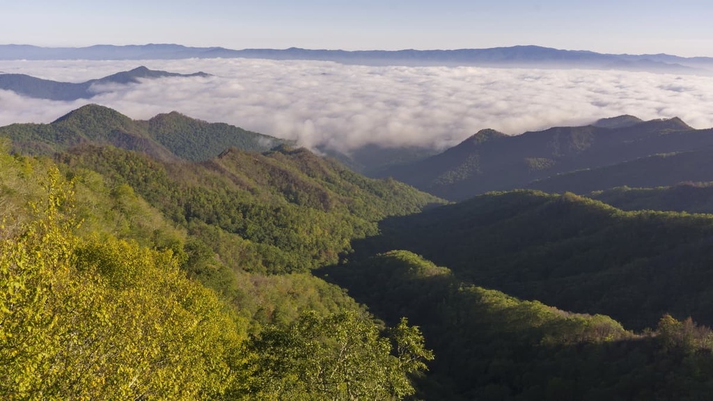
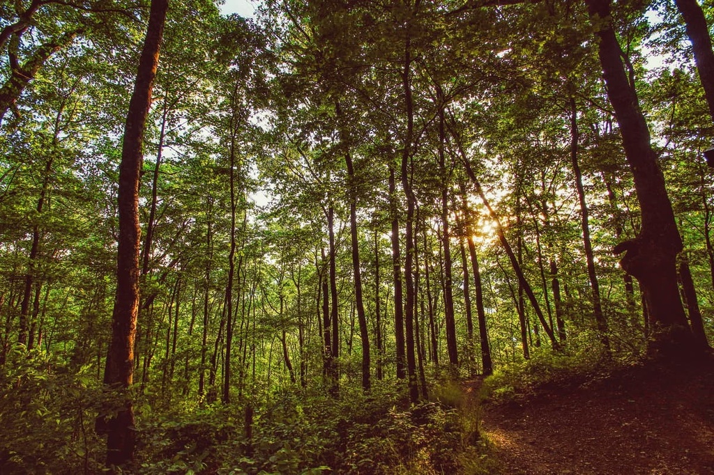
The peaks in the area are part of the southern end of the Blue Ridge Mountains, a subrange of the Appalachian Mountains. Multiple streams and drainages cut through the steep, forested mountains of the wilderness area and flow into the Nantahala, Hiwassee, and Tallulah rivers.
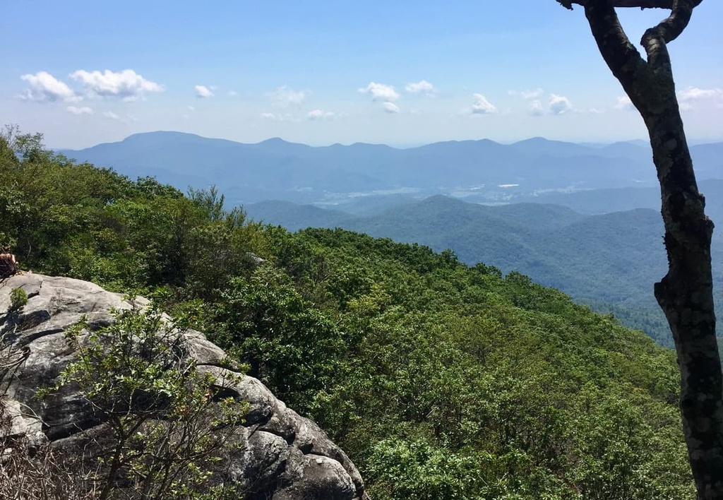
The Appalachian Trail runs through the wilderness area, too. Around 32 mi (51.5 km) of the trail traverses the North Carolina portion of the wilderness area along the Nantahala Range ridgeline while the other 4 mi (6.4 km) of the trail crosses the wilderness in Georgia.
In addition to the rest of the Nantahala National Forest and the Chattahoochee-Oconee National Forest, the Southern Nantahala Wilderness is surrounded by other areas of public land. This includes the Overflow Wilderness Study Area and Satulah Mountain Preserves to the east, the Fires Creek Backcountry Area to the north, and the Swallow Creek Wildlife Management Area to the south.
As they are a part of the Blue Ridge Mountains, the mountains in the Southern Nantahala Wilderness are composed of schists, gneisses, slates, and quartzites, all of which are metamorphic rocks that date back mainly to the Precambrian. There are also extensive igneous rock intrusions among the metamorphic rocks in the region.
The southern Appalachian Mountains have multiple rock layers that are fragments from the collision that created Pangea. In particular, the area features multiple thick layers of sedimentary rock that were deposited in sinking basins, as well as sedimentary and volcanic rocks from the seafloor and even fragments of oceanic crust.
This layering of igneous and sedimentary rock in the region is a result of the collision of the African and North American continental plates. These plates were then pulled apart from each other by rifting, which provided an ideal space for sediment to gather over the course of the next few millions of years.
The Blue Ridge Mountains are a source of multiple mineral resources and gems. Feldspar, in particular, is abundant in this area of North Carolina and the forest’s Spruce Pine district is one of the country’s leading producers of this mineral. The town of Franklin, North Carolina, is also famous for the gems found in its mines.
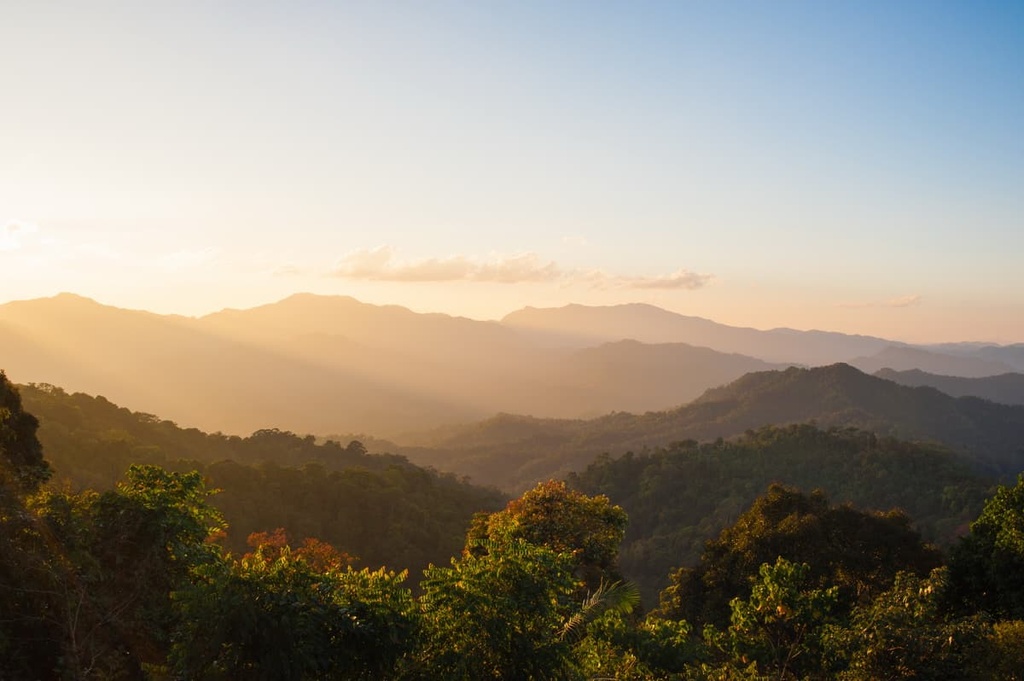
Spruce and fir trees grow on the ridges of the wilderness area. Meanwhile, mixed hardwoods fill in the slopes and lower elevation areas of the Southern Nantahala Wilderness. Although much of the forest in the region was heavily logged around the turn of the twentieth century, thanks to reforestation and conservation efforts, much of the wilderness area is now thickly wooded.
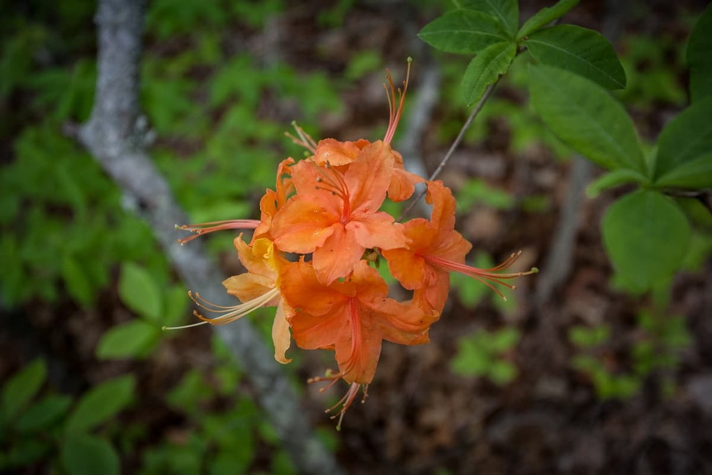
During the spring and summer months, the mountains in the wilderness area come alive with flowering plants like rhododendrons, mountain laurel, dogwoods, and azaleas.
Wildflowers bloom throughout the warmer months in the region, offering visitors a chance to see violets, trilliums, trout lilies, and bluets. Later in the year, the fall months boast an incredible display of color as the region’s deciduous trees turn bright shades of yellow, orange, and red.
The streams and bogs in the wilderness area support a host of different plants and animals. Several species of salamanders, land snails, fish, crayfish, and mussels are endemic to the region. Other animals, such as the bog turtle, are endangered and find important habitats in the wilderness area’s bog systems.
Many birds depend upon the higher elevation spruce-fir forest of the Southern Nantahala Wilderness. Among these species are the red crossbill (Loxia curvirostra), the northern saw-whet owl (Aegolius acadius), black-capped chickadee (Poecile atricapillus), red-breasted nuthatch (Sitta canadensis), brown creeper (Certhia americana), winter wren (Troglodytes hiemalis), and the golden-crowned kinglet (Regulus satrapa).
Mammals commonly found within the deciduous forests of the wilderness area include bears, deer, coyotes, raccoons, bobcats, skunks, and a wide variety of rodents.

The name Nantahala comes from Cherokee and can be translated as ‘Land of the Noonday Sun.’ Here, among the thick forest and deep gorges, sunlight penetrates the shady forest only when the sun is high in the sky.
The Cherokee and Creek peoples have ancestral ties to what is now the Southern Nantahala Wilderness. When gold was discovered in the region around 1838, many of the Indigenous people in the region were forced to leave their homelands and were sent to reservations in Oklahoma along the Trail of Tears.
Stretches of the Trail of Tears remain to this day and are preserved as part of the region’s history within the Nantahala National Forest.
As the region’s gold sources became increasingly depleted, settlers switched their focus to logging. Much of the old-growth forest was cut down in the region. Access roads and railways were subsequently carved out in the forest to facilitate the transportation of timber.
The Forest Service began buying land to create what is now the Chattahoochee National Forest and Nantahala National Forest in 1911. Over the course of the following decades, the Forest Service strove to reforest and repopulate the region with native species such as deer and trout. Although much of the old-growth forest was cut down in the wilderness, efforts to reforest the mountains and preserve vital habitats in recent years have been successful.
Most hiking takes place on the North Carolina side of the wilderness area, though there are some limited marked trails in the Georgia part of the wilderness, too. The trails in the Southern Nantahala Wilderness are steep and challenging but popular among the backpackers who seek out rugged landscapes and extended adventures in the region.
Here are some of the best hikes in the Southern Nantahala Wilderness to check out during your next trip to the area.
The only developed trail on the Georgia side of the Southern Nantahala Wilderness is the 4 mi (6.4 km) stretch of the Appalachian Trail that runs north-south through the wilderness area.
If you’re looking for a bit of a longer hiking trip in the wilderness area, you can continue hiking on the Appalachian Trail into North Carolina. Here, you’ll find another 32 mi (51.5 km) of the Appalachian Trail that runs along the ridge of the Nantahala Mountains. In this area, the trail offers sweeping vistas of the surrounding mountains from its many summits and ridgelines.
The Standing Indian Mountain via Deep Gap Trail is popular for its moderate length and intensity. It is approximately 5 miles (8 km) long round trip and it climbs about 1,100 ft (335 m) through thick patches of rhododendron and deciduous forests.
This hike starts at the Deep Gap Trailhead, which is located along Forest Service Road 71 near Franklin, North Carolina. The trail passes several campsites and a primitive shelter for Appalachian Trail thru-hikers. Just before the summit of Standing Indian, you’ll also find a junction for the Lower Ridge Trail, so you can turn this into a longer hike, too.
The Lower Ridge Trail begins in the Standing Indian Basin. It is 4.2 mi (6.8 km) long one-way, and it gains approximately 2,000 ft (610 m) in elevation as you make your way to the summit of Standing Indian Mountain. Around 600 ft (183 m) from the summit, the Lower Ridge Trail connects with the Appalachian Trail at mile marker 87.4.
This trail departs from the road near Standing Indian Campground. The trailhead is located off of Forest Service Road 67 near Franklin, North Carolina.
The Pickens Nose Trail is only 1.5 mi (2.4 km) long round trip, but it winds its way through thickets of rhododendron and offers impressive views from a rocky summit for relatively little effort.
The elevation gain from Pickens Nose Trailhead to the summit of Pickens Nose is around 350 ft (107 m). The trailhead for this hike is located off of Forest Road 83 near Franklin, North Carolina.
Primitive camping is allowed within the Southern Nantahala Wilderness unless stated otherwise. If you want to car camp, you can stay at the Standing Indian Campground, which is a developed campsite with toilets, showers, drinking water, and parking for trailers. Three shelters are also located along the Appalachian Trail within the wilderness area for backpackers to enjoy.
Otherwise, if you’re looking for a place to stay near the Southern Nantahala Wilderness, there are a few towns and communities located nearby that are worth checking out. Here’s a quick look at some of the best places to visit during your next journey to the wilderness area.
The town of Franklin, North Carolina, has a population of around 4,000 people and is known as the “Gem Capital of the World.” The Cowee Valley lies just to the north of the town and draws thousands of visitors to its mines each year. Among the most commonly found gems in the region are rubies, sapphires, and garnets.
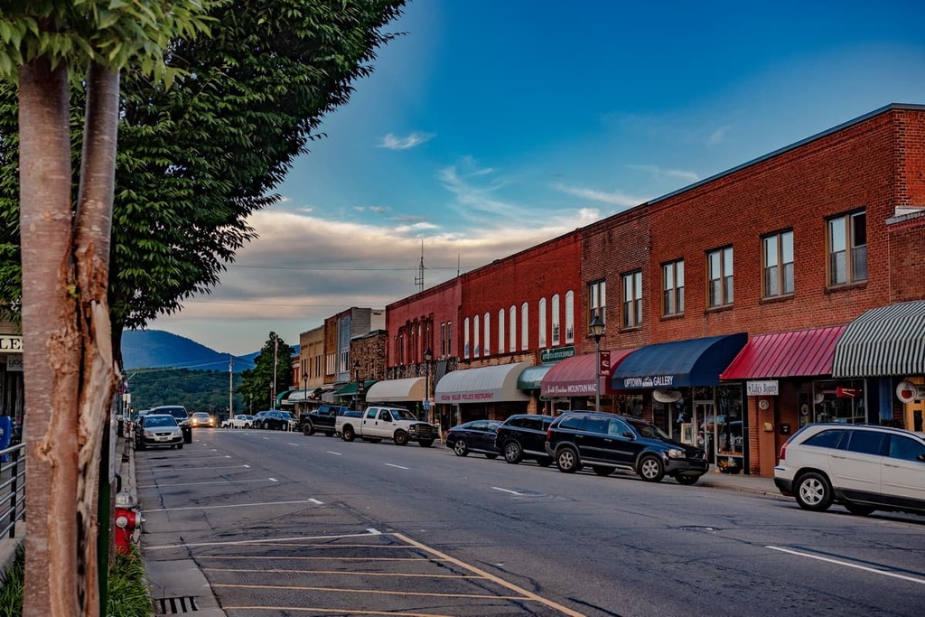
The downtown area of Franklin celebrates the town’s gemstone fame with the Franklin Gem and Mineral Museum. The main street of the town is home to a cute array of shops, galleries, and restaurants. One can find a motel, hotel, or quaint B&B in town, or you can sleep out under the stars at one of the many campsites surrounding Franklin.
If you want to set out on an adventure from Franklin, check out the Wayah Bald Lookout Tower, which is located nearby. The tower is popular for the panoramic vista that it affords of the surrounding region. Franklin is also located between Cullasaja and Nantahala Gorges, making it a prime stop for those looking to get outside and explore the region’s impressive gorges.
Highlands, North Carolina, is a small town with a population of 3,200 people that swells to 18,000 or more in the summer months. It sits at 4,118 ft (1,255 m) elevation, making it one of the highest elevation towns located to the east of the Mississippi River.
This resort mountain town is located along the scenic Highway 64, and it gives visitors both great views and easy access to the surrounding forests. The downtown region of Highlands boasts art galleries, boutiques, antique shops, and a botanical garden. The Highlands Heritage Trail also takes visitors on a historic tour of the town.
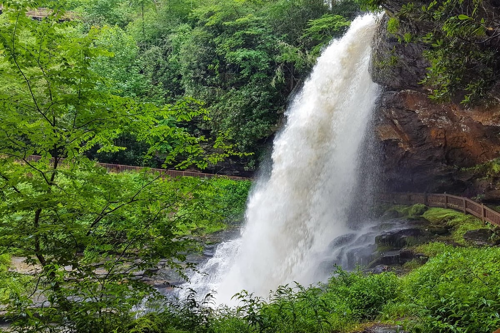
Fishing and golf are popular activities in the region. Many waterfalls, including Dry Falls and Bridal Veil Falls, are easily accessible from Highlands, too. Cliffside Lake and Sunset Rock, both of which are hikes that are less than a mile long, offer visitors stunning views of the surrounding mountains.
As Highlands is a resort town, there are many accommodation options available in the area for visitors to choose from, including hotels, vacation rentals, and lodges. In particular, be sure to check out the Old Edwards Inn and Spa in downtown Highlands. The inn is part of a renovated historic building, and it is complete with a spa and wine bar.
With a population of just shy of 92,000 people, the dynamic city of Asheville is situated among the Blue Ridge Mountains, and it has something to offer for everyone who comes to visit. Numerous hikes and waterfalls lie in the city’s backyard and the downtown area of Asheville is alive with music, arts, historical tours, and farm-fresh eateries.
As far as attractions go, the Biltmore Estate is a historic estate built by George Vanderbilt that’s located in town. Visitors can tour the mansion grounds and they can dine, shop, and even stay the night at the Vanderbilts’ former 8,000 acre (3,237 ha) estate.

Another well-known attraction in the region is the Blue Ridge Parkway, a scenic 469 mi (755 km) road that stretches from Shenandoah National Park in Virginia to Great Smoky Mountains National Park in North Carolina. It’s perfect for cruising, hiking, picnicking, and accessing some of the highest peaks located to the east of the Mississippi River.
Many cafes and restaurants in Asheville celebrate their locally sourced ingredients. All types of cuisines are available in the city, from international flavors to Southern cooking.
From hostels and campsites to B&Bs and resorts, Asheville also offers accommodation options for every pace and style of travel. The city also prides itself on being pet-friendly, and a quick search will turn up numerous accommodations in Asheville that welcome four-legged friends.


The highest peak in Southern Nantahala Wilderness is Standing Indian, at 1,677 m.
Notable peaks in Southern Nantahala Wilderness include Standing Indian, Lower Trail Ridge, Upper Trail Ridge, Big Scaly and Little Bald.


