Get PeakVisor App
Sign In
Search by GPS coordinates
- Latitude
- ° ' ''
- Longitude
- ° ' ''
- Units of Length

Yes
Cancel
❤ Wishlist ×
Choose
Delete
The rugged landscape of Da Xue Mountain and Zhong Xue Mountain Special Scenic Area (大雪山、中雪山特別景觀區) in central Taiwan forms the south-western territory of Shei-Pa National Park (霸國家公園). There are 18 named mountains featured in the special scenic area, the highest and most prominent being Da Xue Shan (大雪山) at 3,530 metres (11,581 ft) in elevation.

Encompassing parts of Tai'an Township (泰安鄉) of Miaoli County (苗栗縣) and the Heping District (和平區) of Taichung City (臺中市) are the fertile forests and jagged terrain of Da Xue Mountain and Zhong Xue Mountain Special Scenic Area. While most of the region is located in Miaoli County, Da Xue Shan and the hills on the western ridge of Xueshan (雪山) spill over into the territory of Taichung City.
With an elevation range of 1,000 to 3,530 metres (3,281 to 11,581 ft), the Da Xue Mountain and Zhong Xue Mountain Special Scenic Area boasts a range of ecosystems and climatic zones. This includes everything from low valleys and sunlit plains to subfrigid mountain summits. The overall mean temperature in the region is 54°F (12°C) and summers generally don’t exceed 64°F (18°C), while winters have an average temperature of 23°F (-5°C).
Out of the 15 named peaks in the region, four mountains in the scenic area are part of Taiwan's 100 tallest mountains, which are also known as Baiyue.
Including Da Xue Shan, these four Baiyue are Zhong Xue Shan (中雪山), Touying Shan (頭鷹山), and Fire Stone Mountain (火石山). Due to their extreme height and their frosty temperatures, the summits of these four Baiyue are usually draped in a year-round blanket of snow.
Rainfall is abundant in Da Xue Mountain and Zhong Xue Mountain Special Scenic Area. The area's annual average precipitation is 1,500 to 3,000 mm (59 to 118 in), which mainly falls in the wet summer months between May and October.
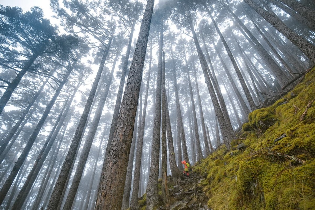
A thriving subalpine hemlock forest hugs the slopes of Zhong Xue Shan. With the regular arrival of thick white clouds in the afternoon, it often looks as if a roaring sea is flowing through the highland forest. The lofty slopes of Da Xue Shan are covered in grasslands of Pseudosasa japonica (arrow bamboo), too.
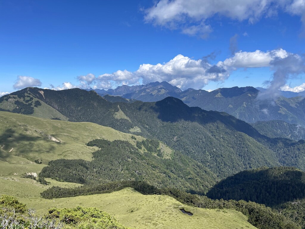
Da Xue Shan National Forest Recreation Area (大雪山森林遊樂區) is located to the southwest of Da Xue Mountain and Zhong Xue Mountain. Meanwhile, Jiaren Mountain and Madara River Regional Ecological Reserve (佳仁山、馬達拉溪區域生態保護區) is situated to the north. Taiwan Sakura Salmon Ecological Reserve (台灣櫻花鈎吻鮭生態保護區) is also located to the east, while the Da'an River (大安溪) is situated to the west.
The hills of Da Xue Mountain and Zhong Xue Mountain Special Scenic Area are the westernmost extension of Taiwan’s second highest peak, Xueshan. Ultimately, the Xueshan Range (雪山山脈) covers the 15 named hills of this area, among others.
Out of Taiwan’s top five mountain ranges, the Xueshan Range is the second-largest massif with a length of 260 km (161 mi) and a width of 28 km (17 mi). Additionally, the range contains a total of 1,233 named hills, 18 of which are Baiyue. A staggering 54 peaks in the range also exceed 3,000 metres (9,842 ft) in elevation.
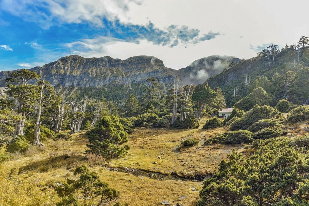
The primary rock strata of the Da Xue and Zhong Xue hills are metamorphic rocks that date back to the Eocene to Miocene. Covering the bedrock is a mixture of auburn shale, slate, and sandstone of varying ages.
The primary ecoregions in the elevated region of Da Xue Mountain and Zhong Xue Mountain Special Scenic Area are the cold temperate and sub-frigid alpine forests.
In the lower elevations, cool temperature plants, such as camphor tree and Taiwan red cypress dominate the region. However, the Da Xue and Zhong Xue region is known for its coniferous woodlands and alpine meadows.
Luscious coniferous plant communities thrive in the Da Xue and Zhong Xue region. This includes Yushan juniper, Taiwan fir, Taiwan hemlock, Taiwan cypress, Taiwania, and Taiwan red pine.
The alpine Pseudosasa japonica bamboo features prominently in the higher elevations of Da Xue Shan. Additionally, gentle mountain flowers, such as rhododendron and hydrangea, are present throughout the mountain trails.
The cooler mid to high elevations are breeding grounds for mammals, such as the Formosan rock macaque, Formosan white flying squirrel, and the Taiwan serow. Da Xue Mountain and Zhong Xue Mountain Special Scenic Area is also a haven for birds, with over 58 species having been recorded in the area to date.
Da Xue Shan was named by the Japanese thanks to its similarity to Da Xue Shan in Hokkaido, Japan. Like its Japanese counterpart, Da Xue Shan has vast mountain meadows of Pseudosasa japonica bamboo.
However, the Atayal people, who have lived in the region for centuries, know the peak as Babo Rinisan. This name translates to “the mountain of tears.”
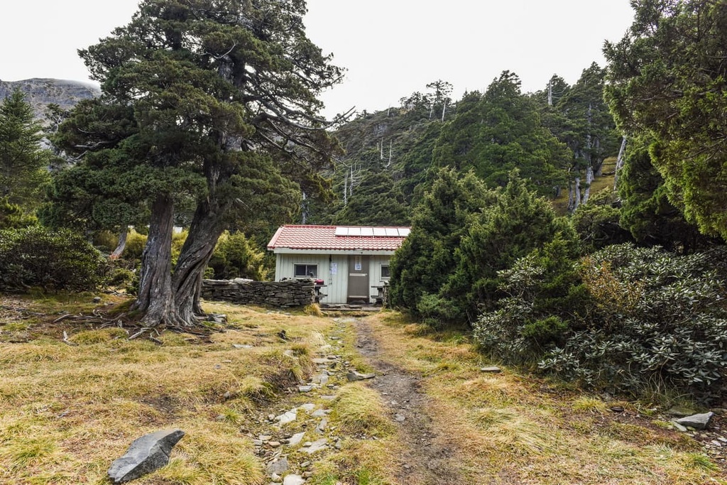
According to Atayal legend, Da Xue Shan was the boundary between the hunting grounds of the Atayal people of the Da Xue Community to the north and the Jia Yang community to the south. If a woman were to be betrothed to a member of the other community, her family would escort her to the boundary line on Daxueshan where she would leave them behind. Thus, many brides have shed tears at this point.
Another well-known sad tale in the region refers to an event that took place on the summit of Zhong Xue Shan.
The story goes that in 1975, Lin Wen’an (林文安), who was responsible for creating the list of Taiwan’s 100 highest mountains, was trekking a new path on Zhong Xue Shan in the height of rainy weather. On the third day of the trek, Lin Wen’an died as a result of heart failure.
A memorial of Lin Wen’an was erected on the mountain to commemorate and honor the man whose efforts created the famous list of Baiyue that exists to this day.
Da Xue Mountain and Zhong Xue Mountain Special Scenic Area is a popular hiking and trekking area. Here are some of the most popular trails in the region to check out on your next visit:
Xueshan’s western ridge features 28.5 km (18 mi) of trail for hikers to enjoy. The rugged West Xue Hiking Trail does not dip under 3,000 metres (9,842 ft) at any point while it makes its way down the western ridge of Xueshan. Along this trail, hikers will climb a total of ten peaks, each of which features its own unique topography and attractions.
The journey begins at either end of the trail, from Xueshan or Zhong Xue Shan; however, the more popular route commences at Taiwan’s second tallest peak, the snow-capped Xueshan.
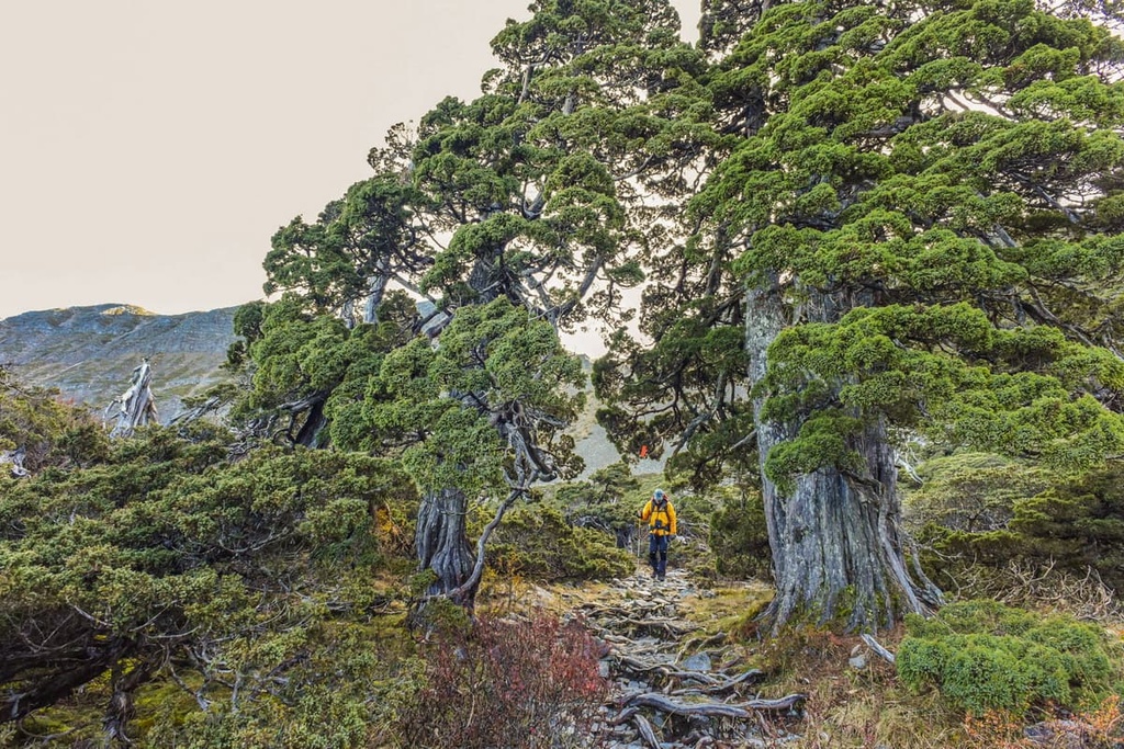
The course then leads to Fire Stone Mountain, Dananshan (大南山), Touying Shan, Qijun Shan (奇峻山), Daxueshan North Peak (大雪山北峰), Da Xue Shan’s grassy meadows, Pipidashan (匹匹達山), and Zhong Xue Shan’s magical hemlock forest.
Thanks to the trail’s high elevation, hikers can see the peaks of Yushan (玉山) in the distance as well as the rest of the Central Mountain Range (中央山脈) as it stretches into hilly Nantou County (南投縣) while they walk.
In the opposite direction, the striking route of the Shengling Line, which connects Xueshan to Dabajianshan (大霸尖山) is clearly visible. Along the entire trek, the glistening snow-covered peak of Xueshan is in constant sight, too.
In addition to these views, the trail’s landscape is majestic and exquisite. Alpine forests of Taiwan hemlock, Taiwan fir, and Yushan juniper create a stirring opaque world of elegantly elongated stems from which brushes of needles spring from countless branches.
The last peak on the West Xue Trail is a popular mountain to the summit in its own right.
Starting at Forest Road 230, hikers first ascend a path of overgrown Miscanthus sinensis before reaching the wild hemlock forest that covers Zhong Xue Shan.
Along the way, hikers are treated to mesmerising views of the snaking ridgeline of the West Xue Hiking Trail leading to Xueshan. To the south, you can see the mountain villages of Heping District.
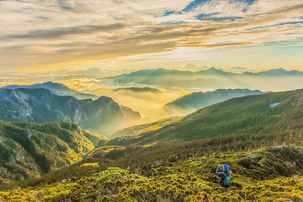
The trek to Zhong Xue Shan involves quite a lot of scrambling, so it’s best for experienced hikers. There are ropes to guide you, but you should still feel comfortable with heights before you attempt this trail. Adding to the tiresome nature of the trail, a thick barrage of Pseudosasa japonica bamboo lines the route.
Before the summit, hikers encounter the memorial to Lin Wen’an, the father of Taiwan’s 100 peaks. The views from this site are exquisite, as rolling blue mountains and verdant green forests complement the creamy white tufted clouds as they gently glide across sunny skies. The peaks of Zhimo Shan (志摩山), Zhima Hanshan (知馬漢山), and Hupan Shan (湖畔山) are visible to the south, too.
The lesser-traveled path of Zhima Hanshan Hiking Trail takes three days for hikers to complete. Due to the remoteness of Zhima Hanshan and the region’s dense Pseudosasa japonica bamboo forests, this trail is particularly challenging and is only suitable for experienced hikers.
To begin, hikers depart from the 50 km (31 mi) mark on Da Xue Shan 200 Forest Road. Constant coverage of camphor trees and Japanese knotweed transform the path into a jungle of greenery as hikers progress on the gentle flat path to Zhima Hanshan.
Hikers then journey through the wild broad-leaved forests of rhododendron that lead to the rubble cliffs of Zhima Hanshan. After hikers reach the forked road, the terrain begins to sharpen, becoming steeper and more demanding.
While the trail is tough and steep, the views are worth the climb. At the top, a grand vista of Hupan Shan is on display with graceful rhododendron flowers adding to the beauty of the scenery. Striking foxgloves also decorate the trail with their charming appearance.
On the second day, hikers advance towards Zhima Hanshan through a burly wood of thick, fallen trees, slippery mossy stones, and hordes of unkempt shrubbery. Hikers then progress toward the Piasang River. Finally, an unyielding thicket of Pseudosasa japonica bamboo obscures the trail to the mountaintop, which leads hikers to a sheltered summit.
As the trail is almost entirely shaded, the highlight of Zhima Hanshan Hiking Trail is the walk itself and its beautiful nature, which includes broad-leaved forests, dense shrubbery, sheltered coniferous woodlands, and the reedy thin swarms of Pseudosasa japonica bamboo. From the summit, hikers retrace their path back to Da Xue Shan 200 Forest Road.
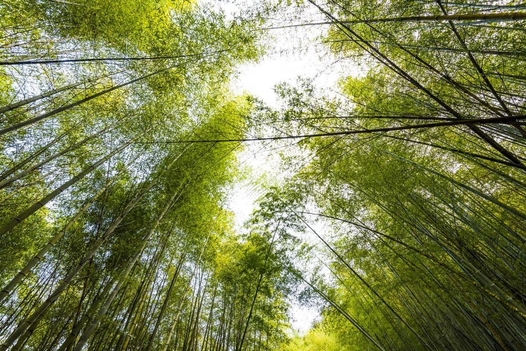
Just to the south of the Da Xue Mountain and Zhong Xue Mountain Special Scenic Area lies the flourishing forests of the Da Xue Shan National Forest Recreation Area, which is well worth a visit if you’re in the region.
Sitting at an elevation of 2,000 metres (6,562 ft), the verdant environment of Da Xue Shan forest is submerged in a constant cover of clouds; thus, a constant layer of mist surrounds the region’s pristine flora.
The mindfulness cultivating activity of forest bathing along the woodlands of Da Xue Shan National Forest Recreation Area is perfect for those seeking rejuvenation and relaxation. Plenty of phytoncides are released into the fresh mountain air from the thriving coniferous forests of Taiwan hemlock, Taiwan red pine, and Taiwan red cypress.
The pristine lake of Tianchi (天池) is nestled on the southern slope of Xiao Xue Shan (小雪山) at 2,600 metres (8,530 ft). After the tiresome climb to summit Xiao Xue Shan, Tianchi is the perfect place to stop to admire the still-freezing lake amidst a dense leafy jungle of cold temperate plants. In the morning and afternoon, a soft layer of mist often hangs over the alpine lake, too.
Da Xue Shan National Forest Recreation Area is known for its scenery, as rhododendron wildflowers bloom between March and May, followed by the string of the violet bell-shaped foxgloves between May to July. In autumn, the Japanese maple trees transform the color palette of the Da Xue Shan forest from vibrant jade to blood orange mixed with honey golds and deep reds.
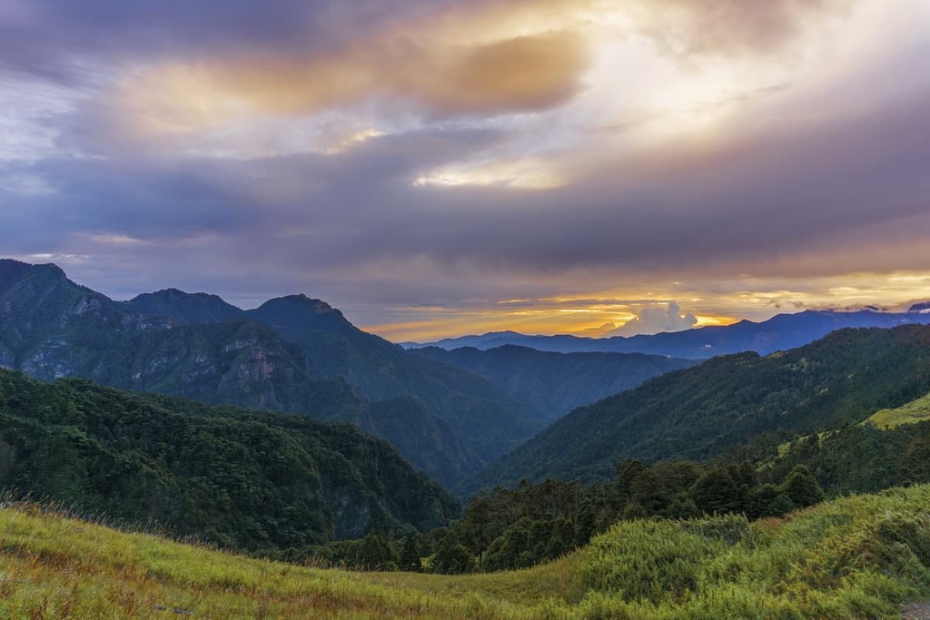
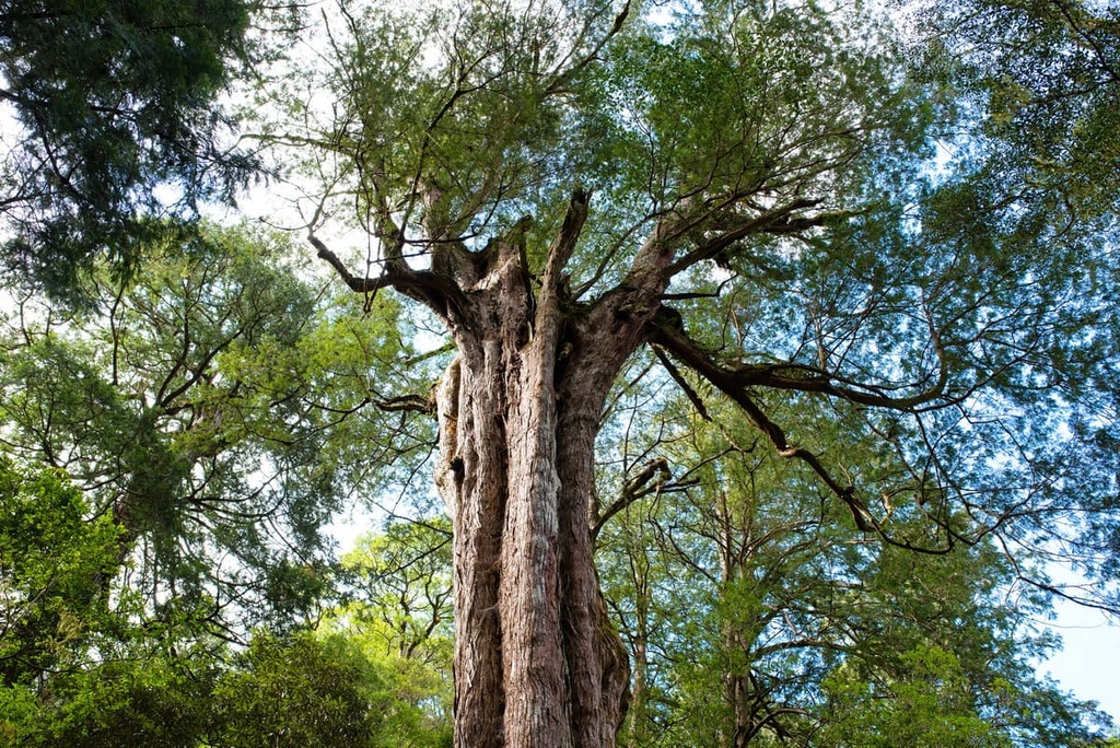
On Xiao Xue Shan’s southern slope sits a giant Taiwan red cypress measuring 49 metres (161 ft) in height and 13 meters (43 ft) in diameter called Xueshan Shenmu.
With an estimated age of 1,400 years, Xueshan Shenmu is one of the oldest trees in Taiwan, as well as its eleventh largest. While other tall trees are usually situated in clusters of similar height, Xueshan Shenmu stands alone, towering above the ground below.
Starting at the Shenmu Parking Lot, the trail to the tree descends 200 metres (656 ft) in elevation throughout 1.5 km (1 mi) of hiking through a mixed broad-leaved/coniferous forest of Huangshan pine, Taiwan red cypress, Taiwan azalea, and Japanese maple. While the journey to Xueshan Shenmu is a leisurely downhill walk, the uphill return is taxing, especially as the mountain air is thin and dry.
Along this short hike, you have the opportunity to see a variety of bird species in the forest. Emperor’s pheasant, white-throated laughing thrush, and the blue-bellied pheasant are typical birds spotted on the trail.
In addition to the scenic plant life and wildlife of the Xueshan Shenmu Hiking Trail, hikers have a clear view of Bei Sanzhui Shan (北三錐山) from the clearing around Xueshan Shenmu. Additionally, as Tianchi also lies on the southern slope of Xiao Xue Shan, you can get there via a short walk from Xueshan Shenmu if you’re looking to extend your adventure.
The two cities of Miaoli and Taichung are located in close proximity to Da Xue Mountain and Zhong Xue Mountain Special Scenic Area. While Miaoli and Taichung are only 59 km (36 mi) apart, they could not be more different in character. Taichung is an exciting city with plenty of artsy attractions, while Miaoli is better known for its slow pace of living.
Visitors often overlook Miaoli for the bigger cities of Taipei (臺北市), Kaohsiung (高雄市), and Taichung; however, the locals are well-aware of its laid-back appeal and its rural charm. For visitors wishing to wander off the beaten track, a trip to Miaoli City is an underrated jewel that’s just waiting to be discovered.
Sixty per cent of Miaoli’s population is of Hakka ancestry. The Hakka are Taiwan’s largest minority group. The Miaoli Hakka Roundhouse Museum is a curved structure built in the style of the ancient walled Hakka communities. Entrance is free, and many exhibitions on Hakka culture are showcased at the museum in order to educate visitors on the lifestyle and traditions of the Hakka people.
Another great day out for adults and children involves picking juicy harvested strawberries at Dahu Strawberry Fields. Visitors to the fields can bask under the Taiwan sun, enjoying the simple task of picking strawberries while revelling in the characteristically Miaoli slow living. Various goodies made from strawberries, such as strawberry drinks, strawberry ice cream, strawberry jam, and strawberry syrup are all for sale at the local shop, too.

Another attraction located just outside the city is the the Lion’s Head Mountain Scenic Area (獅頭山風景區). The scenic area is a 24,200 ha (59,800 ac) region of rugged landscape that features grand Buddhist temples.
Visitors can choose to traverse the many hiking trails of the Lion’s Head Mountain Scenic Area. The 3.5 km (2 mi) Lion’s Head Mountain Historic Trail is a fan-favorite that leads past limestone cliffs carved with calligraphy, luscious thriving woodlands, and eleven temples including Quanhua Temple.
Situated just to the south of Lion’s Head Mountain Scenic Area is the mesmerising valley of the Tai’an Hot Springs (泰安溫泉), which should be on everyone’s list of places to visit in the region. While Miaoli City is one of Taiwan’s best-kept secrets, the attractiveness of Tai’an Hot Springs has brought many tourists to the area thanks to its picturesque setting.
In comparison to Miaoli City, Taichung City is brimming with life and electric energy. However, compared to the likes of Taipei and Kaohsiung, Taiwan’s third-largest city is more tame and relaxed. Therefore, Taichung has the best of both worlds as it is both an exciting city without the hectic energy of a much larger metropolis.
The open space of Calligraphy Park features 6.5 ha (16 acres) of well-manicured lawn with paths that twist and curve amidst creative abstract sculptures. Taichung’s steel blue skyscrapers peep out in the near distance, adding to the scenery. Visitors are even more spoiled by popular landmarks, such as the National Taiwan Museum of Fine Arts and the National Museum of Science, which you can see from the park.
Additionally, visitors to Taichung can wander into the old city alleyways of Herbal Medicine Street. Locals flock to this delightful area for its famous herbal teas. Sharp medicinal whiffs linger in the air along the street well before visitors ever set sight on the ageing wooden stores.
Taichung is conveniently located near the emerald gem of Basianshan National Forest Recreation Area (八仙山國家森林遊樂區). Once an old logging base during the Japanese Occupation Era, Basianshan now showcases evidence from the past from remnants of its logging heyday. Visitors to the region are often astounded by a plethora of trails that take you everywhere from ethereal bamboo woods to romantic cherry blossom forests.

Another rustic and rural attraction is the Lavender Cottage in the Xinshe District (新社區) of Taichung City. Endless crops of the softly scented lavender springs throughout the hillside wedged between Tougui Shan (頭拒山) and Anying Shan (暗影山). From November to April, lavender blossoms through the fields, while sprigs of sage bloom between June to August.
Taichung is the city nearest to Da Xue Mountain and Zhong Xue Mountain Special Scenic Area. Visitors can board the Taiwan High-Speed Rail (HSR) or local express train (TRA) from any major city in Taiwan to reach Taichung.
Visitors can then rent a car or scooter to get to the scenic area. Or they can take a taxi to head to the Da Xue and Zhong Xue mountains. It is a 69 km (43 mi) long journey from Taichung. Meanwhile, the drive from Miaoli, the next closest city, is a 91 km (56 mi) trip.
Explore Da Xue Mountain and Zhong Xue Mountain Special Scenic Area with the PeakVisor 3D Map and identify its summits.


