
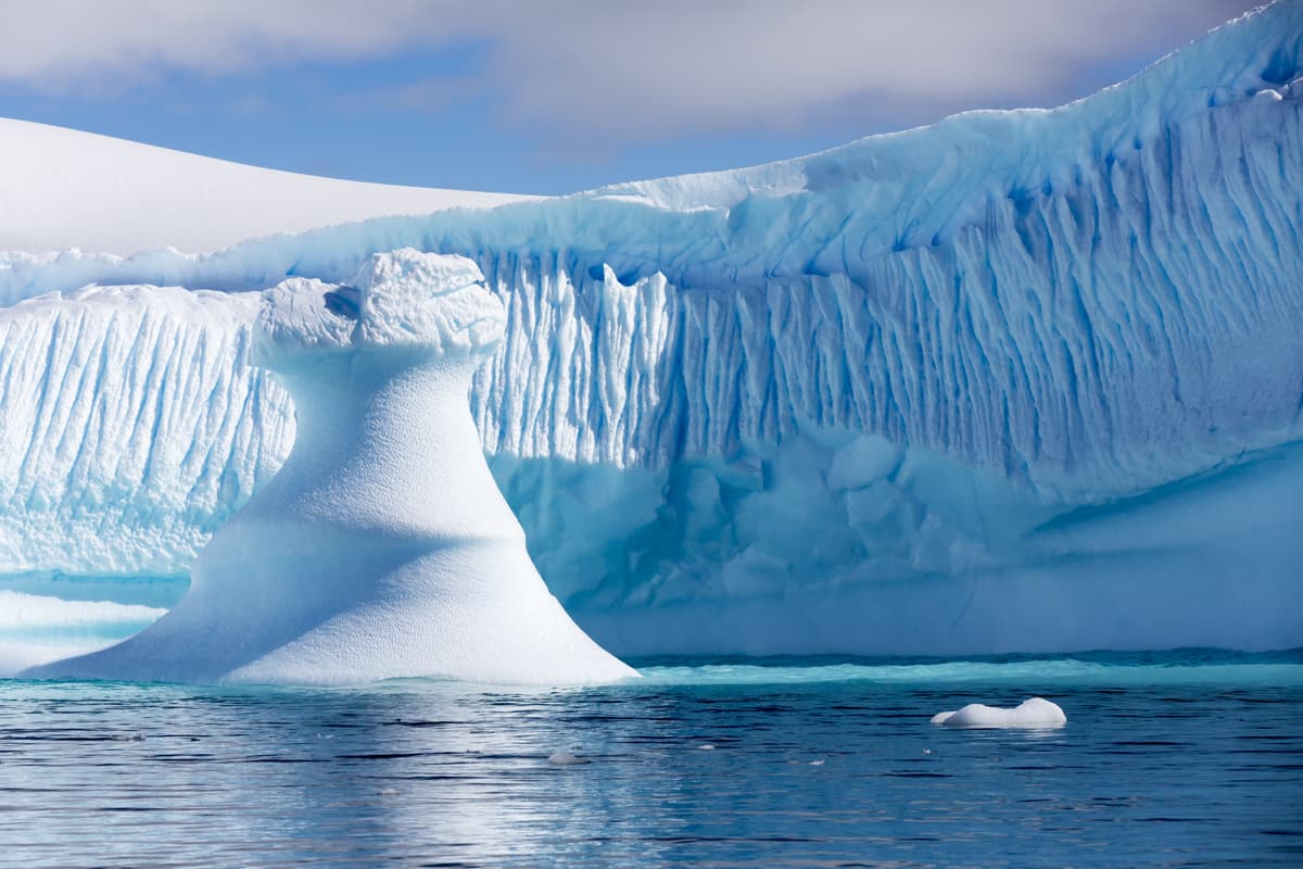
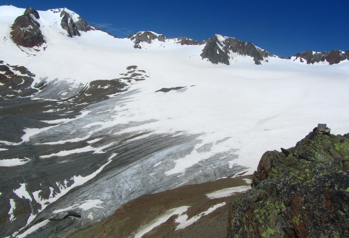
A glacier is a huge mass of ice formed as a result of eons of snow accumulation. Snow gets transformed into ice under pressure or by melting and refreezing. Such processes form powerful flows, domes, and floating slabs.
Despite their solid looks, glaciers undergo constant changes. If there is any increase in sources, e.g. more precipitation and low temperatures, the glacier moves forward. If the snow food becomes scarce, the glacier retreats. There are also ripples inside the glacier itself, connected with its internal structure. Glaciers are characterized by foothill cracks and formations of sharp shapes. The glacier is constantly moving, changing the earth's landscape and transforming the earth itself. Under the pressure of glaciers, water basins, valleys, cliffs and ravines are formed.
Glacier ice is the largest reservoir of fresh water on the Earth.
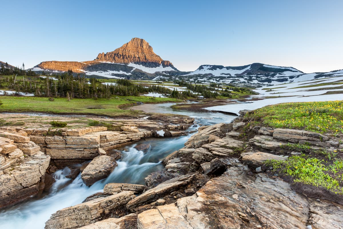
The beauty and power of glaciers is alluring hordes of people who enjoy their glacier experience through excursions, skiing in winter and even in summer. Some glaciers have specially equipped summer ski centers. In the USA, there is Glacier National Park, named after the glaciers that formed a picturesque landscape in the Rocky Mountains. There is a similar park in Canada, and due to its much more northern location, it contains many more glaciers.
Due to ongoing climate change, many glaciers are rapidly losing their mass. Europeans are seriously concerned about the problem of glaciers disappearing, many glaciers are covered with special material during the summer to protect them from melting.
Outstanding Glaciers
Europe
The Vatnajökull Glacier
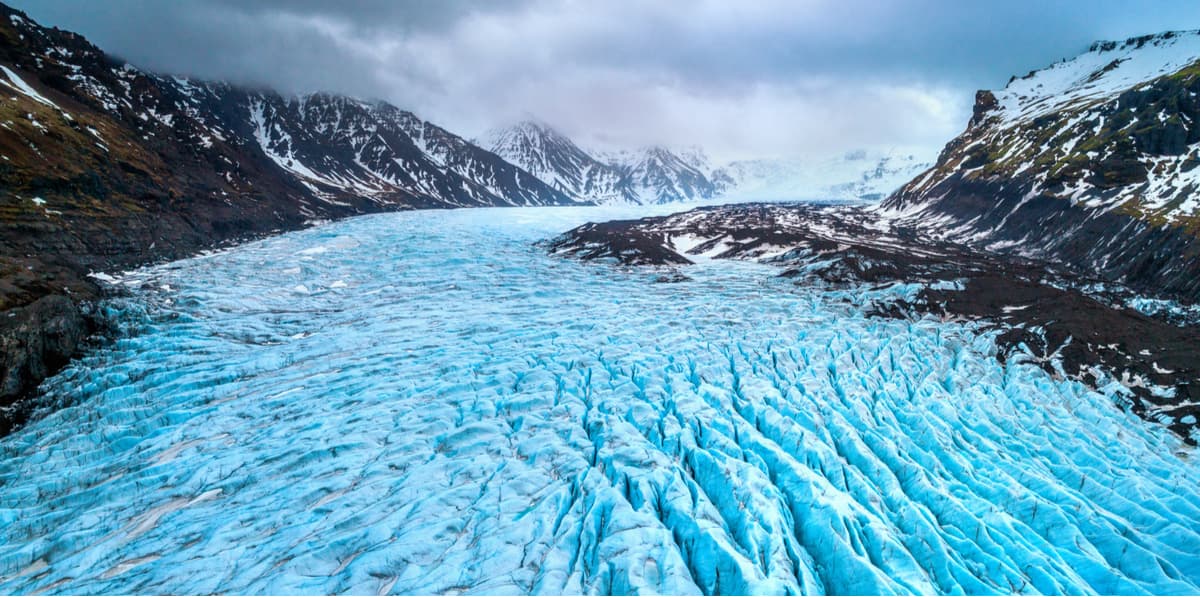
The largest glacier in Europe is located in Iceland, and occupies 8% of the country. Its area is 8,133 sq.km, the volume is estimated at 3100 cubic kilometers. The glacier covers several volcanoes. Inside the glacier there are caves formed by geysers. The average ice thickness is 400 m, the maximum is about 1000 m. Over the past few years, Vatnajökull has been gradually declining, possibly due to climate change and recent volcanic activity. The project researching and documenting the glacier recession can be found here.
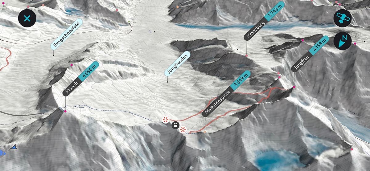
The Aletsch Glacier
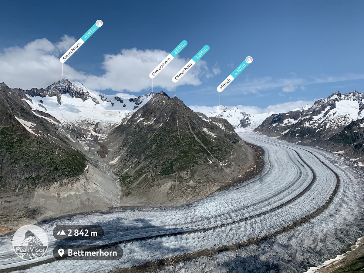
Being the largest in the Alps, the Aletsch Glacier has been lying on the southern slopes of the Bernese Alps for over 10,000 years. It covers an area of 81.7 sq.km. (as of 2011) and, taking into account the area of the four firns that feed it, about 117.6 sq.km. (as of 2002). The total length of the Aletsch Glacier is about 23 kilometers.
The glacier is remarkable for creating a canyon that looks like a man-made road down the slopes to the valley. In December 2001, the Great Aletsch Glacier was included in UNESCO's World Heritage List as the Jungfrau-Aletsch Protected Area.
Asia
The Siachen Glacier
The Siachen glacier is the largest in Asia. It is sadly the highest battleground on earth where India and Pakistan always meet in a frozen standoff. It is the world’s largest non-polar glacier, the Siachen glacier is sometimes called a third pole. This glacier is well known for its scarce population and treacherous climatic conditions. The Siachen boasts more than 2 trillion cubic feet of ice, and within 25 kms has 45 peaks which rise up to a height of 18000 feet.
The Fedchenko Glacier
The Fedchenko Glacier is the biggest in the Pamir and the longest glacier in the world outside the polar regions, the length of the glacier is 77 km. It is located in the Yagzulem Range of the Pamir Mountains, on the territory of central Tajikistan.The area of the glacier is about 700 sq.km., the height of the tongue of the glacier is 2909m. The maximum thickness of the glacier is 1,000 metres, and the volume of the Fedchenko and its dozens of tributaries is estimated at 144 cubic kilometres — about a third of the volume of Lake Erie.
The glacier was discovered in 1878 and named for the 19th-century Russian explorer A.P. Fedchenko. Its middle and upper reaches were first explored in 1928 as part of a major Soviet expedition to the Pamirs region. Over the years the glacier has been the site of several meteorological stations.
North America
The Hubbard Glacier

The Hubbard Glacier is located on the border between Alaska and Canada. It is a dendritic glacier, the largest on the coast of Alaska (the USA). The length of the glacier is 122 km. The glacier rests on the Yakutat Bay. The height of the ice in the bay reaches 120m above sea level, the width of the glacier at the bay is 9 km in summer and about 15 km in winter. The front end of the glacier reaches 120m above sea level. Since the late 1800s, the glacier has been moving 17-18m per year. The Hubbard Glacier has also been thickening and advancing toward the Gulf of Alaska ever since it was first mapped by the International Boundary Commission in 1895. It has had two major surges in the past 30 years. Those surges were big enough to cross the bay, turning the fjord into a lake and threatening to flood the coastal town of Yakutat. And, this is happening despite climate change and the fact that many glaciers are thinning and retreating.
South America
The Perito Moreno Glacier
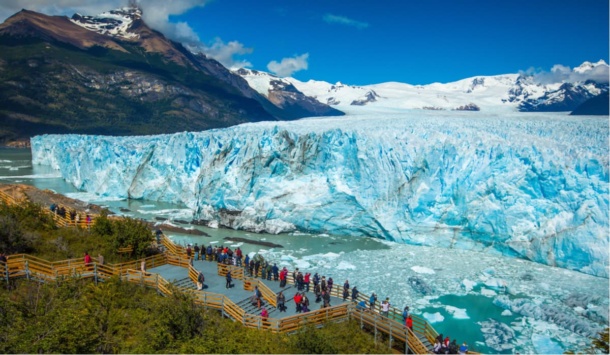
Located in the Los Glaciares National Park in the southwest of Argentina's province of Santa Cruz (and not next to the town of Perito Moreno!), the Perito Moreno glacier is one of the largest of the 48 glaciers emanating from Patagonia’s Southern Ice Field. It was named in honor of the Argentinian explorer Francisco Moreno, who played an important role in the border dispute between Argentina and Chile in the 19th century. In addition, the term ‘perito’ refers to his nickname, which is a Spanish colloquialism for ‘specialist’.One of the most intriguing things about this glacier is that even though it is getting thinner, it continues to advance while most of the world’s glaciers are retreating. Additionally, the glacier dams the southern arm of Argentino lake, causing water to rise and creating pressure as the weight of the ice bears down. This pressure periodically causes rupturing, which in turn sends water to Lake Argentino’s main body. This natural cycle occurs only occasionally, at intervals between one and ten years. If you’re lucky enough to witness it during your visit, you’ll be absolutely astonished at the sound and sight of so much water and ice shifting.
Perito Moreno has an area of 250 sq.km. The average depth is 170m, the maximum is 700m. Its speed is 2m per day (approximately 700m per year). However, the mass losses are approximately the same, so (without taking into account the small deviations) the glacier tongue has not retreated or advanced for 90 years. It is considered one of the most unusual glaciers because it does not lose its mass. This ice plateau is the third largest fresh water reserve in the world. It got on UNESCO's World Heritage List in 1981.
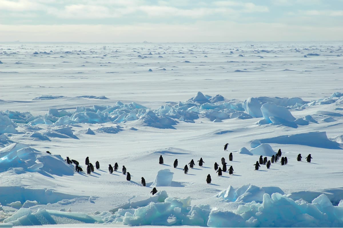
Antarctic glaciers
The Antarctic ice sheet is the largest on our planet and exceeds the closest in scale Greenland ice sheet in size by approximately 10 times. The volume of the glacier is approx.30 million cubic km of ice, 90% of which is ice on land. The glacier cover in Antarctica contains about 80% of the planet's fresh water; if it melts completely, the sea level will rise by almost 60 meters.
The ice sheet is shaped like a dome with increased surface steepness towards the coast, where it is framed by offshore glaciers. The average thickness of the ice layer is 2500-2800 m, reaching its maximum value of 4800 m in some areas of Eastern Antarctica.
Africa
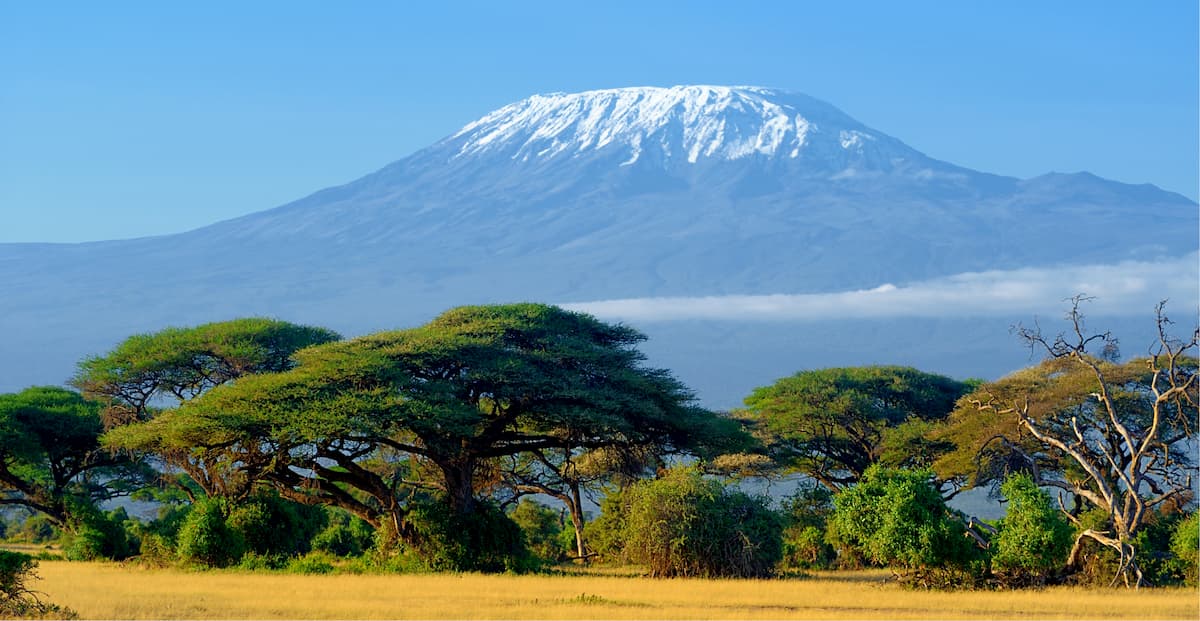
Hardly can anyone associate this hot continent with ice-covered peaks, yet Africa still has its share of glaciers they are all located near the equator! They are found on the Rwenzori Mountains (bordering Uganda and the Democratic Republic of Congo), Mount Kilimanjaro (Tanzania), and Mount Kenya (Kenya).But these glaciers are rapidly disappearing. Since 1900, the glaciers in Africa has lost 80% of their surface area. By the 1990s, they had a total surface area of only 10.7 sq.km. Scientists predict that by 2030, the last remaining ice would be melted away. They were also the center of much global warming alarmist hype until it was proven that retreat and advance of glaciers is not caused by climate change as much as it is caused by overall changes in precipitation.
Australia
Australia has been hotter than hell over the last year. According to wikipedia, there are no glaciers remaining on the Australia mainland or Tasmania. A few, like the Heard Island glaciers are located in the territory of Heard Island and McDonald Islands in the southern Indian Ocean. The Heard Glacier area was discovered by U.S. Captain William Heard in 1853. Scientists call the area an ideal laboratory for studying climate change it is at the end of the Polar Zone and isolated from humans.
Classification of glaciers
Glaciers can be classified in two ways: by their temperature (warm or cold) or by their geographic location. Although it may seem strange to classify a glacier as warm or cold, this label refers to how the glacier moves across the ground. In "warm" glaciers, a film of water provides lubrication to the bottom allowing it to slip across its bed – much the same way as butter ensures that cookies do not stick to a pan. "Cold" glaciers, on the other hand, do not have this layer of water and are frozen to their beds. Movement in these glaciers is very slow, and only comes from the deformation of ice crystals. Most arctic glaciers are "warm" – essentially they are slow moving ice streams that descend from low mountain ranges.
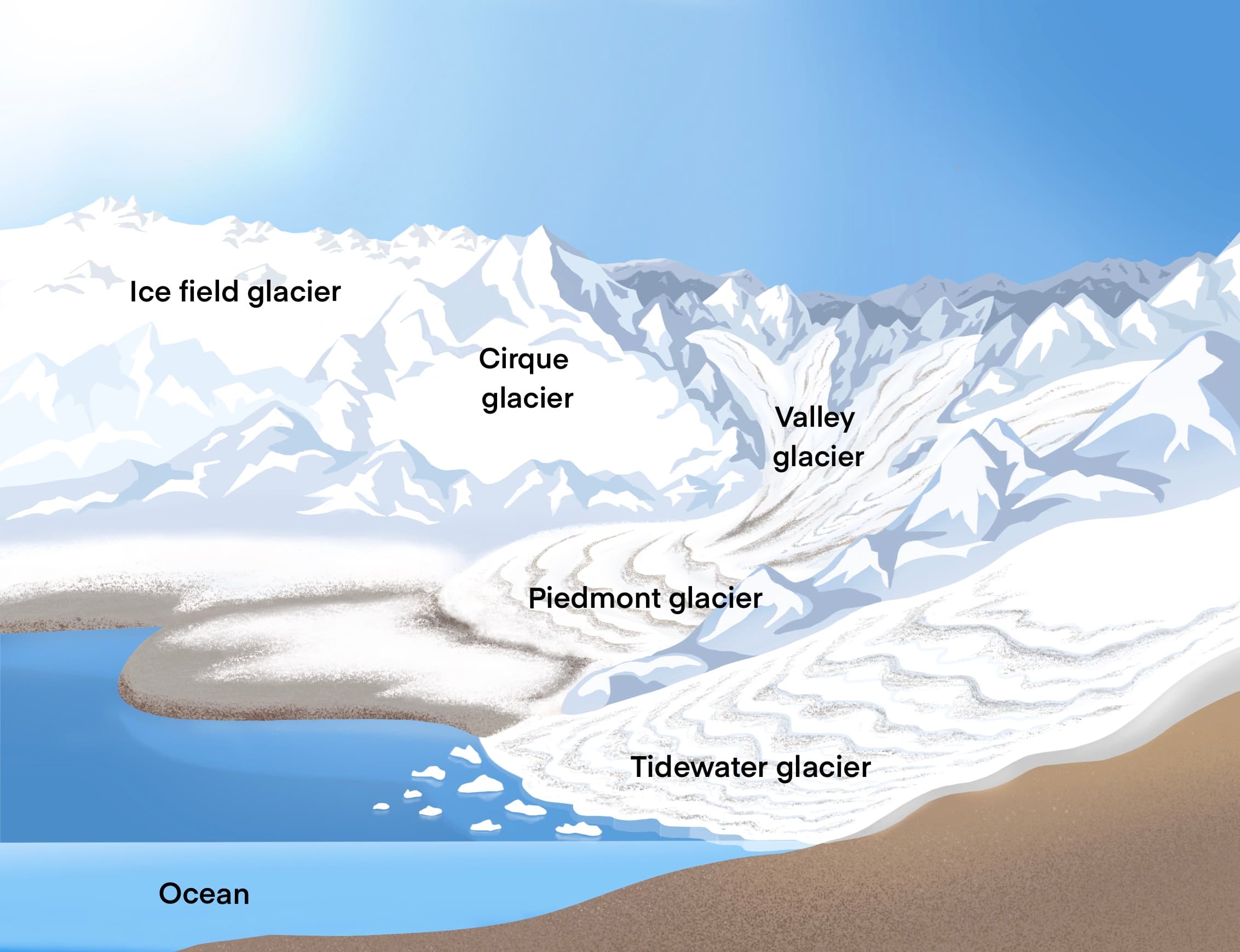
According to their geographic location, glaciers can be classified as ice sheets, ice shelves, ice caps, mountain glaciers, valley glaciers, piedmont glaciers, cirque glaciers, hanging glaciers, and tidewater glaciers. Each of these types of glaciers has unique characteristics.
- Ice sheets are the massively thick glaciers that covered much of the planet during the Ice Age. They occupy broad areas of gentle terrain, but sometimes grow so thick that they cover the underlying features. Ice sheets generally flow outwards in all directions from a central accumulation zone. A modern example is the Antarctic ice sheet, Greenland Ice Sheet. Ice sheets contain vast quantities of fresh water, enough that if melted, global sea levels would rise by over 70 m (230 ft).
- Ice shelves are simply the floating sections of ice sheets – Greenland and Ellesmere Island have a number of such floating ice shelves.
- Smaller ice sheets which are restricted to mountain plateaus, are known as ice caps, such as the Penny Ice Cap on Baffin Island. Surface area is usually less than 50,000 sq.km. They usually occur in Iceland, Canadian Arctic, other high latitude locations. They form primarily in polar and subpolar regions that are relatively flat and high in elevation.
- Ice sheets, in turn, give rise to ice streams, or outlet glaciers, which flow down the valleys between the rocky peaks. From the air, these ice streams look very similar to river drainage systems. In Antarctica, many ice streams drain into large ice shelves. Some drain directly into the sea, often with an ice tongue. Ice streams and outlet glaciers account for up to 90% of discharge from the Antarctic and Greenland Ice Sheets.
- If an ice stream from a mountainous area dumps onto a wide, flat plain, rather than the ocean, a broad lobate form of glacier known as a piedmont develops. A piedmont glacier is basically a valley glacier. The largest piedmont glacier in the world is Malaspina Glacier, Alaska, exits the confines of the mountains and spreads out radially, creating a lobe about 70-km wide.
- A valley glacier fills a valley. Such glaciers usually flow through deep bedrock valleys that confine the ice on either side. Valley glaciers originate in cirque or icefield glaciers. Over time, during glaciation, they carve and shape their valleys. In large systems, valley glaciers may join and form larger glaciers with much greater erosional power.
- Ice fields are large areas of interconnected glaciers in a mountainous region. They are often found in the colder climates and higher altitudes of the world where there is sufficient precipitation for them to form.
- Cirque glaciers are found high on mountainsides and tend to occupy bowl-like hollows. Due to the distinctive shape of those mountainside niches, they are called cirques. Cirque glaciers may be small, filling just a portion of a cirque or slightly larger filling an entire cirque, or even glaciers that form the head of larger valley glaciers. Two glacial cirques may form back to back and erode their backwalls until only a narrow ridge is left. This structure may result in a mountain pass.
- Another mountain-particular phenomenon is hanging glaciers, also called ice aprons, they cling to steep mountainsides. These aprons are frequent causes of massive avalanches. Like cirque glaciers, their width is bigger than their length. Hanging glaciers are common in the Alps, but not in the Arctic because mountain ranges are steeper in Europe.
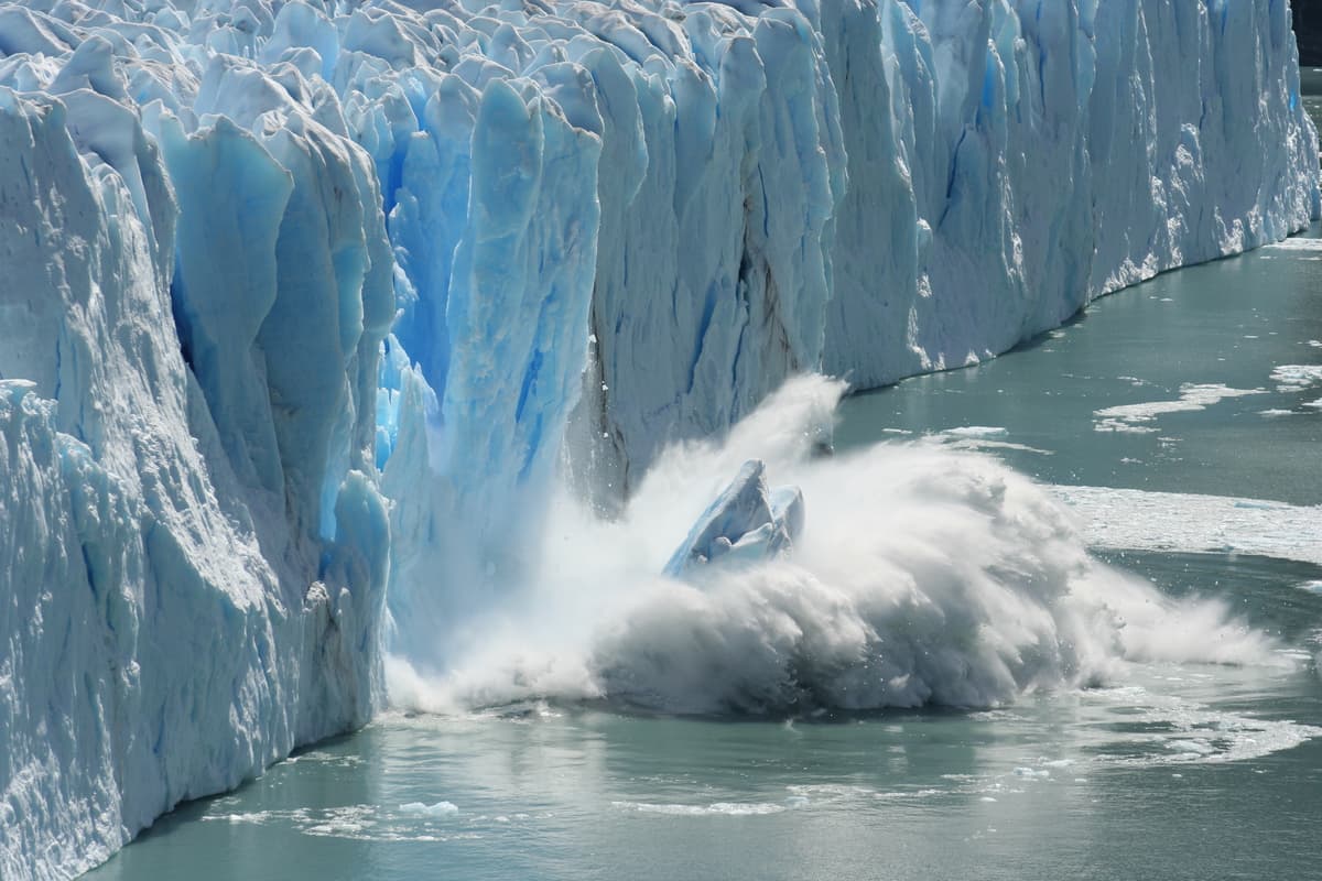
- As their name implies, tidewater glaciers are valley glaciers that flow far enough to reach the sea. They are responsible for calving numerous small icebergs. Tidewater glaciers are usually abundant in Greenland, Antarctica, Baffin and Ellesmere Islands in Canada, Southeast Alaska, and the Northern and Southern Patagonian Ice Fields.
Glaciers can by restricted and unrestricted by the underlying topography. The former category would feature ice fields, valley glaciers, cirque glaciers, piedmont glaciers, and tidewater glaciers. The latter category presupposes that the underlying terrain has little to no impact on the rate or direction of flow. Ice in these glaciers flows in response to differences in the ice thickness and the ice surface slope, and as a result, ice may flow uphill and over underlying topographic high spots. These glaciers include ice sheets, ice caps, ice shelves, ice streams.
Formation and structure
Glaciers form where the accumulation of snow and ice exceeds ablation. Snow falls in the accumulation area, usually the part of the glacier with the highest elevation, adding to the glacier's mass. As the snow slowly accumulates and compresses through gravity to ice. When the mass of snow and ice is sufficiently thick, it is forcing the glacier to move due to a combination of surface slope, gravity and pressure. When snow repeatedly freezes and thaws, it changing into granular ice called firn. This is an intermediate state between snow and glacier ice.
- Ablation area is zone where most of the melting and evaporation occur.
- Accumulation zone is the altitude where the amount of new snow is gained.
Once the balance between these two areas is reached (the snowfall equals the snowmelt), the glacier is considered to be in equilibrium. The equilibrium line separates these two zones. Whenever this equilibrium is disturbed, either by increased snowfall or by excessive melting, the glacier either advances or retreats.
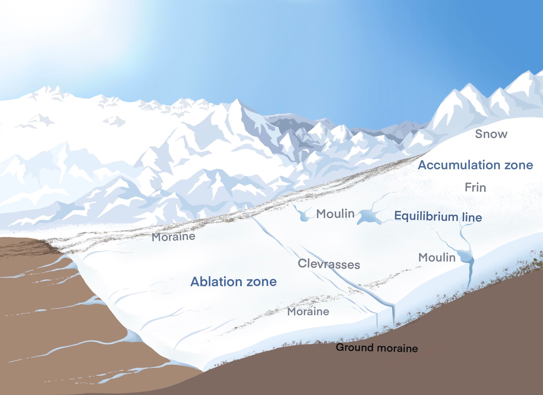
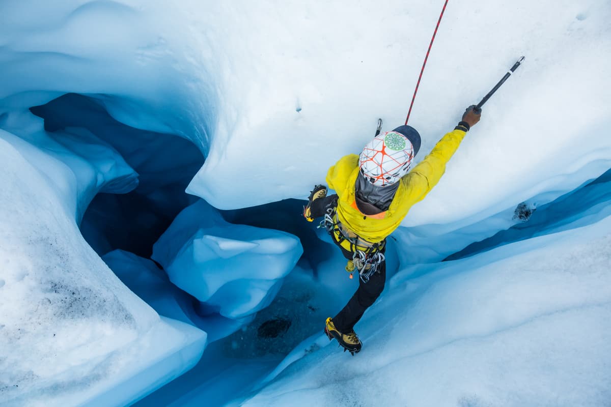
If different parts of the ice move at different speeds and directions, friction creates giant cracks - crevasses. Crevasses make travel over glaciers very dangerous, especially when they are hidden by fragile snow. Other common glacial features are moraines, created when the glacier pushes or carries a mixture of rock, gravel and boulders as it moves. These long, dark bands of debris are visible on top and along the edges of glaciers. Medial moraines run down the middle of a glacier, lateral moraines along the sides, and terminal moraines are found at the terminus, end of a glacier. Moraines can also create moraine dammed lakes.
Due to glacial erosion, there are also found
- Cirques are created when glaciers erode the mountainside, scouring into it and creating rounded hollows with steep uphill faces, shaped like tilted bowls. A cirque is often more visible after the glacier melts away and leaves the bowl-shaped landform behind.
- Arêtes are jagged, narrow ridges created where the back walls of two glaciers meet, eroding the ridge on both sides.
- Horns are created when several cirque glaciers erode a mountain until all that is left is a steep, pointed peak with sharp, ridge-like arêtes leading up to the top.
- Eskers are kind of close to morains, they are the meandering ridges of gravel that were likely deposited by rivers flowing on top of glaciers, through glacial cracks, and/or in tunnels under glaciers. Because glacier ice comprised the banks of these rivers, and that ice eventually melted away, the gravel deposited by the old rivers is now elevated above the surrounding land surfaces.
- Drumlins are long, tear-drop-shaped sedimentary formations. What caused drumlins to form is poorly understood, but scientists believe that they were created subglacially as the ice sheets moved across the landscape during the various ice ages. Theories suggest that drumlins might have been formed as glaciers scraped up sediment from the underlying ground surface, or from erosion or deposition of sediment by glacial meltwater, or some combination of these processes.
Glacier Motion
Glaciers move, or flow, downhill due to gravity, the weight of ice, or due to the different structure of ice. Glacier movement is carried out in two waysю The pressure on ice deeper than 50m causes causes plastic flow inside the ice. Glacier can slide forward or sideways when layers of the ice move relative to each other or ice slides over the terrain on which it sits pushed by the presence of melt water.
Underlying and surrounding topography sometimes determines the direction and rate of flow and ice can flow downhill from the accumulation zone to the ablation area located below the snow line.
Movement along the underside of a glacier is slower than movement at the top due to the friction created as it slides along the ground's surface, and in some cases where the base of the glacier is very cold, the movement at the bottom can be a tiny fraction of the speed of flow at the surface.
If underlying topography has little to no impact on the rate or direction of flow, a glacier flows in response to differences in the ice thickness and the ice surface slope, and as a result, ice may flow uphill and over underlying topographic high spots. The highest moving speeds were recorded in the marginal parts of the Greenland glaciers, where they reach 10 km per year.
The speed of movement varies in different parts of the glacier. The highest travel speed is characteristic of the central part and decreases in the marginal and near-bottom parts due to reduced plasticity of the ice and increased friction over the terrain on which it sits and the valley sides.
Glacier speed varies and depends on the season and temperature, mass and pressure inside the glacier. Also, the speed depends on the area where the glacier is located. For example, mountain glaciers in the Alps move at speeds between 0.1-0.4 and 1.0 m/day. However, some of these glaciers sometimes increase their speed to 10 m/day. The speed of Greenland's outlet glaciers going down into the fjords can reach 25-30 m/day, while in the interior, far from the fjords areas, the speed is merely a few millimeters/day.
A glacier with sharply pronounced fluctuations leading to its rearrangement and redistribution without changing its total mass is called pulsating. Usually with such movements the glacier increases in size and occupies a large area.
A pulsating glacier can travel tens of even hundreds of meters per day. There are numerous known cases of pulsing increase by kilometers and tens of kilometers in the Pamir Mountains, Alaska on Spitsbergen, in the Alps and other areas. Such a sharp increase in glacier velocity is called a surge.
Surge is a regular phenomenon, one of the stages of glacier ripples or pulses.
Due to the fact that people in the glacial mountains of Europe, Asia and North America have been experiencing disastrous consequences of surges, the physics and geography of these processes have been studied in detail by scientists in these regions for a long time. For example, the information about the movement of the Vernagtferner, glacier situated in the southern part of the Ötztal Alps, which was accompanied by catastrophic breakthroughs of the resulting damming lake, has been mapped many times since 1599. One of the world's first glaciological field research stations was established in this valley. Thanks to this, there has been elaborated terminology of the processes related to surges as early as the first half of the 20th century.
We now know of several hundreds of pulsating / surging glaciers. On some glaciers, the surge process has catastrophic consequences for people. For example, the Bear Glacier in the Western Pamir which in 1963 began to move at a speed of up to 50 meters per day and blocked the flow of the Abdukagora River, resulting in the formation of a barrier or damming lake. Such lakes are usually formed in front of the glacier sheet and or in a valley when the ice from the glacier begins to melt. Subsequently, the water broke through the ice dam and, moving at a great speed, destroyed everything in its path.
In 2002, the pulsating Kolka glacier descended in the Karmadon Gorge in the Caucasus. As a result of the tragedy, 126 people died and went missing. The glacier moved at extreme speeds (up to 250 km/h) at a relatively small valley slope angle and consisted of two waves of more than 100 million cubic meters of ice, water and rocks traveling down the valley for almost 20 km. Immediately after the catastrophe, the Kolka glacier had a unique view which was recorded on images from the ISS (International Space Station): its bed was almost completely opened, which in the world practice of glacier exploration has been an unrivalled experience so far.
Currently, there are catalogues of pulsating glaciers being compiled as well as remote monitoring of the Earth glaciers from space.
Glaciers highlights
Global warming is leading to catastrophically rapid glacier melt. Many glaciers have already disappeared or will disappear in the coming decades. This alarming trend is leading to difficulties with freshwater and is threatening food stability.
Experts warn that the problem will affect not only the population of highland regions but also those living far downstream. Since glaciers are an important source of freshwater for mankind, the quality of life, agriculture, industry and shipping depend on the condition of many large rivers. Mountain regions occupy almost a quarter of the Earth's surface and are home to about 1.1 billion people.
Melting of the ice shields of Antarctica and Greenland leads to rising sea level and disturbance of sea currents. There are interesting research by scientists on the causes of accelerating glacier melt. They melt not only due to the global warming of the atmosphere and changes in the movement of warm currents in the Atlantic. Danish researchers from Aarhus University who studied the ice sheet of Greenland for 10 years suggest that such a rapid melting of glaciers in Greenland is due to the deep heat of the planet. Scientists believe that it is the processes taking place in the depths of the Earth that heat the lower layers of the glaciers.
Glacier Lakes
There are plenty of glacier lakes found around the world, they are mainly formed when glaciers begin to melt with the warm season. These lakes can be permanent or temporary, like Lake Braganzavågen in Svalbard, Norway, a temporary glacier‐surge ice‐dammed lake. At its maximum, this lake covered an estimated area of 77 sq.km with a water volume of 1.2 cubic km. Lake sediment up to 80 cm thick was rapidly deposited on top of terrestrial and marine sediments. At its maximum extent, the short‐lived lake was the largest of any known Holocene lake in Svalbard. Glaciers in Northern Europe, Asia and North America are shaping the landscape on all scales, from eroding the large fjords to small scratches and striations on bedrock surfaces. But have you ever realized there can be lakes inside the glacier itself? How come that this water does not freeze like the rest of the glacier?
Subglacial Lakes
Back in the mid-19th century, scientists knew that with a very thick glacier, the temperature at its lower boundary could become equal to the temperature of ice melting. In the 1950s, after studying the glacier of Antarctica, its composition, temperature changes in the thickness of the glacier, scientists assumed that under the dense ice of Antarctica there is a superb freshwater basin of an area almost equal to the area of Europe. They also surmised it must be rich in oxygen which permeates to the upper layers of ice and snow that in turn are gradually sinking into the depths below. And it may very well be that there is life in this subglacial lake. There was also devised a map of the areas of continuous melting at the bedside in the central part of the glacier cover of Antarctica. According to the map, stations Vostok, Amundsen-Scott, Baird are located in areas of continuous bottom thawing and one would logically expect the presence of glacial lakes.
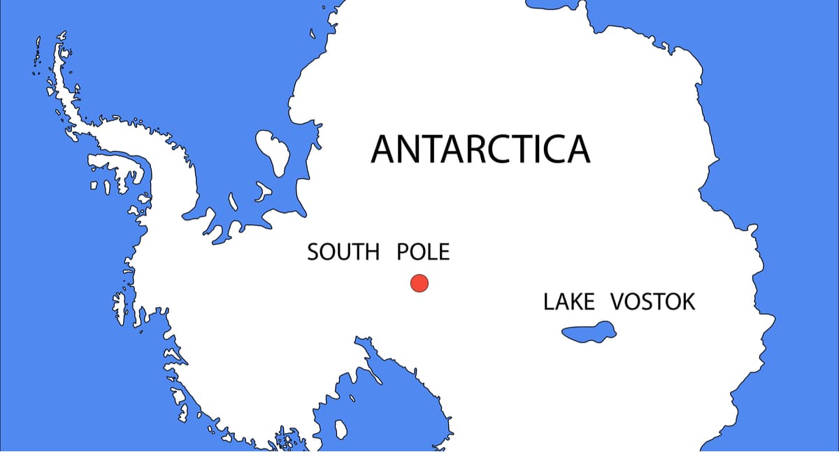
Lake Vostok, the largest in Antarctica
Antarctica’s Lake Vostok, a giant body of water buried beneath about 4000 meters of ice, has had a surge of publicity in recent years. Subglacial lakes were suspected to exist beneath the continent’s ice for decades. This particular lake’s existence, in the vicinity of Vostok Station in East Antarctica (Russian scientific station with an international crew, 77° south latitude, 105° east longitude), was first postulated in the 1960s by Andrei Kapitsa, a geographer and Antarctic explorer. But it was not until 1993 that satellite-based radar altimetry—which measures surface deformation—confirmed that the lake is there. It is the largest subglacial lake on the continent. Lake Vostok has a size of approximately 250×50 km. The estimated area is 15,500 km². The depth is over 1,200 m.
Scientists believe that the waters of the lake can be inhabited by living organisms because it has all the necessary factors for life. Microorganisms adapted to life in such conditions can have unique properties because they were isolated from the Earth's biosphere for a very long time, and therefore evolutionary processes there proceeded independently.
In total, more than 140 subglacial lakes had been discovered in the Antarctic as to 2007.
Glacier archaeology
Glacier archaeology has appeared relatively recently. Acting like natural refrigerators, glaciers give scientists incredible findings. There are artefacts which have preserved only because of being frozen in layers of ice and snow. Global warming is doing its part by discovering thousands of years of hidden ancient artefacts. Perfectly preserved bodies of ancient people, weapons, household items, remains of ancient animals, fossils of ancient plants, it is a genuine treasure chest for research.
Ötzi the Iceman
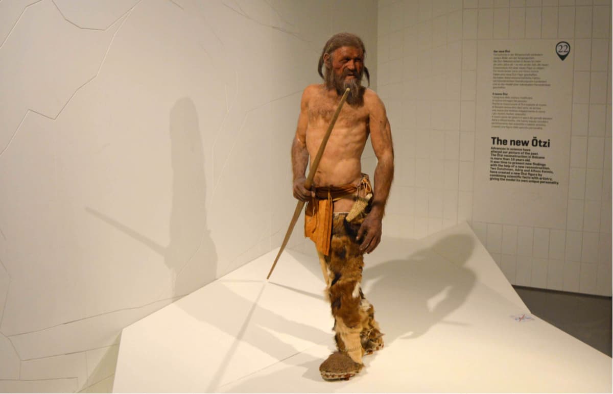
Ötzi was discovered by tourists in 1991 in the mountains, at an altitude of 3200 meters, between Austria and Switzerland. At present, the mummy is the oldest surviving mummy. According to the radiocarbon analysis it is 5100 -5400 years old. It was named Ötzi (by the name of the area where it was found) but is also known as the Iceman, the Similaun Man (Italian: Mummia del Similaun), the Man from Hauslabjoch, the Tyrolean Iceman, and the Hauslabjoch mummy. In 2011, scientists deciphered the Ötzi gene and found that it was not the ancestor of any modern man. His clothes were quite intricate, his body had many tattoos, a copper axe, a quiver with arrows, a bow and a stone knife were also found at the burial place.
Permafrost mammoths
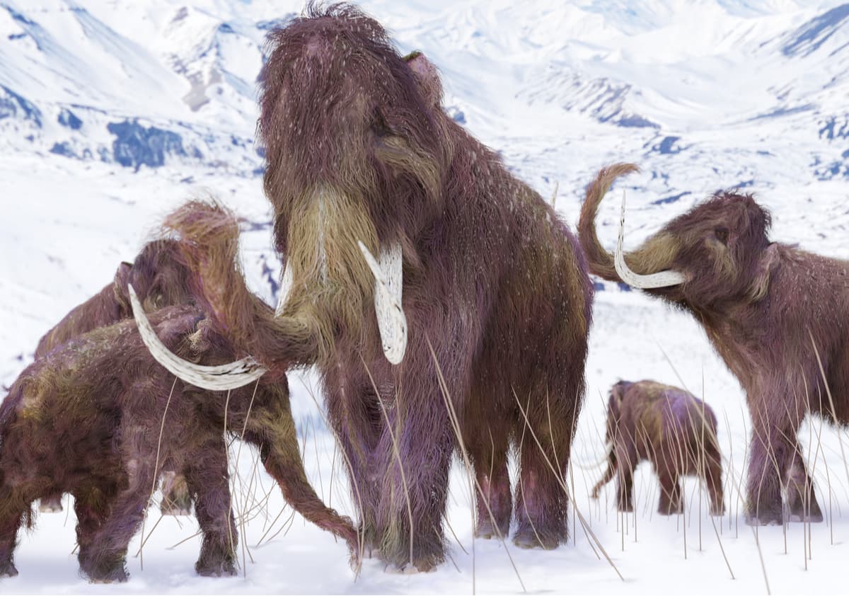
The Kirgilyakhskiy mammoth (or Dima mammoth) was found in 1977 in Magadan region of Russia, it preserved quite perfectly in permafrost. The age of a mammoth at the moment of death is estimated to be 6-7 months. The period of life by different estimates is from 13 to 40 thousand years ago. The degree of preservation is almost 100%. The discovery of the mammoth carcass was immediately recognized as a scientific sensation on a global scale. This was the first time that a mammoth carcass had been found in modern times in the condition suitable for research.
The most massive virus at the moment.
Pithovirus sibericum was discovered in 2014 in a sample of 30,000-years old perennial permafrost from Siberia by French evolutionary biologists Jean-Michel Claverie and Chantal Abergel from the University Aix-Marseille, France. Scientists argue that such viruses are perfectly safe for humans as they only parasitize on amoebas. Yet, the discovery encouraged to shoot the whole season of Canadian 2019 series V-Wars with Ian Somerhalder starring as the main culprit who undug such a virus and brought it back to human areal of habitation. Thus, who knows how such viruses found in permafrost can actually workout.