Share

Scan the QR code and open PeakVisor on your phone
Scan the QR code and open PeakVisor on your phone
The Sheeprock Mountains are a collection of peaks situated in the central part of the US state of Utah. The small range is surrounded by a diverse landscape of deserts and valleys that are located to the southwest of the Great Salt Lake. The tallest and most prominent peak in the range is Black Crook Peak at 9,262 ft (2,823 m) in elevation and with 3,064 ft (934 m) of prominence.
The Sheeprock Mountains are located just northwest of central Utah to the south of the Great Salt Lake. The range runs in a northwest to southeast direction for 24 miles (39 km). It is approximately 9 miles (14 km) wide.
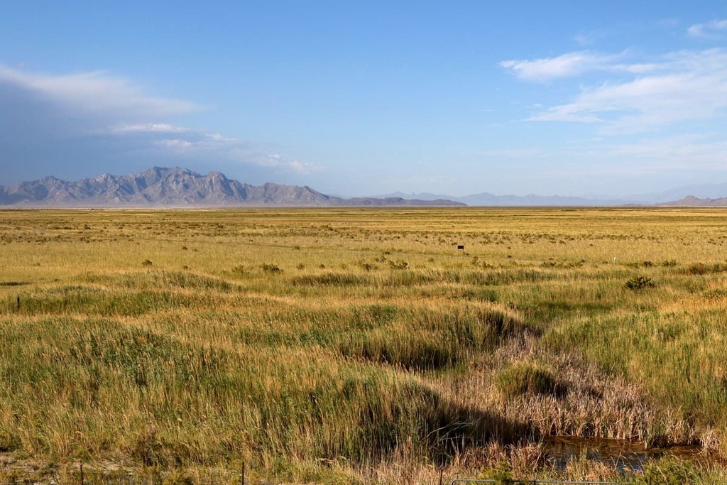
The tallest peaks in the Sheeprock Mountains mark the southeastern border of the range. The range also acts as the northeastern border of the Sevier Desert.
To the northwest of the range lies the Dugway Proving Ground while the bulk of the Great Salt Lake Desert is situated to the north. Rush Valley, Cedar Valley and Utah Valley all lie just north of the range, separating the peaks from the Great Salt Lake.
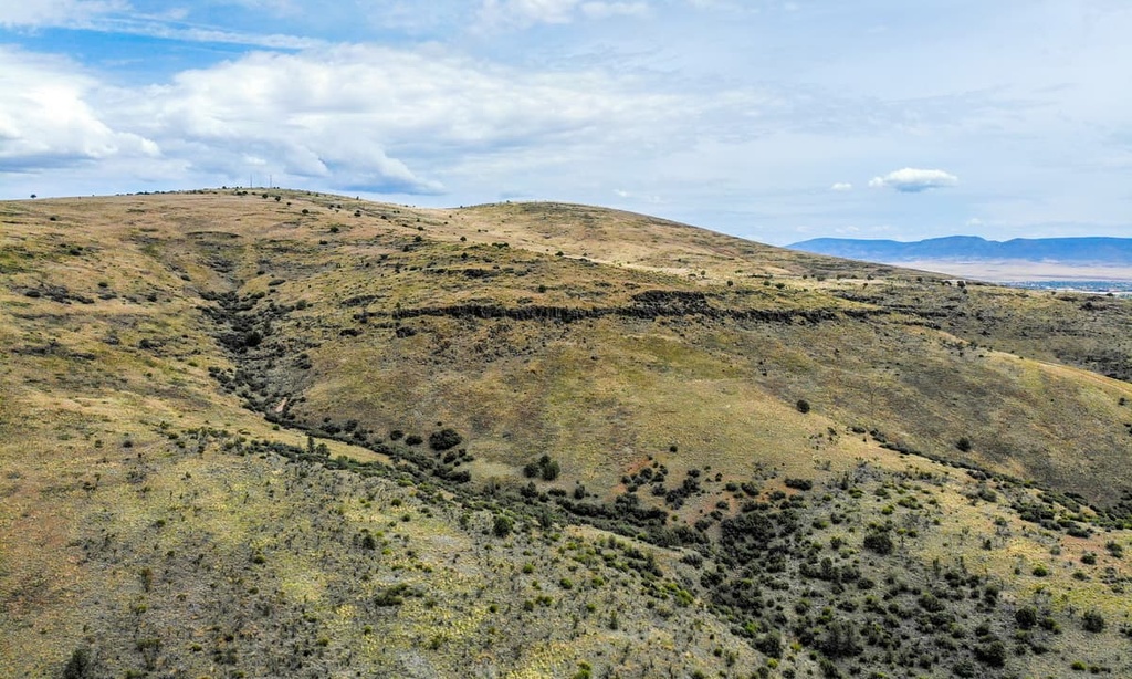
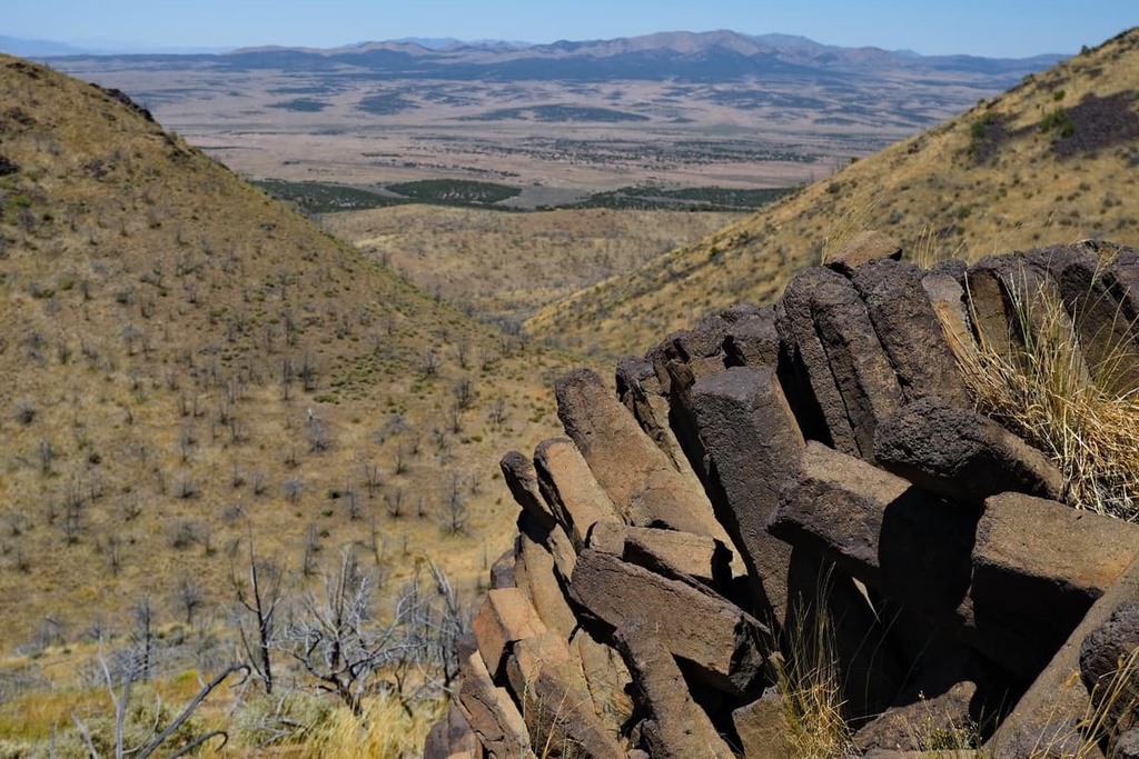
The northern edge of the range is marked by abrupt changes in elevation, as the peaks give way to expansive deserts and valleys. The southern edge of the Sheeprock Mountains is home to more gradual slopes.
Here, rugged ridgelines are met with various sub-ranges and hills that transition into the Rush Valley. The northwestern edge of the range also connects with the southern edge of the Onaqui Mountains.
Between the Sheeprock Mountains and the Onaqui Mountains lies Lookout Pass, which separates Little Mountain and Red Pine Mountain. The Sheeprock Mountains are part of the much larger Great Basin Ranges, which cover a majority of Nevada and western Utah.
The Sheeprock Mountains are located near numerous national forests and wilderness areas. The Deseret Peak Wilderness Area and Cedar Mountain Wilderness Area are located to the north of the range.
Meanwhile, the Mount Nebo Wilderness Area and Uinta National Forest lie to the east of the range. The peaks within the Sheeprock Mountains are part of the Uinta-Wasatch-Cache National Forest, though they are separated from the main portion of the forest.
The peaks within the Sheeprock Mountains are part of the larger Great Basin Ranges, which extend throughout much of Nevada, Utah, Idaho, Oregon, and California.
The topography of the Great Basin Ranges is unique compared to other nearby mountain chains. The Great Basin Ranges are characterized by alternating ranges and basins, a distinct landscape that’s easily seen throughout the region.
This geological formation is seen within the Sheeprock Mountains. Indeed, the range is almost entirely surrounded by vast desert basins, with the exception of the narrow northern ridgeline of the range.
The land in and around the Sheeprock Mountains began taking shape during the Early Miocene. Immense amounts of pressure caused by the movement of tectonic plates led to mountain building in the region. These movements would later form the various ranges and basins that are now found throughout the Great Basin Region.
The Sheeprock Mountains are composed primarily of sedimentary rock. Sections of metamorphic rocks, such as shale, can also be found within the range, though they are less common. Large mineral deposits can be found in much of the Great Basin Region, including the Sheeprock Mountains.
Major peaks within the Sheeprock Mountains include Black Crook Peak, Desert Mountain, Red Pine Mountain, Dutch Peak, and Chicken Rock.
Since the range lies within the Great Basin, it shares characteristics of the Great Basin ecoregion. As a whole the ecoregion is known for being quite dry, showcased by the rather barren desert landscapes throughout.
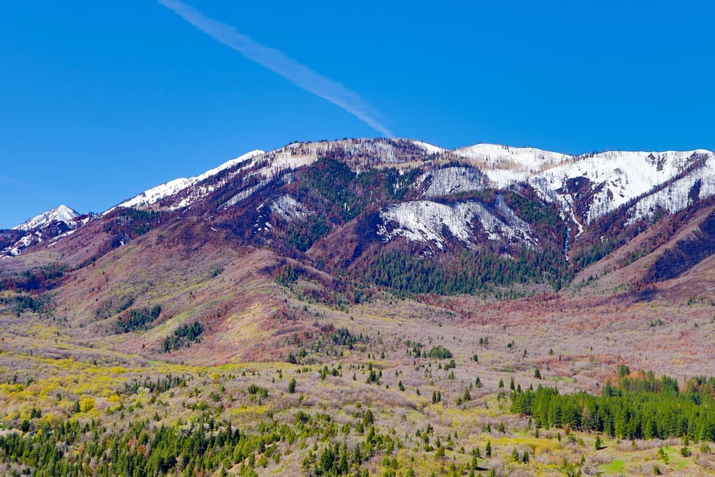
Despite the lack of rainfall in the region, the highest peaks within the Sheeprock Mountains receive more condensation than surrounding peaks. During the winter months, the range receives large amounts of snowfall compared to the nearby basins.
Sagebrush and grasslands dominate the landscape at the lower elevations within the Sheeprock Mountains. Higher elevations have a variety of flora as the range is located between a majority of the Great Basin and the Western Rocky Mountains.
Patches of juniper, Douglas fir, and aspen trees can be found along the hillsides of the range. These forested patches thin out at the highest elevations in the range, giving way to alpine meadows and wildflowers.
Wildlife is found throughout the range and is similar to that of much of the surrounding region. Populations of coyotes, bobcats, cougars, mule deer, and pronghorn are all common in the Sheeprock Mountains. Hikers can also often spot jackrabbits throughout the range.
Additionally, the Sheeprock Mountains are home to their namesake desert bighorn sheep. Although they can be elusive, you can often spot desert bighorn sheep while hiking in the range.
The land surrounding the Sheeprock Mountains has a rich human history that dates back long before the arrival of Europeans. Human settlements in the region are thought to have begun over 10,000 years ago.
Many different Indigenous peoples have inhabited the land in and around the range over the course of countless generations. Many tribal nations, including the Eastern Shoshone Tribe, Confederated Goshute Tribes of the Goshute Reservation, Skull Valley Band of Goshute, Ute Indian Tribe, and Shoshone-Bannock Tribes consider the region to be part of their ancestral homelands.
The first settlers of European descent arrived in the region during the mid 1800s. Many of these settlers were fur trappers. In the 1820s, settlers, such as William Henry Ashley, began traveling further into the Uinta Mountains, which are located to the northeast of the Sheeprock Mountains.
Around the same time, Brigham Young sent a group of the Mormons to the region to establish communities. These early settlements laid the framework for a stream of Mormon immigrants to the region.
Settler communities in the region began to grow with the advent of gold, silver, tungsten, copper, iron, and lead mining in the area. During this time, many Indigenous people were either killed or forcibly removed to reservations.
The Shoshone Tribe joined forces with the Bannock Tribe following the Bear River Massacre in an effort to take back their sacred land. The battles that broke out would later be known as the Snake War. Toward the end of the nineteenth century, the Shoshone people were forcibly moved to reservations located in Idaho and Wyoming.
The Uinta National Forest was established in 1897. In 2007, it was combined with the Wasatch-Cache National Forest to form the Uinta-Wasatch-Cache National Forest. Today, the land surrounding Great Salt Lake has become the most populated region in the entire state.
The Sheeprock Mountains are not as accessible for hiking as many of the surrounding ranges. However, here are some of the most popular hiking opportunities in the range.
The Vernon Reservoir trail is one of the only designated hiking routes within the Sheeprock Mountains. The short trail is 1.2 miles (2 km) long with just 65 ft (20 m) of elevation gain.
This loop trail circles around the reservoir, which is surrounded by forested rolling hills. A small campground is also located along the shores of the reservoir.
Black Crook Peak is the tallest peak in the Sheeprock Mountains. There are no designated trails to the summit, though there are some unmaintained paths that lead to the peak from North Pine Canyon.
From the North Pine Canyon Road, you can follow a rough route up a ridgeline up to the summit. From the summit, hikers have panoramic views of much of the range.
The route up the Southeast Ridge starts northeast of the peak. The primitive trail is 8 miles (12.9 km) long with 3,000 ft (914 m) of elevation gain.
Note that the route requires hikers to scramble up Class 3 terrain. There are also two false summits before you reach the top of the rige. A final scramble leads hikers to the true top of the ridge.
The trail up Red Pine Mountain begins off of Pony Express Road, at the northern edge of the Sheeprock Mountains. From the road, the trail is 4 miles (6.4 km) round trip with 1,600 ft (488 m) of elevation gain to the summit.
Looking for a place to stay near the Sheeprock Mountains? Here are some of the best cities and villages to check out in the region:
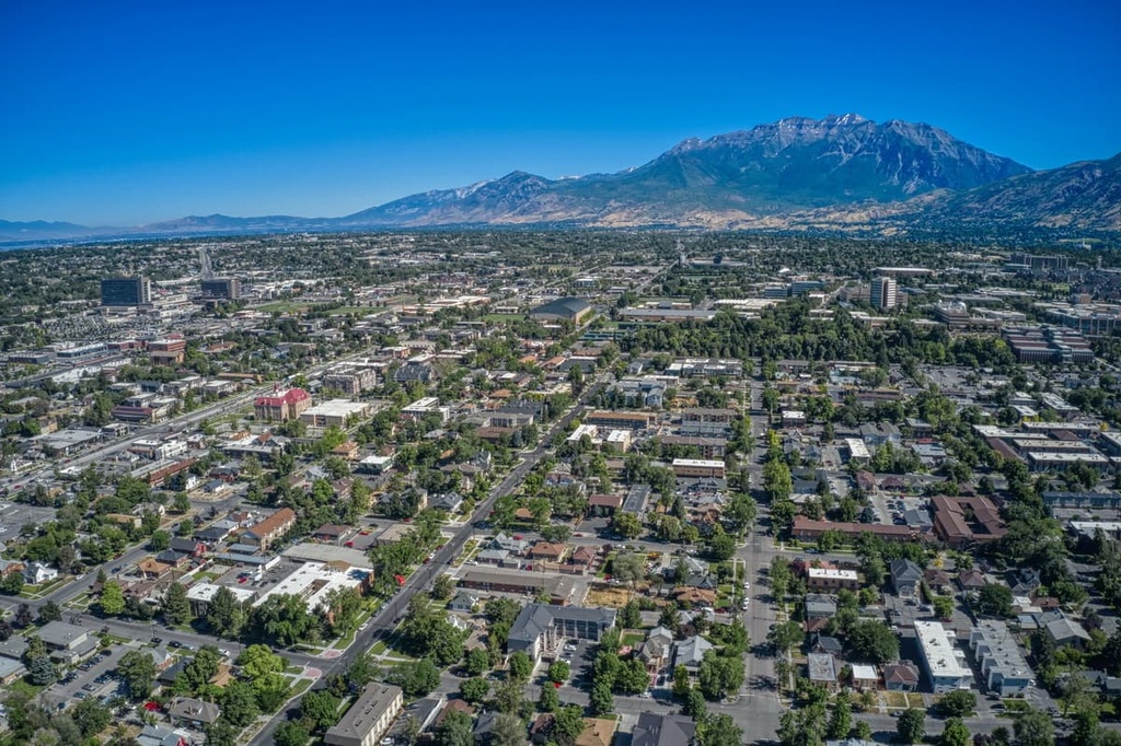
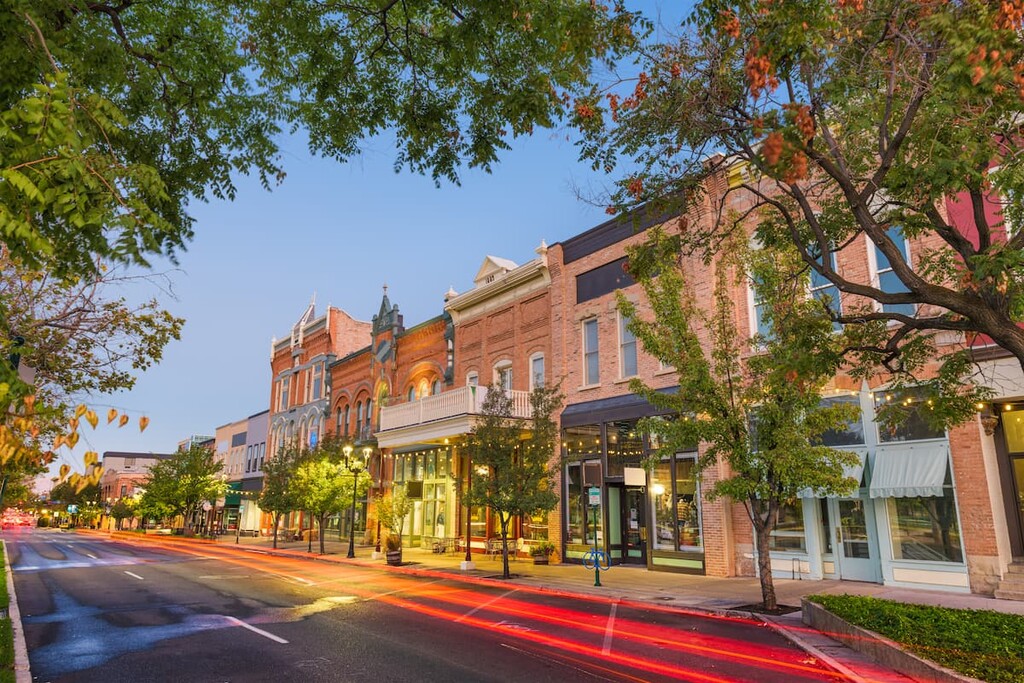
Located to the east of the Sheeprock Mountains along the eastern shore of Utah Lake lies the city of Provo. The city is known for being the home to Brigham Young University as well as numerous museums. While Provo has a population of 116,000 people, the metro population is about 620,000.
Provo is surrounded by opportunities for outdoor recreation. Hiking, running, and mountain biking trails are all within close proximity, along with easy access to national forests, parks, and ski resorts. As one of the largest cities in Utah, Provo is also a hub for cultural events and festivals.
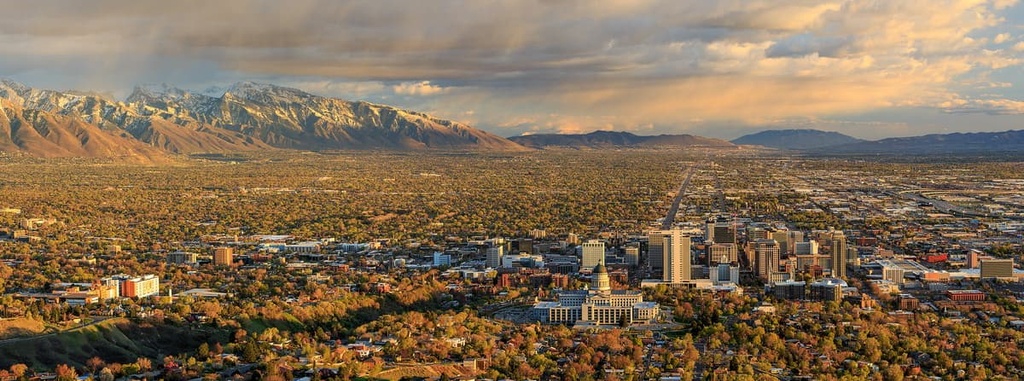
Salt Lake City lies to the northeast of the Sheeprock Mountains. With a city population of nearly 200,000 people, and a metro population of over 1.2 million residents, Salt Lake City is the most populous city in the entire state of Utah.
The city provides easy access to five of the state’s national parks and numerous national forests. During the winter months, locals and visitors alike can explore the nine ski resorts that are all within an hour’s drive of the city. Salt Lake City is also an ideal location for year-round outdoor recreation.

Explore Sheeprock Mountains with the PeakVisor 3D Map and identify its summits.