
Share

Scan the QR code and open PeakVisor on your phone
Scan the QR code and open PeakVisor on your phone
The British Columbia Interior, often referred to as the Interior, is a geographic section of the province of British Columbia in Canada. The most prominent mountain is Shedin Peak. The region is loosely defined but often refers to the 14 regional districts that don’t have a coastline and are not part of the Lower Mainland. As a whole the region is home to approximately 1 million people and spans 669,648 square kilometers.
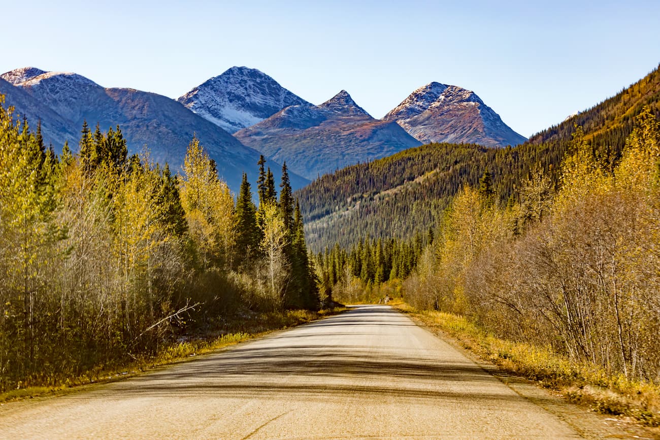
There are 1102 named mountains in British Columbia Interior. Thudaka Peak is the highest point at 2,741 meters. The Interior is defined by its complex landscapes of temperate coniferous forest and alpine tundra mixed throughout the many mountain ranges. Much of the mountain ranges are often grouped together to form the Interior Mountains or Northern Interior Mountains. This comprises most of the mountains in the region that lie just south of Yukon. The subregions of these mountains include the Skeena, Cassiar, Omineca, and Hazelton Mountains with the Coast Range to the west and the Rocky Mountains to the east. The Stikine Plateau, which has a mixture of plateaus and smaller mountain ranges, is also included in the Interior Mountains. Within the four major ranges lie numerous smaller ranges, each uniquely defined.
The Interior Plateau is broken into four major sections; Cariboo, Chilcotin, Nechako, and Thompson plateaus. Much of the British Columbia is part of the Intermontane Belt, a physio geological region that stretches from Washington State up through Yukon. The mountain formations in this region have little similarities with the surrounding mountains. About 115 million years ago, the Insular Islands collided with what was then the Pacific Northwest. This collision resulted in magma, compression of the two plates, from it forming the Intermontane Belt.

The Interior is home to seemingly countless Provincial Parks. Not to mention it has the icon Coastal and Rocky Mountains on either side. Here a just a few of the icon parks within the British Columbia Interior
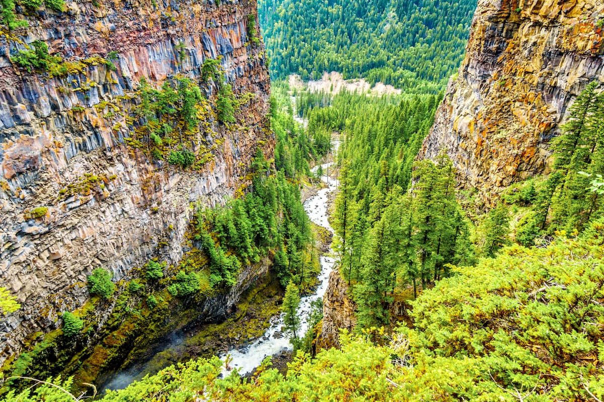
Ts’il?os Provinical Park: Ts'il?os (pronounced “sigh-loss”) Provincial Park is a provincial park located in British Columbia in Canada. The park spans 233,240 hectares across BC. Established in 1994, the Ts'il?os Provincial Park is known for the rugged mountains, clear lakes, glaciers, alpine meadows, and waterfalls. The park is home to Chilko Lake which is the largest, natural high-elevation freshwater lake in all of Canada. The lake is surrounded by vast peaks while the waters are crystal clear. The lake is also home to spawning sockeye salmon along its shores.
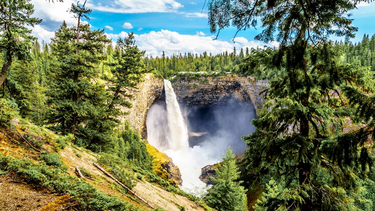
Wells Gray Provincial Park: Wells Gray Provincial Park is British Columbia’s fourth largest park, spanning 5,250 square kilometers. The park is full of a diverse range of landscapes, featuring calm mountain meadows, to rigid peaks and some of the tallest waterfalls in the province. Hikes include Helmcken Falls, Trophy Mountain, Spahtas Falls, and numerous others.
Spatsizi Plateau Wilderness Provincial Park: The Spatsizi Plateau Wilderness Provincial Park is the second largest park in BC, spanning 696,160 hectares. The park includes two distinct regions, the Spatsizi Plateau and the Skeena Mountains. The McEwan Creek Trail and the Eaglenest Creek Trail lead into the park where a network of over 160km of trails can be enjoyed.
Glacier National Park of Canada: Not to be confused with Glacier National Park in Montana, USA, the Glacier National Park of Canada is equally beautiful. Just one of seven National Parks within the country, this protected region spans 1,349 square kilometers. Part of the Selkirk Mountains lie within the park. There are 131 glaciers, and 140 kilometers of established hiking trails in the park. The park is full of rugged mountain peaks, alpine lakes, and massive glaciers, all intermixed with a deep history and historical significance.
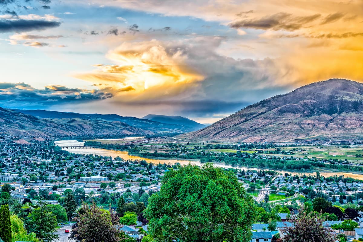
The city sits at the confluence of the two branches Thompson River and Kamloops Lake. With a population of just over 100,000, the city is the one of the largest located north of Vancouver. Surrounded by the Cascade Mountains, Kamloops is a mecca for outdoor activities. An extensive trial network offers ample opportunity for hiking and mountain biking year-round. The city is known as the “Tournament Capital of Canada” and often hosts many sporting events. Just east of the city lies Sun Peaks Resort, for skiing and snowboarding.
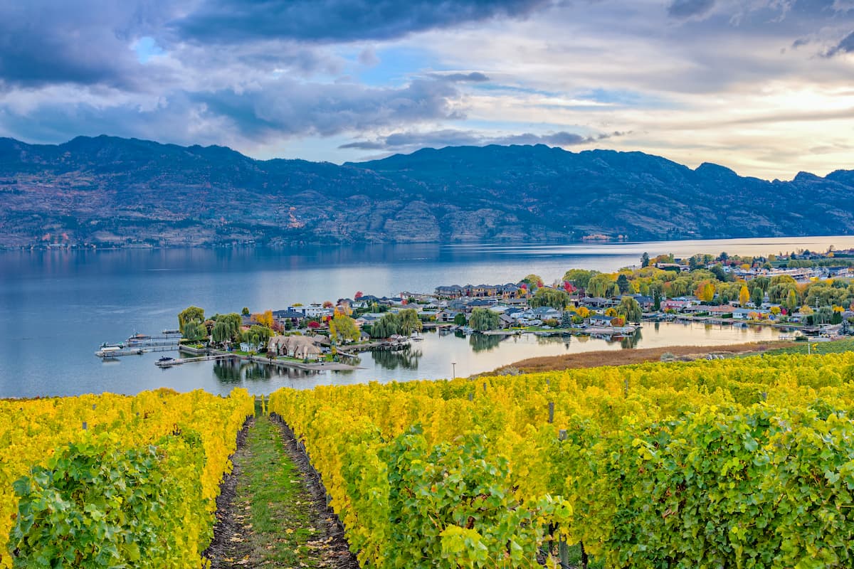
The city of Kelowna lies two hours southeast of the city of Kamloops. Located on Okanagan Lake within the Okanagan Valley of British Columbia, Kelowna is the seventh largest city within the province. The term Kelowna is derived from the Okanagan language term for grizzly bear. The city sits on the eastern shore of Okanagan Lake and is a notable stop within the wine country. During warmer months the town is full of water sports, hiking, biking, and running. Take a trip to Myra Canyon on the reclaimed Kettle Valley Railway. From there cycle through tunnels and along a steep canyon rock face.
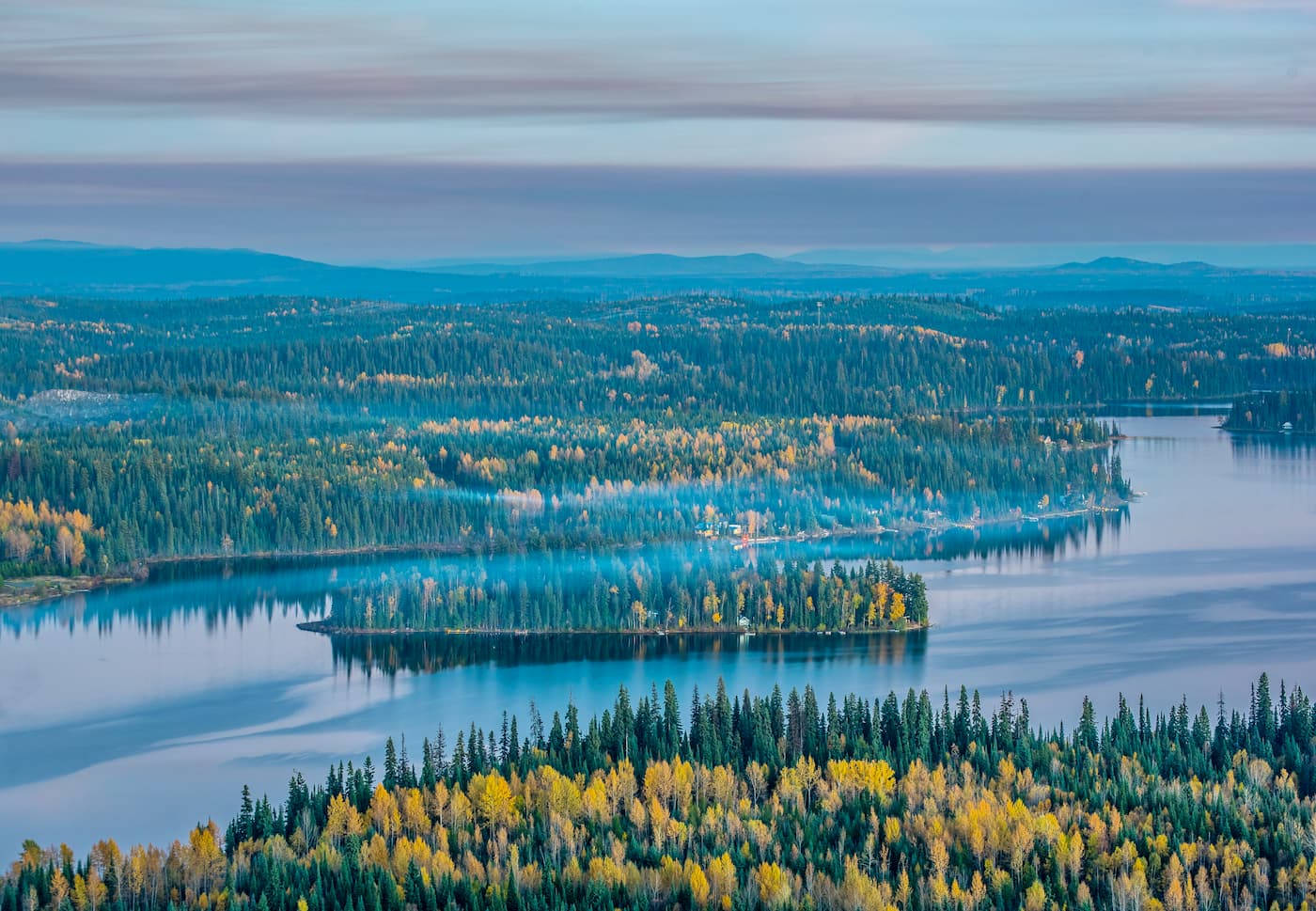
The city of Prince George is located at the northern end of the Quesnel Highlands. With a population of nearly 90,000, Prince George is the largest city located in northern British Columbia. The city is situated at the confluence of the Fraser and Nechako rivers near the transition of the northern and southern Rocky Mountain Trench. Within the city there are riverfront trails although the city is known for being close to four provincial parks. The parks offer an abundance of trails as well as skiing.
Explore British Columbia Interior with the PeakVisor 3D Map and identify its summits.


