
Scan the QR code and open PeakVisor on your phone
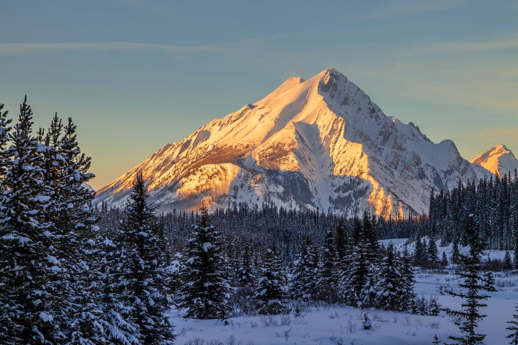
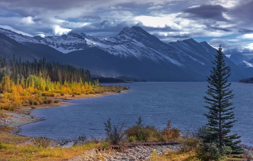
One of the front ranges of the Canadian Rocky Mountains, The Goat Range sits along the western shore of the Spray Lakes Reservoir in Kananaskis Country in Alberta, Canada. The peaks offer spectacular views of Banff National Park and Kananaskis Country. The three named peaks in this range are: Old Goat Mountain (3120m/10236ft), Mount Nestor (2931m/9616ft), and Goatview Peak (2881m/9222ft).
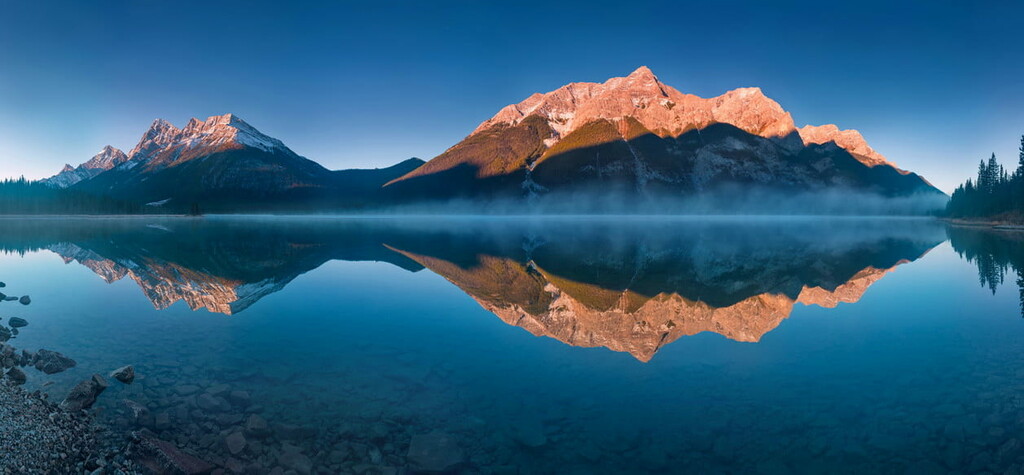
Running nearly north to south with a slight west to east orientation, the Goat Range straddles the borders of two parks: Banff National Park is to the west and Spray Valley Provincial Park to the east. The ridges and peaks of the range delineate part of the border between the parks.
The range is located south of the towns of Banff and Canmore, Alberta. The range lies upon the western shore of the Spray Lakes Reservoir and is accessible from Highway 742 (Smith Dorrien Trail) and the West Side Road, which follows the west side of the reservoir.
The Sundance Range parallels the Goat Range to the west while the Kananaskis Range sits to the east. Iconic peaks such as Ha Ling and the Three Sisters are visible from the range.
Created during the Laramide orogeny, the Rocky Mountains started forming during the Late Cretaceous, 70 to 80 million years ago, though the mountain building event ended about 35 to 55 million years ago. Tectonic plates from the west slid under the North American Plate causing the formation of mountain ranges from Canada to Mexico, and as far east as South Dakota.
Since a seabed was raised up to form the mountains, sedimentary rocks comprise the majority of the Goat Range. Limestones, dolomites, and shales compose the peaks, ridges, and cliffs of the range with outcrops of sandstones, siltstones, and coal.
During the Pleistocene epoch, about 2.6 million to 11,700 years ago, the Rocky Mountains were heavily glaciated. The glaciation and subsequent retreating of the glaciers created much of the topography of the range creating the cirques and moraines.
The Old Goat Glacier is a remnant of the last glacial maximum and it is found on the eastern slopes of Old Goat Mountain. Although it is not generally visible from below as the view is blocked by the buttress of the mountain, there is a trail near the Spray Lakes West Campground that leads up to the glacier.
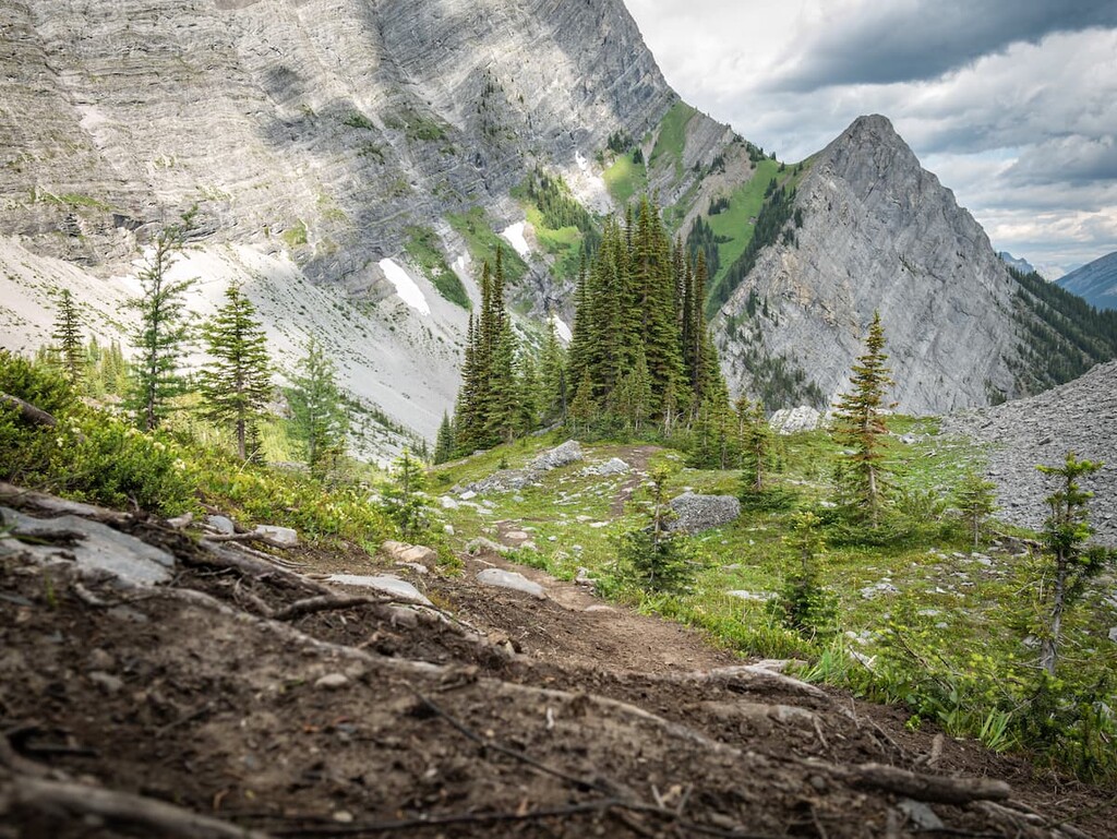
The Goat Range consists of the rocky and harsh alpine habitat above the tree line and forested subalpine habitats below the tree line.
Plants and animals are sparse in the alpine areas of the range and consist mainly of lichen covered rocks, grassy meadows, mat vegetation, shrubs, and krummholz.
Sedges and heathers cling to the edges of snowbeds and grouseberry grows in protected areas. Stunted subalpine fir and Engelman spruce may be spotted amongst the rocky outcrops and grasses. Lengthy snow cover and cold temperatures prevent most flora from thriving in the area.
Birds are the only animals known to regularly inhabit the alpine areas of the Goat Range. White-tailed ptarmigan, gray-crowned rosy finch, horned lark, and the American pipit are found in the area during nesting season. Solitary mammals occasionally migrate through the alpine zone to reach another area.
Lower altitudes allow for significant flora and fauna to inhabit the area. Due to fires in 1867 and 1895, the eastern slopes of the range along the Spray Lakes Reservoir are dominated by lodgepole pine. Though not as numerous, subalpine fir, Engelman spruce, aspen and larch are also found throughout the range.
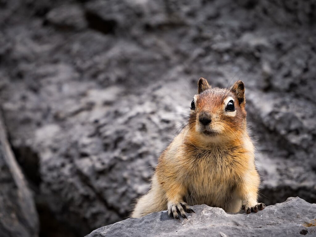
Many different animals inhabit the subalpine of the Goat Range. Large predators such as grizzly bears, black bears, cougars, and wolves make their home in the range. Ungulates such as elk, mule deer, white-tailed deer, and mountain sheep are common to the range. It is also possible to hear the screech of the marmot and find evidence of pika and ground squirrels.
Below the range, there are many fish species to find in the Spray Lakes Reservoir. Dams have reduced the water flow to the Spray River and Goat Creek and as a result many native fish species have died out in the area. Currently, mountain whitefish are the last native species in the rivers. However, lake trout, which are native to Alberta, have been introduced, as have brook trout and rainbow trout.
Human habitation of the region is suspected to have begun 8,000 years ago. Cultural sites in the area suggest continuous use for the last 7,000 years. Archaeologists believe people from as far away as Idaho, in the United States of America used to hunt and forage here during the summer.
Kootenai and Salish First Nations from British Columbia are believed to have traversed the region on trading missions to the plains. Since the 1600s the Stoney (Nakoda) peoples have used the area for hunting, gathering, ceremonial, and spiritual purposes.
European use of this region began with James Sinclair in the early 1800s and further mapping of the area was done by the Palliser Expedition in the 1850s. The Goat Range may have previously been home to minor logging operations; however, dams prevented further logging since the river could no longer transport logs.
Several dams were built between 1932 and 1955 in the valley east of the range along the Spray River and Goat Creek. These dams provided hydroelectric power to towns in the valley and Calgary. The Spray Lake Reservoir at the base of the Goat Range was created in 1950 with the construction of Canyon Dam and Three Sisters Dam.
Whether you’d like a hike to a glacier, a mountain scramble, or a paddle on the reservoir, the Goat Range has many activities to offer. Here are some of the attractions of the area:
The trail to Old Goat Glacier, a 10 km (6 mi) out and back, is the only official hiking trail in the range. The hike grants access to the glacier and views across the valley towards the Big Sister (Faith Peak) and Mount Lawrence Grassi in Bow Valley Wildland Provincial Park.
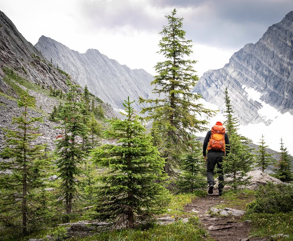
Considered an intermediate hike, with steep sections and an unclear trail, it can be hiked year-round. The trailhead is located at the Spray Lakes West Campground and the trail winds along the valley towards Old Goat Mountain until it ascends into the glacial gully. During the winter, snowshoes can be helpful, and avalanches are a risk.
Mount Nestor was named after a destroyer which was sunk during the Battle of Jutland in World War One. The trail up Mount Nestor is considered a moderate scramble and not a hike. A scramble is more akin to mountaineering and it is not just a “very difficult” level hike. Exposure (the risk of falling off) and the need for climbing are common on scrambles.
The south aspect of Mount Nestor provides the scrambling route, while the east face is favored by climbers. Though difficult to ascend, the route to the summit is apparent and it’s difficult to get lost on your way up.
From the road you follow the gully up the south side of the mountain into the U-shaped trough, called a syncline, until you reach the western ridge. Once atop the ridge, follow it to the summit.
From the summit you will be rewarded with views of the Spray River valley, the ranges across Kananaskis Country, as well as views of Banff National Park. Descent can be by the same route or the other gully that leads from the peak. Mount Nestor can offer a good scramble with great views, but it is not the inexperienced.
Unlike many of the nearby mountains, Old Goat Mountain was not named after a person or a ship from the Battle of Jutland. Indeed the peak was named “Old Goat” in memory of Rick Collier, a founding member of the Old Goats Climbing Club. He climbed the peak many times and wrote about the mountain and its routes.
Like the Mount Nestor scramble, this is not a hike. The Old Goat Mountain scramble is considered difficult or a “climbers scramble.” There is considerable climbing that must be done in order to reach the summit. This scramble should only be attempted if you have adequate experience.
The scramble starts in a drainage on the southeast side of the mountain near the base of Mount Nestor. The route continues up the drainage and along onto the ridge. The drainage is described as overgrown, and the ridge traverse is said to have many obstacles.
The ascent is difficult with consistent exposure and it requires a high degree of scrambling ability. The descent is more difficult and dangerous, and some will bring a rope to rappel down the steepest sections instead of risking down-climbing unassisted.
The views from the route and summit are spectacular, but the value of the view should be weighed against your experience and the risks.
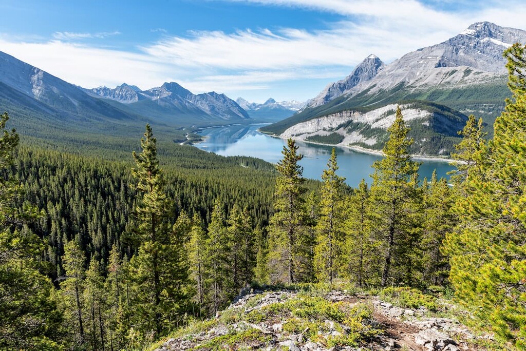
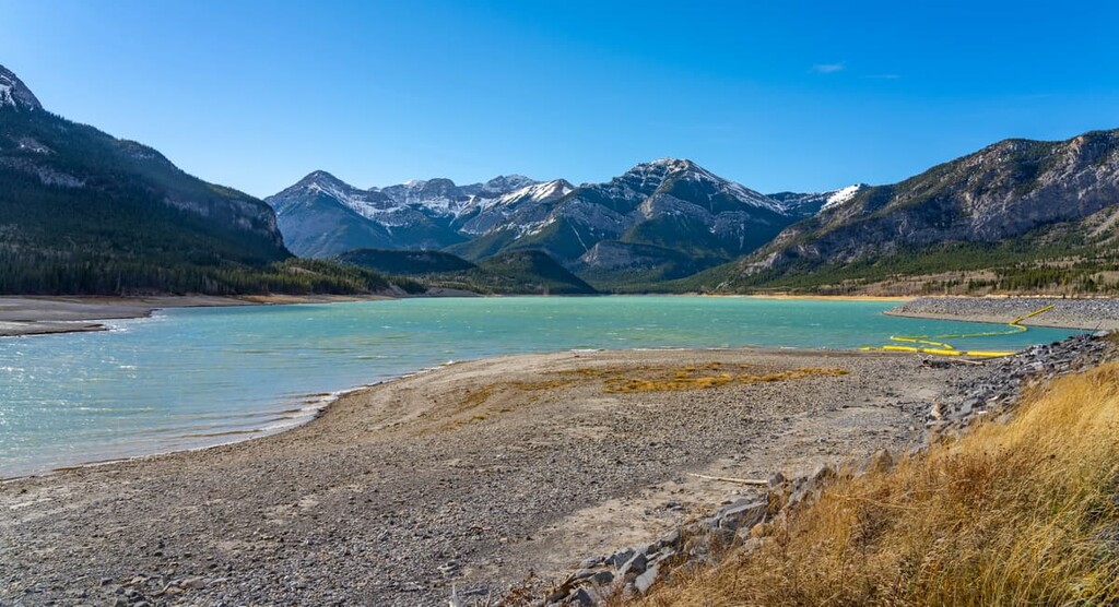
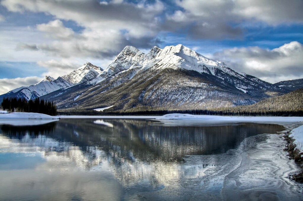
Located at the base of the Goat Range, the Spray Lakes were originally a string of smaller lakes along the Spray River, a tributary to the Bow River. With the completion of Canyon Dam and Three Sisters Dam in 1950, the Spray Lakes were turned into a single reservoir to provide power to the Bow Valley hydroelectric system.
The Spray Lakes Reservoir offers boating, paddle sports, and fishing in the summer, with ice fishing and skating in the winter. A seasonal campground is found along the western shore and hiking trails surround the reservoir. The Spray Lakes Reservoir is a beautiful place to visit and play.
The Goat Range is accessible from Canmore by following Highway 742 south to the Spray Lakes Reservoir. Banff is located just north of the range. Driving from Banff to the range will take you through Canmore; however, one can follow hiking trails south out of the Banff townsite that will allow you to reach the Goat Range in short order.
Nestled in the heart of the Bow Valley, Canmore, like many towns along the mountain railway, started as a coal mining settlement. It is located near the western edge of Banff National Park so it’s a good place to stay if you’re interested in exploring fun destinations and activities in the region.
Canmore provides easy access to hiking trails like Ha Ling Peak, Chester Lake and Grotto Canyon. In addition to hiking, Canmore offers ample opportunity for road and mountain biking.
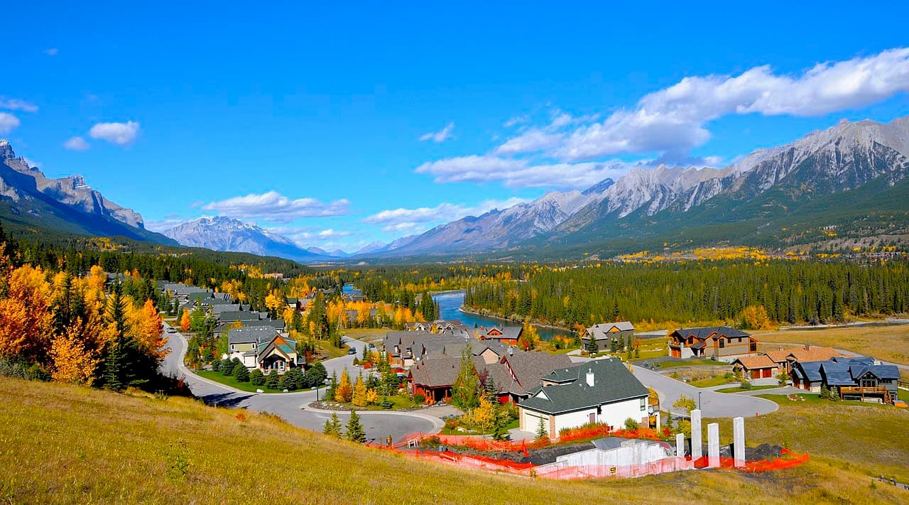
The snow-filled months are typically the busiest months in Canmore, as it is a wonderful tourist town for the surrounding ski resorts, such as Sunshine and Lake Louise.
Located in Banff National Park and home to the famous Cave and Basin Hot Springs, Banff offers plenty of lodging and a unique mountain lifestyle experience. With amazing mountain views from the streets, such as the iconic East End of Rundle (EEOR), and the world famous Fairmont Banff Springs Hotel, Banff offers a first-class mountain experience.
From Banff, mountain trails, peaks, and phenomenal views are easily accessible on a day trip. You can then return to your luxurious lodging and end your day in one of the many spas, where you can enjoy a relaxing massage.
This amazing town does get busy in the summer and winter seasons. Spring and fall offer a time when the trails and sidewalks are less busy, and fall is the time when you can witness the incredible changing colors of the larch trees along the mountain ridges.
Since the town is situated within a national park, wildlife sightings are to be expected. It isn’t uncommon to see elk roam the townsite.


