
Scan the QR code and open PeakVisor on your phone
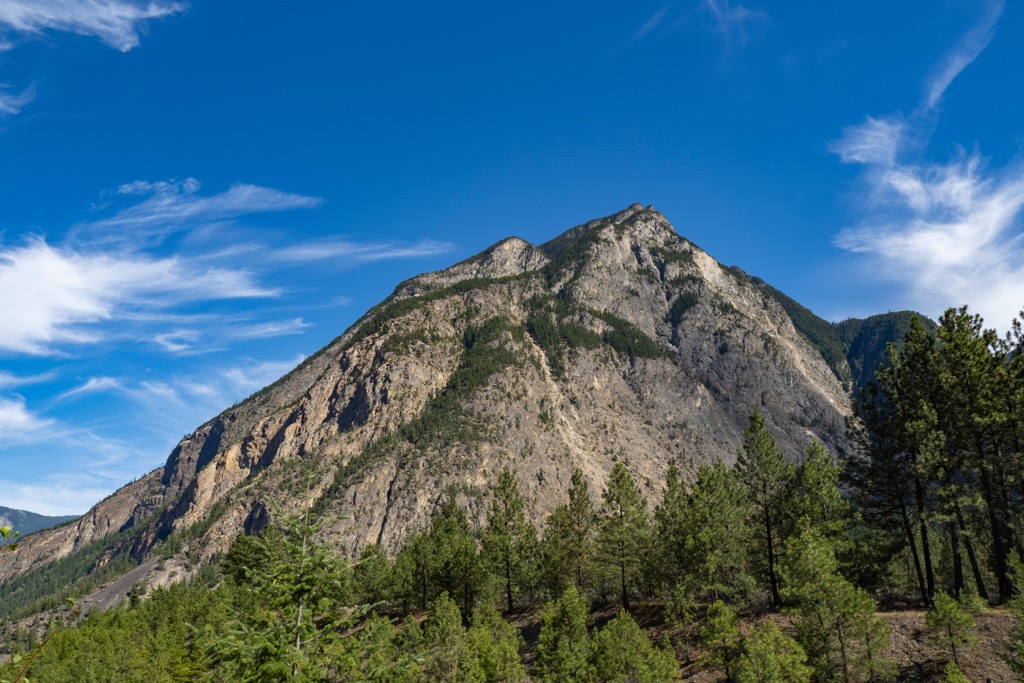
Upper Rogers kólii7 Conservancy has 4 named peaks. The highest is Skook Jim Mountain at 2,602 m. Other notable peaks include Caltha Peak, Diversion Peak and Tynemouth Mountain.
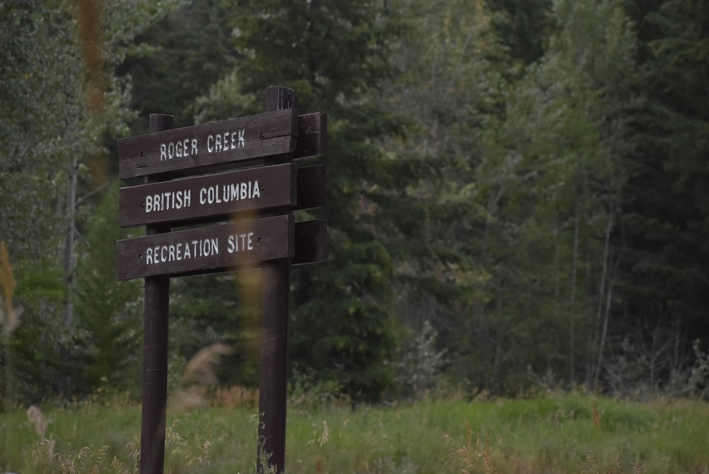
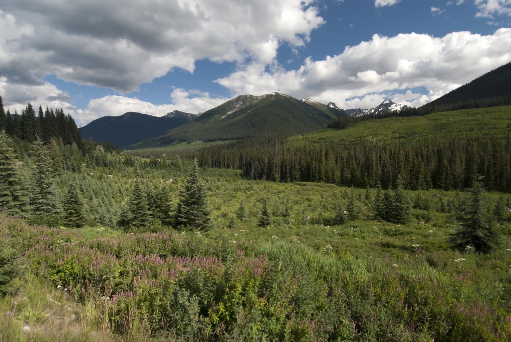
Upper Rogers kólii7 Conservancy is in the Pacific Ranges of southwest British Columbia, Canada. The conservancy is in the headwaters of the Rogers Creek watershed and encompasses beautiful montane forests, pristine alpine lakes, peaceful subalpine meadows and 4 peaks, of which Skook Jim Mountain (2,602 m/8,537 ft) is the tallest.
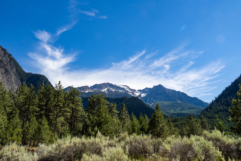
Situated in the southern Coast Mountains of British Columbia, Canada, Upper Rogers kólii7 Conservancy protects 3,605 hectares (8,908 acres) of the headwaters of Rogers Creek. The conservancy encompasses alpine lakes, subalpine meadows, montane forests, and portions of the Skook Jim and Caltha glaciers.
The word “kólli7” is pronounced ko-leh, and is Ucwalmicwts for “high green meadow” which reflects the alpine nature of the conservancy. The conservancy is about 18 km (11 mi) southeast of Lillooet Lake and is in the traditional territory of the In-SHUCK-ch Nation. In addition to the wilderness conservation, the conservancy protects a significant cultural site of the In-SHCUK-ch people.
Upper Rogers kólii7 Conservancy is in the Lillooet Ranges of the Pacific Ranges, which is a subrange of the Canadian Coast Mountains. Primary access to the park is via the In-SHUCK-ch Forest Service Road which runs along the east side of Lillooet Lake.
The conservancy is one of many protected areas in the region, and part of its reason for existence is to conserve part of the transition zone between the coastal and interior mountains of the Pacific Ranges. The following are some of the other adjacent and nearby parks and conservancies:
Upper Rogers kólii7 Conservancy is the Lillooet Ranges which is a subrange of the Pacific Ranges. The Pacific Ranges are the southern subrange of the Coast Mountains which dominate the west coast of Canada and border the southern tip of Alaska.
The Pacific Ranges are essentially granitic mountains that border the coastal trough to the west and BC’s Interior Mountains which are located to the east. The Lillooet Ranges are along the east side of the Pacific Ranges with the Fraser River as the eastern boundary, the Lillooet and Harrison rivers as the western edge, and the Nahatlatch River as the northern limit.
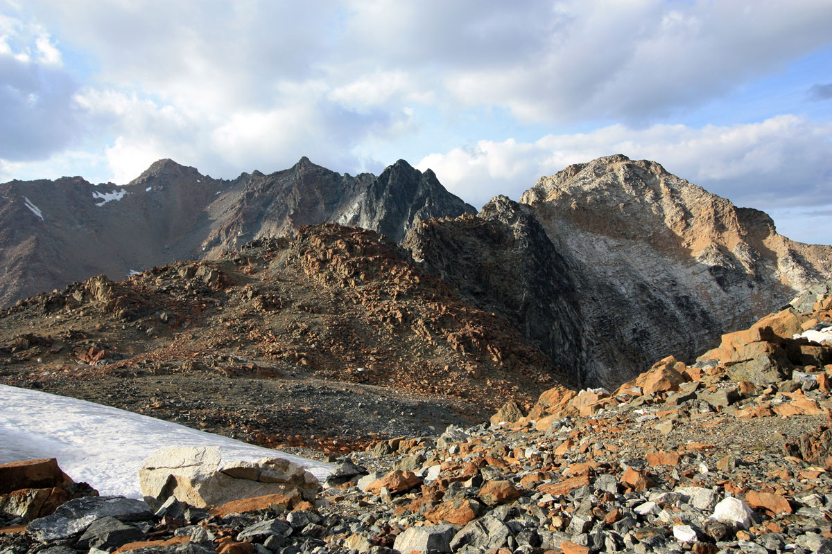
The Lillooet Ranges are extremely rugged with varied terrain and they contain some of the highest peaks in southwestern British Columbia. These mountains trace their origins to periods of sedimentation interrupted by volcanic eruption during the Paleozoic and early Mesozoic.
During the Jurassic and Cretaceous there was a period of mountain building and magma intrusion which uplifted the layers of sedimentary rocks and volcanic activity created massive granitic batholiths. The Cretaceous was a time of massive erosion that filled low-lying areas with sediment and exposed the granitic cores of the mountain range.
The final uplift of the Pacific Ranges occurred around 60 million years ago along the axes of the previous batholithic intrusions. Erosion continued and the rivers deeply incised the terrain as it was raised up creating the mature topography of the range, previous to the Pleistocene.
During the Pleistocene the alpine glaciers sharpened the high peaks and the ice sheet, which was 2.5 km (8,000 ft) thick in some areas, rounded the lower peaks and softened the topography by making existing valleys wilder and deeper. Furthermore, the valleys were filled with a mantle of glacial debris as wells as being littered with formations of glacial deposits.
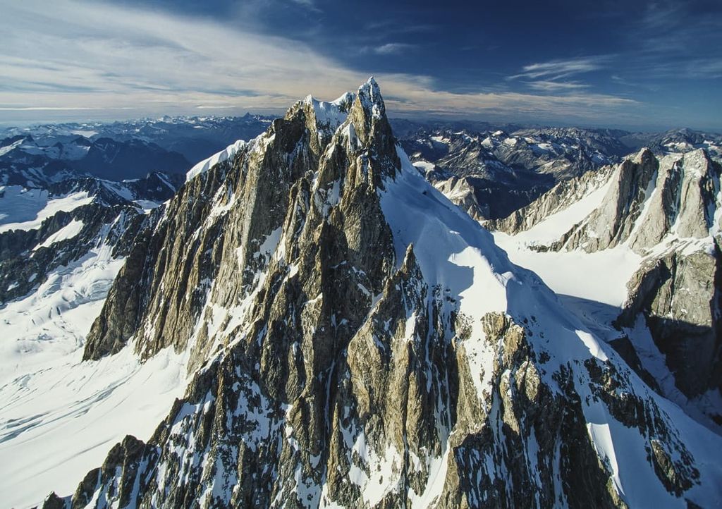
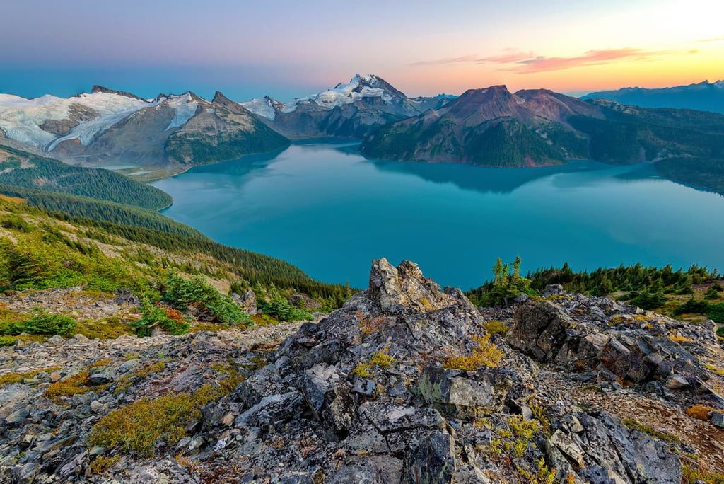
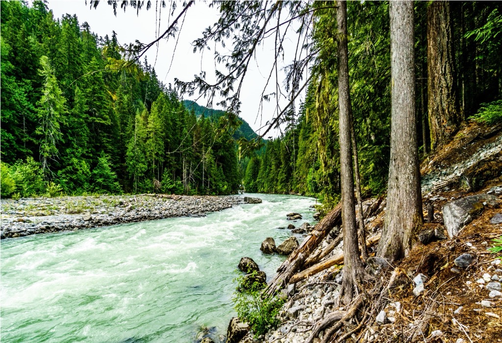
Some of the evidence of the glaciers are the glacial moraines, cirques, eskers, and tarns which are found in the alpine areas. Parts of the Skook Jim glacier and Caltha glacier are within the conservancy and their meltwaters sustain the water levels of Rogers Creek during the dry summer months.
Upper Rogers kólii7 Conservancy at the edge of the ecological division between the coastal ecosystems and the ecosystems which are common in the interior of BC. The climate of the park is relatively warm; however, it is much drier than the mountains to the west, especially at higher elevations.
The lowest elevations of the conservancy contain forests of red cedar, western hemlock, big leaf maple, and alder. The subalpine forests are filled with amabilis fir, mountain hemlock, and varying amounts of yellow cedar.

The word “kólli7” is Ucwalmicwts for “high green meadow”, and the abundant alpine areas of the conservancy are filled with grassy meadows and mountain heather.
The highlands are home to hoary marmots and mountain goats while bears inhabit the slopes and valleys of the conservancy. The conservancy plays a vital role in linking habitats for several species, including grizzly bears, American black bears, and wolverines. Many animals travel through these valleys as they migrate between the coastal areas and the interior plateaus.
In general, the conservancy provides winter habitat for black-tailed deer in the lower elevation and winter habitat for mountain goats in the higher elevations. The old growth forests protected in the conservancy provide important habitat for the endangered northern spotted owl, of which two breeding pairs are known to occur in the neighboring Stein Valley.

The Rogers Creek watershed is part of a regional matrix of areas inhabited and used traditionally by indigenous people along the Lillooet River. Upper Rogers kólii7 Conservancy is in the traditional territory of a group now referred to as the In-SHUCK-ch Nation, which is a collective of indigenous groups who have inhabited the area around the lower Lillooet River.
Historically, indigenous villages were common along the Lillooet River at or near every major confluence. While not within the boundaries of the conservancy, there was a village west of the conservancy at the confluence of the Lillooet River and Rogers Creek.
Archaeological work and historical maps show the existence of a village at the confluence as late as the late nineteenth century. Findings at the village site suggest that it is between 1,250 and 6,200 years old.
The indigenous people who lived along the Lillooet River used the resources of the watershed from the river to the highlands. Gathering resources and hunting were commonly practiced upon the land of the conservancy and it was also a place of spirit quests.
Fishing for salmon along the Lillooet River was an important part of the sustenance for the indigenous people and hunting in the highlands held equal importance. The hunters would travel through the alpine meadows hunting deer and mountain goats. In some locations in the conservancy there are piles of rocks which were created to use as deer blinds, where the hunters hid while stalking deer.
The ancient people lived a semi-sedentary or sedentary lifestyle with their riverside villages occupied most of the year. In season, hunters would take day trips or multi-day trips to the highlands to hunt, at which time they would make temporary camps aside the alpine lakes. The men hunted deer, mountain goats, and elf, in addition to trapping hoary marmot.
The conservancy contains ancient travel routes between the Lillooet River and the Stein Valley. It is believed that there were travel routes through the Rogers Creek watershed and the Lizzie Creek watershed, with the main route crossing the top of the conservancy.
It is believed that most trails follow ridges, which are easy to navigate. Villages and their activities centered around their watershed and they would travel to neighboring watersheds for trading. Furthermore, the In-SHUCK-ch were known to travel up and down the Harrison and Lillooet lakes to trade with the Sto:lo at the mouth of the Harrison River and the Upper Lillooet at Anderson Lake.
The inhabitants of the lower Lillooet River area were along an important trade route which connected the Stein River Valley and the Pitt Lake area. People would travel this route to access trade opportunities with other villages and to access hunting grounds and areas rich with other resources. It was common practice for travelers to use caves and rock covers for temporary shelter along the route.
While the village's site has been long abandoned, the In-SHUCK-ch have a close connection with their traditional territory. The First Nations of the area are still able to practice traditional activities in the conservancy such as hunting, gathering, and cultural uses.
There are no official trails or facilities in Upper Rogers kólii7 Conservancy and the land has been protected from further commercial use and maintained as a place where the First Nations can practice parts of their traditional lifestyle and culture.
Thankfully, the conservancy is open to the public and visitors can hike and camp throughout most of the park. While there are no official trails in the park, generations of use have created routes to the alpine lakes and meadows.
While exploring the conservancy it is important to recognize there are many archaeological features that should be left undisturbed. In the conservancy visitors may come across the piles of stones that were once used as deer blinds, or other remnants of indigenous hunts in the area.
The highlands were also a place where the youth from the village would travel for coming of age ceremonies. During their ceremonial time in the wilderness, many created pictographs. Men also traveled the area and painted upon the rocks to represent what are called, “dream records”.
The locations of the pictographs are not publicly available and they should be respected and left alone to maintain the cultural integrity and respect for the land and the previous inhabitants. It was also common for the people to carve figures into trees or to paint the trunks once the bark was removed.
Located in the rugged Coast Mountains, the following are the major communities close to Upper Rogers kólii7 Conservancy
Lillooet is about 70 km (42 mi) northeast of Upper Rogers kólii7 Conservancy at the confluence of the Fraser and Bridge rivers. The community is located on the traditional territory of the St’at’imc First Nation, who have lived in the area for thousands of years. It is believed that the area surrounding Lillooet is one of the oldest continuously inhabited areas in North America.
While the indigenous had lived along the Fraser River for thousands of years, European settlement began in the 1860s when gold was reported in the Fraser Canyon. The miners, prospectors, and the businesses that followed started the first settlement of Lillooet.
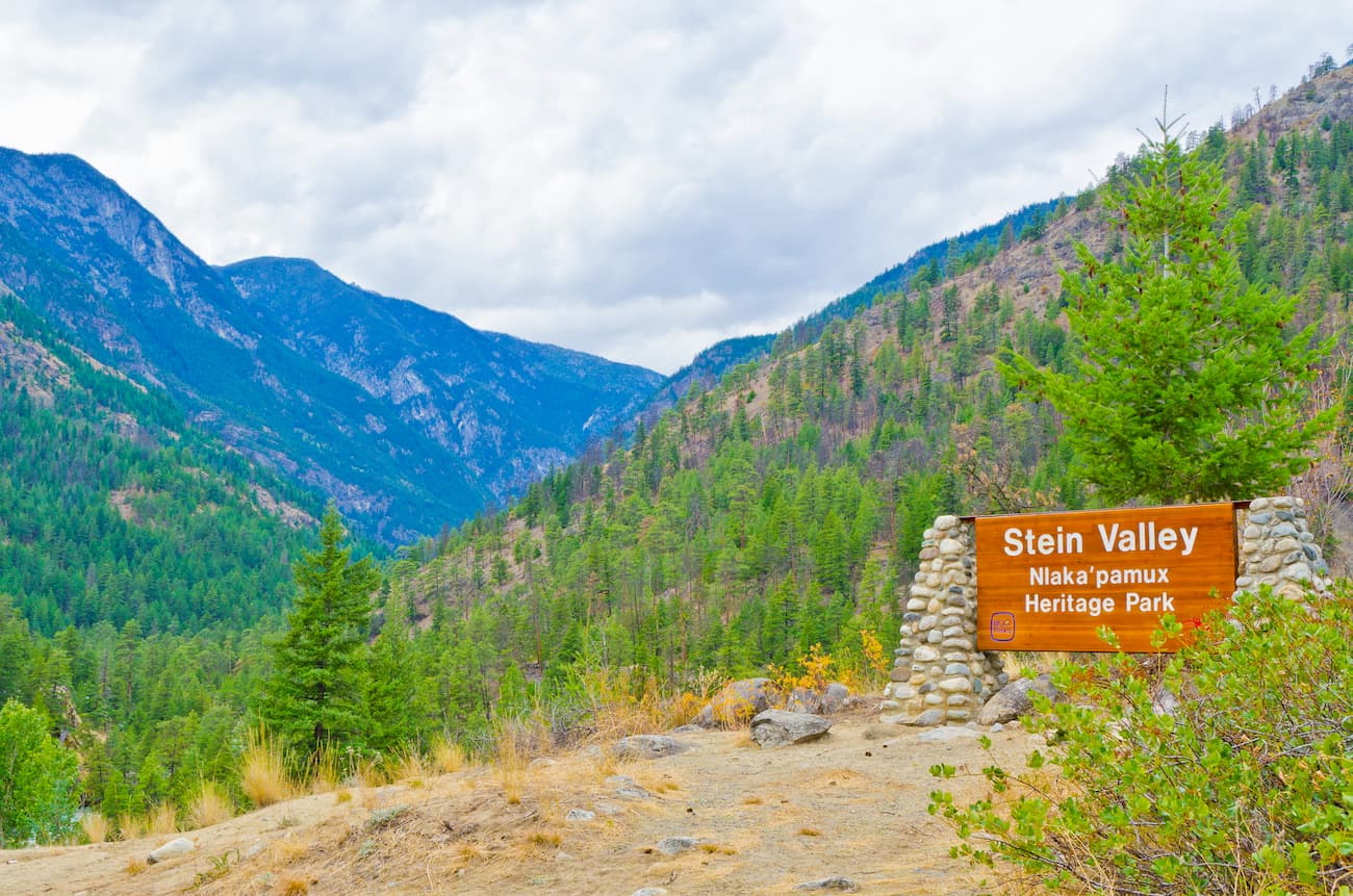
Surrounding Lillooet are some stunning wilderness areas such as Stein Valley Nlaka’pamux Heritage Park, South Chilcotin Mountains Provincial Park, Churn Creek Protected Area, and Marble Range Provincial Park. West along the highway, near Pemberton, is the beautiful Nairn Falls Provincial Park and Joffre Lakes Provincial Park.

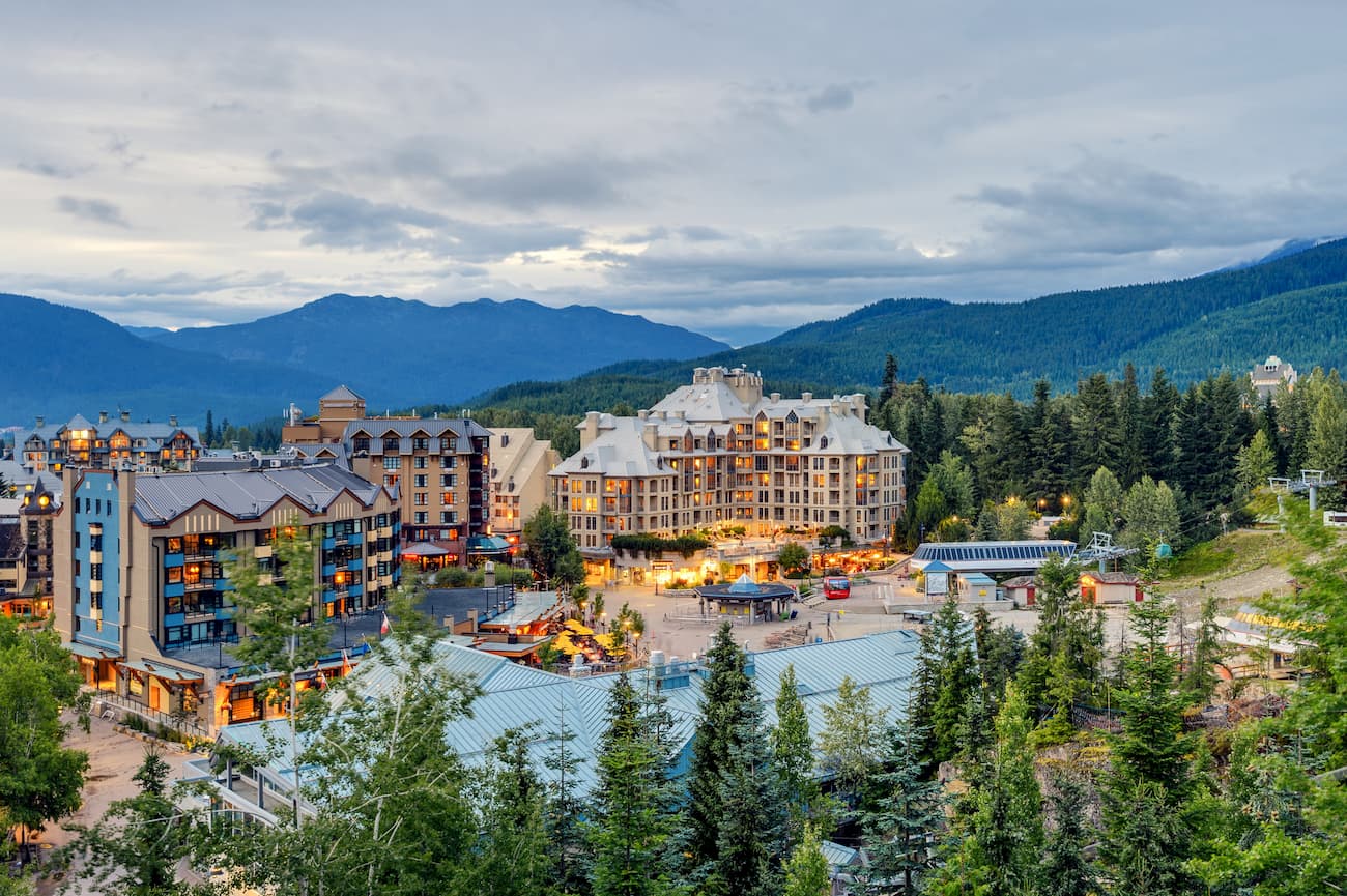
Located in the shadows of the stunning Fitzsimmons and Spearhead ranges, Whistler is a resort community about 40 km (24 mi) due west of Upper Rogers kólii7 Conservancy. It is the main resort community for the Whistler Blackcomb ski area.
With over two million annual visitors, most come to the community to ski at the resort during the winter. However, summer is also a busy time as mountain biking and downhill trails are rising in popularity.
The Singing Pass Trail and the High Note Trail to the top of Whistler Mountain are among the most popular hikes from the community; however, there are many places to explore from town. One of the easy treks is a short hike to the train wreck at the south end of town.
Visitors may pass through Whistler as they travel to the nearby wilderness areas of Birkenhead Lake Provincial Park, Joffre Lakes Provincial Park, Garibaldi Provincial Park, and Stein Valley Nlaka’pamux Heritage Park.
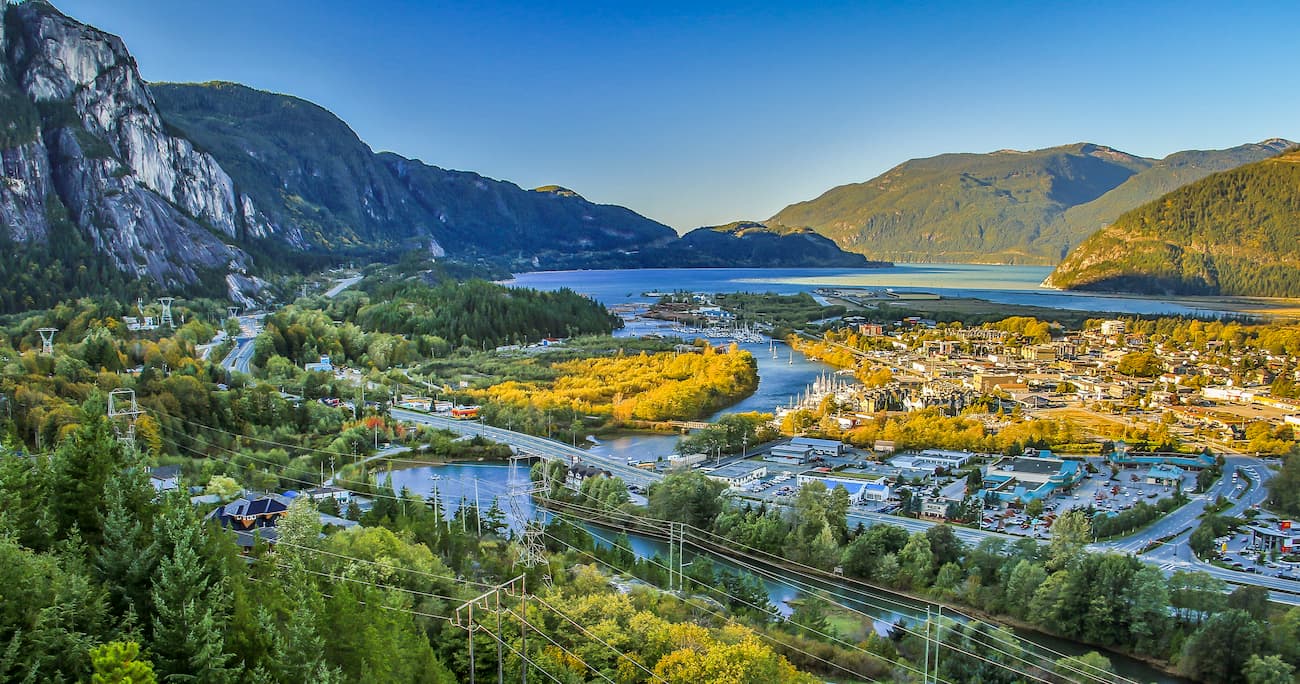
Squamish is a climbing mecca in the Canadian Coast Mountains about 60 km (36 mi) south of Whistler. There are thousands of published routes in the mountains around the community that draw climbers from around the world.
While climbing is the major tourist draw to the community, there are still incredible wilderness areas nearby for hiking and sightseeing. Some of the popular parks nearby are Breckendale Eagles Provincial Park, Tantalus Provincial Park, and Garibaldi Provincial Park.
Shannon Falls, Murrin Park, The Malamute, and the Smoke Bluffs are popular climbing areas and Stawamus Chief Provincial Park contains a legendary granite massif. Over 2,000 climbing routes and 2,500 bouldering problems have been published in local guidebooks.


The highest peak in Upper Rogers kólii7 Conservancy is Skook Jim Mountain, at 2,602 m.
Notable peaks in Upper Rogers kólii7 Conservancy include Skook Jim Mountain, Caltha Peak, Diversion Peak and Tynemouth Mountain.


