Scan the QR code and open PeakVisor on your phone
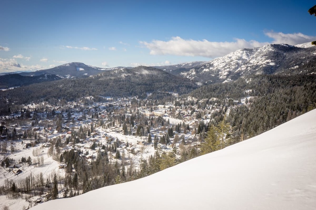
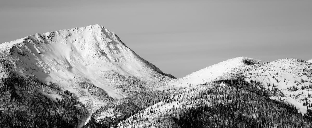
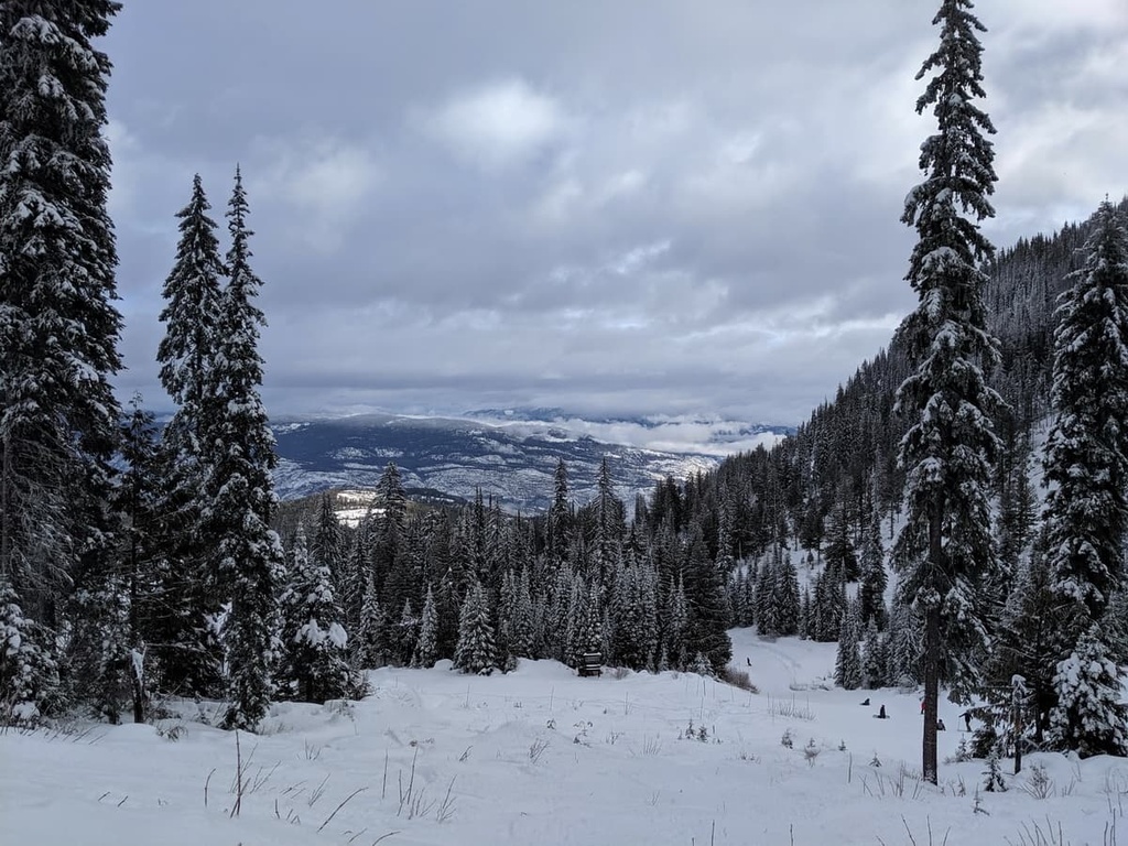
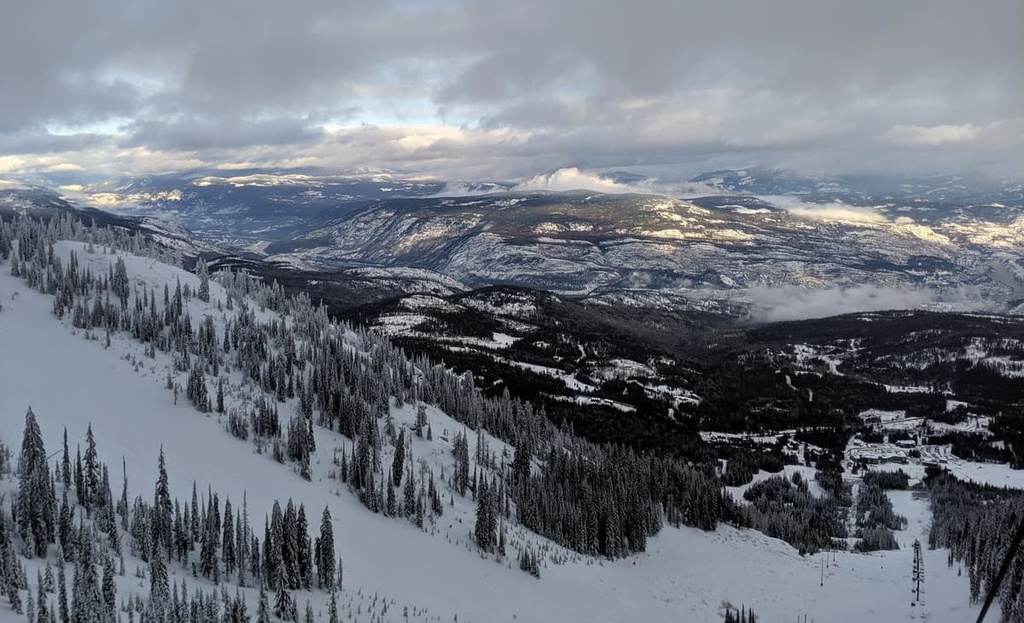
The Rossland Range Recreation Site is a public use area in the Monashee Mountains of southern British Columbia, Canada. The recreation site has been popular with locals for nearly a century and there are trails throughout the mountains that lead to each of the 6 named peaks in the area. The tallest and most prominent of these 6 peaks is Old Glory Mountain, which stands 2,376 m (7,795 ft) tall and has 1,154 m (3,786 ft) of prominence.
Located in the Rossland Range of the Columbia Mountains in southern British Columbia, Canada, Rossland Range Recreation Site is a popular destination for local and regional outdoor enthusiasts. The recreation site is located near the town of Rossland, and there are many trails and activities to choose from in the park.
The park is particularly popular with local skiers, who have been exploring the range for nearly 100 years. Locals have created trails to all six of the peaks in the park as well as those surrounding the recreation site. The tallest mountain in the park is Old Glory Mountain, which stands 2,376 m (7,795 ft) tall and has 1,154 m (3,786 ft) of prominence.
The recreation site is one of many popular hiking and backcountry skiing areas in the region. The following are some of the other parks and protected areas in the surrounding region:
The recreation site is also located near Colville National Forest in the US state of Washington.
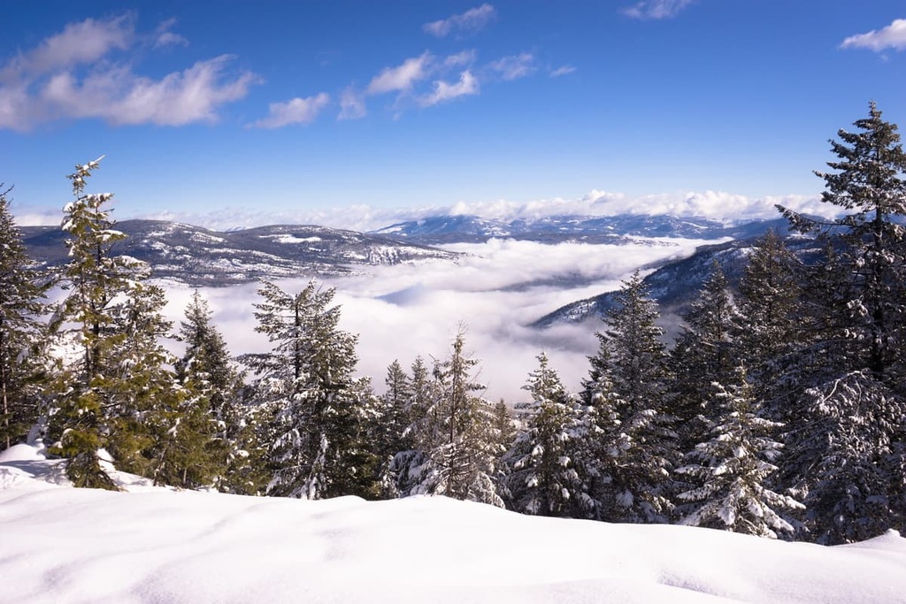
The aptly named Rossland Range Recreation Site encompasses part of the Rossland Range of the Monashee Mountains. The Monashee Mountains are the southernmost division of the Columbia Mountains, which also include the Purcell and Selkirk mountains.
Located adjacent to the Rossland Range is the Christina Range, which is situated to the west, and the Bonnington Range, which is situated to the east. Further to the west are also the Midway Range and the Beaverdell Range while further north is the Kokanee Range.
The oldest rocks found in Rossland Range began as layers of mud and sediment that accumulated at the bottom of a tropical sea about 300 million years ago during the Pennsylvanian subperiod of the Paleozoic era. This sedimentary layer forms the base of the geology in the region and is called the Mount Roberts Formation.
During the Jurassic, the region experienced an extension of the Earth’s crust, and a fault formed through the middle of what would become the Rossland Range. The fault created a region of unique geology and it is believed that this fault led to the creation of a chain of volcanoes, including the stratovolcano known as the Rossland Volcano.
The west side of the Rossland Range, which features mountains such as Red Mountain, and those of the Rossland Range Recreation Site, feature primarily marine sediments. However, the east side of the fault, which includes the Columbia Mountains, is composed mostly of volcanic material.
About 190 million years ago, the Mount Roberts Formation was intruded by magma, which cooled below the surface. The cracks and fissures of the intrusive monzonite would later fill with deposits of copper and gold. About 25 million years after the Rossland Monzonite intrusion, the Trail Pluton started to form, and along with it, sizable deposits of molybdenum.
During the Pleistocene, glaciers formed among the peaks of the Rossland Range and flowed down the slopes. As the Earth turned colder, the glaciers converged into the ice sheet that covered much of western Canada at the time.
The soft layers of rock were scoured by the ice sheet as it moved across the continent, displacing massive amounts of rock as glacial debris. Glaciers created much of the modern topography of the range as debris filled in low spots and alpine glaciers carved out cirques and valleys. Evidence of glacial movement in the region is seen in the many moraines, kames, and eskers that persist to this day.
The flora of the alpine region of Rossland Range Recreation Site is stunted or naturally small. It usually consists of lichens growing on rocks and sedges as well as heath growing in protected outcroppings near summer snowfields. Occasionally, krummholz (stunted trees that tend to grow in clusters close to the ground) can be found on ledges, which provide shelter so communities of plants can grow.
Mountain goats and bighorn sheep spend part of their time among the alpine rocks of the recreation sites; however, the most consistent inhabitants of the region’s alpine are several bird species. In particular, you may see white-tailed ptarmigans, American pipits, grey-crowned rosy finches, and horned larks nesting among the rocks.
Along the slopes of the recreation site is the subalpine region where Engelmann spruce and subalpine fir grow in open stands on the mountains. Meanwhile, dense lodgepole pine forests inhabit the lower elevations. Buffaloberry, grouseberry, and five-leaved bramble are common undergrowth plants in these subalpine forests.
The forests and meadows are home to many large animals, including elk, grizzly bears, black bears, deer, mountain goats, bighorn sheep, wolves, and cougars. Wet meadows and streamside shrubbery provide essential habitats to small mammals in the region, too, such as long-tailed voles, northern bog lemmings, and heather voles.
Rossland Range Recreation Site is located along the border between the traditional territory of the Syilx and Ktunaxa First Nations. The Syilx are a people of the Interior Salish culture and they arrived in central British Columbia as early as 4,000 years ago, displacing any previous communities. Also known as the Okanagan, the Syilx traditionally resided in the Okanagan Highlands of British Columbia and Washington.
The area of the Kootenay River is the traditional territory of the Ktunaxa; however, the Ktunaxa were known to have lived as far east as the eastern slopes of the Rocky Mountains as well as to the west of the Columbia Mountains. The Ktunaxa are one of the few First Nations that are possibly descended from the original inhabitants that arrived in the region at the end of the most recent glacial maximum.
While there is no known archeological evidence of First Nations inhabitation of the recreation site itself, many contemporary members of these First Nations visit the area to pick huckleberries. Near the Rossland Range Recreation Site, at the confluence of the Columbia River and creeks flowing from the park, various sites of archeological significance have also been uncovered.
During the late 1800s, sizable deposits of workable ore were discovered along the nearby slopes of Red Mountain, which led to a period of industrialization that lasted until the 1930s. On the slopes of the range, you can find the remnants of old mining works; however, none were as successful as the Rossland Gold mine, which produced over six million tons of gold-copper ore from 1891 to 1928.
Much of the area surrounding Rossland Range Recreation site has been affected by mining and logging. A forest service lookout was built on Old Glory Peak in 1926. In 1942, the Old Glory weather station was built, making it the highest elevation weather station in Canada at the time.
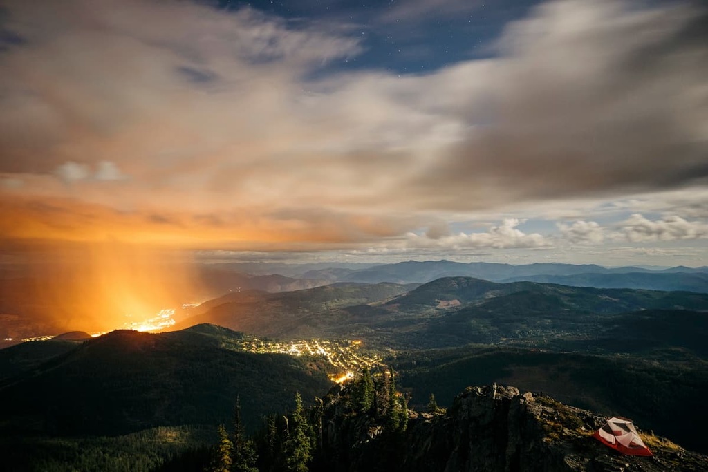
From the 1930s, a local ski culture developed in the Rossland area and the locals built a series of huts and cabins in the Rossland Range to add comfort to their ski touring. In recent years, the area has seen a significant uptick in the amount of visitors enjoying the area, especially for backcountry skiing and snowshoeing.
Rossland Range Recreation Site is the culmination of decades of work by local clubs and outdoor enthusiasts who wanted to preserve the recreational value of the Rossland Range. The major activities in the range are skiing and snowshoeing; however, there are also many summer visitors who hike and bike the many trails. The following are some of the major trails and attractions in the area:
There are a couple routes to the top of Old Glory Mountain that are suitable for ski touring or hiking.
Both trails are just shy of 20 km (12 mi) long and are considered difficult. The summit of Old Glory Mountain offers views for over a 100 kilometers (60 mi) in every direction, so it’s well worth the effort to climb up the trail.
The Seven Summits Trail is a nearly 30 km (18 mi) point-to-point trail that takes you across the spine of the Rossland Range.
The trail starts along the highway in the Rossland Range Recreation Site and follows the ridgeline of the range as it skits the summits of Mount Lepsoe, Mount Plewman, Grey Mountain, and Record Mountain. It also takes you to the top of a few other unnamed summits before it ends on Rossland Cascade Road.
The trail is a popular single track route for mountain bikers in addition to hikers and trail runners. While on this trail, you can enjoy an incredible series of ever-changing vistas in the mountains.
The Nancy Greene summit is one of the more popular destinations in the Rossland Range. This moderate trail is only 10 km (6 mi) long round trip, and it is a great trail for hiking or snowshoeing.
Along the way, you’ll also pass by some of the range’s popular cabins. Each of these cabins makes for a nice place to stop and rest after a day of adventure in the Rossland Range.
The Monashee Mountains of southern British Columbia are a vast wilderness with many opportunities for incredible front and backcountry adventures. All of the trails in the Rossland Range Recreation site are suitable as day trips from the nearby communities.
The following are some of the many nearby communities where you can relax after a long day of hiking, skiing, or biking in the Rossland Range Recreation Site.
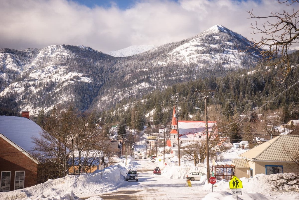
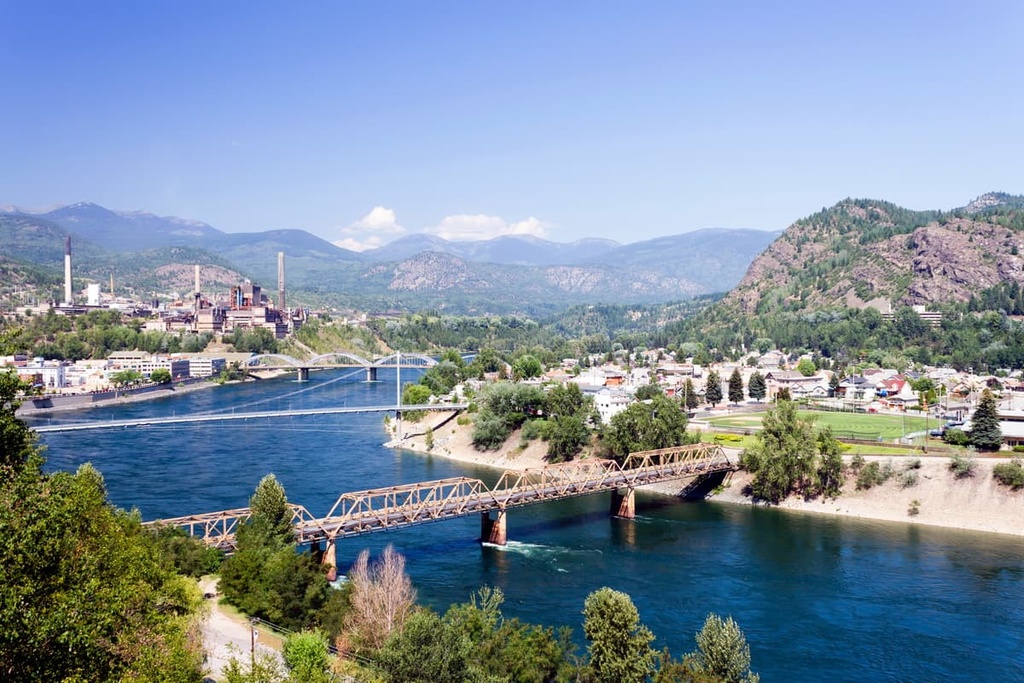
Incorporated as a city in 1901, the city of Trail was named after the Dewdney Trail that once passed through the area. Trail is located about 10 km (6 mi) from Rossland Range Recreation Site, and it has many attractions and hikes for visitors to enjoy. This includes Beaver Creek Provincial Park, the Columbia River Skywalk, and many museums and art galleries.
Some of the popular trails around the city include the Columbia River Trail, the Rusty Chainsaw Loop, Sunningdale Trail, and Miral Heights and Bluffs Trail. A couple other trails that are worth checking out include the Elder Trail, and the Raven Cliff to McQuarrie Creek Trail.
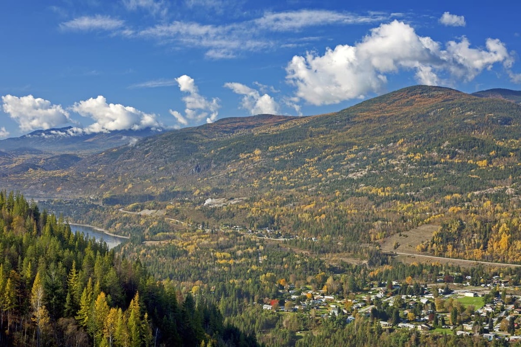
Castlegar is a community in Central Kootenay that’s located about 30 km (18 mi) from Rossland Range Recreation Site. The city is situated in the Selkirk Mountains at the confluence of the Kootenay and Columbia Rivers.
Although the area is culturally significant to the Sinixt and Ktunaxa First Nations, Castlegar itself started as a settlement for miners as they searched for gold. The city has a rich history that dates back to the mining and forestry activities of the nineteenth and twentieth centuries.
Some of the major attractions in Castlegar, aside from its access to incredible wilderness areas, are the Doukhobor Discovery Centre, Kootenay Gallery, and Zuckerberg Island Park. Some of the recommended hiking trails in the regions include the hikes to the Brilliant Overlook, McPhee Waterfalls, Dove Hill, and the Zuckerberg Island Loop.