
Scan the QR code and open PeakVisor on your phone
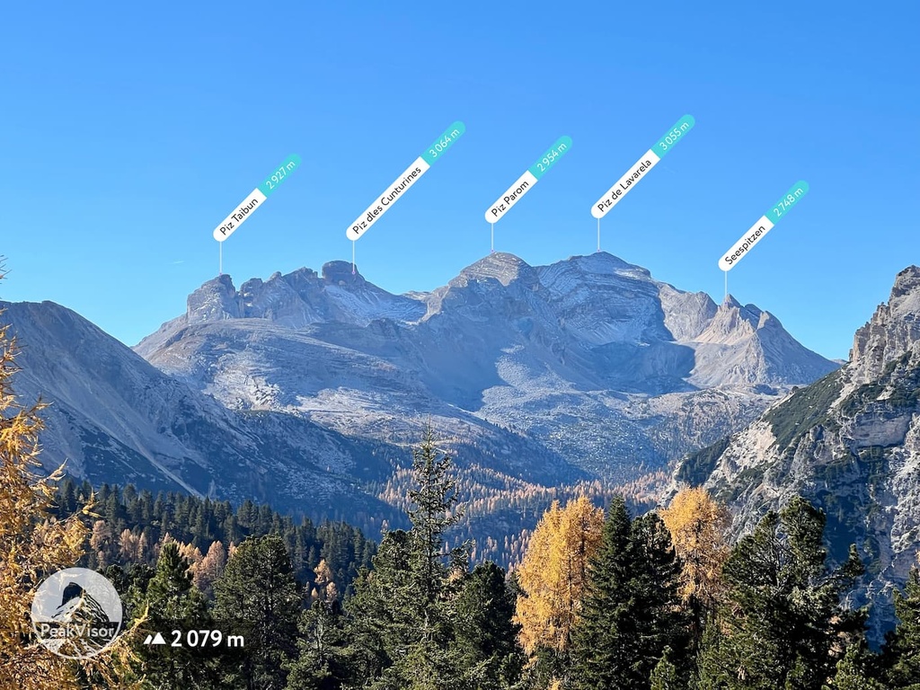
Fanes-Sennes-Braies Nature Park has 110 named peaks. The highest is Hohe Gaisl at 3,140 m. Other notable peaks include Piz dles Cunturines, Piz de Lavarela and Lavarela de Fora.
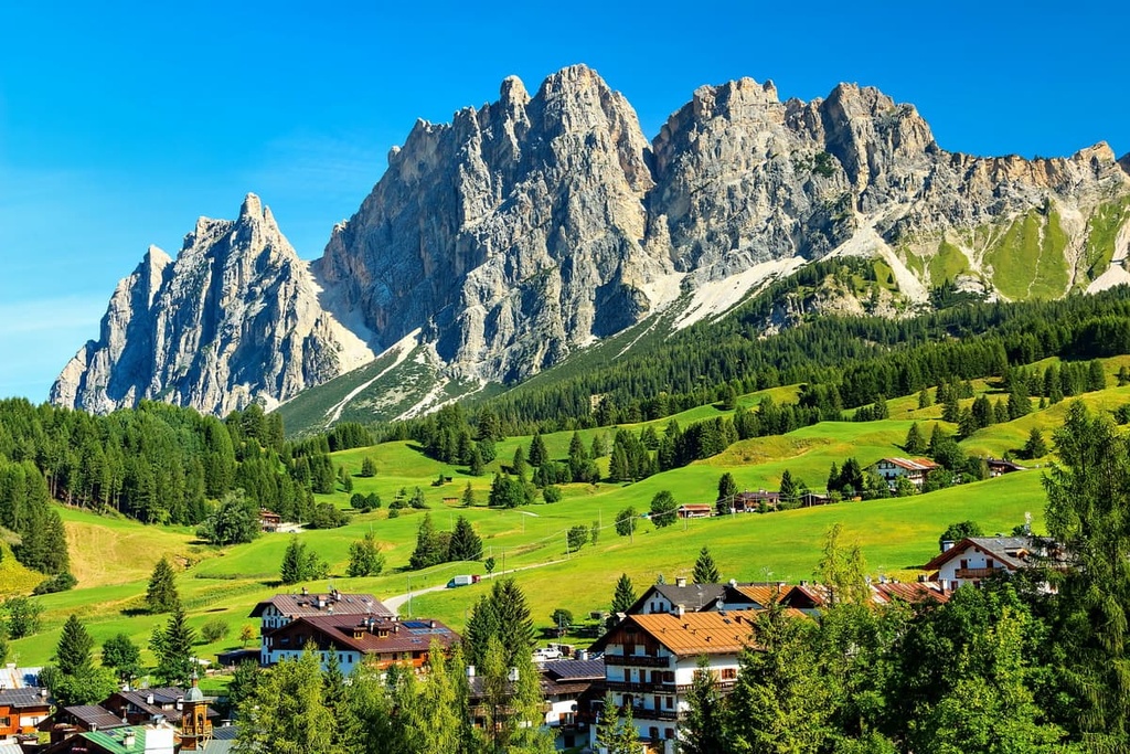
Fanes-Senes-Braies Nature Park is one of ten nature parks in the Dolomites of northern Italy. The main feature of the park is Braies Lake, though the park is also known for its rugged peaks. There are 110 named mountains in the nature park. The highest and the most prominent mountain in the park is Hohe Gaisl / Croda Rossa d’Ampezzo (3,146 m / 10,322 ft).
The name of Fanes-Senes-Braies Nature Park (Parco naturale Fanes-Sennes-Braies/Naturpark Fanes-Sennes-Prags/Parch natural Fanes-Senes-Braies) comes from the names of the two mountain groups found in its territory: Fanes Group and Braies Dolomites.
The word Senes (Sennes) is the name of the mountain plateau and its surrounding peaks that’s located in the center of the Fanes and Braies groups.
The park was founded in 1980 to protect its unique geology, landscape, flora, and fauna, as well as to attract tourists. The park is also a part of the European-wide Natura 2000 sites. According to the European Commission's definition, these sites are “the main instrument of the European Union's policy for the conservation of biodiversity.”
Fanes-Sennes-Braies Nature Park is located in two provinces and two regions: Bolzano / South Tyrol in Trentino-Alto Adige and Belluno in Veneto.
It belongs to the following municipalities: Toblach (Dobbiaco), Prags (Braies), Olang (Valdaora), Abtei (Badia), Enneberg (Marebbe / Mareo) and Wengen (La Valle / La Val). At the same time, it is part of the West Dolomites subregion.
The park is one of seven nature parks in the province of South Tyrol alongside Schlern-Rosengarten / Sciliar-Catinaccio Nature Park, Monte Corno Nature Park, Gruppo di Tessa Nature Park, and Stelvio National Park, among others. Additionally, the park is also one of ten nature parks in the Dolomites, alongside Tre Cime Nature Park, Dolomiti Bellunesi National Park, and Bletterbach Geopark.
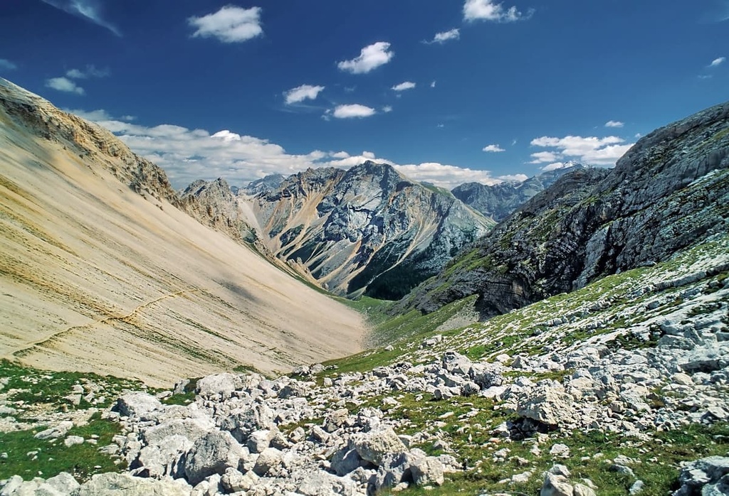
The total area of the park is 25,453 ha (62,895 acres). It almost completely encompases both the Fanes and Braies groups.
The exact boundaries of the park follow the ridgelines of the following peaks:
The boundaries of the park also coincide with the following valleys:
That said, Fanes-Senes-Braies Nature Park is far from the only protected area in the region. To the east, it borders Ampezzo Dolomites Nature Park, which itself shares a border with Tre Cime Nature Park. Together, these three parks form one of the largest natural areas in the region for hiking and other activities.
The fastest and easiest way to get to the park is from the commune of Brunico / Bruneck (17 km / 10.5 mi, 20 minutes by car), which is located to the north. You can get to Brunico from Bolzano via a short car ride (77 km / 48 mi / 1 hour).
In the summer and winter seasons, there is also regular bus service to Brunico via Südtirol Mobil. Or, you can take the Trenitalia trains from Bolzano to the commune.
The most interesting aspect of the geology of the Fanes-Sennes-Braies Nature Park is the fact that it contains evidence of two completely different periods in the history of dolomite development.
On the one hand, there is Fanes Plateau, which formed in the late Triassic period, Jurassic, and Cretaceous periods. This region represents the final part of the Dolomite’s “marine” history, making it the youngest dolomite rocks in the region (25 million years old).
On the other hand, some of the rocks in the second mountain group in the park, Braies Dolomites, date back to the Anisian age (247 to 242 million years ago), making them the oldest type of dolomite in the region.
According to PeakVisor’s founder, "the geographical composition of the protected area is quite peculiar and combines the seemingly incompatible: nearly impassable rock walls tower above dense forests, high-altitude alpine pastures, the world-famous Lake Braies and its surroundings."
Next is his brief account of the three main features of the park's landscape listed above:
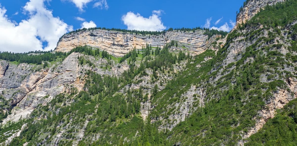
The highlands of Fanes and Sennes are surrounded by a ring of steep mountain chains that remind you of giant Colosseum-like arenas. During the tectonic deformations that occurred during the Alpine orogeny, the region’s limestone formations were erratically distorted and folded or molded into bizarre forms like the steps of an amphitheater.
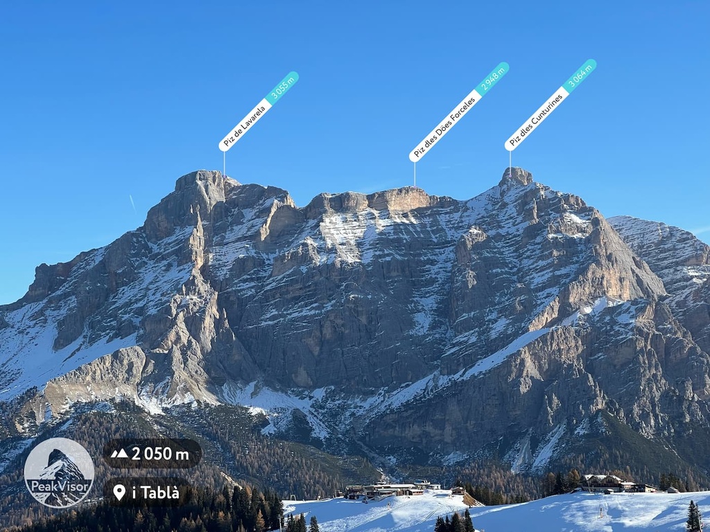
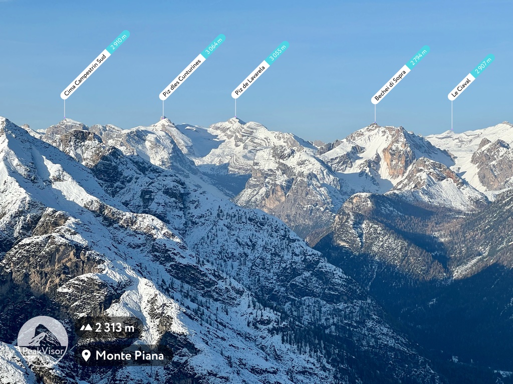
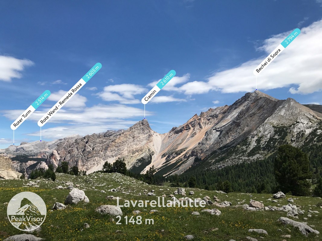
The Fanes is the largest high-altitude plateau in the park, it is characterized by a large number of water bodies and their surrounding tall mountains. This plateau dominates the major part of the Fanes Group of the Dolomites range. The highest and the most prominent peak on the plateau is Piz dles Cunturines 3,064 m (10,052 ft).
The Sennes is a plateau, smaller than Fanes, located on the opposite side of the deep Tamersc Valley. Mountains in this area belong to the Braies Dolomites range.
That said, the name of the park could have been even longer if the large eastern part of the park—Prato Piazza / Plätzwiesen or Piazza Plateau—had been included as well.
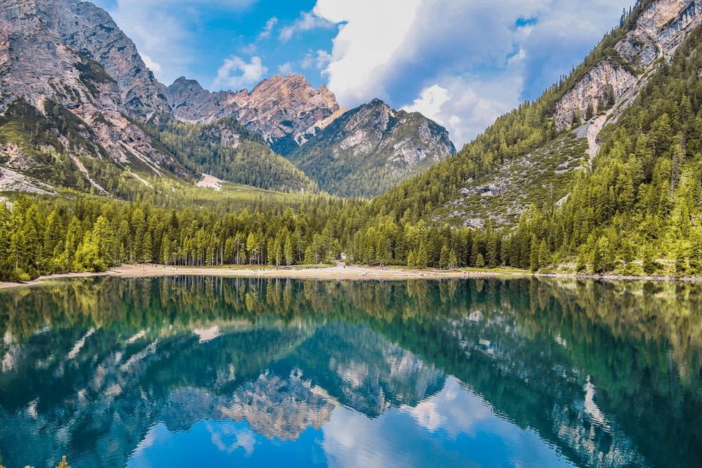
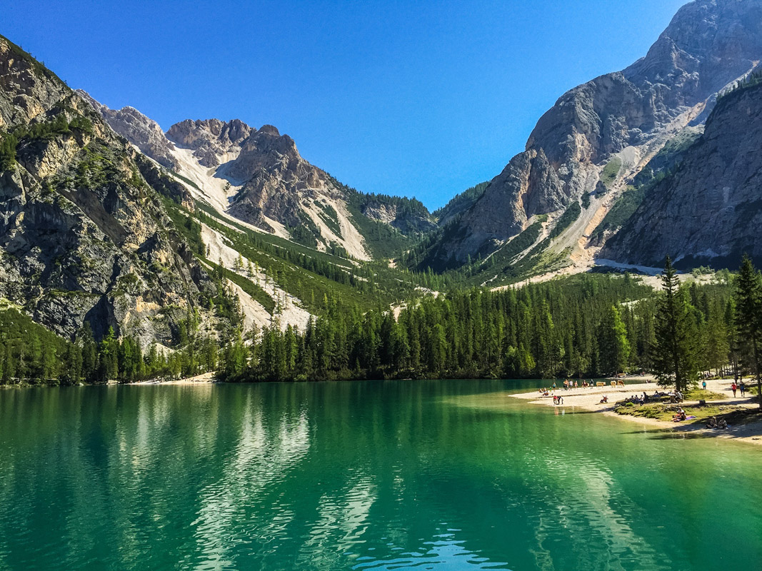
Lake Braies is located in a gorgeous part of the park. Flanked by fantastic rocks and mountain peaks, it is an ideal place for relaxing and regaining one’s strength.
Do note that Lake Braies is one of the most popular spots in the entire Dolomites, so it is highly advised to arrive (very) early before parking lots are full. Or even better, consider staying in the hotel by the lake—it’s exceptional.
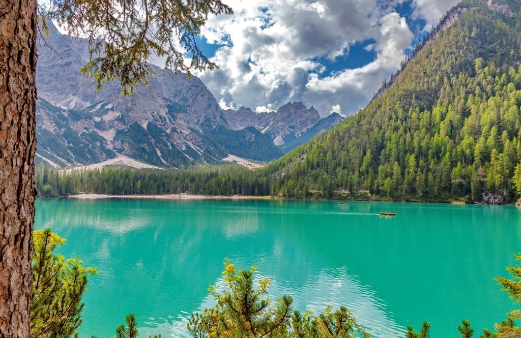
However, this lake is not the only one in the park. For example, the beautiful but much less famous Limo Lake is located in the geographical center of the protected area.
The flora and fauna of the Fanes-Sennes-Braies Nature Park are typical of the entire Dolomites, but the park is home to some unique species.
For example, like other parks and groups in the region, the woodlands here consist mostly of spruce and Scots pines, which grow between 900 and 1,200 meters (2,952 and 3,937 feet) above sea level. These trees are replaced by larch and cambric pines as you approach the tree line, beyond which you find only bare cliffs covered with shrubs and grass.
Much of the nature park is covered with alpine meadows and pastures at elevations of 2,000 to 2,800 meters (6,561 to 9,186 feet). This means a lot of panoramic views for photographers and hiking enthusiasts with cows and sheep peacefully grazing in the meadows in the foreground.
As elsewhere in the Dolomites, the park is home to many medium and large size animals, including hares, badgers, foxes, chamois, bears, and deer, not to mention dozens of species of birds, fish, and reptiles in rivers and lakes.
One of the most common mammal species in the park is the marmots. They live here in great numbers thanks to the numerous channels, fissures, and sinkholes in deep karst rocks in the region (no other area in the Dolomites is that deeply characterized by karst as Fanes Group). These features make the park an ideal environment for such animals.
In the center of the park, there is the rock formation known as the “Parliament of Marmots.” According to local legend, it sheltered the last inhabitants of the Kingdom of Fanes after its collapse.
Because of this, in general, marmots are considered one of the symbols of the Dolomites, along with bears, ibexes, and deer. The ancestors of today’s Ladins, the original inhabitants of this region, identified themselves with these peace-loving animals. You can easily see the marmots on your hike through the park.
Two large mountain groups are found within the park: Fanes Group and Braies Dolomites. These ranges run in a north-south direction and are adjacent to each other. Both groups belong to the Dolomites according to the German-Austrian Alpine Club classification, as well as the Italian classification SOIUSA.
Some people also argue that there’s a separate group called the Senes / Sennes group, which contains the peaks located between the Fanes and Braies groups. But, formally, these peaks belong to the Braies Dolomites. One of the main peaks in this group is Monte Sella di Sennes (2,787 m / 9,143 ft).
Major peaks in the park include Lagazuoi Piccolo (2,778 m / 9,114 ft), Piz dles Cunturines (3,064 m / 10,052 ft), and Cima Dieci / Zehnerspitze/ Sas dles Diesc (3,026 m / 9,927 ft) in the Fanes Group, and Hohe Gaisl / Croda Rossa d’Ampezzo (3,146 m / 10,322 ft), Seekofel / Croda del Becco (2,810 m / 9,220 ft), and Kronplatz / Plan de Corones (2,275 m / 7,464 ft) in the Braies Dolomites.
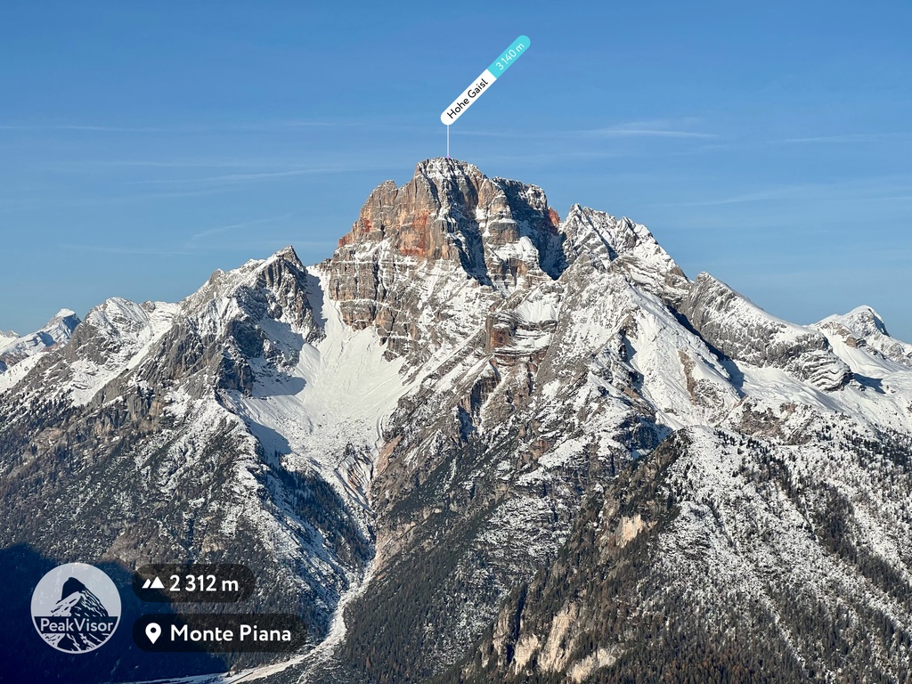
The highest and the most prominent mountain of the park is Hohe Gaisl / Croda Rossa d’Ampezzo (3,146 m / 10,322 ft). Meanwhile, the lowest peak is Cimabanche (1,565 m / 5,134 ft).
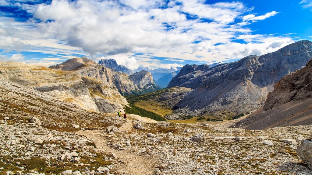
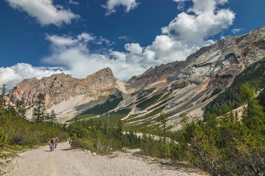
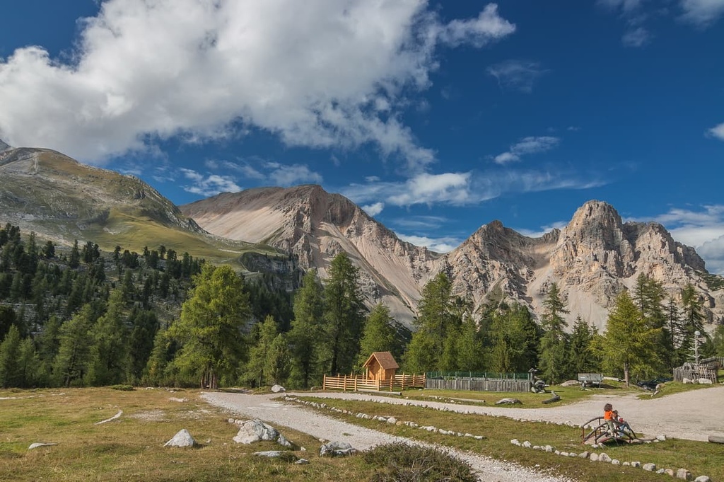
The Fanes-Senes-Braies Nature Park offers dozens of marked hiking trails of varying lengths and levels of difficulty, from half-day hikes to multi-day trips through the entire park's territory. PeakVisor’s founder gave us some useful details about the most important hiking areas in the park:
Typically the first part of any hike in Fanes is the trail from rifugio Pederù to either rifugio Lavarella or rifugio Fanes. It takes slightly over 2 hours and involves 520 m (1,706 ft) of elevation gain over 6.5 km (4 mi).
From the mountain huts at the Fanes highlands, the opportunities for adventure are endless. Families often take scenic walks around the lakes and the creeks connecting them. But there are many demanding hikes to the summits of these peaks for the more adventurous among us to enjoy. Here are some peaks in the region that you can summit without special equipment:
Additionally, at the southern extreme of the nature park, there's a little known yet incredibly beautiful valley near rifugio Fanes. It’s an optimal starting point for demanding hikes to Piz de Lavarela (5 hours one way) and Vallon Bianco (3:30 hours one way). The latter boasts unparalleled views of Tofana di Dentro (3,228 m / 10,590 ft) and Tofana di Rozes (3,235 m / 10,613 ft).
There are three main areas for hiking in the Braies Group:
Braies Lake and Surroundings
While it is perfectly fine to visit one of the world's most famous lakes and do just a brief loop around the lake, I highly encourage you to skip the crowds and venture into the mountains high above the lake.
On a hot summer day, while heading back to the parking lot, the idea of taking a dip in a cold mountain lake will be much more attractive than in the morning. Be sure to pack your swimming suit when hiking in this area so that you’re ready to jump in the lake!
Senes / Sennes Subgroup
From the Senes Plateau, you can take a trail from rifugio Pederu to Sennes Hutte. It takes slightly more than 2 hours for most people to complete and it involves 700 m (2,296 ft) of elevation gain.
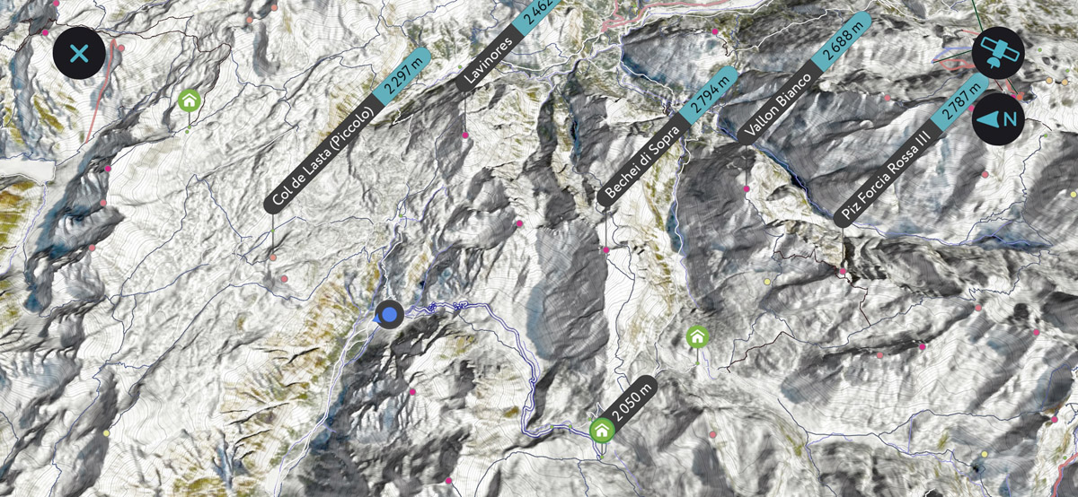
From the Sennes Hutte, you can scale Col de Lasta Piccolo (2,297 m / 7,536 ft) in just 40 minutes and an additional 180 m (590 ft) of elevation gain. Or you can undertake a much more demanding hike to enjoy the panoramic views from the summits of Monte Sella di Sennes (2,787 m / 9,134 ft) or Croda del Becco (2,800 m / 9,186 ft).
Both hikes require slightly more than 3 hours of trekking and about 750 m (2,460 ft) of elevation gain over a distance of 4.5 km (2.7 mi). Additionally to get spectacular vistas, Croda del Becco boasts an unusual glimpse of Braies Lake from more than a 1 km (0.6 mi) above.
Prato Piazza / Plätzwiese Plateau
The easternmost section of the nature park, the Prato Piazza / Plätzwiese Plateau is a hidden gem that’s not to be missed. You can enjoy breathtaking views of Croda Rossa right from the plateau and an unbeatable panorama from the top of Durrenstein / Pico di Vallandro (2,842 m / 9,324 ft).l.
You can read more about particular trails in both three main areas in the guide to the Braies Dolomites.
Lake Braies itself is also the starting point for the famed “Alta Via 1 delle Dolomiti” (“The Dolomites High Route 1”), the classic trekking route of the Alps that travels through 150 km (93 miles) of impressive scenery and finishes in the Dolomiti Bellunesi National Park.
In the Fanes-Senes-Braies Nature Park, you will find four of the 12 large ski areas of the famous Dolomiti Superski system, namely: Alta Badia, Cortina d'Ampezzo, Tre Cime, and Plan de Corones / Kronplatz. Each of them offer tens of kilometers of slopes of all levels of difficulty as well as many ski lifts.
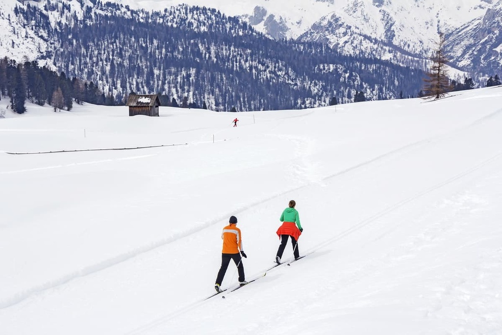
In the park, there are also trails for cross country skiing and ski touring, as well as snowshoe hiking trails.
Learn more about skiing in the Dolomites in the general guide to these mountains and in the individual group guides.
Check the Fanes-Sennes-Braies ski map on the larger Trentino-Alto Adige/Südtirol and Veneto regions of Italy ski maps in the World Mountain Lifts section of the site. It includes information about open ski lifts / slopes in the Fanes-Sennes-Braies Nature Park in real-time with opening dates and hours. There are also year-round cable cars, funiculars, cog railways, aerial tramways, and all other types of mountain lifts.
The park’s visitor center is located in San Vigilio di Marebbe (St. Vigil in Enneberg) near the park’s northwestern borders.
You can easily find the visitor center in the town. It’s a large two-story building with a semi-circular shape and large windows. It is worthy of a visit in its own right. Inside you’ll find a great exhibition with 3D maps that offer insight into the park and this area of Dolomites. You can also take a virtual tour of the museum before your trip.
Fanes-Senes-Braies Nature Park Visitor Center
Via Katharina Lanz, 96, 39030, San Vigilio di Marebbe, BZ, Italy
+39 0474506120
Opening Hours:
According to PeakVisor’s founder, "the whole area of the Dolomites is a hiker’s paradise with endless accommodation opportunities. There are hotels even in the smallest villages and mountain huts that aren’t very different from ordinary hotels, but are usually positioned outside of local settlements."
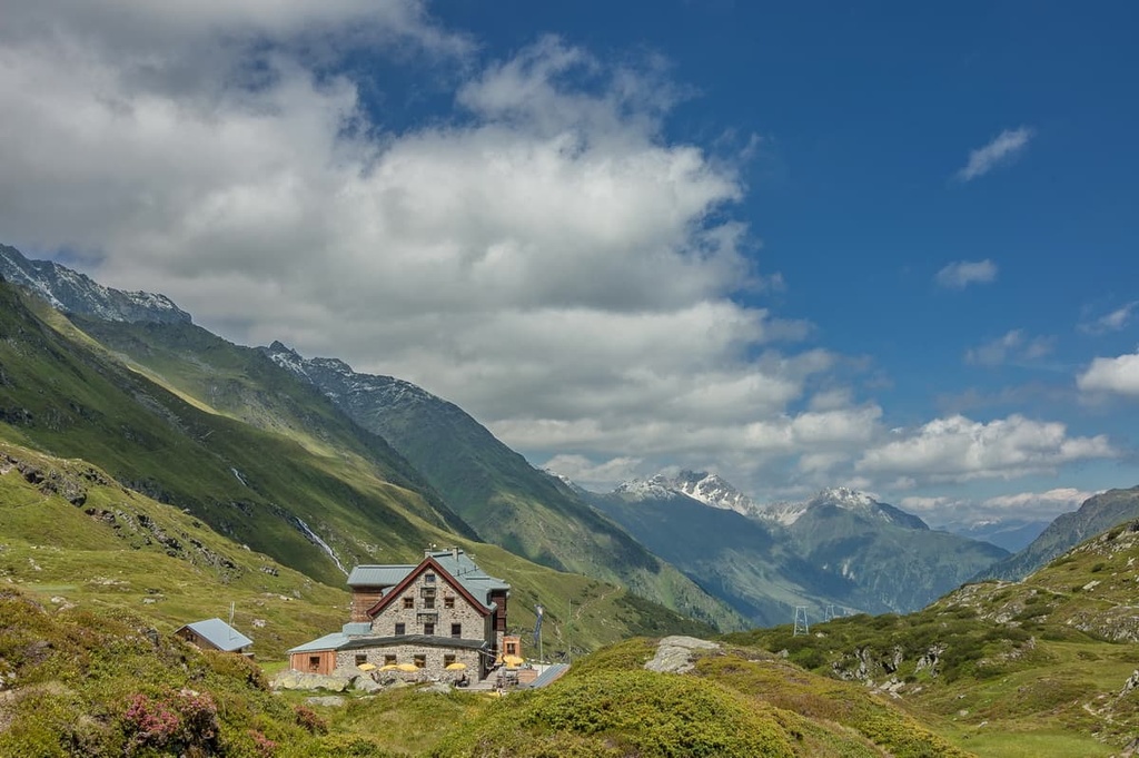
Fanes-Senes-Braies Nature Park is no exception. But while hotels can be found everywhere in the world, it is only here that you can spend the night or two in a traditional alpine hut in the middle of a pasture, on a pass, or at the foot of an amazing summit. In Italian, such huts are called rifugios.
Here’s a complete list of the main rifugios in the park.
On the borders of the Fanes-Senes-Braies Nature Park, there are many interesting and beautiful towns and villages, all worth a visit, including Toblach (Dobbiaco), Prags (Braies), Olang (Valdaora), Abtei (Badia), Enneberg (Marebbe / Mareo), and Wengen (La Valle / La Val).
Some of the most important communities in the region include Cortina d’Ampezzo, Caprile, Arabba and Corvara. However, you probably won’t be able to visit them all in just one trip because there’s just too much to do in the region!
Here are some of the bigger towns for you to consider as a basecamp if you’d like to stay closer to civilization.
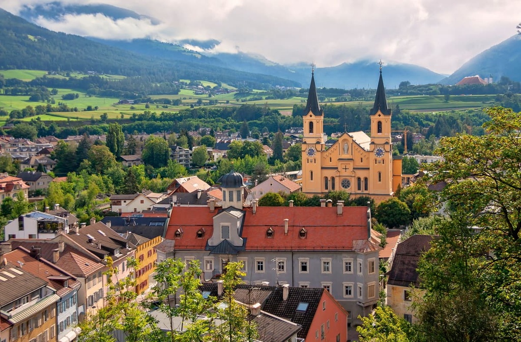
Bruneck is a typical South Tyrolean town located in the Puster Valley in Trentino-Alto Adige region. With more than 16,000 residents, it’s the largest community in the valley. Bruneck has a rich history going back as far as the thirteenth century.
The town was built around the castle of the same name, Bruneck Castle. It boasts many historical buildings, such as Church of the Assumption of Mary (Chiesa di Maria Assunta), Church of Saint Spirit (Chiesa dello Spirito Santo), and Church of Saint Catherine (Chiesa di Santa Caterina), among others. There are a lot of interesting buildings on the main pedestrian zone—Via Centrale.
Bruneck is also a convenient base for excursions into both the Fanes-Sennes-Braies Nature Park and the Puez-Odle Nature Park.
Here’s the official tourist site of Bruneck if you need more information: Bruneck.com.
A much smaller, yet not less interesting, option is the village of Badia in the Trentino-Alto Adige region. In wintertime, it becomes one of the most famous ski resorts in the Dolomites.
The village of Badia is tucked between Dolomite cliffs. Badia is a real gem of traditional Alpine rural architecture, which you can see in one of several well-preserved Ladin hamlets. Also, from the village, there's a lift that takes you to rifugio Santa Croce, which was built in 1718 at the base of the Sass dla Crusc. This makes it a great viewpoint to have a look of the Badia from above.
Also, the municipality of Badia offers an educational trail that connects the Rüdederia and Rü farms above San Cassiano. This path boasts seven interactive panels and stages, most of which focus on the various forms of landscape.
This is the official tourist site of Badia if you need more information: Altabadia.org.
Proudly carrying an informal title of the “Queen of the Dolomites,” Cortina is one of the finest towns in the whole region. The town was the host of the Winter Olympics in 1956. Cortina will host the Winter Olympics for the second time in 2026 alongside Bormio in Lombardy.
The city is surrounded by exceptional mountains and natural landmarks, including Monte Cristallo, Antelao, and Tofana. Photographers from all over the world come here for the postcard-quality photos and breathtaking vistas.
Cortina is a convenient base for those willing to venture to the Fanes-Sennes-Braies Nature Park, Tre Cime, Sorapiss, and Cinque Torri. In fact, Cortina d’Ampezzo is one of PeakVisor’s main playgrounds where we often develop, test, and do quality control for all the major features in the app. Several virtual demos in the app feature Cortina landscapes.
Here's the official tourist site of Cortina d'Ampezzo where you can get more information: Dolomiti.org.


The highest peak in Fanes-Sennes-Braies Nature Park is Hohe Gaisl, at 3,140 m.
Notable peaks in Fanes-Sennes-Braies Nature Park include Hohe Gaisl, Piz dles Cunturines, Piz de Lavarela, Lavarela de Fora and Piza dales Diesc.


