
Scan the QR code and open PeakVisor on your phone
Muscogee (Creek) Nation has 37 named peaks. The highest is Lamar Mountain at 338 m. Other notable peaks include Dude Ranch Hill, Pine Hill and Tabletop Mountain.
The Muscogee (Creek) Nation (Este Mvskokvlke) is a sovereign Indigenous nation with a reservation that’s located in the eastern region of the US state of Oklahoma. The reservation of the Muscogee (Creek) Nation contains 37 named mountains. The tallest peak on the reservation is Lamar Mountain at 1,109 ft (338 m) in elevation while the most prominent mountain on the reservation is Badger Hill, which has 299 ft (91 m) of prominence.
The Muscogee (Creek) Nation (Este Mvskokvlke) currently has over 86,000 enrolled members. The tribal nation’s reservation encompasses parts of 11 counties in eastern Oklahoma, and it covers roughly 3 million acres (1.2 million ha) of terrain.
The reservation of the Muscogee (Creek) Nation is one of the five Indigenous reservations that are located in eastern Oklahoma. The other nations with reservations in the region include the Cherokee, Choctaw, Seminole, and Chickasaw.
Additionally, the Muscogee Nation’s reservation is located to the south and west of the reservation of the Cherokee Nation. It is also located to the north of the Choctaw reservation and the Chickasaw reservation as well as to the east of the Seminole reservation.

The reservation of the Muscogee (Creek) Nation lies within two geographic regions of Oklahoma. The northern stretches of the reservation are part of Green Country, which is located in the northeastern corner of the state.
Here, the land features a multitude of lakes and densely wooded hillsides that lead into the Ozark Mountains. The foothills of the Boston Mountains, a subrange of the Ozark Mountains, cover land in both Oklahoma and Arkansas.
The southern portion of the reservation lies in Choctaw Country, which covers the southeastern portion of the state. This region is the most forested and mountainous part of Oklahoma, and it contains the Ouachita Mountains.
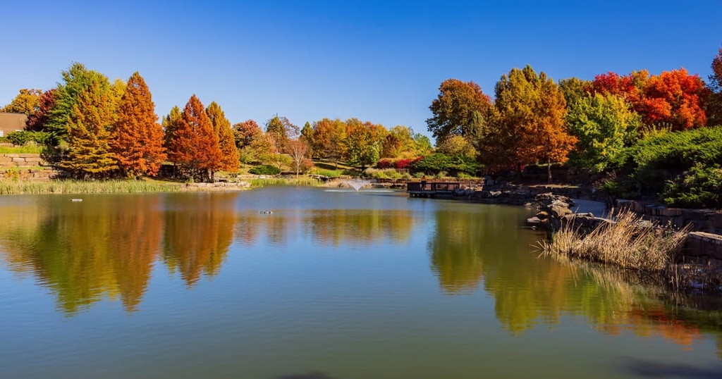
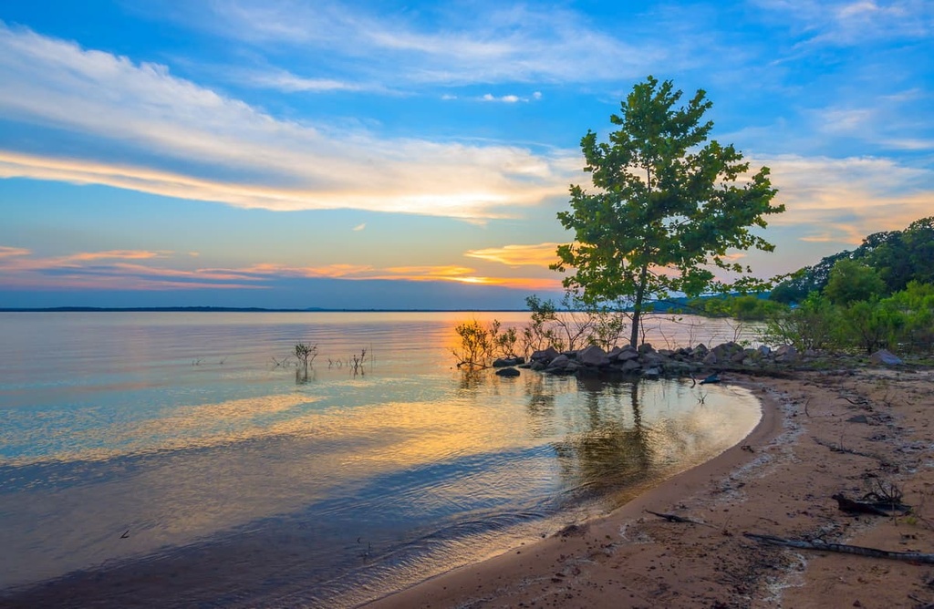
The Arkansas River runs directly through the reservation in a northwest-southeast direction. Some of the lakes that are located in and around the reservation include Eufaula Lake, Robert S. Kerr Reservoir, Tenkiller Ferry Lake, and Fort Gibson Lake.
Finally, the Cherokee Nation is surrounded by a number of popular outdoor recreation areas. In particular, it is located near the Ouachita National Forest, Joseph H. Williams Tallgrass Prairie Preserve, and Ozark-Saint Francis National Forest.
The geological history of the land located within the Muscogee (Creek) Nation reservation is closely intertwined with the formation of Ozark Highlands, the Ouachita Mountains, and their many subranges.
The reservation lies in the foothills of the Ozark Mountains and the foothills of the Ouachita Mountains. The bedrock found in the area began forming nearly 540 million years ago when the region was located at the bottom of an ancient sea. Over the course of millions of years, the sediment at the floor of this ocean was transformed into rock.
Today, some of the most common rocks that are found in the area include shales, limestones, sandstones, cherts, and siltstones. The greater Ozark region experienced uplift during the Paleozoic Era, which caused the seafloor to be raised up and a vast dome to form.
Over the course of millions of years, rivers and streams in the region carved out the landscape, leaving behind the alternating valleys, ridges, and bluffs that are visible today. Nevertheless, the land that’s located to the west of the range, including parts of the Muscogee (Creek) Nation reservation, is relatively flat.
Some of the major peaks that are located on the lands of the Muscogee (Creek) Nation include Lamar Mountain, Badger Hill , Dude Ranch Hill, Conjada Mountains, and Tiger Mountain.
The land that’s located to the east of the reservation is marked by rolling hillsides that lead into the Ozark Highlands. Here, the forested landscape consists of oak, pine, and hickory trees. Other common tree species that are found in the region include white oak, shortleaf pine, post oak, northern red oak, and blackjack oak.
The flatter land that’s found within the reservation supports a variety of low-growing plants, including grama, bluestem, and buffalo grasses. Meanwhile, the game preserves and the vast forested landscapes that are located just to the east of the reservation allow for various species of animals to thrive throughout the region.
Prior to the arrival of European settlers, both elk and bison roamed the land that is now the Muscogee (Creek) Nation reservation. Nowadays, coyotes and white-tailed deer are among the most common mid-sized animals in the area. Meanwhile, the waterways of the region support various species of trout, largemouth bass, crappie, channel catfish, and even salamanders.
Birds of prey, such as bald eagles, are regularly spotted on the reservation along with wild turkeys. Also note that the forested landscape that’s located to the east of the reservation is home to black bears, so adventure with caution when in the area.

Humans have inhabited the land throughout what is now the southeastern US for thousands of years. However, the Muscogee (Creek) people and other members of the contemporary Muscogee (Creek) Nation are not originally from the region that is now Oklahoma.
Rather, as was the case with many other tribes, the Muscogee (Creek) were forcibly relocated to what is now Oklahoma as part of the Indian Removal Act of 1830. The ancestral homelands of the Muscogee are located in what is now the southeastern US, including present-day Tennessee, Alabama, Georgia, and Florida.
Initially, the Muscogee were not technically one tribe. Rather, the Muscogee Confederacy, which can be viewed as a precursor to the formation of the contemporary Muscogee (Creek) Nation, was a union of multiple related Muscogee-speaking tribes and bands. There are also other Muscogee tribes located throughout what is now the US, such as the Alabama-Coushatta Tribe of Texas and the Poarch Band of Creek Indians.
The first contact between the Muscogee people and Europeans occurred in around 1540 during the expedition led by Spaniard Hernando de Soto to present-day Tennessee. These European colonizers and settlers brought with them many diseases such as smallpox and measles that most Indigenous communities had no natural immunity to. These introduced diseases decimated many Indigenous communities in what is now the US, including the Muscogee.
As European colonizers continued to expand westward during the early years of the United States, the Muscogee Confederacy grew in size as it absorbed other bands and fragments of tribes. As the population of settlers in the region steadily increased, the Indigneous peoples fought to protect and preserve their homelands.
The passage of the Indian Removal Act in 1830 was the culmination of the US governments’ effort to forcibly resettle the Indigenous people of the southeastern US on land located to the west of the Mississippi River.
Despite the Muscogee’s efforts to stay on their land, however, the US government forcibly removed around 20,000 Muscogee people to what is now Oklahoma during the nineteenth century. Indeed, during what would later be known as “The Trail of Tears,” thousands of Indigneous people were forced to walk from their ancestral homelands to Oklahoma.
The initial boundaries of the Muscogee (Creek) reservation was established in 1866 alongside the boundaries of the handful of other reservations in what is now Oklahoma. In 1970, the Muscogee Nation was able to regain federal recognition and it ratified a new constitution shortly afterward in 1979.
In 2020, the United States Supreme Court ruled that the Muscogee (Creek) Nation reservation continues to exist as part of the Sharp v. Murphy case. This may seem like an odd thing for the Supreme Court to rule on; however, there was some debate as to whether Congress disestablished the Muscogee (Creek) Nation reservation in 1907 after Oklahoma became a state.
In any case, the US Supreme Court upheld the existence of the Muscogee (Creek) Nation reservation in 2020. Of course, the current territory of the reservation represents just a fraction of the size of the nation’s traditional territory, which spanned much of what is now the southeastern US before colonization.
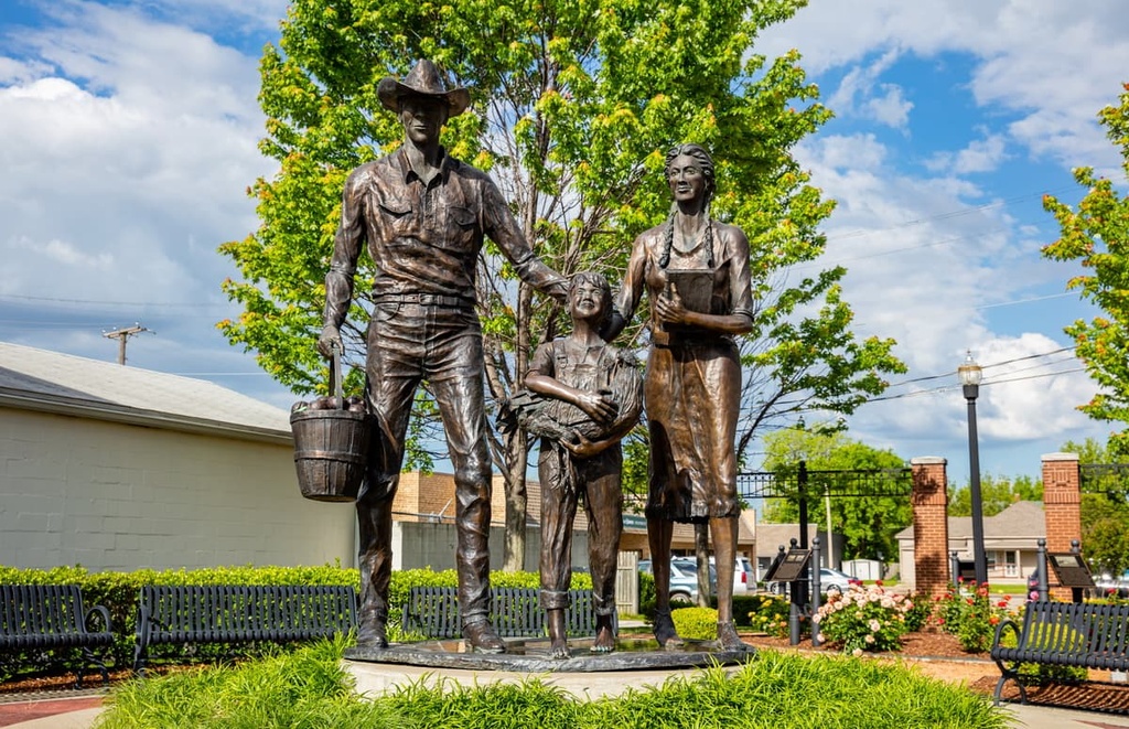
The Muscogee (Creek) Nation is a sovereign tribal nation that has its own government structure and constitution. Members of the Muscogee (Creek) Nation are primarily descendants of the Muscogee-speaking people who were forced to walk to Oklahoma on the Trail of Tears.
In the past, the tribe’s membership also included descendants of the so-called Creek Freedmen, who were the people of African descent who were enslaved by the Muscogee before emancipation.
The descendants of the Creek Freedmen were members of the Muscogee Nation until 2001 when the tribe’s membership rules changed. Many Creek Freedmen descendants are fighting to rejoin the tribe. The issue is quite controversial within the Muscogee (Creek) Nation and the Creek Freedmen community.

You can learn more about the Muscogee (Creek) Nation on their official website.
The Muscogee (Creek) Nation is home to numerous trails for outdoor recreation. Keep in mind that the Muscogee (Creek) Nation is a self-governed and sovereign nation that has control over its reservation, so there may be closed areas within the territory. Be sure to respect any access restrictions whenever you visit the Muscogee (Creek) Nation reservation.
With that in mind, here are some of the best hikes that are located on and around the Muscogee (Creek) Nation to check out during your next trip to the region.
Bixhoma Lake is a popular destination that’s located to the southeast of Tulsa. This small lake is surrounded by deciduous trees that provide hikers with some shade during the warmer months.
There are two trails that lead around the lake. The first of these trails is the main loop, which follows closely along the edge of the lake. This trail is 3.3 miles (5.3 km) in length and it has 150 feet (46 m) of elevation gain.
The second trail involves more uphill climbing around the lake as it takes hikers to a scenic viewpoint that overlooks the surrounding region. This route is known as the Tallulahs Trail. It is 3.9 miles (6.3 km) in length and it has 495 feet (151 m) of elevation gain.
The Oak Leaf Trail lies along the eastern shores of Okmulgee Lake in the southwestern portion of the Muscogee (Creek) Nation reservation. This loop trail is relatively flat for the first half of the journey as it follows along the shores of the lake.
The second half of this hike climbs gently uphill, and it offers hikers a view of both the lake down below and the relatively flat land that extends out to the west. This route is 2.6 miles (4.2 km) in length and it has 167 feet (51 m) of elevation gain.
The Jean-Pierre Chouteau Nature Trail is a gentle hike that travels along the northern shores of the Grand and Arkansas rivers.
This out-and-back route follows the forested banks of these rivers and features a suspension bridge that traverses over a small creek. This trail is 2.7 miles (4.3 km) in length and it has 65 feet (20 m) of elevation gain.
Looking for a place to stay near the Muscogee (Creek) Nation? Here are some of the best cities and villages to check out in the region:
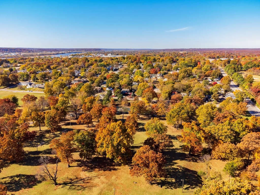
The city of Tulsa lies along the northern edge of the Muscogee (Creek) Nation. As it is home to over 400,000 residents, Tulsa is the second-most populous city in the state of Oklahoma.

As one of the larger cities in the state, Tulsa is home to multiple museums and art galleries. Popular sites in the city include the Gilcrease Museum, Philbrook Museum of Art, and Woody Guthrie Center.
In addition to museums and galleries, there are plenty of other great activities to enjoy in Tulsa. This includes hiking on the many trails that line either side of the Arkansas River as it runs through the heart of the city. There are also plenty of great restaurants to check out in Tulsa both before and after your hiking adventures.
The city of Muskogee is located on the eastern edge of the Muscogee (Creek) Nation. Interestingly, the city of Muskogee was historically called the Three Rivers as it is situated near to the confluence of the Arkansas River, Verdigris River, and Grand River.
Nowadays, the city is home to around 37,000 residents, and it features popular sites such as the Five Civilized Tribes Museum, Three Rivers Museum, Oklahoma Music Hall of Fame, and the Ataloa Lodge Museum.
Muskogee is also the economic center of eastern Oklahoma. The downtown area of the city boasts local shops, restaurants, and cafés, all of which offer a calmer atmosphere for visitors to enjoy when compared to the bustling streets of nearby Tulsa.


The highest peak in Muscogee (Creek) Nation is Lamar Mountain, at 338 m.
Notable peaks in Muscogee (Creek) Nation include Lamar Mountain, Dude Ranch Hill, Pine Hill, Tabletop Mountain and Conjada Mountains.


