
Scan the QR code and open PeakVisor on your phone
Cherokee Nation has 226 named peaks. The highest is Workman Mountain at 523 m. Other notable peaks include Muskrat Mountain, Doublehead Mountain and Killer Mountain.
Cherokee Nation (ᏣᎳᎩᎯ ᎠᏰᎵ/Tsalagihi Ayeli) is a sovereign Indigenous nation with a reservation that’s located in the northeastern region of the US state of Oklahoma. The reservation of the Cherokee Nation contains 226 named mountains. The tallest peak is Workman Mountain at 1,716 ft (523 m) in elevation and the most prominent is Doublehead Mountain with 597 ft (182 m) of prominence.
The Cherokee Nation (ᏣᎳᎩᎯ ᎠᏰᎵ/ Tsalagihi Ayeli) is a the largest of the three federally-recognized tribes of Cherokee in the United States. It is a sovereign Indigenous nation that has tribal jurisdiction over a reservation that covers a wide swath of land in northeastern Oklahoma.
The other two Cherokee tribal nations are the Eastern Band of Cherokee Indians (ᏣᎳᎩᏱ ᏕᏣᏓᏂᎸᎩ/Tsalagiyi Detsadanilvgi), which is based in what is now North Carolina and the United Keetoowah Band of Cherokee Indians (ᎠᏂᎩᏚᏩᎩ ᎠᏂᏴᏫᏯ/Anigiduwagi Aniyvwiya), which is headquartered in Tahlequah, Oklahoma (ᏓᎵᏆ/Da-li-gwa), alongside the Cherokee Nation.
The reservation of the Cherokee Nation spans 6,962 sq. miles (18,030 sq km) across northeastern Oklahoma. It is one of the largest areas of tribally managed lands in the contemporary United States after the reservations of the Navajo Nation, the Choctaw Nation, the Chickasaw Nation, and the Ute Indian Tribe of the Uintah and Ouray Reservation.
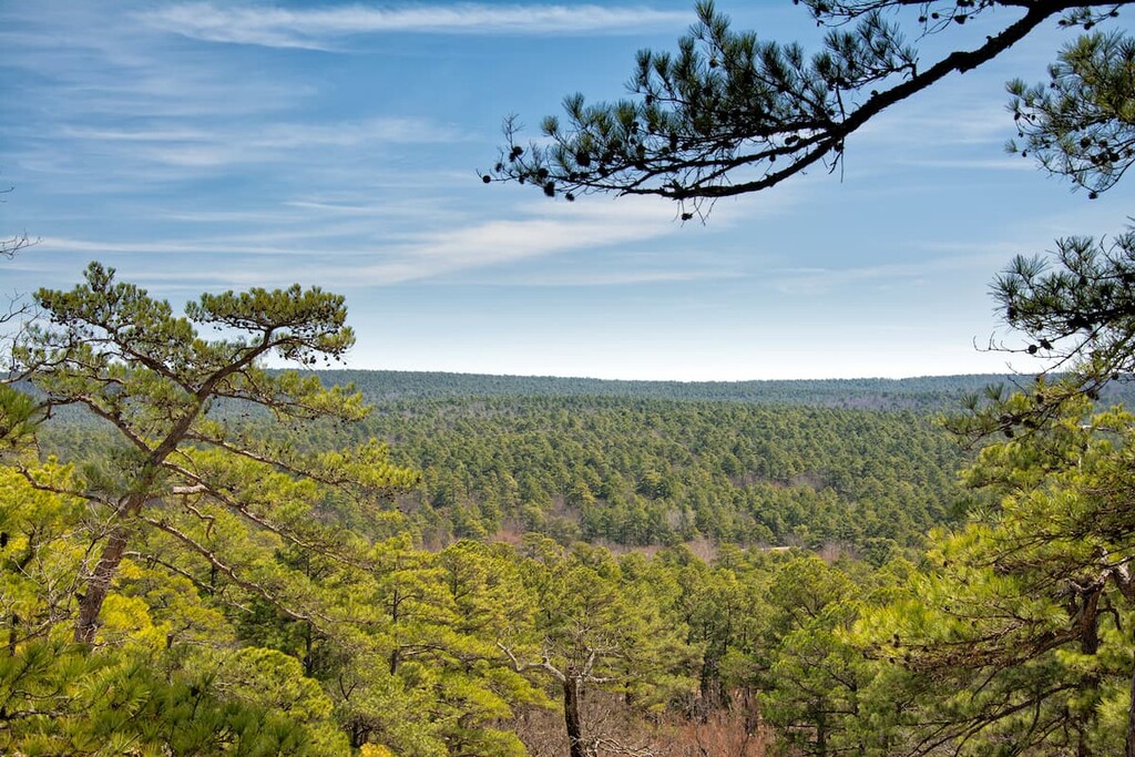
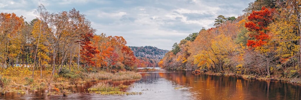
The northeastern section of the reservation of the Cherokee Nation is marked by the Ozark Mountains. The Boston Mountains, a subrange of the Ozark Mountains, span across both Arkansas and Oklahoma.
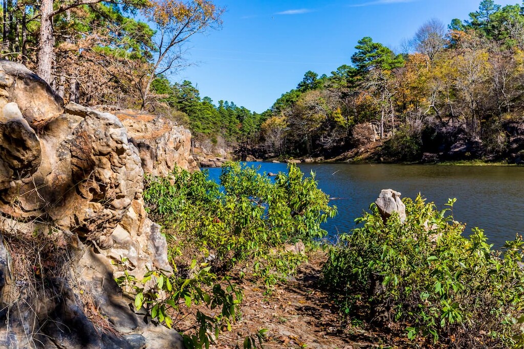
This mountain range is part of the larger Ozark Plateau. This section of the nation’s reservation is defined by steep ridges and valleys. Numerous rivers wind throughout the landscape resulting in many caves and sinkholes.
The rolling mountains are marked by densely forested hillsides. To the west and the south of the Ozark Plateau lies the Prairie Plains which encompasses much of the landscape throughout the Cherokee Nation.
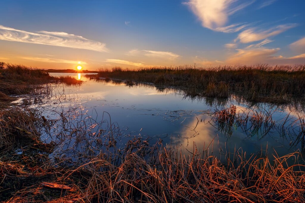
The more rugged portions of land in the plains are typically used for grazing. The gentle slopes within the river valleys of the Prairie Plains are used primarily for vegetable farming. Spring-fed rivers run throughout the entire region with numerous lakes and lagoons scattered throughout.
Additionally, Cherokee Nation is surrounded by popular outdoor recreation areas. The Ozark-St. Francis National Forest is situated to the east, Ouachita National Forest is to the southeast, and Robbers Cave State Park to the south.
The geological formation of the lands of the contemporary Cherokee Nation is closely intertwined with the formation of the Ozark Highlands. The peaks in the region, along with the Boston Mountains and Prairie Plains, began forming during the late Paleozoic era.
The Ozark Plateau was in the process of uplifting as the South American plate and the North American plate collided. After being uplifted to its elevated position, the plateau was extensively eroded by rivers and streams. This erosion carved away at the landscape to create the many valleys and mountains that we see today.
The eastern stretches of the lands of the Cherokee Nation used to be much flatter, similar to its western section. Yet over the course of millions of years, the rivers of the region carved out the Boston Mountains and the numerous deep valleys amongst the peaks.
Major peaks within the lands of the Cherokee Nation include Workman Mountain, Doublehead Mountain, Muskrat Mountain, Killer Mountain, Hay Ridge, and Big Round Mountain.
The rolling hills in the east of the Cherokee Nation are dominated by a forested landscape. Pine, oak, and hickory trees encompass the eastern region of the nation. Shortleaf pine, white oak, northern red oak, post oak, and blackjack oak are common species found in the forest.
The undergrowth in the Boston Mountains is home to dogwood, maple, and redbud trees. Various grasses are found in the Prairie Plains including bluestem, buffalo, and grama grasses.
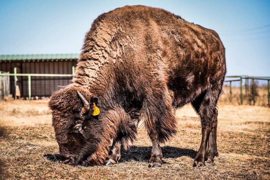
Both white-tailed deer and coyotes can be found throughout the nation. Elk and bison once inhabited the region prior to the arrival of European colonizers, after which point many native species were extirpated from the landscape.
The numerous rivers on the lands of the Cherokee Nation provide habitat for salamanders, and various species of trout. Other species of fish include channel catfish, largemouth bass and crappie.
Large populations of trout help feed the bald eagles region. In the eastern stretches of the Cherokee Nation, populations of black bears, rabbits, and wild turkeys can be spotted.
The land that is now part of the Cherokee Nation reservation has been inhabited for thousands of years.
As early as 8,000 years ago, what is now the southern United States was inhabited by people of the Paleo-Indian (Paleo-American) culture. These people are thought to have arrived to the Americans during the late Pleistocene period.
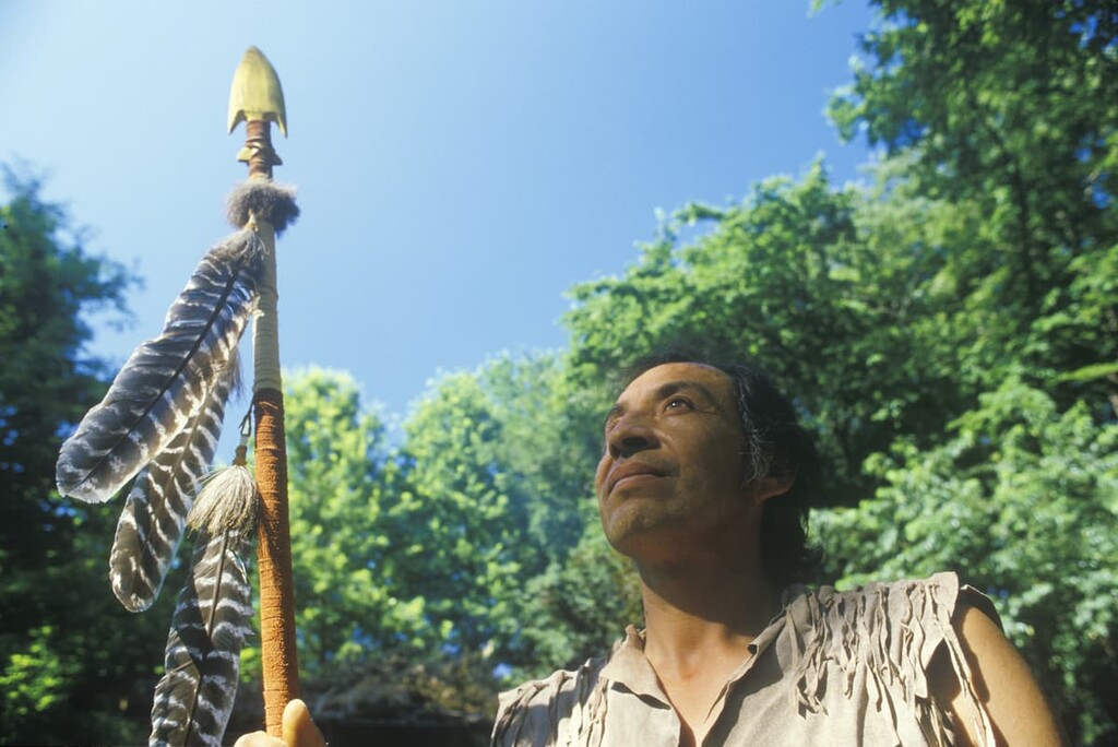
However, the contemporary Cherokee Nation does not have its ancestral roots in Oklahoma. The people within the Cherokee Nation once lived in what is present day North Carolina and throughout what is now known as the southeastern United States, such as in Tennessee and Georgia.
The first recorded contact between the Cherokee people and Europeans occurred in 1540 during the expedition of Spaniard Hernando de Soto in Tennessee. In the years that followed the Cherokee people traded and had treaties with the English, Irish, and Scots.
The Cherokee people formed an organized national government in the late 1700s around the time that they began to make treaties with the European colonizers. However, in the early 1800s, after the discovery of gold in northern Georgia, the US government continued a practice of forced removal of Indigenous peoples from their ancestral homelands.
In the 1830s, the US Government tried to force the Cherokee Nation to sign the Treaty of New Echota. This treaty was an attempt to make the Cherokee Nation cede its remaining homelands in exchange for land in what is now Arkansas. The Cherokee Nation technically never signed nor approved the treaty, but it was used as the legal basis for the forced removal of the Cherokee from their ancestral homelands along the Trail of Tears.
Approximately 16,000 Cherokee were forced to walk for around six to seven months to Arkansas. It’s estimated that approximately 4,000 Cherokee died during the journey.
After arriving in what was then called “Indian Territory,” the resilient Cherokee Nation rebuilt a community in what is now Oklahoma. The nation ratified a new constitution in 1839 and established a new supreme court in 1844.
The American Civil War resulted in immense loss for the Cherokee people. The Curtis Act was passed in 1898 and led to further destruction to the Cherokee Nation. As a result of this act and the establishment of the state of Oklahoma in 1907, the infrastructure of the Cherokee Nation was dissolved overnight. This led to a long period of poverty for many Cherokee who had lost, yet again, their lands.
However, in 1970, the Principal Chief’s Act made it easier for many tribal nations, including the Cherokee Nation, to reclaim tribal sovereignty and to re-establish a government. This allowed for the ratification of a new constitution in 1975.
These days, the Cherokee Nation is a relatively large sovereign tribal nation with some 390,000 enrolled citizens, of which approximately 141,000 live on the tribe’s reservation. The Cherokee Nation is also one of the largest employers in northeastern Oklahoma and it is a major player in the region’s economy.
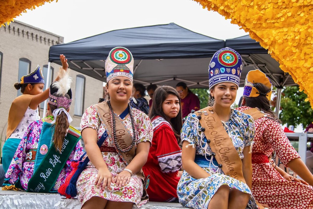
The Cherokee Nation continues to promote and uphold its rich cultural traditions through its heritage center, arts center, and Cherokee language classes. The Cherokee Nation welcomes visitors who want to learn more about the nation’s cultural heritage and people who want to enjoy the nation’s stunning outdoor recreation destinations.
You can learn more about tourism in the area at VisitCherokeeNation.com
The Cherokee Nation is home to numerous protected regions for outdoor recreation. Here are a few of the parks and forest located within and near the nation:
Located near the eastern border of the nation lies Lake Eucha Park. Despite the name, the park is not on the shores of nearby Lake Eucha. The park spans just over 30 acres (13 ha) across the region.
A unique feature of Lake Eucha Park is that the entire park, along with the pool, can be reserved for day use. While overnight camping is prohibited, the park is also home to numerous picnic tables and hiking trails.
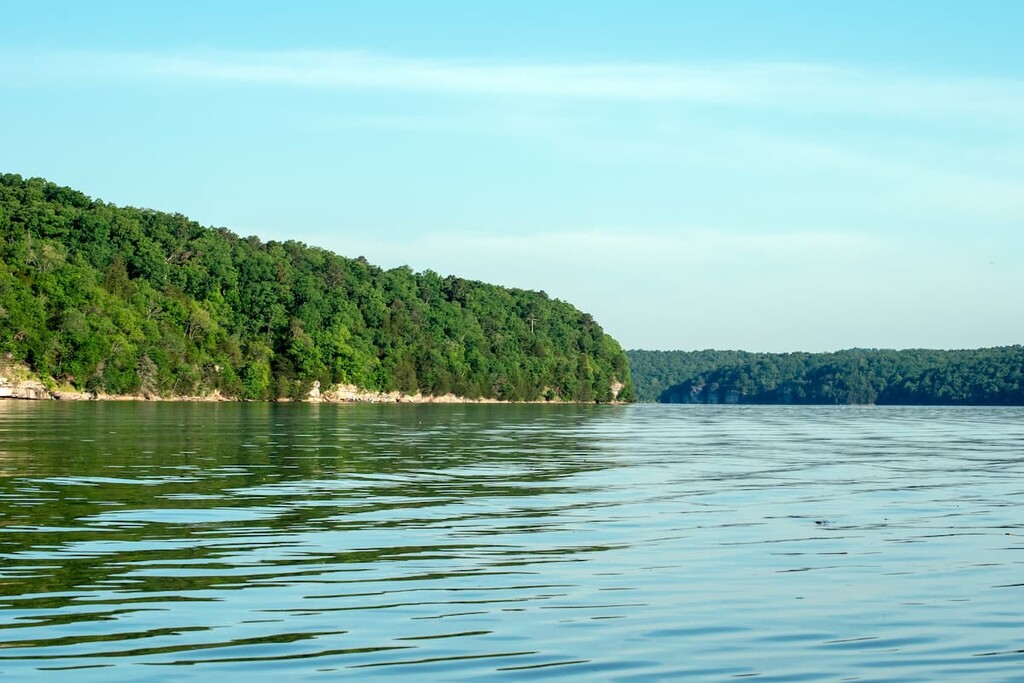
Situated along the shores of Gibson Lake lies Sequoyah State Park. The park spans 2,200 acres on a peninsula and has numerous campsites and hiking trails.
As a popular recreation destination, Sequoyah State Park is also equipped with a marina, golf course, nature center, and riding stables. Popular hiking routes in the park include Scissortail Trail, Bluebird Trail, and Fossil Trail.

The Ozark-Saint Francis National Forest lies to the east of the Cherokee Nation. Situated in Arkansas, the forest covers 1.2 million acres (485,600 ha) within the Ozark Mountains. There are five wilderness areas within the protected forest.
Well-known hiking trails and areas in the forest include Whitaker Point Trail, Hawksbill Crag, Glory Hole Waterfall Trail, and the Devils Canyon Scenic Area.
Robbers Cave State Park lies to the south of the Cherokee Nation. Situated in the San Bois Mountains, the park spans 8,000 acres (3,200 ha) of land and is known for its numerous hiking trails.
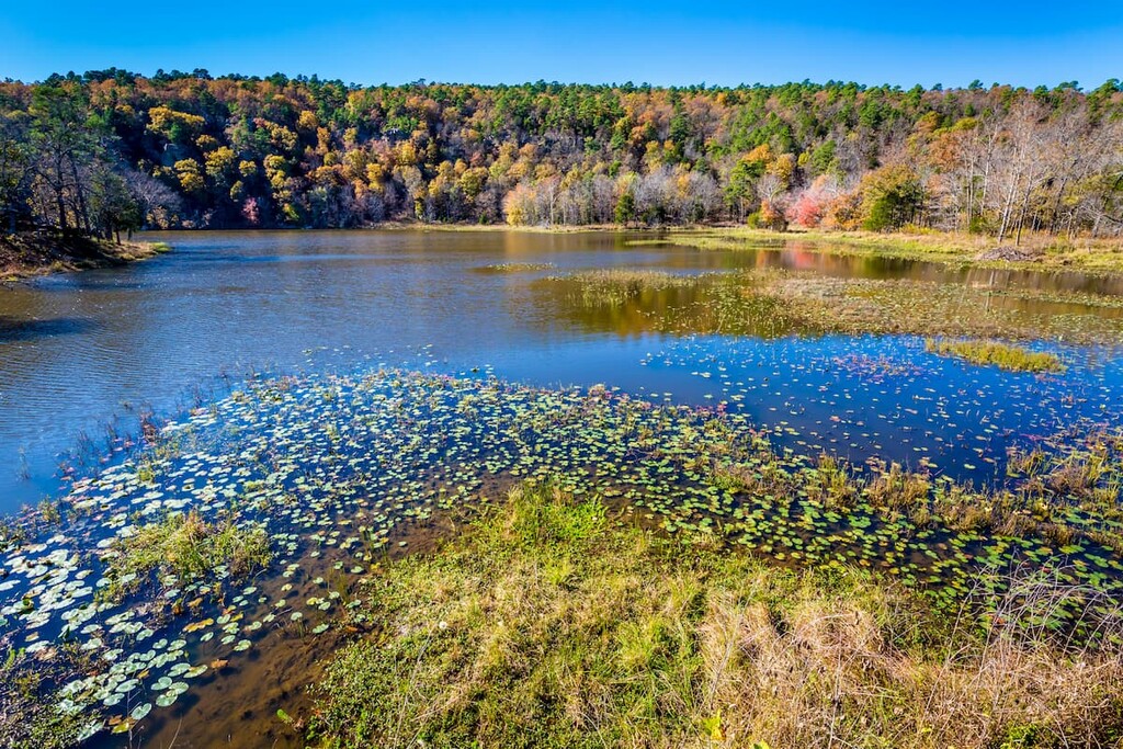
Besides hiking, Robbers Cave State Park is home to three lakes: Lake Wayne Wallace, Coon Creek Lake, and Lake Carlton. The lakes provide ample opportunity for fishing, kayaking, and swimming.
The vast majority of Ouachita National Forest is located in Arkansas, to the southeast of the Cherokee Nation. It is home to a diversity of landscapes as well as six designated wilderness areas.
Popular hikes in the region include the Ouachita National Recreation Trail, Eagle Rock Loop, and the Winding Stairs Trail. Many of the trails in the forest showcase the numerous rivers and waterfalls of the region.
Looking for a place to stay near the Cherokee Nation reservation? Here are some of the best cities and villages to check out in the region:
Tahlequah is the capital city of the Cherokee Nation. Situated along the western foothills of the Ozark Mountains, the city has a population of around 17,000. The city was established as the capital back in 1839 when the indigenous people were forced to relocate to the region.
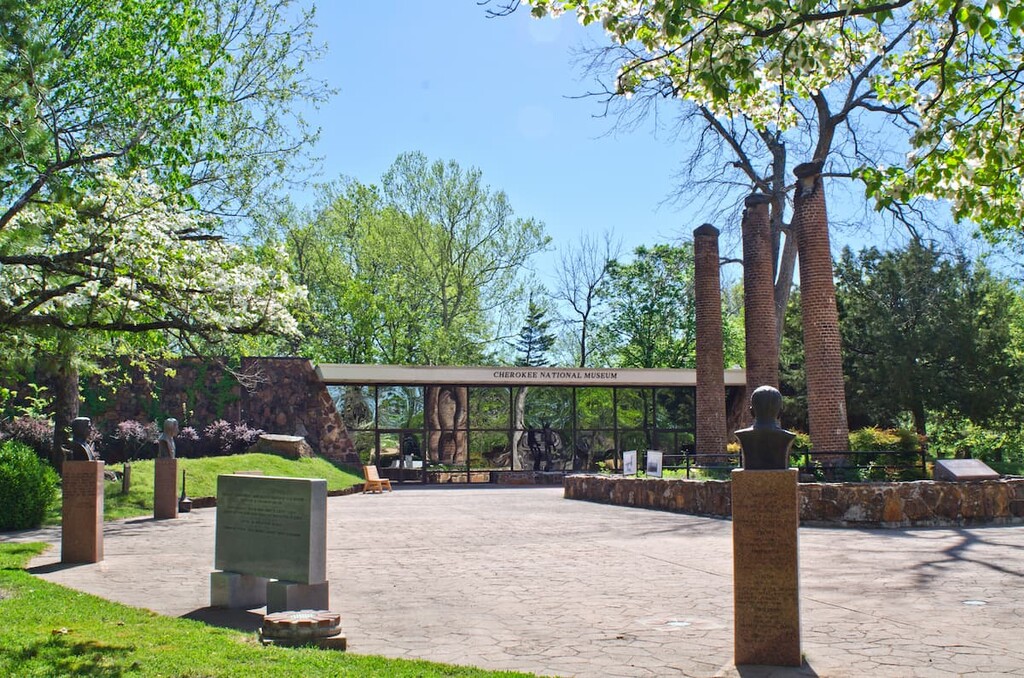
Within the city lies the Cherokee National Supreme Court Museum. As the name suggests the building was once home to the nation’s Supreme Court but has since been converted to a museum which is open to the public. Tahlequah is also home to the Cherokee National History Museum.
Located in the northeastern region of the Cherokee Nation lies Grove. The city has a population of just over 7,000 and is situated near the Brand Lake o’ the Cherokees. The lake is used for professional bass fishing as well as outdoor recreation.
Other points of interest in Grove include the Lendonwood Gardens, Har-Ber Village Museum, and Splitlog Church. The small city is often visited over holiday weekends.

Located on the western edge of the Cherokee Nation lies the city of Tulsa. The city has a population of over 400,000 people, making it the second most populous city in the entire state. Tulsa has a unique culture that’s a blend of southern, midwestern, and southwestern US cultures.
Because Tulsa is one of the major cities in the state, it is also home to numerous museums such as the Philbrook Museum of Art, the Gilcrease Museum, and the Woody Guthrie Center. Today the leading sectors in the city are finance, aviation, and technology.


The highest peak in Cherokee Nation is Workman Mountain, at 523 m.
Notable peaks in Cherokee Nation include Workman Mountain, Muskrat Mountain, Doublehead Mountain, Killer Mountain and Big Round Mountain.


