Scan the QR code and open PeakVisor on your phone
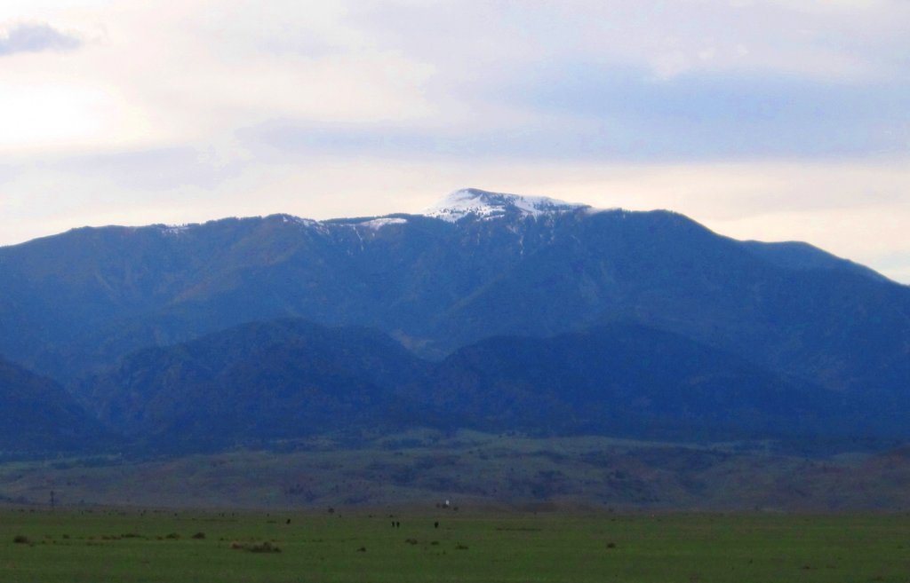
The Greenhorn Mountain Wilderness is a protected area located in the south-central part of the US state of Colorado. This remote wilderness is thought to be home to some of the most rugged and unexplored terrain in the entire state. The tallest and most prominent peak in the wilderness is Greenhorn Mountain at 12,346 ft (3,763 m) in elevation and with 3,766 ft (1,148 m) of prominence.
The Greenhorn Mountain wilderness lies in south-central Colorado to the south of the city of Colorado Springs. The wilderness is named after Greenhorn Mountain, the tallest and most prominent peak in the region.
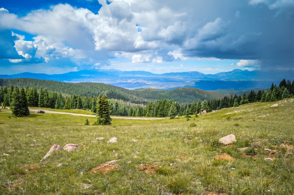
The peaks within the wilderness are part of the Wet Mountains, a small subrange of the Sangre de Cristo Range. This range is part of the larger Southern Rocky Mountains. The wilderness also lies within the San Isabel National Forest, which extends across the southern portion of the state.
Other nearby subranges in the region include the Sawatch Range and the Collegiate Peaks. The entire wilderness spans 23,087 acres (9,343 ha) of terrain across the region’s mountainous landscape. Elevations in the wilderness range from lows of around 7,600 feet (2,316 m) up to the summit of Greenhorn Mountain.
Around two-thirds of the wilderness is forested, while the rest is primarily dominated by alpine terrain and steep canyons. The Greenhorn Mountain Wilderness is also known for having one of the most dramatic changes in landscapes in the entire state as it contains terrain that transitions quickly from plains to mountains.
A majority of the east-facing slopes in the wilderness area are barren and showcase these dramatic changes in elevation. The western slopes of the wilderness feature more tree coverage and alpine tundra. But unlike many other parts of Colorado, there are no major lakes or ponds found in the wilderness.
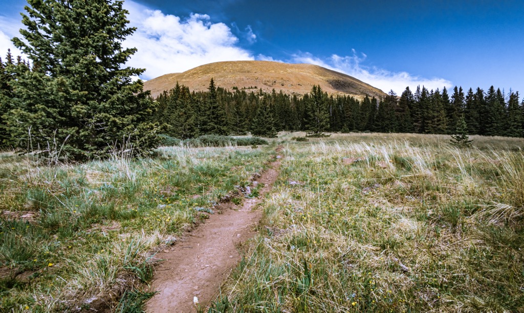
There are only 11 miles (18 km) of marked trails in the entire wilderness area, all of which can be found in the northern half of the region. A lack of water and developed trails have left the southern part of the wilderness area relatively untouched by outdoor adventurers.
The Greenhorn Mountain Wilderness lies within the San Isabel National Forest and is surrounded by numerous other protected areas. The Royal Gorge Field Office of the Bureau of Land Management (BLM) and the San Isabel National Forest surround the wilderness area.
Furthermore, Pueblo Mountain Park is situated to the north of the wilderness while the Sangre de Cristo Wilderness Area, Great Sand Dunes National Preserve, and Great Sand Dunes National Park are all located to the west.
The peaks within the Greenhorn Mountain Wilderness are part of the Wet Mountains, a subrange of the Sangre de Cristo Mountains that are a subrange of the Southern Rocky Mountains.
These rugged peaks formed with the rest of the Sangre de Cristo Mountains. The range was slowly uplifted and began taking shape during the Laramide orogeny. The western side of the range is bound by the Rio Grande Rift while the eastern edge is marked by numerous thrust faults.
These thrust faults forced the range upward and moved the range eastward to its current location. The faults have allowed Precambrian basement rock and sedimentary strata to collide along with sections of igneous rocks.
In the past, widespread volcanic activity also occurred in southern Colorado, giving rise to the towering peaks of the region. Though they are less common within the wilderness, visitors can spot plutons in the nearby San Juan Mountains.
Though the range currently receives very little rainfall, much of the region was heavily glaciated during the last glacial maximum. As the glaciers retreated, deep canyons and glacial cirques were left behind, adding to the dramatic changes in elevation that we now see on the eastern side of the wilderness.
Major peaks located within the Greenhorn Mountain Wilderness include Greenhorn Mountain, North Peak, and Santana Butte.
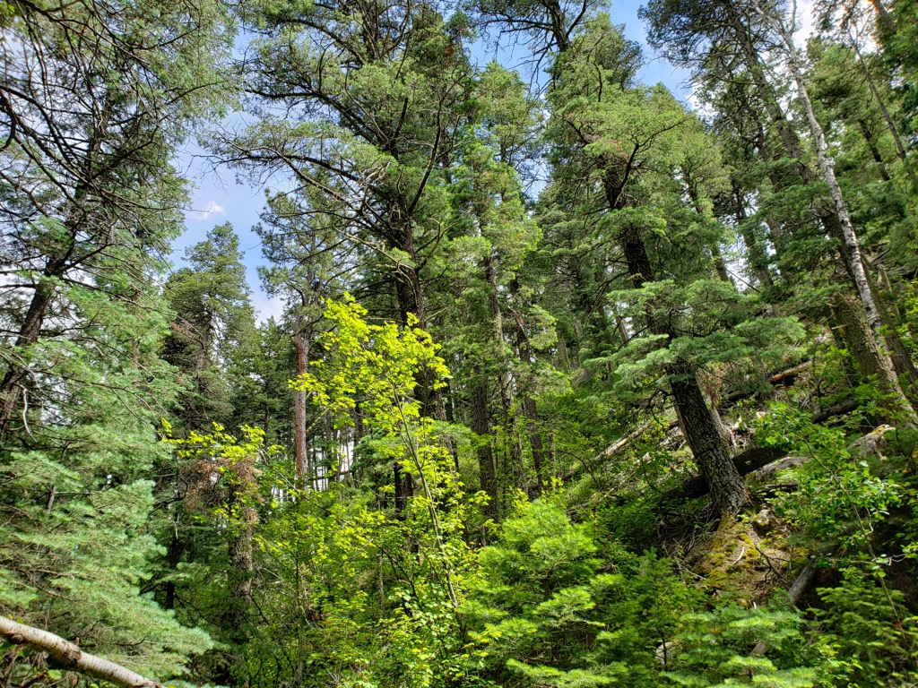
A majority of the plant life in the wilderness is located along the western side of the region. Here, the forest consists of dry oakbrush, ponderosa pine, and pinyon-juniper. Stands of aspen, fir, and spruce are also common at higher elevations in the wilderness.
The alpine terrain in the wilderness area features minimal amounts of flora. Hikers can expect to see small shrubs, low-growing grasses, and occasional wildflowers during the warmer months of the year.
Because the region receives such little rainfall, it’s difficult for many animals to thrive in the wilderness area. Nevertheless, some of the most common animal species in the region include bighorn sheep, elk, and mule deer.
The few streams that do cut across the wilderness provide much-needed habitat for the threatened greenback cutthroat trout. The occasional mountain lion, mountain goat, and wild turkey can also be spotted in the wilderness.
The land in and surrounding the Greenhorn Mountain Wilderness has been inhabited by humans since long before the arrival of European settlers. The region is part of the ancestral homelands of the Lipan Apache, Jicarilla Apache, Cheyenne, and Ute people.
Although many Apache bands traditionally lived primarily in what is now Texas, their territory did extend into present-day southern Colorado. The Cheyenne also originally lived on land to the east of Colorado, but they eventually moved farther west and settled along the Platte River during the early nineteenth century.
The Ute traditionally lived throughout southwestern Colorado. Many of their main settlements were historically located to the west of the wilderness where there was more reliable rainfall and water supply.
Some of the first settlers of European descent to visit the region were Spanish conquistadors. By the eighteenth century, fur trappers and traders began arriving in the area, and many people also came to the region in search of silver and gold. Gold was eventually found in the nearby San Juan Mountains during the Charles Baker Expedition in 1860, which ultimately led to the Colorado gold rush.
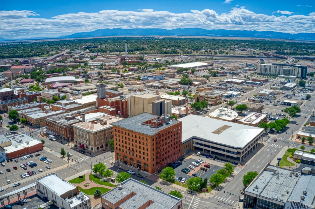
The city of Pueblo lies just to the north of the wilderness and was originally established in the 1840s. Pueblo continued to grow in the following decades, and it eventually became one of the largest producers of steel in the entire country.
The Fort Pueblo Massacre occurred in 1854 as the Utes and Jicarilla Apaches retaliated against the new settlers who were displacing them from their homelands. The arrival of European diseases, such as smallpox, also decimated Indigenous communities that had no natural immunity to these illnesses.
Despite their efforts, Indigenous tribes were eventually forcibly removed from their native homelands and placed on reservations in the surrounding states. Today, there are many tribes in the region, including the Lipan Apache Tribe of Texas, Jicarilla Apache Nation, Cheyenne and Arapaho Tribes, and the Southern Ute Indian Tribe, among others.
San Isabel National Forest was originally established in 1902 as a forest reserve, though it became a national forest in 1907. It expanded in size over the following decades and it eventually became administratively combined with Pike National Forest in 1973.
The Greenhorn Mountain Wilderness was established in 1993 as part of the Colorado Wilderness Act, which established more than a dozen other wilderness areas in the state.
The Greenhorn Mountain Wilderness is home to a few hiking trails, though most of the region is undeveloped. Due to the rugged nature of the wilderness, hiking in the region is only suitable for experienced trekkers.

It can also get very hot in the wilderness during the summer months and water sources are not reliable. Therefore, anyone looking to trek in the Greenhorn Mountain Wilderness during the summer months should be prepared for the extreme conditions. Bring lots of water, wear sun-protective clothing, and don’t be afraid to turn back if the temperatures are too hot to hike in safely.
With that in mind, here’s a look at some of the most popular hiking areas in the wilderness.
The trail to the summit of North Peak is arguably the most popular hiking route in the wilderness. This route begins along the eastern side of the wilderness and climbs steadily throughout. Hikers on this trail pass through forested hillsides and seasonal creeks before climbing above the treeline.
From the rocky summit, hikers can enjoy unobstructed views of the surrounding wilderness, including Greenhorn Mountain to the south. This out-and-back trail is 13.1 miles (21 km) in length and it has 4,878 feet (1,487 m) of elevation gain.
The Apache Falls Trail is an out-and-back route located along the eastern side of the wilderness. The trail begins in the barren prairie lands before climbing steadily through the steep forested foothills. After climbing, the trail then descends into a valley before reaching Apache Falls.
These stunning falls cascade down the rock wall to a small pool at their base. This out-and-back trail is 10.2 miles (16.4 km) in length and it has 2,949 feet (899 m) of elevation gain.
To reach the summit of Greenhorn Mountain, hikers must drive 24 miles (38 km) up a service road before reaching the beginning of the hike. From there, the trail climbs steadily above the treeline before reaching the barren summit.
As the tallest peak in the region, hikers are rewarded with panoramic views of the landscape and the Sangre de Cristo Mountains. This out-and-back trail is 6 miles (9.6 km) in length and it has 764 feet (233 m) of elevation gain.
Looking for a place to stay near the Greenhorn Mountain Wilderness? Here are some of the best cities and villages to check out in the region.
The city of Pueblo lies just to the north of the wilderness area. It is home to around 111,000 residents, and it is located along the Arkansas River. Pueblo boasts over 300 days of sunshine annually and it has a relatively mild climate, making it an ideal place for outdoor recreation.
Common outdoor activities in the region include trail running, mountain biking, hiking, rock climbing, and fly fishing. Visitors to Pueblo can enjoy the Arkansas River or cool off in the nearby Lake Pueblo State Park.
The downtown streets of Pueblo are home to multiple museums and sites such as the Pueblo Heritage Museum, Rosemount Museum, El Pueblo History Museum, and Steelworks Museum. Plus, Pueblo’s many local restaurants, breweries, and pubs offer a relaxing end to a day spent exploring.
Situated less than an hour’s drive to the north of Pueblo is the city of Colorado Springs. With a metro population of around 755,000 people, Colorado Springs is the second-largest city in the state of Colorado. As it is situated near the base of Pikes Peak, the city is a hub for outdoor recreation and tourism.

Near Colorado Springs, you can also find the Garden of the Gods, a National Natural Landmark that’s open to the public. The red rock sandstone at the landmark provides a stunning backdrop for a multitude of activities. Visitors can explore the region by hiking, mountain biking, rock climbing, and even whitewater rafting.
Each year, the city hosts a hot air balloon festival known as the Colorado Springs Labor Day Liftoff. There are over 30 craft breweries in the city, too, along with countless local restaurants for visitors to enjoy.