
Scan the QR code and open PeakVisor on your phone
The Cranberry Wildlife Management Area (WMA) is an outdoor recreation destination located within the US state of West Virginia. The WMA lies within the Monongahela National Forest. The tallest peak in the region is Barlow Top at 4,541 feet (1,384 m) while the most prominent is Briery Knob with 1,125 feet (343 m) of prominence.
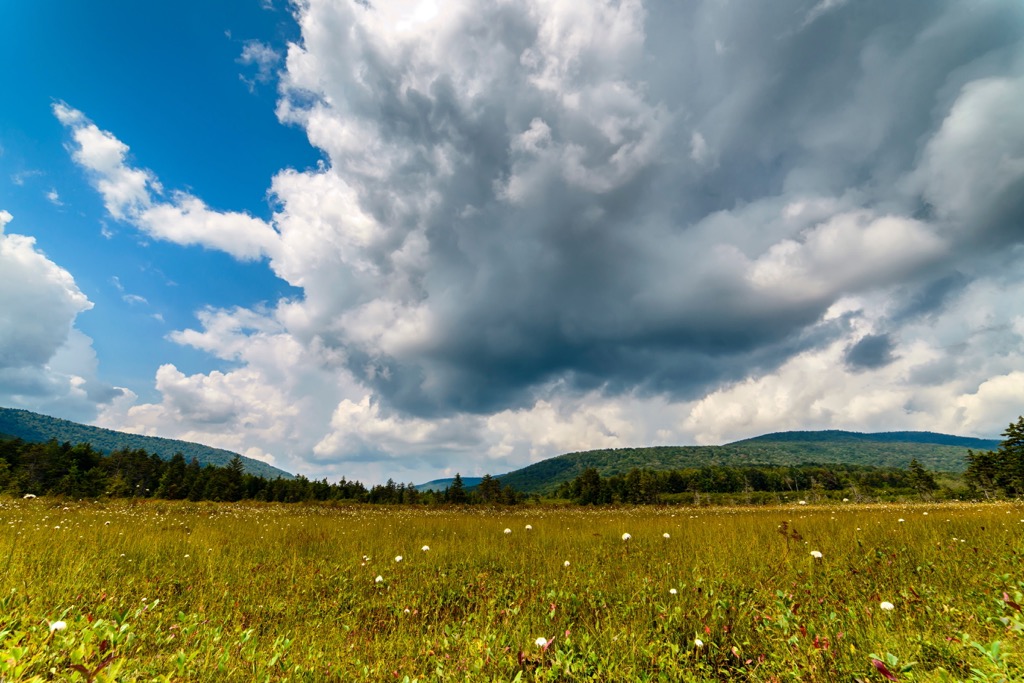
The Cranberry WMA lies in south central West Virginia within the Monongahela National Forest. This managed area spans 159,170 acres (64,414 ha) of national forest land and also encompasses the Cranberry Wilderness.
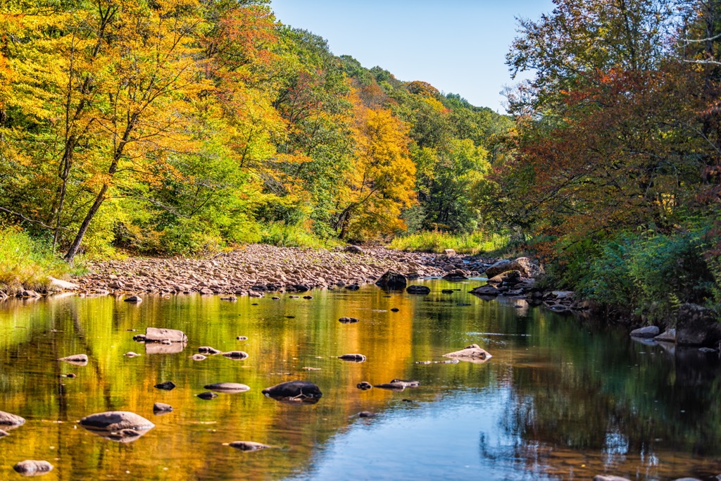
The WMA covers land in Nicholas, Webster, Greenbrier, and Pocahontas counties within the state. The Cranberry River divides the WMA into northern and southern sections. Other major bodies of water include the Cherry River, Williams River, and Dogway Fork Cranberry River. The Elk River lies just north of the WMA.
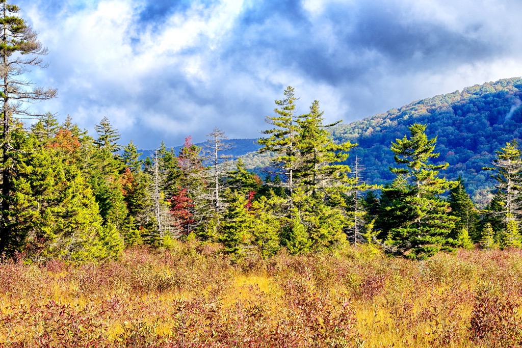
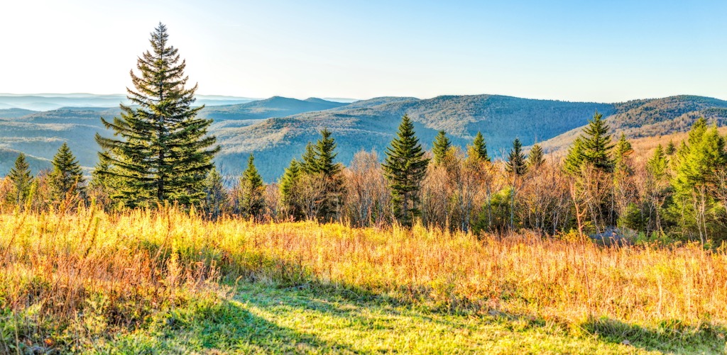
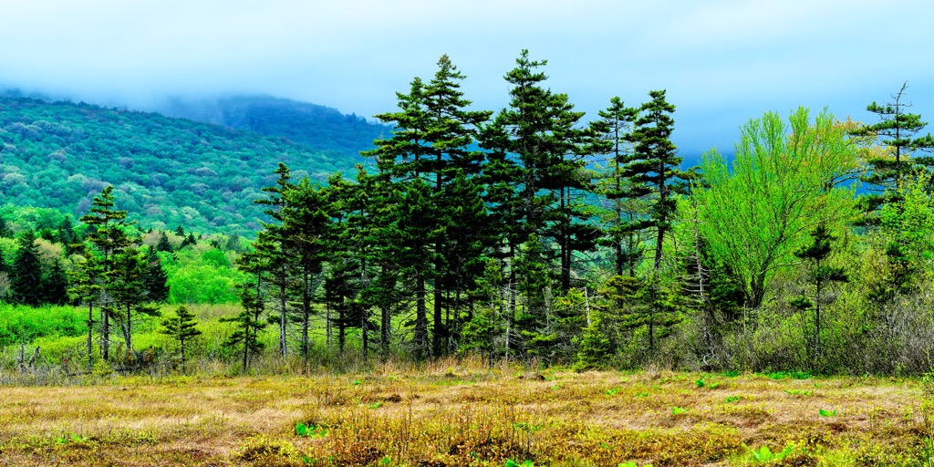
Elevations range from 1,000 feet (305 m) up to the summit of Barlow Top. The region features mountainous terrain and vast sections of hardwood forests. The densely forested hillsides add to the ruggedness of the landscape.
The region is also named after Cranberry Mountain and the Cranberry Glades which are located in the eastern section of the WMA. The glades consist of five boreal-type bogs, high in the Allegheny Mountains, near the headwaters of the Cranberry River.
The forested hills lead to minimal amounts of viewpoints throughout the region. Seasonal creeks, streams, and ponds are scattered throughout the landscape.
The Cranberry WMA lies within the Monongahela National Forest., and is surrounded by various other protected areas. The Calvin Price State Forest and Rimel Wildlife Management Area lies to the east while the Handley and Tea Creek Wildlife Management Areas are situated to the north. The Summersville Lake Wildlife Management Area is to the west and the New River Gorge National River is to the southwest.
The mountains found throughout the WMA and the rest of the Monongahela National Forest are part of the Appalachian Mountains. This larger range extends from the US state of Alabama northward to the Canadian province of Newfoundland and Labrador.
Furthermore, the peaks in this region are part of the Allegheny Mountains, a subrange of the Appalachian Mountains. This subrange spans approximately 400 miles (644 km) in a northeast-southwest orientation.
This range covers land in eastern West Virginia and southwestern Maryland. They mark one of the most rugged sections of the greater Appalachian range, with the Allegheny Plateau to the west and the Blue Ridge Mountains to the east.
The alternating valleys and ridges found in the region were formed by continual thrusting and folding during the Alleghanian orogeny. This geological process created a major mountain building event, laying the foundation for much of the Appalachian Range.
The westward folded layers consist primarily of sedimentary rock. Native bedrock is exposed throughout the higher elevations in the range, due to the continual pattern of freezing and thawing. Mineral hot springs lie throughout the range, with many having been transformed into resorts.
Major peaks found within the Cranberry WMA include Barlow Top, Briery Knob, Sugar Creek Mountain, Kennison Mountains, Blue Knob, and Chestnut Knob.
The flora and fauna of the region is similar to species found throughout the Allegheny Mountains. The forested hillsides are populated by hardwood trees along with red spruce. Other tree species include red maple, eastern hemlock, and mountain ash.
Common mammals include black bear, white-tailed deer, foxes, squirrels, chipmunks, weasels, and raccoons. Grouse, turkey, beaver, and snow hare are commonly hunted and trapped animals. Prior to the arrival of Europeans, elk, bison, and mountain lions roamed freely throughout the landscape.
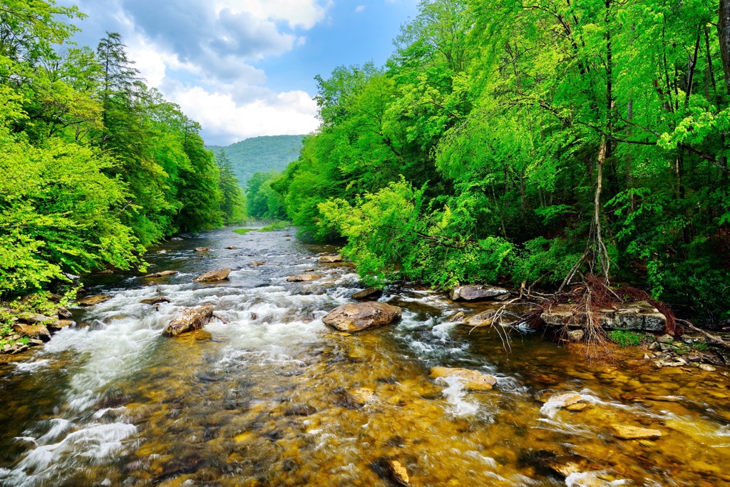
A variety of trout inhabit the various waterways of the WMA. Birds of prey such as hawks, eagles, and owls also use the rivers as a primary source of food.
The land in and surrounding the Cranberry WMA has been inhabited by humans long before the arrival of European settlers. This region marks part of the ancestral homelands of the Shawnee Tribe.
Settlers began arriving in present day West Virginia during the seventeenth century. These early settlers would often establish homesteads and slowly began interacting with the Shawnee Tribe. More groups of settlers began arriving in the nearby Shenandoah Valley during the 1730s.
As the number of settlers began to grow, battles began to break out as the Shawnee people worked to protect and preserve their way of life and native homelands. The Shawnee were steadily forced off of their land and onto less fertile regions by the US government.
The French and Indian War took place from 1754 to 1763, further forcing the Indigenous people from their land. While some Shawnee members fled west, others remained, determined to live on their homelands.
The arrival of European diseases, such as measles and smallpox, further reduced the number of Indigenous people in the region as they had no natural immunity to the illnesses. The Treaty of Fort Meigs in 1817 forced the remaining members of the Shawnee tribe onto three reservations in present-day Ohio.
The surrounding Monongahela National Forest was established in 1911 with the passage of the Weeks Act. The forest continued to grow in size throughout the following decades.
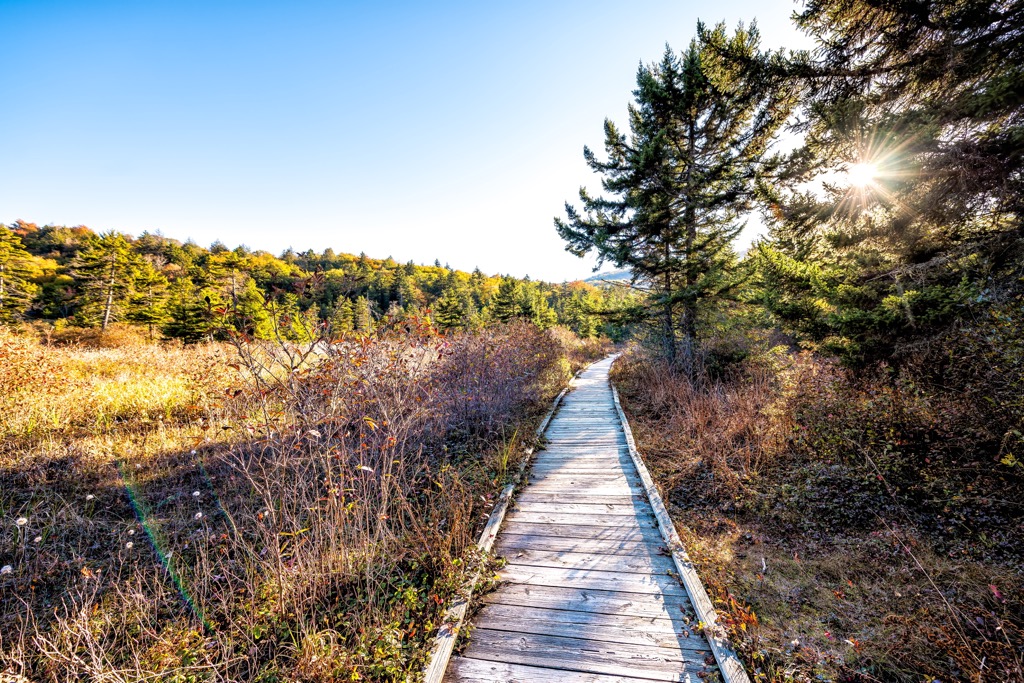
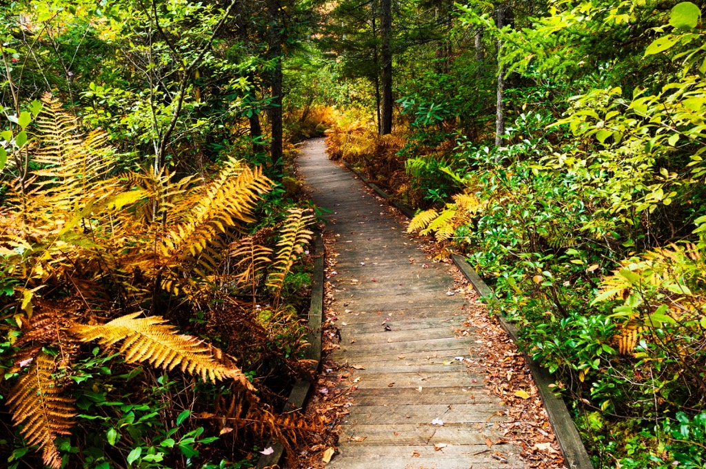
The Cranberry WMA is home to numerous hiking trails. Here are a few of the popular routes within this portion of the national forest:
This hiking route is located along the eastern edge of the WMA near the Cranberry Glades Botanical Area. The loop trail winds through the wetlands of the region, circling around the unique glades.
The South Fork Cranberry River runs through the region along with numerous creeks, streams, and bogs. The loop trail is 8.1 miles (13 km) in length and has 459 feet (140 m) of elevation gain. Hikers can also backpack into a campground found on the northern edge of the loop.
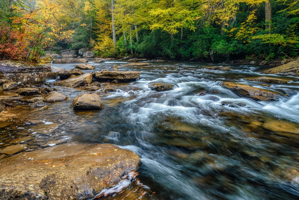
The Cranberry Wilderness lies within the Cranberry WMA and features some of the most stunning terrain in the state. The loop begins by following along the Dogway Fork Cranberry River before meeting up with the Cranberry River.
The views during the hike are of the various rivers and lush forested landscape. Portions of the hike are service roads rather than single track. Hikers pass along the summit of Kennison Mountain and the Tumbling Rock Shelter. The loop is 20.6 miles (33 km) in length with 2,513 feet (766 m) of elevation gain.
The Cranberry River Road provides a more accessible route into the WMA. True to its name, the trail follows along the Cranberry River and features minimal amounts of elevation gain. The flat trail is also partially paved making it accessible for both walking and biking.
The entire out and back trail is 10 miles (16 km) with 314 feet (96 m) of elevation gain. Hikers can complete the entire route or a shorter out and back section to enjoy the river views.
Looking for a place to stay near the Cranberry Wildlife Management Area? Here are some of the best cities and villages to check out in the region:
Hot Springs, Virginia lies just east of the WMA near the state’s border. The census-designated region is only home to around 700 residents but is home to numerous hot springs as well as a famous resort.

One of the most well known resorts is the Omni Homestead Resort. The resort offers accommodations as well as a central location for exploring the wild hot springs that lie nearby. The town features local music and events, offering an ideal way to relax after exploring the surrounding mountains.
The city of Charleston, West Virginia lies west of the WMA. Situated at the confluence of the Elk and Kanawha rivers, Charleston is home to around 48,000 residents and is the capital of the state.

The East End is a historical district in the city, home to vast mansions and the Clay Center for Arts and Sciences. Other popular activities include Capital Market, West Virginia State Museum, Haddad Riverfront Park, and the West Virginia symphony Orchestra.
Charleston lies on the Western Allegheny Plateau, close to the Allegheny Mountains. Visitors can easily take day trips to explore the hiking, backpacking, biking, and kayaking of the region.


