Scan the QR code and open PeakVisor on your phone
Lovingly known as the Apple Isle, the rugged and beautiful Tasmania is the smallest and southernmost state in Australia. Tasmania is home to 2,906 named mountains, the highest and most prominent of which is Mount Ossa (1,617m/5,305ft).
The state of Tasmania (Lutruwita) is located in the southeastern part of Australia, just to the south of Victoria. Tasmania is an archipelago that contains the main island of Tasmania, as well as its surrounding 334 islands. It also contains Macquarie Island, which is a UNESCO World Heritage Site in the south Pacific Ocean that’s about halfway between New Zealand and Antarctica.
With a total area of some 90,758 square kilometers (35,042 square miles), Tasmania is the smallest of Australia’s states in terms of total land area. Furthermore, with a population of around 550,000 people, it is home to less than one-third of the population of the second least-populous state, South Australia, though it is home to twice as many people as the Northern Territory.
That being said, the main island of Tasmania is the world’s 26th largest island after Sakhalin in Russia, Banks Island in Canada, and the main island of Sri Lanka. Meanwhile, it is slightly larger than Devon Island in Canada, Alexander Island in South America (claimed by Argentina, Chile, and the United Kingdom), and the Isla Grande de Tierra del Fuego, which is split between Argentina and Chile.
As an archipelago of islands, Tasmania does not share any land borders with any other geopolitical entity or administrative subdivision. However, it is located just across the Bass Strait, which has an average width of about 250 km (160 miles), from the state of Victoria to the north. Furthermore, it is separated from the country of New Zealand by the Tasman Sea to the east.
Tasmania is officially divided up into 20 land districts, many of which were formerly counties. However, the land administrative districts of Tasmania are more for cadastral (real estate and land recording) purposes than for political reasons.
There are also 29 administrative districts in the state that are known as the Councils of Tasmania. These areas are used for town planning purposes and local government as well as for elections to the Tasmanian Government. The 29 government areas of Tasmania are also further grouped up into 6 regions, though this is more for statistical purposes.
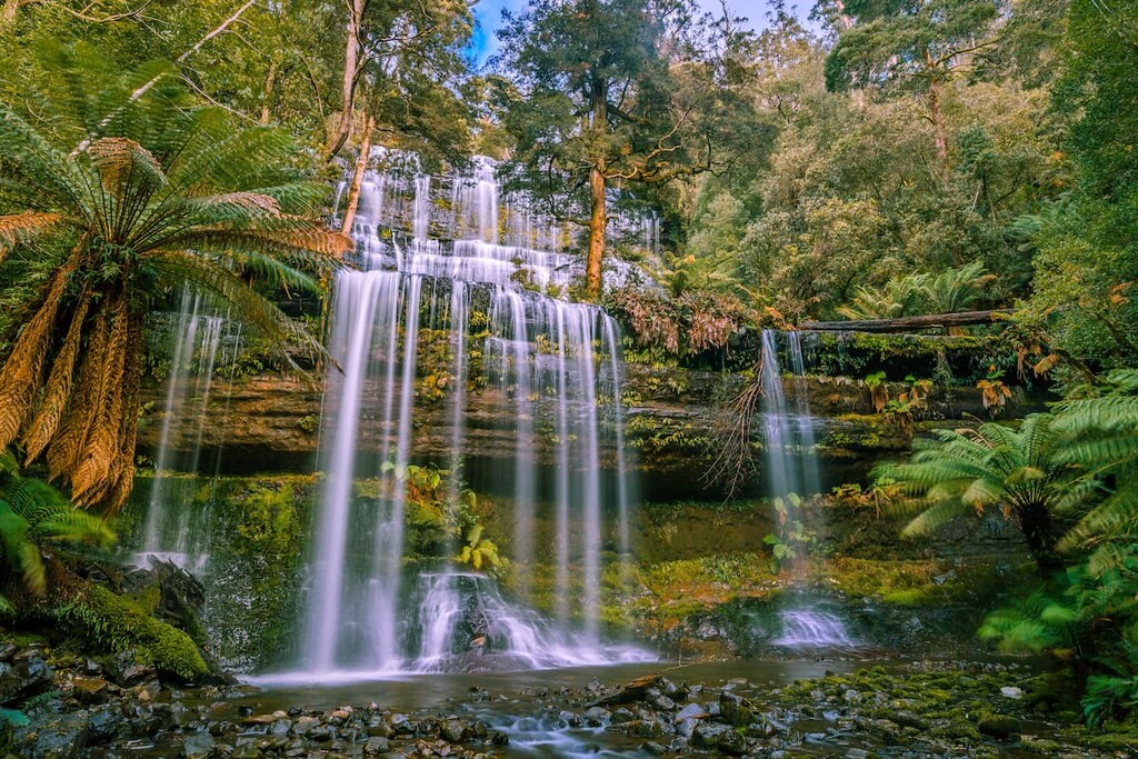
Within Tasmania, approximately 40% of the state is protected as either a national park, world heritage site, regional park, or another type of reserve. In fact, there are 19 national parks in Tasmania, including:
There are also dozens of other natural protected areas in the state of Tasmania. However, due to the sheer number of them, it’s easiest to discuss the protected areas of the state by dividing the state up into two rough geographic regions—east and west.
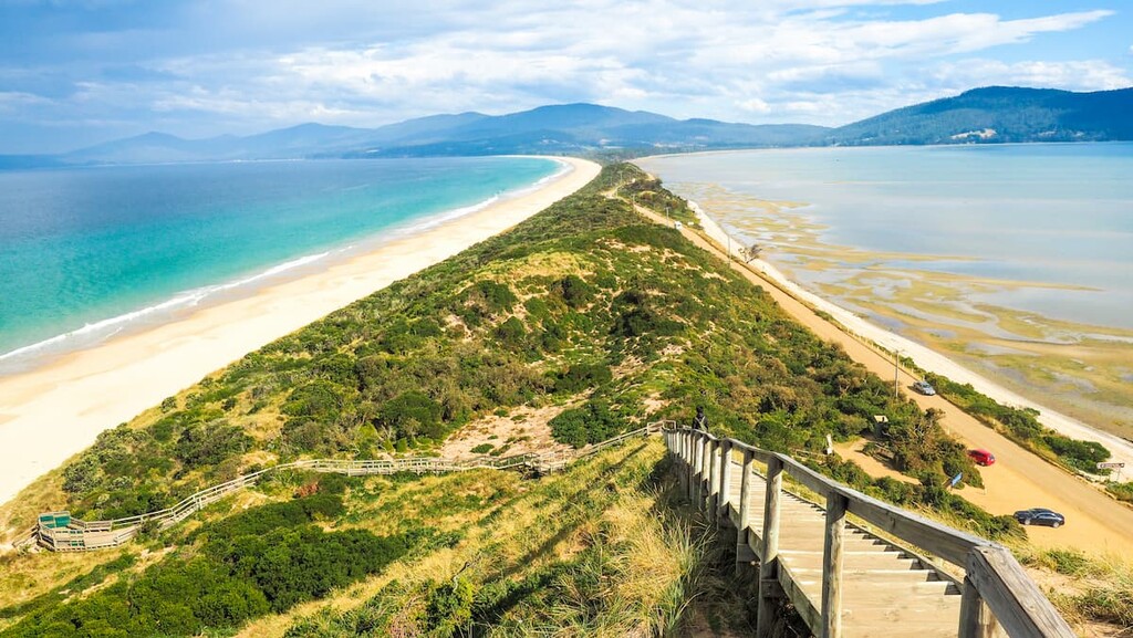
Eastern Tasmania roughly refers to the eastern half of the big island of Tasmania as well as the islands located in the eastern half of the Tasmanian Archipelago. This includes part or all of the local government areas of:
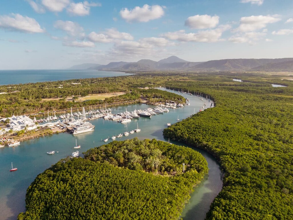
Eastern Tasmania is by far the most populous part of the island as about half of the state’s residents live in Hobart, which is in southeastern Tasmania.
This part of the state is also home to a superb collection of recreation areas and conservation areas. These include:
Furthermore, there are plenty of regional reserves to be found in eastern Tasmania, such as:
As the name suggests, Western Tasmania refers to the western half of the state. This roughly corresponds to the local government areas of :
Western Tasmania is substantially less populated than the rest of the island, though the city of Burnie is located in northwestern Tasmania. Furthermore, the city of Davenport could technically be considered to be in Western Tasmania, though it is more or less located in the central part of the main island’s northern coast.
Geographic specifics aside, Western Tasmania is home to a fantastic array of regional reserves, such as:
The western half of the main island also includes a number of conservation and recreation areas, such as:
Although it makes up just a small fraction of Tasmania’s total land area and, despite its vast distance from the main island of Tasmania, Macquarie Island is a unique and stunning place that’s well worth a mention.
As we’ve mentioned, Macquarie Island is located in the southern Pacific Ocean, about 1,500 km (930 mi) from Tasmania. The island is part of the Huon Valley Council, though it does not have any permanent population. It does, however, have a research station from the Australian Antarctic Program called the Macquarie Island Station.
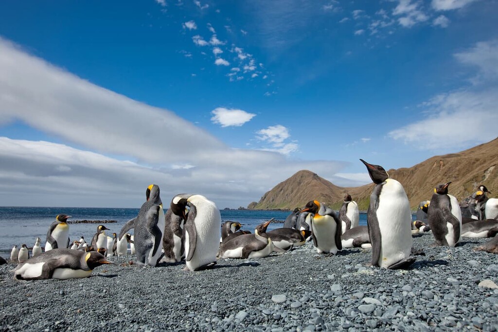
The island is a designated UNESCO World Heritage Site due to its exceptional and unique biodiversity. In particular, the island is home to the world’s only population of royal penguin, which is closely related to the macaroni penguin.
Furthermore, Macquarie Island is home to sizable populations of Antarctic fur seals, subantarctic fur seals, New Zealand fur seals, and southern elephant seals.
Getting to Macquarie Island isn’t easy, and it is only accessible to the general public by ship. However, once you arrive, there are plenty of sites to see and explore on the island.
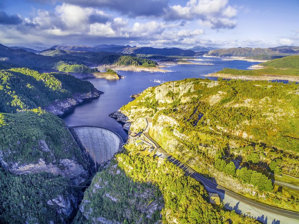
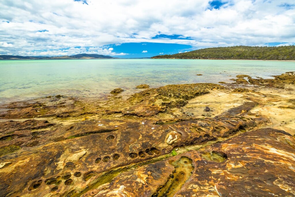
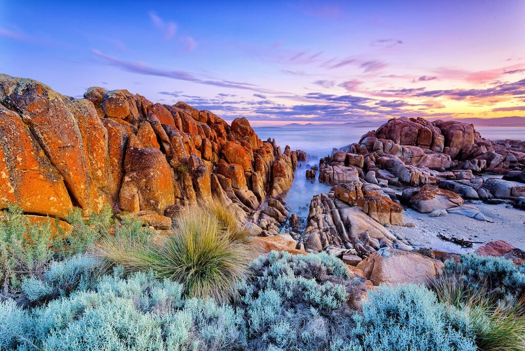
The many islands that make up the state of Tasmania have a rich and varied geologic history. The oldest rocks within the state of Tasmania date back to the Precambrian and they are located mostly in the western part of the main island.
During the Cambrian, the region that is now Tasmania saw a large amount of volcanic activity and a decent amount of mountain building. By the Ordovician, many of the mountains in Tasmania were eroded away, leading to the deposition of sediments that would later turn into the sandstones and conglomerates that can be seen today around the town of Queenstown.
The Devonian period then started out much more quietly until tectonic collision led to the formation of the Great Dividing Range. The Great Dividing Range, which runs down much of the eastern coast of Australia, also features prominently in Tasmania.
However, the landscape that we know of in Tasmania today, mostly formed during and after the Tertiary. During this time, the breakup of the supercontinent Gondwana separated Antarctica from Australia.
Then, during the Pleistocene, Tasmania was heavily glaciated at the higher elevations. This glaciation eroded away at the landscape, creating the features that we see today.
Finally, in much more recent years, the opening up of the Bass Strait allowed Tasmania to become the island that exists today. The strait started to form about 14,000 years ago, but didn’t fully cut off the island from the mainland until about 8,000 years ago.
Furthermore, Tasmania is home to an impressive array of mineral deposits. The island has sizable reserves of iron ore, magnesite, silica, tin, fluorite, tungsten, nickel, coal, and gold.
Major peaks in Tasmania include Mount Ossa, Legges Tor, Barn Bluff, Cradle Mountain, and Mount Wellington.
Tasmania is the only state in Australia that is located primarily within the temperate biome, with the exception of Macquarie Island, which is part of the tundra biome. For the most part, the state has a temperate oceanic climate with four distinct seasons.
There are three primary ecoregions in Tasmania: the Tasmanian Central Highland Forests, the Tasmanian Temperate Forests, and the Tasmanian Temperate Rainforests.
The Tasmanian Central Highlands Forest covers the bulk of the central part of the main island of Tasmania. It is dominated by woodlands at lower elevations that eventually give way to alpine coniferous forests and montane shrublands before reaching the alpine zones at the highest elevations.
This ecoregion is home to notable mammals such as the eastern quoll, the eastern barred bandicoot, and the famed Tasmanian devil. It is also home to a great selection of birdlife, particularly in riparian areas.
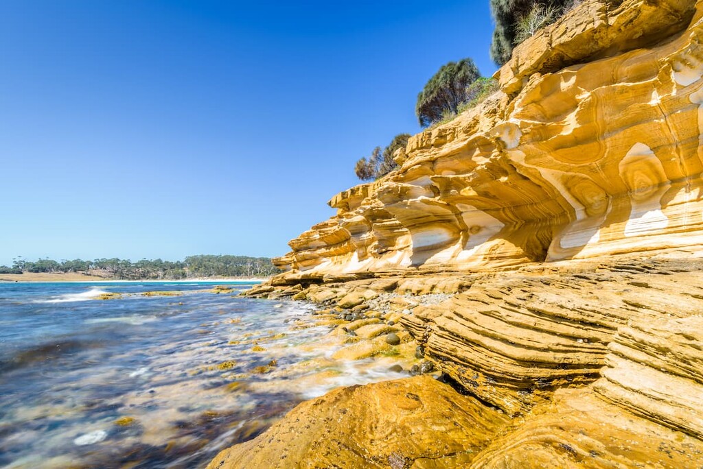
The eastern half of Tasmania is home to the Tasmanian Temperate Forests, which are a temperate broadleaf and mixed forests ecoregion. Over the millennia, this ecoregion has been shaped by fires, both naturally-caused and purposefully set by humans.
The ecoregion contains savannas and woodlands, including dry eucalypt forests. Some of the more notable mammals include the red-necked wallaby, the eastern grey kangaroo, the common wombat, the Tasmanian pygmy possum, the short-beaked echidna, and the platypus.
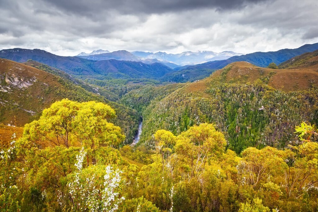
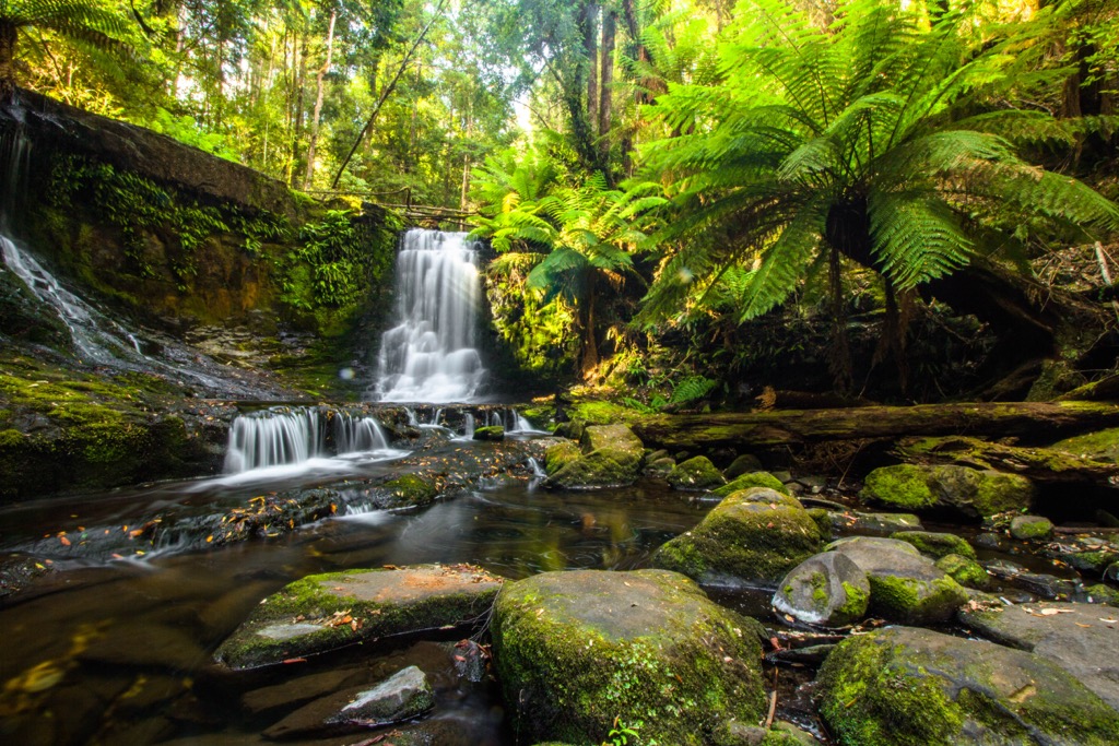
Located on the western half of Tasmania, the Tasmanian Temperate Rainforest is a rugged and stunning ecoregion that’s home to an abundance of wildlife.
There are a number of different plant communities within this ecoregion, each of which demonstrates a high level of endemism. Much of the northern portion of the ecoregion is part of the Tasmanian Wilderness, which is a UNESCO World Heritage Site.
The land that is now called Tasmania has been home to humans for tens of thousands of years. Around 43,000 years ago, what is now the island of Tasmania was still attached to mainland Australia by a large land bridge, which facilitated the migration of Indigenous peoples from the mainland to the island.
Around 40,000 years ago, people lived throughout the main island of Tasmania, including around what is now Hobart, a tradition that continued for tens of thousands of years. By 14,000 years ago, however, the sea levels had risen to the point where the island was starting to be cut off from the mainland, thereby isolating the First Nations on Tasmania.
Within the last 3,000 years, almost the entire island of Tasmania was settled by Indigenous peoples, as were many of the surrounding islands. By the time of European contact, the island’s population was strong and growing.
The Palawa, the dominant First Nation on the island, had settled throughout the island during this time. However, introduced diseases and conflict led to a drastic decline in the Palawa population during the nineteenth century.
There are thousands of Tasmanians of Palawa descent that still live in Tasmania and, after years of research, the once-extinct language called palawa kani has been reconstructed and is spoken in some communities today.
It’s believed that the first person of European descent to have seen the island now called Tasmania was Abel Tasman of the Netherlands who sailed past it in 1642. At the time, Tasman called the island Van Diemen’s Land.
However, Europeans didn’t really visit the island again until the 1780s and 1790s when a number of ships stopped in Tasmania while transiting to New South Wales. During this time, a number of British vessels, including those led by George Bass and Matthew Flinders also visited the island.
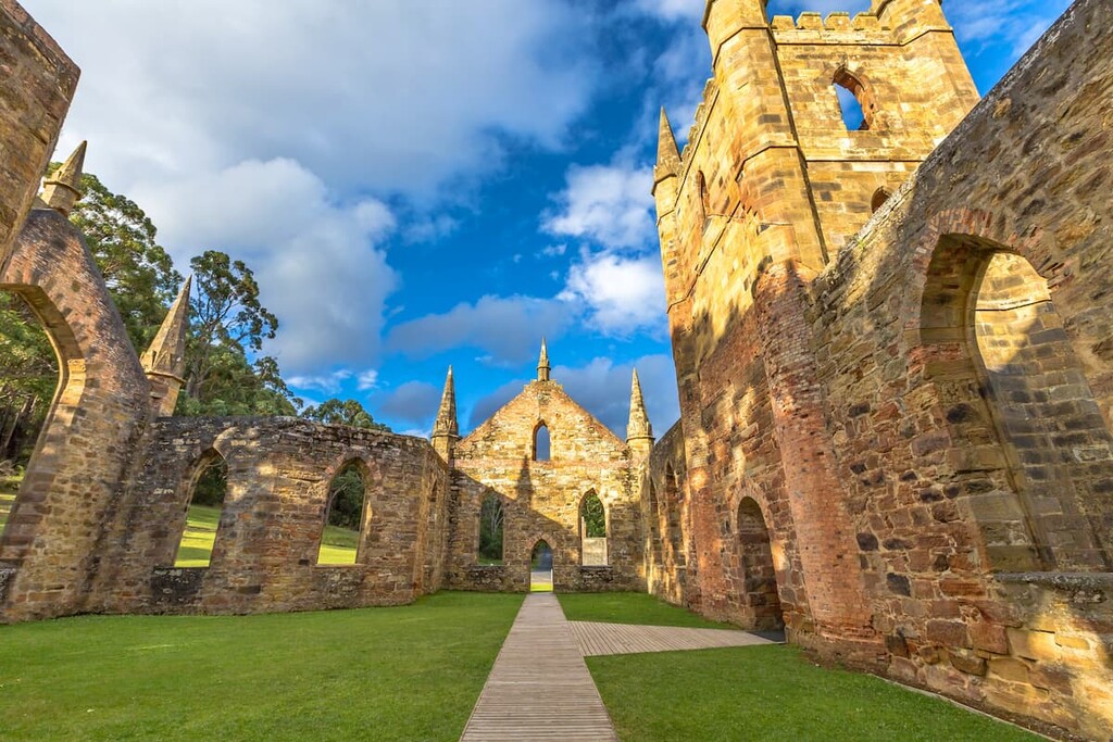
In 1803, the British sent Lieutenant John Bowen and two ships to what is now called Tasmania to start a settlement at what is now Hobart on unceded land. The next few decades saw increasing numbers of British settlers, mostly convicts, arriving in Tasmania to establish penal colonies throughout the island.
The practice of transporting convicts to Tasmania was abolished in the 1850s. However, by then, introduced diseases had decimated the Palawa community. Violence at the hands of settlers was also a cause of the death of many Palawa people, especially as the colonists sought out more land for mining and grazing, which led to a number of wars on the island, including what is called the Black War. As part of this war and as part of a wider system of ethnic cleansing, many Palawa were forcibly removed from their homelands.
In the 1870s, gold was discovered in Tasmania, leading to a large influx of prospectors hoping to strike it rich.
In 1901, what was then the Colony of Tasmania joined the Commonwealth of Australia alongside the country’s five other states. Since then, the state has undergone a large amount of urbanisation, particularly in the Hobart area.
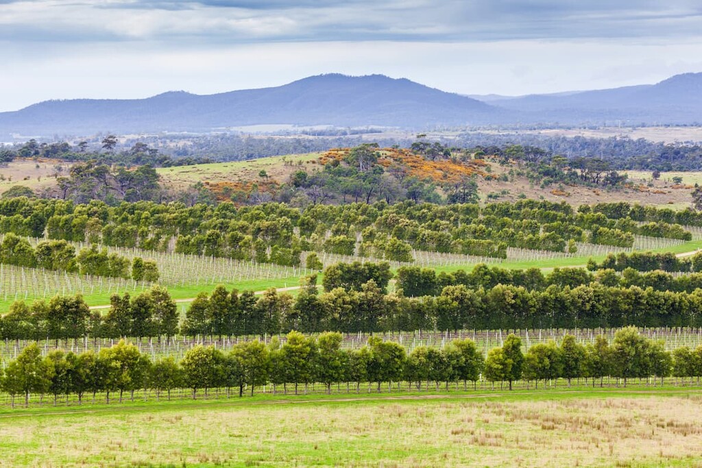
Tasmania has since become a major tourist destination, both from domestic and international visitors. Its plethora of parks and other nature reserves makes it a fantastic place to visit if you’re looking to get outside and enjoy the mountains of Tasmania.
Tasmania is a treasure trove of outdoor adventure. Here are some of the best places to check out on the island:
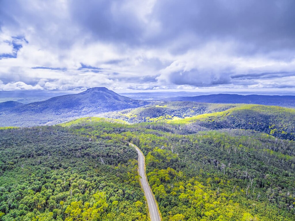
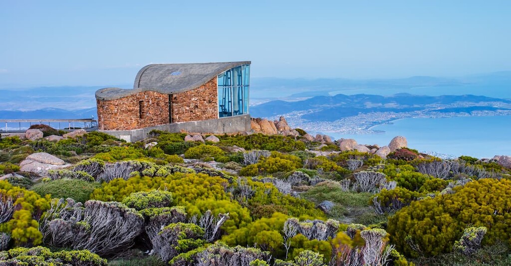
Located just to the east of the city of Hobart, Wellington Park is one of the most popular outdoor recreation destinations in the state. The park contains 28 named mountains, the highest and most prominent of which is Mount Wellington (kunayi).
Wellington Park is technically protected at the same level as other national parks in Tasmania. But, as it also contains some private land it can’t be officially designated as a national park.
The park contains some super hiking paths and alpine huts for visitors to check out and enjoy. Due to the park’s proximity to Hobart, it’s also a great place to visit for a quick day trip.
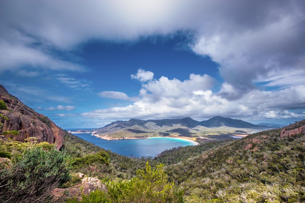
Situated along the central part of Tasmania’s eastern coast, Freycinet National Park is a federally protected area that’s known for its stunning seascapes. The park contains 18 named mountains, the highest and most prominent of which is Mount Freycinet.
Best known for the large and secluded Wineglass Bay, Freycinet National Park protects some of the most magnificent coastline in the state. It is one of the oldest national parks in the state, so it's well worth a visit if you’re in the area.
Freycinet is one of Tasmania’s major tourist attractions and there are plenty of great hiking paths to check out in the park.
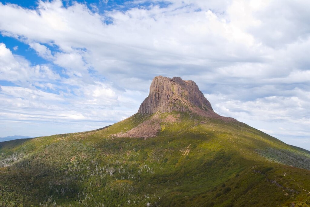
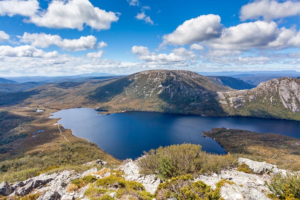
Cradle Mountain-Lake St Clair National Park is located in the west-central part of Tasmania within the island’s Central Highlands Region. It contains 98 named mountains, the highest and most prominent of which is Mount Ossa.
Cradle Mountain-Lake St Clair National Park is one of the state’s premier hiking areas. It is partly located within the Tasmanian Wilderness World Heritage Area and it contains the famous Overland Track hiking trail. It’s also a superb place to see local wildlife which roam the high plateau of the region.
For skiing and snowboarding enthusiasts, there are 2 ski resorts in Tasmania, which are located in the south and north of an island: Ben Lomond and Mount Mawson with more than 5 km (3 mi) of slopes and more than 3 ski lifts each. The latter is also the main ski resort near Hobart, the capital and the largest city in Tasmania.
Check the Tasmania ski resorts map on the larger Australia ski resorts map in the World Mountain Lifts section of the site. It includes information about open ski lifts / slopes in Tasmania in real-time with opening dates and hours. There are also year-round cable cars, funiculars, cog railways, aerial tramways, and all other types of mountain lifts.
Looking for a place to stay in Tasmania? Here are some of the best cities to check out:
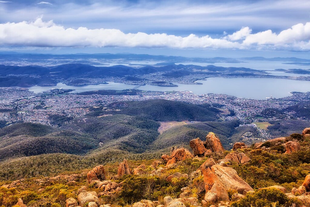
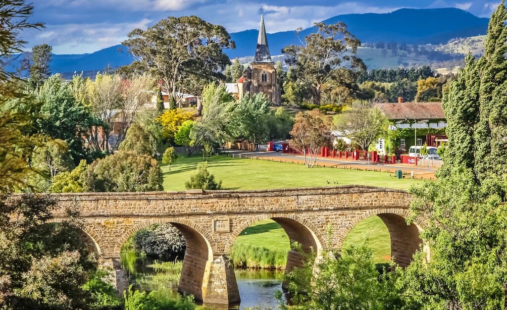
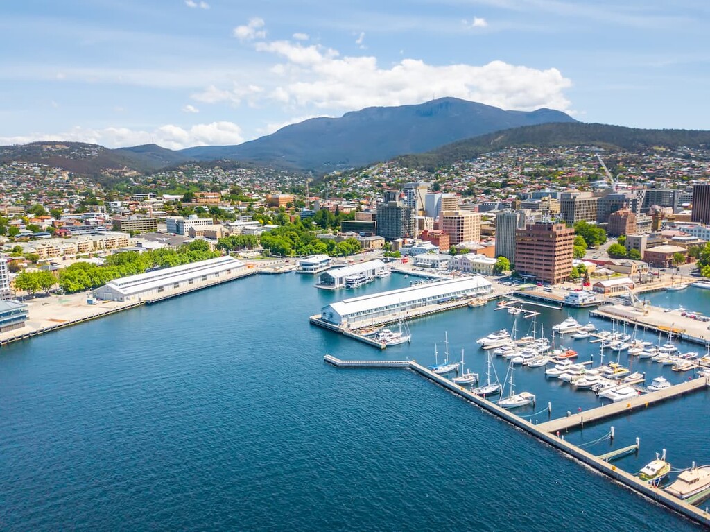
The city of Hobart is located in the southeastern part of Tasmania. It is home to about 250,000 residents, which makes it the most populous city in the state.
Hobart is the capital of Tasmania as well as a hub for commerce and culture in the state. It is home to a major port as well as some of the state’s best museums and cultural sites. The city is also used as a home port for both the Australian and French Antarctic programs, so it’s a popular starting point for scientific research expeditions to the White Continent.
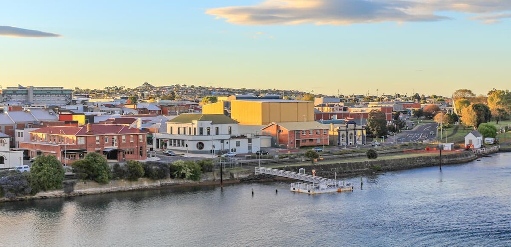
Located along Tasmania’s northern coast, Davenport is home to about 25,00 residents, making it the third-largest city in the state. Devonport is a major hub for activity in the northern part of Tasmania.
It has a regional airport with daily service to Melbourne. Furthermore, the city is home to a number of important museums including a number of cultural centers that document the history of shipping in the Bass Strait.
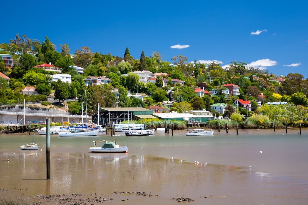
Tasmania’s second-largest city, Launceston is a community of nearly 90,000 people that’s located in the northeastern part of the state. It is home to some of the oldest buildings in Tasmania and it is one of the relatively few sizable inland communities in all of Australia.
These days, Launceston is a hub for tourism in the northern part of Tasmania. It is a popular destination thanks to the stunning Cataract Gorge, which is located just outside the city center.
One of the largest communities in the West Coast region of Tasmania, Queenstown is located in the west-central part of the state on the slopes of Mount Owen. It is home to about 1,700 residents and it has long been a major player in the region’s mining industry.
Queenstown contains some truly beautiful mountainscapes that drive tourists to the region. IT is also located at the end of the West Coast Wilderness Railway, which is a popular way to travel throughout the region for visitors to Tasmania.