Get PeakVisor App
Sign In
Search by GPS coordinates
- Latitude
- ° ' ''
- Longitude
- ° ' ''
- Units of Length

Yes
Cancel
❤ Wishlist ×
Choose
Delete
Home to a diverse landscape of snow-covered mountains, emerald rainforests, deep river valleys, and the elusive Tasmanian devil, Cradle Mountain-Lake St Clair National Park lies in the heart of Tasmania’s Central Highlands. The park features 98 named peaks; Mount Ossa is the highest and most prominent at 1,617 meters (5,305 ft).
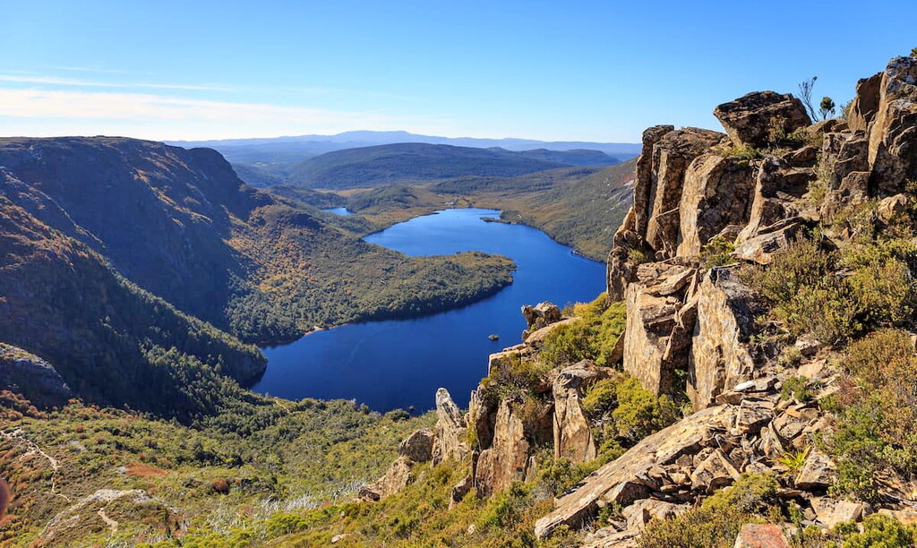
Cradle Mountain-Lake St Clair National Park is 165 km (103 mi) northwest of Hobart in the Tasmanian Wilderness World Heritage Area of Australia’s island state, Tasmania. This temperate wilderness is a World Heritage Site with plenty of adventure, including hiking, mountain climbing, and white water rafting.
Cradle Mountain-Lake St Clair National Park was a region of cultural significance that divided the boundaries between the Big River and Northern Tasmanian Aboriginal nations. As the land’s earliest inhabitants, Tasmania’s indigenous people hunted in this mountainous area since the last glacial maximum, some 10,000 years ago.
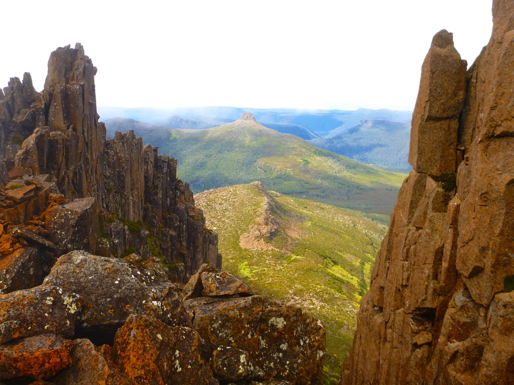
Another significant feature is the park’s diverse landscape. The Overland Track, a 65 km (40 mi) alpine walk rated one of Australia’s finest, best showcases the changing terrain. This bushwalking trail begins at Tasmania’s sixth-tallest peak, Cradle Mountain, in the park’s northern reaches. It traverses alpine plains and passes the prominent hills of Mount Pelion East, Mount Pelion West, Mount Oakleigh, and Mount Ossa before reaching St Clair Lake in the south. The 45 sq km (17 sq mi) lake is Australia’s deepest, with a depth of 215 meters (705 ft).
Cradle Mountain-Lake St Clair National Park has a temperate climate with an annual average temperature of 55°F (13°C) and, like many mountain climes, is known for its unpredictable weather throughout the year. High temperatures in the summer generally peak at 66°F (19°C), while winters dip just below freezing at 32°F (-0.1°C). August, a winter month in the Southern Hemisphere, is the park’s rainiest month, with an average of 237 mm (9 in) of rainfall.
If you’re seeking other parks and areas of nature near Cradle Mountain-Lake St Clair National Park, you’re in luck; protected natural places surround Cradle Mountain. Neighboring Walls of Jerusalem National Park is to the east, Mole Creek Karst National Park is to the southeast, Meredith Range Regional Reserve is to the west, and Franklin-Gordon Wild Rivers National Park is to the south.

Cradle Mountain-Lake St Clair National Park displays geological evidence of three glacial stages over the last 2 million years. The 6 km (4 mi) ice cap from the last glacial maximum carved the jagged landscape of this park and shaped Lake St Clair, Cradle Valley, and Dove River Valley.
The geological composition of Cradle Mountain-Lake St Clair National Park’s hills comprises igneous dolerite from the Permian to Jurassic periods.
Alpine and subalpine vegetation thrive in Cradle Mountain-Lake St Clair National Park, most notably tussocks, ferns, mosses, and fungi. Tasmania is a region of endemic plants, and an astonishing 55% of alpine flora is native to the island. Australia’s only temperate deciduous tree, the Nothofagus gunni, grows in this mountainous region.
Examples of endemic wildlife include the Tasmanian devil, platypus, and short-beaked echidnas. Wombats, possums, Tasmanian pademelons, Bennet’s wallaby, and quolls also inhabit the park. Birdlife includes the endemic flame robin, currawong, and several of Tasmania’s protected bird species.
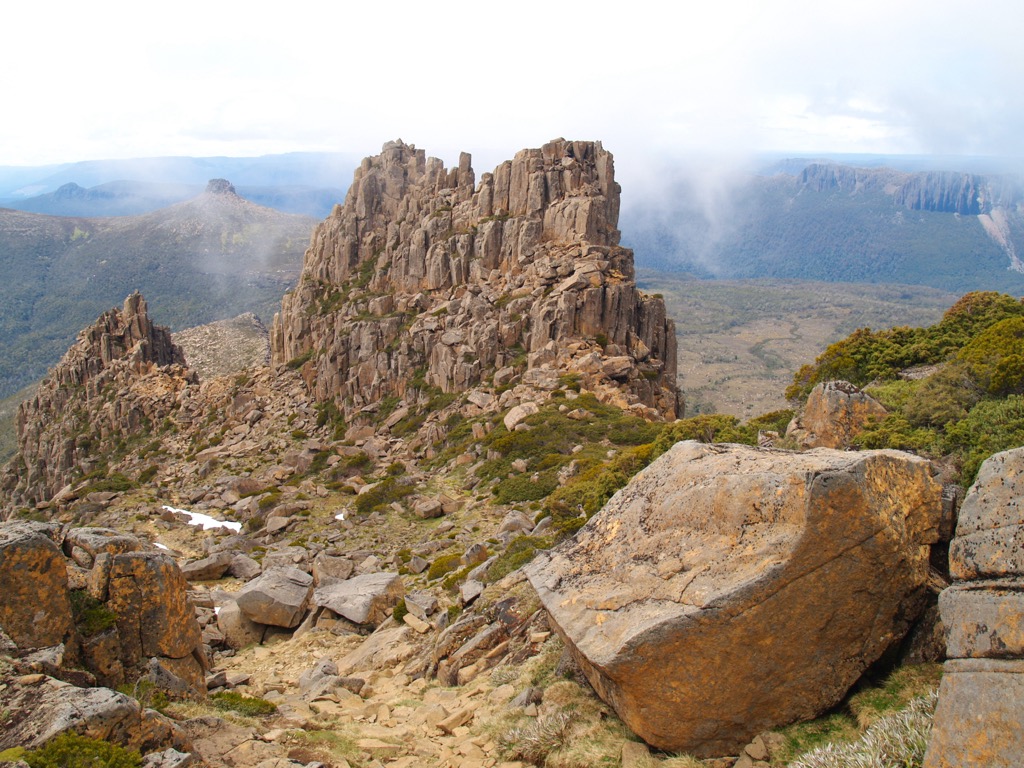
The park’s earliest inhabitants were the Big River and Northern Tasmanian Aboriginal nations, who settled on either side of Cradle Mountain. While it’s unlikely that Tasmania’s indigenous people lived on Cradle Mountain, they would enter the highlands as hunting grounds in the summer months. Aboriginal sites and artifacts discovered in Cradle Valley include stone tools, rock shelters, and caves.
European settlers arrived in Tasmania in 1803 and profoundly impacted the Aboriginal people’s way of life, leading to the persecution and marginalization of their communities. The last recorded sightings of free Tasmanian Aboriginal people were in the vicinity of Cradle Mountain in 1836.
As more Europeans arrived in Tasmania throughout the late 19th and early 20th centuries, interest in Cradle Mountain’s natural beauty began to blossom. Gustav Weindorfer, an Austrian-born conservationist who visited Cradle Valley in 1909, was a crucial figure in the preservation movement. Inspired by the stunning landscapes, Weindorfer campaigned for the area’s protection and lobbied to create a national park.
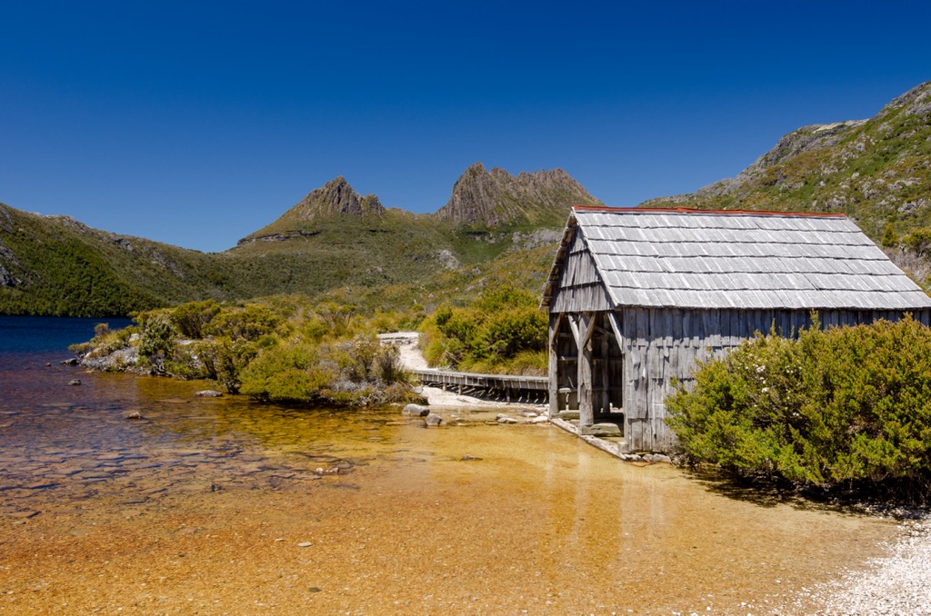
After having been initially established as a scenic reserve in 1922, the area became recognized as a wildlife reserve in 1927. Twenty years later, the government established Cradle Mountain-Lake St Clair as a full-fledged National Park.
In 1982, Cradle Mountain-Lake St Clair National Park and several other parks and reserves in Tasmania were inscribed as part of the Tasmanian Wilderness World Heritage Area. This designation recognized the area's outstanding universal value in terms of natural and cultural heritage.
Explore these leading hiking trails and natural areas in Cradle Mountain-Lake St Clair National Park:
A route of rugged terrain, diverse ecosystems, and stunning views, Cradle Mountain Summit is a popular trek among adventure enthusiasts. Cradle Mountain Summit is a steep 12 km (7 mi) track best suited for clear, dry weather.
The path ascends through various landscapes from the Dove Lake car park trailhead, including dense forests, alpine meadows, and exposed rocky sections. One of the trail’s highlights is the ascent of Marion's Lookout, a steep and challenging section showcasing panoramic views of Dove Lake and the surrounding valleys.

From Marion's Lookout, the trail continues along a ridgeline toward the Cradle Mountain Summit. The final section involves scrambling and careful footing as you reach the summit.
Reaching the top of Cradle Mountain is a significant achievement and offers spectacular views as a reward. At an elevation of 1,545 meters (5,069 feet), the summit provides sweeping outlooks of the national park, including Dove Lake, Barn Bluff, and the surrounding mountain ranges.
A world-renowned and iconic long-distance hiking trail, the Overland Track stretches approximately 65 km (40 mi) from Cradle Mountain to Lake St Clair. En route, it offers a captivating journey through some of Tasmania's most breathtaking landscapes.
Most of the journey is above 1,000 meters (3,281 ft), so you’ll always be afforded incredible prospects of the surrounding terrain.

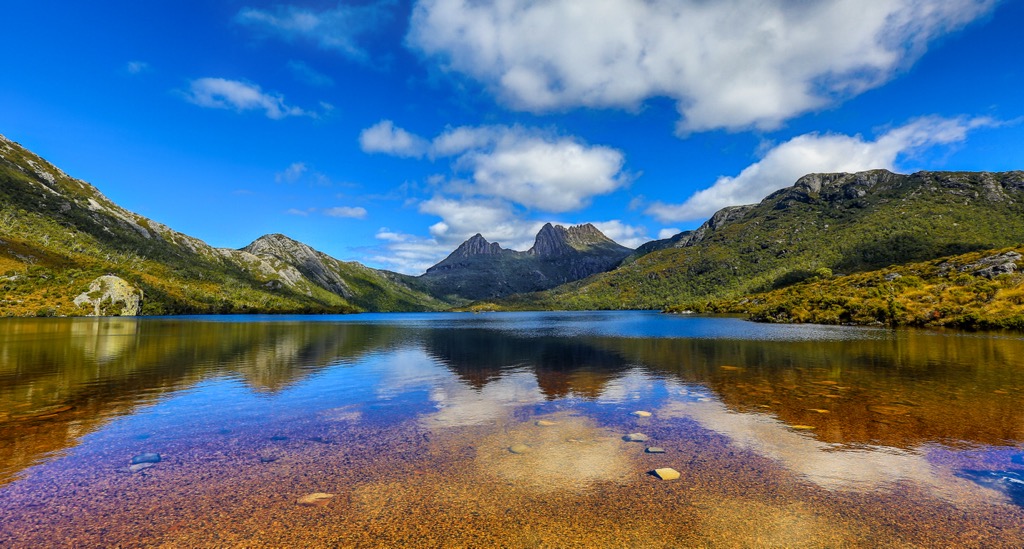
Starting in the north, you’ll ascend Cradle Mountain, then descend toward Dove Lake, where Cradle’s lofty pinnacle reflects in the still waters. The trail continues to Barn Bluff before entering the alpine meadows of the Pelion Plains, bordered by Mount Pelion East and Mount Pelion West.
The route passes around the park’s highest peak, with an optional spur trail to scale Mount Ossa’s summit. Before you reach Lake St Clair, you’ll bushwalk through Pine Valley’s eucalyptus jungle. Finally, you’ll reach Australia’s deepest freshwater lake, surrounded by ancient rainforest, to round off the adventure through Tasmania’s pristine wilderness.
Mount Ossa is nestled in the remote wilderness of Cradle Mountain-Lake St Clair National Park. Tasmania’s highest peak offers mesmerizing outlooks from its 1,617-meter (5,305 ft) summit and is accessible by a much-loved 11 km (7 mi) route. The summit is a popular side trek from the Overland Track.
As you climb Mount Ossa, you'll be afforded outlooks onto the magnificent landscapes of emerald rainforests and alpine fields. Along the trail, you may encounter the Tasmanian devils, wombats, and wallabies that inhabit this area.

Although it’s a relatively easy climb overall, the challenge begins in the last third of Mount Ossa Trail. The terrain steepens abruptly, and the difficulty increases tenfold on a rainy day when the route is slippery.
Dove Lake Walk displays breathtaking scenery and diverse vegetation on the 6 km (4 mi) circular route. One of the highlights is the opportunity to capture spectacular photographs of the iconic Cradle Mountain reflecting in the calm waters of Dove Lake.
You’ll encounter changing ecology from ancient King Billy pine and sassafras rainforests to button grass moorlands and glacially carved valleys. It’s an easy path with picturesque views for those who don’t want to trek too far.
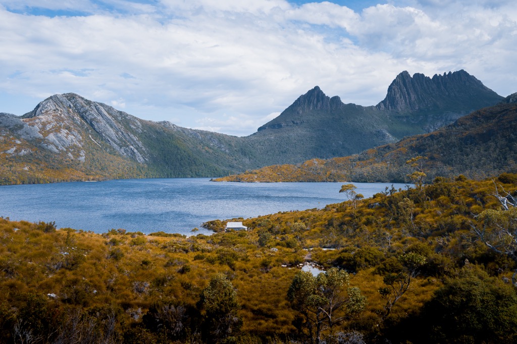
Renowned for its natural beauty and tranquil atmosphere, the Enchanted Walk immerses visitors in the stunning Tasmanian wilderness. A short, accessible loop track that winds through lush rainforest, it’s suitable for all ages and fitness levels, making it a popular choice for families.
You’ll pass towering trees, moss-covered rocks, and ferns along the route. One of the distinctive features is Pencil Pine Falls, a picturesque cascade that tumbles down a rocky slope.
Another attraction is the reflective Wombat Pool, a serene and reflective body of water that perfectly mirrors the surrounding forest. You’re likelier to see wombats and pademelons here due to the area’s relative solitude and quiet.

Trek the lush 13 km (8 mi) trail through forests to reach the alpine Shadow Lake at nearly 1,000 meters (3,281 ft).
One of the trail’s focal points is the diverse ecology. It starts in a wet forest near Lake St Clair, transforming into eucalyptus forest and subalpine button grass meadows as the elevation rises. Subalpine vegetation thrives near Shadow Lake, where you’ll see growths of snow gum, sedges, and pencil pines.
Mount Hugel is visible from the halfway point of the trail, at Shadow Lake, and you’ll have great outlooks onto Forgotten Lake, located behind Shadow Lake.

Check out the best places to stay when visiting Cradle Mountain-Lake St Clair National Park:
Nestled between the stunning Mount Wellington and the picturesque Derwent River, Tasmania’s capital is known for its natural beauty. It offers a charming blend of historic architecture, a vibrant arts scene, and a thriving food and wine culture, making it a popular destination for nature lovers and culture enthusiasts.
Take a scenic hike up Mount Wellington to experience breathtaking panoramic views of Hobart, its harbor, and its surroundings. The mountain offers various walking trails and picnic spots and is popular for sunrise or sunset photography.
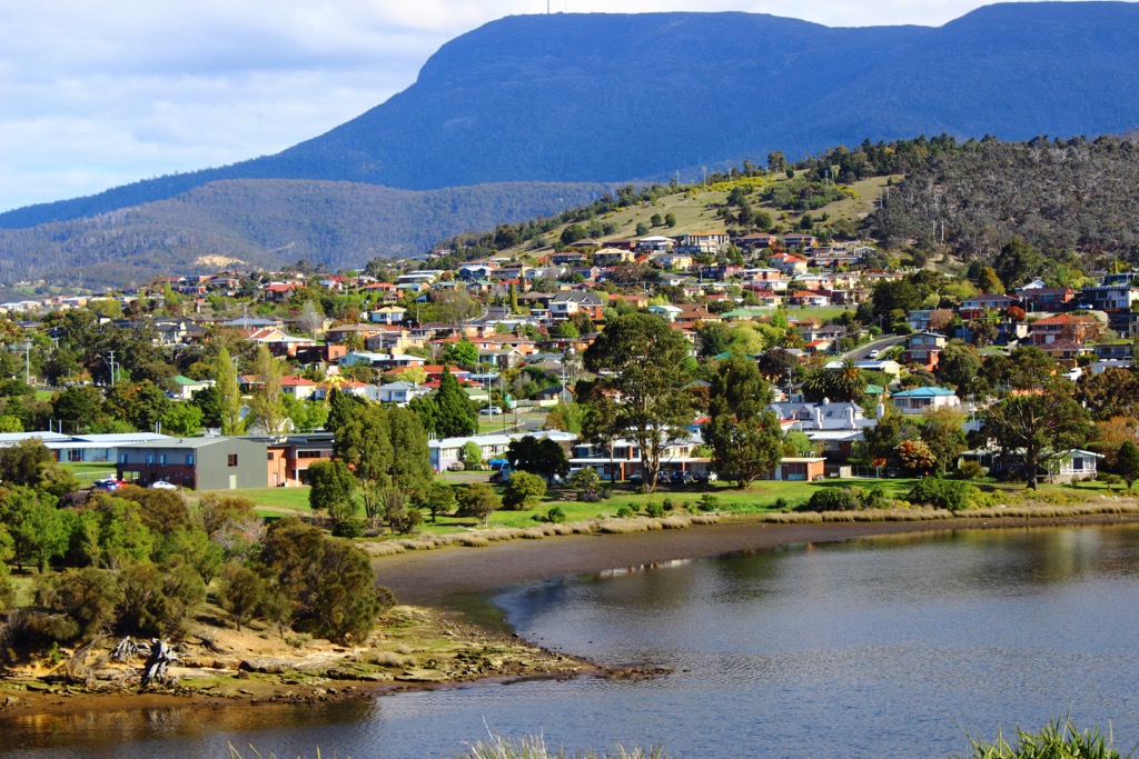
Explore the historic waterfront precinct of Salamanca Place, known for its Georgian sandstone buildings. Enjoy the vibrant Saturday Salamanca Market, browse through art galleries, dine at waterfront restaurants, and soak in the lively atmosphere.
For a change of scenery, embark on a day tour to Bruny Island, located just off the coast of Hobart. Indulge in delicious local produce, such as oysters and cheese, and go on nature walks or wildlife cruises to spot seals, dolphins, and seabirds.
Launceston offers visitors a mix of vibrant culture, historic architecture, and outdoor adventure. From exploring the picturesque Cataract Gorge to wandering through the city's charming streets lined with Victorian-era buildings, Launceston is a delightful destination for history buffs and those wanting to explore the outdoors.
Spend some time at the City Park, a picturesque public park in the heart of Launceston. Admire the vibrant flower displays, visit the Japanese Macaque monkey enclosure, and relax in the tranquil surroundings.
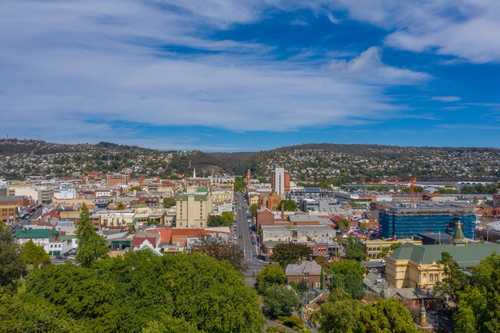
Take a wine-tasting adventure along the Tamar Valley Wine Route. Discover award-winning wineries, indulge in delicious local wines, and enjoy the breathtaking views of vineyards and the Tamar River.
Don’t miss the stunning Cataract Gorge, a natural reserve just a short distance from the city center. Explore walking trails, take a scenic chairlift ride, swim in the pool, or enjoy a picnic amidst the beautiful landscapes.
It’s best to drive to Cradle Mountain-Lake St Clair National Park. Two park entrances are in the north and south, easily reachable from Hobart and Launceston. From Hobart to the south entrance, the drive averages 2 hours and 20 minutes over 175 km (109 mi). The park is slightly closer to Launceston at 147 km (91 mi) with a drive time of just over 2 hours.
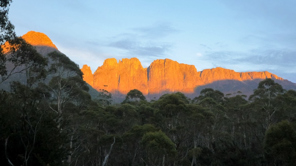
Explore Cradle Mountain-Lake St Clair National Park with the PeakVisor 3D Map and identify its summits.


