
Share

Scan the QR code and open PeakVisor on your phone
Scan the QR code and open PeakVisor on your phone
The Portneuf Range is an under-the-radar destination in the US state of Idaho, home to downhill skiing and quiet hiking trails. There are 27 named mountains in range, the highest and the most prominent of which is Bonneville Peak at (9,259 ft/2,822m)
The Portneuf Range is located in Bannock County in southeastern Idaho. It is bordered to the west by the Bannock Range and to the east by the Blackfoot and Bear River ranges. The mountains run about 60 miles (96 km) in a north-south orientation from the towns of Blackfoot and Pocatello to the towns of Treasureton and Preston.
The peaks in the Portneuf Range form a ridgeline that reaches over 9,000 ft (2,743 m) in elevation, bisected in the center by the Portneuf River. Most of the northern portion of the range lies within the Caribou-Targhee National Forest. Meanwhile, the southern half of the range below Lava Hot Springs is managed by the state of Idaho with some areas of Bureau of Land Management (BLM) interspersed throughout the area.
The far northern peaks of the range, Mount Putnam and South Putnam Mountain, lie within the Fort Hall Reservation. You’ll need permission from the Shoshone-Bannock Tribes to climb these mountains.
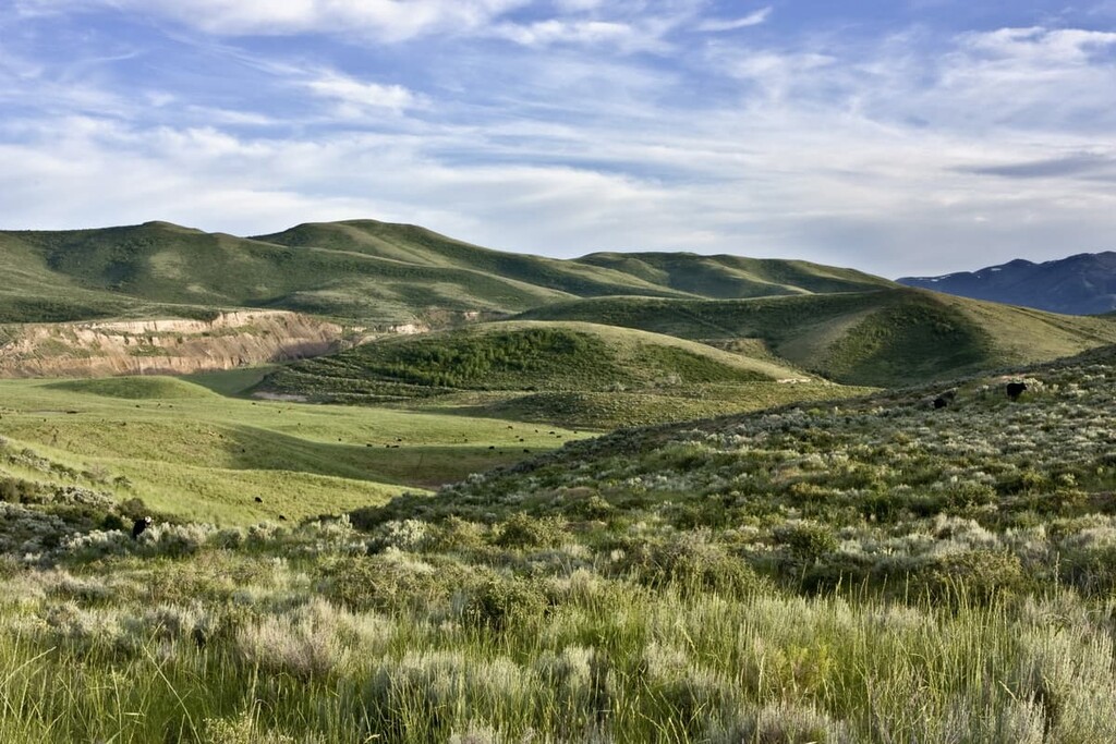
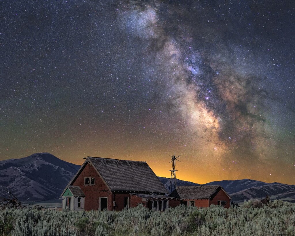
The mountains of the Portneuf Range have forested slopes, but typically treeless open summits offering beautiful views. There are small ponds and streams throughout the arid range, but no major alpine lakes.
The dry climate in the area keeps the snowpack relatively low by Idaho standards, though Bonneville Peak still receives an average of over 200 inches (500 cm) of snow per year. The mountains are most frequently climbed in the winter.
Skiing is also popular in the Portneuf Range. The northwestern slopes of Bonneville Peak, the highest mountain in the range, are home to Pebble Creek, a downhill ski area that’s been in operation for over 70 years.
During the fall, the Portneuf Range is frequented by hunters in search of big and small game. Hiking, fishing, camping, and off-road driving are popular during the warmer months, but in general, the mountains are minimally visited and offer plenty of peace and solitude.
The premier hiking trail in the area is the Boundary Trail, which forms a 36-mile (58 km) loop around the central Portneuf peaks. In addition to hikers, the trail is open to mountain bikes, motorcycles, horses, ATVs, and skiers.
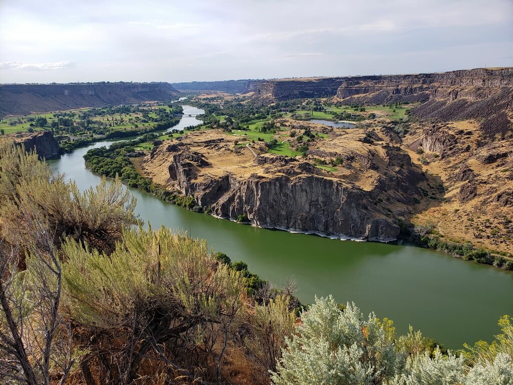
From the high peaks of the Portneuf Range, you can see all the way to the Snake River Plain, and, on a clear day, to the Lost River and Lemhi ranges to the north. There are numerous hiking opportunities in the area, including in the Caribou-Targhee National Forest, the Minidoka District of the Sawtooth National Forest, and Craters of the Moon National Monument.
The Portneuf Range is located in a complex geological area of Idaho, where the Snake River Plain, the Idaho-Wyoming thrust, and the vast Basin and Range province meet. The Portneuf Range is a product of basin and range thrusting.
The rocks in the area are mostly layers of sedimentary and volcanic formations, including limestone, shale, dolomite, and quartzite. Volcanic rock is highly visible and overlays most of the sedimentary rocks in the range, especially in the north near Pocatello.
Another notable geological feature in the area are the large boulders deposited by the Bonneville Flood about 15,000 years ago. The flood broke out from Bonneville Lake, a massive prehistoric lake in the area which was once similar in size to Lake Michigan.
The Bonneville Flood broke out at Red Rock Pass near the southern end of the range, releasing a massive flood of water equivalent to six times the flow of the Mississippi River. This flood carried and deposited boulders around the area.
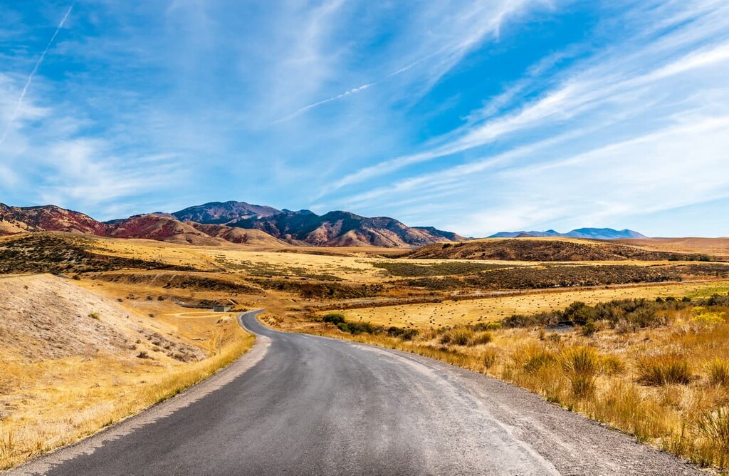
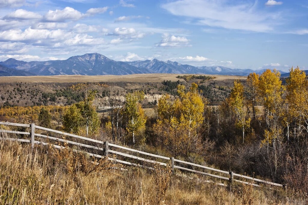
The Portneuf Range is a semi-arid area, with nearby Pocatello receiving only about 13 inches (33 cm) of rain per year. The lower slopes of mountains are covered by sagebrush steppe and grasslands. At higher elevations, there are forested areas featuring conifers. The Portneuf Range peaks are mostly open, offering beautiful views of the surrounding mountains and valleys.
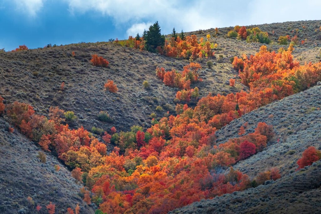
In other areas of the range, there are woodland riparian areas along rivers featuring stands of aspen trees. Like much of Idaho, this area has multiple species of wildflowers, including western monkshood, small flower woodlandstar, and Scarlet gilia.
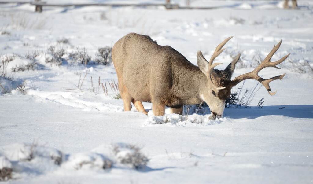
The Portneuf Range is an important wintering area for mule deer. Big game and upland game hunting are popular here. Notable birds in the area include sharp-tailed grouse and Merriam’s wild turkeys, which were reintroduced in 2002 and now number high enough to be hunted. Rivers and streams near the Portneuf Range are home to Yellowstone cutthroat trout.
The Portneuf Range is part of the traditional lands of the Shoshone-Bannock Tribes, who have lived in the area for thousands of years. Archeological finds from nearby Craters of the Moon National Monument date human presence in the area as far back as 14,000 years ago.
The Shoshone-Bannock Tribes traditionally lived semi-nomadic lifestyles, hunting and fishing across much of what is now called southern and eastern Idaho before the arrival of Europeans and Euro-Americans. They spoke Shoshoni, a Numic language in the Uto-Aztecan language family that is still spoken by about 1,000 people today.
Europeans and Euro-Americans first began arriving in the area of the Portneuf Range in the early 1800s. These initial arrivals were bands of fur trappers or small expedition groups. However, by the middle of the century, huge numbers of emigrants were passing through the area on the Oregon and California trails. The Portneuf Gap was an important transit point for pioneers, gold miners, and eventually, the railroad.
As large numbers of migrants from the east strained the resources the Shoshone-Bannock depended on, the Tribes sought to defend their traditional lands and way of life. This led to increasing conflicts with the settlers that culminated in the US Army being called into the territory in 1858.
In 1863, the US Army massacred more than 400 Shoshone men, women, and children at Bear River just south of the Portneuf Range. After this, the Tribes were forced to sign a peace treaty and relocate to land that’s today the Fort Hall Reservation.
Today, more than 5,000 members of the Shoshone-Bannock Tribes live on the Fort Hall Reservation. The closest town to the reservation, Pocatello, is named after a Shoshone chief and warrior who led the Tribes during the late 1800s.
The highest peak in the Portneuf Range, Bonneville Peak, is named for Benjamin Louis Eulalie de Bonneville, a French-American army captain and fur trapper who led expeditions throughout the northwest in the early 1800s and helped blaze part of the Oregon Trail.
The mining boom of the late 1800s, along with the railroad, helped populate the area with settlers and bring new people from the eastern US. When the mining boom died down, many of the remaining settlers turned to agriculture. Cattle ranching is still a major occupation in the area to this day.
Most of the Portneuf Range peaks are open at their summits and offer beautiful views. There are three main sections to the range. The northern section covers Bonneville, Snow, and Haystack peaks. The southern section covers the second highest peak in the range, Sedgwick Peak.
The third section of the range includes Mount Putnam and South Putnam Mountain, which form the first peaks of the range in the north. These mountains are within the Fort Hall Reservation and they require permission from the Shoshone-Bannock Tribes to climb. There are public trails bordering this area to the south, but the summits aren’t open to the public.
The Boundary Trail is one of the main public use trails in the area. It makes a 36 mile (58 km) loop around the north central peaks of the northern range, leading over the summits and linking together many of the main recreation areas, including the Big Springs Campground, Green Canyon, and Harkness Canyon.
This hiking area covers the Caribou-Targhee National Forest segment of the range north of the Portneuf River.
Bonneville Peak
There are multiple routes to the top of the Portneuf Range’s highest peak, but the shortest one starts at the base of the Pebble Creek Ski Area. Just because this hike is shorter doesn’t mean it’s easy. You’ll have to climb to the top of the ski resort via a dirt road with lots of switchbacks.
From the top of the highest chairlift, there will be minimal trail to follow, but the area is wide open and relatively easy to navigate in. Head up to the ridge and turn south to reach the peak. From there, the walk is easier and features beautiful views. You’ll know you’re at the top when you find a ski sticking out of a pile of rocks.
You can also reach the summit of Bonneville Peak from the south, on the Robber’s Roost Trail. This makes for a long, 15-mile (24 km) full-day hike.
Big Canyon Trail
This is a beautiful and fairly steep trail exclusively for non-motorized use, which is good if you’re looking for some peace and solitude. The trail starts near the Big Spring campground on the east side of the Portneuf Range.
The trail leads up through the canyon to an unnamed peak in the saddle between Snow Peak and Haystack Peak. From here, you can gain the ridge and continue to the highest peaks in this area of the range.
Lava Hot Springs is a tourist town located in the beautiful valley between the northern and southern ends of the Portneuf Range. It’s a good gateway to the lower half of the range.
Centennial Trail – Lava Hot Springs
The Centennial Trail takes you up one of the mountains south of the town of Lava Hot Springs to the site of an old molybdenum mine. The views along this trail are beautiful. You’ll be able to look out over the town and the valley for almost the whole hike. Be warned though, this trail is short but steep.
While this trail is called the Centennial Trail, it doesn’t parallel the Idaho Centennial Trail, which is a 900 mile (1,500 km) long-distance trail that travels north-south all the way through Idaho.
Sedgwick Peak
Reaching the top of Sedgwick Peak, the tallest point in the southern Portneuf Range, requires a long hike with some serious elevation gain. This route, from Lava Hot Springs over Twin Knobs and Baldy Mountain, actually follows a 4x4-only dirt road, so you can drive it with the right vehicle. Views along the ridgeline are beautiful.
Looking for a place to stay in the Portneuf Range? Here are some of the best cities and towns to check out:
Located just northwest of the mountains, Pocatello is the largest town near the Portneuf Range. Pocatello is home to over 50,000 people, which makes it the fifth-largest city in Idaho.
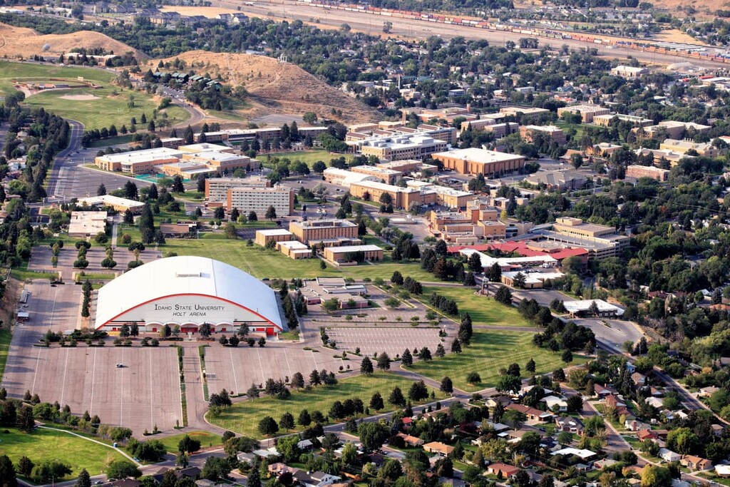
There are a handful of attractions for visitors, including a natural history museum, an outdoor art gallery, a museum dedicated to the Shoshone-Bannock Tribes, and a “Museum of Clean.” Outside the city, there are numerous hiking and mountain biking trails.
The tourist town of Lava Hot Springs sits dead center in the Portneuf Range, in the valley where the Portneuf River bisects the mountains. The town is just 11 miles (18 km) east of I-15, so it’s a good stop on the route from Salt Lake City to Jackson Hole or Yellowstone National Park.
Lava Hot Springs is all about the waterparks and pools. There’s an Olympic-size swimming pool and an innertube run that travels through the town itself, along with zip lines, a golf course, and campgrounds.
While these are developed hot springs, they use geothermally-heated water from naturally occurring hot springs. These springs lack the strong sulfur smell that many natural hot springs in Idaho have.
Located about 150 miles (240 km) south of Portneuf Range, Salt Lake City, Utah is a major hub for the mountain west. It’s the state capital and largest city in Utah, with close to 200,000 residents.

Salt Lake City was founded by Mormon settlers and it remains the headquarters for the church. Some of the religious institutions, including the Salt Lake Temple and Mormon Tabernacle, are major tourist draws.
Outdoor recreation is another major draw to Salt Lake City. Just to the east of the city lies Little Cottonwood Canyon, home to two major ski areas and year-round hiking and climbing. The city also serves as a jumping-off point for people heading into the national parks in southern Utah.
Explore Portneuf Range with the PeakVisor 3D Map and identify its summits.


