
Scan the QR code and open PeakVisor on your phone
The Bannock Range include 28 named peaks. The highest is Oxford Peak at 2,832 m. Other notable peaks include Elkhorn Peak, Wakley Peak and Oxford Ridge.
The Bannock Range is a mountain range situated in the southeastern part of the US state of Idaho. The remote range extends into the northern stretches of Utah. There are 28 named mountains in the range, the tallest and most prominent of which is Oxford Peak at 9,291 feet (2,832 m) with 4,029 feet (1,228 m) of prominence.
The Bannock Range is situated in southeastern Idaho. The Portneuf River runs along the eastern edge of the range while the Snake River is situated to the north. Along the eastern edge of the southern stretches of the range lies the Bear River.
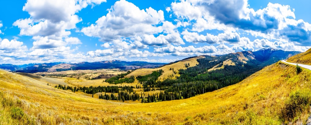
This north to south running range spans 65 miles (105 km) across southeastern Idaho into northeastern Utah. Peaks in the range are often broken into three main sections, north, central, and south.
These three sections are separated by low mountain passes. The northern section spans from the city of Pocatello to Garden Creek Gap while the central section lies along Interstate 15. Peaks in the southern section of the range lie along the east side of Interstate 15, extending into northern Utah.
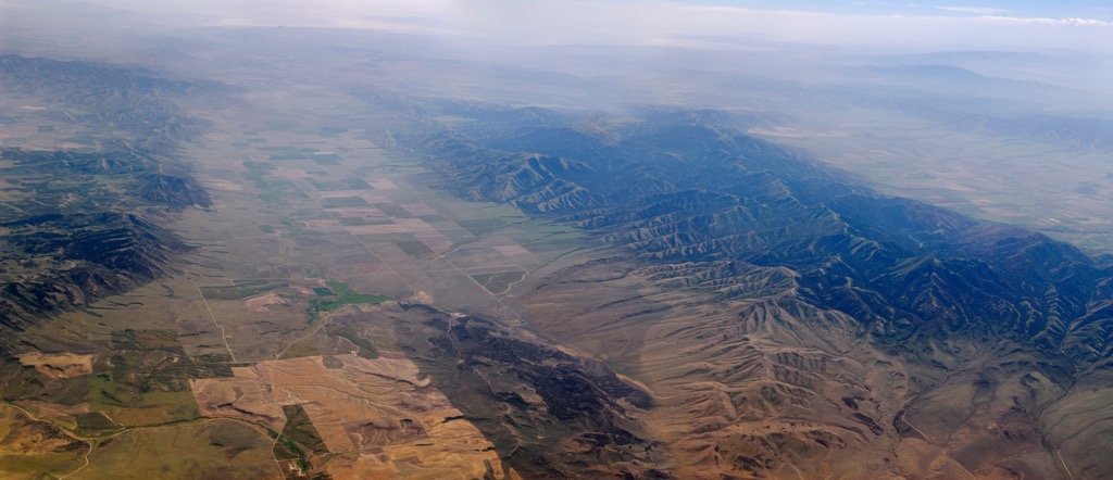
The Portneuf Range lies to the east, separated by a valley, with the Deep Creek Mountains situated to the west. South of the range lie the Northern Wasatch Mountains along with Marsh Valley, often called Malad Valley or Cache Valley.
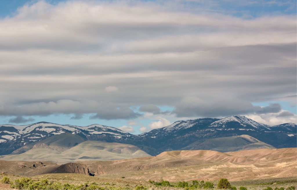
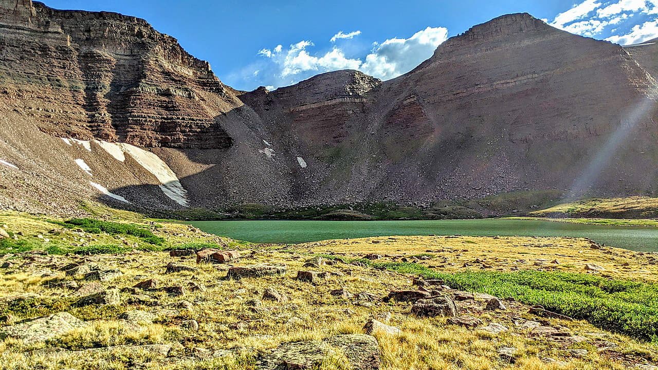
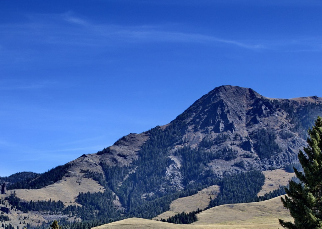
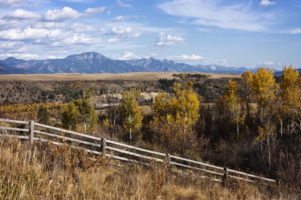
Lush vegetation and patches of trees cover these rolling hills and rounded summits. There are multiple streams that run through the range though there are no alpine lakes. Within the Bannock Range lie numerous subranges including Malad Range, Samaria Mountains, North Hansel Mountains, and the Pleasantview Hills.
The Bannock Mountains lie within Caribou-Targhee National Forest. Other sections of this national forest extend to the east and northeast. To the south and southeast lies a section of the Uinta-Wasatch-Cache National Forest. Further west of the range is the Sawtooth National Forest with the Craters of the Moon National Preserve to the northwest.
The Bannock Range is a subrange of the Western Rocky Mountains, which extend throughout the states of Utah, Wyoming, Colorado, and Idaho. These peaks mark some of the most northwestern peaks in the Western Rocky Mountains.
This mountainous region began forming during the Laramide orogeny, a major mountain building event that occurred 80 to 55 million years ago. The peaks were formed by the subduction of the Farallon plate beneath the North American plate.
Immense pressure caused by this subduction, forced the peaks upwards, forming much of the Rocky Mountains. The Bannock Range was less glaciated than other nearby ranges during the Pleistocene epoch.
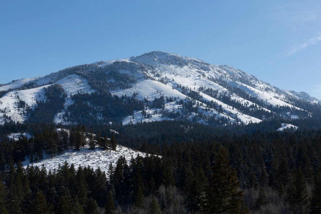
Minimal glacial retreating, coupled with millions of years of erosion, rounded out the range from its once jagged formation. A majority of the range is limestone with outer layers primarily consisting of quartzite, shale, and dolomite. Foothills in the range feature volcanic and basalt cliff formations.
Major peaks within the Bannock Range include Oxford Peak, Elkhorn Peak, Old Tom Mountain, and Rock Knoll.
Though the Bannock Range appears to feature minimal amounts of biodiversity, the hillsides help support a wide range of both flora and fauna.
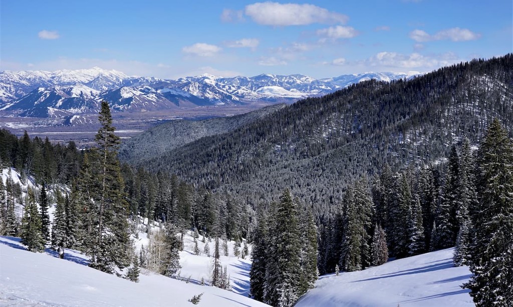
Rolling hillsides are covered with green grasses, sagebrush, and other low growing plants. As elevations increase, the terrain is able to support stands of fir, spruce, and lodgepole pine trees. Some of the peaks in the range feature minimal amounts of vegetation, instead covered by rock fields.
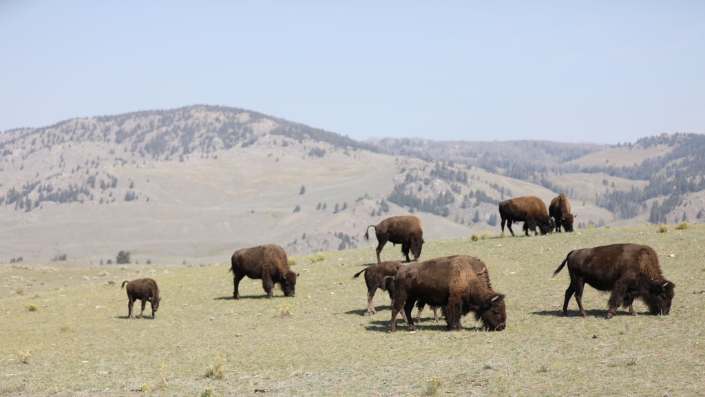
The surrounding network of Caribou–Targhee National Forest helps support populations of larger mammals. Throughout the national forest lie populations of elk, mule deer, moose, black bears, and wolves.
Bison also inhabit the region though they are more likely to be found in the northern stretches of the national forest near Yellowstone National Park. Nearby waterways support a variety of trout. Fishers will find native Yellowstone cutthroat trout along with rainbow trout and brown trout, along with Rocky Mountain whitefish.
The Bannock Range has been named after the Indigenous Bannock Tribe. This region of land has been inhabited by humans for thousands of years. Some of the most prominent tribes with ancestral ties to this land are the Shoshone-Bannock and Ute peoples.
The Shoshone people originated in the Great Basin while the Bannock are believed to have inhabited present-day eastern Oregon before arriving in the region.
By the early 1800s, settlers of European descent began arriving throughout the region. Many of the early settlers began establishing communities and homesteads. Other people who flocked to the region included fur trappers and traders.
During the early 1800s, settlers of European descent began establishing homesteads and communities in the region. Settler communities grew in population as fur trappers and traders arrived in droves. Fort Hall, which marks one of the first permanent establishments by the people of European descent, was created in 1834.
As the fur trapping industry began subsiding, Fort Hall transitioned to a stopping point for people traveling along the Oregon Trail. Populations rose drastically throughout the 1860s during the gold rush of the region.
This increased population led to numerous disputes between the Indigenous peoples of the region and the colonizers. Under leadership of Chief Pocatello, the Shoshone and Bannock Tribes were forced to sign the Fort Bridger Treaty of 1868, which drastically reduced their claim to their native homelands.
Members of both tribes were forcibly removed from their homelands and onto Fort Hall Reservation. The US government did not uphold their promise to supply the tribes with an annual supply of goods. This led to widespread hunger and disease throughout the reservation.
The US government then drastically reduced the Fort Hall Reservation, selling the surrounding land to new settlers. This spurred an armed conflict between the Shoshone-Bannock Tribes and the US military in 1878.
These series of battles would later be known as the Bannock Wars. While ongoing conflict led to this war, the poor living conditions on the Fort Hall Reservations acted as a major factor. Those who remained in the region were forced back onto reservations by the US government.
The land within Caribou–Targhee National Forest, which extends throughout the range, first became protected in 1903.
The Bannock Range is home to numerous hiking trails, with a majority of trails found in the northern stretches of the range. Here are some of the most popular hiking areas in the region:
This loop trail winds through the forested landscape in the range before opening up to the rolling hillsides found at higher elevations. Located just outside the city of Potcatello, the trail climbs gently throughout while passing along small creeks. The loop is 4.6 miles (7.4 km) long and features 479 feet (146 m) of total elevation gain.
The Gibson Jack Trail steadily climbs through the forested hillsides, up to the main ridgeline in the range. During the fall months, the trail features changing aspens amidst the evergreen trees. The summer months provide hikers with views of seasonal wildflowers in the meadows scattered throughout the range. This out and back route passes along the base of Rock Knoll, totaling 7.5 miles (12 km) with 1,315 feet (401 m) of elevation gain.
This out and back trail begins northwest of Scout Mountain and loops around the south side of the peak before reaching the summit. Situated near the heart of the range, this remote route passes through lush alpine pastures along its route to the summit. The out and back trail is 8.4 miles (13.5 km) and features 1,676 feet (511 m) of elevation gain.
A short and steep trail leads to the summit of Elkhorn Peak, the second tallest and second most prominent peak in the range. After passing through the forested hillsides, hikers approach the summit, which is free of flora. The top of the peak offers panoramic views of the surrounding range and national forest. The out and back trail is 6.9 miles (11 km) and features 2,519 feet (768 m) of elevation gain.
Looking for a place to stay near the Bannock Range? Here are some of the best cities and villages to check out in the region:
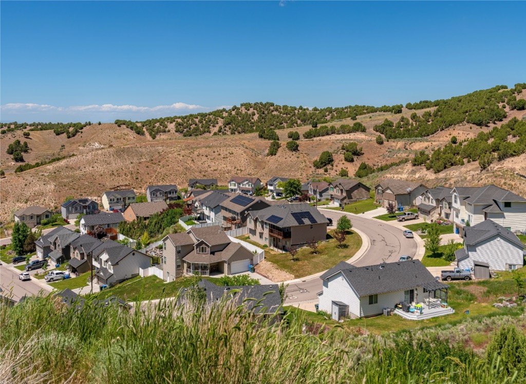
The city of Pocatello lies at the northern edge of the Bannock Range. Pocatello was named after Chief Pocatello, who was one of the most prominent leaders of the Shoshone peoples during the nineteenth century.
Today the city is home to 56,000 residents, marking the fifth largest city in the state of Idaho. Within the city lies Idaho State University, which is the largest employer in the region. Besides the abundance of hiking trails in the range, the Bannock Range also features numerous opportunities for fly fishing and rock climbing.
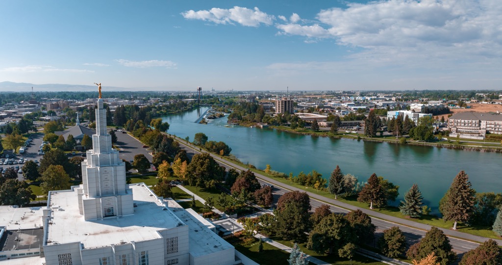
North of the Bannock Range lies the city of Idaho Falls. Home to around 65,000 residents, Idaho Falls marks the largest city in the state outside of the Boise metropolitan area. This relatively large population has established Idaho Falls as the cultural and economic hub for eastern Idaho.
Situated along the Snake River, a greenbelt runs through the city along either side of the river. Within a two hour drive of the city lies both Yellowstone National Park and Grand Teton National Park. The Museum of Idaho and the Art Museum of Eastern Idaho are located in the downtown region of the city.


The highest peak in the Bannock Range is Oxford Peak, at 2,832 m.
The Bannock Range have 28 named peaks.


