Scan the QR code and open PeakVisor on your phone
The Craters of the Moon National Preserve is a volcanic region in the south central region of the US state of Idaho. The terrain features numerous craters, lava flows, and volcanic cones. There are 25 named mountains in the preserve. The tallest peak is North Laidlaw Butte at 5,912 feet (1,802 m) tall while the most prominent is Laidlaw Butte with 367 feet (112 m) of prominence.
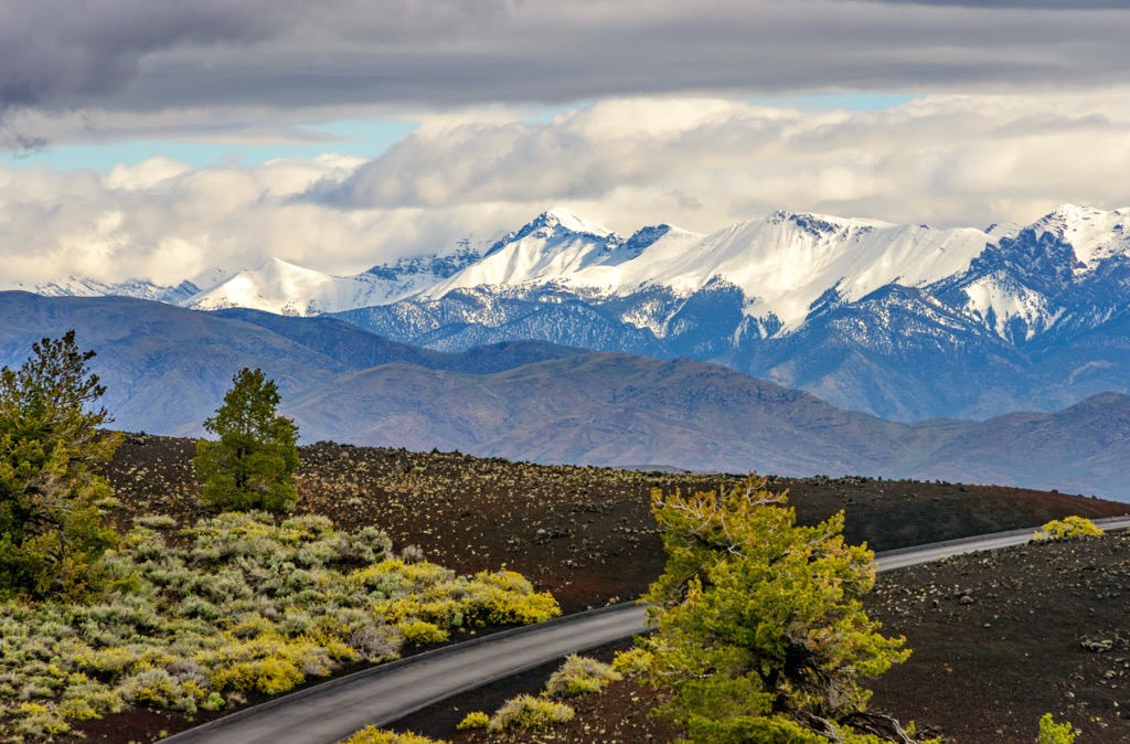
The Craters of the Moon National Preserve lies in the south central region of the US state of Idaho. Situated near the base of the Pioneer Mountains, the terrain is marked by volcanic craters, cones, and lava flows.
This national preserve is administratively combined with the Craters of the Moon National Monument, located in the northern section of the preserve. Together these two regions span 753,000 acres (304,728 ha) across the region.
Three lava fields lie within the protected region, situated along the Great Rift in Idaho. The preserve covers land in Blaine, Butte, Lincoln, Minidoka, and Power counties.
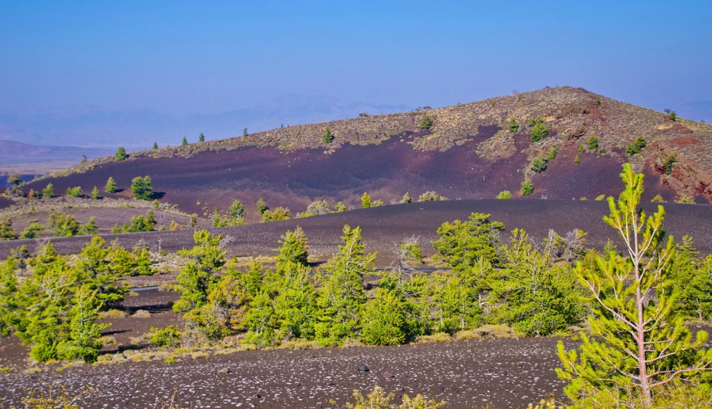
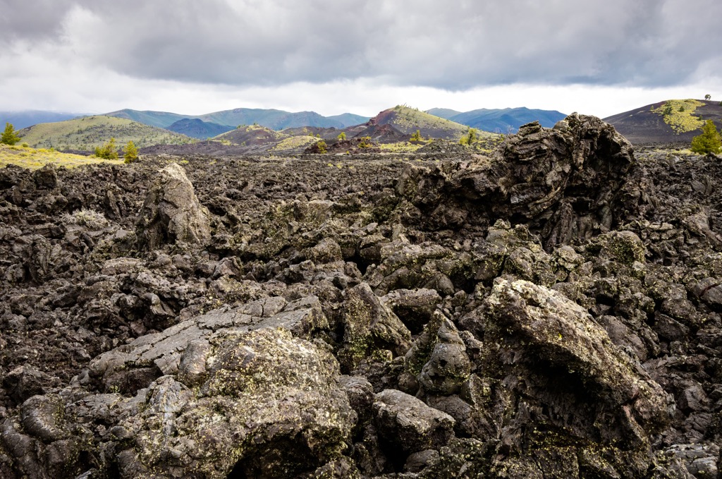
This terrain marks one of the best-preserved flood basalt areas in the contiguous US states. The volcanic region is classified as dormant though scientists believe that the region may erupt in the future.
There are over 35 craters in the region with some of them as large as half a mile (0.8 km) across. Within the preserve and monument lie roughly 400 square miles (1,000 square km) of sagebrush steppe grasslands amidst the volcanic terrain.
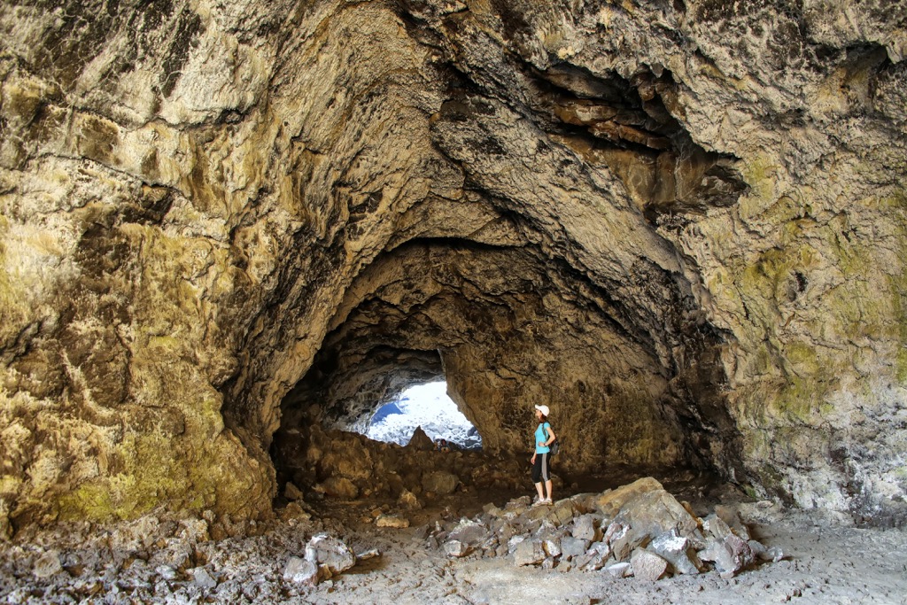
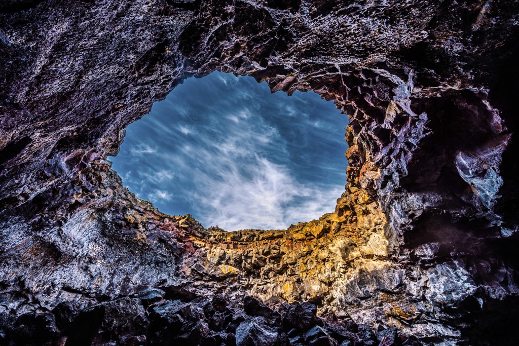
The name “Craters of the Moon” was given to the region due to its close resemblance to the surface of Earth’s moon. Throughout the region lie other volcanic features such as tree molds and lava tubes. The Snake River lies directly south of the preserve.
Within the preserve lies the Craters of the Moon National Monument and the Craters of the Moon Wilderness Area. Further north lies portions of both Sawtooth and Salmon-Challis National Forests. South of the preserve lies other sections of Sawtooth National Forest and City of Rocks National Reserve, while portions of Caribou-Targhee National Forest lie to the southeast and northeast.
The land within the Craters of the Moon National Monument and Preserve, has historically been home to volcanic activity for millions of years. The hotspot that now lies under Yellowstone National Park, located northeast of the preserve, was located underneath the preserve between 8 to 10 million years ago.
This hotspot caused numerous eruptions of rhyolite magma to occur. While the hotspot remained stationary, the North American continental plate drifted to the southwest, resulting in over 100 eruptions, forming calderas that spanned between 10 to 40 miles (16 to 65 km) wide.
Terrain in the preserve, including the lava flows visible today, were formed between 15,000 and 2,000 years ago, making them some of the youngest lava flows on the continent. These lava eruptions came from the Great Rift, which marks a series of cracks in the Earth’s crust situated southeast of the preserve.
The Craters of the Moon lava field spans 600 square miles (1,550 sq km) across the preserve, marking the largest lava field in the region. Various types of basalt lava can be found in the region amidst the nearly 60 overlapping lava fields.
Though classified as dormant, scientists believe that there will be future eruptions at the Craters of the Moon. Over the past 15,000 years, eruptions have been occurring at the Great Rift roughly every 2,000 years, though it has been over 2,000 years since the last known eruption in the region.
Major peaks within the preserve include North Laidlaw Butte, Laidlaw Butte, Pillar Butte, and Bear Den Butte.
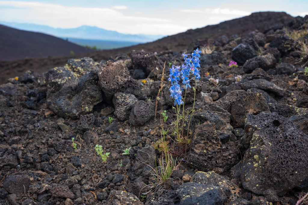
Despite the harsh living conditions of the lava fields, a variety of both flora and fauna are able to live throughout the region. This area only receives about 15-20 inches (38-51 cm) of annual rainfall.
Sections of plant life can be found in areas of older lava flows, often surrounded by less hospitable newer lava flows. The shrubs and grasslands support populations of sagebrush, antelope bitterbrush, juniper trees, and pine trees.
Prior to the arrival of European-Americans colonization, the region supported large populations of grizzly bears, bighorn sheep, and bison. Today, the largest mammal found in the volcanic region is mule deer.
Many of the animals that inhabit the region primarily spend time in the nearby national forests. Some species that withstand these harsh conditions include the yellow pine chipmunk, pika, Great Basin pocket mouse, and marmot. The lava tube beetle can be found in the preserve, marking the only place on earth where this species lives.
Humans have inhabited the land surrounding Craters of the Moon National Preserve as early as 12,000 to 14,000 years ago. The Shoshone and Bannock Tribes are the most prominent peoples with ancestral ties to this region of land.
Both of these Tribes traditionally lived a semi-nomadic lifestyle, migrating into the mountains during the summer months and staying in the valleys during the winter. These Tribes traveled and visited the northern stretches of the protected region with thousands of artifacts having been found in the area.
Ancestors of the Shoshone-Bannock Tribes likely witnessed the most recent eruption in the Craters of the Moon region. Stories have been passed down through generations, describing the lava flow like a large snake squeezing the mountain until lava flowed.
Large groups of European-American settlers arrived in the region during the 1840s and 1850s, many of whom were passing through along the Oregon Trail. This increased population drastically threatened the hunting lands of the Shoshone-Bannock Tribes and their traditional ways of life.
Many people traveling along the Oregon Trail passed through the region as the Goodale’s Cutoff route led travelers around the edge of the lava fields. By 1863 roughly 70 percent of travelers along the Oregon Trail had taken this route.
Conflicts began to rise between the Indigenous Tribes and the settlers in 1858. The US Army was called into the region, waging battles with the Indigenous peoples who had inhabited the land since time immemorial. The Bear River Massacre occurred in 1863 when more than 400 Shoshone members were killed by the US Army.
Following this devastating massacre, the Tribe was forced to sign a peace treaty which moved them from their ancestral homelands to the present-day Fort Hall Reservation southeast of Craters of the Moon. Today more than 5,000 members of the Shoshone-Bannock Tribes live on the reservation.
The volcanic terrain was deemed uninhabitable by European-Americans. During the 1920s, Idahoan Robert Limbert proposed the region be designated as a national park. In 1924, President Coolidge established Craters of the Moon National Monument. This protected terrain was drastically expanded in 2000 by President Bill Clinton.
In 2002, portions of the monument were designated as the Craters of the Moon National Preserve. The protected area was under threat of being downsized under President Donald Trump, though it was never officially downsized.
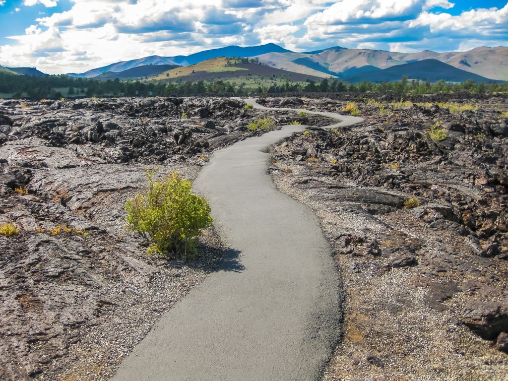
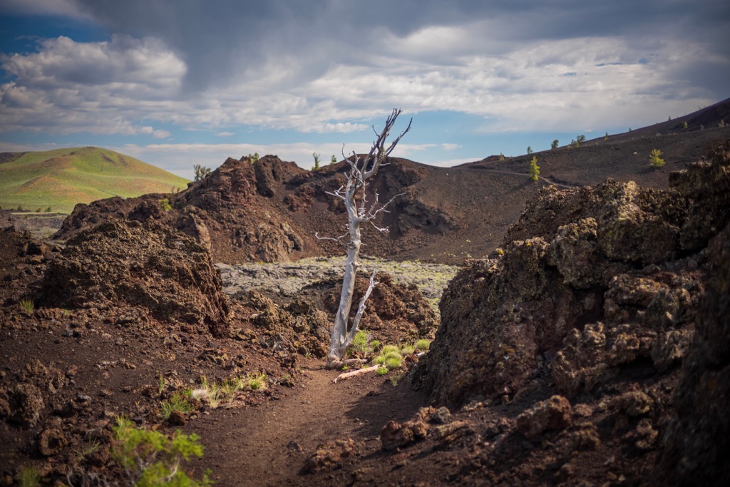
Major hiking trails in the region are all located in the northern stretches of the preserve, within the national monument protected region. Here are some of the most popular hiking areas in the region:
This out and back route runs along the northwestern flank of the North Crater while dropping into the crater itself. Hikers can note the missing portion of the crater, which was blown away during a previous eruption. This out and back route also passes by Big Craters before returning to the start. Round trip the route is 3.5 miles (5.6 km) and features 666 feet (203 m) of elevation gain.
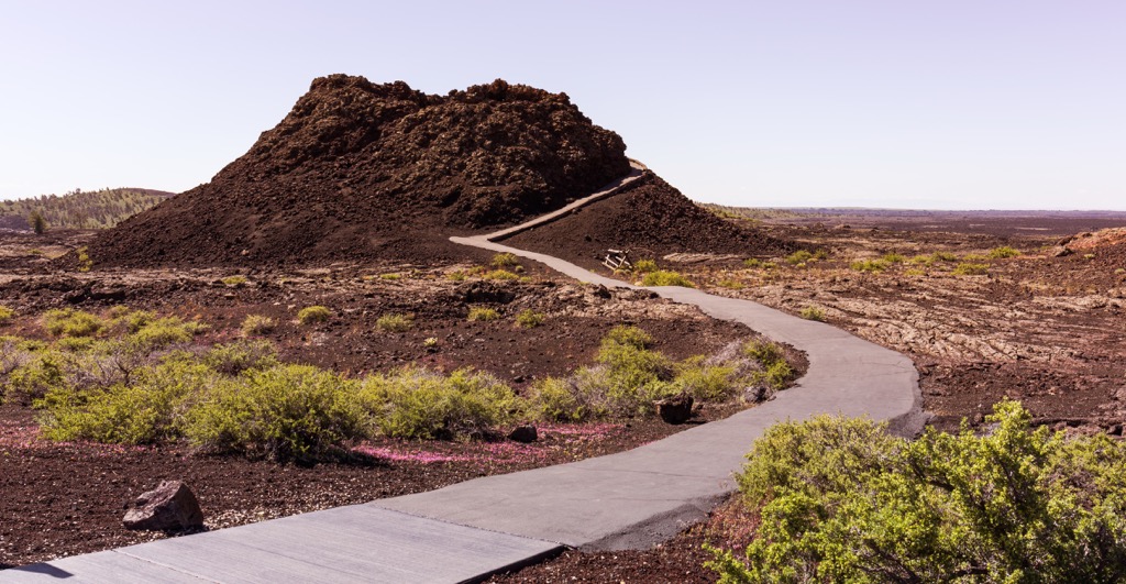
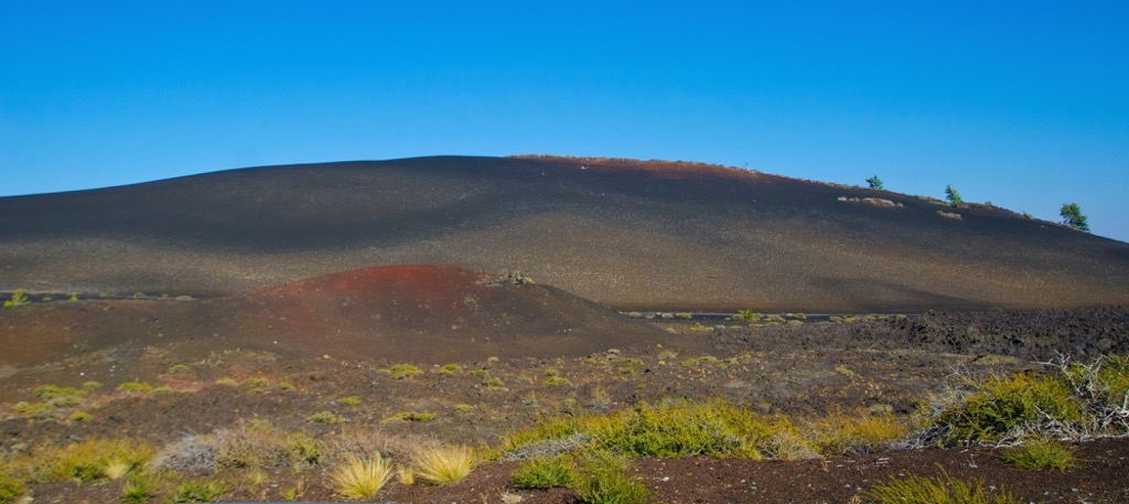
This short and steep trail takes hikers to the top of Inferno Cone. From the summit hikers have panoramic views of the national preserve and monument with the Snake River Plain extending to the south and the Pioneer Mountains to the north. The route is 0.4 miles (0.6 km) and features 141 feet (43 m) of elevation gain.
This trail allows hikers to explore Broke Top, which marks the freshest section of lava flow in the region. Along the route lie numerous viewpoints including the Big Sink Overlook, tree molds, and Buffalo Caves. Those who enter the caves are recommended to wear a hard hat and bring a flashlight. This loop route is 1.8 miles (2.9 km) and features 167 feet (51 m) of elevation gain.
True to its name, this route showcases some of the volcanic caves in the region. Hikers are able to enter many of the caves for an inside look of the previous volcanic activity that shaped the area. The caves are occasionally closed to help protect the populations of bats that live in them. This out and back route is 1.8 miles (2.9 km) long and features 75 feet (23 m) of elevation gain.
Looking for a place to stay near the Craters of the Moon National Preserve? Here are some of the best cities and villages to check out in the region:
The city of Pocatello lies just southeast of the Craters of the Moon National Preserve. Pocatello is named after Chief Pocatello, a prominent leader of the Shoshone Tribe during the nineteenth century.
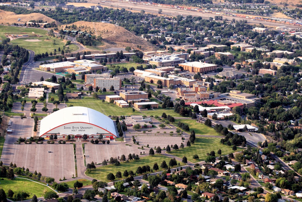
Situated in the foothills of the Bannock Range, just south of the Snake River, Pocatello is home to 56,000 residents, making it the fifth largest city in the state of Idaho. The city is home to Idaho State University which marks the largest employer in the area. The nearby Bannock Range provides opportunities for hiking, fly fishing, and rock climbing.
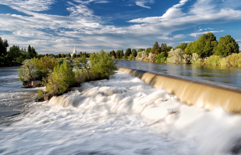
Idaho Falls lies east of the national preserve, situated along the banks of the Snake River. With a population of 65,000 residents, the city marks the largest in the state outside of the Boise metropolitan area. Idaho Falls acts as a cultural and economic center for eastern Idaho and western Wyoming.
A greenbelt runs along the banks of the Snake River, offering quaint pathways amidst the city. Both Yellowstone National Park and Grand Teton National Park lie within a two hour drive of the city, located to the east in the state of Wyoming. Idaho Falls is also home to the Art Museum of Eastern Idaho.