
Scan the QR code and open PeakVisor on your phone
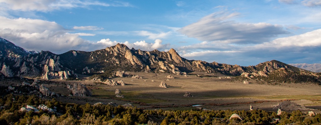
City of Rocks National Reserve has 17 named peaks. The highest is Graham Peak at 2,701 m. Other notable peaks include Mahogany Mountain, Granite Peak and Steinfells Dome.
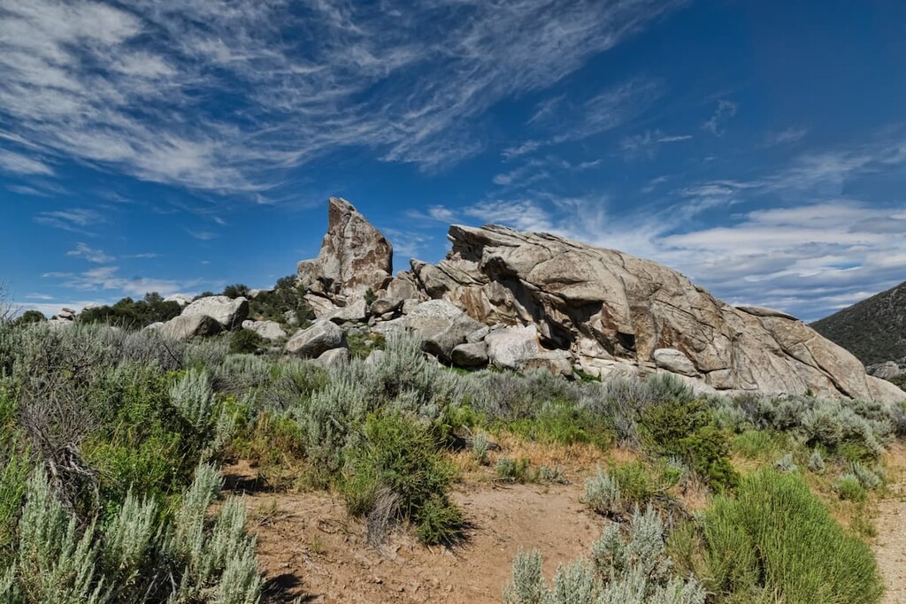
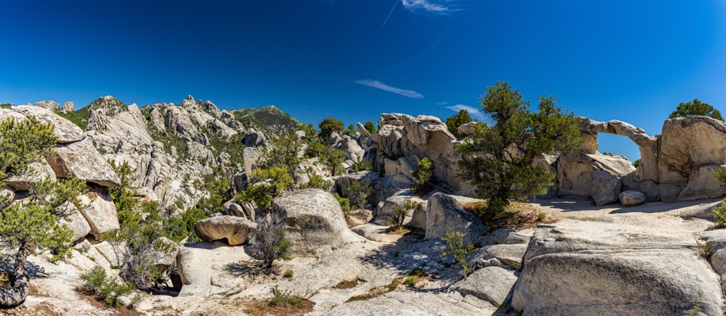
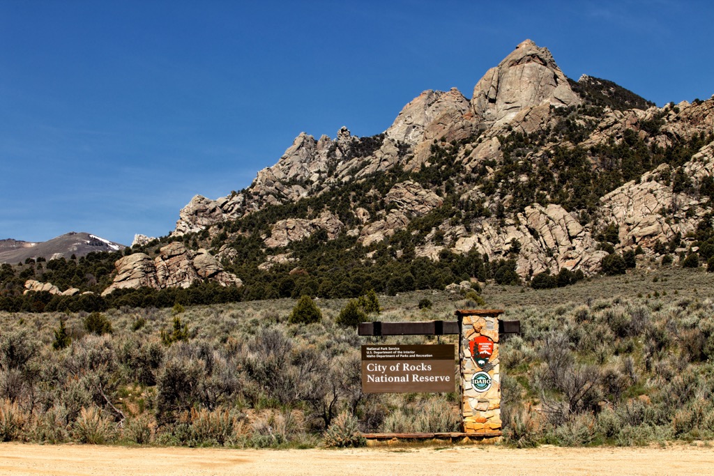
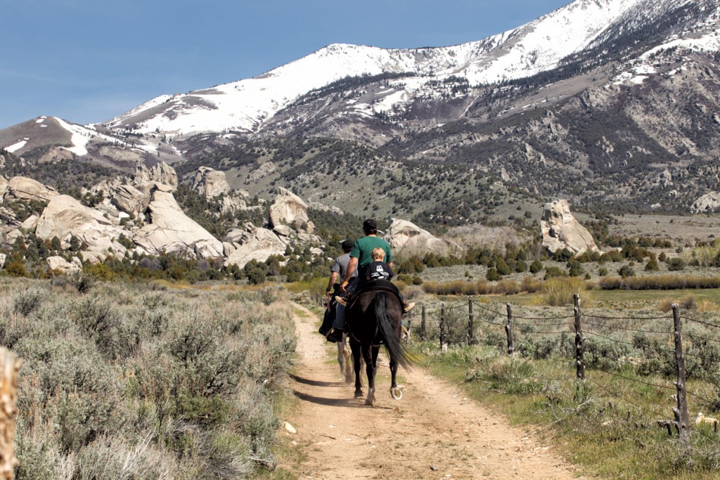
The City of Rocks National Reserve is an iconic geological area in southern Idaho, USA, with granite spires and over 700 climbing routes that make this a rock climber’s paradise. In addition to climbing, the national reserve welcomes hikers, bikers, backpackers, and horse riders. Of the 17 named mountains in the reserve, Graham Peak is the highest (8,862 ft/2,701 m) and Mahogany Mountain (7,713 ft/2,351 m) is the most prominent with a prominence of 876 ft (267 m).
The City of Rocks National Reserve encompasses 14,407 acres (5,830 ha), one fourth of which is privately owned, in southern Idaho. It was established in 1988 as it became increasingly popular among outdoor recreationists, climbers in particular.
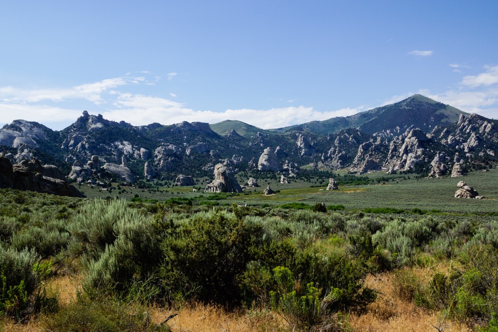
The peaks here are part of the Albion Mountains. The reserve lies just south of Sawtooth National Forest. To the southeast lies the Raft River Mountains, to the east the Black Pine Mountains, and to the north the Snake River Plain and Castle Rocks State Park.
The streams and waterways within City of Rocks are part of the Snake River watershed. The Snake River is a tributary of the Columbia River.
The tallest peaks in the reserve are Graham Peak (8,862 ft/2,701 m), Mahogany Mountain (7,713 ft/2,351 m), Granite Peak (7,654 ft/2,333 m), Steinfells Dome (7,356 ft/2,242 m), and Train Rock (7,349 ft/2,240 m).
The Albion Mountains lie within the City of Rocks National Reserve and are part of the Basin and Range provinces. These provinces formed from crustal extension. As faults developed, mountains were uplifted and valleys sank down, creating the alternating ridges and valleys seen in the area today.
The oldest rocks, exposed Archean basement rocks, come from the Green Creek Complex which dates as far back as 2.5 billion years. They included granite, granitic gneiss, schist, and amphibolite. The very oldest rock is brown schist, rich in biotite mica and distinguishable from younger rock by the dark color that comes from minerals with high iron content.
Elba quartzite developed after the Green Creek Complex. It came from quartz-rich sandstone that is light in color and weather resistant thanks to the quartz content. The sand that developed into sandstone was likely deposited during the Proterozoic era 15,000 to 600 million years ago.
The youngest rock composition in the region is Almo pluton, approximately 28 million years old. Granitic rocks from this formation account for the majority of spires in the reserve. Many dikes cut through the Almo pluton, such as pegmatite dikes with large crystals. Joints run through every outcrop which influences the size and shape of the spires. The joints are created by three steps – contraction, extensional tectonics, and expansion as overlying rock is eroded away.
Despite sometimes harsh seeming conditions among the rocky outcroppings, the reserve actually supports a diverse range of habitats as it spans the northern Basin and Range provinces. Ecological communities include pinyon-juniper woodlands, aspen-riparian ecosystems, sagebrush steppe, mountain mahogany forests, and high elevation meadows.
The region is home to more than 450 plant species and there are around 100 kinds of wildflowers that burst into bloom each summer. One common and important plant in the ecosystem is the antelope bitterbrush. This shrub is an important food source for pronghorns and mule deer, and birds and rodents eat the seeds. It is often used in restoration to prevent erosion or stabilize a damaged piece of land.
The reserve is home to wildlife, some easier to spot than others. The more common species include mule deer, cottontails, jackrabbits, marmots, and chipmunks. Less common but nonetheless present are mountain lions, bobcats, coyotes, moose, and elk. Approximately 180 species of birds live here and a complete checklist can be found here. The area provides habitat for a handful of lizard and snake species, and one kind of amphibian – the boreal chorus frog.
The City of Rocks National Reserve is the native homeland of the Shoshone and Paiute tribes. Earliest human inhabitation can be traced back to the end of the Pleistocene since big spearheads used to hunt megafauna have been discovered in the area. As the megafauna died off and the Holocene era bega, tools shifted to smaller spear points and eventually bows and arrows to hunt smaller game.
The different bands of the Shoshone were named after diet staples, such as the rabbit eaters, the pine nut eaters, and the fish eaters. The Bannock, related to the Northern Paiute, also occupied the area.
The California Trail cut through what is now the City of Rock and ushered in the first major wave of European and American settlers to the region. Roughly 240,000 people moved west between 1848 (when gold was discovered in California) and 1869 (when the transcontinental railroad was completed).
Many travelers on this route camped at Circle Creek and some even wrote or etched their names onto the rock. In the southern part of the reserve, the trail had a junction with the Salt Lake Alternate Trail for people heading to Salt Lake City.
After the railroad was built and fewer people emigrated on foot, the trail became used as a stage route connecting the railroad in Kelton, Utah and Boise, Idaho, a mining hub at the time.
In the early 1900s, the area was divided into a handful of land patents and farms. However, poor farming conditions led to the land being increasingly used as rangeland for grazing. The area first started to become a popular recreation area in the 1960s, first for the rock formations and history, and shortly thereafter for rock climbers.
In order to protect and maintain the area, the national reserve was established in 1988 and is jointly managed by the National Park Service and the Idaho Department of Parks and Recreation.
A full list of hikes ranging from easy to strenuous can be found here. Forest Road 707 leads to the summit of Graham Peak. However, it is a rough road with varying conditions depending on ice and snow, and there are steep drop offs at points.
The City of Rocks Loop is 6.8 mi (10.9 km) and considered strenuous. Although there are several access points to the trail, the North Fork Circle Creek trailhead across from the Emery Creek picnic area is popular. The trail traverses sagebrush flats and stands of pine trees, passes iconic rock formations, and provides fantastic views of the surrounding reserve.
The Stripe Rock Loop is 3.5 mi (5.6 km) and, as its name suggests, features a striking aplite dike that cuts across a rock face. This trail leads to other popular trails such as Geo Watt, Site 18, North Fork Circle Creek, Bumble, and Box Top. It is open to hikers, bikers, and horses. Bikers are recommended to take the loop counterclockwise.
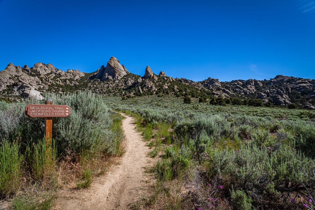
An easy but informative path, the Geological Interpretive Trail is 1 mi (1.6 km) long. Along the way are 12 interpretive stops that explain some key geological points of the area. The trail also comes up close to several rock formations and examples of rocks from the Green Creek Complex and the Almo Pluton.
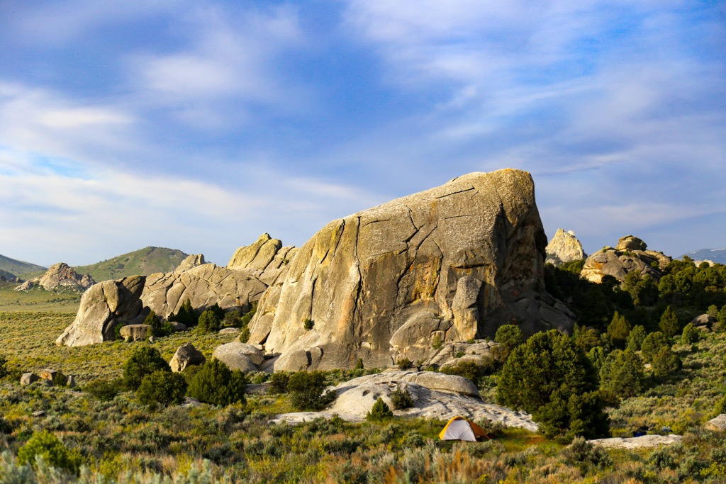
Two campgrounds provide quick access to the reserve – the City of Rocks Campground and the Castle Rocks’ Smoky Mountain Campground. They do fill up fast so it is best to reserve in advance.
Salt Lake City, Utah is a 2.5 hour drive to the south. The Great Salt Lake is a classic attraction. It is the largest natural lake west of the Mississippi River and the largest saltwater lake in the western hemisphere. Visitors can sail, kayak, float, hike, bike, or go birdwatching on and around the lake.
The city itself is home to a population of 200,000 and has several great art museums, including the Utah Museum of Fine Art and the Utah Museum of Contemporary Arts. There is always something happening around the city from concert series to farmers markets to art shows.
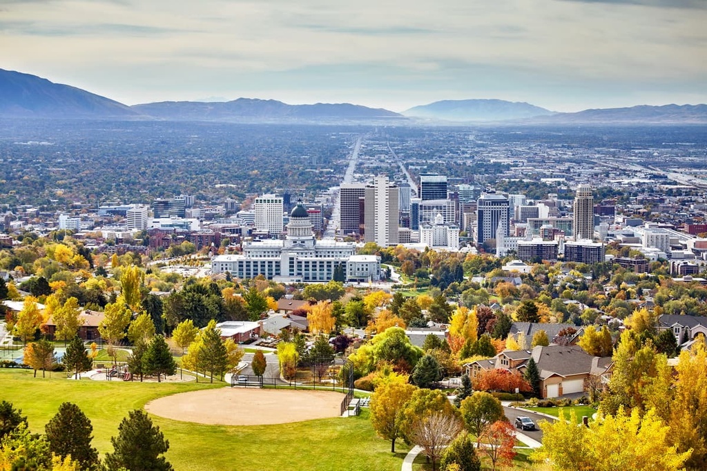
The dining scene is hip and modern, offering a range of fine dining, quirky cafes, vegan and vegetarian options, and lively bars. In addition to standard hotels, motels, and B&Bs, there are beautiful mountain resorts and campsites located close to the city.
A little over three hours away, Boise has a population of 228,000 people and tons of opportunities to get outside. Close to the city is the Boise River and a number of popular trails such as Table Rock Trail with amazing lookouts. Parks in the city offer miles of trails for hiking, running, and biking, and the winter brings skiers and snowboarders to the region.
There are options for dining out with a modest spread of international cuisines thrown into the mix. Many restaurants use locally sourced products when possible. The city has accommodations ranging from scenic resorts to economical hotels to cozy cabins.
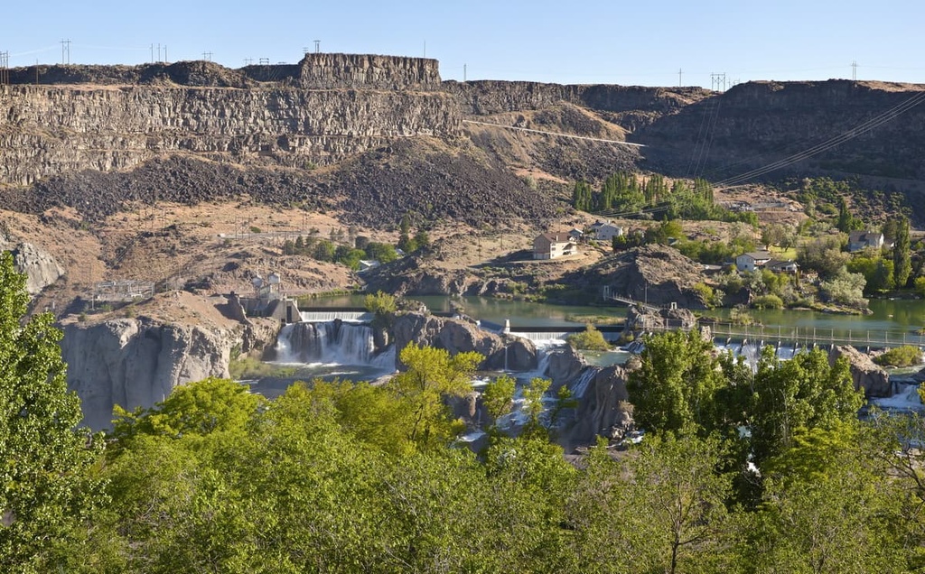
A smaller city of 50,000 people, Twin Falls is a 1.5 hour drive away from the reserve. One of its biggest attractions is the Snake River Canyon, popular for rock climbing, zip lining, hiking, and kayaking. The plaza downtown is a hub for community events and live music.
There are many breweries and a small restaurant selection including American and Mexican food, diners, and cafes. The city offers lodging including hotels, RV parks, and campgrounds.


The highest peak in City of Rocks National Reserve is Graham Peak, at 2,701 m.
Notable peaks in City of Rocks National Reserve include Graham Peak, Mahogany Mountain, Granite Peak, Steinfells Dome and Train Rock.


