Scan the QR code and open PeakVisor on your phone
The Redcloud Peak Wilderness Study Area (WSA) is a mountainous region located in the southwestern part of the US state of Colorado. The wilderness study area lies within the Southern Rocky Mountains, which run throughout the western side of the state. The tallest and most prominent peak in the wilderness study area is Redcloud Peak (14,042 feet/4,280 m).
The Redcloud Peak WSA is situated in southwestern Colorado within the Southern Rocky Mountains. The mountainous landscape of the area is administered by the Gunnison Field Office of the Bureau of Land Management (BLM). The entire wilderness study area is located within Hinsdale County.
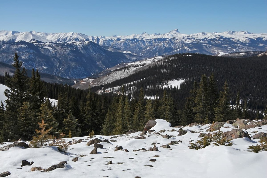
The wilderness study area encompasses 38,495 acres (15,578 ha) of terrain across the Southern Rocky Mountains. Elevations in the area range from lows of around 9,310 feet (2,838 m) up to the summit of Redcloud Peak at 14,042 feet (4,280 m).
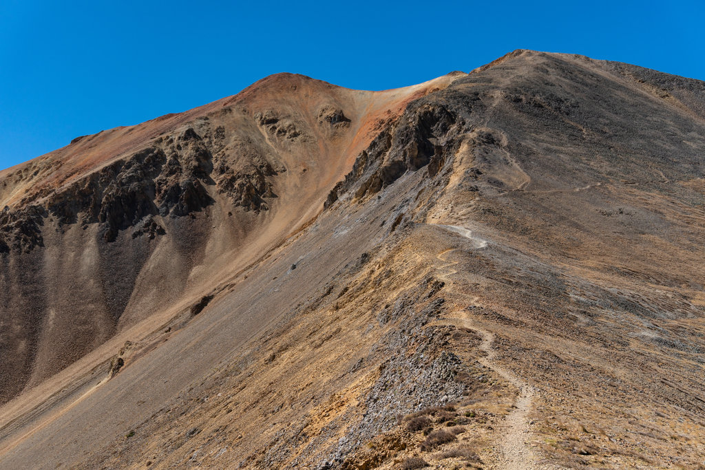
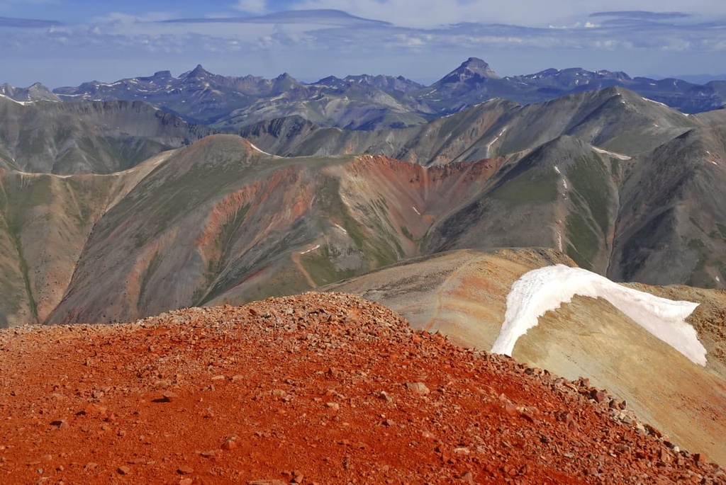
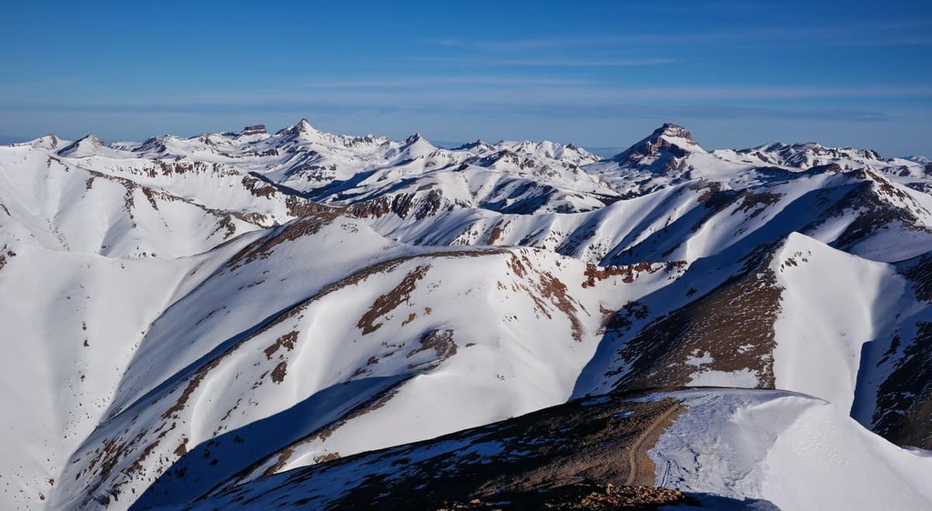
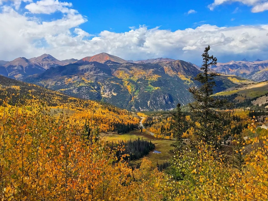
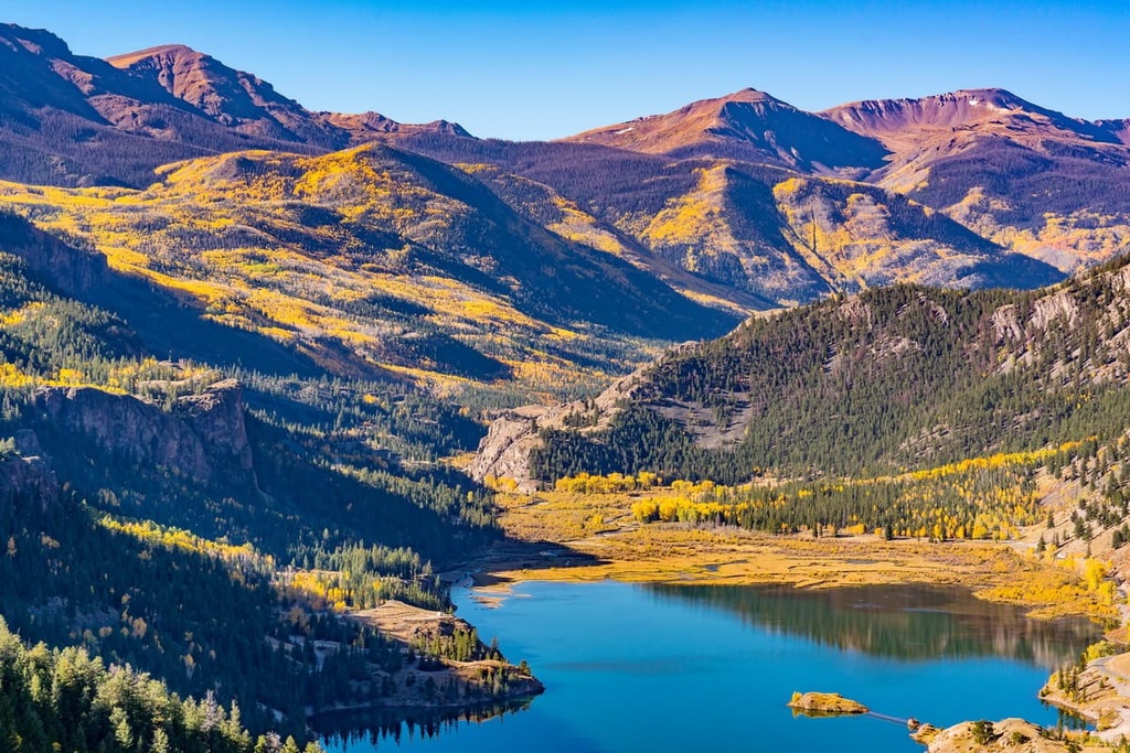
The lower elevations in the region are marked by densely forested hillsides that feature gentle slopes and sweeping valleys. As elevations increase, the forest begins to thin, giving way to tundra-like alpine landscapes. Here, hikers will find glacial cirques, craggy peaks, sweeping ridgelines, alpine meadows, lakes, and various streams.
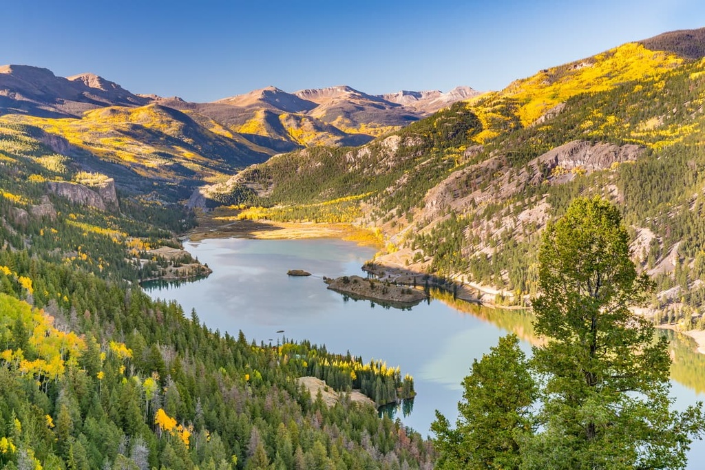
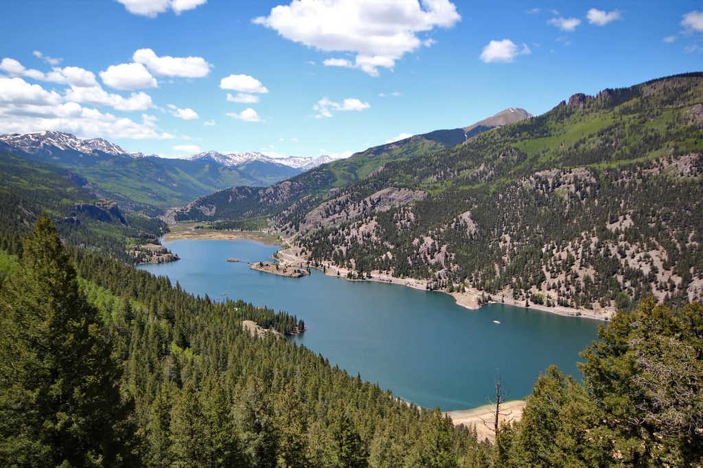
Henson Creek marks the northern boundary of the wilderness study area while the Lake Fork Gunnison River lies along its northern, eastern, and southern boundaries. Other notable creeks and rivers in the area include East Fork Alpine Gulch, Bent Creek, and Copper Creek.
A majority of the wilderness study area is dominated by an alpine landscape that has minimal tree coverage. This rugged terrain defines not only the wilderness study area but also much of southwestern Colorado.
The Redcloud Peak WSA is surrounded by a number of other protected areas. For example, just to the south of Redcloud Peak lies the Handies Peak Wilderness Study Area and Gunnison National Forest. The Tres Rios Field Office is also situated to the west of the wilderness study area along with the American Flats Wilderness Study Area. Furthermore, Uncompahgre National Forest is located to the north of the WSA while the Rio Grande National Forest is situated to the east.
The peaks within the Redcloud Peak WSA are part of the Southern Rocky Mountains, which run between southern Wyoming and central New Mexico. These peaks are a subrange of the greater Rocky Mountains.
The rocky ridgelines, peaks, and rock formations in the wilderness study area date back to the Precambrian. Rocks from this time make up the core of these peaks while the outer rock layers are from the much more recent Cenozoic era.
The Southern Rocky Mountain was created when two continental plates collided with one another. This collision resulted in widespread folding, thrusting, and volcanic activity, and it ultimately gave rise to many of the subranges found in western Colorado to this day.
This region is also part of the San Juan Mountains, which extend across southwestern Colorado. Plutons found in the San Juan Mountains further showcase the volcanic history of the region.
During the last glacial maximum, much of the region was heavily glaciated. As the glaciers began to retreat, glacial cirques, canyons, and steep cliffs were left behind. The history of volcanic activity in the region has also made sections of the San Juan Mountains rich in minerals. As a result, the range was once a very popular destination among miners in search of silver and gold.
Major peaks located within the Redcloud Peak WSA include Redcloud Peak, Sunshine Peak, Red Mountain, and Grassy Mountain.
The Redcloud Peak Wilderness Study Area is home to a diversity of flora and fauna. As far as plant life goes, the lower elevations of the region are populated by Engelmann spruce, subalpine fir, and aspen trees. Small meadows can be found amongst these forested patches along with sagebrush steppe.
At higher elevations, the wilderness study area features alpine grasses, sedges, forbs, and thickets of willow. Wildflowers bloom in the region during the warmer months of the year while the tallest peaks in the region remain free of plant life all year long.
Mule deer and elk inhabit vast sections of the wilderness study area during the summer months. However, as temperatures begin to decrease, the animals retreat to lower elevations for the winter. Other large mammals found in the wilderness study area include mountain lions, bighorn sheep, bobcats, black bears, and coyotes.
The alpine terrain in the wilderness study area also provides the ideal habitat for both pikas and marmots. The various waterways in the region are even home to cutthroat trout and other species of fish. The endemic and endangered Uncompahgre fritillary butterfly can occasionally be spotted in the region, too.
Long before the arrival of European settlers, Indigenous peoples lived throughout the land that is now located within and around the Redcloud Peak Wilderness Study Area.
The San Juan Mountains are part of the historical homelands of the Ute. The Ute would traditionally migrate with the changing of the seasons, often spending the summer months at higher elevations and the winter months in the lower river valleys.
Over the course of countless generations, these migration patterns led to the creation of numerous foot trails throughout the San Juan Mountains. These pathways would later be used and expanded by the arrival of both US and Spanish settlers.
Some of the first settlers of European descent to arrive in the region were the Spanish conquistadors in the early eighteenth century who came in search of silver and gold. By the 1820s, groups of US settlers began arriving in present-day Colorado, often in the hopes of joining the fur trapping industry.
Early trappers and traders, such as Kit Carson, spoke of the prospect of gold in the surrounding San Juan Mountains. In 1860, the Charles Baker Expedition finally found gold in the range, a discovery that ultimately led to the rise of the Colorado Gold Rush.
As settler populations grew rapidly in the region, many of the settlers disregarded the claims of the Ute to their ancestral lands. Fights and disputes regularly broke out between the tribes and the settlers, though the settlers were often backed up by the US government.
In 1873, the Ute and the settlers negotiated the Brunot Agreement. This agreement was meant to provide the Ute with 3.5 million acres (1.4 million ha) of land throughout the San Juan Mountains. The agreement also stated that the Ute had the right to hunt and gather on the surrounding land in the region in perpetuity.
Despite the fact that this agreement was signed, the settlers continued to harass, displace, and murder the Ute and other Indigenous people who lived in the region. Those who remained were forcibly removed from their homelands and relocated onto reservations in southern Colorado. Today, many descendants of the Ute people with ties to this area are members of the Southern Ute Indian Tribe.
Many of the early settlements in the region slowly transformed into mountain towns that are centered around outdoor recreation. However, some towns in the San Juan Mountains were completely abandoned, leading to the formation of ghost towns throughout the range.
The nearby Gunnison National Forest was established in 1905. The Redcloud Peak WSA was designated in 1980 due to its wilderness characteristics. However, it is not yet a formal wilderness (that requires a designation by Congress). The BLM is tasked with managing the Redcloud Peak WSA as if it were a wilderness until Congress decides to either formally designate it as a wilderness or end its WSA status.
The Redcloud Peak WSA is home to a handful of hiking trails. Here are some of the most popular hiking areas in the wilderness study area.
The trail to Redcloud and Sunshine peaks is the most popular hiking route in the wilderness study area. This out-and-back trail offers hikers multiple route options depending on the adventure length and difficulty that they are looking for. These route options include:
The Alpine Loop National Backcountry Byway is a long 4x4 loop road that winds through the Redcloud Peak WSA and other surrounding wilderness areas. Though not a hike, per se, the route allows individuals to witness the stunning beauty of the San Juan Mountains.
Those wishing to drive this OHV/off-roading route must have a 4WD vehicle with high clearance as the road is rough and unmaintained in sections. The entire loop drive is 73 miles (117 km) long and it brings you to incredible panoramic viewpoints where you can enjoy sweeping vistas of the region’s alpine lakes, rugged mountains, and dense forests.
Looking for a place to stay near the Redcloud Peak WSA? Here are some of the best cities and villages to check out in the region.
Lake City lies just to the north of the Redcloud Peak WSA. The city is situated along the Lake Fork Gunnison River near where it drains into Lake San Cristobal. This historic city was originally established during the Colorado gold rush and is currently home to around 400 residents.
The San Juan Mountains tower above the historic Lake City, which also serves as a hub for outdoor recreation. Popular activities in the area around Lake City include hiking, camping, boating, fishing, trail running, mountain biking, and rock climbing. Lake City is also known for being one of the most remote towns in the continental US.
Within Lake City, there are also plenty of great activities for visitors to enjoy, such as skiing at the nearby Lake City Ski Hill. During the winter months, visitors can also go ice skating on the frozen Lake San Cristobal or explore the city’s groomed cross-country ski trails. Small shops and cafés can be found in the streets of Lake City’s small downtown area, too, if you’re looking for something to do after a long day of hiking.
The town of Telluride lies just to the west of the Redcloud Peak WSA. Another former mining town, Telluride is a popular adventure destination that lies in a box canyon and is surrounded by forested peaks and rugged mountains. The famous Bridal Veil Falls lie at the end of the canyon and provide even more splendor to the landscape.
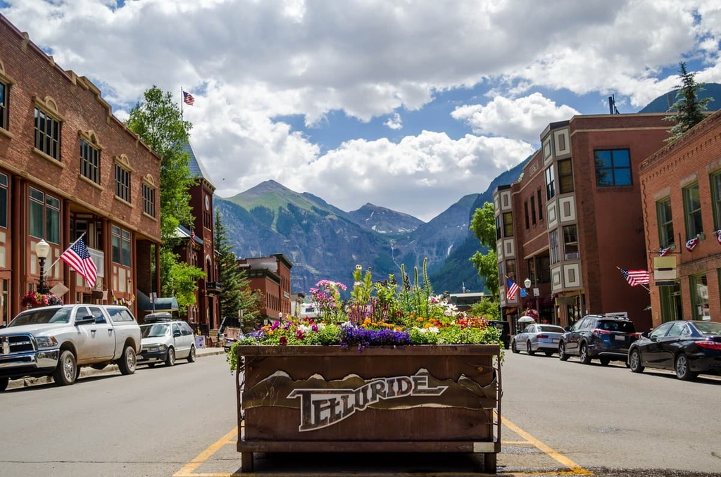
During the winter months, the Telluride Ski Resort is the town’s main attraction. Additionally, during the warmer months of the year, Telluride is also a popular place for mountain biking, hiking, and trail running. Many of the hikes that surround the city feature wildflowers, waterfalls, and alpine lakes.
Nowadays, around 2,600 residents live in Telluride year-round. The town features numerous local shops, restaurants, and cafés, too, all of which offer the perfect way to relax after a long day of hiking and adventure.