Scan the QR code and open PeakVisor on your phone
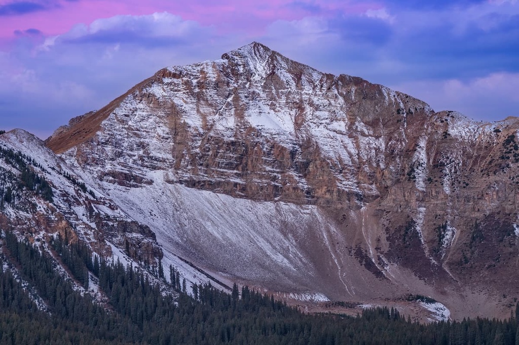
The Gunnison Field Office is an office of the Bureau of Land Management (BLM) that’s located in the southwestern part of the US state of Colorado. The field office manages a stretch of rugged and remote land that’s situated between some of the state's most well-known mountain towns. The tallest and most prominent peak in the field office is Handies Peak at 14,055 ft (4,284 m) in elevation and with 1,910 ft (582 m) of prominence.
The Gunnison Field Office is one of 17 Bureau of Land Management (BLM) field offices in the state of Colorado. It is located in the San Juan Mountains, which are situated in the southwestern part of the state.
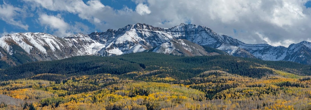
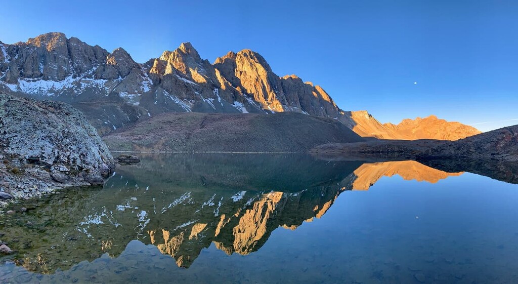
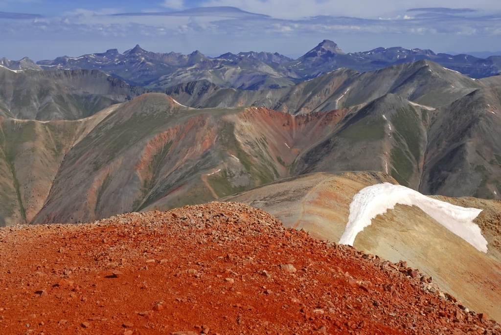
The field office encompasses more than 600,000 acres (242,800 ha) of land and is surrounded by numerous national forests. Rolling forested hills and steep sagebrush steppes mark the lower elevations in the region. Major wilderness areas that are managed by the field office include Handies Peak Wilderness and Redcloud Peak Wilderness.
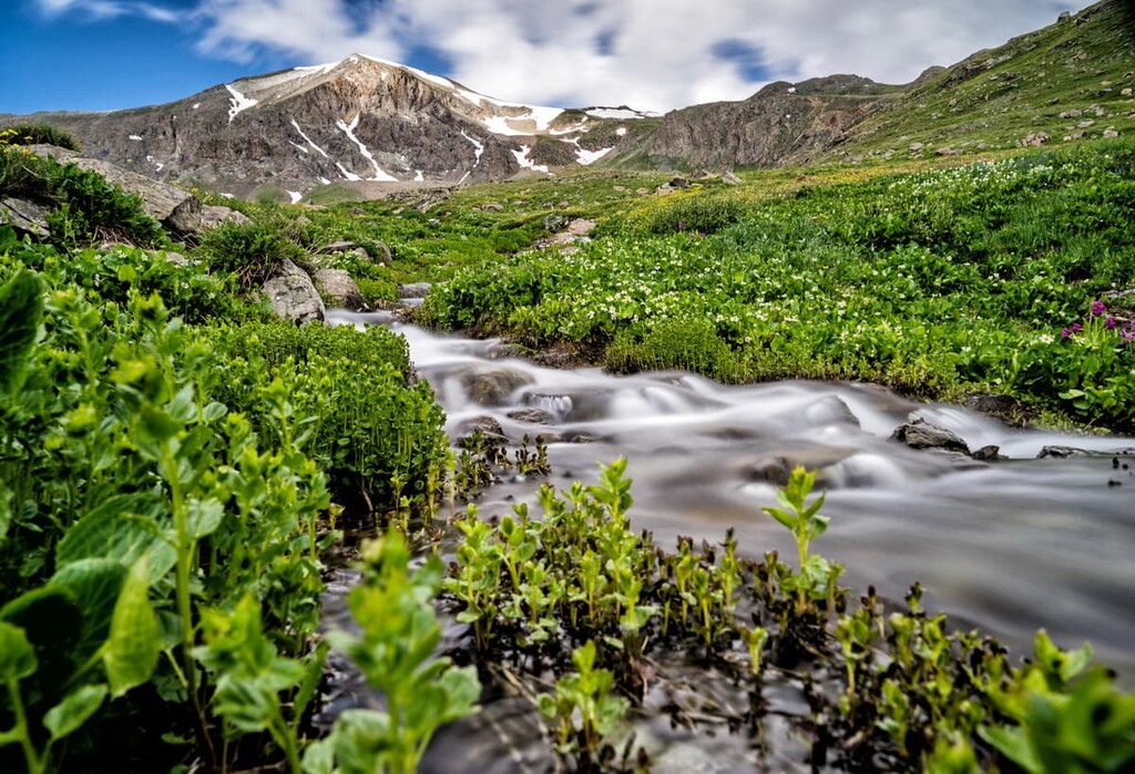
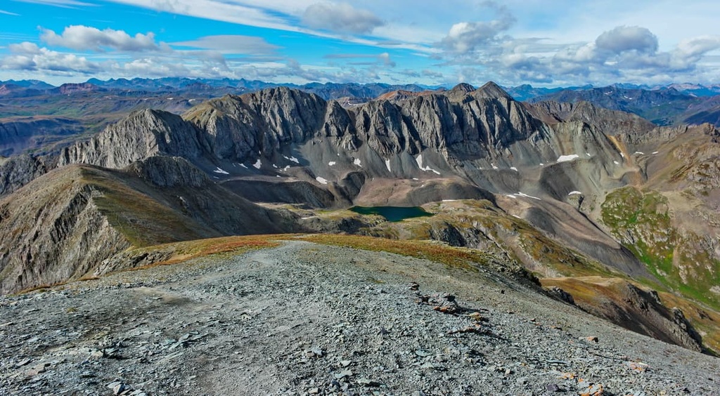
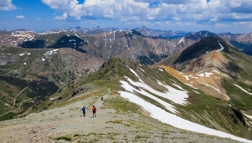
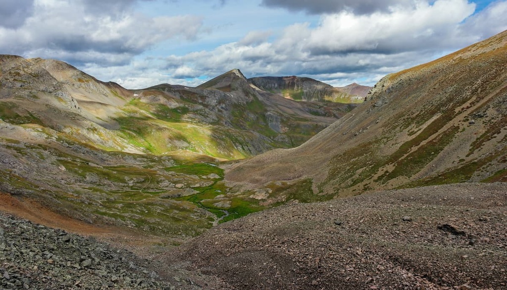
At higher elevations, the landscape in the field office is marked by vast alpine pastures, scree fields, barren hillsides, and rugged rocky ridgelines. The highest peaks within the field office are free of trees, offering panoramic views of the surrounding mountain ranges.
The high elevation mountains are the most defining features of the region. In fact, three peaks in the forest stand at over 14,000 ft (4,267 m) in elevation. There are numerous waterways found throughout Gunnison Field Office, too.
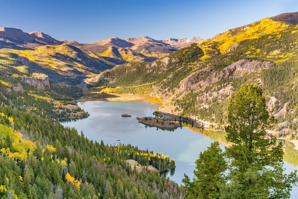
As it is situated in the upper Gunnison River Basin, the Gunnison Field Office is home to major rivers and creeks such as the Gunnison River, Tomichi Creek, Lake Fork Gunnison River, and Henson Creek. Both Lake San Cristobal and Blue Mesa Reservoir, Colorado’s largest body of water, are located within the field office.
The Gunnison Field Office is surrounded by various other national forests and parks. The San Juan National Forest lies directly to the south of the field office while the Rio Grande National Forest is located to the east, Uncompahgre National Forest is nestled to the west, and the Gunnison National Forest is located to the north.
The peaks within Gunnison Field Office are part of the San Juan Mountains, a subrange of the Southern Rocky Mountains. The San Juan Mountains extend throughout southwestern Colorado and northwestern New Mexico.
The towering peaks and rock formations found in the region date back to the Precambrian. Rocks from the Precambrian in the field office can often be found at the core of the region’s peaks while the outer layers date back to the Cenozoic.
This subrange was created when two continental plates collided with one another, resulting in an immense amount of folding and faulting. Continual pressure from this collision created widespread volcanic activity in the region about 30 million years ago. Plutons found throughout the San Juan Mountains help showcase this volcanic history to this day.
Glacial retreat further carved out the landscape in the field office, leaving behind a variety of steep cliffs, box canyons, and glacial cirques. Additionally, the region’s history of volcanic activity has also made the San Juan Mountains rich in minerals. During the nineteenth century, the range attracted miners in search of silver and gold.
Major peaks located within the Gunnison Field Office include Handies Peak, Redcloud Peak, Sunshine Peak, Weed Mountain, and Wildhorse Peak.
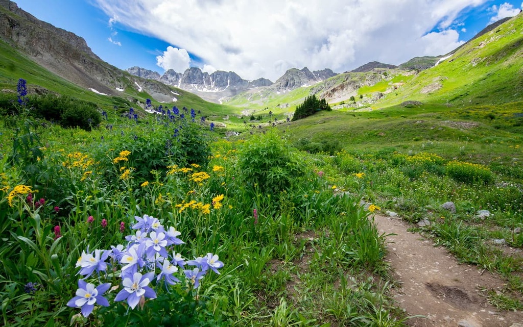
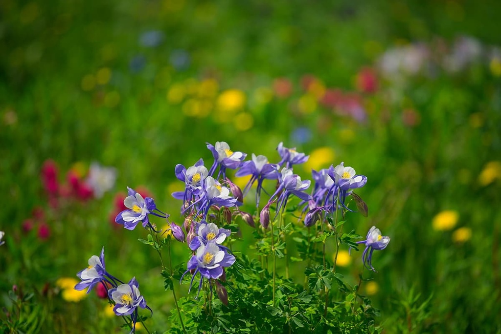
The varied topography of the Gunnison Field Office allows for a plethora of flora and fauna to thrive.
At elevations around 7,000 ft (2,134 m) the landscape is marked by dry sagebrush steppes. As elevations increase these dry landscapes are met with dense forests that contain populations of aspen, Douglas fir, lodgepole pine, ponderosa pine, Engelmann spruce, and subalpine fir.
The highest elevations in the Gunnison Field Office feature alpine tundra meadows. Here, the flora is marked by low-growing grasses, shrubs, and wildflowers. Scree fields and rocky peaks in the field office are generally void of vegetation except for alpine flowers and other similar plants.
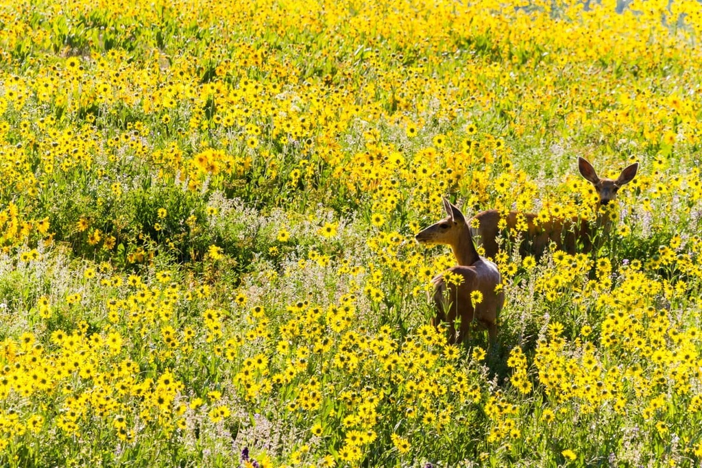
Animals found in the field office are similar to those found throughout the surrounding national forests. Larger mammals in the region include bighorn sheep, mule deer, elk, and moose. Many of these animals migrate to lower elevations during the winter months even though they graze at higher elevations during the summer.
The rocky fields in the field office also provide the ideal habitat for marmots. The forests in the region are also home to mountain lions, black bears, and ground squirrels. Meanwhile, the skies of the region are inhabited by various species of falcons, eagles, and songbirds. Birds of prey in the region often feast on smaller animals such as rodents and large insects.
The Ute people have historically lived in the San Juan Mountains since time immemorial. Traditionally, the Ute lived a nomadic lifestyle that took them throughout the San Juan Range and a large part of the Great Basin, which includes much of what is now Colorado and Utah.
They would live in communities at higher elevations in their territory during the summer months and at lower elevations during the winter. The Ute generally ate a diet that consisted of elk, buffalo, mule deer, and jackrabbit along with various berries and roots.
The paths created by the Ute people would later be used by Spanish travelers and American miners who ventured to the region. Throughout the eighteenth century, there were multiple Spanish expeditions that traveled throughout the San Juan Mountains
American settlers of European descent arrived in the region during the 1820s. Many of the first settlers were fur trappers who exploited the land for beavers, leading to the rapid population decline of these animals. Many trappers, including the famous Kit Carson, insisted that the San Juan Mountains were full of valuable minerals such as silver and gold.
In 1860, the Charles Baker Expedition found gold in the western San Juan Mountains. This discovery led to a massive gold rush that brought miners to the area from across the eastern United States. The vast majority of these settlers completely disregarded the Ute peoples' claim to their ancestral homelands.
In 1873, Ute Tribal leaders and the American government negotiated the Brunot Agreement, which was supposed to provide the Ute with 3.5 million acres (1.4 million ha) of land within the San Juan Mountains and the right to hunt on this land.
After the agreement was made official, the settlers continued to harass, kill, and forcibly remove the Ute from their lands. The Ute were eventually forced onto reservations in southern Colorado, often far away from their ancestral homelands.
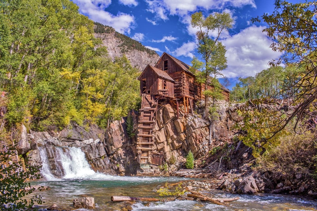
Simultaneously, mining settlements continued to grow quickly throughout southwestern Colorado. While some of these towns have since become abandoned ghost towns, others continue to grow, giving way to the multitude of small mountain towns that are present today. Many of the nearby national forests were established in the early twentieth century.
The Bureau of Land Management wasn’t created until 1946 when President Harry Truman combined the Grazing Service and the General Land Office.
The Gunnison Field Office is a part of the Southwest District Office of the BLM alongside the Tres Rios and Uncompahgre field offices. It is also part of the greater Upper Colorado Basin region as a result of the BLM’s internal reorganization of 2018.
The Gunnison Field Office is home to numerous hiking trails. Here are some of the most popular hiking areas in the region to check out during your next visit.
The Handies Peak Wilderness Study Area lies just to the north of Eureka, Colorado. Home to the tallest peak in the field office as well as a handful of alpine lakes, there are numerous popular hiking trails within the wilderness to enjoy.
Some of the most popular routes include:
The Redcloud Peak Wilderness Study Area is situated right near Handies Peak Wilderness Study Area. The wilderness study area features the second and third tallest peaks in the Gunnison Field Office.
Some of the major hikes in the area include:
Looking for a place to stay near the Gunnison Field Office? Here are some of the best cities and villages to check out in the region:
The town of Gunnison is surrounded by the Gunnison Field Office and Gunnison National Forest.
Situated at the northern edge of the Gunnison Field Office, the town of Gunnison is home to around 6,500 residents. The town is known for being a hub of outdoor recreation. Nearby ski resorts, national forests, and wilderness areas in the region around Gunnison provide hundreds of miles of trails for everyone to enjoy.
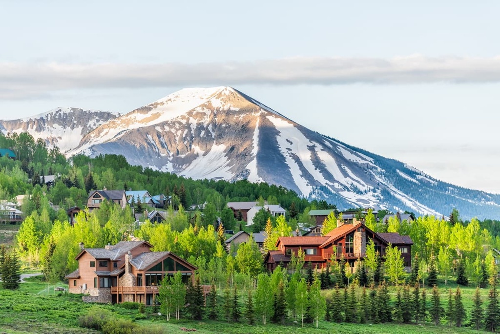
Popular summer activities in Gunnison include hiking, trail running, backpacking, and mountain biking while the winter months provide opportunities for skiing, snowboarding, snowshoeing, cross country skiing, and snowmobiling.
The Blue Mesa Reservoir lies just west of the town, and it is Colorado’s largest body of water. Harmans Rocks Recreation Area and Black Canyon are also located near Gunnison, providing over 8,000 acres (3,200 ha) of cliffs for rock climbers to enjoy.
Lake City is located near the southern edge of Gunnison Field Office. Situated at the confluence of Henson Creek and Lake Fork Gunnison River, Lake City is home to around 400 people.
The remote town lies along the Silver Thread Scenic Byway in the heart of the San Juan Mountains. Lake City is known for being one of the most remote towns in the contiguous 48 states.
Visitors to Lake City can venture into the remote mountains surrounding the town by hiking, trail running, and mountain biking. San Cristobal Lake lies at the southern end of the city, offering a relaxing setting after a long day of exploring. During the winter months, visitors can also ice skate along the frozen San Cristobal Lake or go skiing at the nearby Lake City Ski Hill.