
Scan the QR code and open PeakVisor on your phone
The Handies Peak Wilderness Study Area (WSA) is a proposed protected area located in the southwestern part of the US state of Colorado. The wilderness study area is administered by the Bureau of Land Management’s (BLM) Gunnison Field Office along with the nearby Redcloud Peak Wilderness Study Area. The tallest and most prominent peak in the wilderness study area is Handies Peak at 14,055 feet (4,284 m) in elevation and with 1,909 feet (582 m) of prominence.
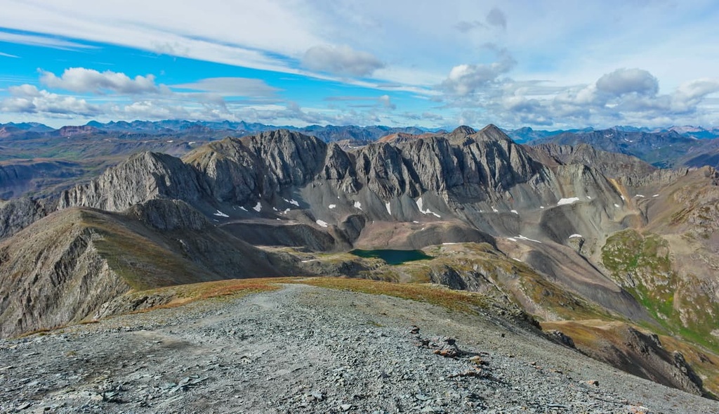
The Handies Peak Wilderness Study Area (WSA) is situated in the Southern Rocky Mountains of southwestern Colorado. The wilderness study area’s rugged alpine landscape is home to Handies Peak, which is the tallest peak on land that’s managed by the Bureau of Land Management in the continental US.
Overall, the wilderness study area covers 16,301 acres (6,597 ha) of terrain. It is also administratively combined with the nearby Redcloud Peak WSA. Elevations in the wilderness study area range from lows of around 9,400 feet (2,865 m) up to the summit of Handies Peak.
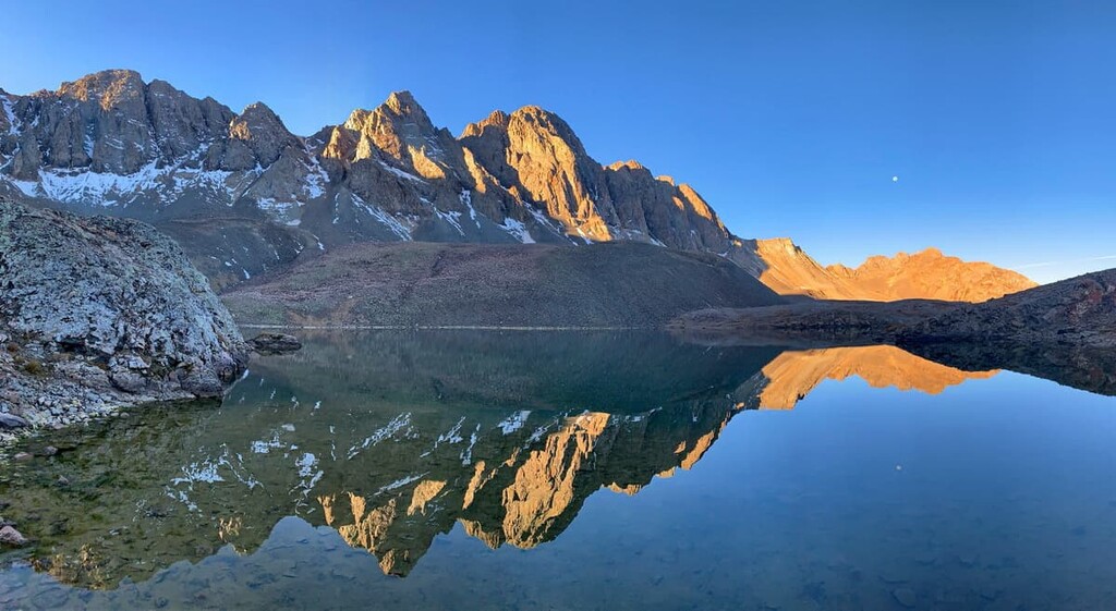
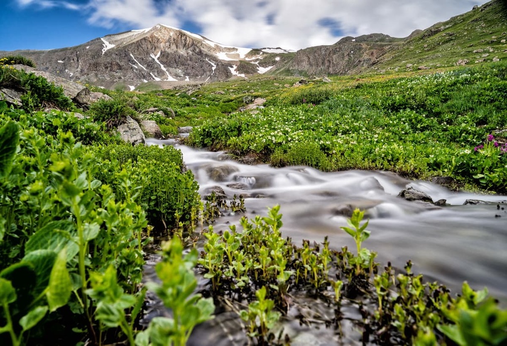
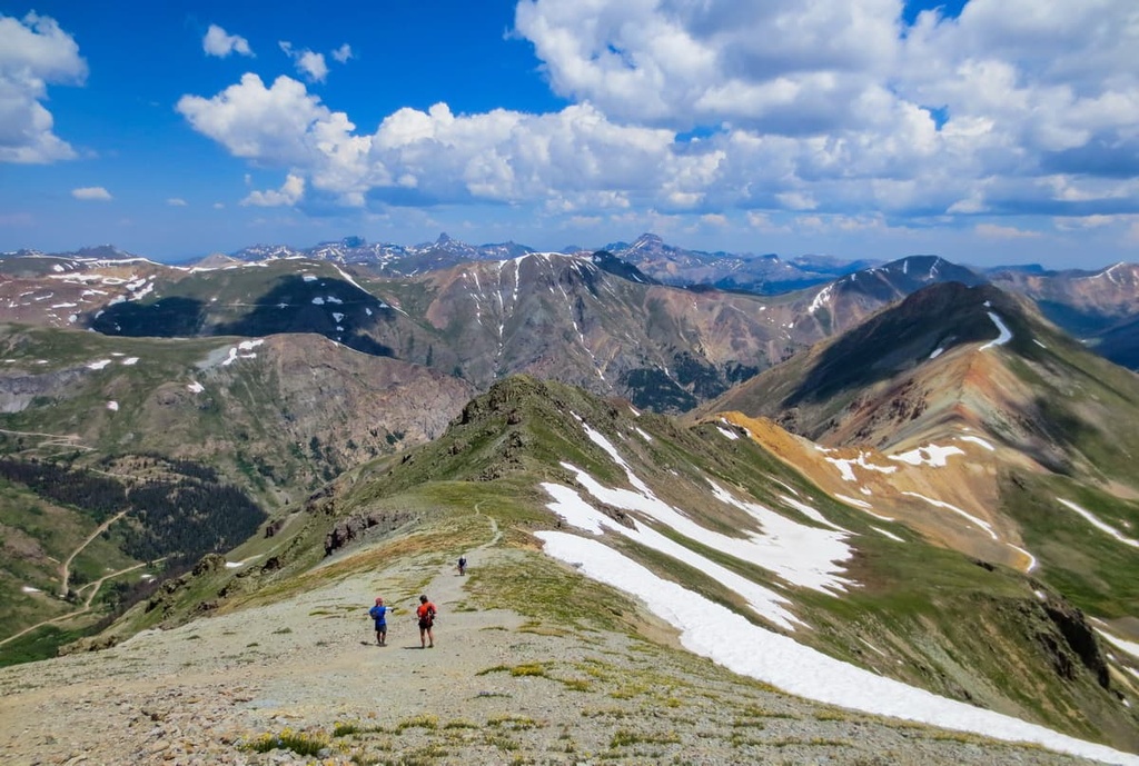
Lower elevations in the wilderness study area are marked by steep forested hillsides and river canyons. As elevations increase in the area, the tree coverage quickly thins, and it eventually gives way to a vast alpine tundra. Here, the landscape is marked by glacial cirques, a diverse array of vegetation, rugged rock formations, and sweeping vistas.
The Lake Fork Creek headwaters are located in the wilderness study area, too. In fact, Lake Fork Creek travels through the region before joining the Lake Fork Gunnison River. Meanwhile, the western boundary of the wilderness study area is marked by the Animas River. Other notable creeks in the wilderness study area include Snare Creek, Cinnamon Creek, Mill Gulch, and Cottonwood Creek.
The wilderness study area is known for its breathtaking alpine terrain, lakes, and canyons. There are twelve peaks in the wilderness study area that tower above 13,000 feet (3,962 m) in elevation, too.
The Handies Peak WSA is part of the Gunnison Field Office and is surrounded by other protected areas.
In particular, the Gunnison National Forest and Tres Rios Field Office are both situated to the south of the WSA along with the Weminuche Wilderness Area. Additionally, the Redcloud Peak Wilderness Study Area lies to the east of the Handies Peak WSA while the Uncompahgre Wilderness Area and Uncompahgre National Forest extend to the west and north.
The peaks within the Handies Peak WSA are part of the San Juan Mountains. The San Juan Mountains are a subrange of the Southern Rocky Mountains that cover the bulk of southwestern Colorado.
Many of the rock formations within the wilderness study area date back to the Precambrian. Rocks of this age are often found at the core of the region’s peaks while the outer layers of rock in the area tend to be much younger and they often date back to the Cenozoic era.
The Southern Rocky Mountains, a subrange of the larger Rocky Mountains, were created by the collision of tectonic plates. The collision created faults, and it resulted in the thrusting and folding of the Earth’s crust, which ultimately led to widespread volcanic activity.
The San Juan Mountains extend far beyond the boundaries of the wilderness study area, and they span much of southwestern Colorado. Plutons can be found throughout the range, too.
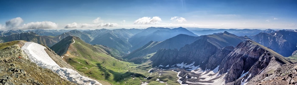
A vast majority of the San Juan Mountains were heavily glaciated during the last glacial maximum. As the glaciers retreated, rugged ridgelines, valleys, and glacial cirques were left behind.
The San Juan Mountains are also known for being rich in minerals, especially silver and gold. These vast mineral deposits eventually led thousands of prospectors to the area during the Colorado gold rush.
Major peaks that are located within the Handies Peak WSA include Handies Peak, Niagara Peak, Whitecross Mountain, Jones Mountain, American Peak, and Crown Mountain.
The flora and fauna found within the wilderness study area are similar to the plants and animals that are found throughout southwestern Colorado. In particular, the lower elevations of the Handies Peak Wilderness Study Area are densely forested while the region’s higher elevations typically showcase an incredible alpine tundra.
Hikers can find subalpine fir, aspen, and Engelmann spruce in the foothills of the region’s peaks, along with smaller patches of meadows. At higher elevations, the landscape transitions into alpine terrain.
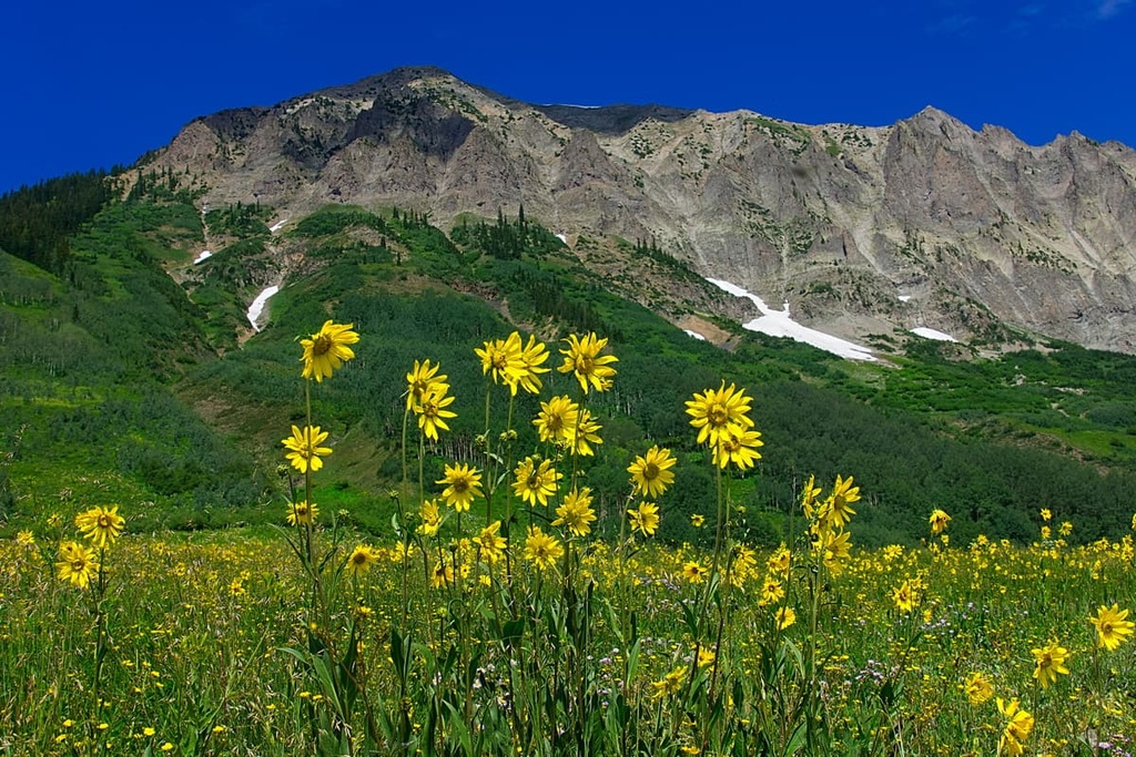
A majority of the wilderness study area is marked by alpine meadows that are filled with grasses, forbs, sedges, wildflowers, and thickets of willow trees. Hikers can often spot wildflowers during the early summer months in the WSA once the snow has melted.
Large populations of deer and elk inhabit the wilderness study area, too, though they often migrate to higher elevations during the summer. Other mammals that you might see in the region include bighorn sheep, black bears, bobcats, mountain lions, and coyotes.
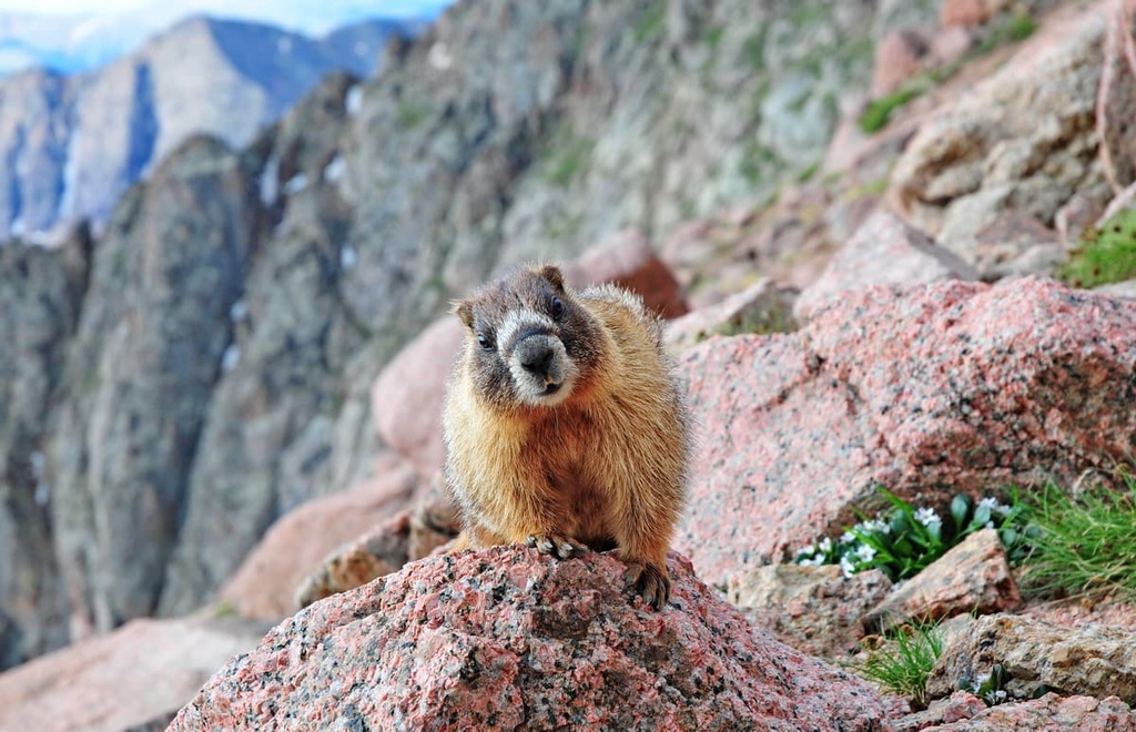
Furthermore, the WSA’s rocky scree fields provide an ideal habitat for marmots and pikas. The surrounding rivers and streams in the area are also home to cutthroat trout.
The land in and around the Handies Peak WSA has been home to humans for thousands of years. More specifically, the WSA is located on the ancestral homelands of the Ute.
Traditionally, the Ute would migrate from place to place with the changing of the seasons. They would often spend the winter months at lower elevations in the region and the summers at higher elevations, tracking the animals they hunted.
This seasonal migration created a vast network of trails that stretched across the San Juan Mountains. These trails would later be used by the Spanish and American settlers who explored the region.
In the early eighteenth century, Spanish conquistadors arrived in the region in search of silver and gold. In the 1820s, settlers of European descent started to arrive throughout present-day Colorado. Many of these settlers were fur trappers who were drawn to the region by the prospect of making it rich in the fur industry.
Kit Carson, a trapper and trader, was among the many American settlers who traveled to the region during the nineteenth century. He believed that the surrounding mountains were rich in gold, which encouraged others to follow in his footsteps. The Charles Baker Expedition in 1860 finally found gold in the San Juan Mountains. This discovery ultimately led to the start of the Colorado gold rush.
This rapid population growth led to numerous disputes between the Indigenous people who had been living in the region for millennia and the new settlers. A majority of the settlers disregarded the Ute’s claim to their ancestral homelands, an opinion that was often backed by the US government.
The Brunot Agreement was negotiated between the two groups in 1873 and was supposed to provide the Ute with 3.5 million acres (1.4 million ha) of land in the San Juan Mountains. The agreement was also supposed to provide the Ute with hunting and gathering access to the region in perpetuity.
Despite the agreement, however, the settlers in the region continued to attack, displace, and murder the Indigenous people who lived in the area, and they eventually forced the Indigenous people who remained in the region onto reservations. Nowadays, many descendants of the Ute with ancestral ties to the region are members of the Southern Ute Indian Tribe.
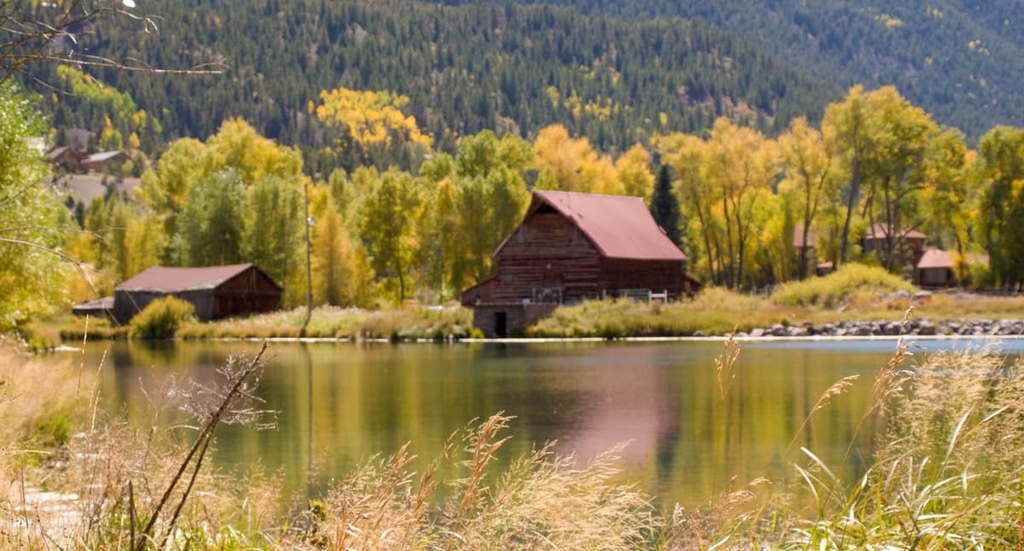
Furthermore, during the Colorado gold rush, numerous towns and settlements were created throughout the San Juan Mountains. While some of these settlements were eventually abandoned and became ghost towns, many transformed into mountain towns that are now centered around outdoor recreation.
In more recent decades, much of southwestern Colorado has also been acquired by the US government and turned into public land. For example, the Gunnison National Forest, which lies to the south, was established in 1905 along with a number of other national forests in the region. The Handies Peak WSA was designated many decades later in 1980.
The Handies Peak WSA is home to a few different hiking trails. Here are some of the most popular hiking areas in the wilderness study area to check out during your next trip to the region.
At 14,055 feet (4,284 m) in elevation, Handies Peak is the focal point of the entire wilderness study area. There are multiple routes that lead to the summit of this peak:
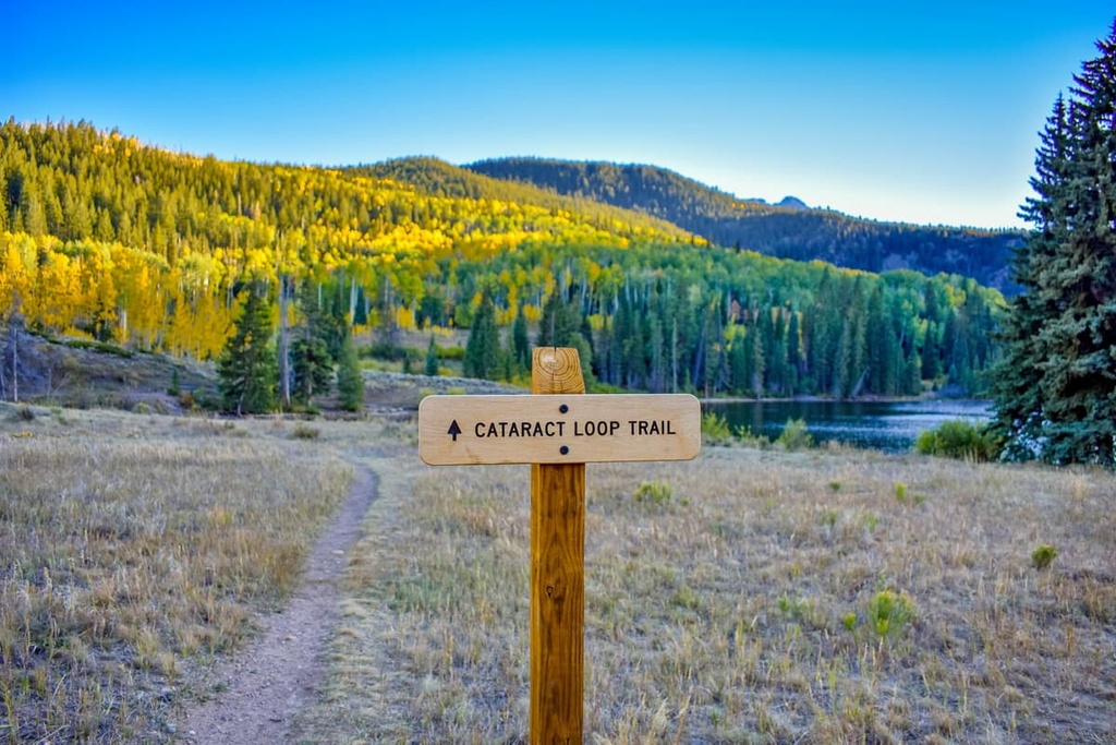
The Cataract Lake Trail takes hikers through a range of different types of terrain within the wilderness study area. This trail begins at Cottonwood Creek and follows along the banks of Cataract Gulch. After climbing through some forested hillsides and crossing multiple creeks, the trail eventually opens to views of alpine meadows.
The trail slowly flattens out as you get near Cataract Lake and it also passes by numerous other small alpine lakes. This out-and-back trail is 8.6 miles (13.8 km) in length and it has 2,742 feet (836 m) of elevation gain.
The American Basin Trail is a relatively gentle hike that encompasses the first portion of the Handies Peak Trail.
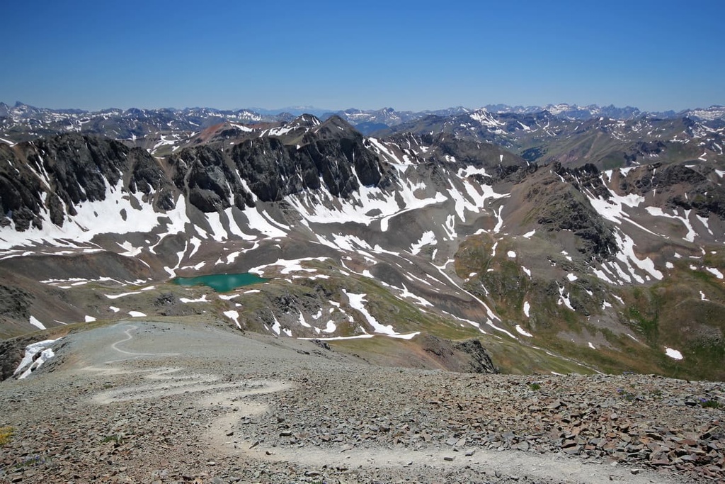
Hikers on this trail can get an opportunity to experience the mountain’s exquisite alpine terrain and its excellent views of Sloan Lake without having to climb to the summit of Handies Peak. This out-and-back trail is 2.1 miles (3.4 km) in length and it has 879 feet (268 m) of elevation gain.
Looking for a place to stay near the Handies Peak WSA? Here are some of the best cities and villages to check out in the region.
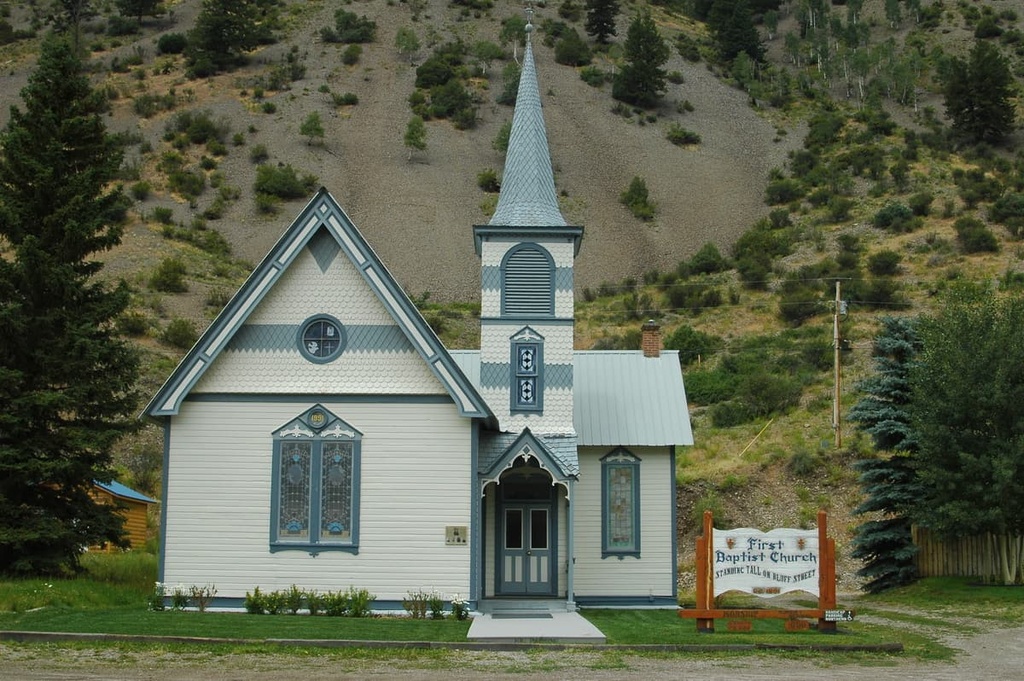
Lake City lies just to the northeast of the Handies Peak WSA. Situated along the Lake Fork Gunnison River, the town lies just to the north of Lake San Cristobal. Lake City was originally established during the Colorado gold rush and it is home to around 400 residents.
This quaint town is surrounded by the San Juan Mountains, and it provides locals and visitors alike with opportunities for year-round outdoor recreation. During the winter months, activities that visitors can enjoy in the area include skiing at the Lake City Ski Hill (which boasts four ski runs), ice skating on the frozen Lake San Cristobal, or exploring the town’s many groomed cross-country skiing trails.
The summer months in Lake City see the town transform into a hub for hiking, camping, fishing, trail running, and mountain biking. Despite the plethora of activities that are available in the area, Lake City is known for being one of the most remote towns in the continental United States.
The town of Telluride lies to the west of the Handies Peak WSA near the Uncompahgre National Forest. Originally established as a mining town, Telluride is now a bustling mountain town that sits in a large box canyon along the San Miguel River.
Within the city also lies the Telluride Ski Resort, which is the main attraction of the region. Amidst the hills of the resort lies Mountain Village, an upscale area that’s popular among tourists. Around 2,600 residents live in Telluride, too, and you can find plenty of local shops and cafés along the community’s downtown streets.
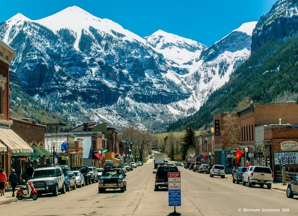
During the summer months, the town of Telluride becomes a haven for mountain biking, hiking, and trail running. Since it is surrounded by national forests, the Telluride region is full of seemingly endless trails for hiking and sightseeing.


