Scan the QR code and open PeakVisor on your phone
Mountain Lake Wilderness encompasses 16,525 acres (6,687 ha) along the border of Virginia and West Virginia in the United States. It lies within Jefferson National Forest and a section of the Appalachian Trail runs through it. There are 10 named mountains in the wilderness. The highest and most prominent is Stony Creek Lookout Tower at 4,127 ft (1,258 m) tall with a prominence of 427 ft (130 m).
Established in 1984, Mountain Lake Wilderness saw significant expansions in 2009 to reach its current size of 16,525 acres (6,687 ha). Lying on state borders, 13,804 acres (5,586 ha) are in Virginia and 2,721 acres (1,101 ha) are in West Virginia. It is part of Craig and Giles Counties in Virginia, and Monroe County in West Virginia. The wilderness is part of the Jefferson National Forest within the Eastern Divide district.
Mountain Lake, which lies just beyond the wilderness boundary, is the only natural lake in western Virginia. The wilderness itself is primarily a highland plateau that sits directly on the Eastern Continental Divide. Elevations run between 2,200 ft (670 m) to over 4,100 ft (1,250 m) along the Appalachian Ridges. The wilderness contains 21 mi (34 km) of trails, including about 5 mi (8 km) of the Appalachian National Scenic Trail.
Situated on the Eastern Continental Divide, streams and waterways diverge from the wilderness, some flowing towards the Chesapeake Bay and others to the Gulf of Mexico. War Spur Branch, Saltpeter Branch, Bee Branch and several other streams and tributaries flow east into Johns Creek that flows into the James River and ultimately to the Chesapeake Bay. On the west side, the White Rocks Branch feeds into Stoney Creek which in turn flows into the Gulf of Mexico via New River.
The tallest peaks in the wilderness are Stony Creek Lookout Tower (4,127 ft/1,258 m), Wind Rock (4,124 ft/1,257 m), Lone Pine Peak (4,045 ft/1,233 m), Salt Pond Mountain (4,042 ft/1,232 m), and White Rocks (3,957 ft/1,206 m).
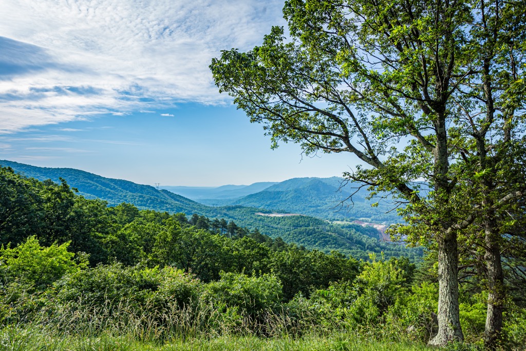
Mountains in the wilderness are part of the Appalachian Ridges in the Blue Ridge Province, in close proximity to the Valley and Ridge Province.
The Blue Ridge Province stretches from Pennsylvania to Georgia. It is composed of deformed metamorphic rocks from the Precambrian era, such as schists, gneisses, slates, and quartzites with numerous igneous intrusions throughout. This geologic province is divided from the neighboring Valley and Ridge Province by thrust faults in the younger sedimentary rocks.
The Blue Ridge Province is as narrow as 12 mi (20 km) at some points and up to 70 mi (113 km) wide as it reaches further south. Shenandoah National Park and Great Smoky Mountain National Park are both part of this province. Feldspar and, historically, copper, have been mined from mountains in the Blue Ridge Province.
The nearby Valley and Ridge Province contains synclines and anticlines made up of early Paleozoic sedimentary rocks. Limestones and shales predominate in the valleys while sandstones and conglomerates, less susceptible to erosion, compose the ridges.
This province formed from compression during the formation of the supercontinent Pangea and subsequent orogenies that uplifted the Appalachian Mountains. Natural resources found in the region include coal, iron, and zinc. In some limestone beds, karst topography has carved out cave systems.
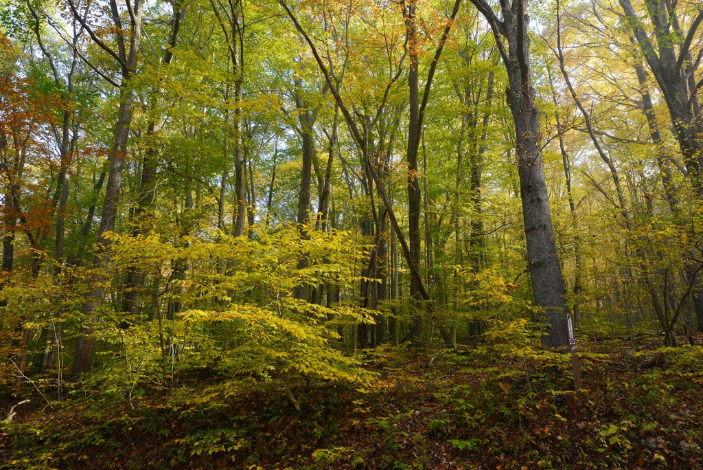
Forests within Mountain Lake Wilderness fall within the Eastern Deciduous Forest Province and are typical Appalachian hardwood forests. Along drier ridgelines, oak, hickory, and pine dominate. In wetter areas, such as the high elevation wetlands on the summit of Salt Pond Mountain, red spruce, yellow birch, and northern red oak thrive.
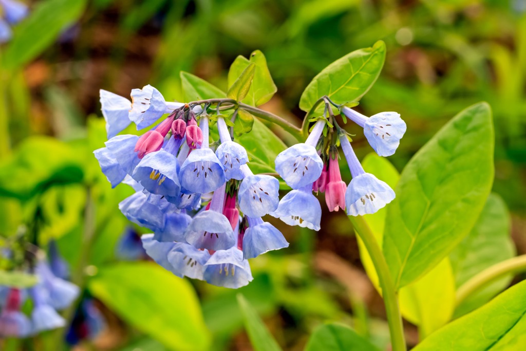
There are a few stands of virgin spruce and hemlock tucked throughout the wilderness. In total, there are more than 40 tree species and over 2,000 species of shrubs and herbaceous plants.
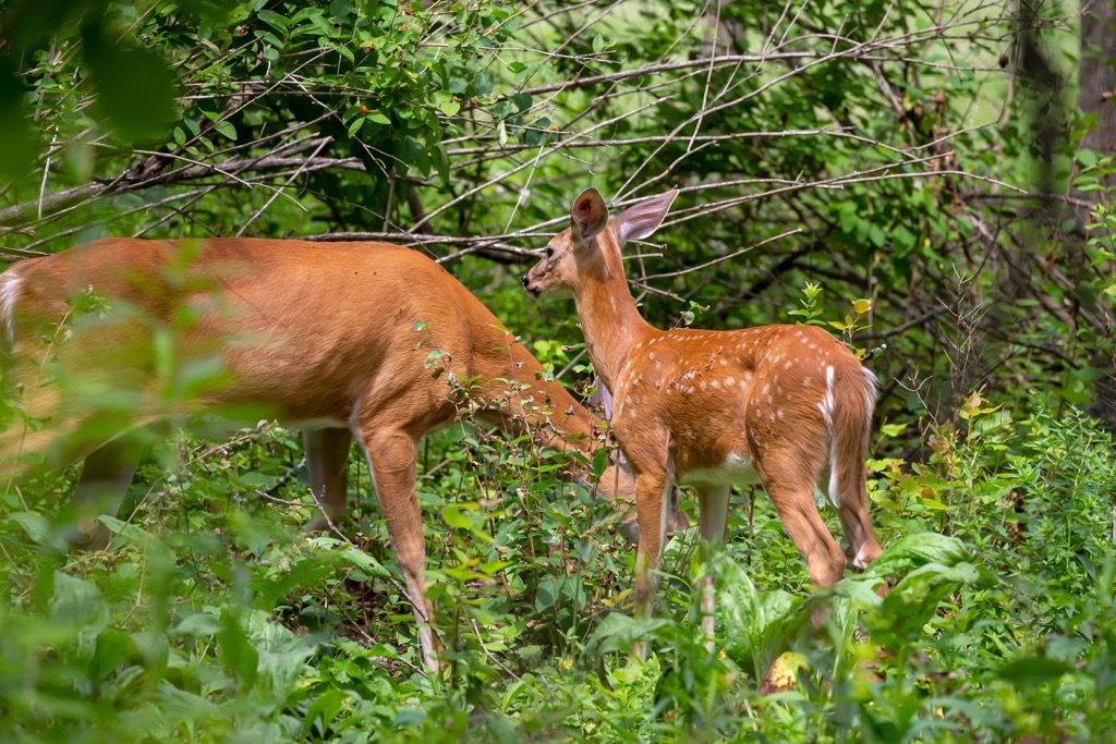
The George Washington and Jefferson National Forests provide habitat for around 200 species of birds and around 55 mammal species. Mammal species range from the standard white tailed deer, coyotes, rabbits, foxes, bats, and black bears, to rarer species like the water shrews and rock voles.
Prior to becoming protected, the region suffered from intensive mining and lumber extraction, as well as the chestnut blight, a fungus that wiped out nearly all chestnut trees in the early 1900s. Chestnut trees at the time accounted for up to 70% of trees in some stands and the nuts were widely consumed by humans and wildlife.
The land that is now the George Washington and Jefferson National Forests is the ancestral land of the Monacan, Cherokee, and Shawnee. The first European settlers to the region were Scotch-Irish and German.
Settlers quickly set their sights on mining and lumber in the region. With no regulations in place, rapid extraction of natural resources led to deforestation, extreme erosion, and subsequently, waterways clogged with silt and increased flooding events.
In 1891, the Forest Reserve Act passed. As the precursor to the National Forest System, this was an important first step in protecting degraded lands from further damage. In 1911, the Weeks Act allowed the government to buy mountain land in order to manage watersheds.
The wilderness was initially established in 1984, with acreage being added over the following decades.
Mountain Lake Wilderness has 21 mi (34 km) of trails including about 5 mi (8 km) of the Appalachian Trail. Primitive camping is allowed within the wilderness.
The Appalachian Trail to Kelly Knob is a 4.8 mi (7.7 km) out and back trail that ascends 945 ft (288 m). The first section of the trail is steep but then levels out and becomes easier. This trail is rated as moderate and has good tree cover. Pay attention to trail markers as moss on trees can partially obscure markers and fallen leaves may cover the path.
This trail combination begins along the 1.7 mi (2.7 km) War Spur Loop Trail, joins the 1.2 mi (1.9 km) War Branch Trail, and carries on to intersect with the Appalachian Trail. At the junction with the Appalachian Trail, turn left and continue on for 3.6 mi (5.8 km) to reach the Wind Rock Overlook. The first two branches of this route are considered easy but scenic.
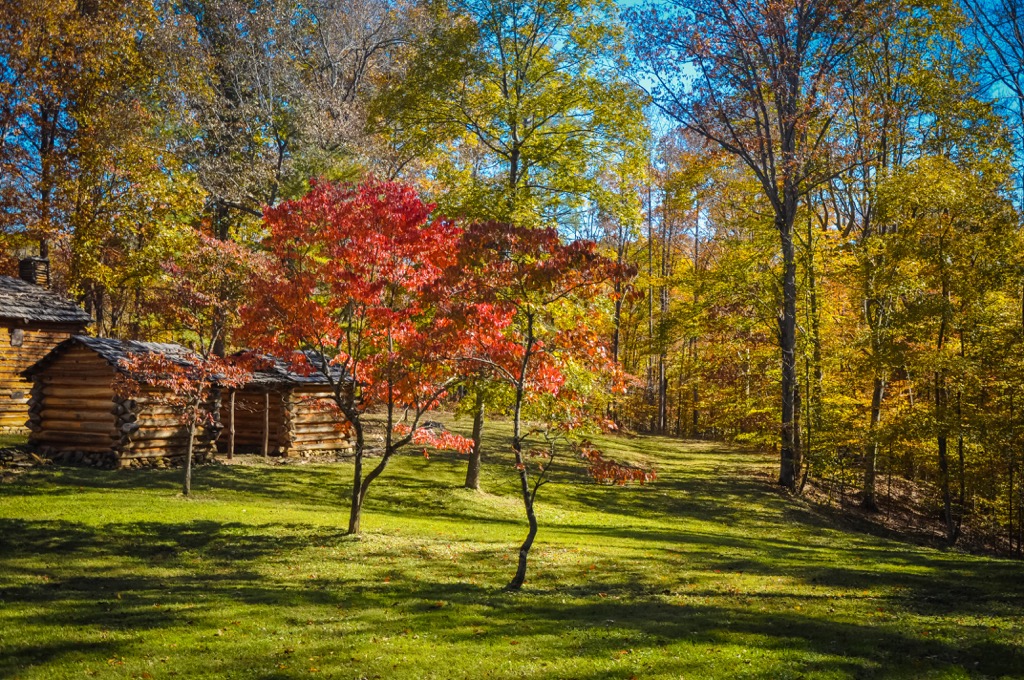
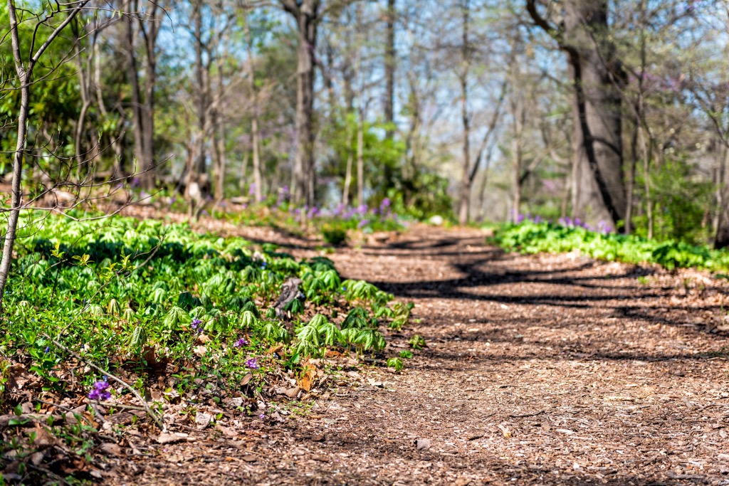
Each season offers a new experience as wildflowers, rhododendrons, and flame azaleas bloom in the spring and bright foliage and ferns are on display in the fall. There are also great views of the wilderness, Johns Creek Mountain, and the surrounding valley.
Most hikers prefer to take the War Spur Loop counter-clockwise. It is possible to also do only one or two legs of this combined trail for a shorter hike.
In addition to primitive camping in the wilderness, there are established campgrounds in the surrounding George Washington and Jefferson National Forests. The wilderness can be accessed within a few hours from cities in Virginia and West Virginia.
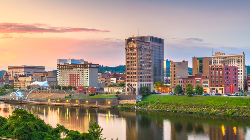
A little over an hour’s drive away, Roanoke is surrounded by the beauty of the Blue Ridge Mountains. It is a great base point to explore the mountains on foot or by bike, to cruise along the Blue Ridge Parkway, or to paddle in nearby waterways. One classic attraction is the Roanoke Star, perched atop Mill Mountain and illuminated every night.
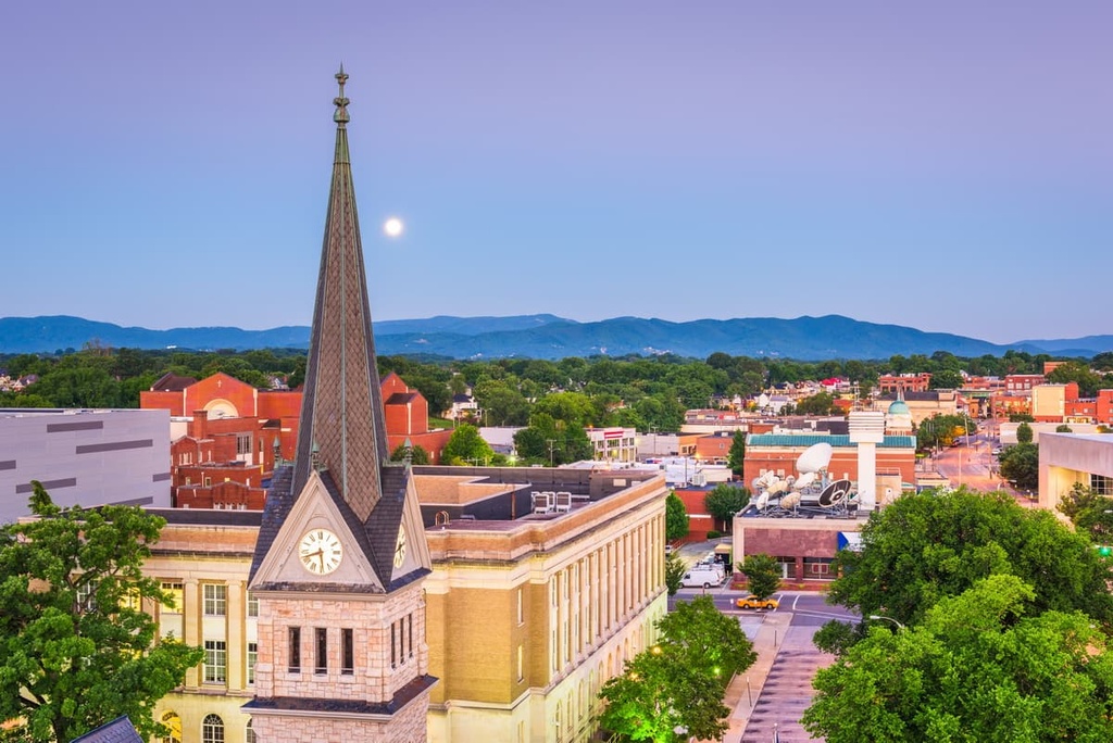
This city with a population of 100,000 has a good dining scene. Farmers markets highlight the rich productivity of the region and it's easy to find something to eat whether it's a quick bite from a food truck, a farm-to-table restaurant, Indian food, or homemade bread fresh from a bakery. There is a wide range of lodging options available including hotels, resorts, cabins, and campsites.
It’s a four hour drive to Richmond, Virginia’s capital with a population of 230,000 people. The city offers quick outdoor access to prime rock climbing, hiking, and mountain biking spots. Bikers can follow the 52 mi (84 km) Virginia Capital Trail and paddlers can enjoy the Class III and IV rapids on the James River.
The city has a big art scene with numerous galleries, as well as the Virginia Museum of Fine Art and the Institute for Contemporary Art. This city also speaks to a foodie’s heart with everything from soul food to locally sourced fish and produce to Mediterranean to fine French dining. There is a wide selection of accommodations available throughout the city and located conveniently near the airport.

Charleston, West Virginia, population 47,000, is a two hour drive from the wilderness. The city lies close to miles of trails in Kanawha State Forest and opportunities to kayak, boat, and fish in the Coal and Elk Rivers.
In addition to standard American fare with breweries, pubs, bistros, and cafes, the small city also has diverse cuisines like Filipino, Thai, Japanese, and Jamaican. Lodging options included inns, hotels, rental cabins, RV parks, and campsites.