
Scan the QR code and open PeakVisor on your phone
Guanshan Major Wildlife Habitat has 87 named peaks. The highest is Guan Shan at 3,668 m. Other notable peaks include Xiangyang Shan, Sancha Shan and Xiangyangshanbeifeng.
Guanshan Major Wildlife Habitat (關山野生動物重要棲息環境) is a protected area in eastern Taiwan. It partially overlaps the southernmost section of Yushan National Park (玉山國家公園). The reserve includes part of Central Mountain Range (中央山脈) and it contains 87 named peaks. The highest and most prominent peak in the reserve is Guanshan (關山) at 3,668 metres (12,034 ft) in elevation.
Covering an area of 69,077 ha (170,693 ac), Guanshan Major Wildlife Habitat is eastern Taiwan’s largest protected wildlife habitat. The vast region encompasses parts of Zhuoxi Township (卓溪鄉) in Hualien County (花蓮縣) and Haiduan (海端鄉) and Yanping (延平鄉) townships in Taitung County (臺東縣).
The rugged peaks of the Central Mountain Range stand tall and mighty in the Guanshan Major Wildlife Habitat. The region is home to 10 of Taiwan’s 100 peaks, which are also referred to as Baiyue. The Baiyue of Guanshan Major Wildlife Habitat are:
Guanshan Major Wildlife Habitat has a chilly average annual temperature of 50°F (10°C) as the region encompasses a corridor of high mountains. The yearly average rainfall in the reserve is about ] 2,800 mm (110 in). This is partly due to the onslaught of the northeast monsoon and the summer typhoons, which carry heavy torrential rain to eastern Taiwan.
The Southern Cross-Island Highway, also known as the Nanheng Highway, dissects the wildlife habitat in two parts. The elevation in the reserve varies from as low as 200 metres (656 ft) to 3,668 metres (12,034 ft).
Located to the north of Guanshan Major Wildlife Habitat is Yushan National Park. Meanwhile, to the south of the reserve is the Shuanggui Lake Major Wildlife Habitat (雙鬼湖野生動物重要棲息環境). Finally, Dulan Forest (都蘭林場) is located to the east and Alishan National Forest Recreation Area (阿里山國家森林遊樂區) is situated to the northwest.
Guanshan Major Wildlife Habitat includes the central portion of the Central Mountain Range, which runs from Yilan County (宜蘭縣) in the north, instead of from New Taipei City (新北市).
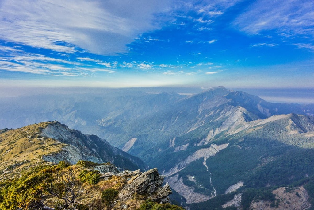
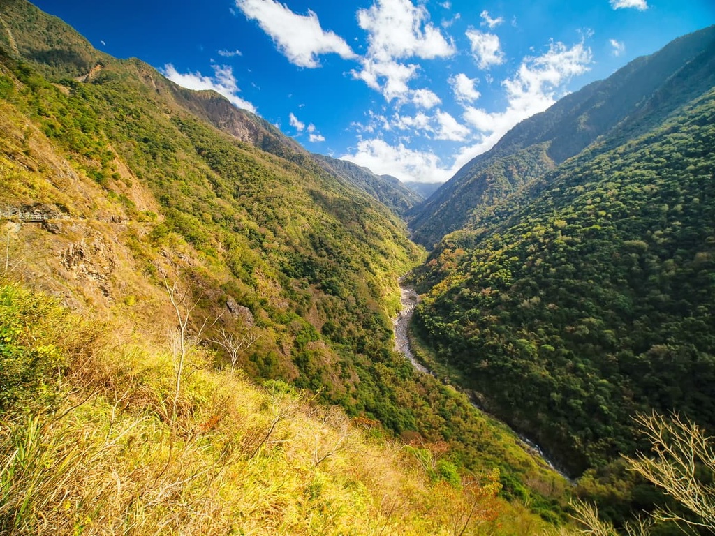
The mountains of Guanshan Major Wildlife Habitat consist of metamorphic rock from the Eocene epoch. These rocks are typically fragile and unstable. Thus, the reserve is home to the Xianyang Collapse, a 10 km (6 mi) stretch of crumbling rock and sheer cliffs that extends from Guanshan to Xiangyang Shan.
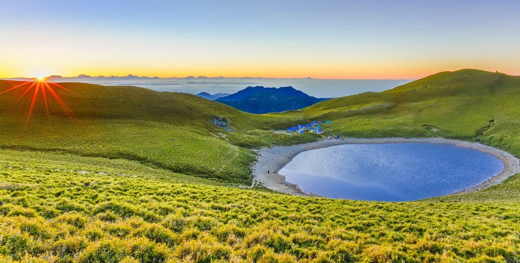
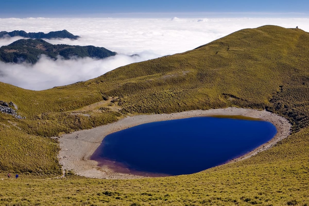
The second highest lake in Taiwan, Jiaming Lake (嘉明湖), is situated at 3,310 metres (10,860 ft) in elevation on the southeast slope of Sancha Shan in the reserve. Jiaming Lake is believed to have formed as a result of meteor impacts some 100,000 years ago.
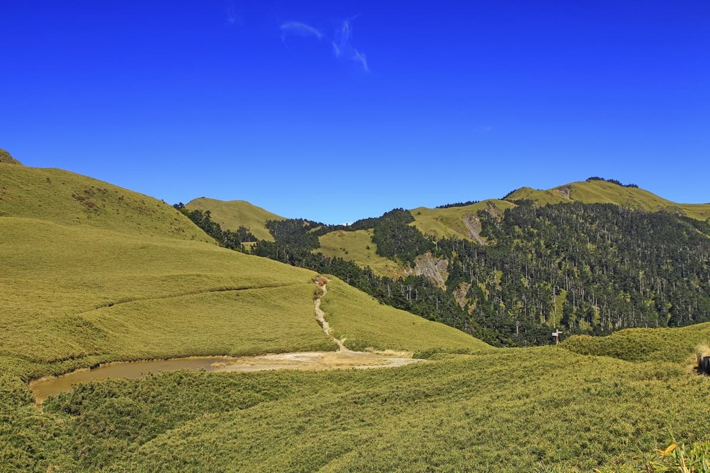
Five distinct ecozones are present in the Guanshan Major Wildlife Habitat's environment. This includes grasslands, bush, conifers, hardwoods, and a mix of conifer and hardwood forests.
In the highest elevation zone of 3,600 metres (11,811 ft) and above lies the sub-cold zone of hardy Yushan cane and Pseudosasa japonica bamboo. Alpine flowers like Yushan rhododendron and Yushan azaleas can also be seen on the reserve’s highest peaks.
Just below the sub-cold zone, in the subalpine zone, there is a dense evergreen coniferous forest of Taiwan fir and Yushan juniper.
In the elevation below that, between 2,000 to 3,000 metres (6,562 to 9,843 ft), lies a mixture of pine and broad-leaved trees. Here, plant species, such as Taiwan spruce, Taiwan hemlock, Mori oak, and bird-lime tree thrive.
A temperate warm forest belt exists between 1,000 to 2,000 metres (3,281 to 6,562 ft) where a mixture of pine and Lauraceae plants dominate the landscape. Taiwan red cypress and Schima superba are abundant in this zone.
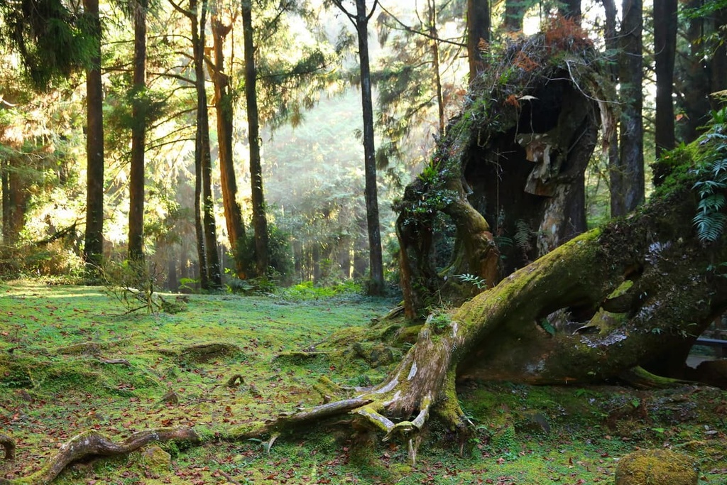
Finally, a temperate rainforest is present in elevations lower than 1,000 metres (3,281 ft). The vegetation here includes Lauraceae, Fagaceae, and Theaceae plants. The forests at these lower elevations are also home to 737 species of vascular plants.
In terms of wildlife, 29 mammals, such as the endangered Formosan black bear, roam the high mountains of the Guanshan Major Wildlife Habitat. Hodgon's hawk eagle, Mikhado's pheasant, and Swinhoe's pheasant, are just 3 of the 65 bird species found in the wildlife habitat.
Additionally, the hundred pace viper is 1 of the 29 species of reptiles and amphibians that are present in the Guanshan Major Wildlife Habitat.
The land that is now part of the Guanshan Major Wildlife Habitat is part of the traditional territory of the Bunun people. Like the Atayal, the Bunun traditionally live in some of the most mountainous regions of Taiwan, particularly in villages that are at elevations between 1,000 to 1,500 metres (3,281 to 4,921 ft).
However, during the Japanese Occupation Era, many Japanese forestry officials took an interest in the cypress-filled forests in what is now Guanshan Major Wildlife Habitat. As a result, in 1930, the Bunun were forced to leave their homelands. They were then forced to live along roads that were regularly patrolled by Japanese officials.
Guanshan Yueling Ancient Road is just one of these many roads that happens to cross through the Guanshan Major Wildlife Habitat. Once a 170 km (105 mi) road linking Kaohsiung City (高雄市) to Taitung County, most of this thoroughfare was transformed into a highway after the end of the Japanese Occupation Era.
However, only 3.5 km (2 mi) of the ancient road exists to this day. Nowadays, the road showcases some important cultural artefacts, such as kilns that were used to keep warm during the winter months.
A variety of mountains, historic roads, forest areas, and hot springs entice visitors to the scenic land of Guanshan Major Wildlife Habitat. Here are some of the best hikes to check out in the region:
As its name suggests, this trail summits four Baiyue that are located close to the Southern Cross-Island Highway, which divides the wildlife habitat into two zones.
While Kuhanuoxin Shan (庫哈諾辛山) technically falls outside of the wildlife habitat, the remaining Baiyue of Guanshan, Taguan Shan, and Guanshanling Shan are wholly located within the reserve.
This hike begins at the trailhead to Kuhanuoxin Shan at Jingqiao Mountain Pass. Kuhanuoxin Shan is renowned for its steep gradient and, indeed, it is the steepest mountain out of the four Baiyue on this trek.
As hikers pass the 2,000-metre (6,562 ft) elevation point on this trek, dense woodlands of Taiwan hemlock shelter the path. As the elevation increases, a thicket of Taiwan fir awaits.
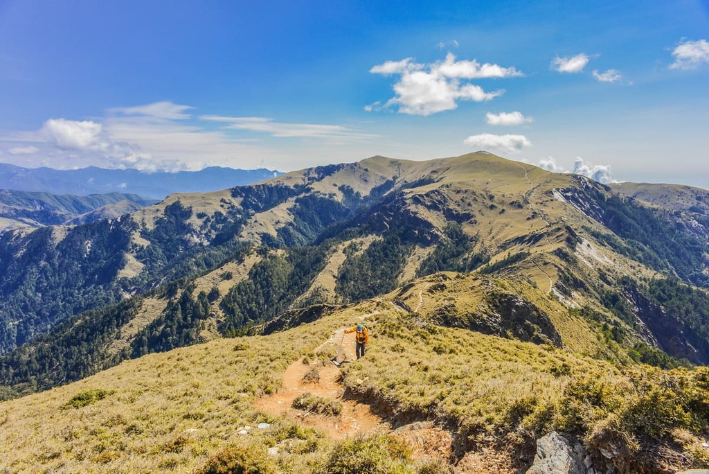
In the clearings of this trail between 2,000 to 3,000 metres (6,562 to 9,843 ft), one can see the broken cliffs of Xiangyang Shan, which is also known as the Xiangyang Collapse. The views from Kuhanuoxin Shan are sublime, as Yushan (玉山) stands tall in the north and a clear view of Guanshan awaits to the south.
From here, hikers proceed towards Kuhanuoxin Mountain House, an overnight camp. The following day, hikers will head toward the peak of Guanshan. However, note that a thin and icy veil of morning mist often descends on the mountain, draping its hazy blanket along the trail.
While Kuhanuoxin Shan is the steepest climb on this trek, the trail to Guanshan is the most chilling, as hikers must traverse a rocky, narrow ridgeline of Guanshan. In the afternoon, thick clouds tend to descend on the mountain, obstructing the otherwise expansive views.

Hikers then revisit Kuhanuoxin Mountain House to rest for the night, after which they will proceed to Taguan Shan. This mammoth journey involves a 16.2 km (10 mi) trek on the third hiking day.
It is a 14 km (8.6 mi) trip from Kuhanuoxin Mountain House to reach the trailhead for Taguan Shan, which is situated on the Southern Cross-Island Highway. It’s also a further 2.2 km (1.3 mi) climb to reach the summit.
Taguan Shan features a cypress woodland of towering trees. After enjoying the cool respite of the remote forest, grasslands of Pseudosasa japonica bamboo signal to hikers that the summit is nearby.
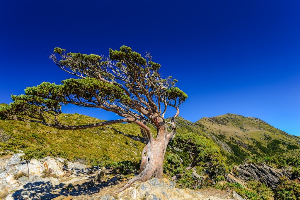
Here, Guanshan Beifeng (關山北峰) and the nearby Yingzizui Shan (鷹仔嘴山) are in full view. A tall and ancient 1,000-year-old cypress tree also awaits hikers on the descent from Taguan Shan.
On the fourth and final day of this trek, hikers set off for the final Baiyue of Guanshanling Shan. The trailhead is situated on the Southern Cross-Island Highway. After the previous day’s lengthy journey, the 1.5 km (0.9 mi) climb to Guanshanling Shan is a most welcoming treat.
As hikers ascend the trail, a canopy of Taiwan hemlock shrouds the route. The striking white bark of the Yushan juniper tree with its distorted and crooked branches creates a spooky, stirring atmosphere.
Unruly pastures of Pseudosasa japonica bamboo once again indicate your proximity to the summit. Hikers can reflect on their journey by viewing the previous Baiyue of Kuhanuoxin Shan, Guanshan, and Taguan Shan.
The path to Jiaming Lake forms part of the South Second Section Hiking Trail. Though it is known for being one of the most intense and challenging trails in the region, the 13 km (8 mi) route to Jiaming Lake is just a fraction of the longer 89 km (55 mi) South Second Section Hiking Trail.
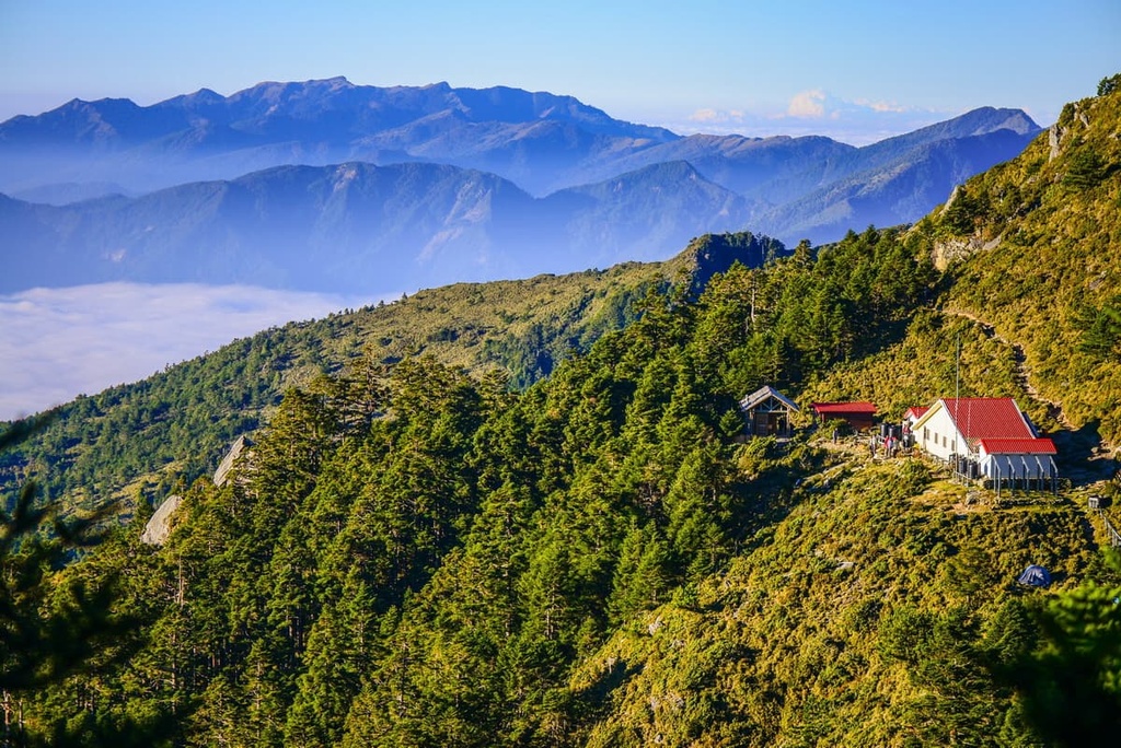
Starting from Xiangyang Shan Climbing Pass, hikers on this trail must first ascend the hill to Xiangyang Mountain House. As the path is steep, hikers will likely need numerous breaks to catch their breath and to mentally prepare themselves to tackle the trail ahead.
Once hikers have regained their composure at Xiangyang Mountain House, they can proceed toward the Xiangyang Famous Tree, which is also known as Bai Mulin.
Here, a woodland of pallid white trees creates an ethereal presence of dead Taiwan fir, hemlock and Yushan juniper. Although these were once healthy trees, forest fires stripped them of life, transforming them into an ashy white shell of their original selves.
While the trees have changed, it is relatively easy to recognise the tree species. Taiwan fir has the longest and straightest trunk of all the trees in the forest, while Taiwan spruce has countless twigs that extend out from its plentiful branches. The typically white Yushan juniper is also easy to identify, thanks to its contorted form.
After reaching this unique woodland, hikers then progress towards Jiaming Lake Mountain House, a climb that takes you up to about 3,380 metres (11,089 ft). Along the way, feathery clouds typically perch themselves on the hills, sweeping their soft tendrils on the high mountain foliage.
The following morning, hikers set off toward the undulating alpine grasslands of Sancha Shan. Known for its excellent views, from here, hikers can see the peaks of Xiangyang Shan, Xinkang Shan, Xiuguluan Shan (秀姑巒山, Yunfeng Shan (雲峰山), and Yushan.
Located on the southeast slope of Sancha Shan is the shining sapphire alpine Jiaming Lake. The water's still surface mirrors the glorious sunny skies and shines like a pearl embedded in the tufted grassland. While hikers soak in the serene landscape of Jiaming Lake, they can spot Taiwan sambar deer roaming in the alpine meadows.
Along the way, alpine flowers add a touch of elegance to the scenery as Yushan azaleas, Taiwan lily, Yushan rhododendron, and Alishan gentian bloom in the spring and summer months. While winter brings bitterly cold and freezing weather, the crunchy snow set against the still waters of Jiaming Lake creates an otherworldly frosted utopia.
Reserved for the most skilled and experienced hikers, this goliath trek of 89 km (55 mi) summits nine Baiyue in an S-shaped path from north to south. While all the peaks fall within Yushan National Park's boundaries, only the two last mountains are situated within the Guanshan Major Wildlife Habitat. However, due to the revered status of this arduous trail, it’s well worth mentioning in this guide.
Hikers can begin this trail either in the north at Dongpu Mountain Pass or at Xiangyang Mountain Pass in the south. Hikers will then spend eight days of the trail walking at elevations of 3,000 metres (9,843 ft) or higher.
The most challenging aspect of traversing the main ridge of the Central Mountain Range is the constant climbing up and down slopes of 1,000 metres (3,281 ft) or more. This repeated pattern of ascent and descent creates tired legs and weary hikers after just a few hours on the trail.
Starting from the north, hikers will climb:
Crossing these nine Baiyue means that the trail is rich in flora and fauna. It features forests of Taiwan cypress, Taiwan spruce, and subalpine woodlands of Taiwan fir, hemlock, and Yushan juniper.
Meadows of Pseudosasa japonica bamboo also dominate the sub-cold zone of the peaks, while silvergrass (Miscanthus sinensis) grows in clusters in the grasslands at lower elevations.
As the Southern Second Section Hiking Trail traverses the remote region of the Central Mountain Range, the night sky is illuminated with constellations of twinkling stars. Hikers are also rewarded with eight mesmerising sunrises and sunsets during this adventure.
The only remains of the Guanshan Yueling Ancient Road that were not converted into a highway is a deserted 3.5 km (2 mi) section of road that’s now known as the Zhongzhiguan Ancient Road.
Starting from Zhongzhiguan, the path climbs steadily up a mountain to reach the pristine lake of Tianchi on the northeast slope of Kuhanuoxin Shan.
Lush forests of Taiwan hemlock adorn the ancient path. This greenery transforms into a crimson deluge of golden dried leaves that crunch on the forest floor during the autumn months.
Here, dampness lingers in the chilly air as the shaded, dense forest traps the warm Taiwan sun from touching the earthen path. The humidity of the sheltered forest encourages moss growth; thus, a velvety sheen of emerald moss hugs the surface of rough trees and smooth rocks.
Situated at the 154 km (95.6 mi) mark on the Southern Cross-Island Highway is the virescent green mountain forest of the Xiangyang Forest Recreation Area (向陽國家森林遊樂區).
Sitting at an elevation of 2,320 metres (7,611 ft), the Xiangyang Forest Recreation Area consists of a temperate forest of coniferous and broad-leaved trees. The mountainous forest covers an area of 362 ha (894 ac). The dominant plant species here are Taiwan red cypress and Taiwan two-leaf pine.
Five trails meander across the elevated forests in the recreation area. While spring and summer bring vitality to the verdant woods, autumn is the best season to visit as deep burgundy contrasts against the bright yellow shades of forest foliage.
As the area is located at a relatively high elevation, the views from the forest are unparalleled. Taiwan’s highest peak, Yushan, is seen in the north with Xiuguluan Shan and Batongguan Shan. The exposed Guanshan cliff is noted in the west, as are Taguan Shan and Xitou Shan (溪頭山). This Recreation Area is closed currently, please check its official website before setting off.
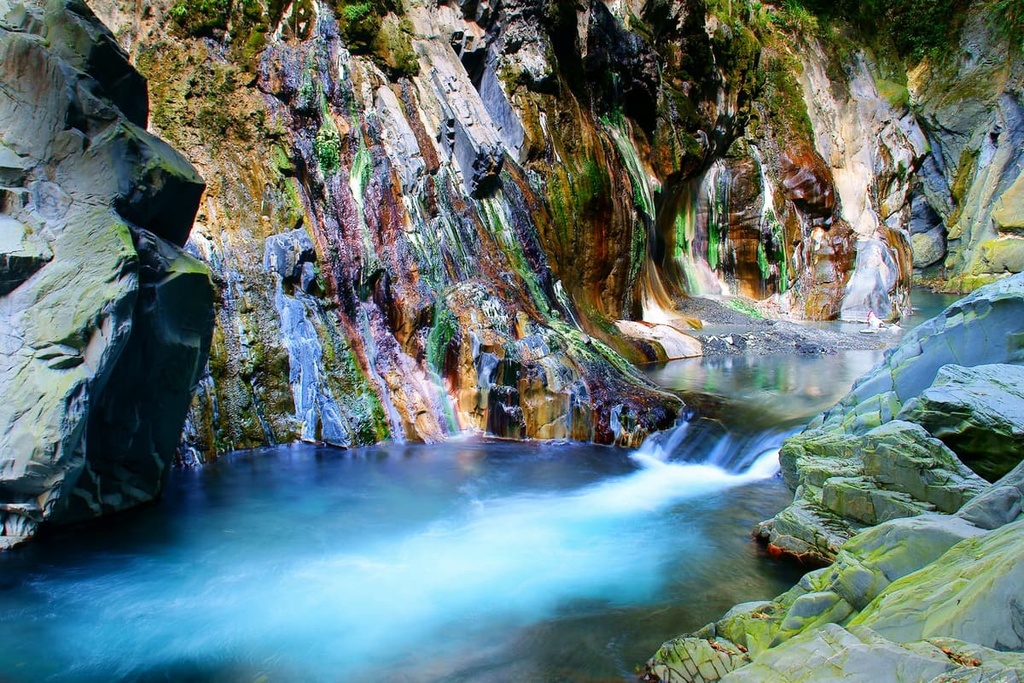
At Lisong Hot Springs, rapids of water gush down the rocky cliffs. Unlike Taiwan’s many other hot springs, Lisong Hot Spring is actually a 30-metre (98 ft) high waterfall. Nevertheless, the weak alkaline carbonate water of the falls is usually between 113 to 149°F (45 to 65°C).
Considered the most beautiful wild hot stream in Taiwan, the thermal waters of Lisong Hot Springs have painted the rock walls behind the falls in striking shades of sapphire turquoise intertwined with pearly whites.
Pockets of jade also feature on the cliffs, thanks to algae growth in the area. Here, the mist from the hot springs rises from the aquamarine water against the beautifully dyed and patterned craggy cliff walls.
The journey to Lisong Hot Springs involves a 3 km (1.8 mi) hike through rugged terrain. Starting from the 168.5 km (104.7 mi) mark on the Southern Cross-Island Highway, the trek takes two hours to reach the well-hidden paradise of Lisong Hot Springs. Visitors should be careful when venturing out on this hike due to the many cliffs and drops along the way.
The east coast of Taiwan is less populated and less visited than the island’s western coast. This is because the Central Mountain Range is a major natural barrier between the two parts of the island, making transport difficult to the more remote eastern shores of Taiwan.
Nevertheless, Hualien (花蓮市) and Taitung (臺東市) are two major cities on Taiwan’s east coast. These two cities make for great starting points into Guanshan Major Wildlife Habitat.

Hualien City evokes a mellow charm, as locals here enjoy a slower-paced life than residents of Taipei (臺北市) or Taichung (臺中市). However, Hualien is a magnet for tourists wishing to venture into Taiwan’s top attraction: Taroko National Park (太魯閣國家公園).
A dreamland of nature, it is no wonder that Taroko National Park is a resonance of breathtaking beauty. Here, swirling marble patterned cliffs jut above the Liwu River’s sparkling tanzanite waters that snake its course into the harsh, rippling terrain of numerous Baiyue.
At the park, a plethora of trails leads visitors across the sheer marble cliffs towards the iconic and dramatic scene of Taroko Gorge. In addition to this, there are many trails for visitors wishing to climb Baiyue that boast panoramic views of the park.
Nanbin Park lies on the shorefront of Hualien City. A firm-favourite amongst locals and visitors, the coastal walks in the park along the esplanade offer incredible ocean views. Furthermore, from the park, one can admire the scenic mountains that encircle the city. Nanbin Beach is also scattered with pebbles and adorned with subtropical pine trees.
Qixingtan Beach is synonymous with Hualien, as the shoreline stretches endlessly across the coast, with a verdant jungle of foliage bordering the pebble banks on which the cerulean waters of the Pacific Ocean ferociously lap.
Due to its popularity, Qixingtan Beach can be crowded. For a more intimate experience, head further north to Manbo Beach. Devoid of crowds, at Manbo Beach, one can only hear the sound of the crashing waves on the soft gravel beach. Here, sharp cliffs line the ocean’s edge, adding drama to the pristine pebble beach.
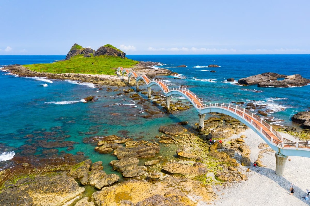
Another attraction near the city is the East Coast National Scenic Area, which is a coastal drive that connects the northeast of Hualien to the southeast of Taitung. Highway 11 links these two cities, which are 170 km (105 mi) apart.
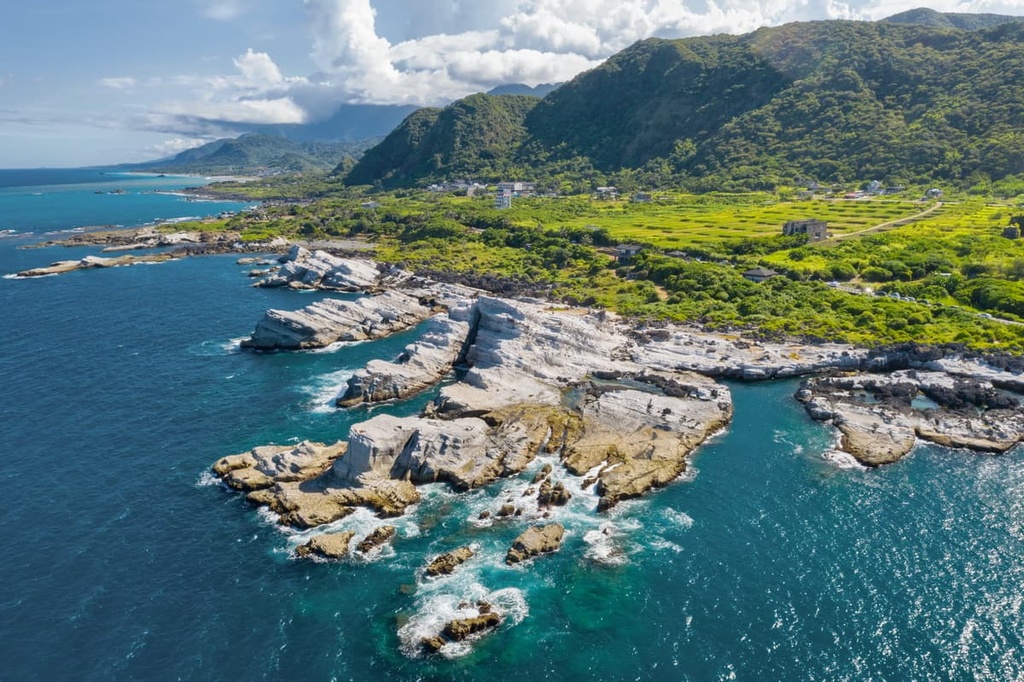
Highlights along the way include Shitiping’s volcanic rock formations, Baxiandong’s weathered caves, and Chenggong’s fishing village. Visitors can also find a bounty of top-rated surf spots along this route in Dulan, Chenggong, and Donghe.
The most southern city of eastern Taiwan, Taitung is best known for its beaches. Wedged between the Pacific Ocean’s shore, pastures of rice paddies and rugged mountain terrain, nature surrounds the coastal haven of Taitung.
One of Taitung’s most scenic areas is the Taitung Forest Park. Covering 280 ha (692 ac) of woodlands, it is the largest park in the city. It is often referred to as the Blackwood forest due to its density of dark beefwood trees. The Beinan River feeds into the vast Pipa Lake and it features water so clear that you can see the lakebed.

Meanwhile, Yuan Sen Garden contains over 200 native medicinal plant species. The park is sectioned into six gardens based on plant type. While roaming the grounds, visitors can note the splendid views of grassland pastures and valleys. At night, it is the best place to view the illuminated city of Taitung.
The wet sand and calm waters of Douli Beach at low tide reflect the soft late afternoon sky. Additionally, the still water mirrors the sky overhead, forming a cerulean sphere. The beach is also a popular place to surf at high tide. The Duli people also traditionally live in this area. They are known for their crafts and excellent weaving skills. Visitors can admire their craftwork and taste their traditional cuisine at local restaurants.
From Taitung, visitors can drive along the east coast toward the southern tropical paradise of Kenting. While here, you can see the golden sandy beaches, banyan forests, and fairytale stalactite caves of the wondrous Kenting National Park (墾丁國家公園).
From the major cities of Taipei, Taoyuan, Hsinchu, Taichung, Chiayi, Tainan and Kaohsiung, take the local express train (TRA) to Taitung.
Unfortunately, the Taiwan High-Speed Rail (HSR) is not linked to the east coast, so take the HSR either to Taipei or Kaohsiung. From there, you can catch the local express train to Taitung.
It is best to drive to the area as public transport to Guanshan Major Wildlife Habitat is severely limited. One can hire a car or scooter in Taitung and journey 85 km (53 mi) to Guanshan Major Wildlife Habitat.


The highest peak in Guanshan Major Wildlife Habitat is Guan Shan, at 3,668 m.
Notable peaks in Guanshan Major Wildlife Habitat include Guan Shan, Xiangyang Shan, Sancha Shan, Xiangyangshanbeifeng and Guan Shan Beifeng.


