
Scan the QR code and open PeakVisor on your phone
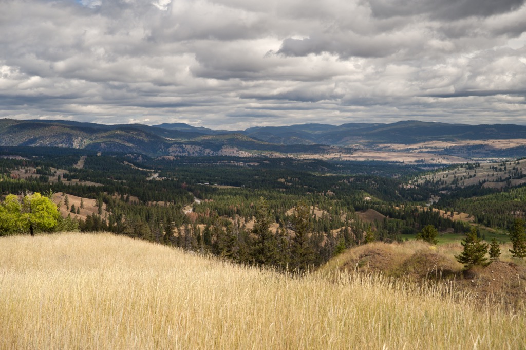
Brent Mountain Protected Area is on the Thompson Plateau of British Columbia, Canada. Their protected area encompasses three mountains of which Mount Brent (2,202 m/7,224 ft) is the tallest and the most prominent with a prominence of 397 m (1,302 ft). The rolling terrain makes it an enjoyable area for hiking and biking in the summer and snowshoeing and snowmobiling in the winter.
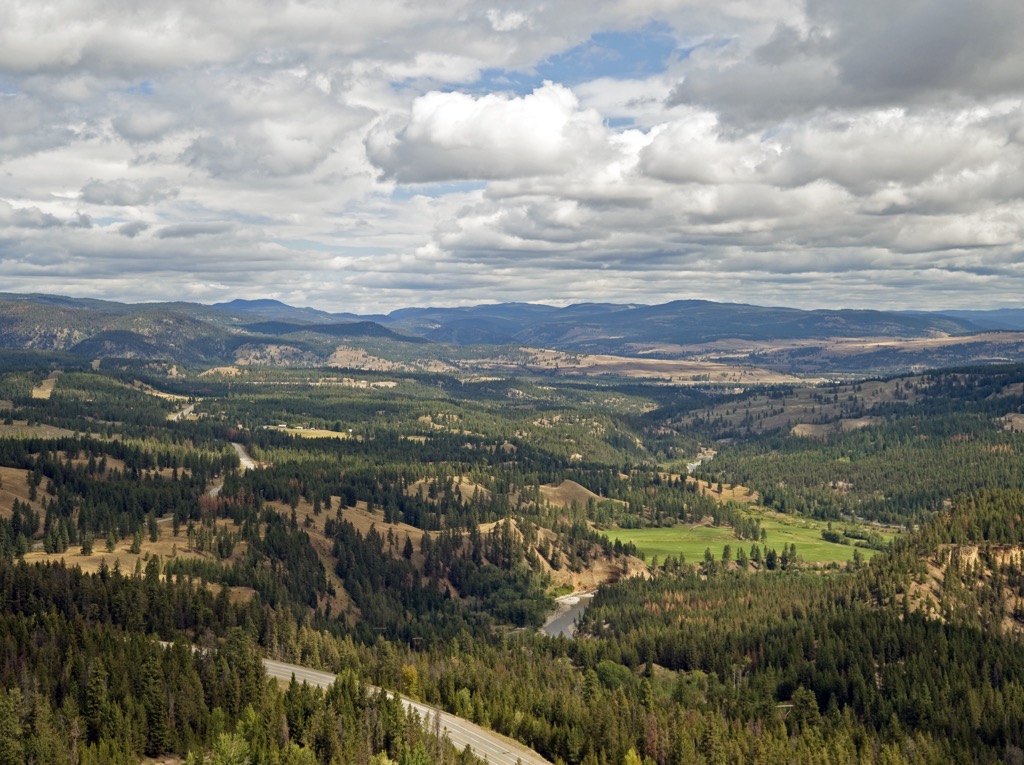
Situated in the Regional District of Okanagan-Similkameen of southern British Columbia, Canada, Brent Mountain Protected Area encompasses 4,344 ha (10,734 acres) of extensive wetlands, subalpine parkland and meadows, and alpine meadows. Having been established in2001, Brent Mountain Protected Area has the only protected area upon the southern Thompson Plateau.
Brent Mountain Protected Area was named for the tallest of its three peaks, Mount Brent which has 2,202 m (7,224 ft) of elevation and 397 m (1,302 ft) of prominence. The two other peaks in the protected area are Sheep Rock (2,197 m/ 7,208 ft) and 1990 (1,989 m/ 6,526 ft).
It is believed that Mount Brent was named after Frederick Brent, a US Army cavalryman who came to the Okanagan in 1865. The protected area and mountain are west of the Okanagan Valley and the nearby communities are Penticton, Summerland, and Hedley.
The protected area is upon the southern end of the Thompson Plateau, adjacent to the Okanagan Range of what are called the Cascade Mountains in Canada. Brent Mountain Protected Area encompasses the headwaters of Shingle Creek, Skulaow Creek, June Creek, and Shatford Creek. The protected area contains the uplands of Brent Mountain and Sheep Rock east of Broken Creek.
There are many nearby parks and protected areas in the nearby Okanagan Valley and in the Cascade Mountains. The following is a short list of some of the nearby parks:
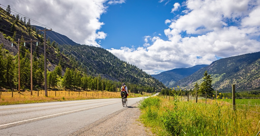
The protected area is about 22 km (13 mi) west of Penticton and is accessible by following the Shatford Forest Service Road north from Apex Mountain Road. This area is an active logging area and caution is advised for traveling as well as using GPS and properly scaled topographical maps. Due to the possibility of water bars across the road, vehicles with high clearance are recommended.
Brent Mountain Protected Area is upon the Thompson Plateau, which contains a variety of rocks that formed under different environmental conditions and at different times. The Thompson Plateau is the most southerly of the plateaus in Interior British Columbia, all of which have a rich geological history.
Originating as a volcanic island arc in the Pacific Ocean, the bedrock of the Thompson Plateau accreted to the west coast of Canada during the Mesozoic. Indeed, North America’s ancient continental margin lies roughly along the spine of the Canadian Rockies and as such, most of British Columbia’s land was the result of the accretion of exotic terranes.
Exotic terranes, that included micro-continents and volcanic island arcs formed in the Pacific Ocean and as their tectonic plates subducted beneath the westward moving North American plate, the land was skimmed off and welded to the edge of the continent. Accretion events are typically associated with significant volcanic activity which helps to weld the new landmass in place.
The Thompson Plateau was an area that had significant seismic and volcanic activity throughout its history. The plateau is home to some volcanoes that erupted upon the surface during the accretion of the island arc, while at other locations the magma simply intruded the older sedimentary and volcanic layers to form new granitic rocks.
The most recent volcanic activity in the region occurred during the Miocene when lava flowed from fissures and shield volcanoes to blanket the region. Giant’s Head is a nearby example of one of the region’s volcanoes and it is in Summerland, which is about 20 km (12 miles) northeast of Brent Mountain Protected Area.
The Okanagan is a geologically fascinating area due to the Okanagan Fault which runs through the Okanagan Valley, east of Brent Mountain Protected Area. After the tectonic collisions that created British Columbia, there was a period of when, instead of the crust being compressed, it relaxed, at which time volcanic activity was frequent.
Then, between 36 and 24 million years ago, the Okanagan Fault pulled apart, shifting the upper layers as much as 100 km (60 mi) to the west. That is to say, the roots of Mount Munson, another volcano, which is just northeast of Penticton, are as much as 100 km (60 mi) to the east.
The physiography and topography were greatly influenced by erosion from the creeks and streams for millions of years and then finally the glaciers of the Pleistocene. Off and on for millions of years, Brent Mountain Protected Area was covered by several successive ice sheets.
The ice sheets were often several kilometers thick in places and they slowly eroded the peaks and ridges that were covered. The glaciers left vast deposits of glacial till and silt across the Okanagan Valley. In fact, Okanagan Lake is a kettle lake that formed along the Okanagan Fault and in some places below the lake, the layer of glacial sediment extends to the bedrock which is below sea level.
In general, the region is known to have rolling plateau uplands with steep sided plateau walls and large inter-plateau lowlands. The peaks of Brent Mountain Protected Area are part of the rolling uplands and are notable as being the only protected alpine area in the Southern Thompson Uplands ecosection.
While the nearby Okanagan Valley is known for its sagebrush and grass covered steppes and parkland stands of Ponderosa pine and Douglas fir in a sea of rough grasses, the uplands around Brent Mountain Protected Area have significant forests and there is significant logging activity in the area.
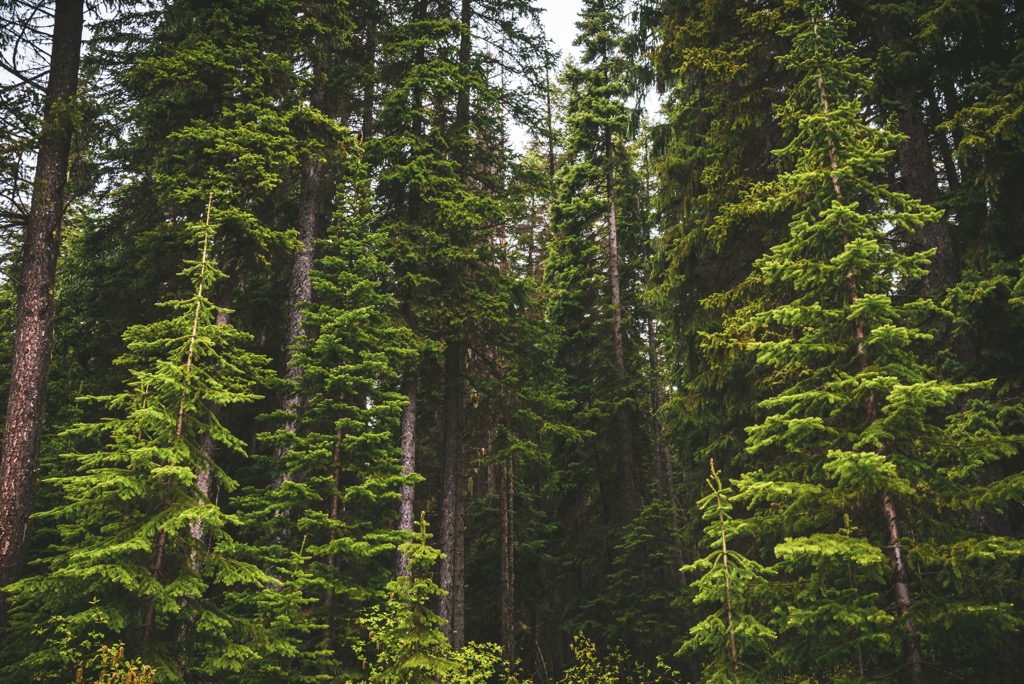
The forests around Brent Mountain Protected Area transition from lodgepole pine and Douglas fir forests to a dense growth of Engelmann and white spruce with subalpine fir mixed in. Alpine larch and white bark pine may be found along ridges and along the treeline.
The subalpine forests turn into a parkland-like mosaic at higher elevations, being interspersed with sedge-grass meadows. As the trees reach their elevation limit their growth is often stunted by the cold and the winter winds bend and shape them.
The stunted and twisted trees are known as krummholz and they can look like stunning bonsai trees with elegant curves in their trunks and stripped bark from winter storms. The krummholz make a stunning foreground while gazing out from the mountain.
The highest elevations are part of the Interior Mountain-Heather Alpine zone which is dominated by heath and communities of sedge and grass. The shallow soil supports several plants such as alpine fescue, mountain avens, dwarf willows, and lupines, some of which were traditionally gathered by indigenous groups from Mount Brent.
Part of the importance of Brent Mountain Protected Area and other nearby conservation areas is to give wildlife a migration route between their different habitats. Black bears, fishers, martens, and lynx all travel through the region of Brent Mountain as they migrate between the boreal forests of British Columbia and the montane forests of Washington and Idaho.
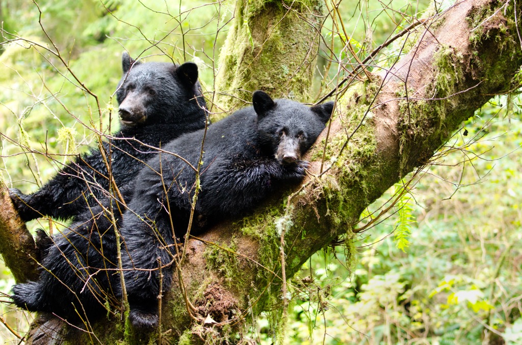
Some of the other wildlife that you may see or encounter while visiting Brent Mountain Protected Area are mule deer, white-tailed deer, moose, bobcat, cougar, and coyote. Grizzly bears are uncommon; however, at times they wander through the region. Furthermore, California and Rocky Mountain big horned sheep may be seen upon the rocky cliffs and rugged grasslands of the region.
The traditional territory of the Nlaka’pamux and Syilx First Nations encompasses the Brent Mountain Protected Area. As part of the Interior Salish Culture, the Nlaka’pamux and Syilx are the descendants of Salish people that migrated inland about 4,000 years ago.
The human habitation of the Thompson Plateau and around Brent Mountain Protected Area extends back about 12,000 years as small bands started occupying the region hunting game and gathering from the diverse flora for subsistence.
The technology of these ancient people advanced to suit the local environment and there are the remains of earth ovens that are estimated to be about 8,000 years old near camas meadows which they tended as a form of early agriculture.
About 4,000 years ago there is a shift in the archeological record that shows the inhabitants of the region started living in larger semi-sedentary villages as opposed to small, nomadic bands. This also correlates to the time when people from the west coast Salish Culture migrated into the interior of British Columbia.
The Interior Salish culture displaced the original inhabitants of the plateaus. It is not clear how the displacement proceeded, whether it was through warfare or advanced technology. Some suggest that the Interior Salish had superior fishing technology and skills gained by their coastal ancestors that enabled them to survive during a time when large game became scarce.
The lifestyle of the indigenous of the area changed in the beginning of the nineteenth century when the fur trade made its way into the Okanagan Valley. The first settlement in the area is credited to Father Pandosy, Father Richard, and Brother Surel, who were Oblate missionaries that settled in the Okanagan in 1859.
By the beginning of the twentieth century, the agricultural potential of the region was obvious and settlers came to farm and ranch the region. Indeed, In 1893, Lord Aberdeen, the Governor General at the time, bought huge tracts of land in the Okanagan for its fruit growing potential.
The orchards and vineyards generally lay east of Brent Mountain Protected Area and it is the logging industry that made its mark around the protected area. Logging with its attendant roads has been extensive around the protected area. Indeed, a fire lookout tower was constructed in the 1930s upon the summit of Mount Brent to help protect the region and its valuable lumber from fires.
It was finally in 2001 that Brent Mountain Protected Area was established to preserve the unique upland alpine zone that is found around the summits of Mount Brent and Sheep Rock.
There are two major destinations in Brent Mountain Protected Area, which are the summits of Mount Brent and Sheep Rock. During the summer these trails are popular hiking and cycling destinations and during the winter snowmobiles traverse the area and snowshoes may be used to trek through the beautiful alpine area.
The following are brief descriptions of the two major trails:
The trail to the summit of Mount Brent is the main hike in Brent Mountain Protected Area and the trail is signed well and easy to follow. The view from the summit is spectacular on a clear day from which you can see the Monashee Mountains to the north and the peaks of the Cascades to the south.
The summit of Brent Mountain has an old fire lookout that was built in the 1930s and is one of the last fire lookout towers remaining in the Okanagan. From the trailhead it is about 5 km (3 mi) to the summit and there is about 500 m (1,640 ft) of elevation gain along the trail.
There is a connector route from the summit of Mount Brent to the summit of Sheep Rock so that ambitious hikers can summit both peaks as part of a loop.
The trek to the top of Sheep Rock is longer and has more elevation gain then the hike to Mount Brent; however, the hike to Sheep Rock is considered the easier of the two. The summit of Sheep Rock is about 5.5 km (3.3 mi) from the trailhead with an elevation gain of about 580 m (1,900 ft).
The trail is well established and winds through the lovely alpine region of the protected area. If you’re fortunate to be hiking during the right season, you’ll be treated to a display of the stunning wildflowers that fill the alpine meadows. From the summit you’ll be able to appreciate the stunning 360-degree view of the region and beyond if the skies are clear.
Located west of the Okanagan Valley, Brent Mountain Protected Area was established to preserve a sample of the rare plateau uplands alpine zone. While surrounded by logging cut blocks and forest service roads, the protected area preserves the beautiful wilderness meadows where indigenous people have harvested lupins for generations.
The following are some of the nearby cities from where you can easily visit Brent Mountain Protected Area:
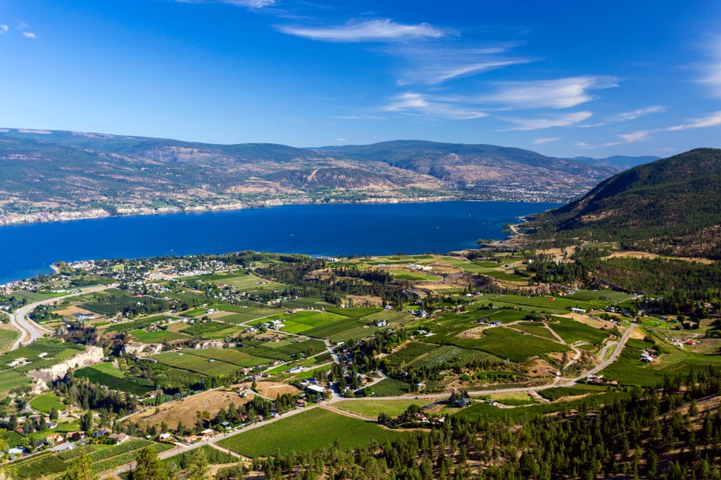
Penticton is situated at the south end of Okanagan Lake about 22 km (13 mi) west of Brent Mountain Protected Area. As the largest city in the Regional District of Okanagan-Similkameen, most visitors come to Penticton to enjoy the beach and to play on the waters of Okanagan and Skaha lakes.
Purchasing and eating the ripe peaches, nectarines, plums, blackberries, blueberries, cherries, and other fruits from the orchard stands is a wonderful way to spend an afternoon. Other activities to enjoy are cycling the Kettle Valley Railway Trail, rock climbing at Skaha Bluffs, skiing at Apex Mountain Resort which is located just south of Brent Mountain Protected Area.
There are many beautiful wilderness areas surrounding Penticton, throughout the Okanagan Valley. When you’re wanting some time away from the lake and the beaches you can find some great hiking trails at Little White Mountain Provincial Park, Myra-Bellevue Provincial Park, White Lake Grasslands Protected Area, and Brent Mountain Protected Area.
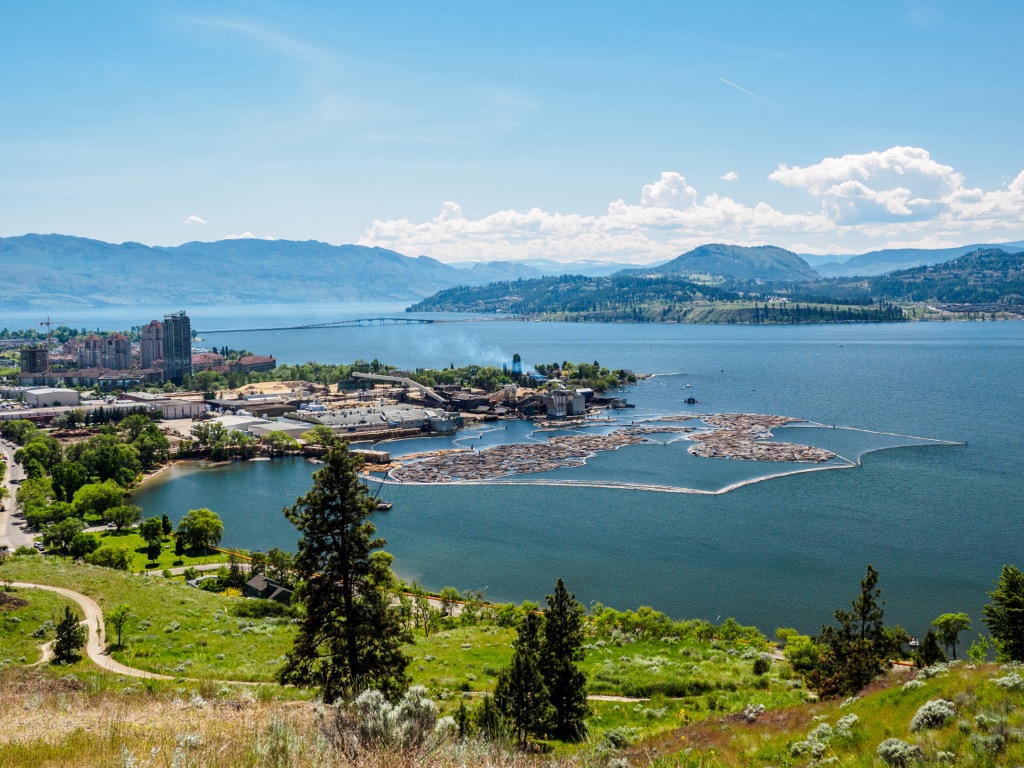
Kelowna is about 95 km (57 mi) northeast of Brent Mountain Protected Area and is the primary city in the Okanagan Valley. Situated upon the eastern shore of Okanagan Lake, it is the largest city in the region and the warm climate attracts visitors from across the country.
Summer is certainly the busiest tourist season in Kelowna, as visitors flock to the Okanagan to enjoy the sandy beaches and the giant lake. However, there are also many great attractions during the winter as well with great ski resorts at Big White, Silver Star, Sun Peaks, and Apex Mountain.
Summer or winter, there are many great wilderness areas for hiking around Kelowna, such as Okanagan Mountain Provincial Park and Myra-Bellevue Provincial Park which are close to the city. Fintry Provincial Park is just up the lake and there are White Lake and South Okanagan grasslands protected areas at the south end of the valley which are among the most endangered and rare ecosystems in Canada.


