
Scan the QR code and open PeakVisor on your phone
White Lake Grasslands Protected Area is in southern British Columbia, Canada. The protected area encompasses five summits, of which Mount McLellan (949 m/3,114 ft) is the tallest and Mount Keogan (913 m/2,995 ft) is the most prominent. The protected area helps preserve the delicate and beautiful grasslands ecosystem of the region.
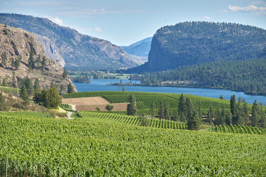
In southern British Columbia, Canada, White Lake Grasslands Protected Area rises from the western shores of Vaseux Lake and encompasses the White Lake basin. The area contains a delicate ecosystem of sagebrush, grasslands, open forests of Ponderosa pine, alkali ponds, and rock outcroppings.
There are four mountains encompassed within the protected area, of which Mount McLellan is the tallest, standing 949 m (3,114 ft) above sea level. Mount McLellan is the northernmost of the five peaks, followed by Mount Hawthorne, Mount Keogan, nʕaylintn which is also referred to as McIntyre Bluff, and finally Seacrest Mountain.
The protected area is one of many in the Regional District of Okanagan-Similkameen and Highway 97, the Okanagan Highway is the primary access route to the park. From the highway, visitors can turn off onto side roads to arrive at specific places in the protected area.
Mahoney Lake Ecological Reserve is essentially encompassed by White Lake Grasslands Protected Area and the protected area is part of a broader collection of protected areas. Some of the nearby protected areas and provincial parks include:
White Lake Grasslands Protected Area is upon the Thompson Plateau, which is the most southerly of the plateau areas in Interior British Columbia. The plateau contains a variety of rocks that formed under different environmental conditions and at different times.
The rocks that form the Thompson Plateau originated in the Pacific as a volcanic island arc which was accreted to the North American plate during the Mesozoic. The accretion occurred because the underlying tectonic plate subducted beneath the continental plate. Periods of accretions are also a time of significant volcanic activity.
While some volcanoes erupted upon the surface during the accretion of the island arc, at other locations the magma simply intruded the older sedimentary and volcanic layers to form new granitic rocks. The most recent volcanic activity in the region occurred during the Miocene when lava flowed from fissures and shield volcanoes to blanket the region.
The physiography of White Lake Grasslands Protected Area was essentially in place by the end of the Pliocene. During the subsequent millions of years of the Pleistocene the protected area was covered by several successive ice sheets.
The ice sheets, which covered western Canada, reached thicknesses of several kilometers in some places. The peaks and ridges of the protected area were overridden by the ices sheets which consequently rounded the summits and ridges. Vast deposits of glacial till and silt were deposited across the Okanagan Valley.

The White Lake Grasslands Protected Area of the Thompson Plateau is within the South Okanagan Basin and encompasses three of the major ecological zones of British Columbia, including the Interior Douglas Fir Zone, Ponderosa Pine Zone, and the Bunchgrass Zone. These are the driest and hottest ecosystems in British Columbia.
Most of the protected area is considered part of the Ponderosa Pine Zone where the Ponderosa pines are mixed with stands of Douglas fir and grassy meadows. The area is a mosaic of open stands of ponderosa pine and fir, thickets of dense trees, rocky outcrops, and grasslands of bluebunch wheatgrass, rough fescue, big sage, rabbit brush, yarrow, and pasture sage.
The Interior Douglas Fir Zone ecosystems of the protected area are mainly forested areas filled with Douglas fir. Douglas fir and Ponderosa pine both have thick bark which makes them resistant to the grass fires which are frequent throughout the Okanagan.
The Bunchgrass zone is the driest and hottest climate in the province and is typically found at the lower elevations of the Okanagan. Clumps of bluebunch wheatgrass, big sagebrush, and a variety of early spring blooming plants grow in the protected area. Between the grasses and plants is a thin layer of lichens and mosses which form a cryptogamic crust to help prevent erosion.
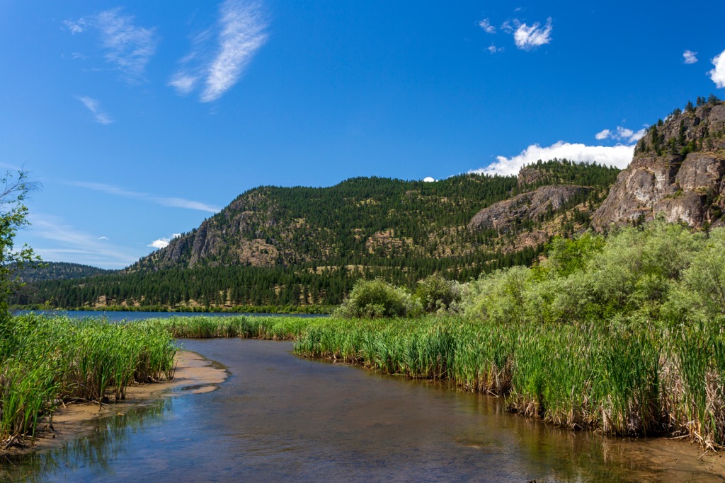
The protected area has a rich diversity of habitats such as the grasslands, rocky outcrops, the open forests, alkali lakes, and the lush areas adjacent to the creeks and lakes. Indeed, the protected area was established to preserve the habitat of ten endangered species and 20 species of special concern.
Some of the endangered species include the tiger salamander, desert night snake, Brewer’s sparrow, burrowing owl, peregrine and prairie falcon, and the white headed woodpecker. Endangered mammals include the badger and the white-tailed jackrabbit, while Columbia goldenweed and the nettle-leaved giant-hyssop are endangered plants found in the protected area.
Furthermore the protected area is an important winter area for mule deer and a winter range and a lambing area for California bighorn sheep. White Lake Grasslands Protected Area is part of a cross valley corridor of rare ecosystems.

The southern interior of British Columbia has been home to indigenous populations for thousands of years. The current indigenous population are typically part of the Interior Salish culture which arrived in the interior of British Columbia about 4,000 years ago.
The Interior Salish culture emerged when members of the coastal Salish culture came inland. While the interior was already inhabited by other cultures, the Interior Salish culture proved dominant. While warfare likely occurred, there is a strong belief that the members of the migrating Salish culture simply had better knowledge and technology, such as their fishing skills, to adapt to the changing climate of the time.
After supplanting the previous occupants, the Salish culture flourished in interior British Columbia. It is believed that the Interior Salish culture reached its peak about 3,000 years ago when an estimated 12,000 people of the Interior Salish culture inhabited the Okanagan Valley and surrounding areas.
White Lake Grasslands Protected Area is part of the traditional territory and ancestral homelands of a number of First Nations, including the Syilx Okanagan Nation and the Nlaka'pamux Nation Tribal Council.
Within the protected area there are eight known archeological sites which include rock shelters, pictographs, quarry/workshop, cache pit, and house pits. It is believed that with systematic archeological surveys that more sites would certainly be discovered in the protected area.
While there are indications of non-Indigenous travelers in the area as early as the 1500s, such as the Spanish searching as far north as Kelowna in their search for the legendary El Dorado, the first recorded non-Indigenous person in the area was David Stuart. Stuart established Fort Okanagan at the confluence of the Okanagan and Columbia Rivers in 1811.
With the advent of the fur trade in the Okanagan, the Fur Brigade Trail was established across the region. The Fur Brigade Trail was created based on the existing indigenous trails and the fur traders used it to shuttle furs from the north to the Columbia River for transport. In White Lake Grasslands Protected Area, the Fur Brigade Trail traverses Myers Flats, near the south end of the protected area.
Furthermore, the protected area encompasses parts of the pioneer homesteads that were part of the early settlement of the Okanagan. Orchards, ranching, farming, vineyards, and other industries have flourished throughout the Okanagan Valley and have had an impact on the delicate ecosystems of the region.
White Lake Grasslands Protected Area was established in 2001 through the Okanagan-Shuswap Land & Resource Management Plan to preserve the delicate ecosystems and habitats for the endangered species.

There are great opportunities for hiking, horseback riding, mountain biking, and nature and wildlife viewing in White Lake Grassland Protected Area. The following are some of the major trails to enjoy in the park:
There are two major routes to the summit of Mount Keogan, the most prominent peak in the protected area. The most popular trail starts near the Mahoney Ecological Reserve and is a 11.4 km (6.8 mi) loop. The trail named Dogtown is a steep and exposed trail that leads to the summit and the loop can be finished by following the gradual and forested Go East Old Man and Five Lake Lookout Trail back to the trail head.
The summit of Mount Keogan is a rocky bluff with fantastic views of the valley and the rest of the protected area. The other trail to the summit starts south of Mount Keogan and is a bit of an off-trail slog; however, it gives a different perspective of the area while hiking
The trail to the summit of Mount Hawthorne is a moderate 10.5 km (6.3 mi) out-and-back trail with about 511 m (1,676 ft) of elevation gain. The trailhead is on one of the area's old roads and is relatively easy to follow.
Starting from the trailhead, hikers follow an old road through a forested area until the trees start thinning out, at which point cairns are used to mark the trail. Hikers can follow the cairns to the summit and if you go just beyond the summit you’ll be rewarded with better views of Skaha Lake, Penticton, and Okanagan Lake.
White Lake is not in the protected area because it is owned by the Nature Trust which manages the land adjacent to the lake. The White Lake Trail runs between White Lake and Mahoney Lake, in the middle of the protected area.
A typical starting point for hiking the trail is near White Lake, at a roadside pullout off Fairview-White Lake Road. Starting from an information shelter, the trail then passes through an aspen stand and follows a chain of alkali ponds.
The trail follows a pass that is bounded by rock bluffs on the north and a treed ridge on the south. The trail overlooks Mahoney Lake and the rugged terrain of the northern section of the protected area. The trail descends and crosses a dam to enter the forests of Ponderosa pine and eventually you’ll end up on another old road along the western shore of Mahoney Lake where the trail ends at Green Lake Road.
Due to its favorable climate, the Okanagan is a popular tourist destination. While most visitors come to the region to enjoy the lakes, the bluffs and peaks that overlook the valley are certainly enticing. The following are the major cities near White Lake Grassland Protected Area.
The Osoyoos is about 30 km (18 mi) south of White Lake Grasslands Protected Area and is a popular summer tourist destination. The community typically records the hottest summer temperatures in Canada and is located adjacent to a beautiful lake.
Tourism and agriculture are the major drivers of the town’s economy, and the combination of the two industries has created agro-tourism in the region where visitors can explore the local orchards and vineyards.
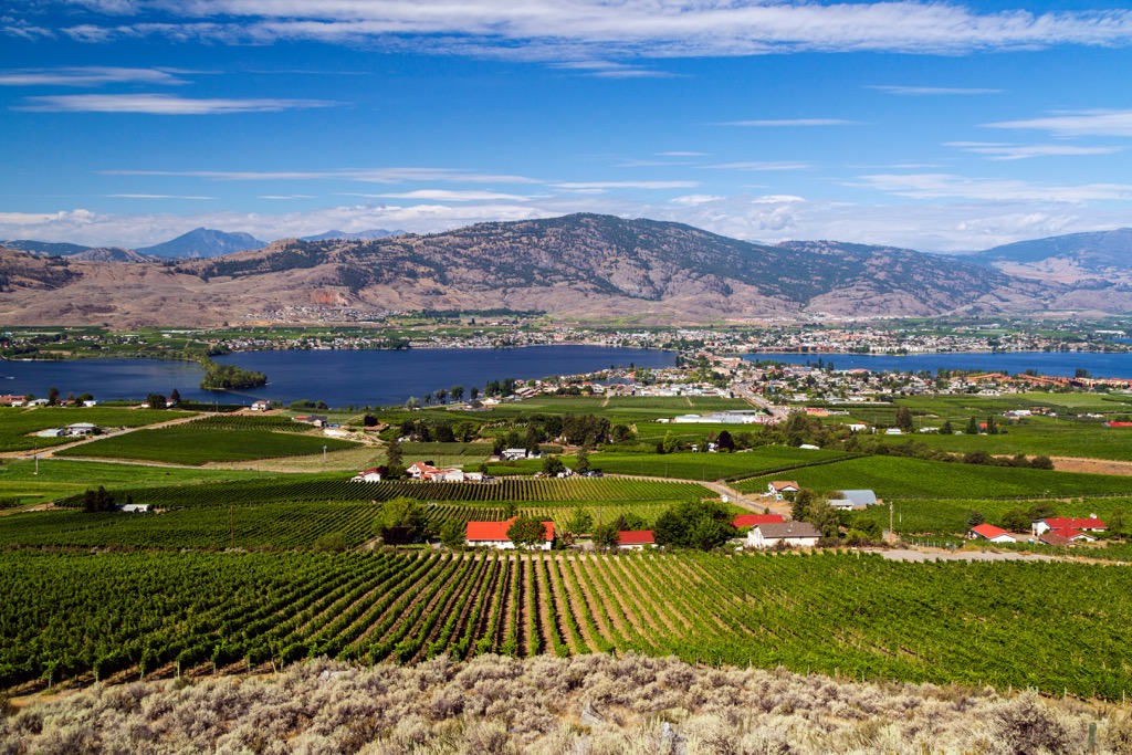
Some local attractions are Spotted Lake, which is a saline endorheic alkali lake, the Osoyoos Desert Centre, and the Nk’mip Desert Cultural Center. However, most people do come for Osoyoos Lake, which is among the warmest freshwater lakes in Canada.
However, despite the draw of the lake, I always have to go for at least one hike while I’m visiting the Okanagan, as the bluffs and ridges overlooking the valley seem like incredible places to explore. Some of the hiking areas around Osoyoos include White Lake Grasslands Protected Area, Vaseux Protected Area, and Anarchist Protected Area, and White Lake Grasslands Protected Area.
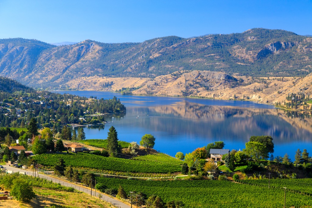
Penticton is about 30 km (18 mi) north of the White Lake Grasslands Protected Area, situated at the south end of Okanagan Lake. Like most of the Okanagan communities, agriculture and tourism are the major industries.
Penticton is the largest city in the Regional District of Okanagan-Similkameen and most visitors come to Penticton to enjoy the beach and the relatively warm waters of Okanagan and Skaha lakes. Other activities to enjoy are cycling the Kettle Valley Railway Trail, rock climbing at Skaha Bluffs, skiing at Apex Mountain Resort, or playing a round or two at one of the city’s many golf courses.
There are many beautiful wilderness areas that overlook the Okanagan Valley and have great hiking trails. Some of the popular hiking areas around Penticton are Little White Mountain Provincial Park, Myra-Bellevue Provincial Park, White Lake Grasslands Protected Area, and Brent Mountain Protected Area.
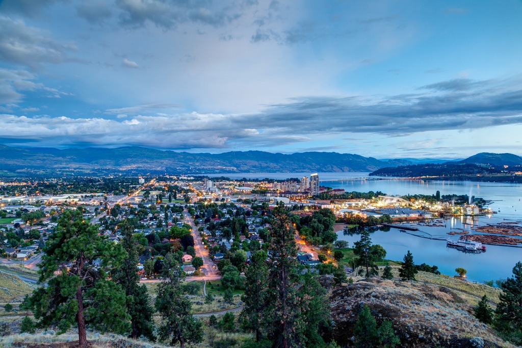
Kelowna is about 90 km (54 mi) north of White Lake Grasslands Protected Area and generally considered the capital of the Okanagan. It is the largest city in the region and it is situated on the eastern shore of the beautiful Okanagan Lake, and it has a wide range of accommodations and attractions available.
The city is generally full of tourists during the summer, who have traveled from across western Canada to enjoy the warm lakes and hot days. The beaches are certainly among the most popular places to spend time while in Kelowna; however. There are also some great hiking areas near Kelowna, too.
Okanagan Mountain Provincial Park and Myra-Bellevue Provincial Park are certainly close to the city and Fintry Provincial Park is just up the lake. Further south are some of the protected grasslands which are among the most endangered and rare ecosystems in Canada.
Among the grasslands are White Lake and South Okanagan grasslands protected areas that are worth visiting for great hikes, wonderful views, and opportunities to explore an area that has ancient history sites and historical settlement sites.


