From Coastal Peaks to Sea Cliffs to Island Summits, Here Are the 10 Coastal Destinations for Your Next Hiking Trip
Europe is well known for many things; mountains and coastline are high up on the list. The Alps are the world’s premier mountain destination. Meanwhile, the image of the cobalt blue Mediterranean Sea as you twist your way through old-world wine country is collectively burned into our subconscious. But Europe has many more mountains than just the Alps. And seas literally surround the continent; in addition to the Mediterranean, you’ve got the North Sea, Baltic Sea, Black Sea, Celtic Sea, and more.
So let’s skip over the stereotypes of European coastal hiking, like Cinque Terre. There’s already more than enough internet content for that kind of stuff. If you’re looking for breezy paved paths with gelato stops every few meters and enough crowds to fill Wembley Stadium, scroll onwards.
This guide focuses on places where coastline gives way to mountains. Places where the land and sea continue to battle it out, year after year. Granite ridges above Arctic beaches, limestone cliffs above the Mediterranean, towering island summits, marble massifs, and karst ranges rising from the Adriatic. So stay tuned!
Tap a marker to jump to that hike. 10 coastal destinations across Europe.
Helvetestinden and Bunes Beach, Lofoten, Norway
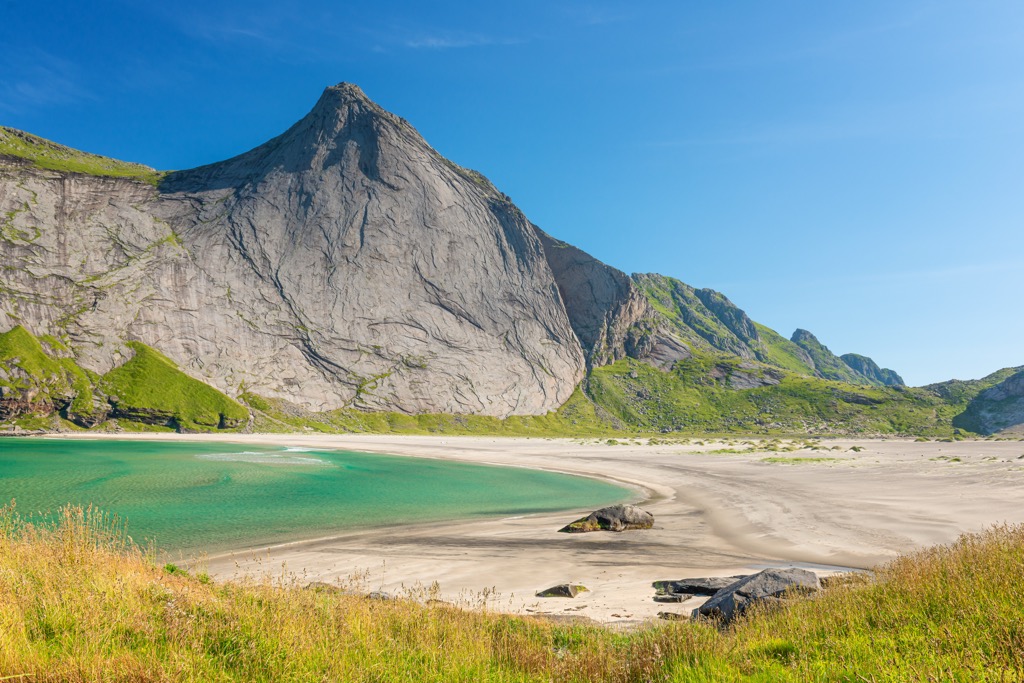
Helvetestinden (literally “hell peak” in Norwegian) is a crown jewel situated on the outer edge of the Lofoten Islands, rising directly above the remote sands of Bunes Beach on the island of Moskenesøya. At approximately 602 meters (1,975 ft) above sea level, the mountain is manageable by the standards of us mere mortals, especially compared to hikes in the Alps!
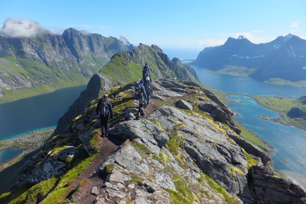
Like anything in Lofoten, prepare yourself for the dramatic. The summit is only a short distance from the fjords, with less than 2 kilometers separating the upper ridge from the coastline in places.
The route begins with a passenger ferry from the village of Reine to the isolated settlement area near Vindstad. From there, hikers cross a low pass before descending to Bunes Beach, a wild, desolate, and beautiful stretch of sand. The mountain rises immediately behind the beach; the terrain consists of sections where careful footing is required, particularly in wet conditions (which are common).
While the route is non-technical, the steepness and exposure on parts of the upper mountain place it firmly in the moderate-to-challenging category. The weather is often harsh and unforgiving; finding a good window may be the crux of this hike.
Once you get your window, the summit ridge is exposed and exciting. A great way to finish this excellent hike. To your west lies the great expanse of the Norwegian Sea; to your east are fjords and windswept beaches.
If you’re looking for more challenge, and you happen to be a strong trad climber…the granite walls of Helvetestinden are among the best granite trad climbing in Europe. Be prepared for a challenge. The easiest route up is 6- (5.10a).
Monte Stello, Cap Corse Peninsula, Corsica, France
Monte Stello is the highest summit on the rugged Cap Corse peninsula, a mountainous tentacle of land that extends northward into the Mediterranean from the main body of Corsica. At 1,307 meters (4,288 ft), the mountain dominates the skyline of northern Corsica.
It’s modest in elevation compared with the highest peaks of the Corsican interior. Still, Monte Stello stretches out to sea like the maidenhead of Corsica, making its prominence known to all.
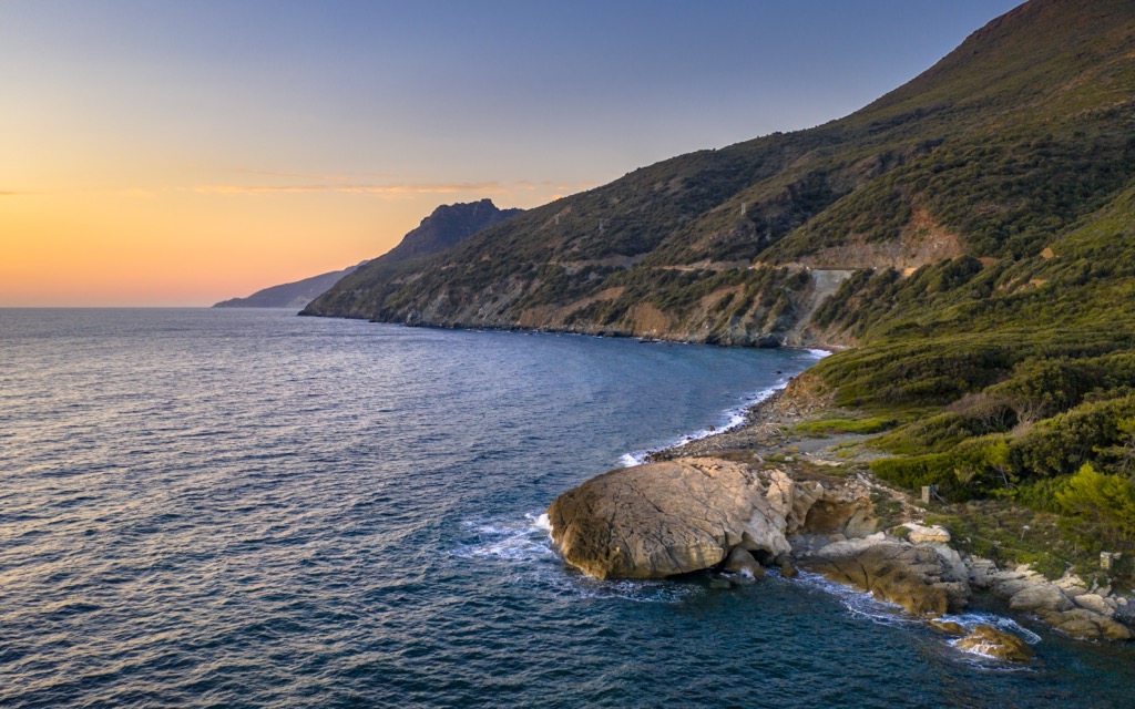
Unlike hikes where distant views of water are an occasional bonus, the Mediterranean is a constant presence throughout this ascent. From higher elevations, hikers can look east toward the Tyrrhenian Sea and west toward the Ligurian Sea, viewing both sides of a peninsula from a single mountain ridge. On clear days, the summit panorama extends across northern Corsica and toward the islands of the Tuscan Archipelago.
The most common approaches begin from coastal villages like Ersa and Canari, though visitors usually access the peninsula through Bastia, the primary ferry port. Trails climb steadily through Mediterranean scrub and chestnut groves, eventually reaching rocky alpine terrain near the summit.
The ascent typically involves between 1,000 and 1,200 meters of elevation gain, depending on the chosen starting point. Despite the modest summit elevation, we’re talking Alps-level of ascent here.
As for crowds, Corsica sees the most visitors in the summer. That’s the best time to lounge around on the beach, but for big elevation gain hikes like this one, the heat is a crux. There’s little respite from the sun in the scrub bush, and few water points due to the rocky terrain.
Path of the Gods: The Lattari Mountains above the Amalfi Coast, Italy
You’ve heard of the Amalfi Coast; it’s a well-trodden destination for all sorts of sightseers. But it would be a crime not to include it on this list, because you can do some serious hiking here. And most visitors don’t make it very far outside of the main villages.
The Lattari Mountains form the mountainous backbone of the Sorrentine Peninsula; they’re responsible for the ridiculous backdrops that make this coastline famous. The range culminates at Monte San Michele at 1,444 meters (4,738 ft), while several other summits exceed 1,000 meters, all overlooking the Mediterranean.
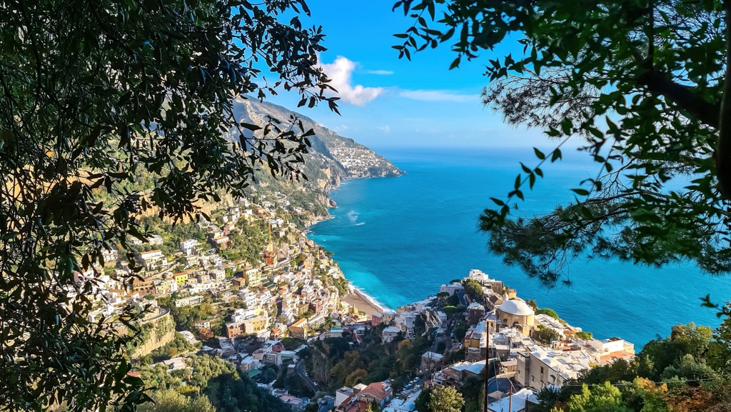
The famous Sentiero degli Dei (Path of the Gods) traverses a spectacular section of this range, offering near-continuous views of coastal villages, craggy peaks, and open water far below. From high points along the crest, the Gulf of Salerno, the Amalfi Coast, the Gulf of Naples, and the island of Capri are visible simultaneously.
The Path of the Gods is incredible, a must-do, but don’t limit yourself to this 3-hour section of trail. Most other hikes begin in the coastal villages, like Amalfi, Positano, or Praiano, all of which connect by road and seasonal ferry services along the coast. However, plenty of trails also start from mountain villages, reducing the total ascent. Unlike the Alps, there are no major cable cars providing access to the highest ridges. Instead, most trials follow ancient mule tracks, stone stairways, and farm trails that have linked the coast upland pastures for time immemorial.
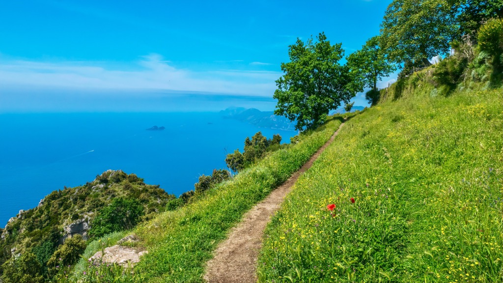
Route difficulty varies. Overall, the paths are non-technical and accessible to experienced hikers with reasonable fitness. The Path of the Gods is considered moderate. Ascents to the highest summits, however, are far more demanding. Depending on the starting point, hikers may face elevation gains of 800 to 1,400 meters in a day. Trails frequently traverse steep limestone slopes and exposed ridges, and planning for summer heat is a necessity.
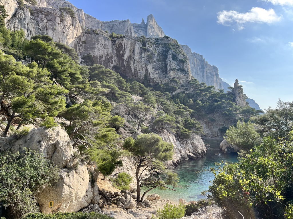
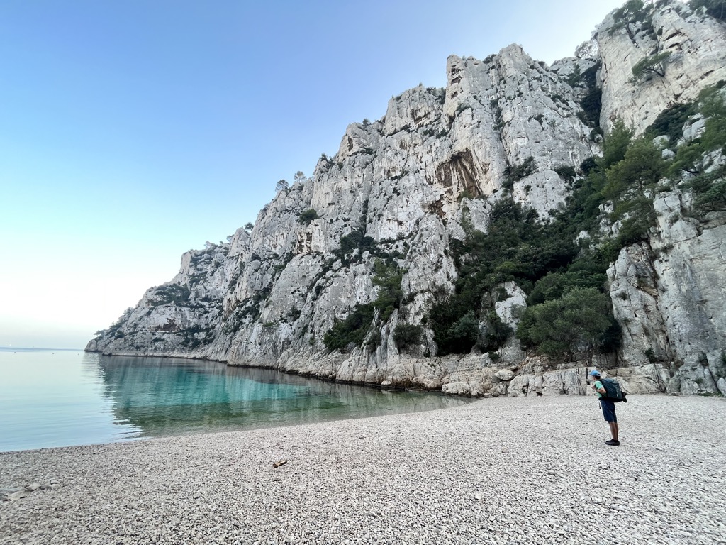
Calanques National Park, France
The Calanques National Park is the capstone of the French Riviera. The limestone cliffs plunging directly into the Mediterranean are so white, they might as well be the gates of Heaven.
There isn’t really a single dominant summit here. The Calanques are basically a system of rocky ridges and narrow fjords—”calanques” simply means “fjords” in French. The highest elevations don’t reach over 700 meters, but you won’t be disappointed with the relief from sea level.
Most hiking here leads from civilization, through the park, and down to one of the Calanques. Starting in Cassis is the worst, if you’re driving; it’s devastatingly hard to find parking. It’s also quite crowded. The Luminy Campus of the University of Marseille is easier, with massive on-campus parking lots directly connected to the trail system. The best option is to opt for public transportation. Buses run regularly and stop at all the major trailheads.
Trails are a mix of singletrack and paved fire roads. No matter what hike you choose, you’ll likely have the opportunity to stare vertically down into turquoise coves that seem beyond the parameters of reality. The most famous calanques are the twin coves of Sugiton (the best, in my opinion), En-Vau, and Morgiou.
Hiking difficulty in the Calanques is moderate to challenging, depending on the trail. Fire roads are straightforward, but the least interesting. Some trails are cut into the limestone with iron railings and chains fixed into the rock. Spots where foot traffic has polished the limestone to the consistency of glass can be incredibly dangerous when wet; fortunately, it doesn’t rain much here outside of winter. While there are no massive single ascents or descents, the up-and-down nature of the terrain means that a full day of hiking will typically involve at least several hundred meters of ascent.
Like other places on this list, summer heat is the crux. Don’t bother coming here in the dead of summer; it’s crowded, and hiking along the paved fire trails is akin to being roasted in an oven. April-June and Sept.-Oct. are the best months.
Apuan Alps, Tuscany, Italy
Everybody has heard of the “Alps,” but how many people have heard of the Apuan Alps? Not many, I’m sure of it. However, while the name doesn’t exactly roll off a hiker’s tongue, the range is famous for its exquisite marble quarries. These working quarries recently took center stage in popular culture, serving as the setting for a major scene in the Academy Award-winning film The Brutalist.
The Apuan Alps rise dramatically above the Tyrrhenian coast of northern Tuscany. Despite the name, the range is geologically separate from the main Alpine chain, aka “the Alps.”
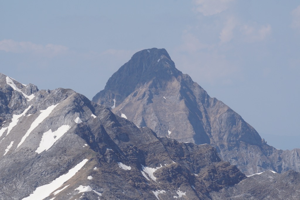
The highest summit, Monte Pisanino, reaches 1,946 meters (6,385 ft), while several neighboring peaks exceed 1,700 meters. From summits, hikers can gaze west across the Tyrrhenian toward the islands of the Tuscan Archipelago, including Elba and Capraia. Turn east, and you’ll be treated to views of the mystical Apennines, which were once the last stronghold for Europe's wolf population before they repopulated the Alps.
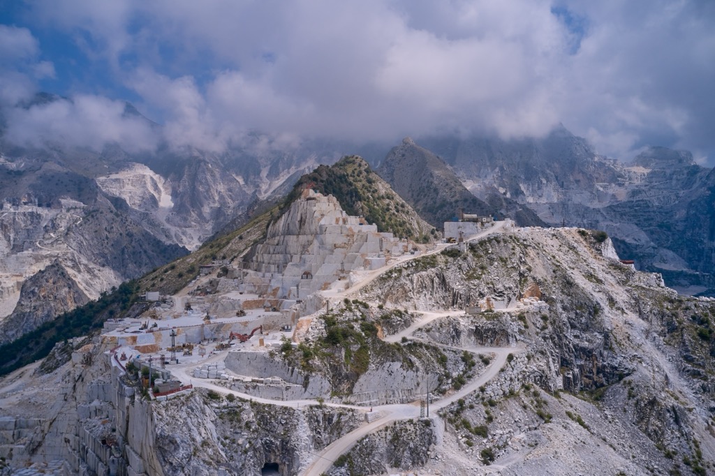
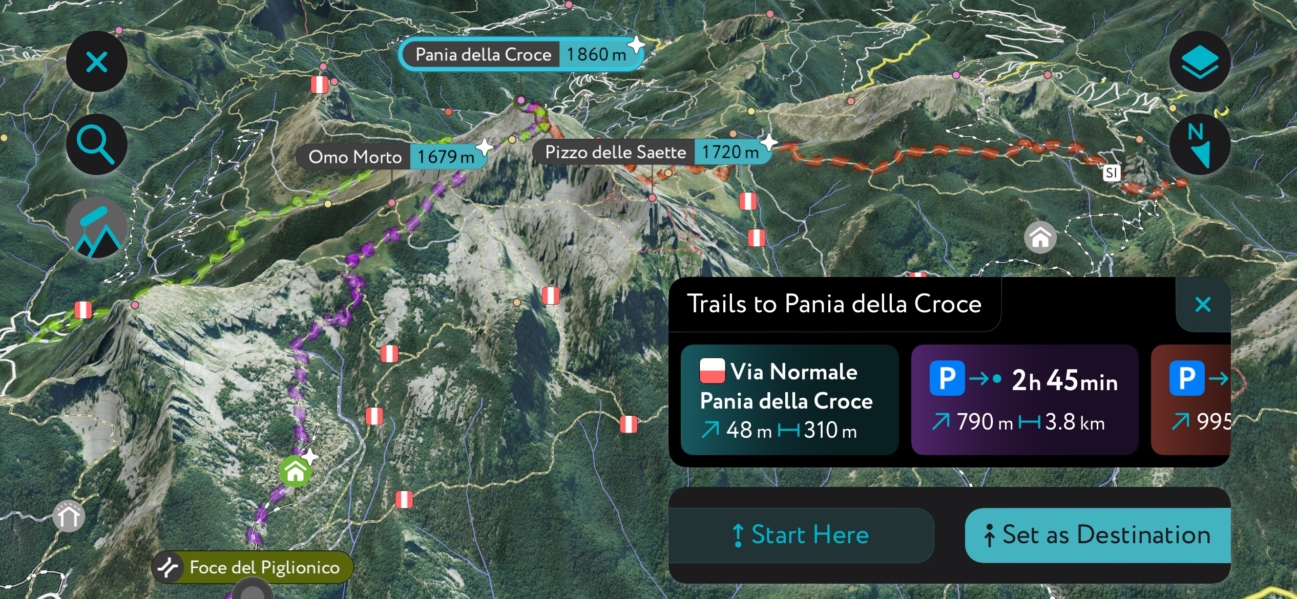
If you’ve got time for one hike, check out the Pania della Croce. There are several routes up this standalone peak at the southern end of the Apuan Alps. Most routes ascend 700-1000 meters, offering hikers views of the Tuscan coast, Carrara marble quarries, and rugged peaks.
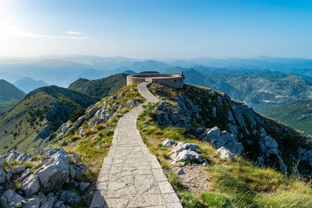
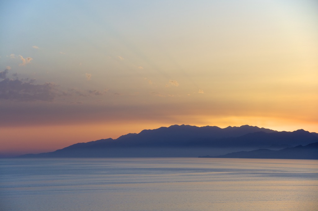
Lovćen and the Bay of Kotor, Montenegro
Looking to break free from Western Europe and head east into the great unknown? Montenegro still has a touch of that exotic, undiscovered feeling. Here, the mountains of Lovćen National Park rise dramatically above the famous Bay of Kotor, creating one of the most impressive coastal mountain landscapes in the Mediterranean. In fact, the peaks of Lovćen are the inspiration for the name Montenegro: Black Mountain.
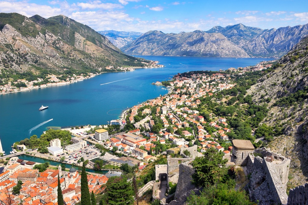
The massif culminates at Štirovnik, the highest summit of Lovćen, which reaches 1,749 meters (5,738 ft). The mountain's immediate rise above the Adriatic coast makes Lovćen appear significantly larger than its elevation alone would suggest. Nearby Jezerski Vrh (1,657 m), home to the Njegoš Mausoleum, is the best-known hiking destination and viewpoint in the range.
Lovćen’s alpine crest lies only 10–15 kilometers from the Bay of Kotor and the Adriatic coastline as the crow flies, creating one of the steepest transitions from coast to mountain anywhere in Europe. On clear days, hikers can enjoy panoramic views across the Bay of Kotor, the Adriatic Sea, and the mountains of coastal Montenegro.
Trails are more accessible than in some regions due to road access. Hikes can involve just a few hundred meters of elevation gain. Conversely, hikers can start at sea level in Kotor and reach the summit of Štirovnik in a single long, arduous day if so inclined.
Most visitors reach Lovćen from the coastal towns of Kotor, Tivat, or Herceg Novi, all of which are located around the Bay of Kotor. The winding Lovćen Road connects the coast directly with the national park and provides access to numerous trailheads.
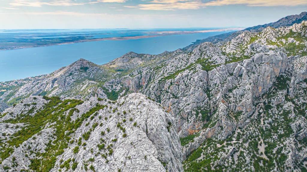
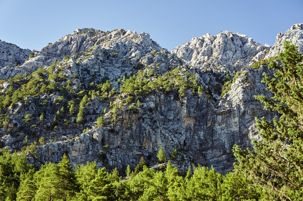
Northern Velebit and Paklenica, Croatia
The Northern Velebit and Paklenica regions form the most spectacular sections of Croatia’s Velebit Mountains. The highest summit in the range, Vaganski Vrh, reaches 1,757 meters (5,764 ft) and is located within the southern Velebit massif near Paklenica National Park. Other notable peaks include Sveto Brdo (1,751 m) and several prominent summits within Northern Velebit National Park. Many other peaks rise more than 1,500 meters above the nearby coastline. This is a massive region, with mountains running parallel to the coast for
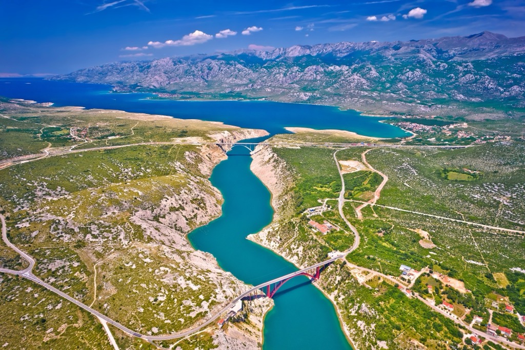
From higher summits and ridges, hikers can often see far across the Adriatic toward the islands of Pag, Rab, and countless smaller islands scattered along the Dalmatian coast.
Northern Velebit offers gentler hiking than Paklenica, though both areas contain challenging terrain. The celebrated Premužić Trail traverses the high karst landscape of Northern Velebit with relatively moderate gradients. The 57 km trail traverses some of the wildest karst terrain in Croatia. Built in the 1930s by engineer Ante Premužić, the route follows a masterfully designed stone path that threads through limestone ridges, sinkholes, forests, and open viewpoints overlooking the Adriatic Sea.
In contrast, Paklenica National Park features deep limestone canyons, steep ascents, and rugged mountain trails leading toward the highest summits of southern Velebit. Route difficulty ranges from moderate on well-maintained paths to strenuous on longer summit ascents.
In Northern Velebit, many hikes begin from mountain roads or high trailheads, resulting in elevation gains of roughly 400–900 meters. In Paklenica, however, ascents frequently begin near sea level. Climbs to Vaganski Vrh or neighboring peaks often involve 1,300–1,700 meters of elevation gain, making them among the most physically demanding day hikes in Croatia.
Access is excellent from coastal towns. Senj and nearby villages along the Kvarner coast access Northern Velebit, while Starigrad is the gateway to Paklenica National Park.
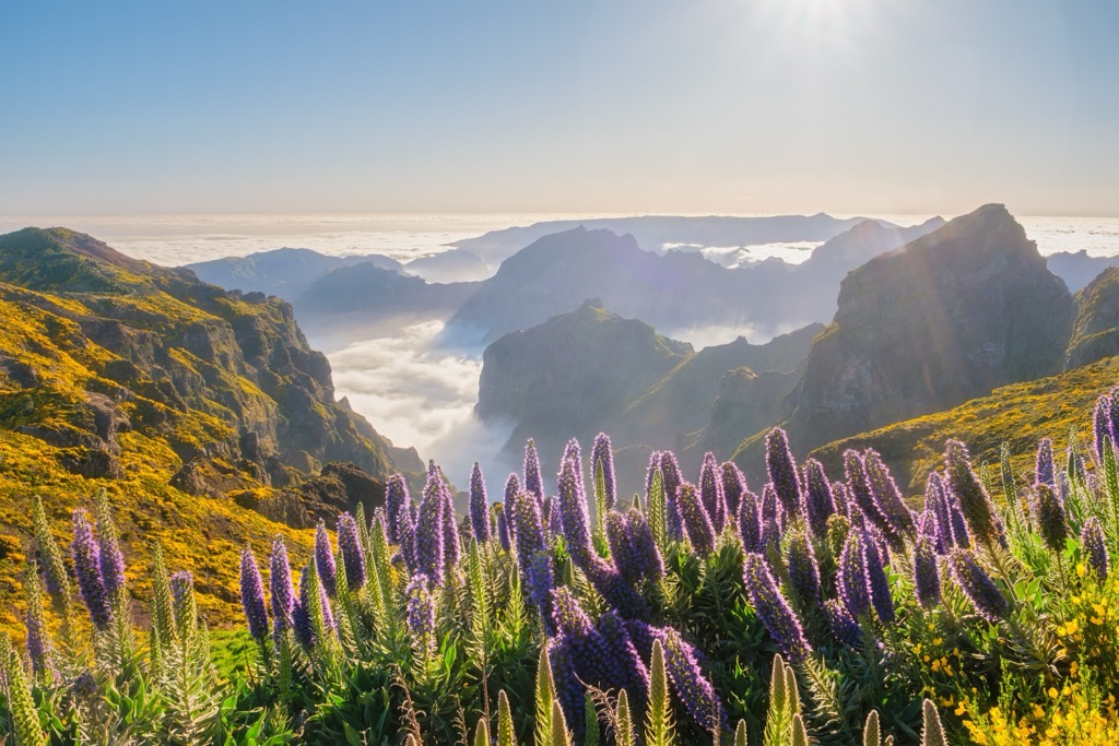
Madeira, Portugal
Madeira. Once a hideout for pirates, now a hotspot for hikers. This Portuguese island is located deep in the Atlantic Ocean, off the coast of Morocco.
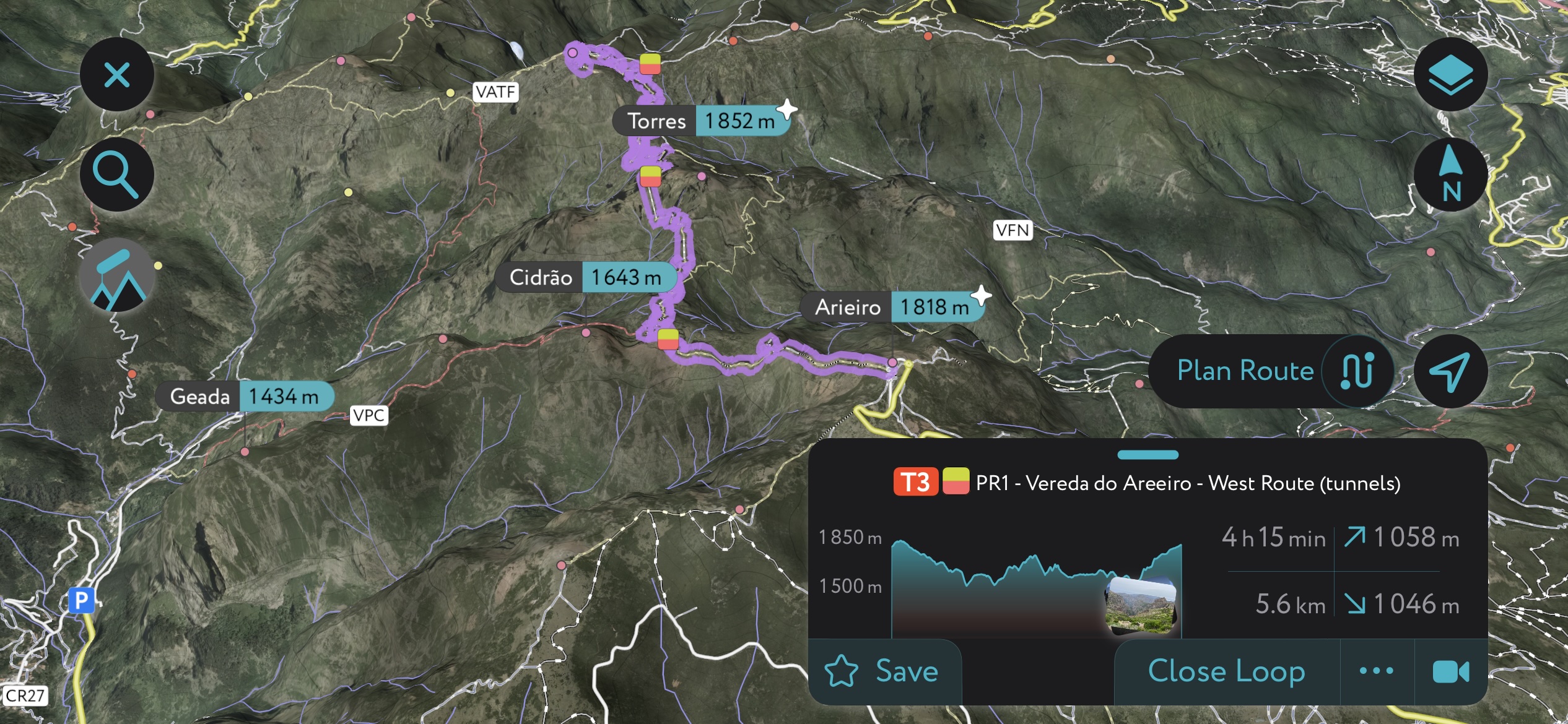
The island’s highest summit, Pico Ruivo, rises to 1,862 meters (6,109 ft) above sea level, while neighboring peaks such as Pico das Torres and Arieiro form a rugged, volcanic landscape.
The central massif lies only 10–15 kilometers from the coastline in many directions, and the mountains rise almost directly from the ocean. Atlantic views are a constant feature of many trails.
Elevation gain varies depending on the route and starting point. Many hikes begin at already elevated trailheads accessible by road. Typical summit ascents involve 500–1,200 meters of elevation gain, though routes starting near coastal towns exceed 1,500 meters.
The island’s most celebrated trail is the Arieiro-to-Pico Ruivo traverse, certainly one of the finest day hikes in Europe. Beginning at Arieiro (1,818 m), the trail follows a spectacular ridge through volcanic spires, tunnels, stairways, and exposed viewpoints before reaching the summit of Pico Ruivo. The trail is relatively short, around 10 kilometers one way, depending on route variations, but it is still physically demanding. However, you can drive to the summit of Arieiro; that’s the key bit that makes this hike so accessible and popular.
The hard part is getting here; air travel is required, or you could spend a few days on a boat. But once arrived, access is excellent. Most visitors stay in Funchal, the island’s capital and principal gateway, while numerous trailheads can be reached by road from towns around the coast.
Lefka Ori, Crete, Greece
You wouldn’t have a list of the best coastal mountain hikes without Greece in the mix. So here we go. The Lefka Ori (White Mountains) dominate western Crete; the highest summit, Pachnes, reaches 2,453 meters (8,048 ft), making it one of the highest coastal mountain summits in Europe.
While these mountains are not quite as close to the coast as some others on this list, from many summits and ridges, hikers can simultaneously see the Cretan Sea to the north and the Libyan Sea to the south.
Route difficulty in the Lefka Ori ranges from moderate to extremely challenging. This range is rougher and more remote than in many other Mediterranean mountain regions. Large sections of the massif consist of broken limestone, rocky plateaus, and poorly vegetated highlands that feel almost lunar. Trails are often marked by stone cairns rather than paths; navigation can become difficult in poor weather. As a result, the Lefka Ori are best suited to experienced hikers.
Elevation gain varies significantly depending on the route. Summit ascents commonly involve 1,000–1,800 meters of elevation gain, while ambitious outings from coastal villages can exceed 2,000 meters of vertical gain. With such massive elevation gradients, hikers traverse a lunar high-mountain desert to a subtropical coastline in a single day.
The most famous trail in the region is undoubtedly the Samaria Gorge, one of Europe's great canyon hikes. Beginning on the Omalos Plateau at approximately 1,200 meters, the route descends through a spectacular limestone gorge for 14.5 kilometers before emerging at the coastal village of Agia Roumeli on the Libyan Sea.
For hikers seeking summits, the ascent of Pachnes is the premier mountain objective in the range. Another outstanding route is the traverse of the Omalos Plateau to Agia Roumeli via Samaria Gorge.
Jaizkibel Ridge, Basque Country, Spain
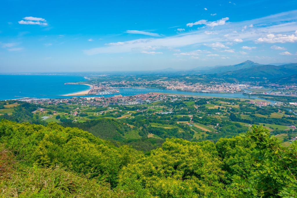
The Jaizkibel Ridge (pronounced high-skee-bell) looms directly above the Bay of Biscay between the towns of Hondarribia and Pasaia, in the heart of the Spanish Basque Country in northern Spain. The highest point, Jaizkibel, reaches 545 meters (1,789 ft).
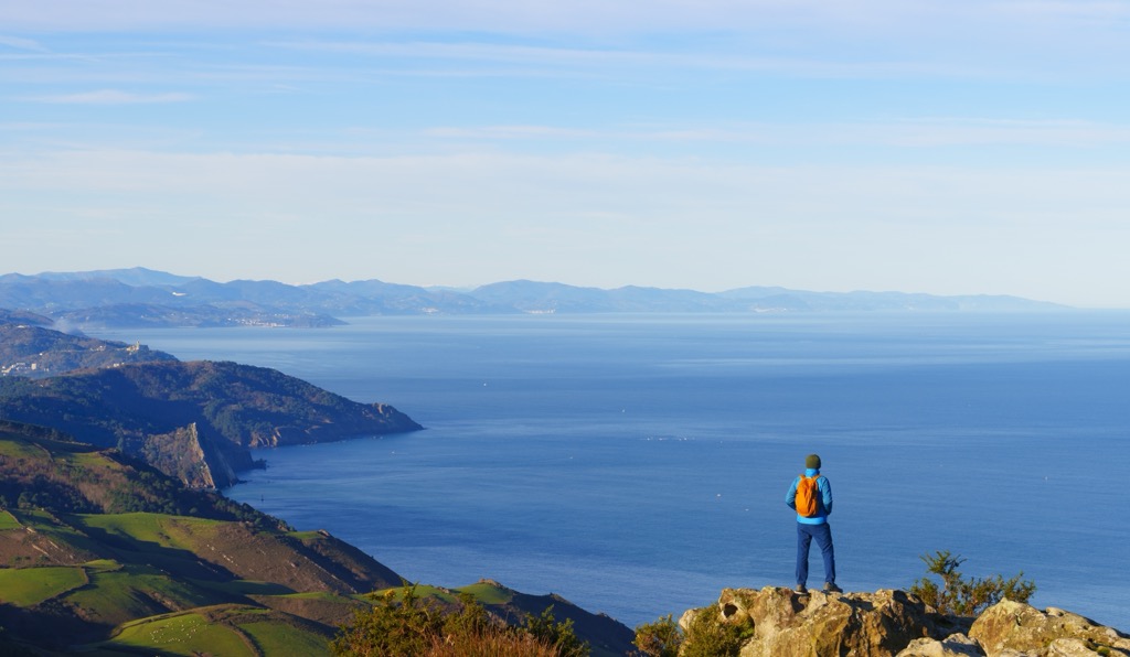
Proximity to the sea is clutch here. Large sections of the ridge lie only 1–3 kilometers from the coastline; the cliffs descend almost directly into the Bay of Biscay. Much of the range is now grassy pasture. As a result, sea views are a constant feature of nearly every hike. Hikers enjoy uninterrupted panoramas across the Atlantic Ocean, the rugged Basque coastline, and the estuary surrounding Hondarribia. On clear days, views extend westward along the coast toward San Sebastián and eastward toward the foothills of the Pyrenees near the French border.
Route difficulty is generally easy to moderate, making Jaizkibel more accessible than many of Europe's larger coastal mountain ranges. The ridge is crossed by well-maintained trails and old military roads, graded for vehicles.
The finest hike in the region is widely considered the Pasaia–Hondarribia Traverse, which follows the crest of Jaizkibel across the entire range. This spectacular trail combines Atlantic cliffs, grassy ridges, forests, old military lookout points, and sweeping views of the Bay of Biscay. The traverse is about 22 kilometers (depending on variations) and involves approximately 1,100 meters of cumulative elevation gain.
Using PeakVisor to Plan Hikes
If you liked this story, you should know that it was brought to you by the one and only PeakVisor App. PeakVisor is a leader in the augmented reality 3D mapping space; we’re the product of nearly a decade of effort from a small software studio smack dab in the middle of the Alps.
PeakVisor Features
In addition to the visually stunning maps, PeakVisor's advantage is its variety of tools for the backcountry:
- Summer and winter modes let you use the app year-round, whether hiking on trails or skiing backcountry routes.
- Thousands of hiking and ski touring routes throughout Norway, the European Alps, and beyond.
- Slope angles help evaluate hiking terrain and difficulty.
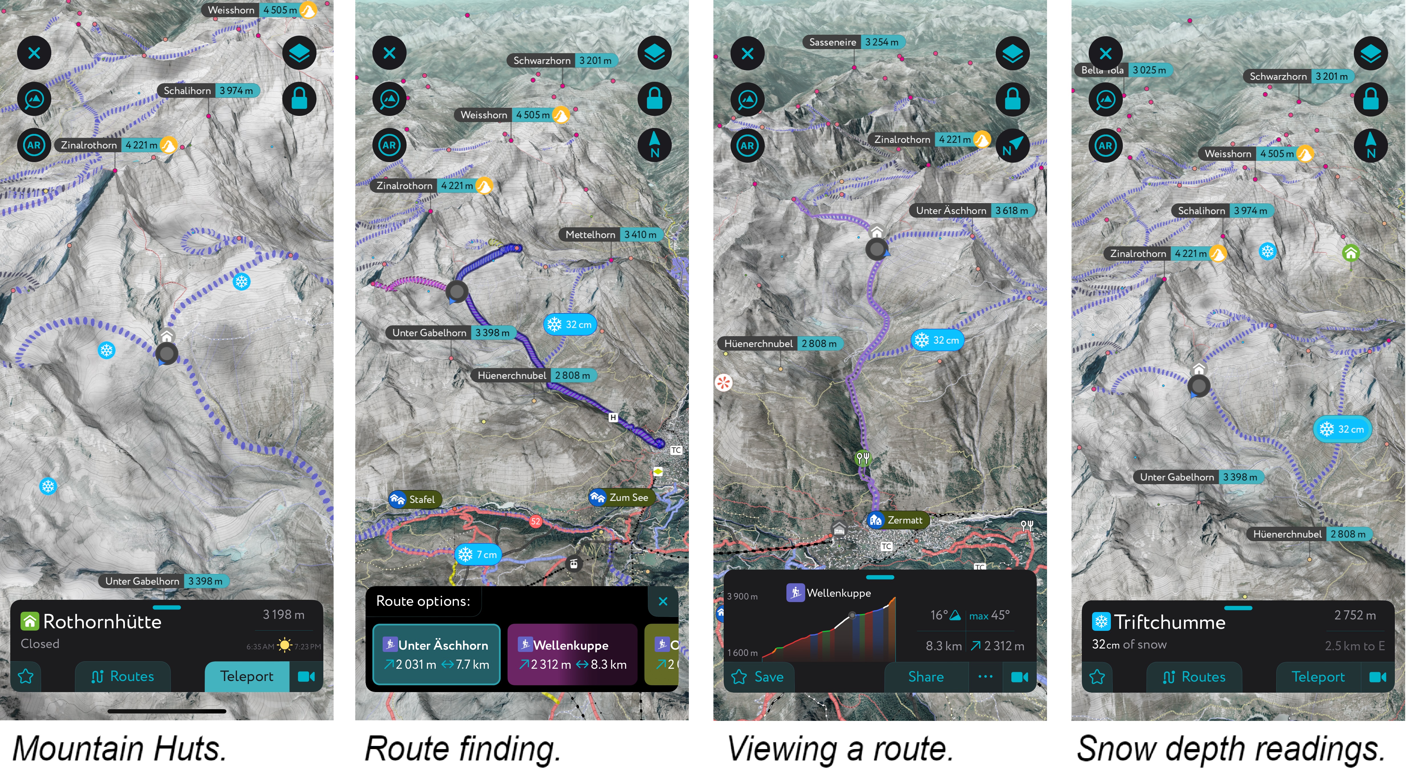
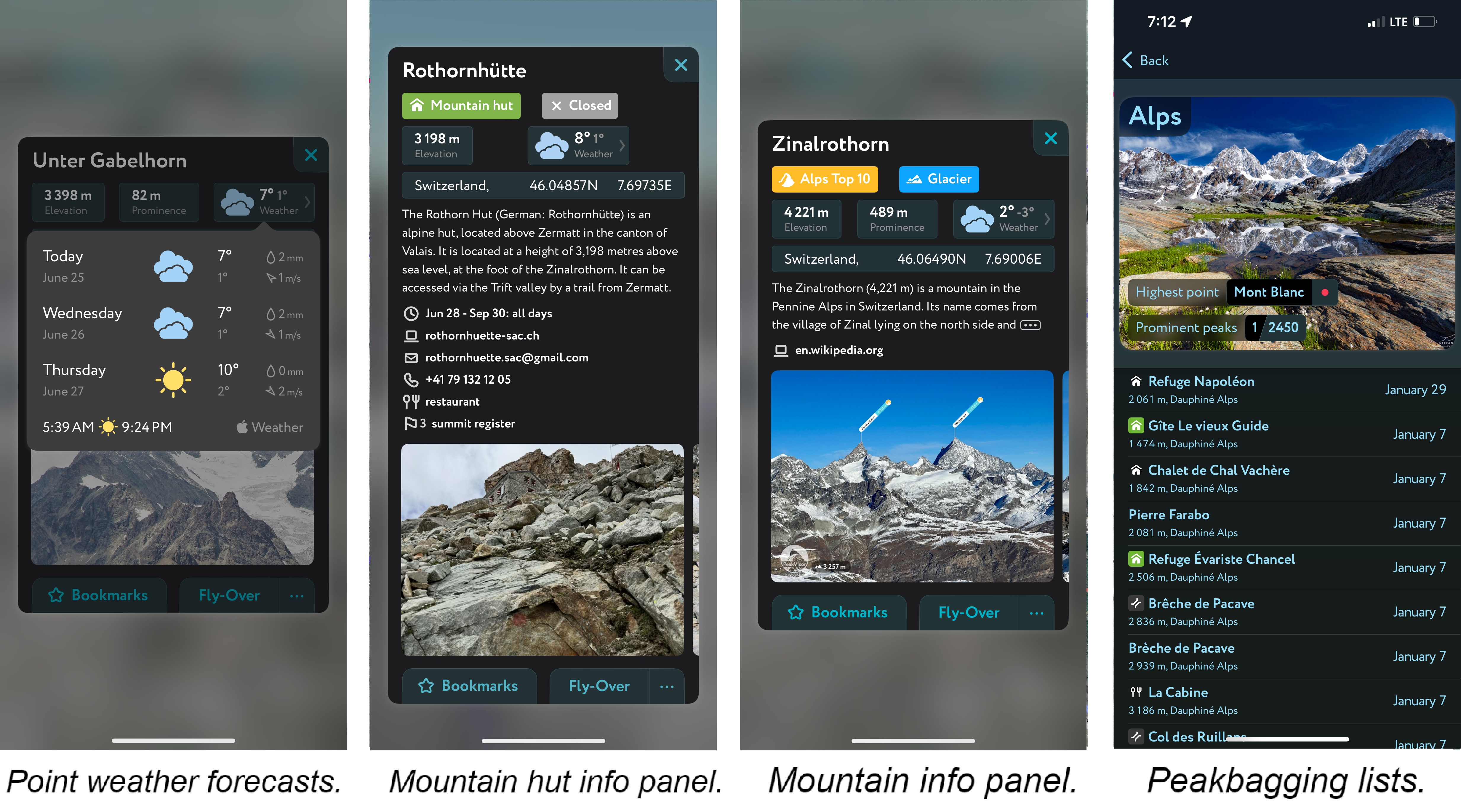
- Mountain hut schedules and contact info save the time and hassle of digging them up separately.
- The route finder feature generates a route for any location on the map. You can tap the route to view it in more detail, including the maximum and average slope angle, length, and elevation gain.
- A point weather forecast for any tap-able location on the map, tailored to the exact GPS location to account for local variations in elevation, aspect, etc., that are standard in the mountains.
- You can use our Hiking Map and Ski Touring Map on your desktop to create GPX files for routes to follow later in the app.